Epic Hawaii Road Trip Itinerary for National Park Lovers
It’s no secret we love the national parks, so our trip to Hawaii centered around visiting the two national parks there – Hawai’i Volcanos and Haleakalā. We were in Hawaii for a week and visited the Big Island and Maui (Haleakalā and Hana). We felt like we had enough time to explore the parks, and saw so many epic sites, but did not have time to explore the entire island. If you love the parks and want an epic weeklong itinerary, feel free to use what we did as a baseline.
We visited Maui in March 2023. Since then, Maui experienced devastating wildfires that destroyed Lahaina. We spent time in Lahaina and it was one of the places on my epic Hawaii itinerary. I’m sharing our time on the island to remember the special time we had and the beauty and history Lahaina holds. I have no doubt Lahaina will return but not sure how long it will take or what the new Lahaina will look like. My deepest condolences to all affected by the fires.
Day 1: Fly into the Kona airport on the Big Island. Rent a car and drive to Hawai’i Volcanos National Park. Spend two nights at the Volcano House in the national park.
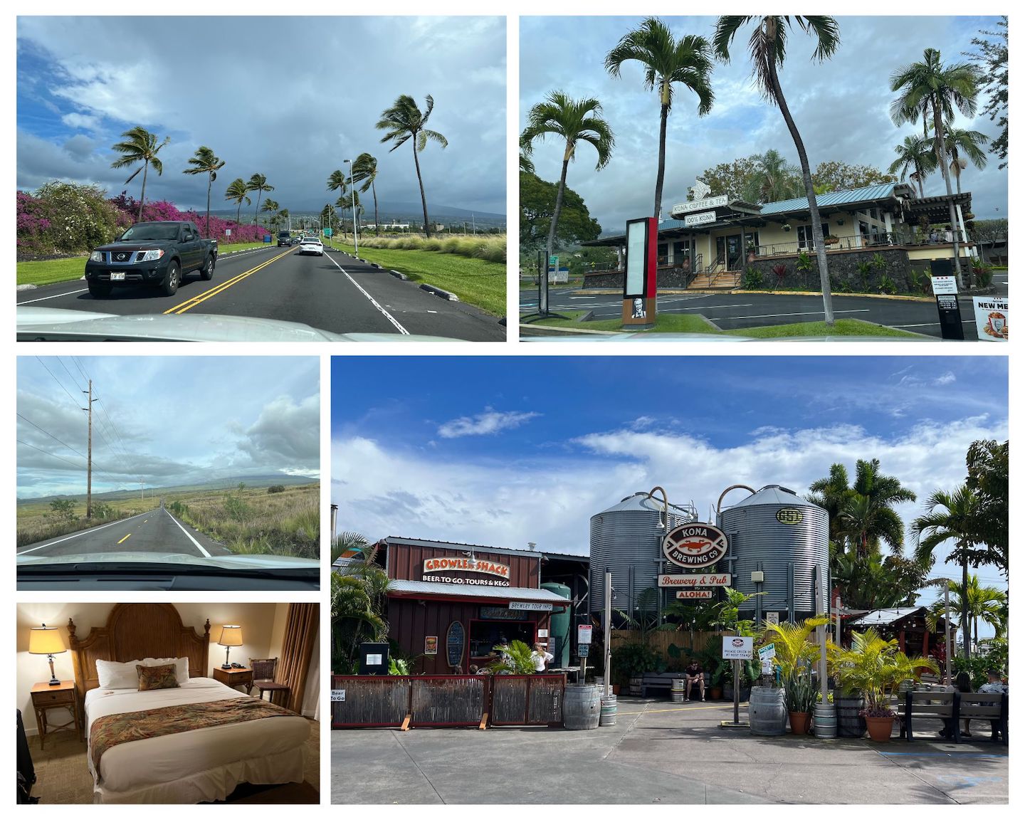
Bonus tips: Grab lunch at Kona Brewing, stop at the grocery store to get any food/snacks for the next few days, and then grab a macadamia nut milk latte from Kona Coffee and Tea before hitting the road to Hawai’i Volcanos National Park. It’s a two hour drive so the caffeine boost is helpful after a long day of flying.
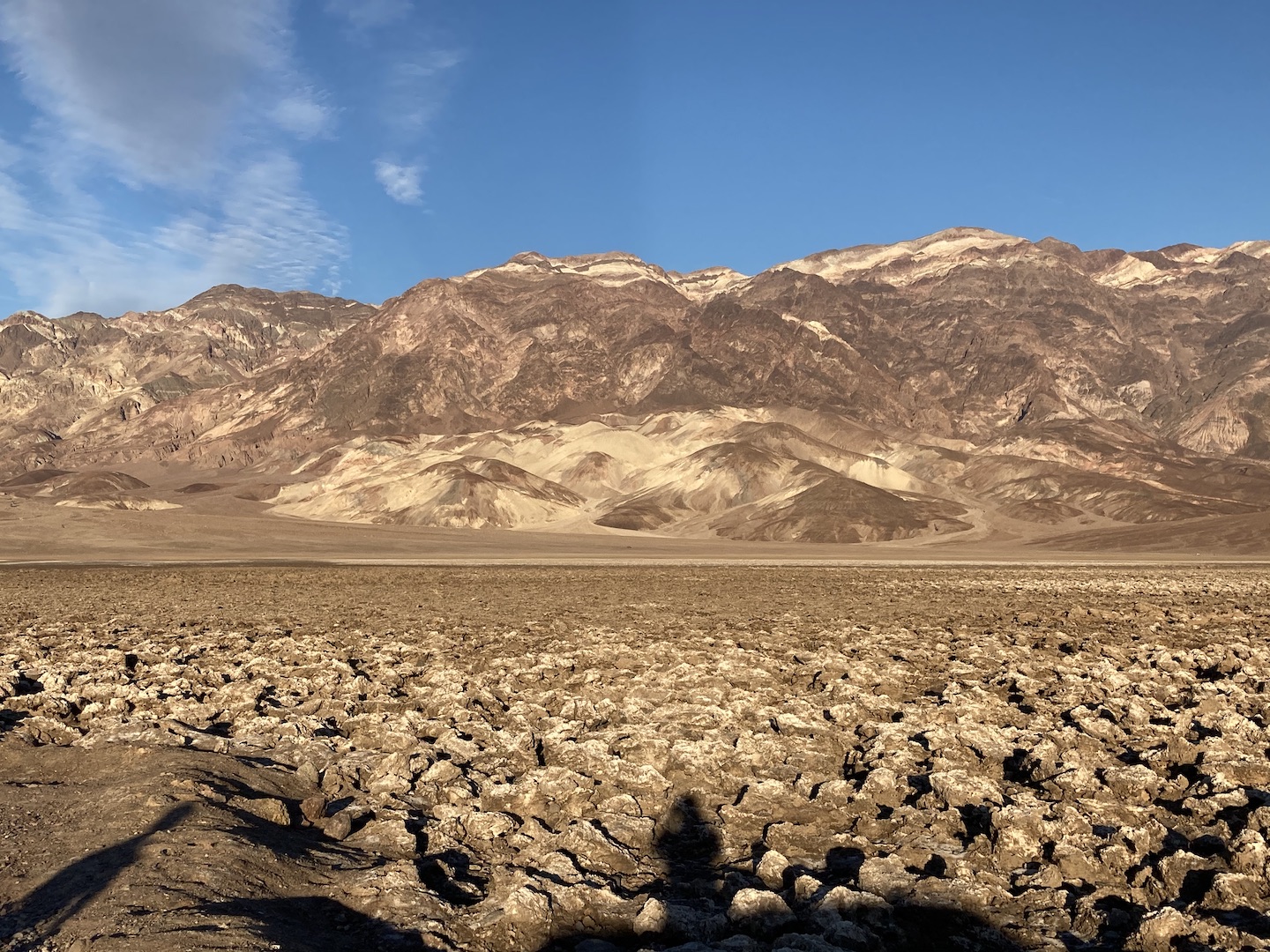
Day 2: Spend the day exploring Hawai’i Volcanos National Park. We made dinner reservations at the Volcano House restaurant and it was a fantastic choice after spending the day exploring and hiking.
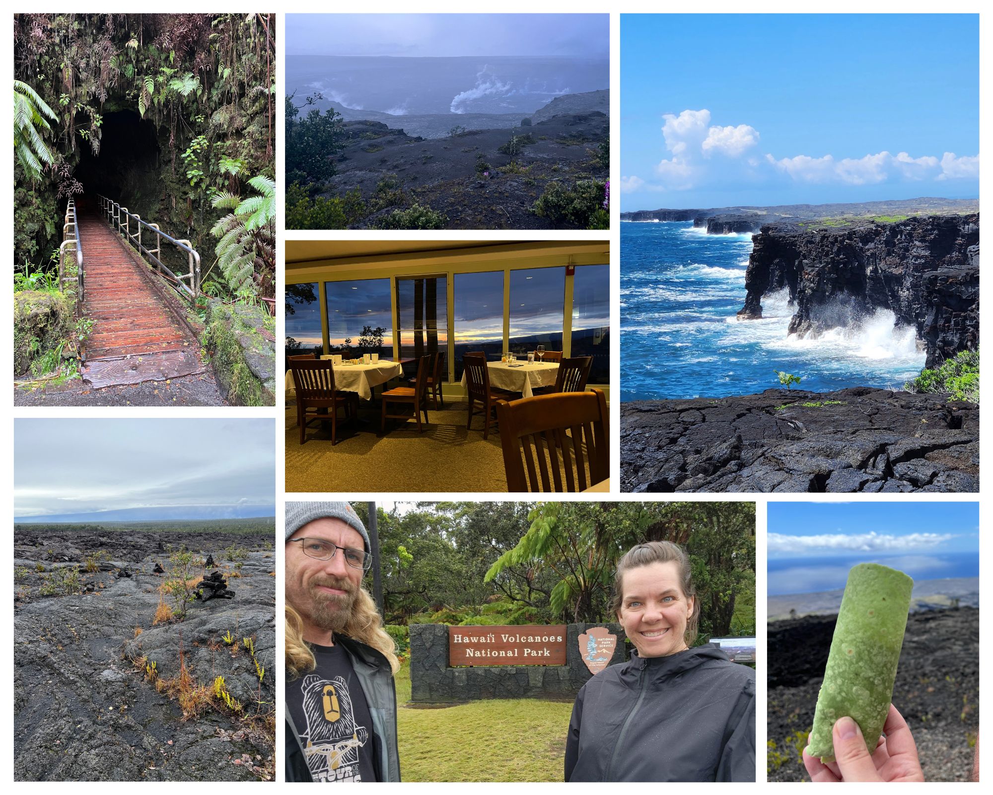
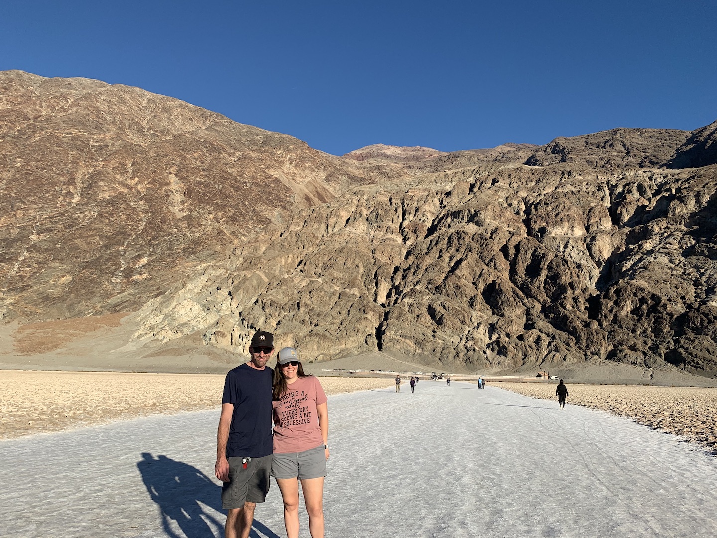
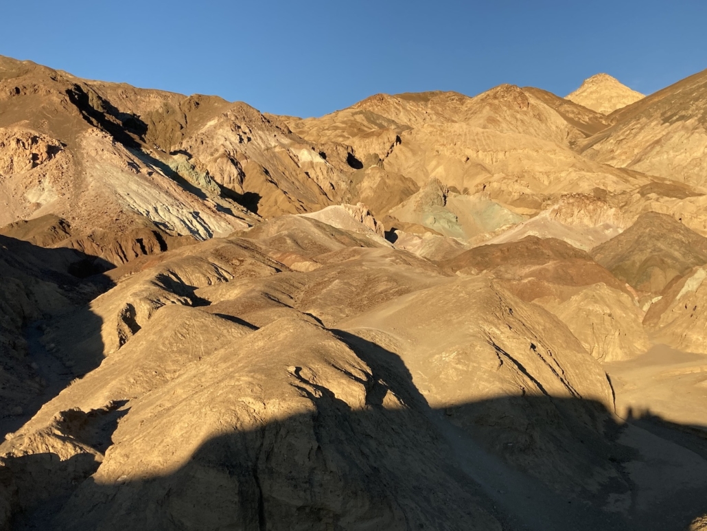
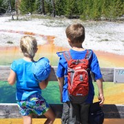
Suggested activities: Obviously get your picture with the sign because were you even there if you don’t have a sign picture? Stop in the Visitor Center to get your map and learn about the park. Drive Crater Rim Road and stop at the view points to see inside the crater. Grab a picnic lunch, drive Chain of Craters Road, and stop at any or all of the stops. Our favorite stops were the Kīlauea Iki Overlook, Thurston Lava Tube, Pu’u Huluhulu Cinder Cone hike, lunch on a curb near the Kealakomo Overlook starring out into the ocean, and the HöleiSeaArch. We wanted to hike the Kīlauea Iki trail but had heavy rain storms off and on and didn’t want to be hiking in the middle of that.
Day 3: Do any remaining things in HVNP and explore the area outside of the park. Can either spend one more night at the Volcano House or stay in a unique AirBnB for the night.
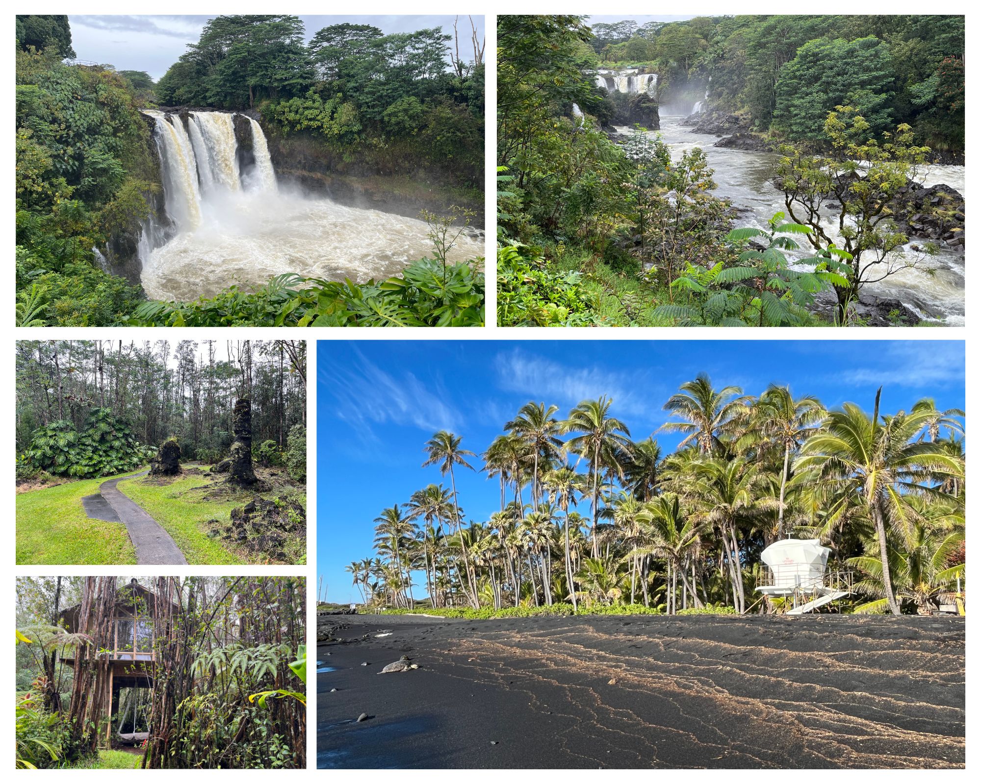
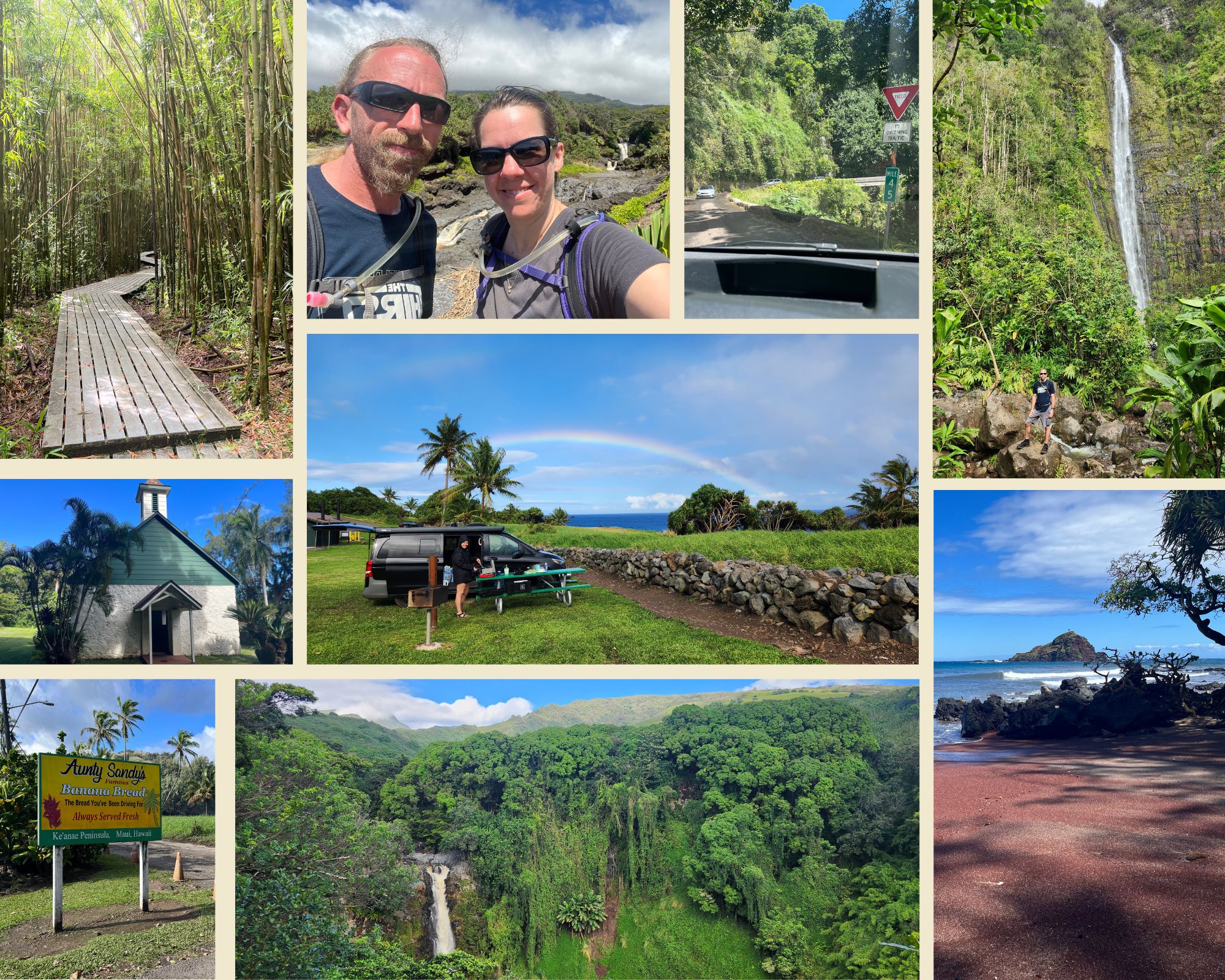
Some of our favorite stops were Punaluʻu Black Sand Beach, Wailuku River State Park (make sure to stop at both stops – Rainbow Falls and Boiling Pots), and Lava Tree State Monument. We stayed in a treehouse in the rainforest outside of HVNP. It was a fun and unique experience but I have mixed feelings about the specific place we stayed.
Day 4: Book an intra island flight for the afternoon to Maui. Spend the morning exploring a few more places on the way back to the airport.
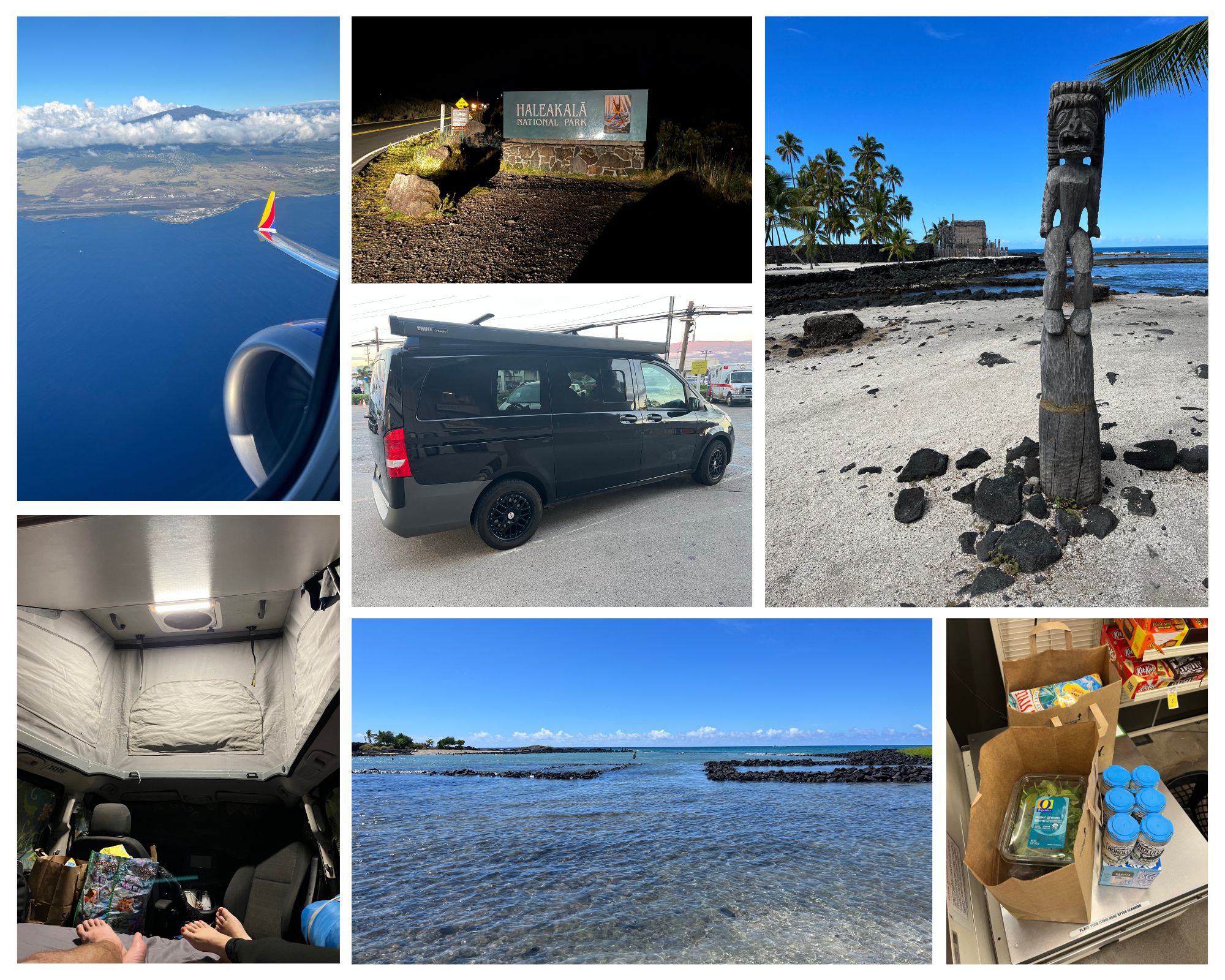
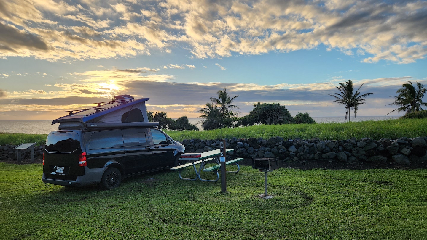
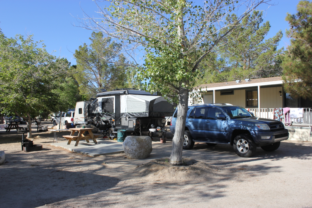
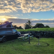
Our favorite stops were Puʻuhonua o Hōnaunau National Historical Park and Kaloko-Honoköhau National Historical Park. If you didn’t get to see the black sand beach yesterday, stop even for a few minutes on your way to Kona. We flew Southwest inter-island but learned they only fly once a day and the flight is often delayed. I’d suggest flying Hawaiian Airlines for inter-island. Once in Maui we picked up the campervan (highly recommend Campervan Hawaii!), stopped at the store for groceries, and headed up to Hosmer Grove Campground to camp for the evening. Because our flight was delayed we pulled in in the dark and didn’t have time to explore. Sad face.
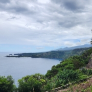
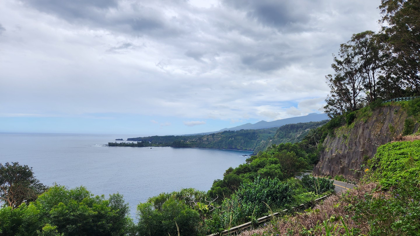
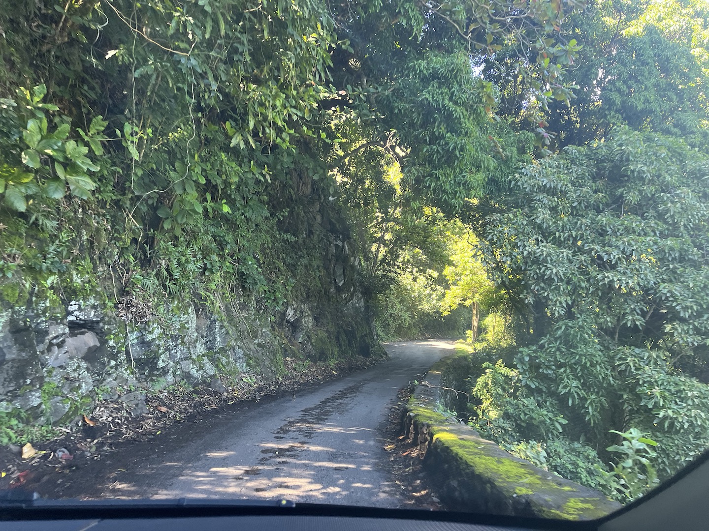
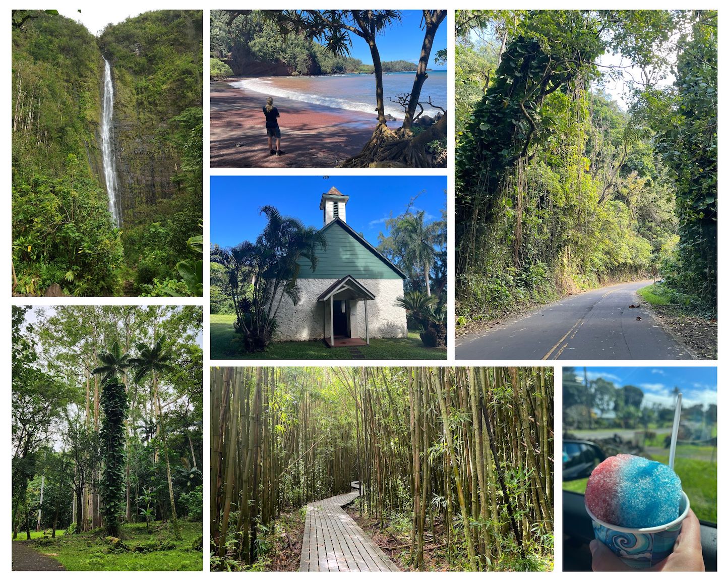
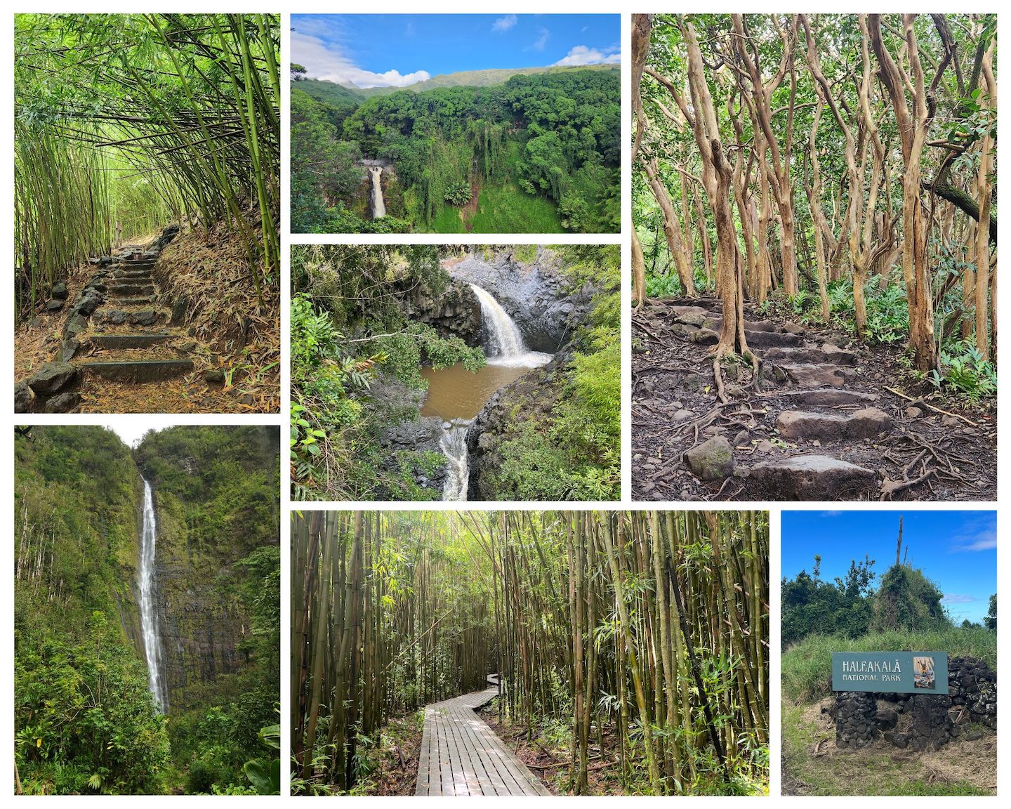
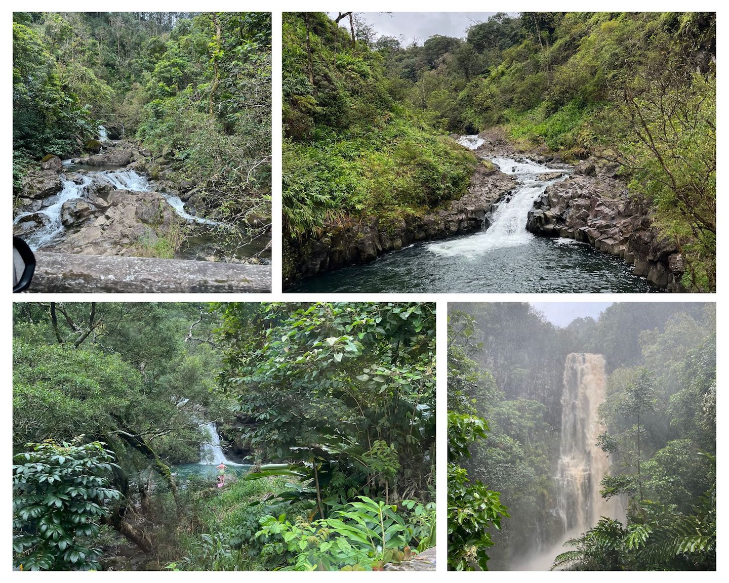
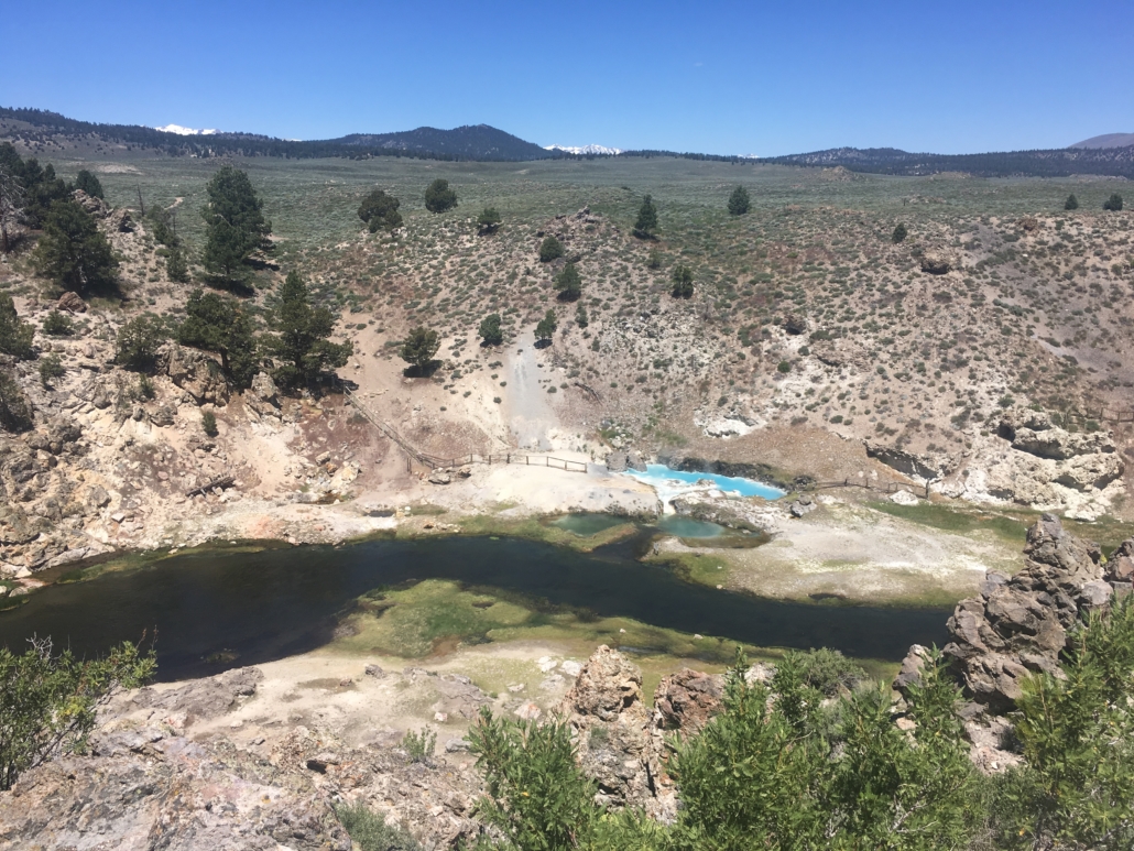
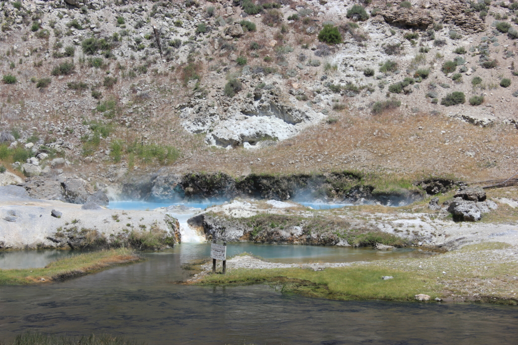
Day 5: Get up super early to watch the sunrise on Haleakala, explore the top of the crater, drive the Road to Hana, and camp at Kīpahulu Campground.
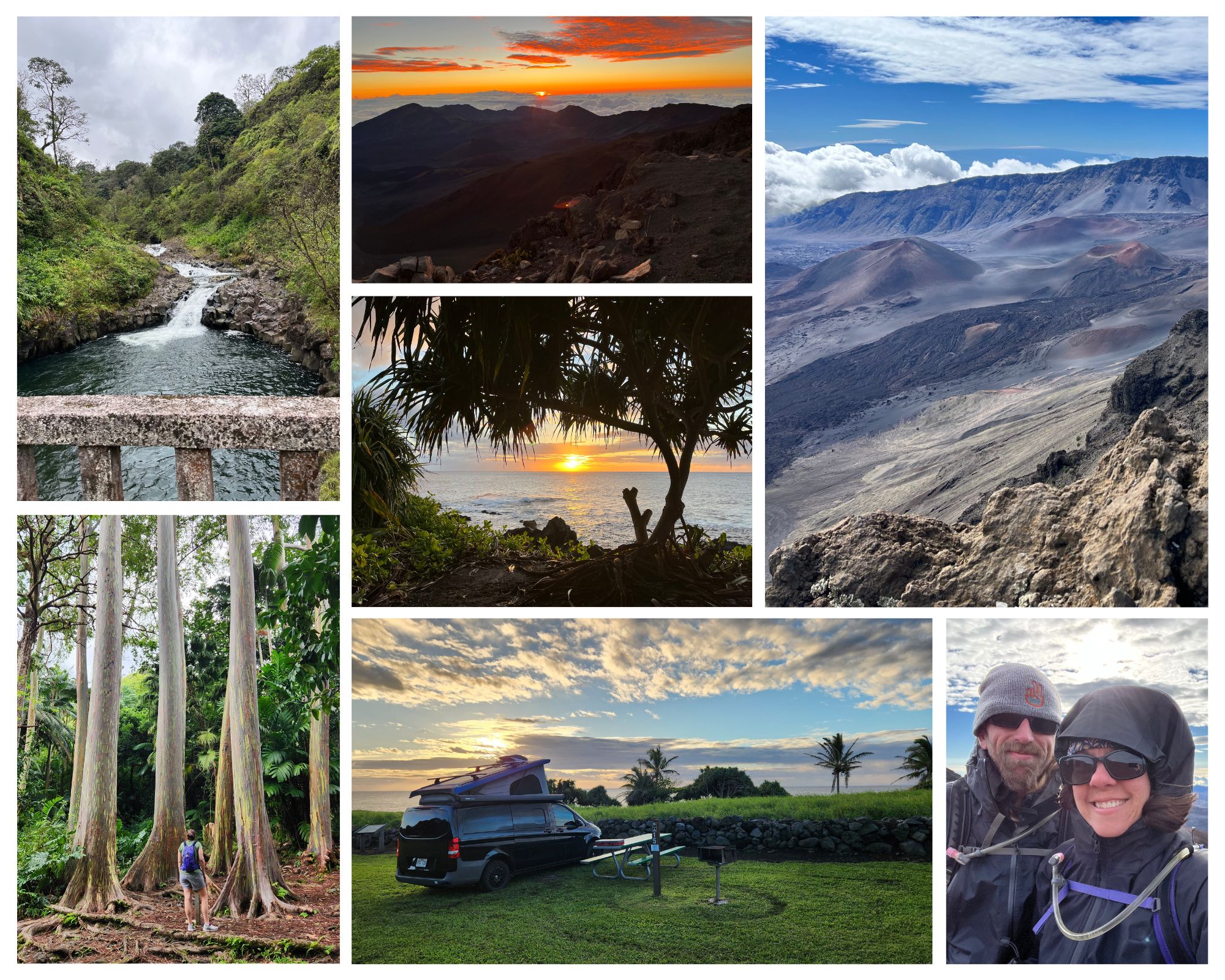
If you’re not staying at Hosmer Grove, be sure to reserve your sunrise ticket ahead of time. Post sunrise, hop in the van to warm up and drink some more coffee. Once warm go hike/explore the top of the crater. Drive to the Kīpahulu Campground in the afternoon and explore the Road to Hana on your way. Stop at attractions as you have time/interest. Driving in at the end of the day seemed ideal for exploring as a lot of the day traffic was on its way out. We had a chill drive and not many people were at the stops. We loved Kīpahulu Campground! Not only did we listen to the ocean for days, it’s such a beautiful area, and there is so much to do nearby.
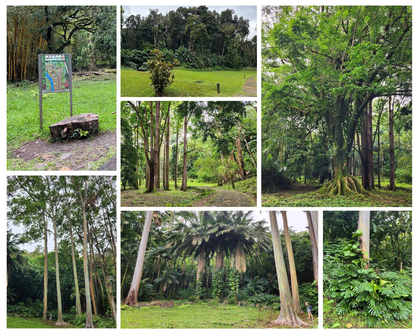
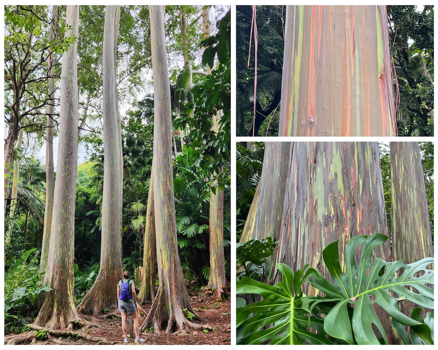
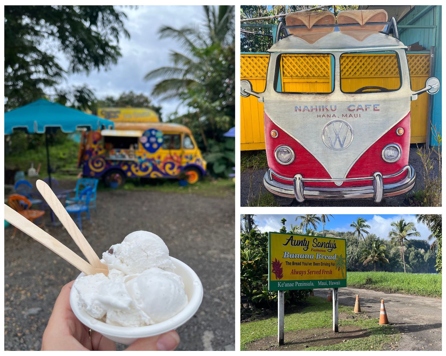
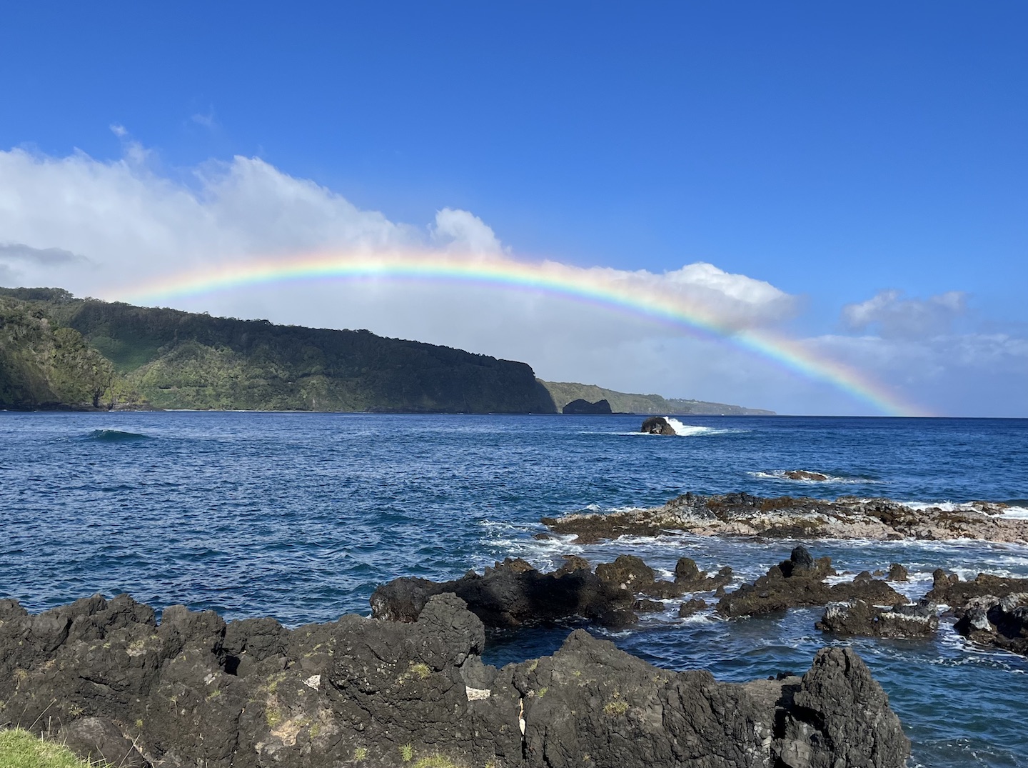
Day 6: Hike the Pipiwai Trail in the morning. Drive to Hana in the afternoon and explore the sites you missed on the drive in. In general, have a chill day in one of the most beautiful places.
Day 7: Chose your own adventure day. This is your last day in Maui so find one more place to explore.
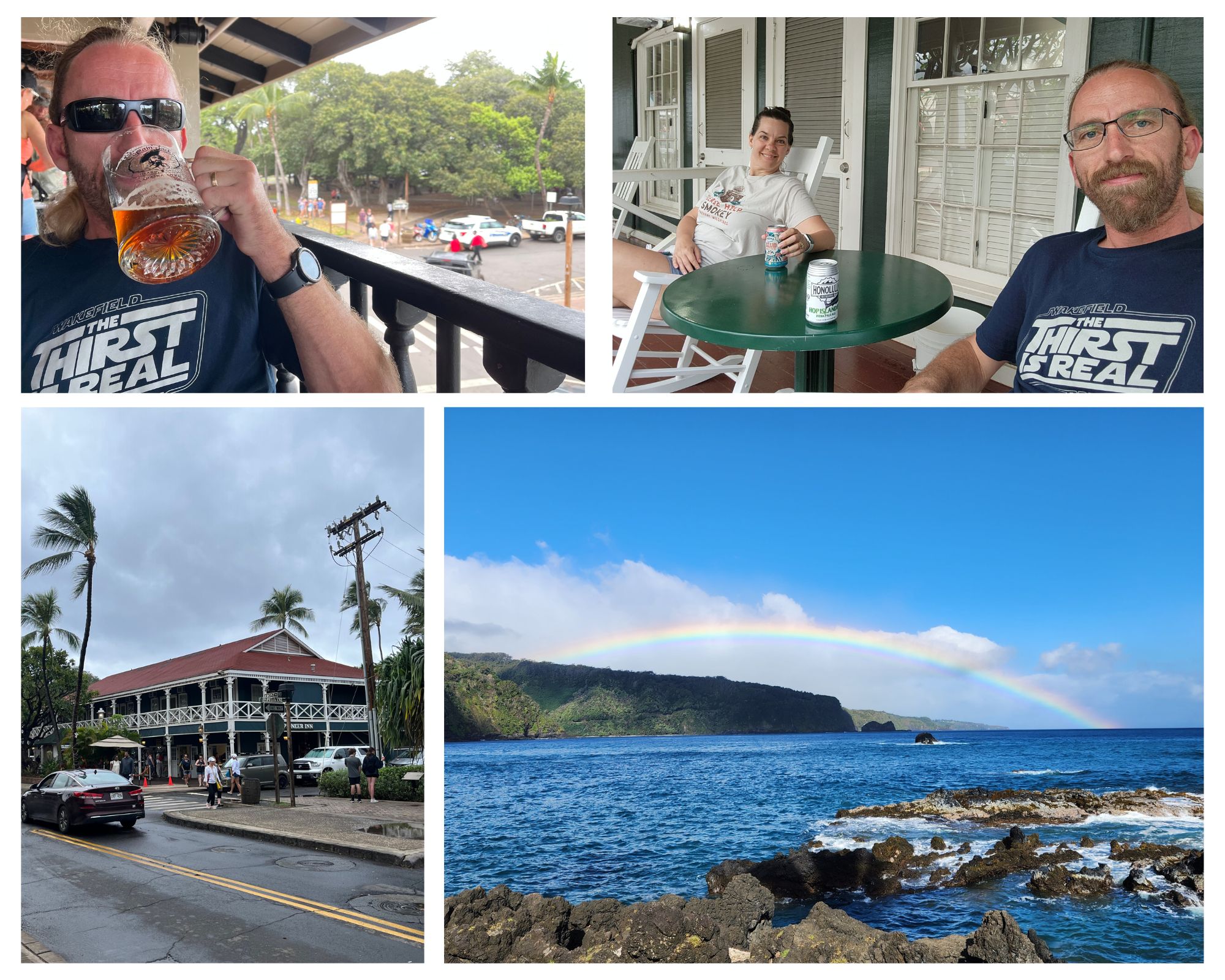
Our final destination was Lahaina. We visited in March which is prime whale watching season and scheduled a tour for the afternoon. Unfortunately, a storm rolled in that day and our tour was cancelled. We stayed at the Best Western on Front Street which was a fun vibe until we tried to go to sleep. The location was great and made for a fun last evening. We were able to do some souvenir shopping, eat, people watch, and get ready to head home. Problem with staying on Front Street is the party doesn’t stop just because you have an early morning flight. :/
Day 8: Return the campervan, head to the airport, and fly home. 🙁
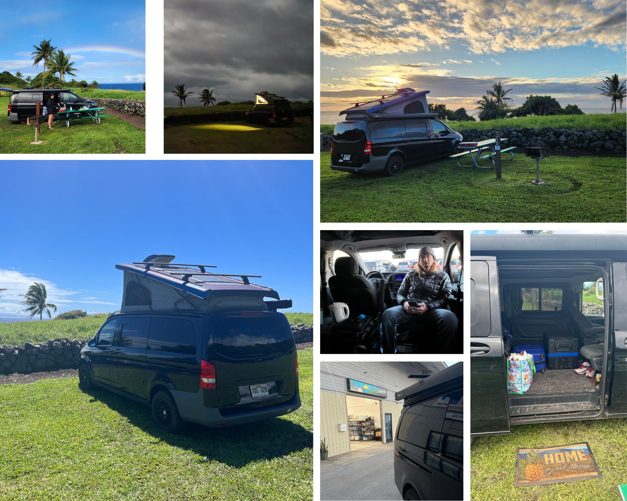
We loved this campervan! It allowed us to experience Maui in a way we never could have staying in a hotel. This will forever be one of our favorite road trips. We rented from Campervan Hawaii and had a fantastic experience. The van was clean and had all the extras needed to live in for a few days. They even gave a full five gallon jug of water. 10/10 stars.
If you have questions about our trip, logistics, etc, feel free to leave a comment. Happy planning!