Driving the White Rim Road in Canyonlands National Park has been on my bucket list since I first saw the road from high atop the plateau back in 2015. We had plans to spend time in Northern California and Oregon in September 2024 but there were wildfires so we ended up in Utah where there were no fires. When we were trying to figure out alternative options for our trip, I was able to snag a White Rim permit so we built a trip around it!
Canyonlands National Park
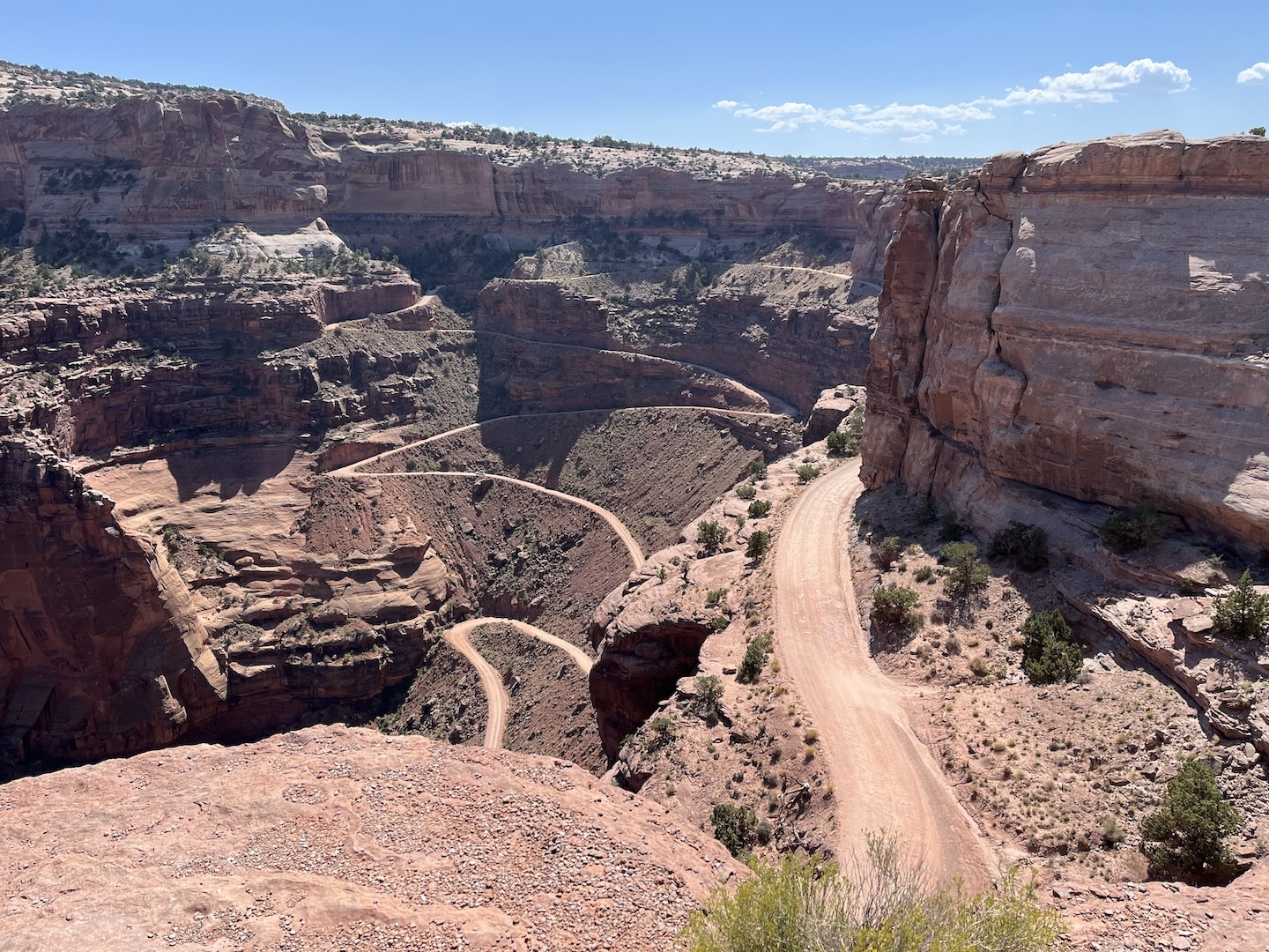
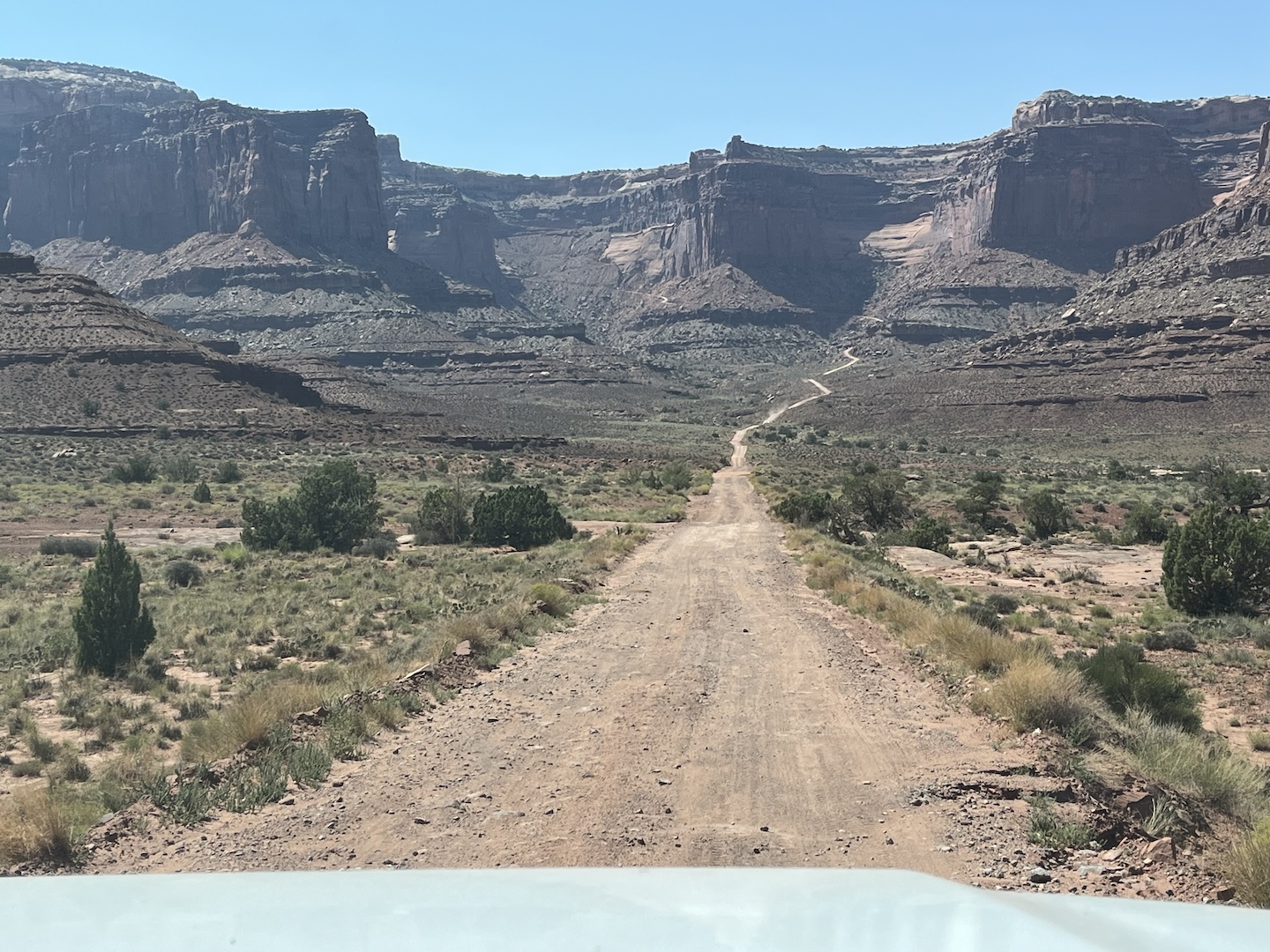
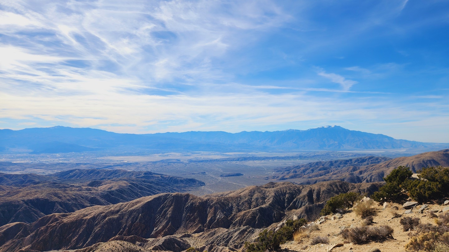
The White Rim Road is a 100-mile four-wheel drive road in Canyonlands National Park. In the picture above you will notice a dirt road in the middle of the picture that outlines the canyon – that’s the White Rim Road. And now you probably understand why I wanted to get down there. I will say, the road looks easier from far away. Lol. It’s a dirt road but very slow going. Like way slower than I was expecting.
There are campsites along the trail and we were able to reserve one halfway through. It seemed like the perfect plan. Drive 45 miles, camp, drive 55 miles. We made the mistake of scouting the start of the trail the day before at which point I started questioning my life choices. The start of the trail is high atop a plateau but you can’t see past this corner without driving it. After driving this I can tell you the road is actually pretty wide in this section and there are large areas to pass. It’s not as sketchy as it looks.
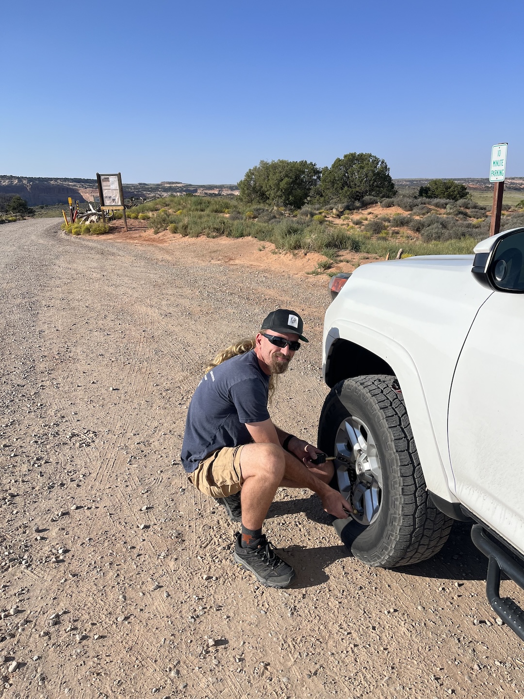
Day of! Starting our adventure by airing down the tires.
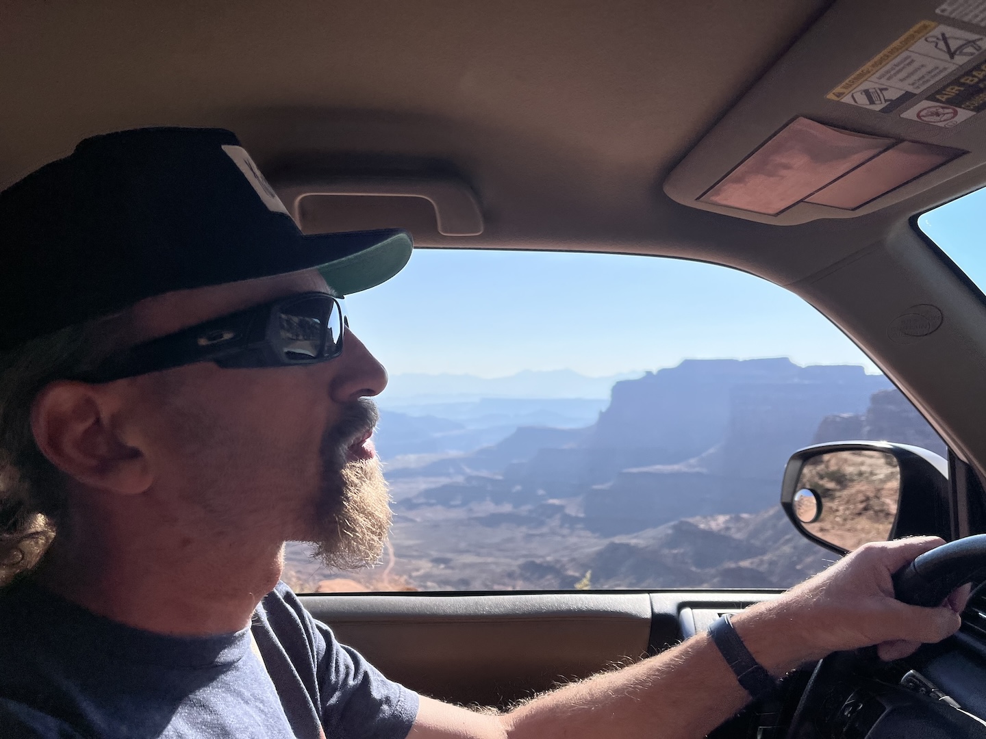
This view is much better than the one we had the day before. The road doesn’t look as stetchy. Let’s do this!
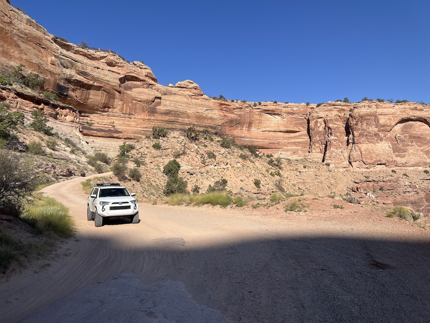
At the start of the Shafrer switchbacks. There’s no turning back now.
The layers. <3
Looking back at what we just drove down. So cool.
Lunch with a view
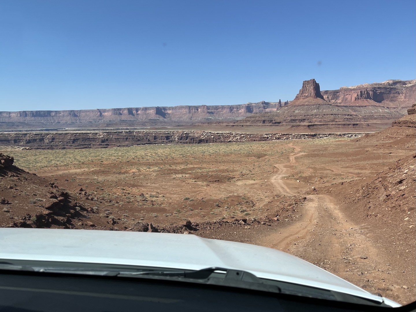
Our plan was to drive the entire 100 miles but we ended up only driving the first 20. In Moab, we stayed at a campground and the guy camping next to us had a very decked out overloading vehicle. We were talking to him about his plans in Moab and if he’s driven the White Rim. He has and said he preferred taking the Shafer Switchbacks to Potash and back to Moab. I was unfamiliar with Potash but did a little research that night to see what he was talking about.
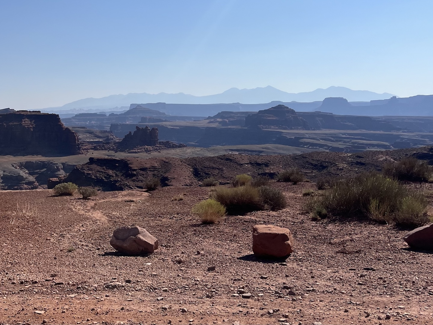
Back to the White Rim. It ended up being a lot slower of a drive than we expected. We rarely exceeded 10 MPH for 20 miles. The trail wasn’t hard but there is exposure in some areas. There are a few obstacles farther into the trail but we didn’t make it that far so I can’t comment on them. It was in the 90s when we were in Moab. The White Rim doesn’t have any shade and there wasn’t much of a breeze. Being outside of our vehicle was not enjoyable. And sunset was at 8pm so we had a long, hot day ahead of us. We weren’t having as exciting of a time as we were expecting so we decided to turn around and take Potash to Moab.
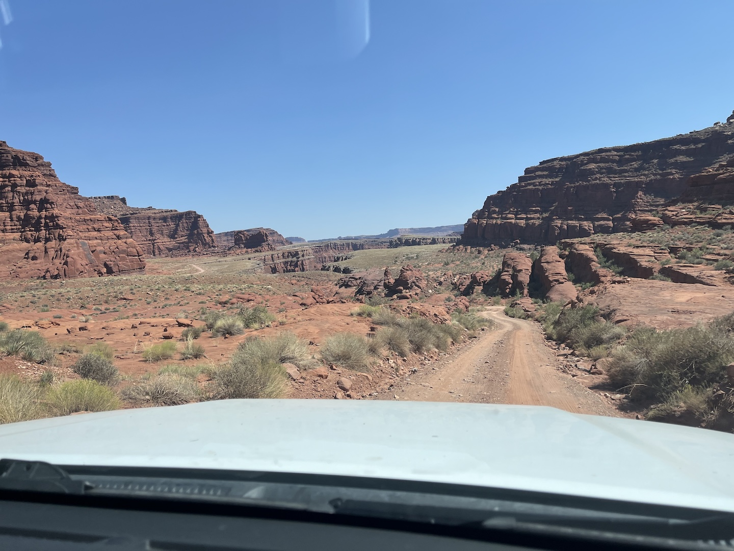
The start of Potash Canyonlands National Park Entrance on Potash Road Thelma & Louise Point Potash evaporation ponds Colorado River
There are a few fun stops on the way to Moab once you hit the paved road. First are dinosaur tracks. I’m not a fan of rock scrambles so I sat this one out. The Husband found the tracks and you can barely see him to the right of the rock. The story is the flat rock under the arrow was on top of the mountain and rolled off at some point. It’s so perfectly placed, which is crazy.
Dinosaur tracks on Potash Road
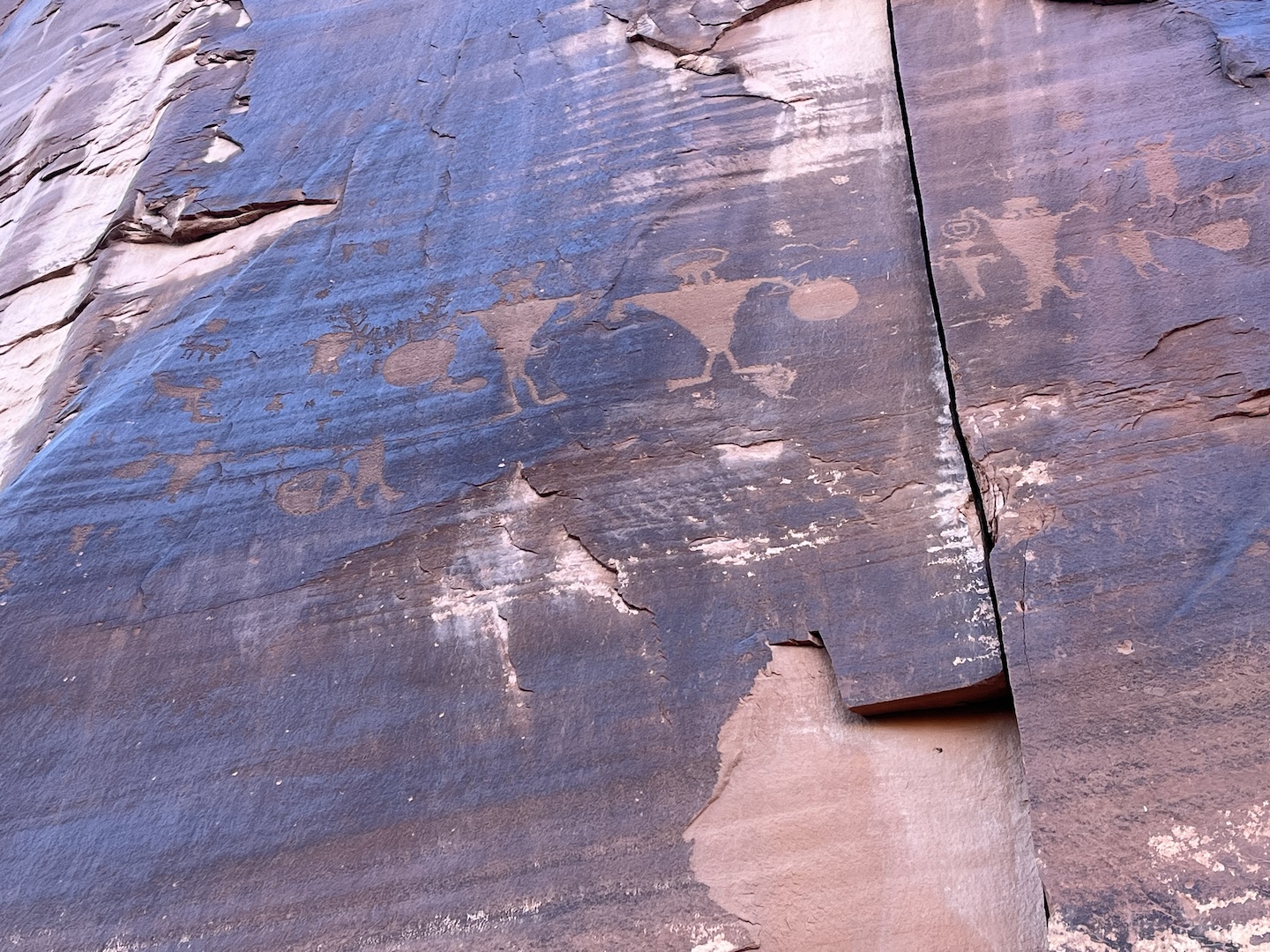
Farther down the road are petroglyphs. They’re right on the side of the road and there is parking.
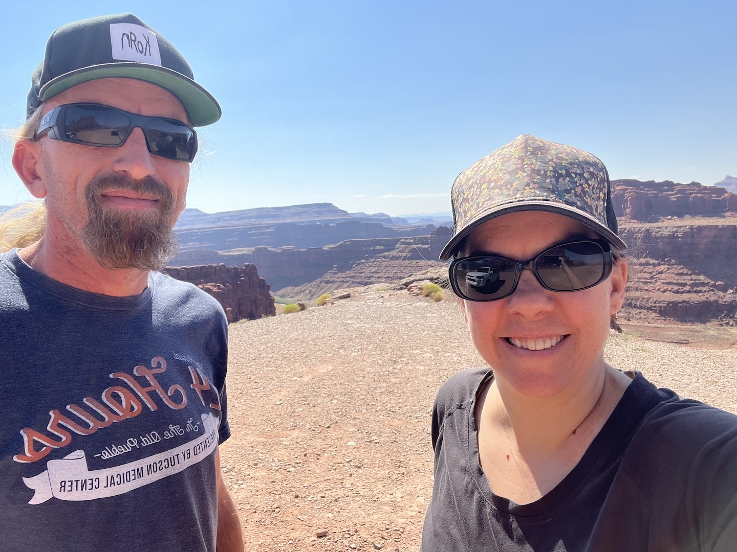
We forgot to visit the Shafer Overlook when we were in the park so we went back the next day to snag this picture and see the Shafer switchbacks from above. It was fun to chat with everyone looking at all the cars going up/down and hear their commentary.
We’d love to finish the White Rim one day when it’s cooler. Knowing how slow going the road is, I might even break it into three days versus two. Overall, we had a great day. It was so fun to start at the top of the plateau and drive our way through all the layers all the way down to the Colorado River!
https://www.theroadwevetraveled.com/wp-content/uploads/2025/10/IMG_3002.jpeg10801440Carolinehttp://www.theroadwevetraveled.com/wp-content/uploads/2015/08/RWT_Logo@3x-300x143.pngCaroline2025-12-22 17:42:242025-12-22 17:42:264 Wheeling in Canyonlands National Park
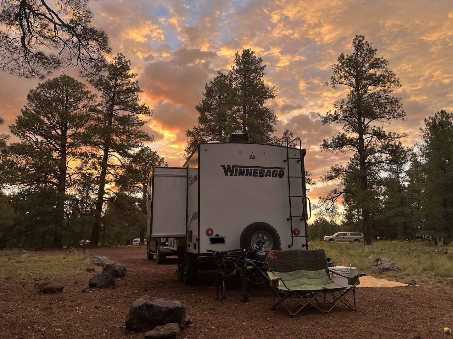
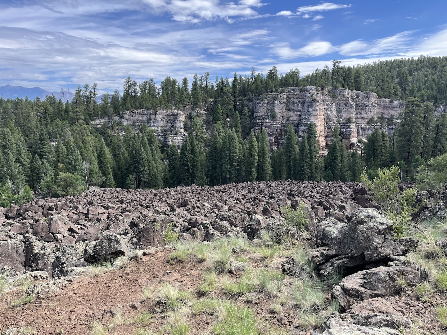
Summer 2024 we spent a week deep in the forest of northern Arizona. It was a more chill vacation than I’m used to but it was absolutely fabulous. We stopped in Flagstaff for two nights on the way north to break up the drive. It just so happens that it was really hot the week we were on vacation so we left our air conditioned house to camp in the heat with no A/C. Cool. We stayed at Canyon Vista Campground just outside of Flagstaff.
Sunset at Canyon Vista Campground
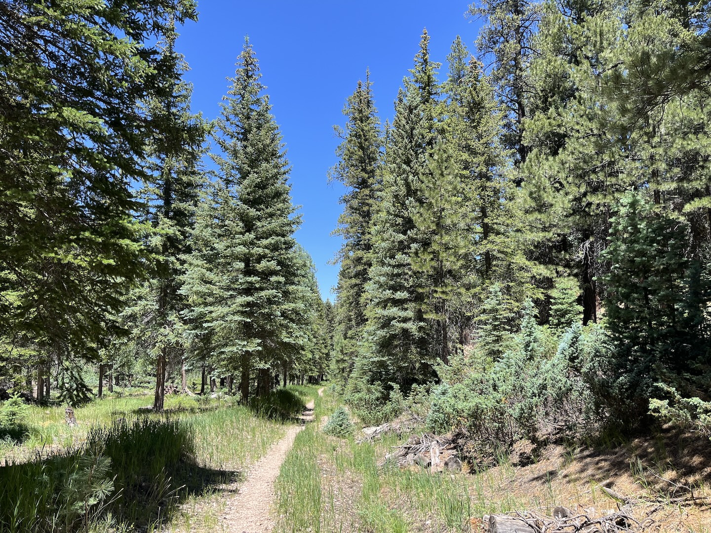
I loved the campground but it’s first come, first serve so not an easy place to get a spot at. The sites are large and the campground backs to the forest and trails. It was honestly perfect, minus the whole hard to get a site thing.
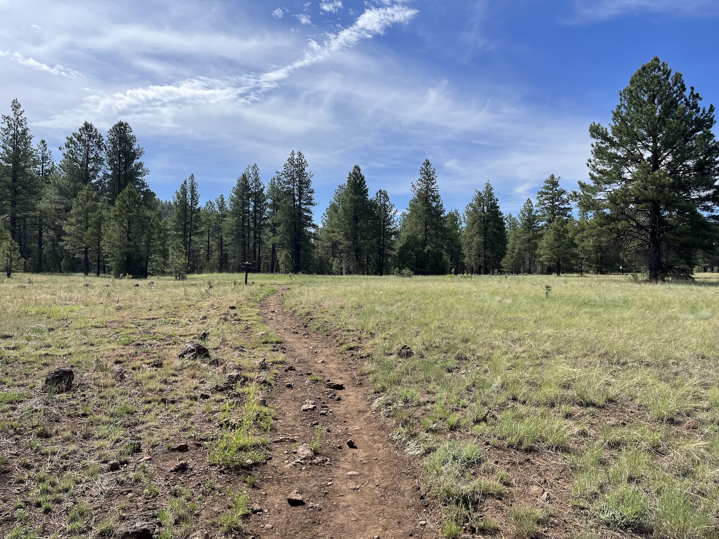
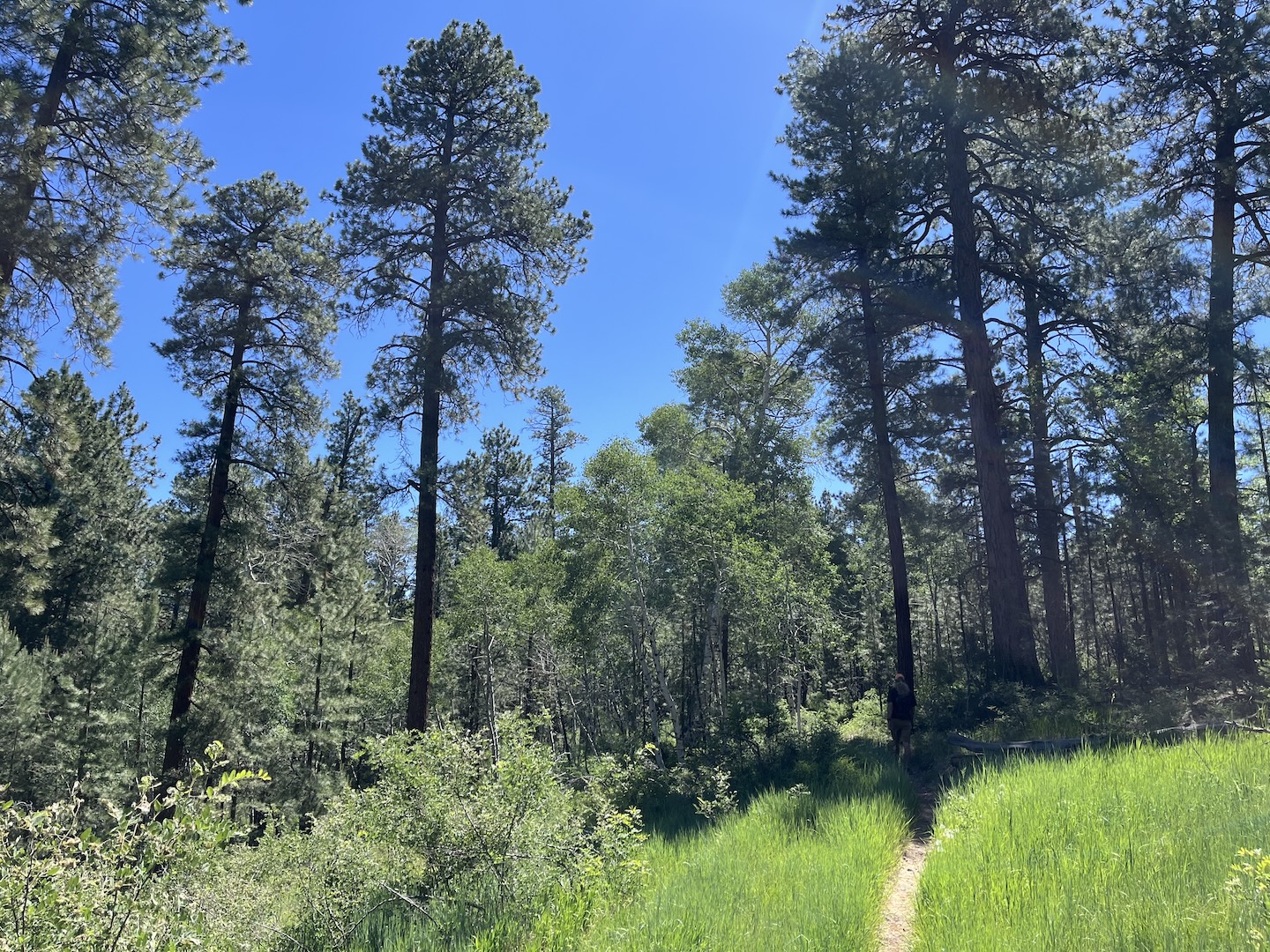
Trails off of Canyon Vista Campground
Trails off of Canyon Vista Campground
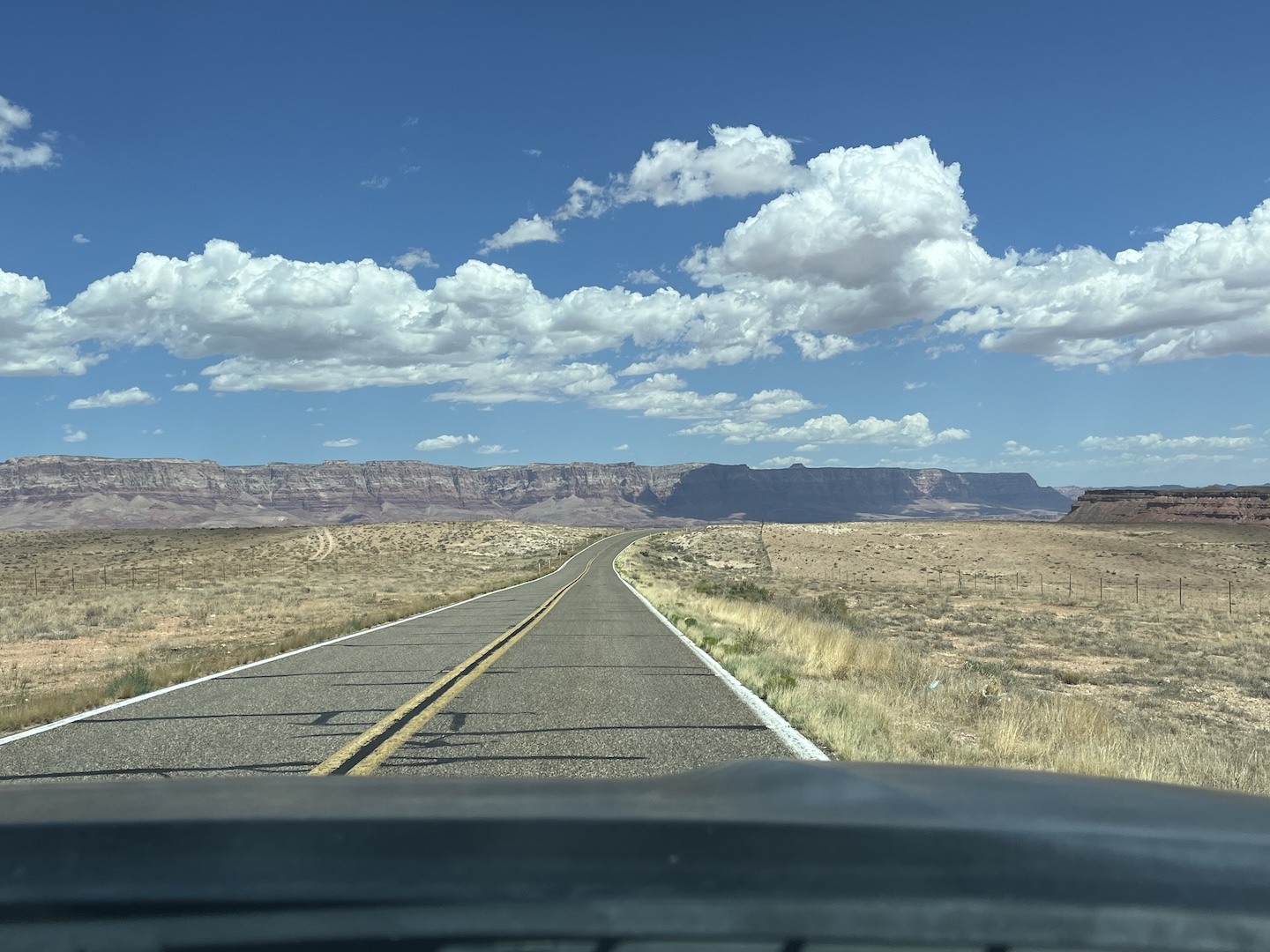
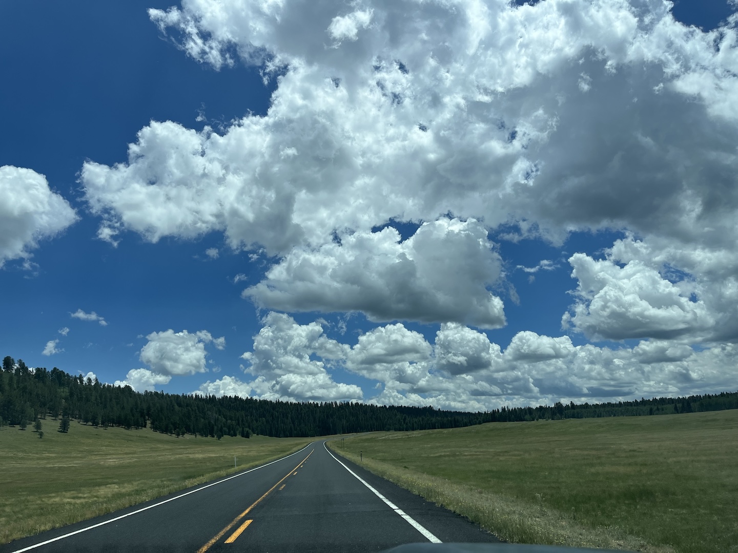
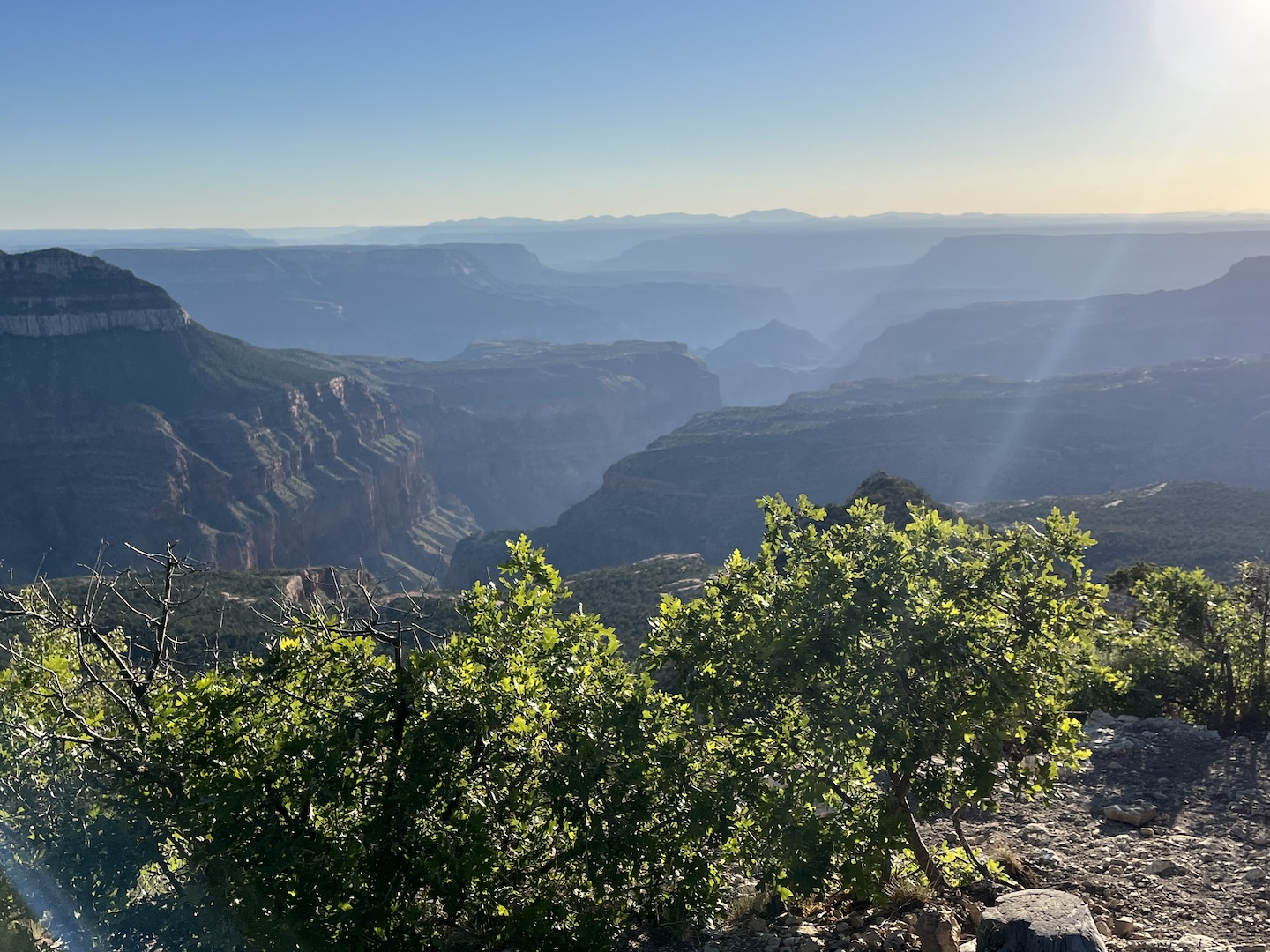
Our goal for the trip was to spend time on the North Rim of the Grand Canyon, the Rainbow Rim area to be specific. We’ve been twice before and have loved it each time. The drive between Flagstaff and the Kiabab Plateau is insanely gorgeous. If you’ve never taken that drive you absolutely should.
Vermillion Cliffs
Driving down the Kaibab Plateau
We visited in early July and expected it to be hard to find a campsite. It was the exact opposite and we got the BEST campsite! The Rainbow Rim area is 20+ miles down a dirt road and on the edge of the Grand Canyon. It’s really secluded and you get no cell service. Talk about peace and solitude.
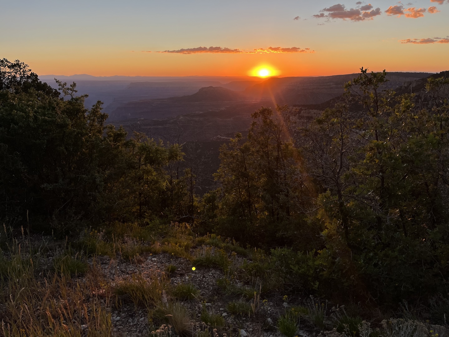
We ended up getting a spot right next to the rim. It was heaven on earth. We watched the sun rise, set, and everything in between over the canyon every day. There were a few people in the vicinity, but they were a little bit down the road.
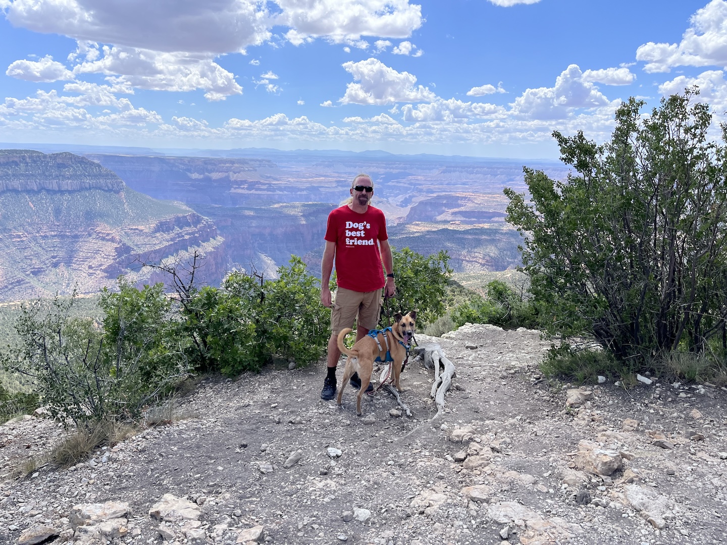
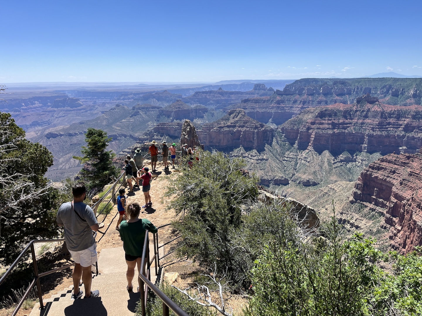
After a few days of solutude we headed into Grand Canyon National Park for a dose of civilation. Smokey was with us so we were limited as to where we could go, but it was still fun. We walked around a little bit, drove to some points we hadn’t previouslly been to, and then headed to the Arizona Trail to hike a little.
Grand Canyon National Park
Point Imperial, Grand Canyon National Park North Rim
Arizona Trail in Grand Canyon National Park North Rim
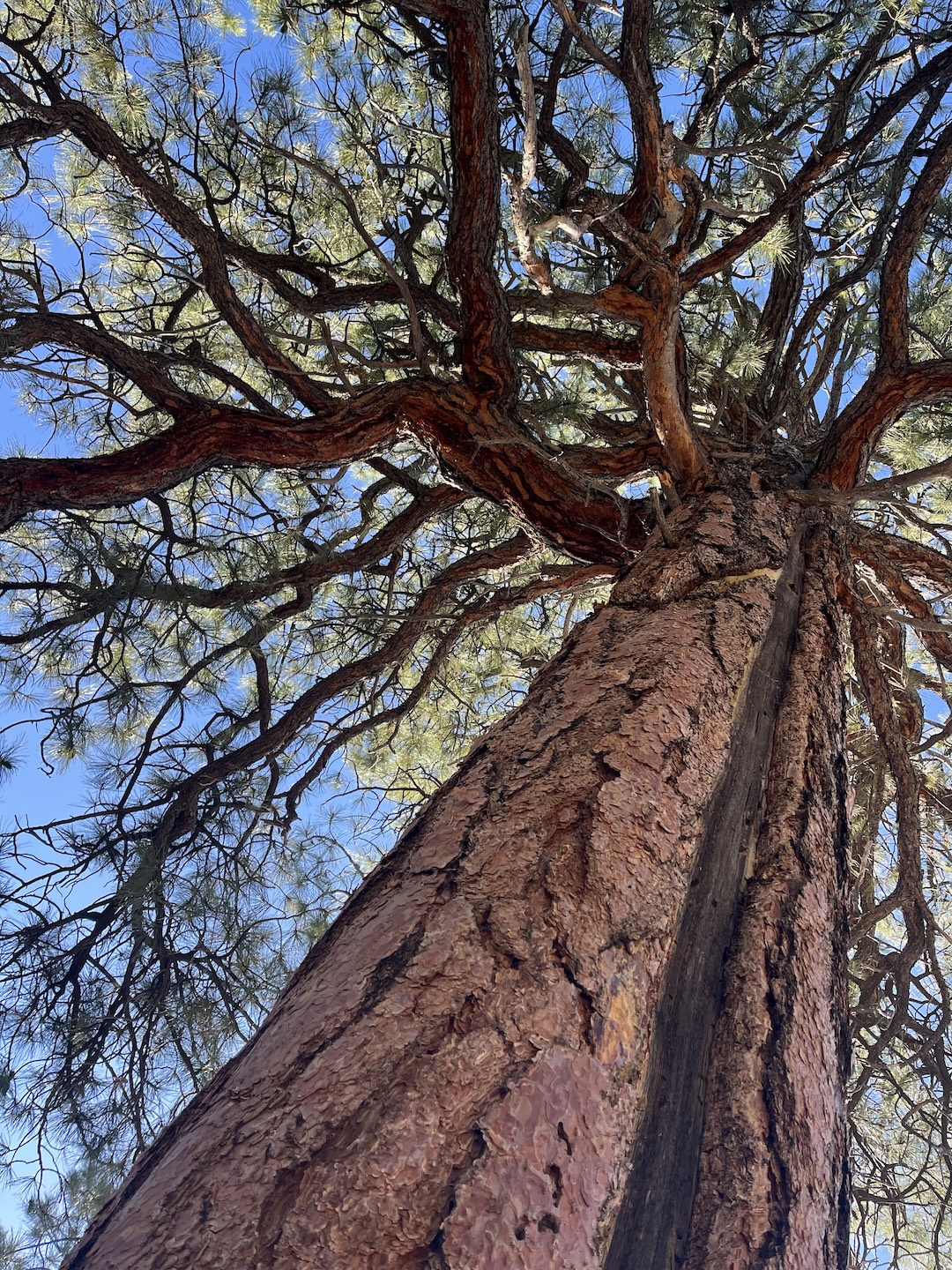
We had set up camp in the shade of a large tree. We spent the afternoons following the shade with our camp chairs and reading. One day I happened to look up at the tree and saw a huge lightning scar. ACK! (Several years ago we were camping during a thunderstorm and our camp was struck by lightning. Not a moment I would like to ever like to EVER repeat and lightning still makes me very jumpy.)
Lightning scar in tree
As I looked around I realized we set up camp under the tallest tree in the area right on the edge of a cliff. Not the smartest move. I immediately crafted a plan in my head in case a storm rolled in (get in the truck and drive away from tree and rim) which we fortunnatly did not have to enact.
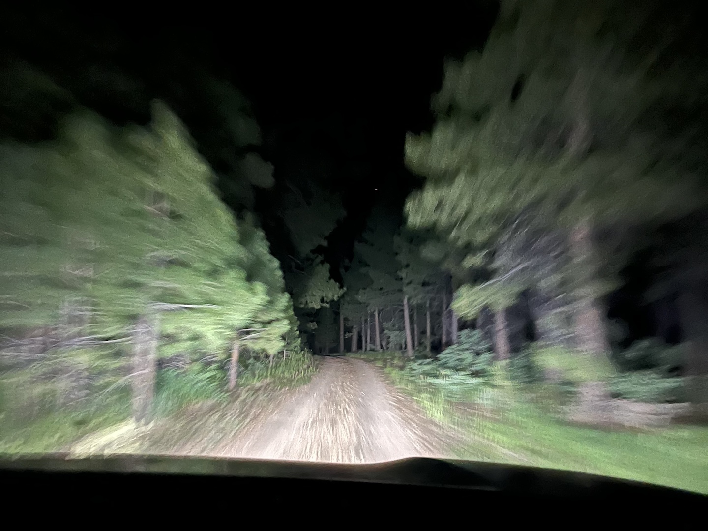
The wind picked up pretty significantly our last evening at camp. We went to bed around 10pm and woke up at midnight to someone knocking on our door and shouting. My immediate thought was we’re either being murdered or there’s an emergency. Fortunantly for us, we were not murdered but for sure not an ideal wake up. There was a very strong smell of smoke in the air and our neighbor wanted to alert us to the situation as he was leaving. It was very kind of him to wake us up, truly. After quickly assessing the situation, we decided to follow suit and leave as well. We were in a very remote location with no cell service and at the dead end of a single road out. When we went to bed at 10pm there was no smell of smoke in the air and two hours later it was very strong. I’ve never packed up so fast in my life.
Driving out of the forest in the middle of the night
As we were driving back towards the main road, we pulled over to let the one other vehicle we saw pass us (we were towing and they were not). They stopped next to us and we chatted for a few minutes. They were also camping in the area, not near us but in the same forest area, and also left due to the very strong smell of smoke. The fact that people in a different area from us also were concerned helped us feel better about our decisions to leave. In a situation like that you never know if you’re overreacting but based on where we were, there isn’t a lot of room for error should there actually be a fire in the area. Better safe than sorry.
We ended up sleeping on the side of the road near the Jacob Lake Inn. We weren’t supposed to sleep there but I didn’t care. It was 2am and we had no where else to go. The next morning we drove back to Flagstaff.
Campsite views on the side of the road
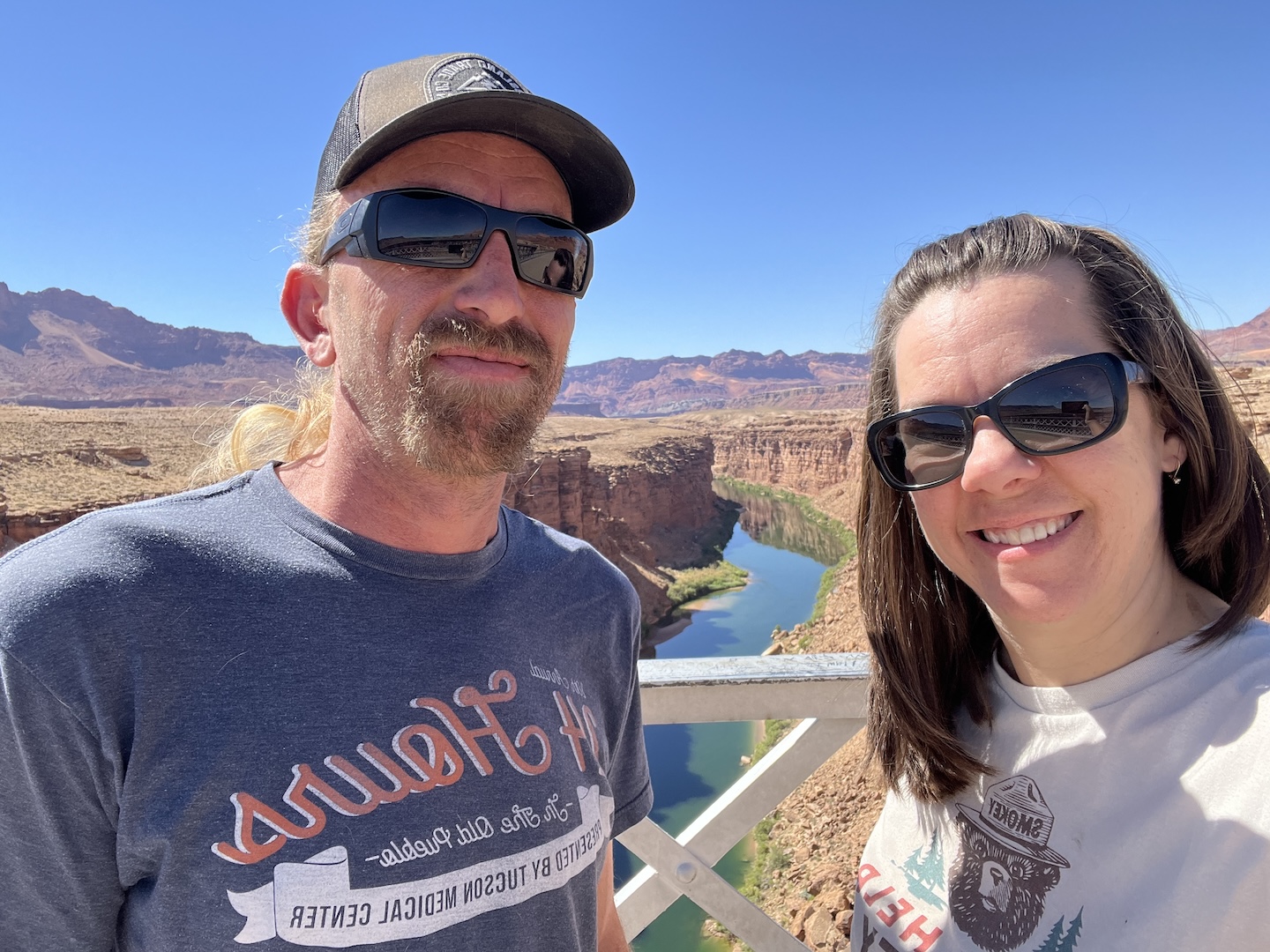
We stopped at the Navajo Bridge on our way to Flagstaff because why not. It’s a quick stop and so pretty.
Navajo Bridge
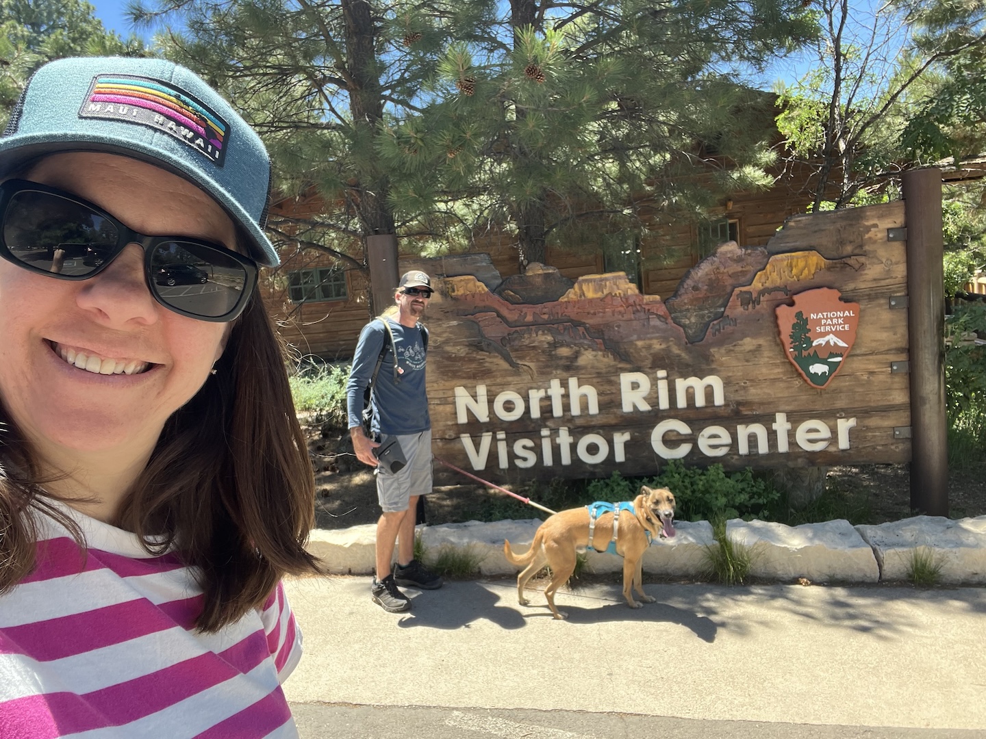
Overall this was an enjoyable trip. We took our dog Smokey and thought he’d love 10 days of camping. Turns out he prefers weekend trips. The first few days he wanted to be outside but after that he was either on a walk or in the camper napping on our bed. He’s such a goofy dog. Love him to death though.
https://www.theroadwevetraveled.com/wp-content/uploads/2025/10/IMG_1140.jpeg10801440Carolinehttp://www.theroadwevetraveled.com/wp-content/uploads/2015/08/RWT_Logo@3x-300x143.pngCaroline2025-10-05 20:40:262025-10-05 21:13:14A Week In Northern Arizona
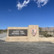
I visited Joshua Tree National Park on a solo trip for my 40th birthday. Recently, my husband and I realized I have visited 30 national parks and he only 29 because he didn’t go on my solo trip. We clearly had to remedy the situation so I planned a trip!
Being that it’s January in a desert park, it’s prime season and last minute campsites are hard to come by. All the reservable sites in the center of the park were booked but I found a few open sites at the Cottonwood Campground, which is an hour away from the main section of the park. One hour is better than not going to we booked the site and started planning.
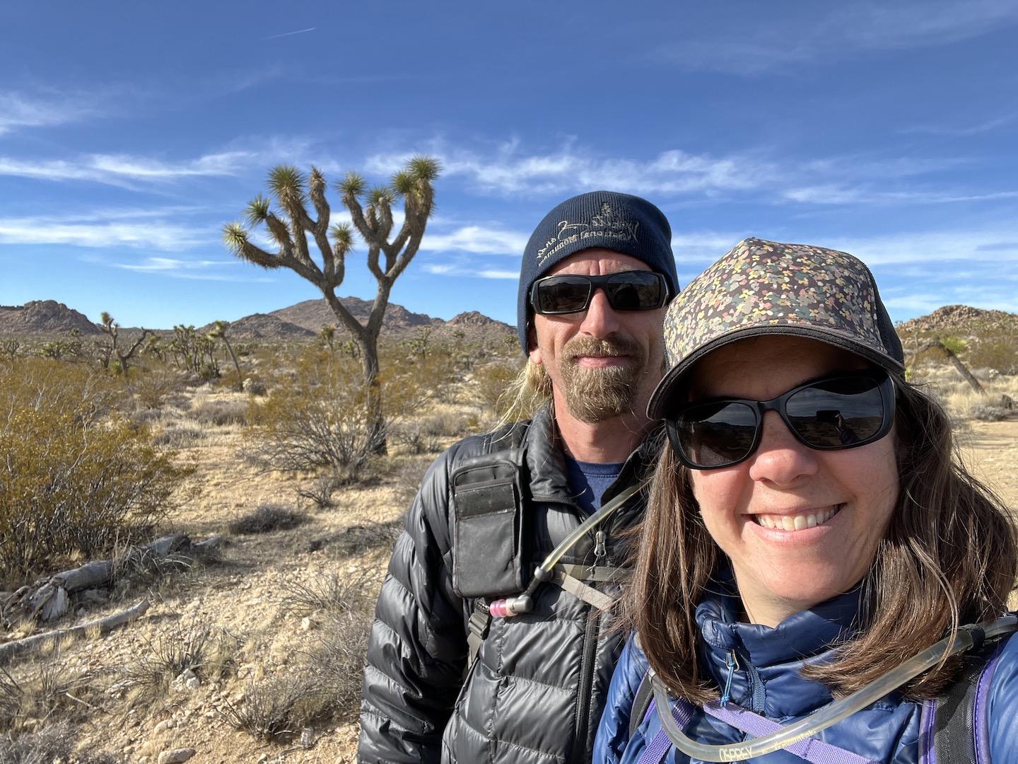
When I visited previously, I was by myself and stuck to the short hikes and more touristy things for obvious reasons. Going back with Brandon meant we could explore more so I started looking into what all there is to do. Basically we did all the things. 3 night camping, 2.5 days exploring, 5 hikes for a total of 13.5 miles, 1 ranger led tour, 2 quick stops, 1 western town, 2 grocery stores, 1 souvenir store, 2 visitor centers, 2 saloons, and drove through all 3 entry points. And that, my friends, is how I like to vacation. 🙂
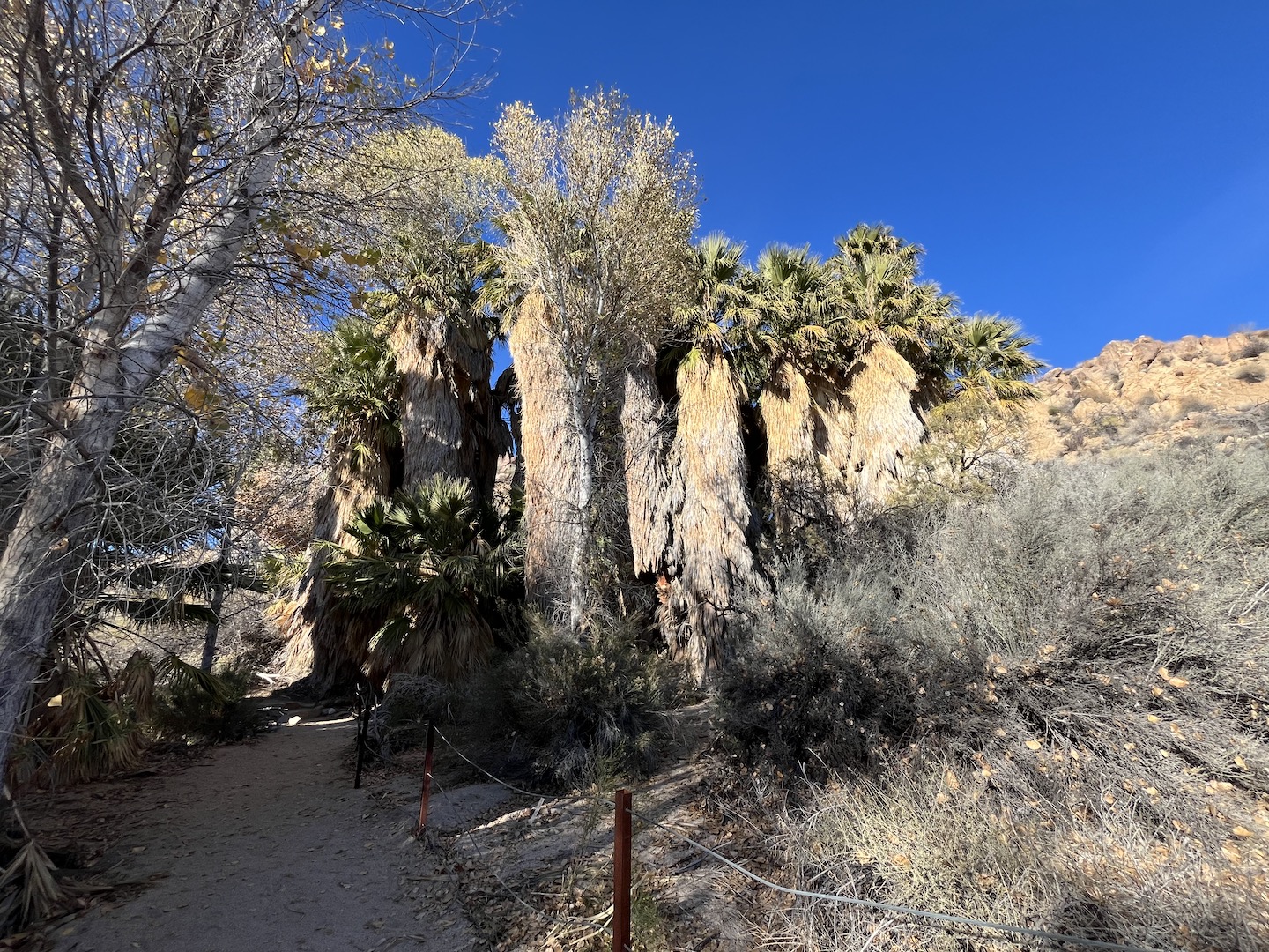
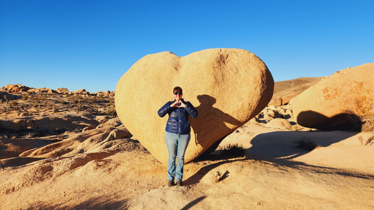
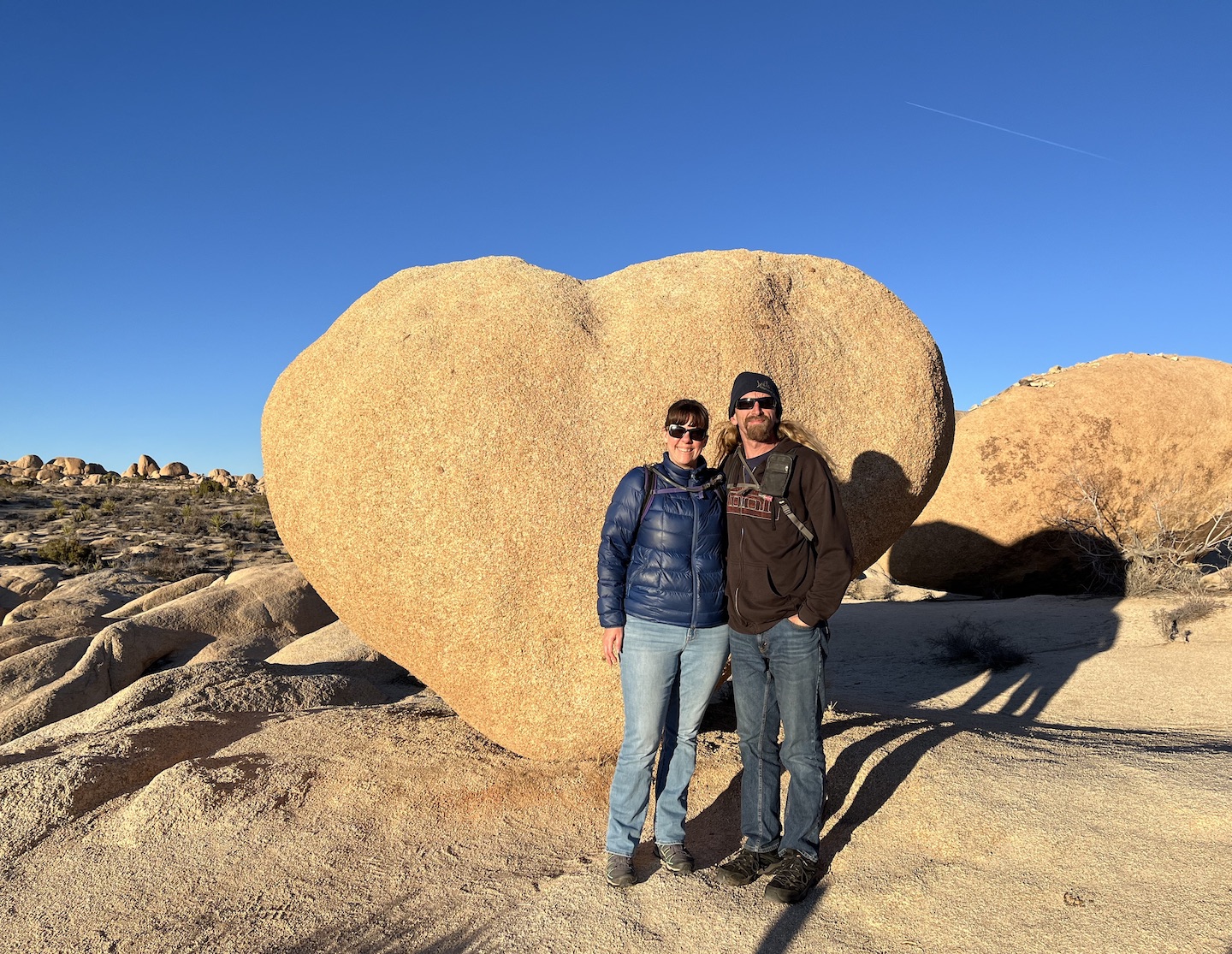
We arrived on a Thursday afternoon and got set up at camp. We still had some daylight to burn so we hit the road. Our first stop was the Cottonwood Spring. Next stop was the visitor center which wasn’t very exciting. Lastly, we headed to the Arch Rock trailhead. My goal was to find heart rock and we did! The internet is an interesting pace. Some places are unmarked and articles never get updated when they become marked. I’m not knocking anyone. People have no way of knowing when something changes but it does make it hard to plan for things. When I was searching for things to do, heart rock kept coming up and people were providing GPS coordinates and crazy directions. We were pleasantly surprised to find that it’s now a marked trail.
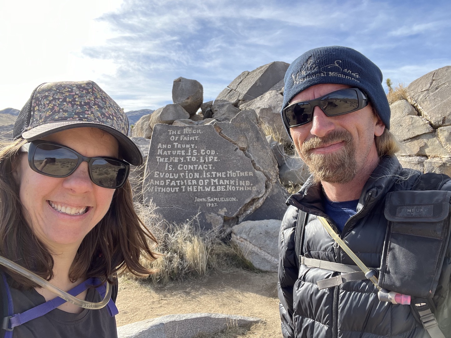
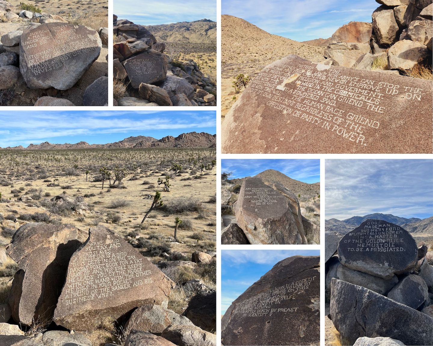
I was super excited for our Friday plans. I read about an unmarked hike to Samuelson Rocks and that was first on our list for the day. It’s not an official trail and on the internet you can find the GPS coordinates. I wasn’t totally keen on the idea of just walking through the desert towards some GPS coordinates and was trying to decide if we should really be going off trail. As I was studying park maps, like more detailed ones, I found actual trails to get to Samuelson Rocks. I’m not giving details, if you want to do this hike, you can figure out how to get there. There is no cell service in Joshua Tree and the trail is totally exposed, so be sure you have a GPS device, water, and snacks. As we turned onto one of the trails there was a sign that said you are entering backcountry. Be prepare to self rescue. When I mentioned this hike to a ranger at the visitor center he rolled his eyes and said there are no trails to it. If they didn’t want people finding the area, I assume it wouldn’t be on maps. My only advise, if you’re going to do this hike, look at the maps and figure out how to get there safely. The area can be very disorienting so make sure you have a GPS device and know how to navigate There is no trailhead and only a small parking pull out so we wanted to be there first thing in the morning to make sure we could park. Before the park was a park, miners and ranchers came to the area to mine for gold and build homesteads. John Samuelson was one of those guys and the legend goes that Samuelson was a radical thinker but no one really seems to know much else about him. He carved his thoughts into eight? boulders all strewn around a rocky hill in the area where he used to live. You can find remnants of the homestead. A car, fence, and bed frame are all randomly in places. What I loved most about this adventure is it was part hike park scavenger hunt. We spent probably a good hour at the site looking for the different rocks. Some are harder to find that others. We had the place to ourselves mostly, with the exception of two guys who happened to be hiking by and asked what we were doing. This hike was definitely a highlight of our trip. We hardly saw a soul and got to see something really special.
After we finished our hike, we headed into the town of Joshua Tree to check out a few places we read about no the internet. The first was Pioneertown. It’s an old western town that was used for movies. We live in Arizona and have several of these, so Pioneertown wasn’t that exciting. There’s a restaurant/bar and some souvenir stores. It’s a little ways out of town so I wouldn’t suggest going unless you really love that kind of thing. We made a few stops in Joshua Tree, the national park visitor center, Joshua Tree Coffee, a souvenir store, and the Joshua Tree Saloon. The place was crazy busy. We could barely get a seat. We drove through the 29 Palms Entrance to work our way back to Cottonwood Springs. It was a long day of driving and exploring but we got to see a lot.
We had 9am reservations for the Keys Ranch Tour so we hit the road early and made our way across the park. We arrived at the meet up location a little early and quickly took a short hike to see the pink house. Overtime people have carved their names into the property so the pictures online are better. I don’t understand why people do that.
We snapped a few pictures and headed to the meet up spot for the Keys Ranch Tour. The tour is in a locked area of Joshua Tree so if you miss the meet up time, you miss the tour. The tour is only offered certain times of the year and does sell out, so if you want to go get your tickets early. I love ranger talks and learning about the history of an area.
After the tour we did a few hikes in the area. First was Barker Dam.
Nest was Hidden Valley.
We drove up to up to the high up view and it was meh. We weren’t ready to call it a day yet, so we decided to his the Lost Horse Mine trail on our way back down from the high up view. Normally I wouldn’t tack a harder trail onto the end of a day but sometimes the spontaneous plans are the best.
The trail felt like a mirage towards the end. My watch mileage was telling me we should almost by there but my eyes felt different looking at how far we still had to go. The mileage was correct, thank goodness. Being that it was the end of the day, there was hardly anyone out hiking so we had to mine to ourselves mostly the entire time we were there. We had a drink and a snack, enjoyed the views, and headed back to the car. We were beat by the time we go back to the truck and this was the perfect end to our trip.
I’m pretty sure I was in bed as soon as we ate dinner. The next morning we packed up and headed home. We had an absolutely fabulous time in Joshua Tree and packed so much into our time. My favorite vacations are where you are so tired by the end of the day you practically fall asleep in your dinner.
https://www.theroadwevetraveled.com/wp-content/uploads/2025/08/IMG_8728.jpeg10801440Carolinehttp://www.theroadwevetraveled.com/wp-content/uploads/2015/08/RWT_Logo@3x-300x143.pngCaroline2025-08-13 03:37:412026-01-05 23:16:14Another Visit to Joshua National Park
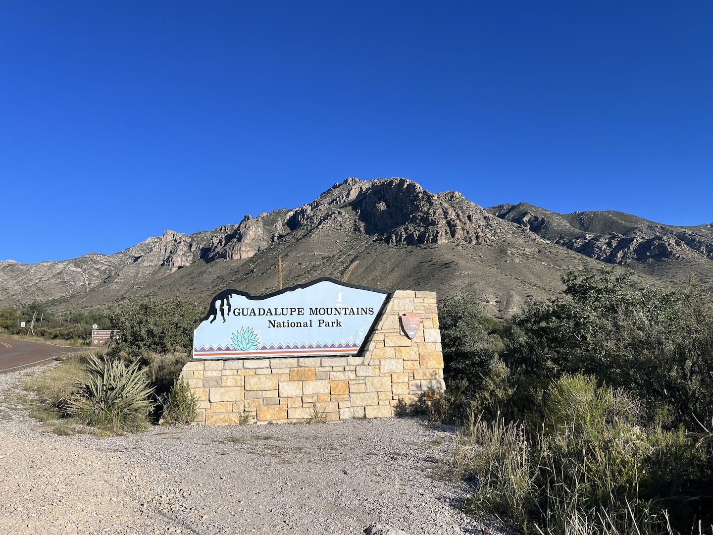
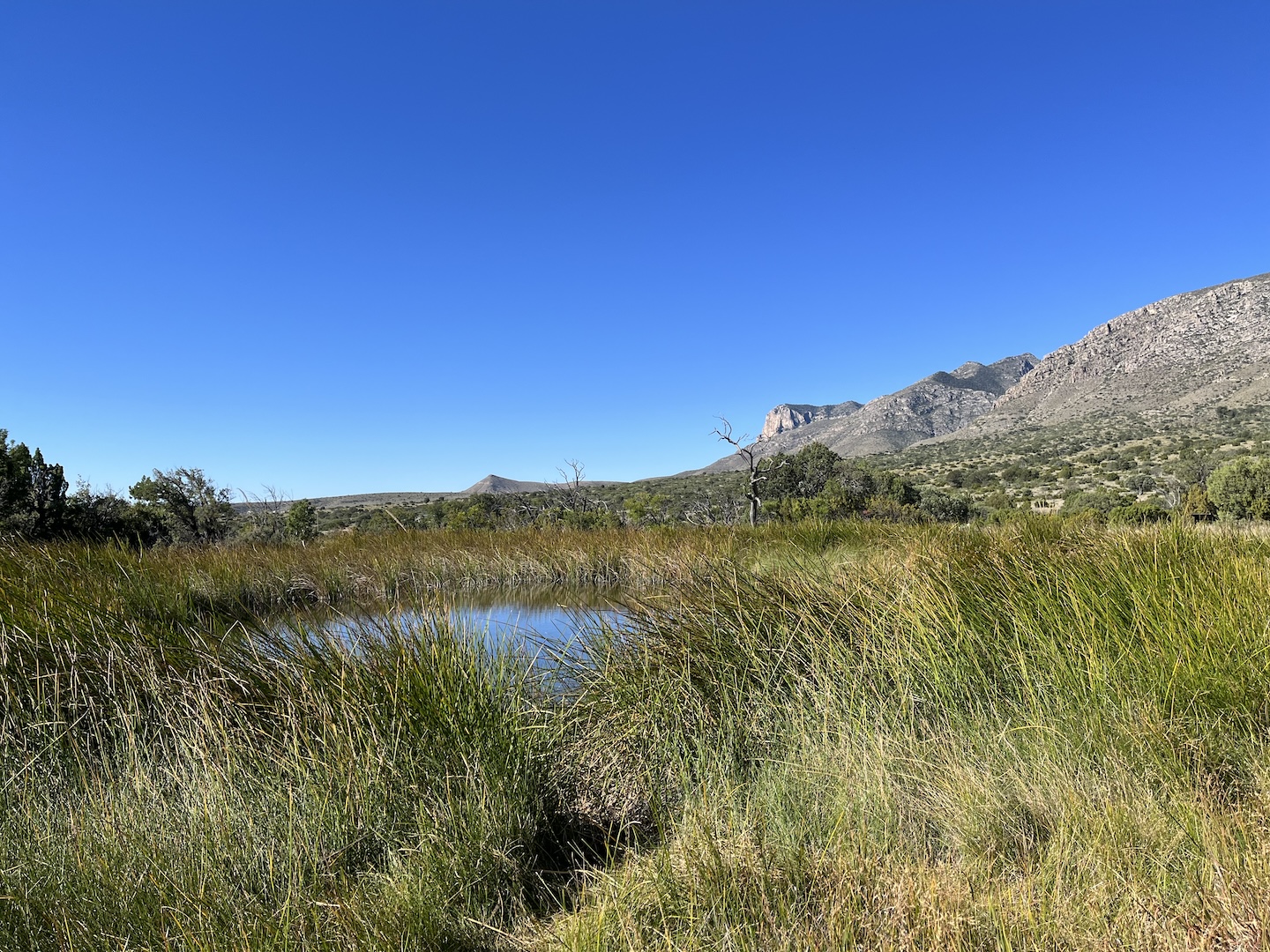
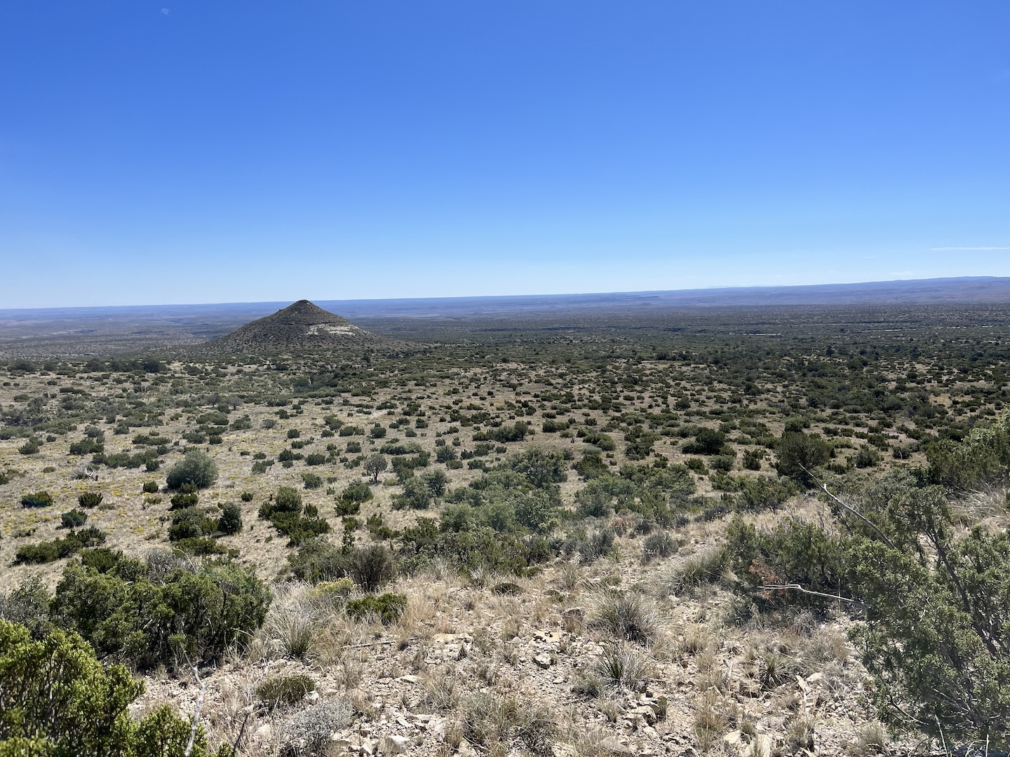
We visited Guadalupe Mountains National Park on the same trip as Carlsbad Caverns National Park. They are neighbors even though they are in different states. Many people go to Guadalupe Mountains to hike to the tallest point in Texas, Guadalupe Peak. We didn’t have time for that on this trip but were able to spend a few hours in the park.
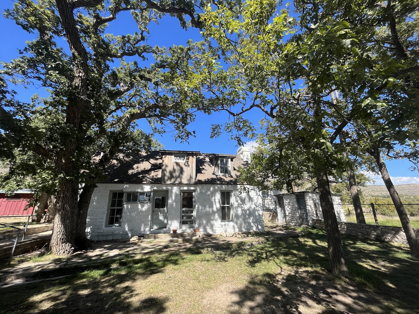
After getting our sign picture and stopping in the visitor center to learn about the park we headed to the Frijole Ranch area. We spent some time exploring the ranch buildings and the nearby spring.
Frijole Ranch Manzanita Spring
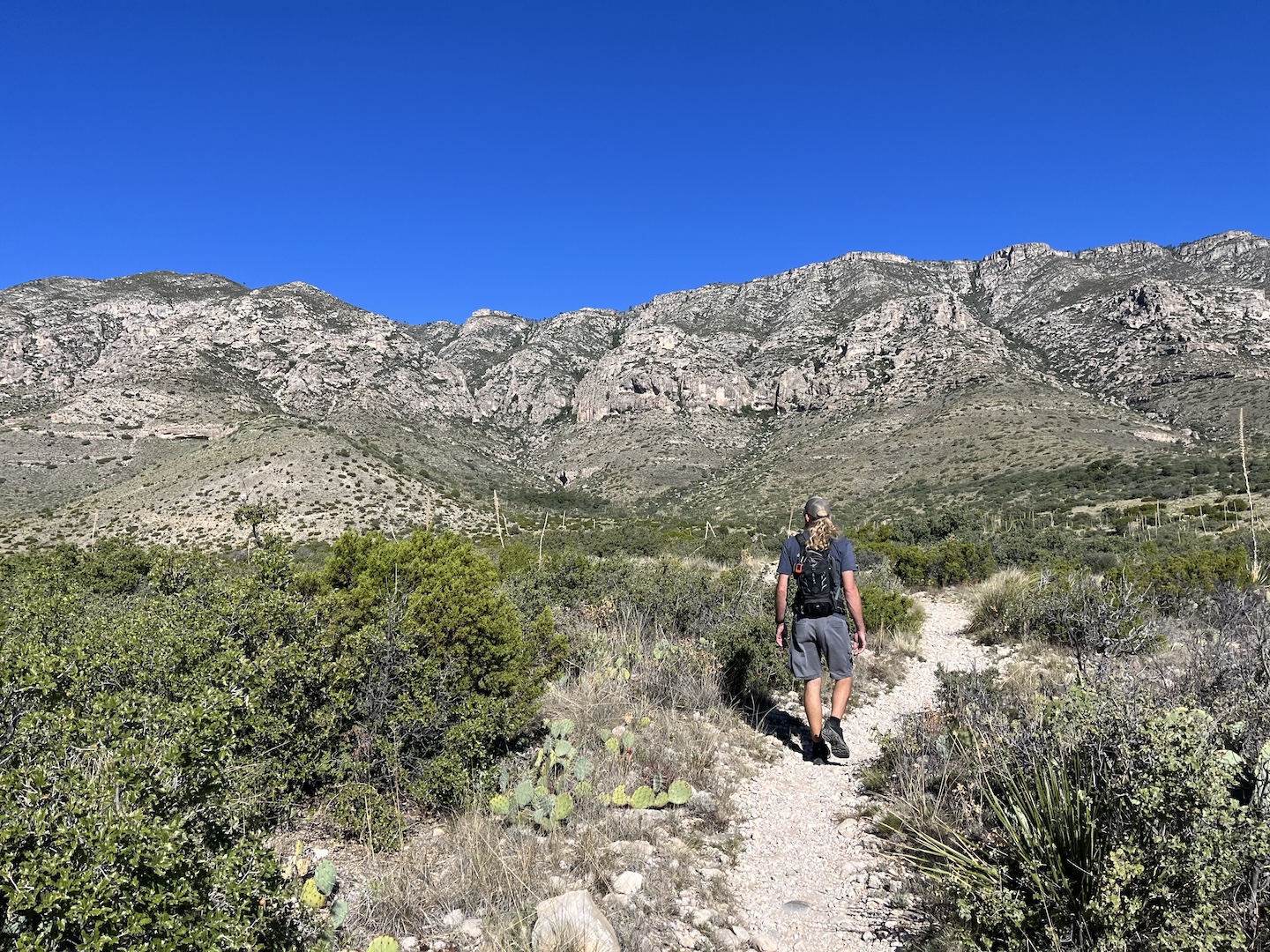
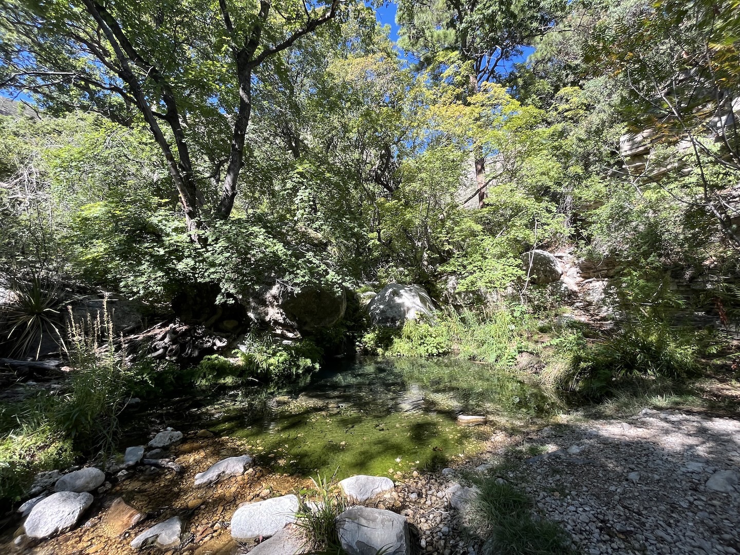
Our final stop in the park was the Smith Springs Trail Loop. The trail goes up about 400 feet to a spring. We got a later start than we wanted and the trail was a little warm. Fortunantly, the spring area is full of trees that provided a perfect place for a snack break. I may have been a little hot and hangry on the hike in so a snack in the shade was good for everyone in the group.
Smith Spring TrailSmith Spring
On our way back to the trailhead we were treated to a nice breeze and beautiful views.
This was a great trail for the short amount of time we had in the park. Water in the desert is always special. I hope to come back one day and hike a few of the other trails.
https://www.theroadwevetraveled.com/wp-content/uploads/2025/08/IMG_7159.jpeg10801440Carolinehttp://www.theroadwevetraveled.com/wp-content/uploads/2015/08/RWT_Logo@3x-300x143.pngCaroline2025-08-12 05:11:342025-08-12 05:11:35Guadalupe Mountains National Park
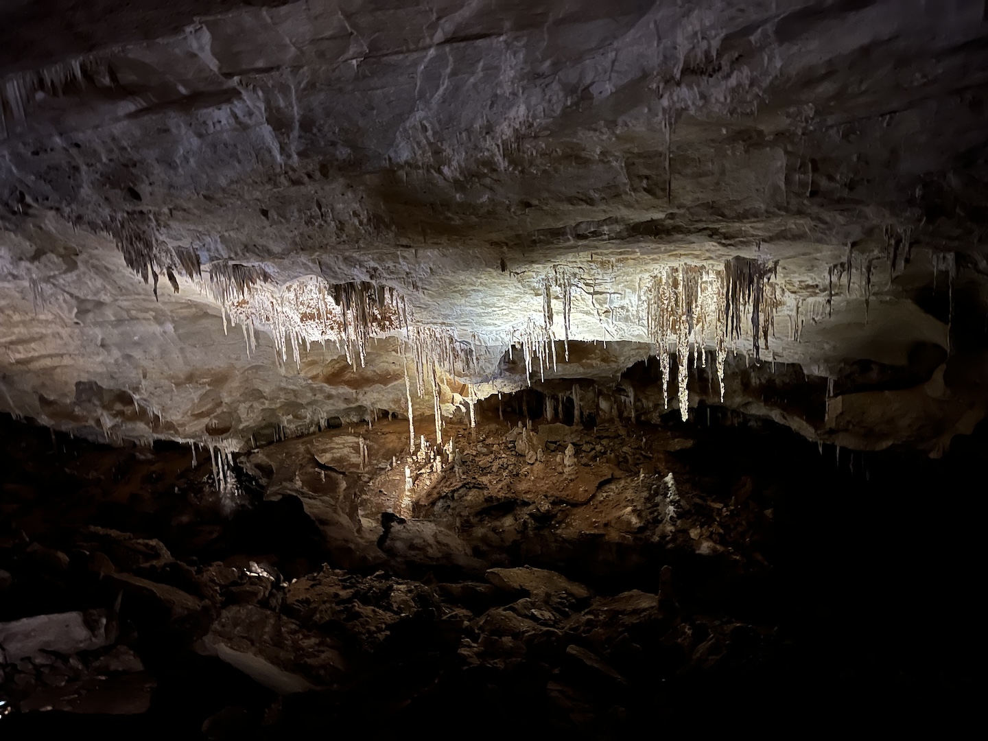
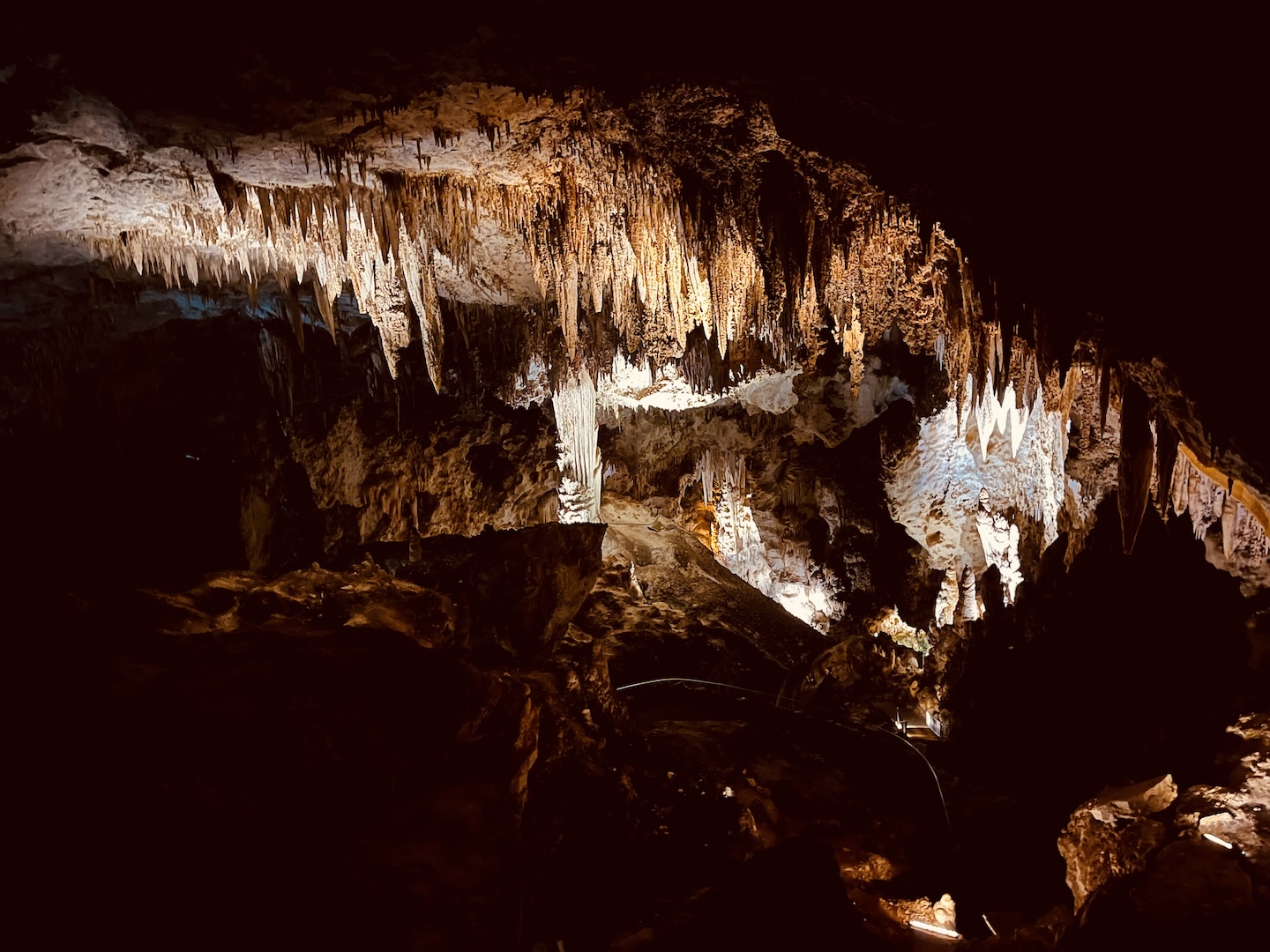
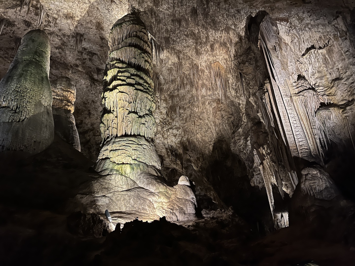
I wasn’t sure what to expect with Carlsbad Caverns National Park. I’ve seen pictures and heard stories but I wasn’t prepared for what we got to see. I think that’s one of the things I love most about visiting new places, especially the national parks. Pictures are beautiful, but they can never capture the awe you feel being in some of theses places.
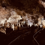
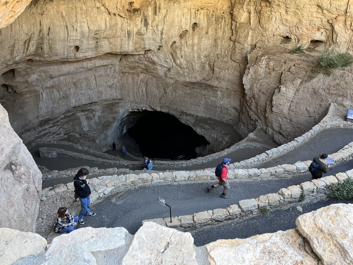
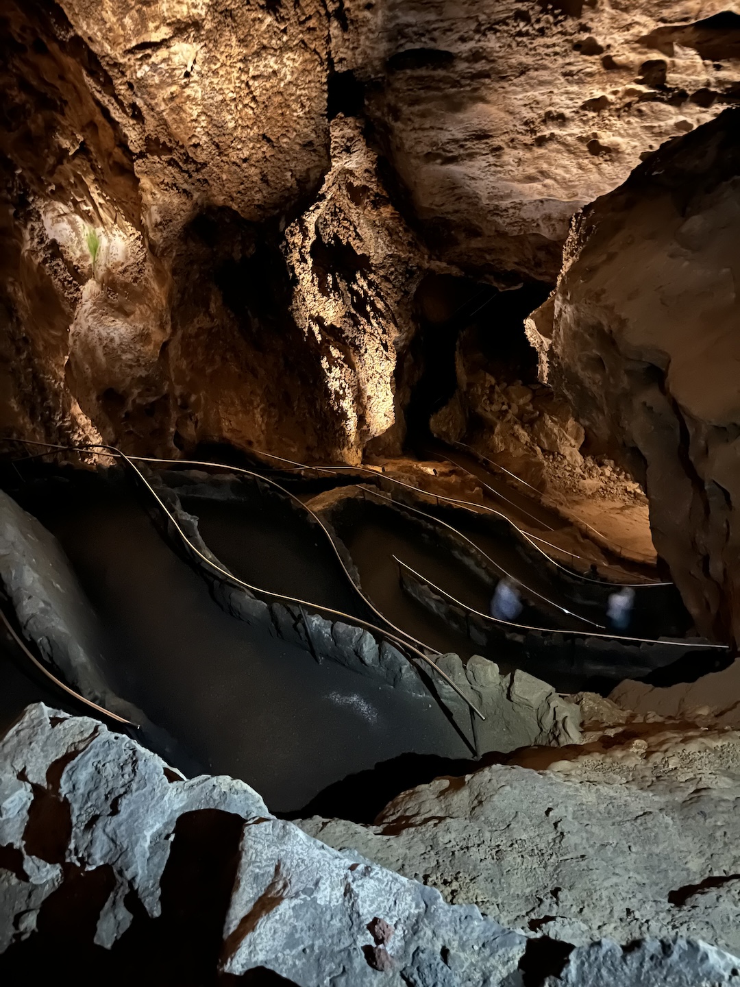
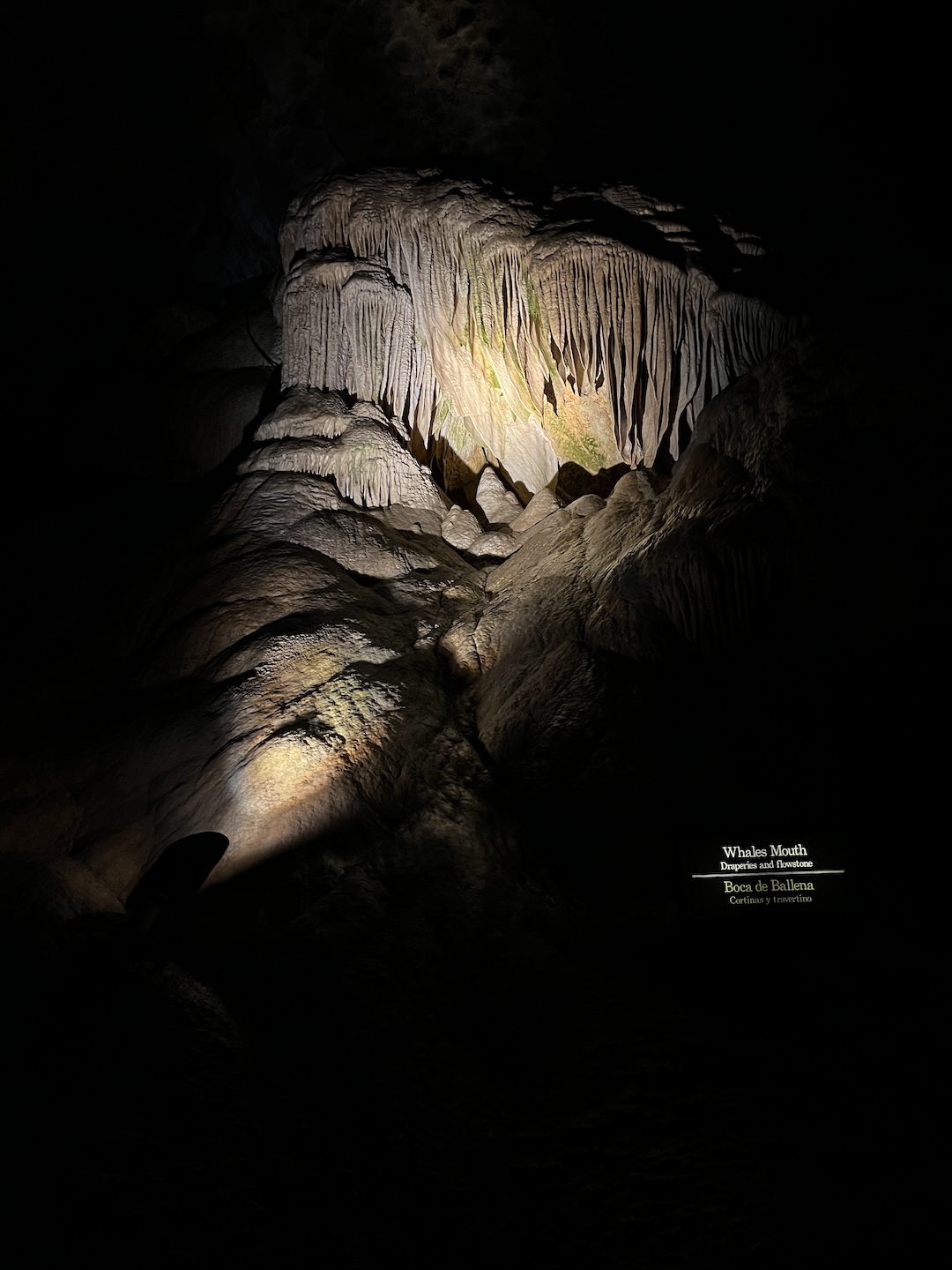
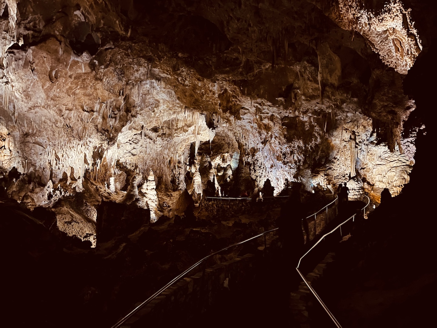
Carlsbad Caverns is known for its incredible caves. The Big Room is the largest single cave chamber by volume in North America. You can get to the Big Room by taking an elevator down or by walking in through the Natural Entrance Trail. We opted for the walk in which is a 1.25 mile trail that decends 750 feet.
The walk in was more stenuous than I expected but I would highly recommend it. It was really incredible to walk in and wind our way down through all the formations. The walk is steep but there is a handrail.
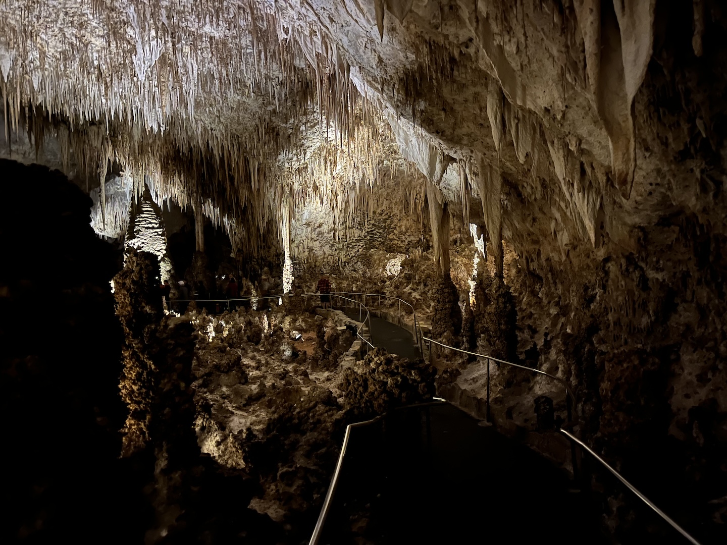
Once in the Big Room there is a 1.25 mile trail that goes around the cave. It’s relatively flat and part is accessible. By the end of our 2.5 miles, walking in plus the trail in the cave, we were beat. We took the elevator out and I have never been so excited for an elevator ride. Had we had to walk out I’d probably have taken up residence in the Big Room.
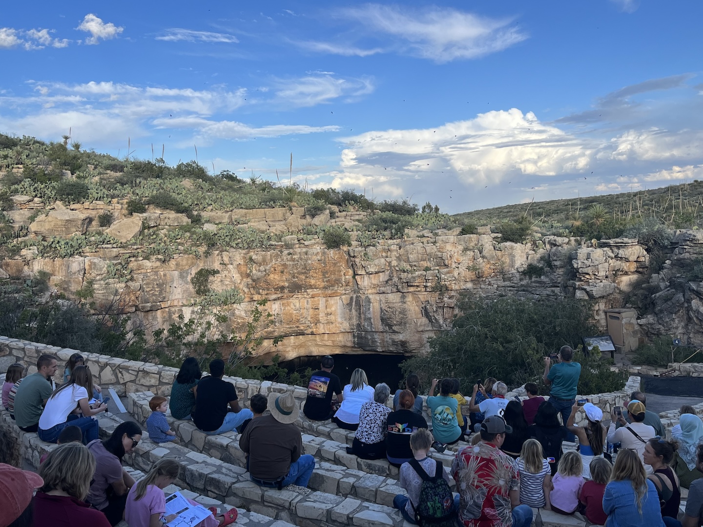
We visited in the fall, October 2023 to be exact, and were able to see the Bat Flight Program! It’s a must do if you’re visiting while the bats are still around. A large colony of Brazilian free-tailed bats call the cave home spring – fall. The bats leave at sunset each night to find food and water.
Prior to the bats exiting, the Cave Swallows that also call the cave home started flying around and putting on a show. I guess they are the opening act. Eventually the bats made their way out and everyone watched in awe as they flew out of the entrance, circled around in groups and made what looked like a cyclone, and then when their group was large enough they flew off. I’m not sure how long we sat there watching, probably an hour, but we had to have seen 100,000+ bats fly off into the sunset.
No picture/recording devices are allowed when the bats are flying so I don’t have any pictures to share but I think that makes this event even more special. It’s something you truly have to witness to see.
I’d recommend visiting Carlsbad Caverns if you are in the area. The cave is accessible, which is super cool. So basically, there’s no reason not to visit. Unless you don’t like caves and then you can take my word for its epicness. 🙂
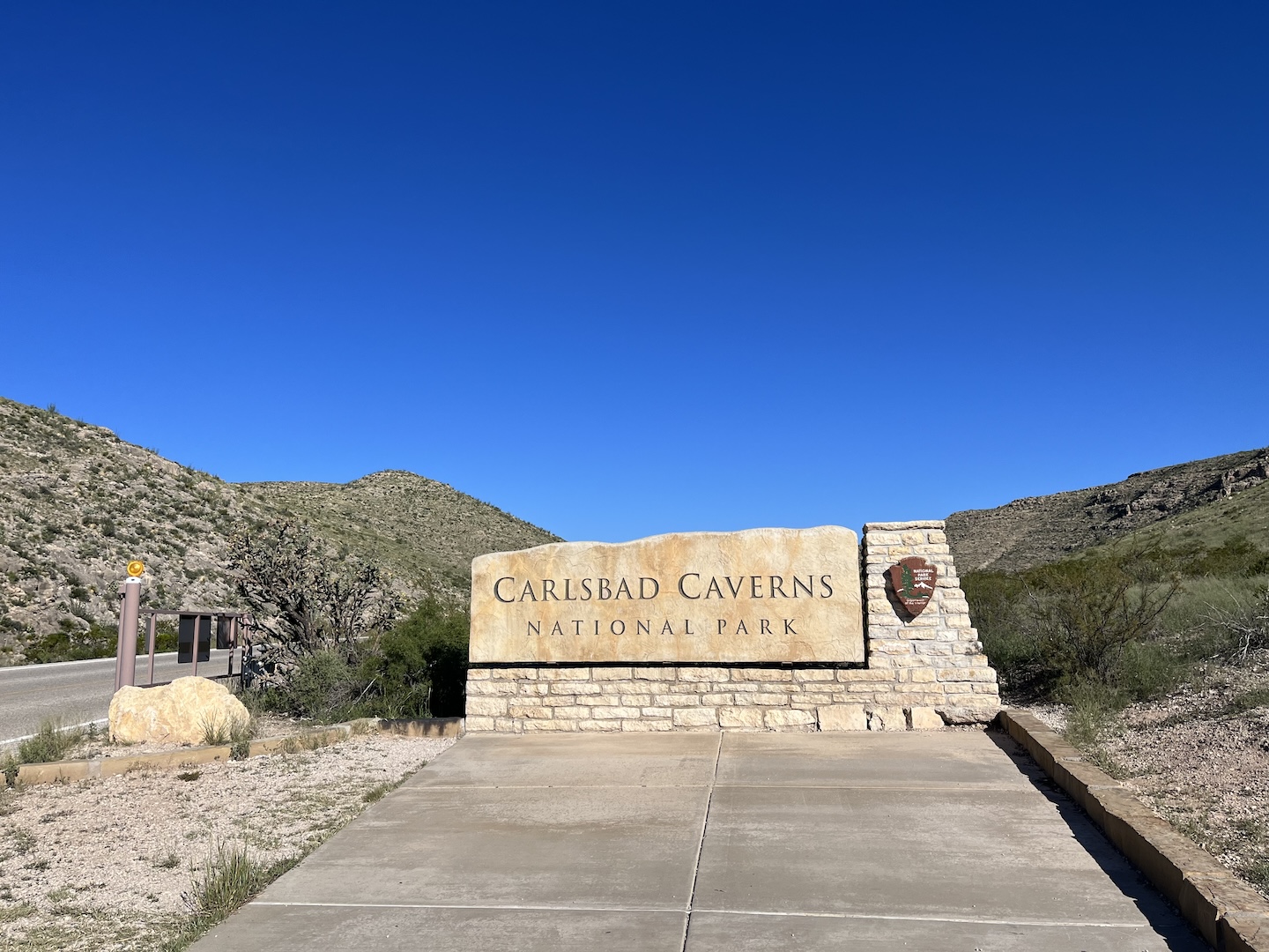
https://www.theroadwevetraveled.com/wp-content/uploads/2025/08/IMG_7092.jpeg10801440Carolinehttp://www.theroadwevetraveled.com/wp-content/uploads/2015/08/RWT_Logo@3x-300x143.pngCaroline2025-08-11 02:11:152025-08-11 02:12:39Carlsbad Caverns National Park
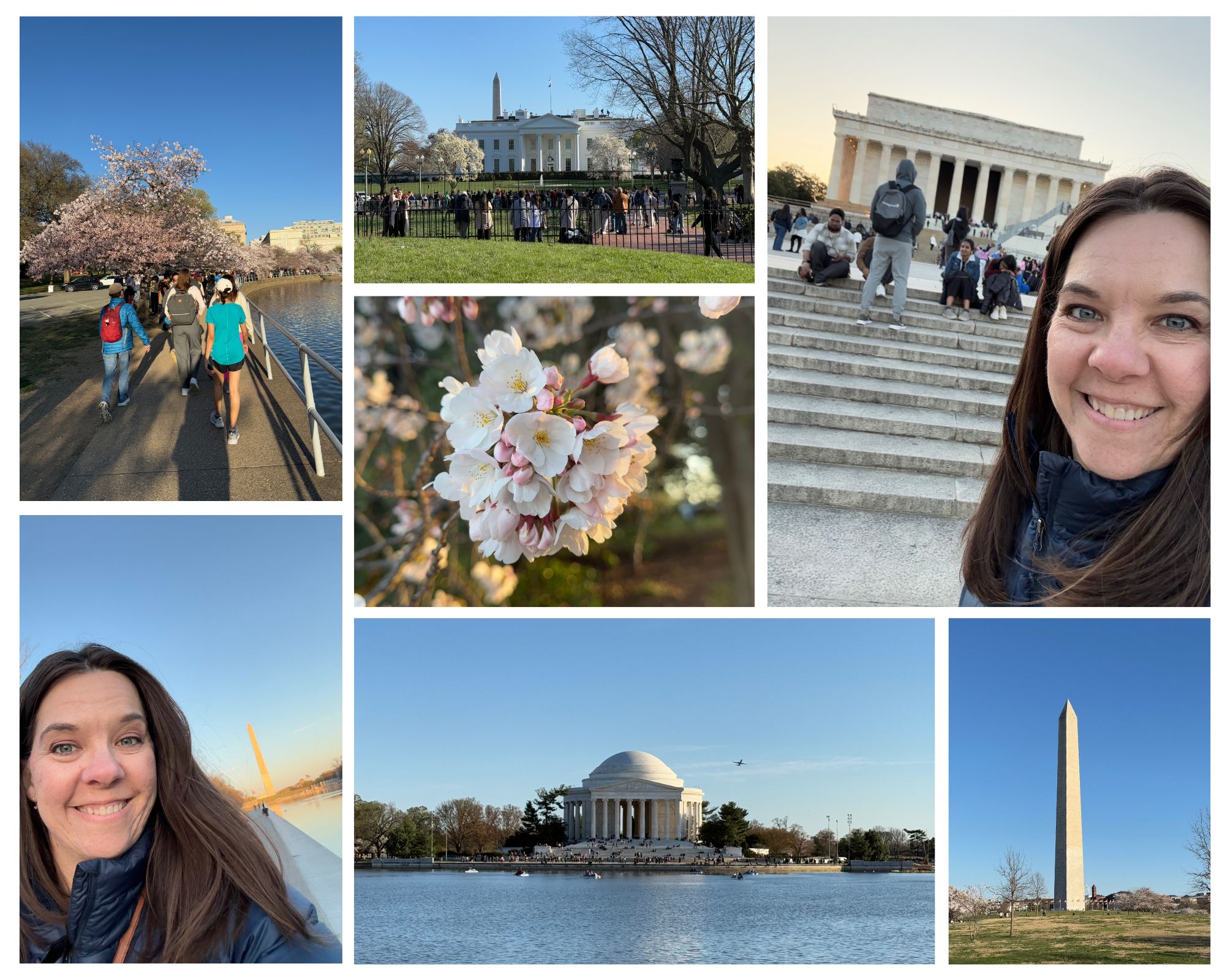
I was in Washington, DC in March for a work conference but have never been so I flew in two days early to explore the city. And even more exciting is that my brother joined me! We’ve always wanted to go to DC and took advantage of the fact that one of us was already there.
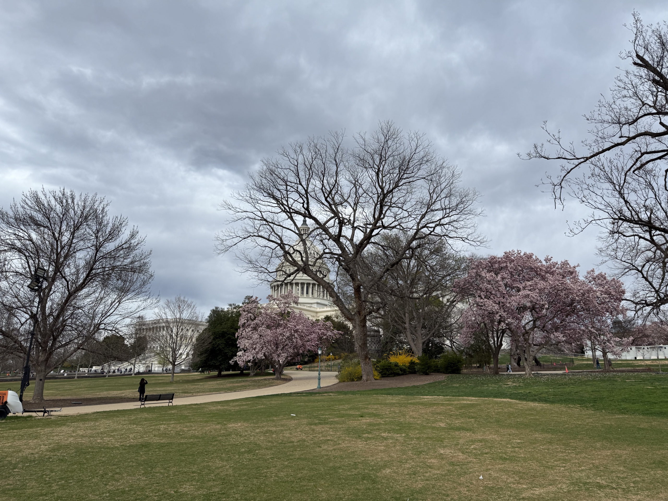
Capitol Hill in Washington, DC
I had a long list of things to do in DC but quickly realized how big the area we wanted to cover is and threw my list away. If you’re coming to DC on a quick trip and want to see some of the popular sites, I’d suggest following what we did as a guide. We saw a lot and got a good taste of the area.
We stayed in the Wharf area and it made a good base location. There are a lot of hotels and restaurants in the area, it’s a short taxi ride from the airport, and it’s easy to walk to the National Mall and monuments. If you’re comfortable walking a few miles this is a great location. It wasn’t a far taxi ride to the mall area either and traffic was less congested than if you are staying north of the mall.
Day 1!
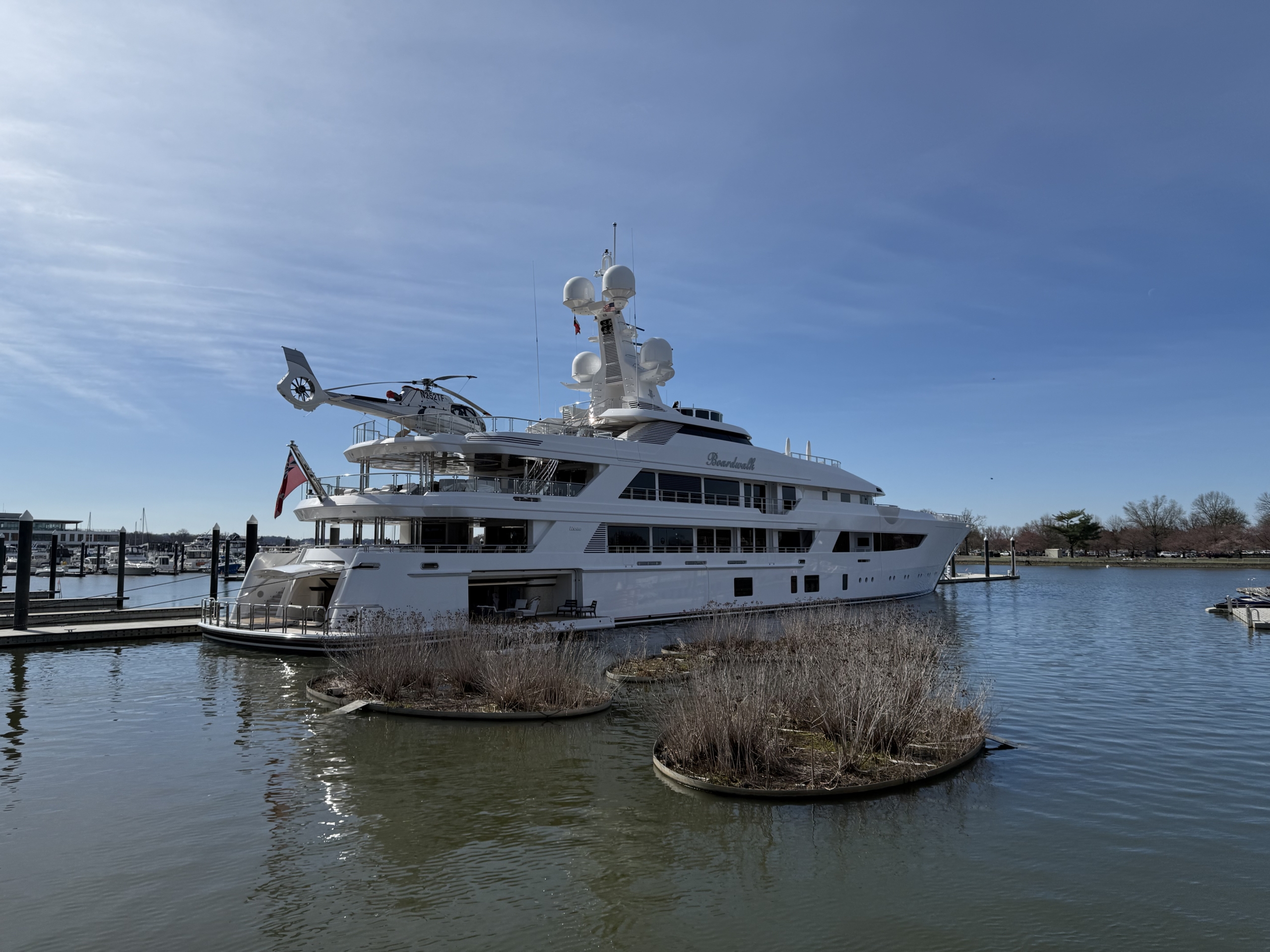
Boardwalk yacht
We started our day by stopping to view a $150 million yacht. After that we walked towards Tidal Basin to see the monuments and memorials.
Our first stop was the Thomas Jefferson Memorial. I’m a huge Hamilton fan and the musical was playing in my head as I walked around.
Thomas Jefferson Memorial
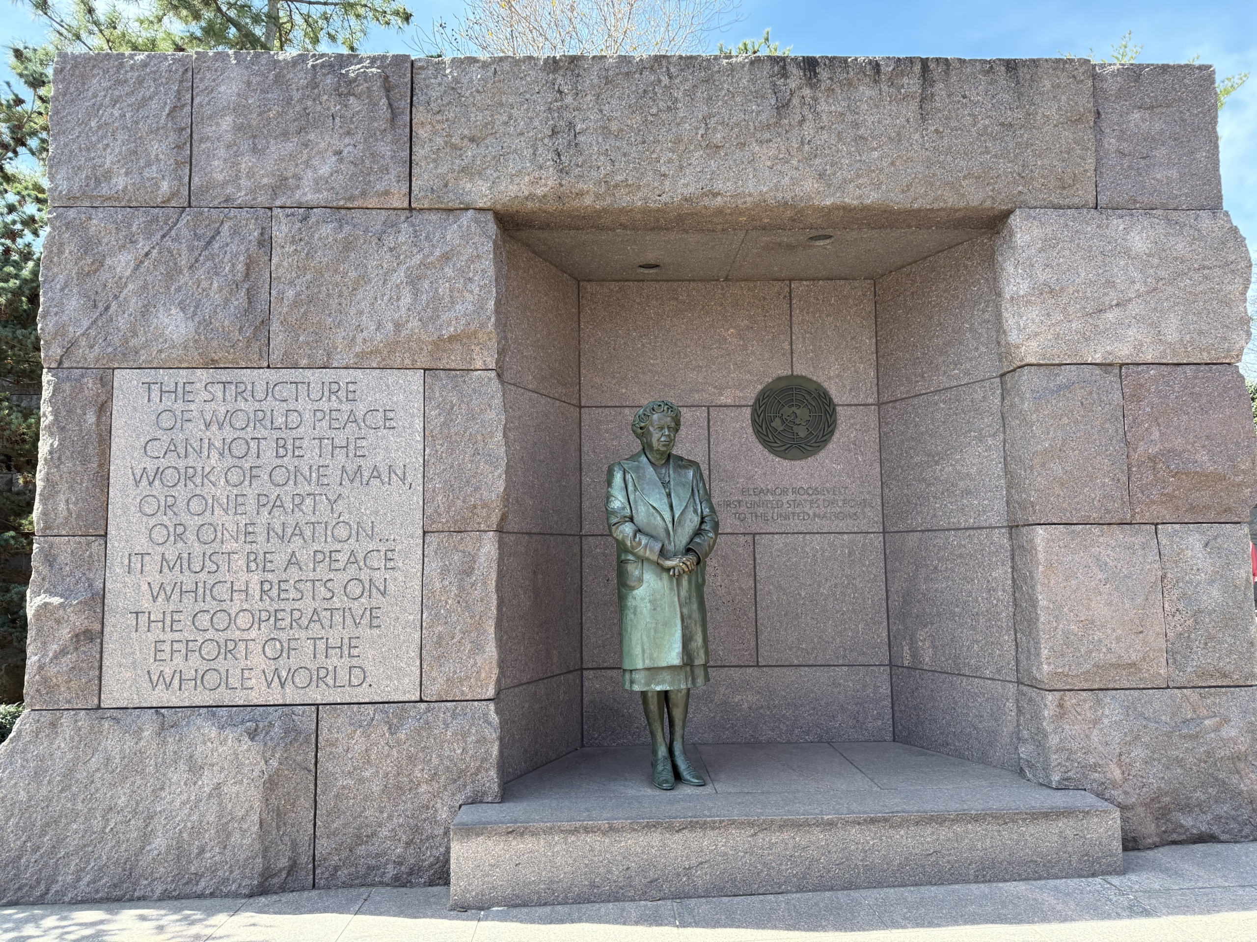
After that was the Franklin Delenor Roosevelt Memorial. It was one of the most impactful and moving memorials we visited.
Franklin Delenor Roosevelt Memorial
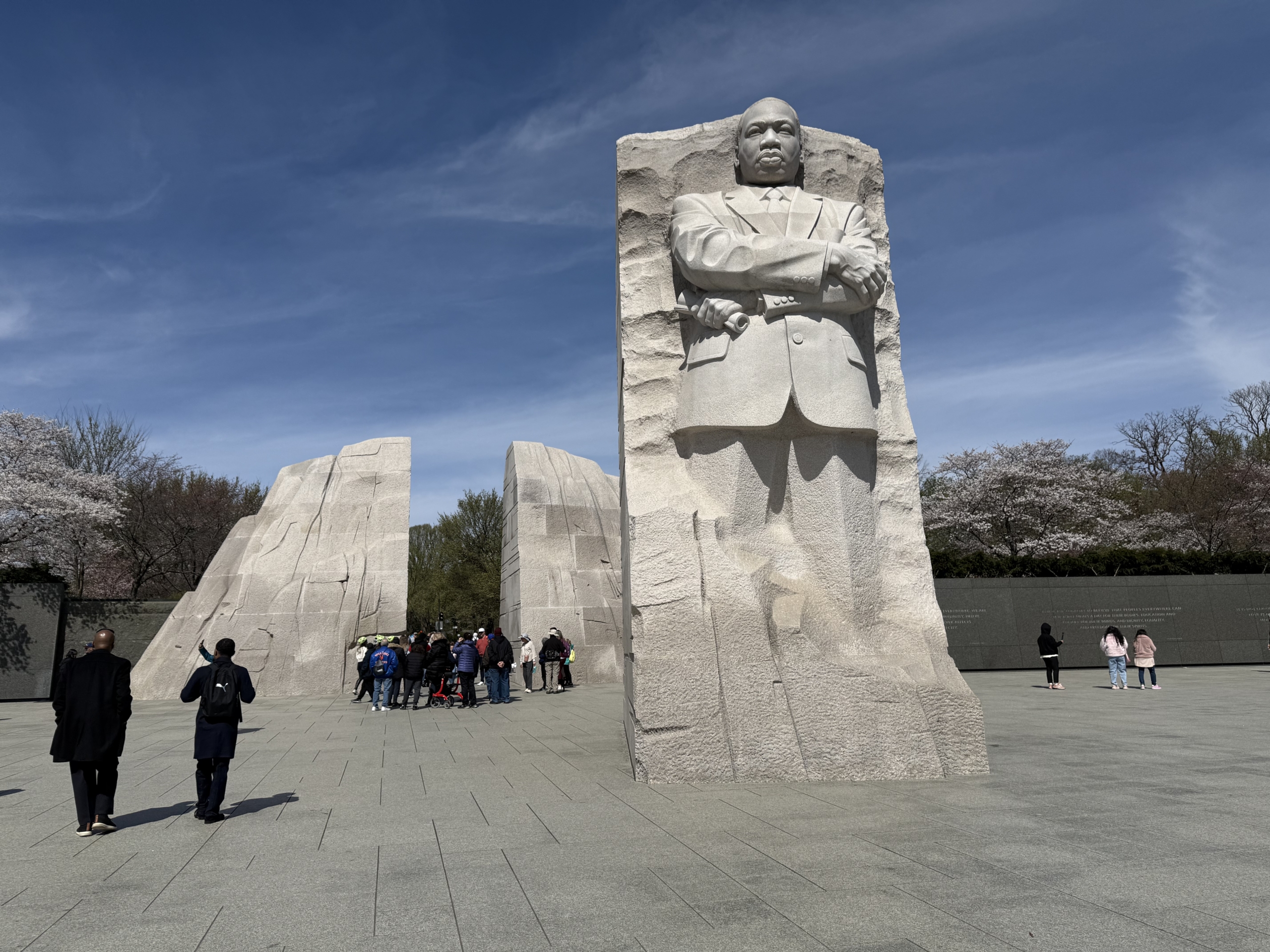
Shortly after that is the Martin Luther King, Jr. Memorial. There are a lot of cherry blossom trees in this area and many were already in bloom.
Martin Luther King, Jr. Memorial
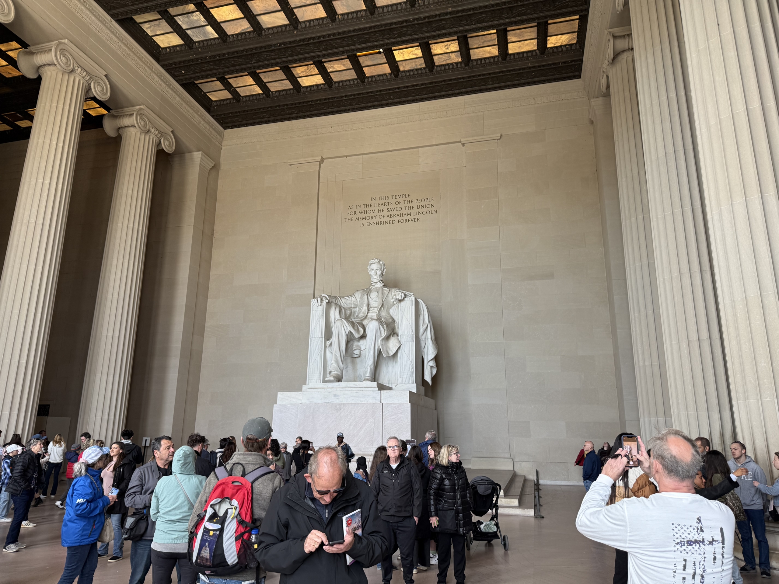
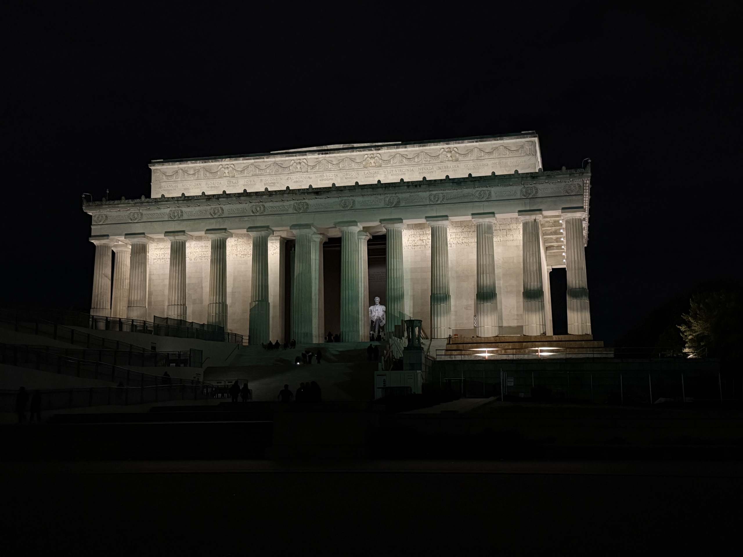
After that we made our way over to the Lincoln Memorial.
Lincoln Memorial
Then the White House. It looked smaller than I was expecting.
The White House
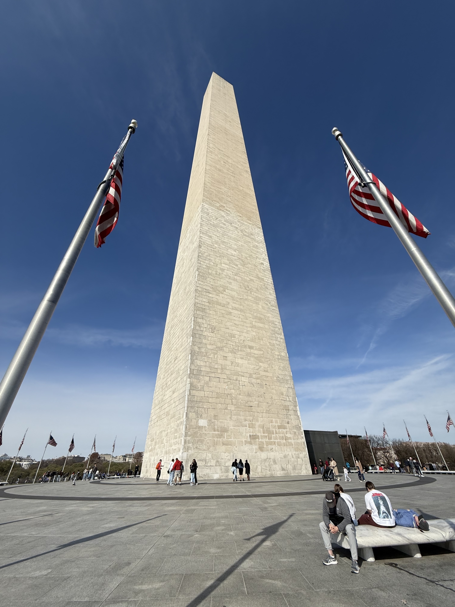
At this point our feet needed a break and we were hungry and decided a lunch break was in order. A friend had recommended The Square so we walked further north only to find it’s closed on Sundays. Bummer. I really need to be better about checking these things before going out of my way. Nothing in the area was open so we had to walk back towards the White House where we found an open coffee shop with food. Hallelujah! After we were properly caffeinated and fed we took a taxi to the Washington Monument to cut out some miles.
Washington Monument
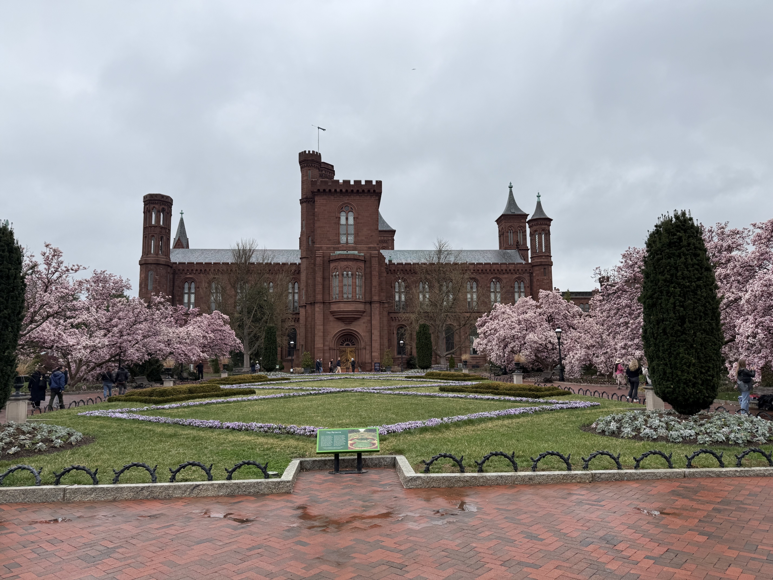
On our walk back to our hotel we went by the Smithsonian Castle. I’m not sure what it is (it’s closed for renovation) but on the backside they have magnolia trees that were in bloom. They are stunning!
Smithsonian Castle
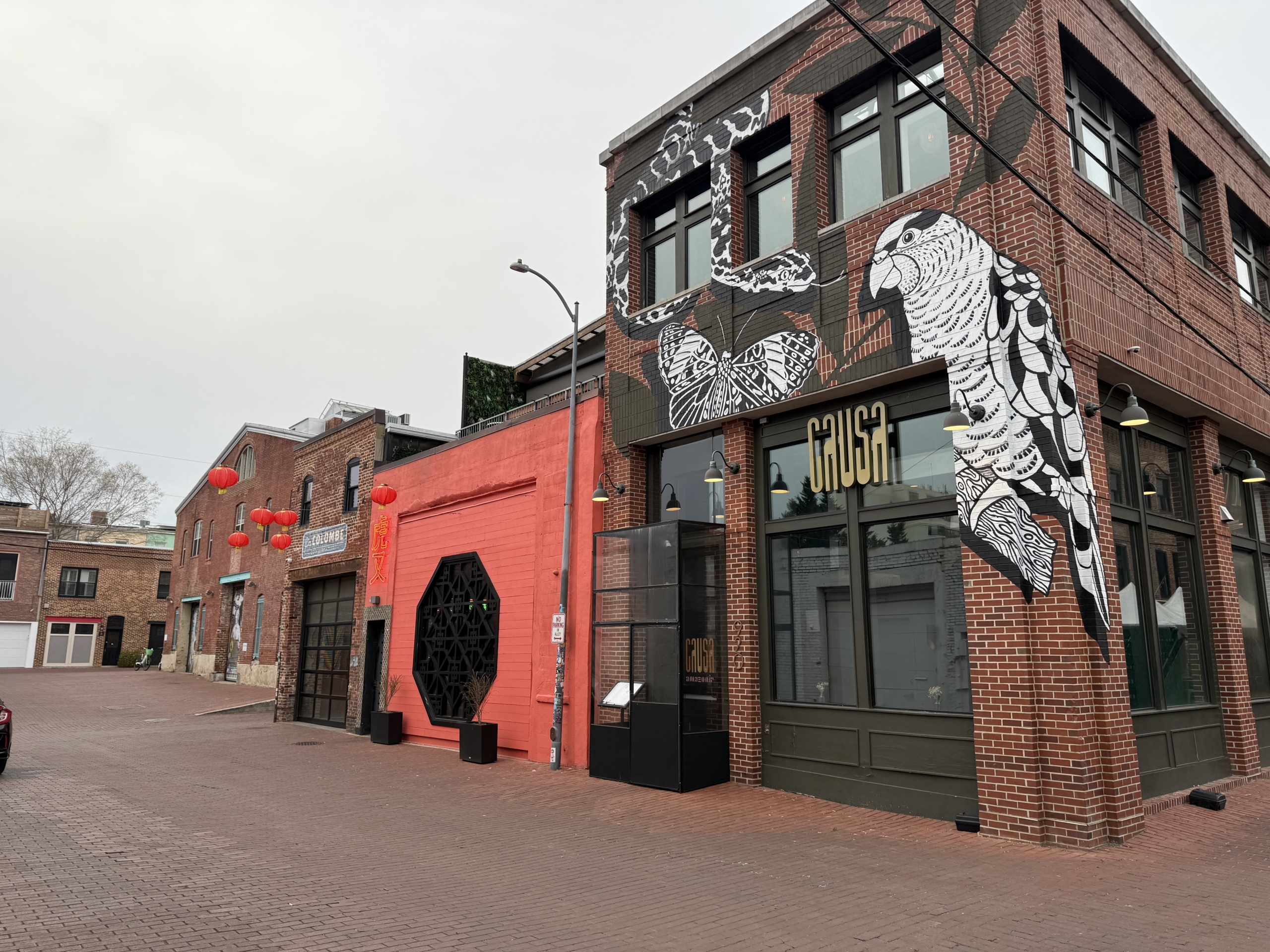
We had dinner reservations at Amazonia and had the BEST dinner! Causa/Amazonia is a dual concept Michelin-starred (!!!) restaurant specializing in Peruvian cuisine. The restaurant is down an alley and hard to find. Probably a sign that we were about to have a fantastic meal! Our taxi dropped us off on the side of a street where the directions ended but we could not find the address anywhere. My smart brother pulled out his phone and was following the walking directions which were taking us down back alleys. Fortunately, our reward was an epic dinner! The service and the food were all excellent. We leaned in to our servers’ recommendations and she did not steer us wrong. I could write about this meal all night but will stop.
After dinner we decided we wanted to see the monuments at night because I was certainly not ready to call it a day yet.
Honest Abe and the Lincoln Memorial at Night
On our way back to the hotel we learned a friend was in town so we turned around and met him for a drink. It was such a fun treat. Meeting up with friends in random places is one of my greatest joys.
Over the course of the day we walked 25,000 steps which is approximately 10 miles. My dogs were tired!
Day 2!
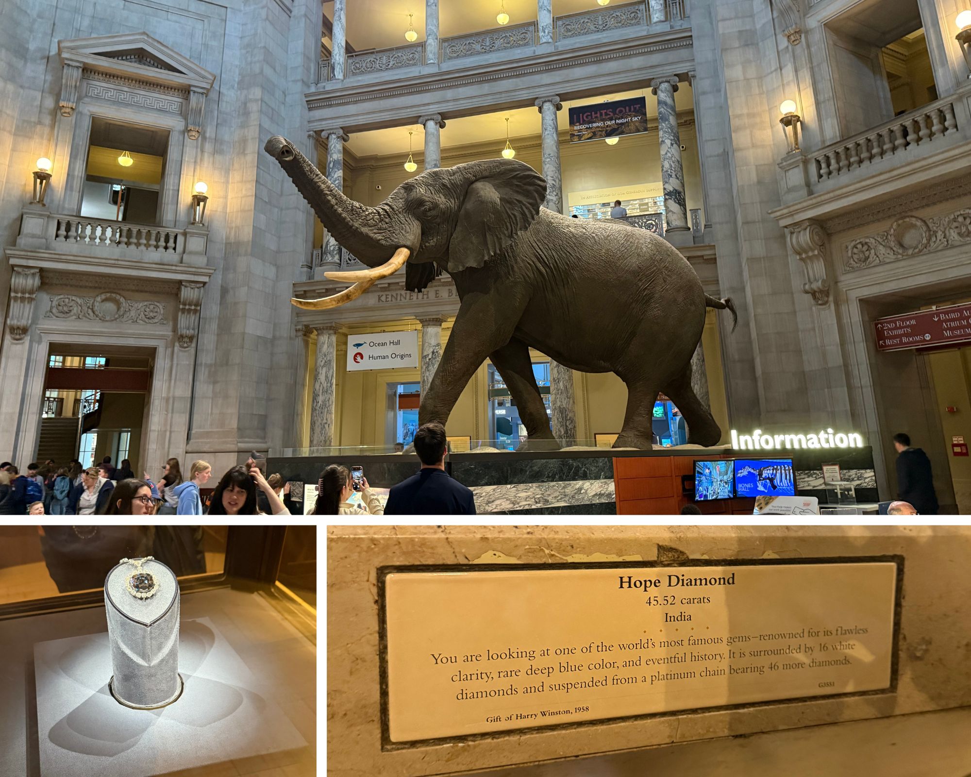
We slept in because 3 hour time change and up very late. It was a rainy day so visiting museums was on the docket. There was a break in the rain so we walked to the mall. We started with the National Museum of Natural History. It was OK but not quite what I was expecting. Maybe I’ve watched Night at the Museum a few too many times. I’m glad to have seen it in person but there were a lot of people and my brain wasn’t in the mood to read a lot of placards. We saw some dinosaurs, human history, and the hope diamond!
Smithsonian National Museum of Natual History
We walked next door to the National Museum of American History and saw the original Star Spangled Banner from 1813. Like the one that inspired our national anthem. IT’S HUGE! You cannot take pictures and it’s in a dark room for protection but it’s really cool to see. Also saw Lin Manuel Miranda’s Hamilton Costume, Walter White’s gear, and a Bob Ross painting!
Smithsonian National Museum of American History
The rain was making it hard to walk around outside and there were so many people in the museums. We found a coffee shop and rested for a bit before moving hotels. I was in town for a conference and it was time to get to work so we moved up towards Dupont Circle. We had an enjoyable dinner at Rosemarino D’Italia and called it a night.
That concludes 2 days in DC! I was there for a few more days for a conference and was mostly in meetings/classes but after a long day of sitting I made a point to see one more thing.
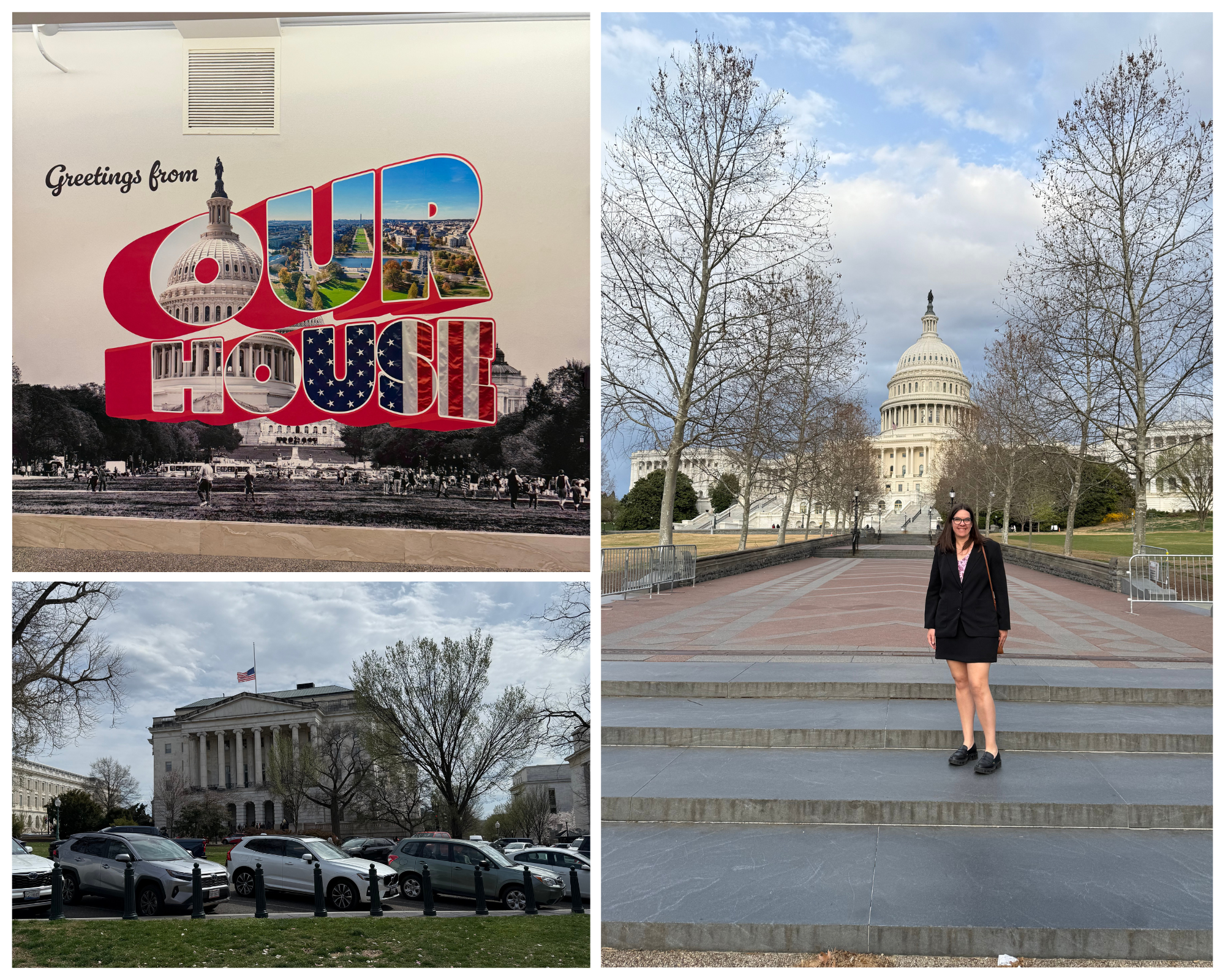
I visited Capitol Hill for work! That was a neat experience. All of my meetings were in the House of Representative buildings. Fun fact: the buildings are all connected by tunnels and it’s a crazy maze. Not sure if that was intentional or not. I love new experiences and this was for sure one.
Capitol Hill
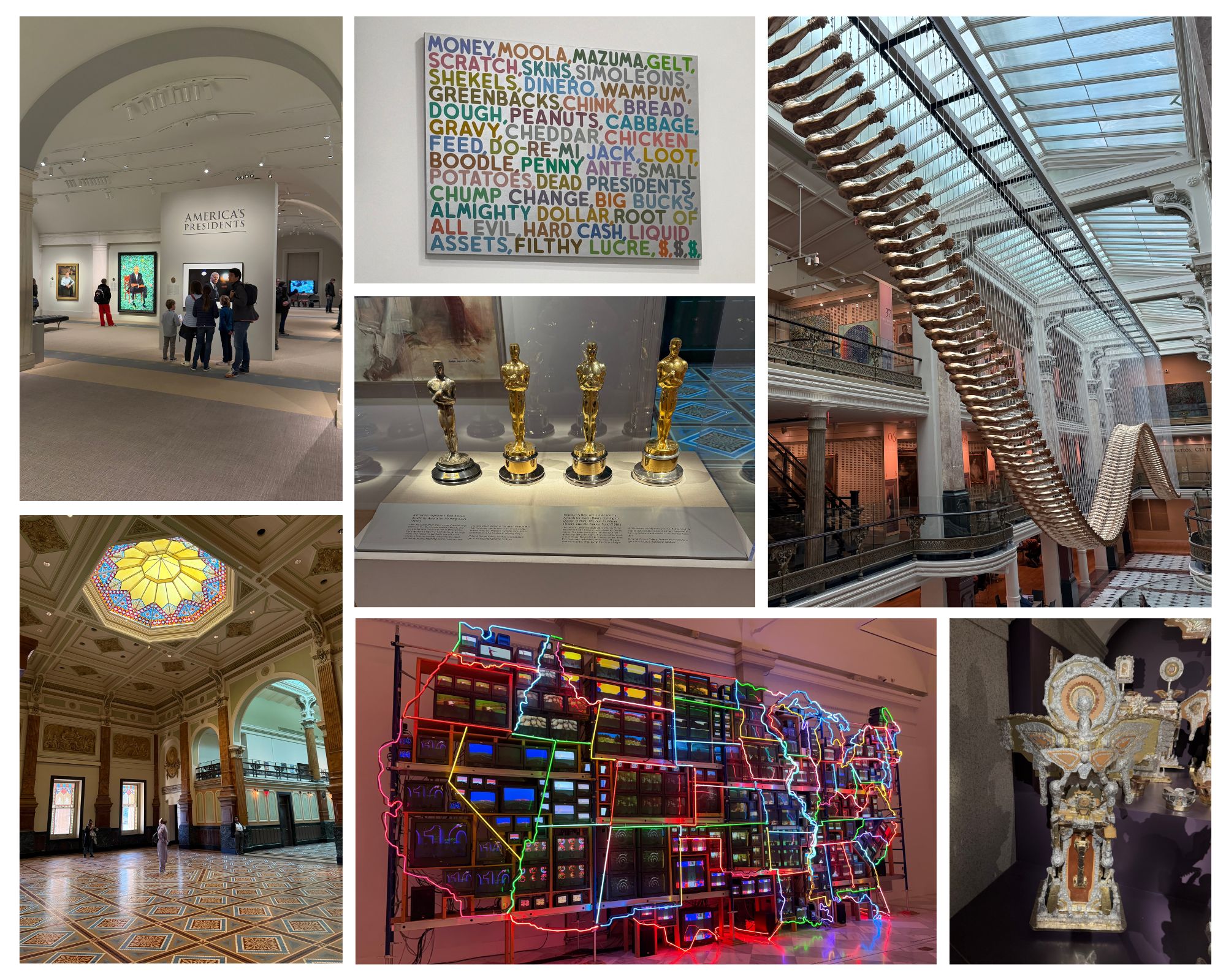
Visited the American Art Museum and National Portrait Gallery. The modern art section was my favorite.
Smithsonian American Art Museum and National Portrait Gallery
The last evening I went on one final walk around DC. I took a taxi to the White House, walked by the Washington Monument, around Tidal Basin, along the Lincoln Reflecting Pool to the Lincoln Memorial where I took a taxi back to my hotel. It was a really enjoyable walk. The cherry blossoms were basically at peak bloom (it was scheduled for the next day) and that was a treat. There were so many people though. There are few things that annoy me more than slow walkers and walking with hundreds of your friends means mostly slow walking. I kept having to remind myself to enjoy the experience. Lol.
Final walk around DC on the eve of peak cherry blossom bloom
Tips for planning a trip to DC:
DC is huge and very congested. I didn’t use the train (Metro) so I can’t comment on that but have heard good things about it. Taxis are readily available but can get expensive really quickly. There is a lot of traffic which means a lot of sitting in traffic jams. If you can, take a taxi versus Uber/Lyft. DC charges fees for using non taxis. Probably not shocking, those fees are not built into the price quoted for the ride. DC is very walkable but pretty spread apart.
If you only have a day or two, I’d suggest doing exactly as we did. Take one day to walk the monuments and the second day to visit museums. Based on how much energy you have you can always add in more. There is so much to do in DC that it’s impossible to fit it all in in a short period of time.
If you want to see the cherry blossoms, I recommend going shortly before peak bloom. The trees are all over the city and bloom at different times. We saw plenty of blooms a week before peak and walking around was much more enjoyable. It was cool to be there at peak, and I’m glad ot have checked that box, but the massive crowds took away from the expereience. It probably wasn’t helpful that I went at 5pm with everyone else in DC.
The monuments and many of the museums are free so that’s fun! DC is a cool town and definitely a place to visit at least once. Bring your good walking shoes and have a blast!
https://www.theroadwevetraveled.com/wp-content/uploads/2025/06/IMG_6916-scaled.jpeg19202560Carolinehttp://www.theroadwevetraveled.com/wp-content/uploads/2015/08/RWT_Logo@3x-300x143.pngCaroline2025-06-08 19:05:182025-06-08 19:05:202 Days In Washington, DC
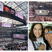
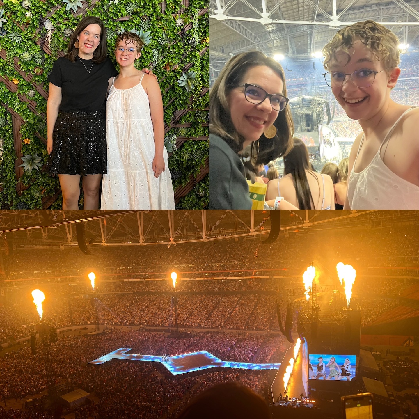
The Eras Tour wrapped up last night after almost two years of shows. I can’t really put into words how I feel. It’s certainly bittersweet. I am so grateful for this show, that I was able to see it in person twice, for all the grainy live streams and videos on socials, and for the community it created. I’ve never been a part of something that has brought people together in the way this has. It’s remarkable and I am forever grateful to be able to witness this firsthand.
I’ve been a Taylor Swift fan since 2013 when I took Girl Child to see the Red Tour. I saw the Eras Tour twice in 2023 and wanted to make note of the concerts because they were so magical. If you’re not a Taylor Swift fan you’re probably rolling your eyes, but there’s a reason we’re all obsessed.
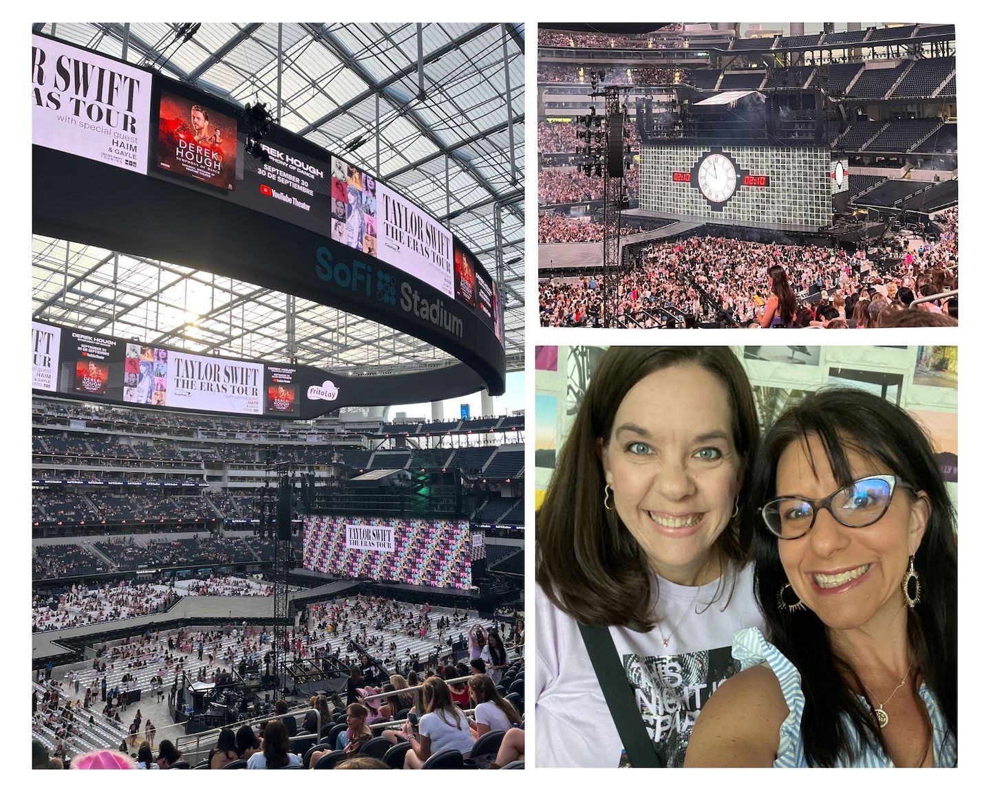
Heading to Glendale for the Eras Tour!
The first show we saw was in Glendale, second night. For those not in the SwiftVerse, Glendale was the opening city of the Eras Tour. We had tickets for the second night and made sure to stay off social media after the first show, so our show was a total surprise. IT WAS EPIC! I took my daughter and it was our third TS show together. Buying concerts tickets from Ticketmaster is nothing short of a nightmare and you basically get what you are lucky enough to grab and pay for before they are sold to someone else. I won’t rehash the fiasco that was getting tickets for this show. We ended up with nosebleeds on the side of the stage.
I don’t love nosebleeds, I’d certainly rather be closer to the stage, but the steepness of the rows makes me uneasy. Seeing the backstage action was cool though. Because it was the first weekend and the show hadn’t blown up on social media yet we didn’t know what we were seeing until after the fact. We saw the cleaning cart, which is what Taylor Swift is wheeled to the stage in. It seemed out of place and super random to be wheeling towards the stage. I grabbed a crappy picture to confirm I was actually seeing a cleaning cart. We also saw people walking backstage in these pink/orange jump suits. In my mind, I was like why are the ghostbusters here? Once the show started I realized they were the dancers. It would have been cooler to see them when I knew who they were but it was still cool to see. The downside to being on the side of the stage is that we missed most of the show visuals which are on a screen at the end of the stage. The screen on the side of the screen only showed Taylor Swift. It was still epic, don’t get me wrong, but we were bummed to be missing out on a part of the show.
A few weeks prior to the Eras Tour a friend died and her funeral was two days before this show. The mix of pain and joy in life is wild. I’m morning the loss of a best friend while simultaneously watching the opening weekend of the Eras Tour with my daughter and friends. Talk about the highest of highs and lowest of lows in the same moment.
Eras Tour Glendale Night 2
Being that we were attending a tour spanning all of Taylor’s albums, we wore outfits that matched our favorite eras. I opted for black and sequins for Reputation and Girl Child opted for a dress and boots for Debut. And we drew our cat eyeliner sharp enough to {insert lyrics from Vigilante Shit}.
Taylor ended up performing for 3.5 hours. Probably around the 3 hour mark I was like is this ever going to end? Her concerts have always been longer than the average but 3.5 was wild.
The show was so epic that I immediately wanted to go again but get better seats. And I wanted to see it while not so deep in grief. As soon as videos and stories hit social media the show started blowing up and the Eras Tour madness began to grow. I knew if I wanted to see it again I’d have to get resale tickets ASAP because the prices would continue to drive up as more shows were held and the excitement grew. Within days we grabbed tickets to LA for night 3. I’ll be honest, buying resale tickets felt a little frivolous and as resale prices continued to climb I questioned selling my tickets. I’m so glad I didn’t because those 24 hours in LA are a core memory and worth every single penny.
Flying to LA to see the Eras Tour rounded out the experience. Shortly after we got to the airport in Tucson we noticed others in Taylor Swift shirts and everyone started to congregate. A young Swiftie came up to our group and offered us all friendship bracelets. (If you’ve not been following the tour, in one song Taylor Swift says to make the friendship bracelets and from that moment on Swifties make bracelets and share them with strangers.) There were several mothers traveling with their daughters and it was so sweet to see. Everything in LA was Taylor Swift themed and so fun!
We took a morning flight and arrived midday. I think we took a nap before the show which was obviously glorious. My biggest concern with the show was getting back to the hotel afterwards. 60,000+ people trying to leave one place at the same time creates insane gridlock. Our hotel wasn’t that far from the stadium but it wasn’t in the safest area to walk through, particularly at night. When we checked in, we found out our hotel was offering a roundtrip bus. The concierge told us the bus would be parked away from the arena so we could easily get out. Great…take my money.
When it was time to go to the concert, we boarded the bus with all the other Swifties and the excitement continued to grow. The bus dropped us off close to the stadium and the driver explained where we would be picked up afterwards. We accidentally purchased club level seats for the show (SCORE!) so getting into the stadium was a breeze. I didn’t even know what club meant, which would explain why we didn’t know what we purchased. Club seats have VIP entrances, their own bathrooms, bars, food, and merchandise, so that was fun. Except not the merchandise. The line was insane every second of the evening. We grabbed a drink and settled into our awesome seats and obviously made friends with people around us.
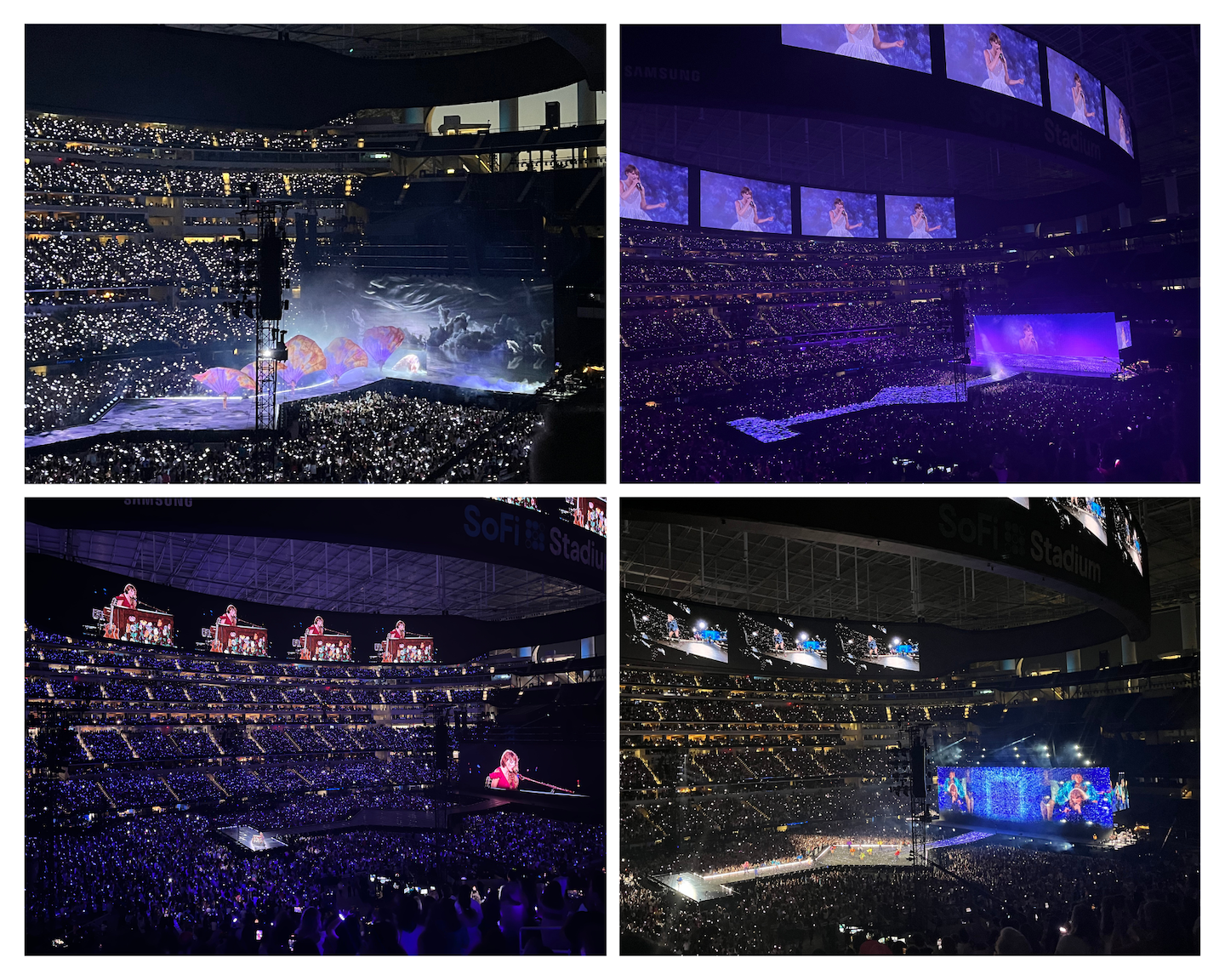
Eras Tour Los Angeles Night 3
One of my absolute favorite parts of the Eras Tour is the opening of the show. A countdown appears on the screen just before Taylor comes out and the energy in the stadium is unlike anything I’ve experienced in my life. Truly magical. And of course, the stadium loses it the second Taylor appears and then we sing together for the next 3.5 hours. After having gone through this experience twice, I can tell you 3 hours is my ideal concert time. Maybe 2.5 – 3. 3.5 was just a little too long. My vocal cords can’t hang for 3.5 hours nor can my feet. The fact that Taylor, her dancers, and band perform night after night confirms they are at the top of their game. An epic feat of endurance and talent.
Eras Tour Los Angeles Night 3
After the show ended we headed to the spot where our bus was supposed to pick us up. Except the bus wasn’t where it said it was supposed to be nor was it the bus we were expecting. Eventually we found a row of charter buses that said they were picking us up. It was super unorganized and we were all a little nervous to get on but also happy to have found some kind of transportation. Eventually the buses started working their way out of the gridlock but the whole experience was strange. There was literally a moment where I was like are we being kidnapped? We seemed to not be going towards our hotel and the driver would randomly stop in the middle of the street, get out of the bus, and go talk to other bus drivers who were doing the same. Eventually our bus started making all kinds of noise and beeping. The driver stoped the bus, opened the door, and told us all to get off because the bus is broken. Um, what? We ended up cramming into the other buses and eventually made our way back to out hotel. I have never been so excited to exit a vehicle in my life. I’m also glad I wasn’t kidnapped. It was such a strange experience.
24 Taylor Swift themed hours was magical. One thing I loved about traveling for a concert of this size is everyone was wearing their TS merchandise or friendship bracelets and was sparking up conversations. I’ve never talked to so many strangers in my life. Standing in the security line at LAX we made friends with everyone around us, discussing which songs we loved most, how many times we’ve seen TS, where we are coming from, how we got tickets. It was so fun. We ended up on the same flight as many of the same people as the day before and were able to hear from the mom/daughter duos about their experience. It was such an incredible experience. I’ve never been a part of something like this before and it was so fun.
Yesterday was the final show of the Eras Tour. I didn’t have tickets but watched it live on YouTube. Shout out to everyone who was live steaming so those of us at home could watch it with you. It was a beautiful show and watching it live was the perfect way to close out these last two years. Thank you to Taylor and her team for creating something so magical.
https://www.theroadwevetraveled.com/wp-content/uploads/2024/11/Beige-minimalist-photo-collage.jpg11521440Carolinehttp://www.theroadwevetraveled.com/wp-content/uploads/2015/08/RWT_Logo@3x-300x143.pngCaroline2024-12-10 06:38:192024-12-17 04:02:42The Eras Tour
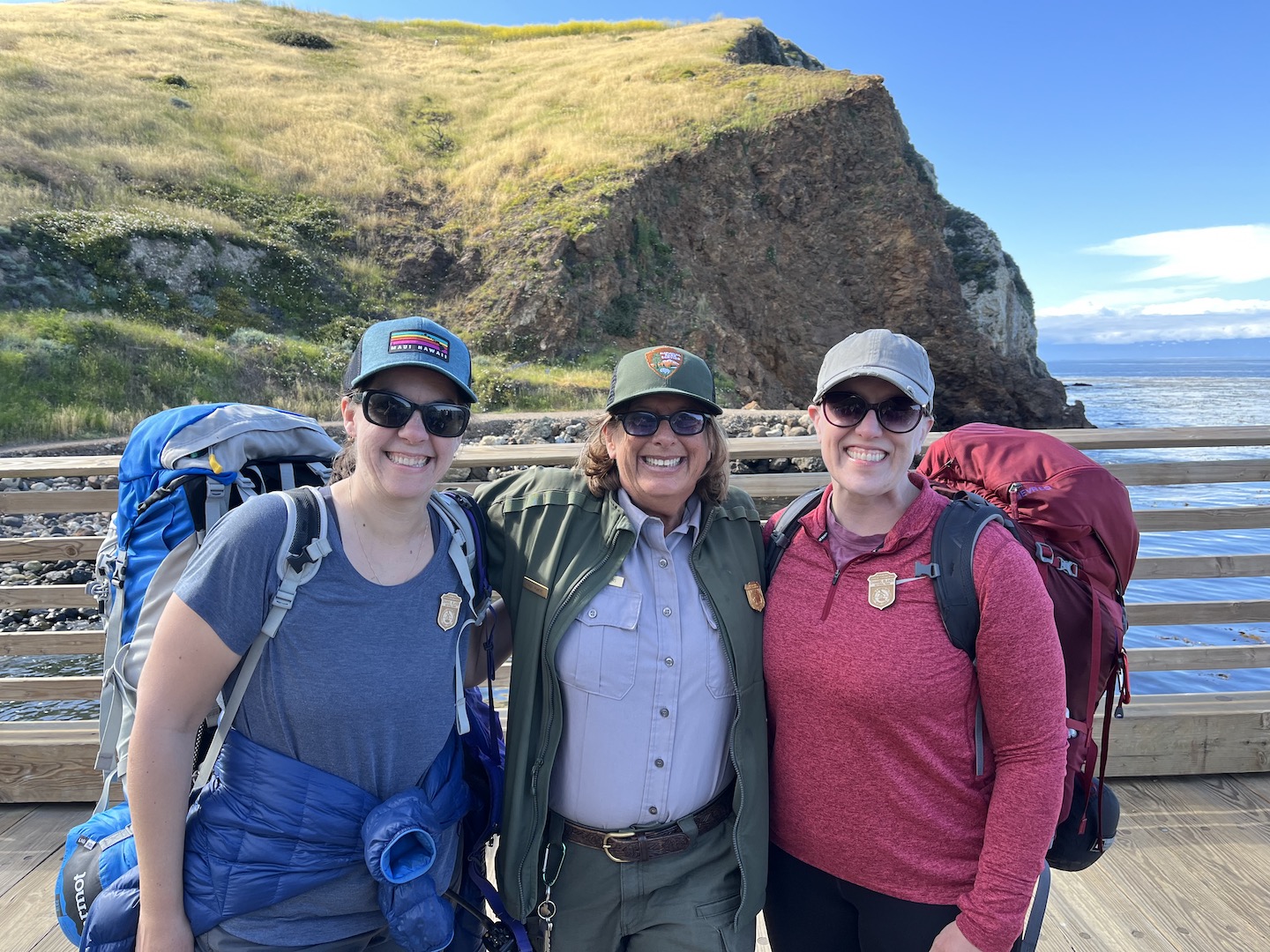
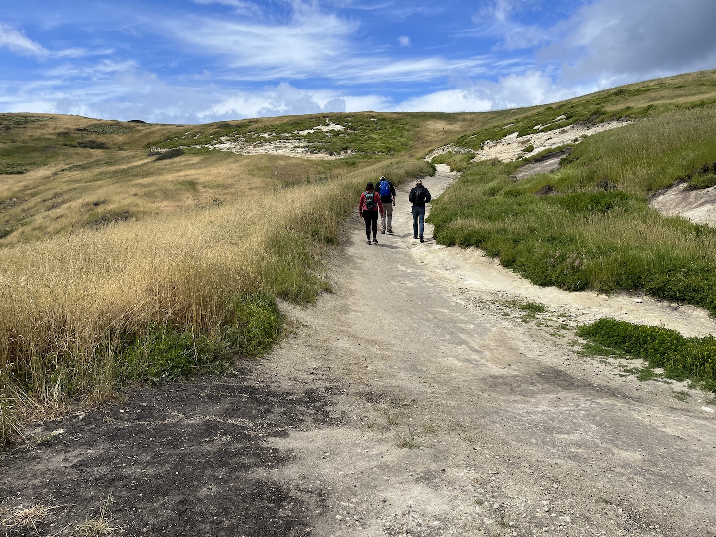
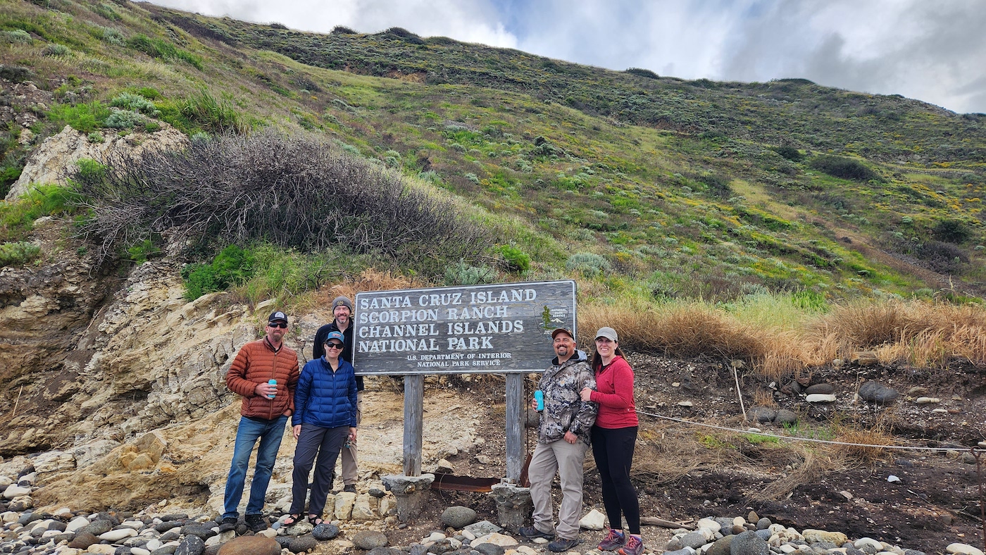
Channel Islands has been on my list for a while. We had a trip planned a couple years ago over fall break, but a crazy storm rolled in and basically cancelled our trip. Channel Islands is definitely one of my favorite national parks. It’s an hourish away from LA and feels otherworldly. The boat ride over was incredible, the islands are gorgeous, the views are epic, the baby foxes are the cutest thing in the world, and the company that joined us was the cherry on the top.
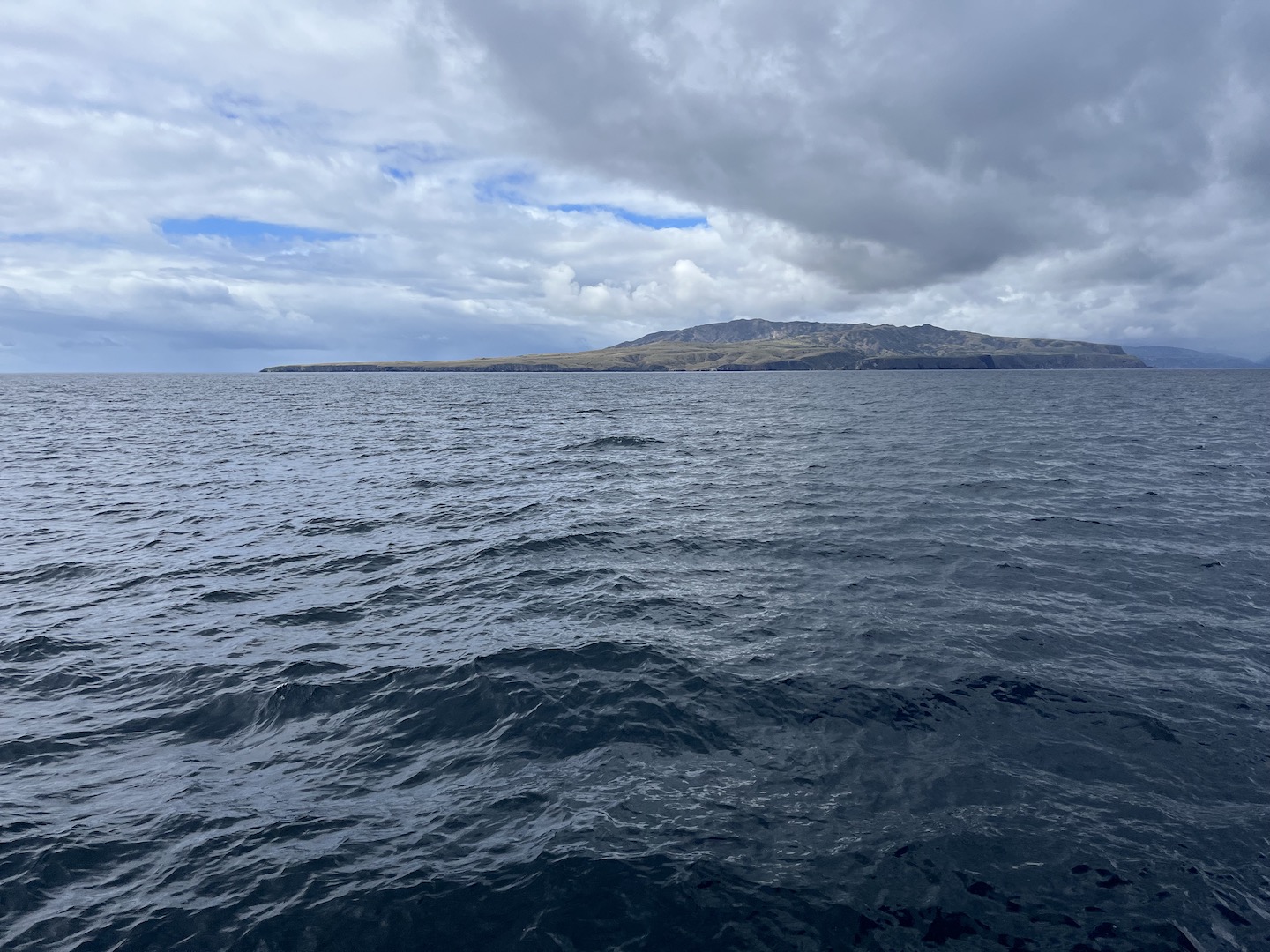
Santa Cruz Island, Channel Islands National Park
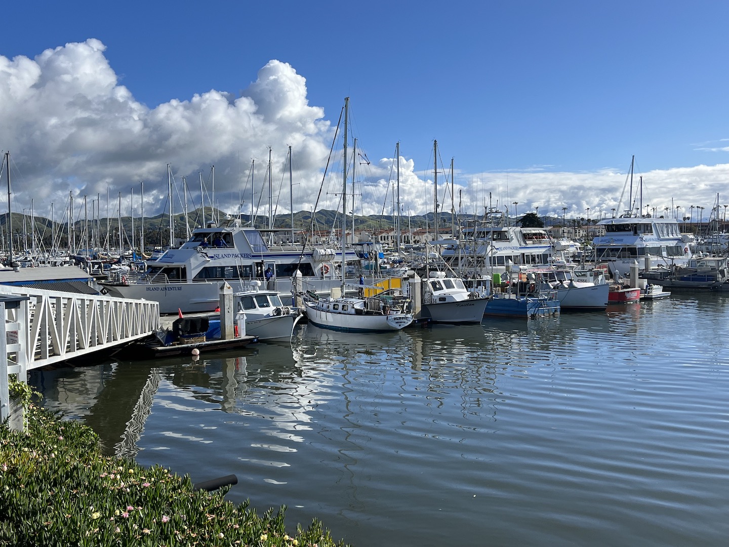
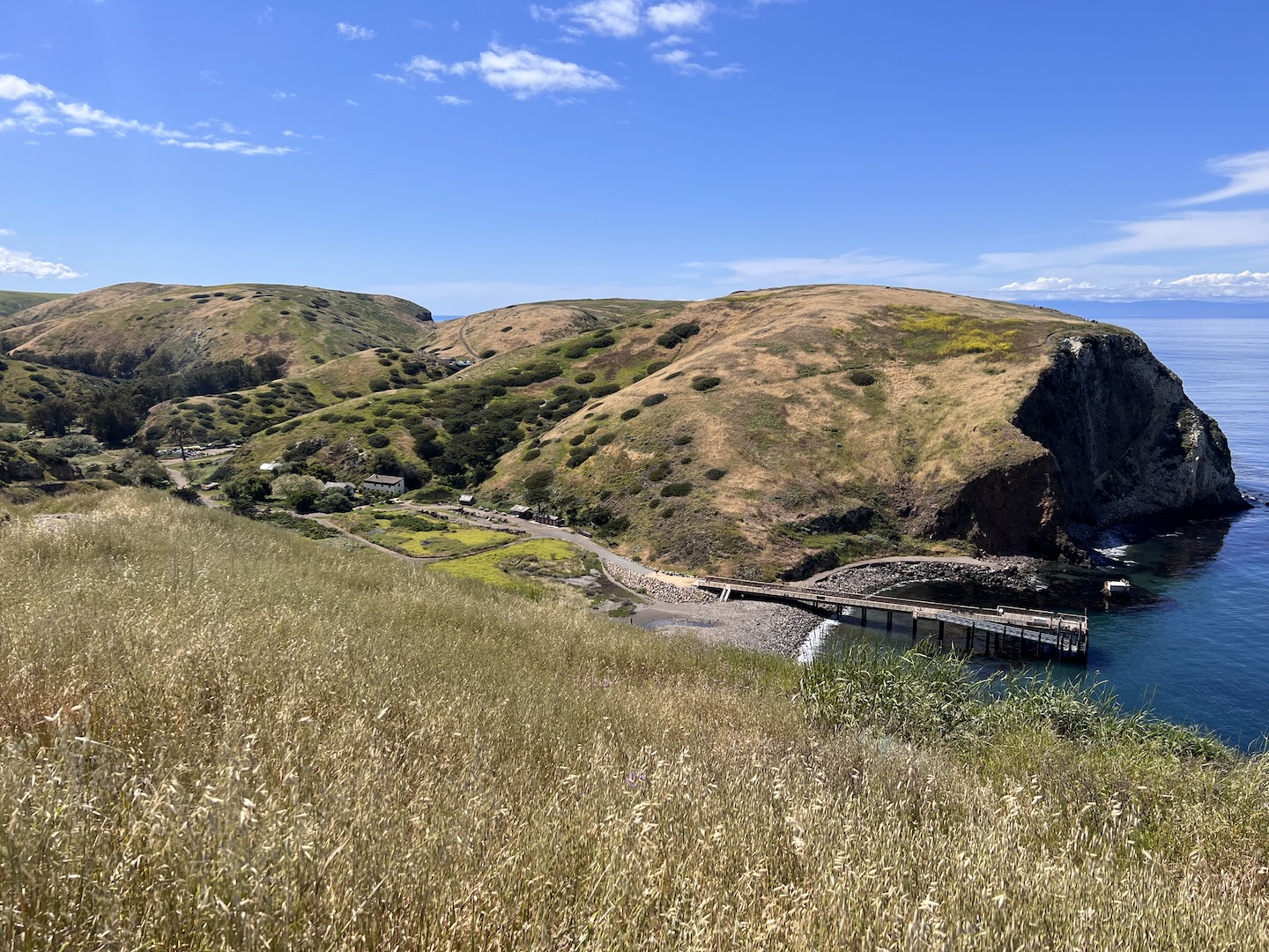
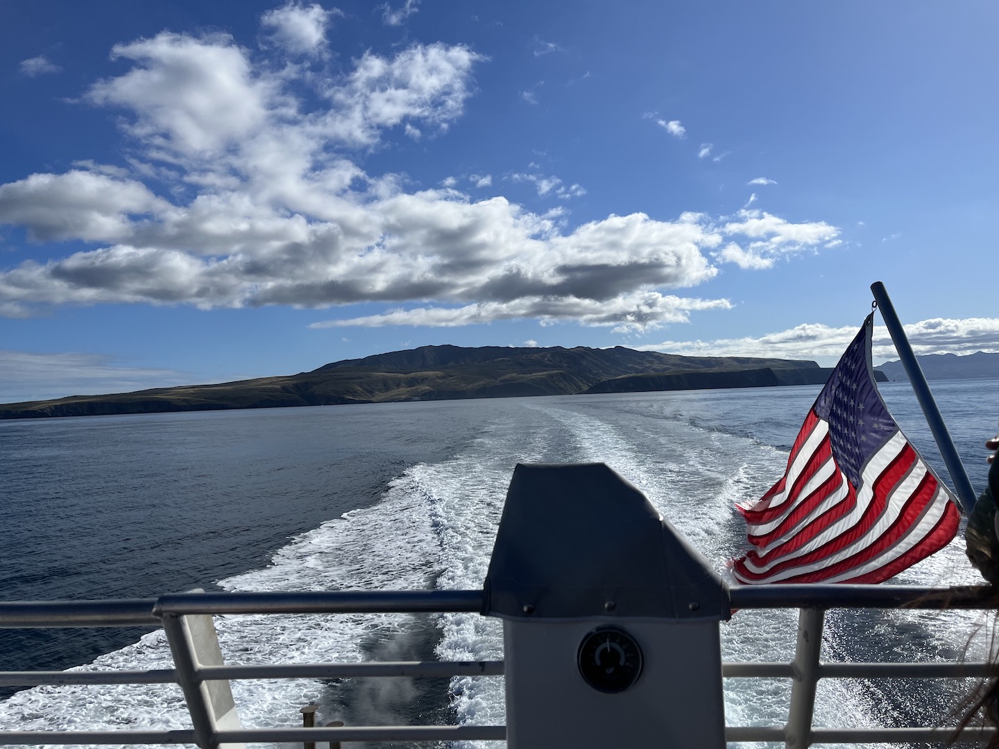
Channel Islands National Park consists of five islands off the coast of Ventura, California. There are no roads/cars on the island and only a few buildings. Mostly structures from when the land was privately owned prior to becoming a national park. It’s a rustic experience which is so fun and harder and harder to come by these days. To get to the islands, you have to take a ferry. We booked an early morning ferry and spent the night in Ventura so we could be at the dock bright and early.
Island Packers ferry
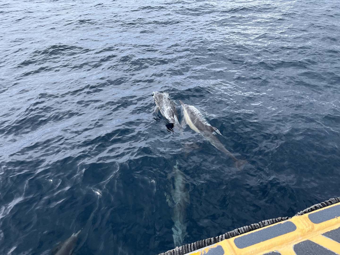
The ferry ride over started our adventure as we saw lots of wildlife. Dolphins swimming with the ferry was definitely a highlight!
Dolphins swimming with the ferry on the way to Santa Cruz Island
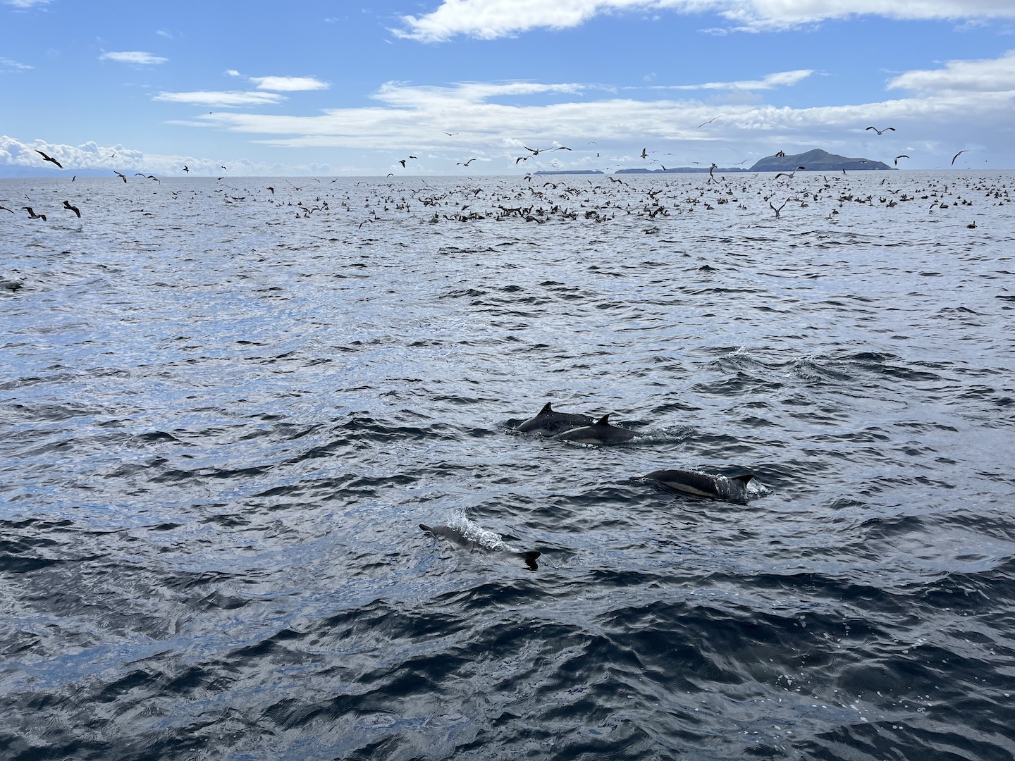
At one point our captain spotted a bunch of birds sitting on the water and circling around. He said that usually means there is a lot of plankton or something in the water which leads to a lot of wildlife. He was right! We saw so many dolphins, a whale, and tons of birds. We stayed there for a while just watching and it was incredible! The ride over was beautiful and added to the excitement of what we were about to see.
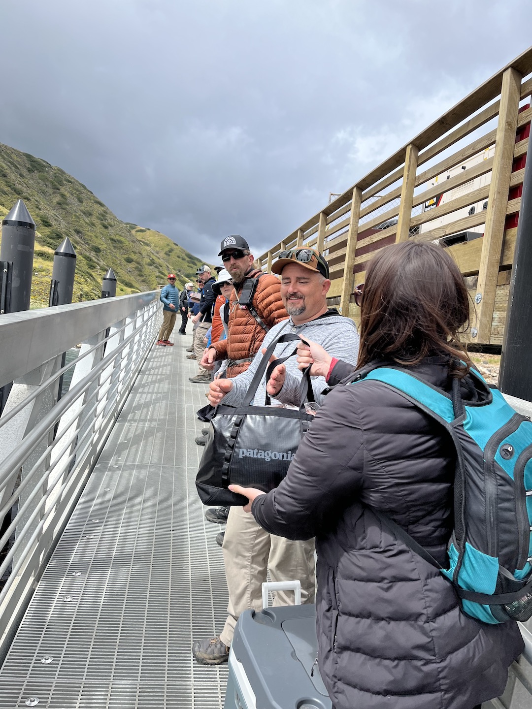
We visited Santa Cruz Island and you can camp or take a day trip. Those camping are the last to exit the ferry as we had to unload our gear. We made a line across the boat/dock and passed every item down one by one. It was an interesting endeavor as not everyone in the line understood we were all in this until all the gear was off the boat. Not just your bag.
Once everything was unloaded, we met with a ranger for a mandatory meeting where she shared tips and warned us about the incredibly cute little island foxes and how much of a nuisance they can be. She played a game and asked a few questions. I knew the answer to one of her questions and won myself a Junior Ranger badge which I proudly wore for the entire weekend! It’s the closest I will ever be to a Ranger so I’ll take it. Ranger Karen was the absolute best! She was so cheerful every time we saw her. I mean, I probably would be too if lived on Santa Cruz Island.
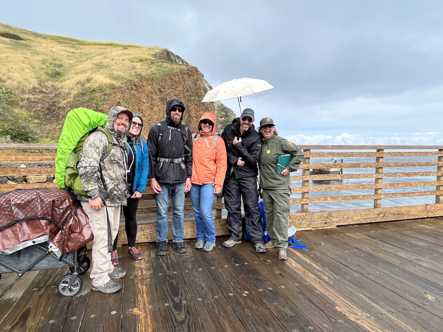
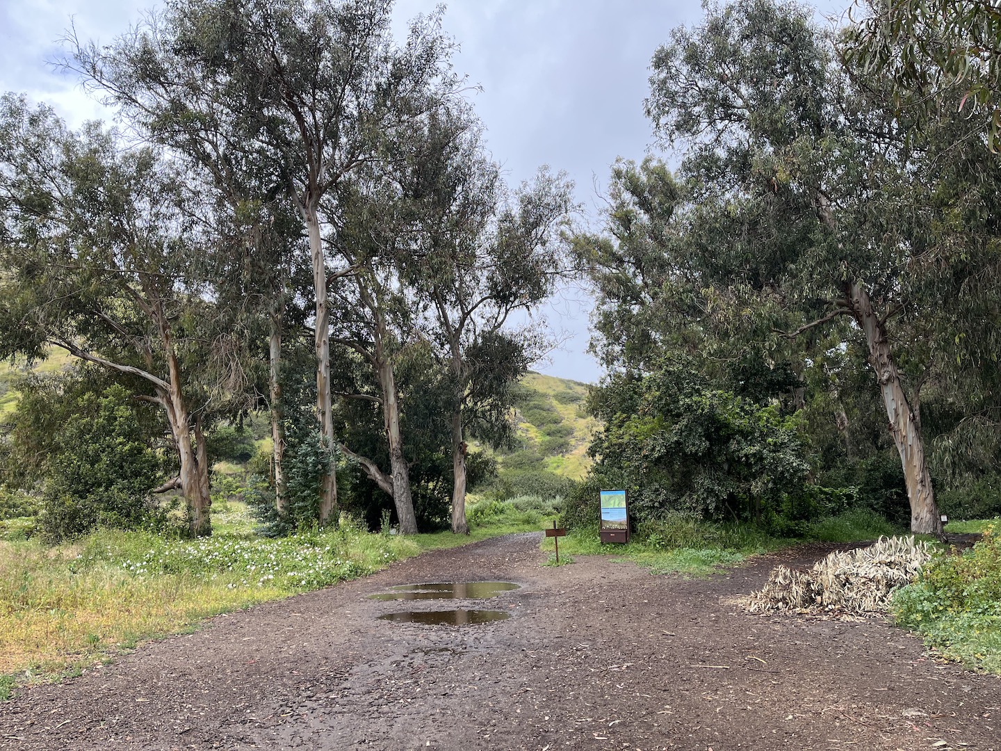
Of course, as soon as we finished our ranger talk it started raining. We quickly put on our rain gear, covered our stuff as best as we could, and made the short walk to the campground. The sites are .5 – 1 mile from the dock, so not too far. You have to be able to carry all your stuff but the walk is easy/flat and you can load your stuff into a wagon. We mostly brought a wagon so we could bring a cooler. (Island Packers has specific rules around what you can bring to the island, so be sure to check those out before packing.)
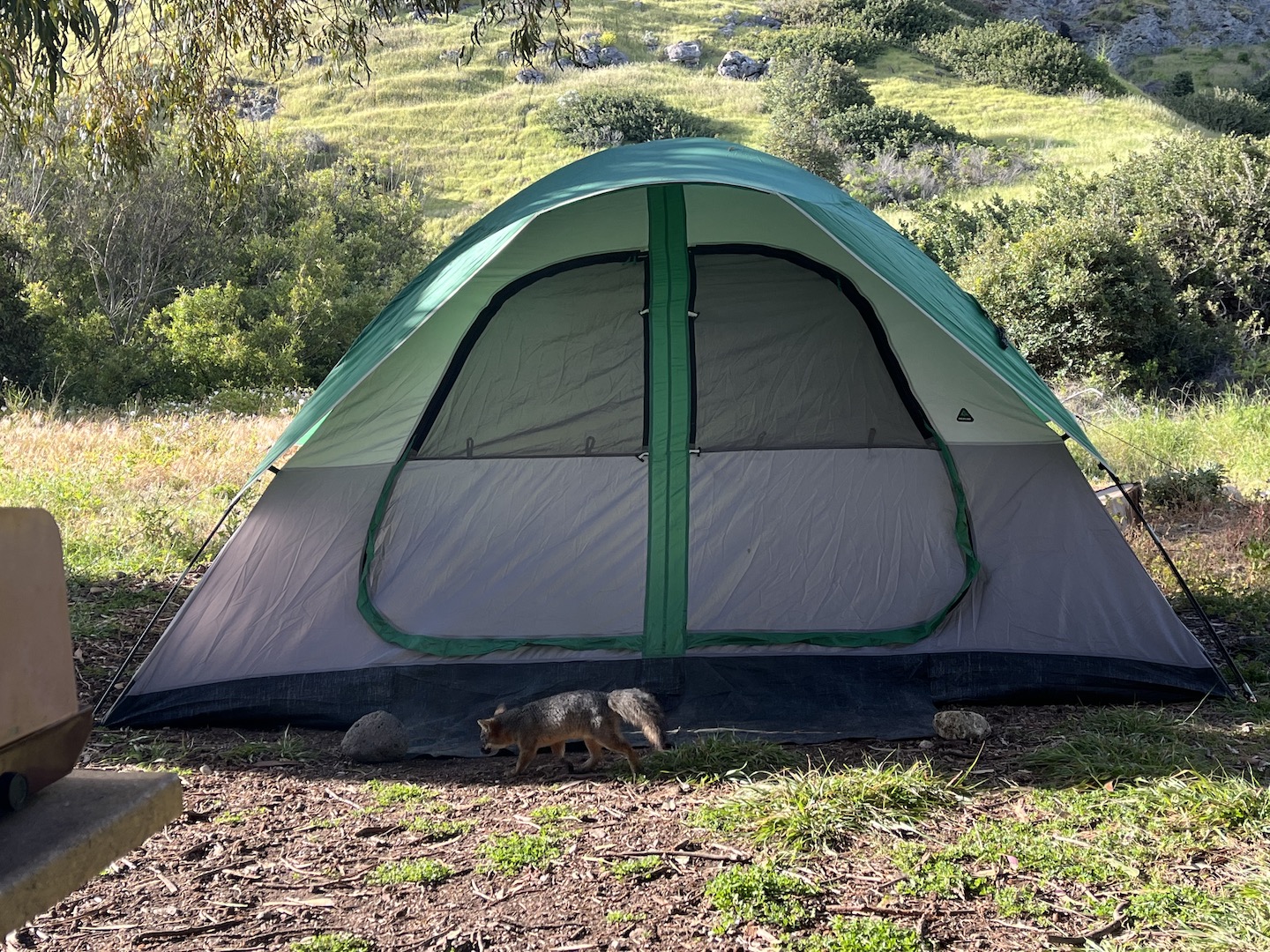
Scorpion Canyon Campground on Santa Cruz Island Channel Islands fox visiting camp
Fortunately it didn’t rain for long and we were able to set up camp and start exploring. We visited May 2023 and everything was green.
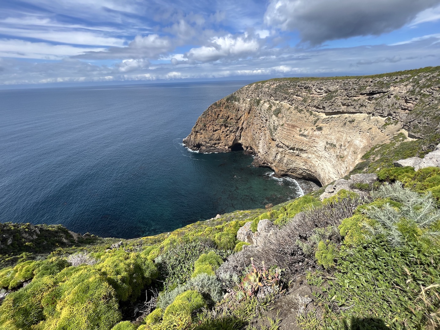
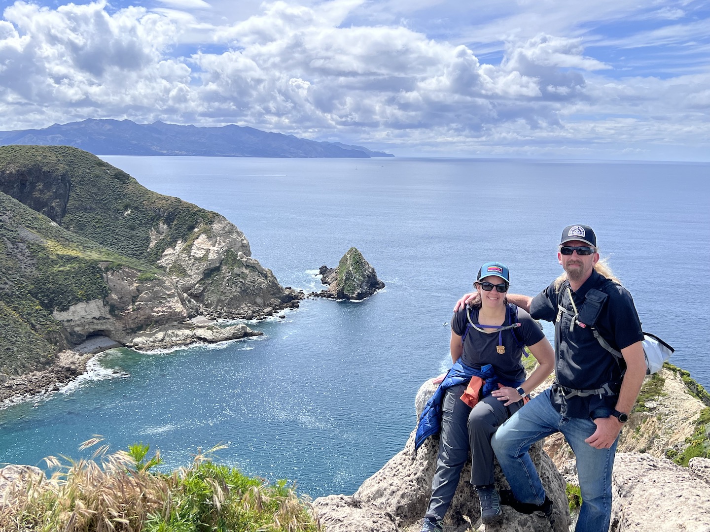
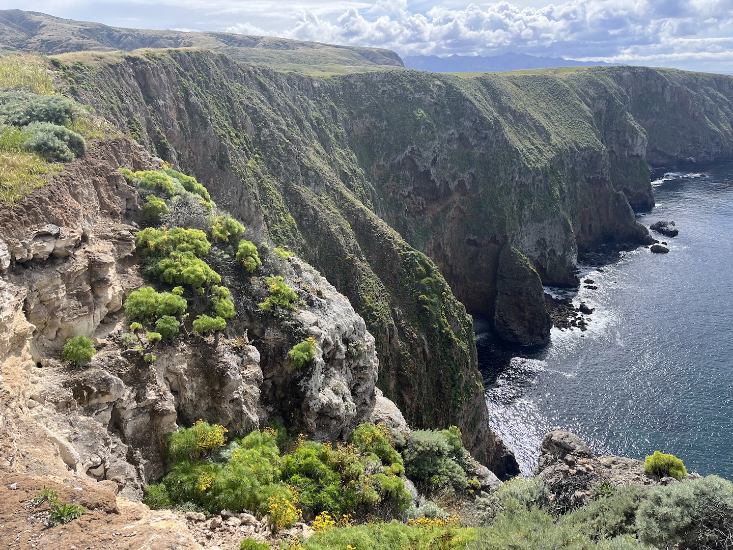
The views are epic once on top of the island. I could not believe LA was just across the channel. We could see it in the distance and it looked so green and hilly.
Eventually we made our way back to camp and then decided to head to the beach for happy hour. Is there anything better than sitting on the beach with friends in a beautiful place listening to the waves?
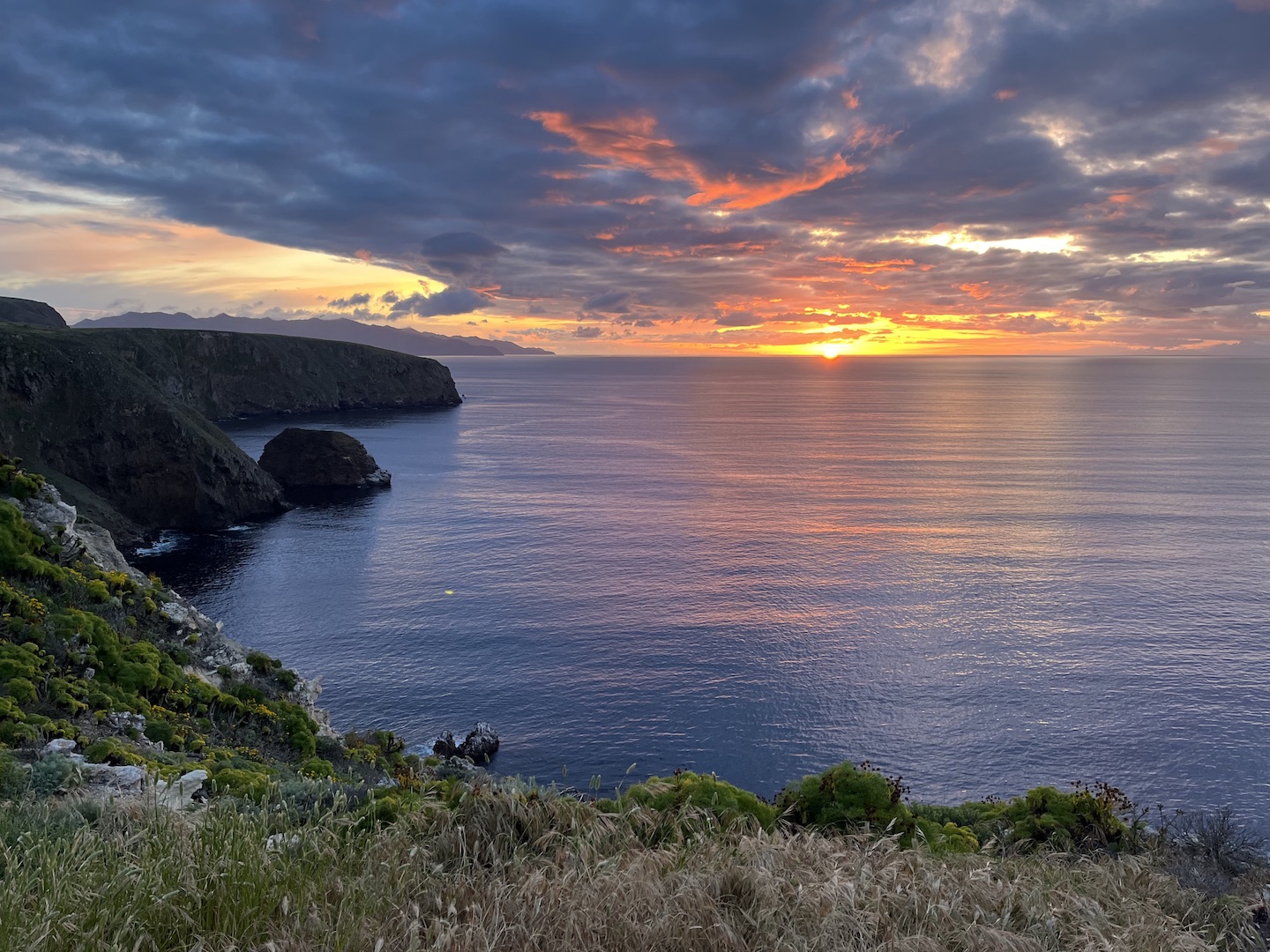
Heads up, there is tar in the water from the channel so be careful where you sit. Apparently tar seeps from the ocean floor off the California coast. We didn’t realize that and ended up with tar on our clothes. At some point after happy hour we ate dinner but I’m not sure if it was before or after we headed up a hill to catch the sunset. EPIC. We finished the night with games around the table. Days like this are what my dreams are made of.
Sunset at Channel Islands National Park
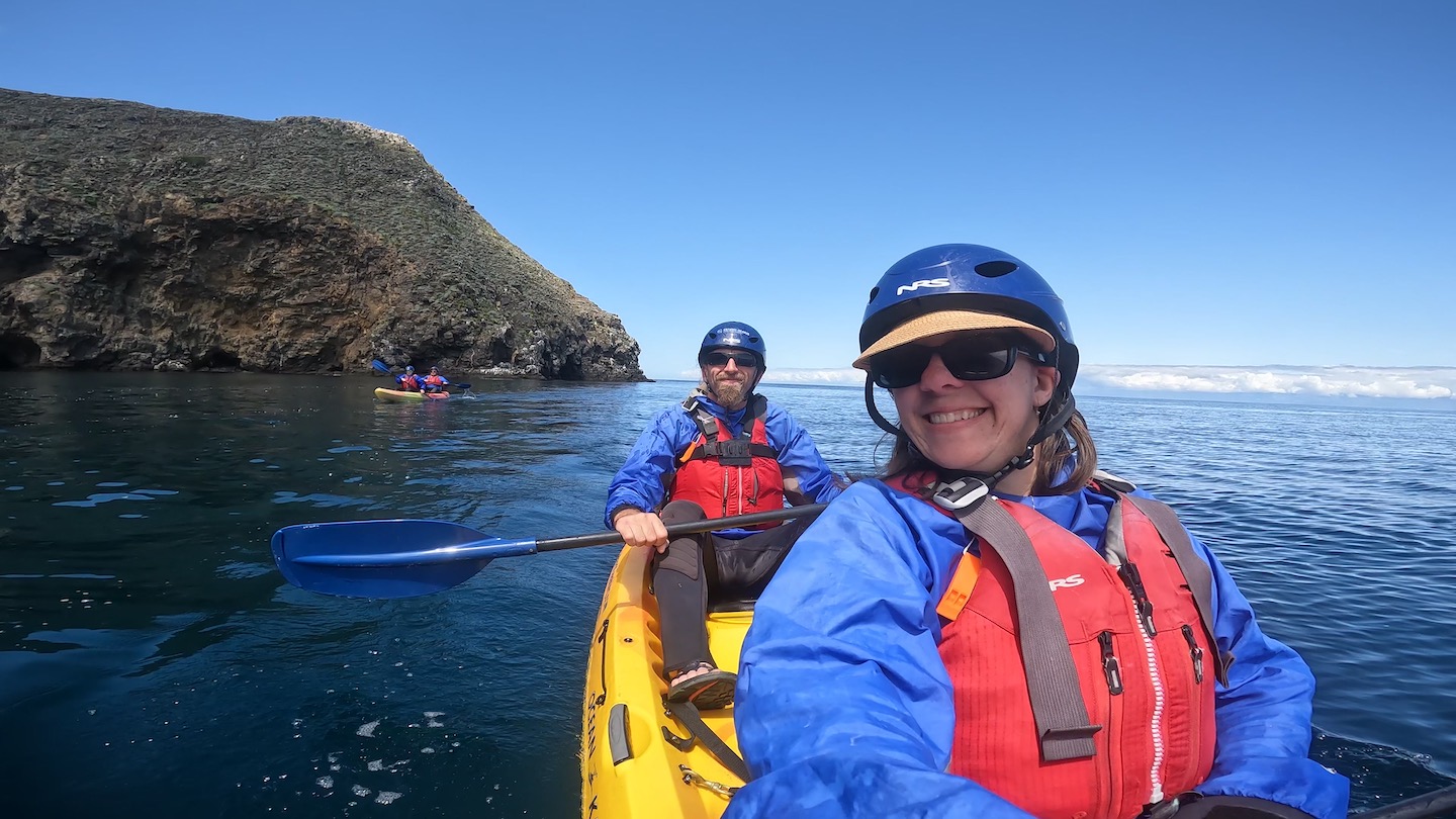
We unfortunately only made camping reservations for one night, so Day 2 started by packing up camp. I would highly recommend two nights on the island. One just wasn’t enough. We booked a sea kayaking excursion in the morning, so once camp was packed we headed over to the beach. We listened to the safety talk, put on our wet suits, grabbed kayaks, and headed out for some fun!
Sea kayaking at Channel Islands National Park
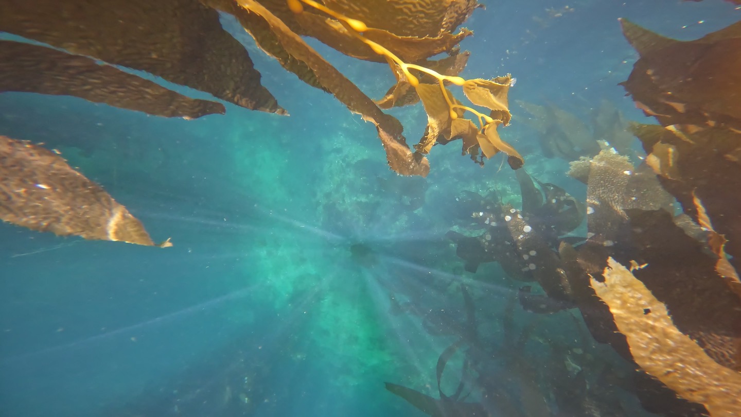
The water was absolutely gorgeous and was a deep, clear shade of blue. There were gorgeous kelp strands everywhere and it was stunning.
Kelp forest at Channel Islands National Park
I made a video of our sea kayaking adventure. I need to send a special shout out to my husband. I didn’t realize how much of a crappy kayaking parter I am until I watched the video. I stopped paddling so many times thinking we were drifting in the proper direction. Nope. Turns out The Husband was steering us. Oops. And thank you!
Scorpion Cove
While waiting for the afternoon ferry back to Ventura we explored the visitor center, took another short hike, and just hung out. We walked up to the top of one of the hills close to the dock and took in the ocean views one last time.
Ferry leaving Santa Cruz Island
We had so much fun on Santa Cruz Island and I’d highly recommend visiting! If you’re not a fan of camping, you can take a day trip. If you’re a camper, spend at least two nights if you can. One night will still be epic though if that’s all you have. We packed a lot of adventure into our roughly 1.5 days on the island. My only complaint is I could have used a nap post kayaking and couldn’t take one because we no longer had a campsite. Campground and ferry reservations fill up fast so make sure to plan ahead so you can make your trip happen. Happy camping!
https://www.theroadwevetraveled.com/wp-content/uploads/2024/06/IMG_3048.jpeg10801440Carolinehttp://www.theroadwevetraveled.com/wp-content/uploads/2015/08/RWT_Logo@3x-300x143.pngCaroline2024-07-22 05:22:252024-07-22 14:25:23Channel Islands National Park
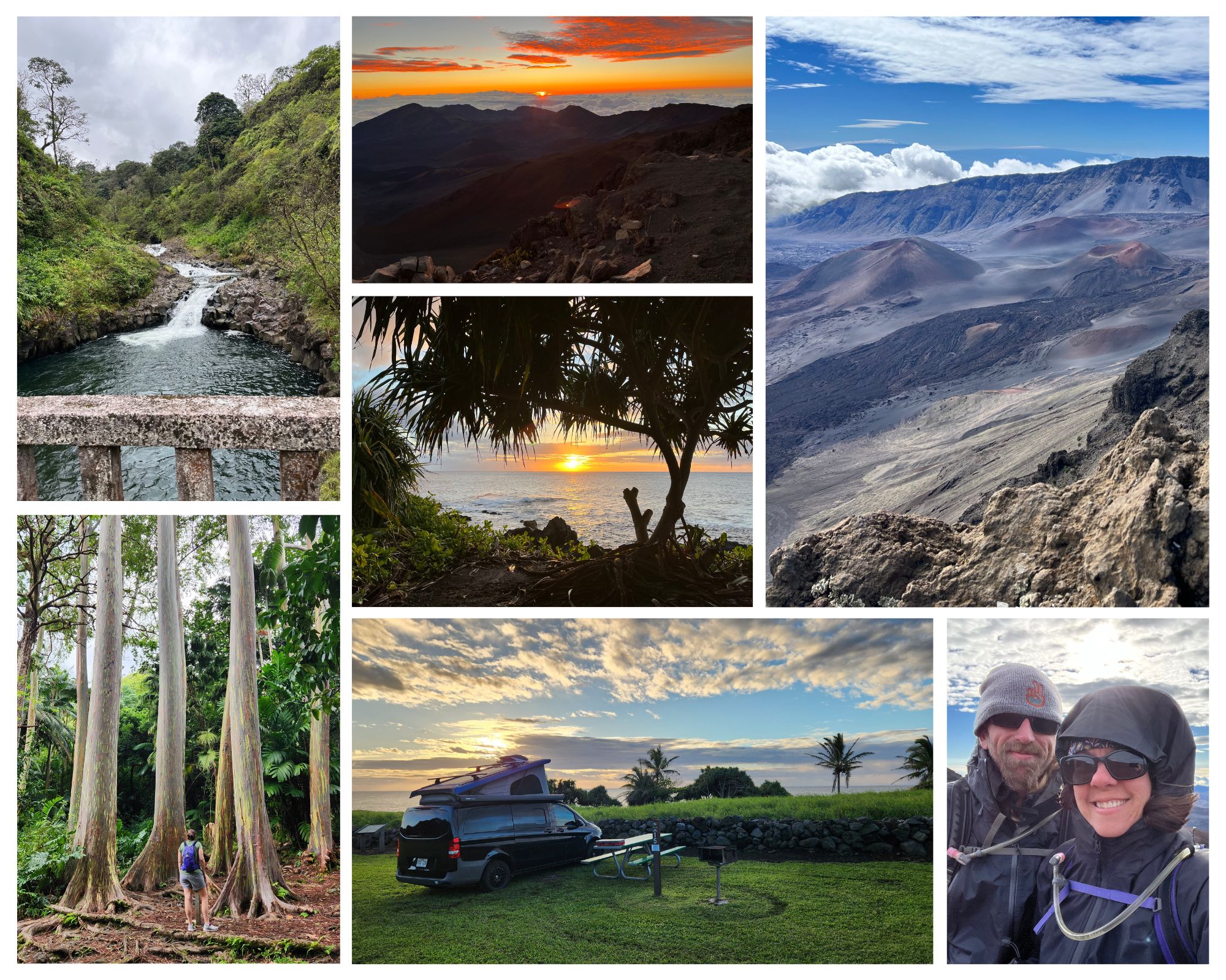
It’s no secret we love the national parks, so our trip to Hawaii centered around visiting the two national parks there – Hawai’i Volcanos and Haleakalā. We were in Hawaii for a week and visited the Big Island and Maui (Haleakalā and Hana). We felt like we had enough time to explore the parks, and saw so many epic sites, but did not have time to explore the entire island. If you love the parks and want an epic weeklong itinerary, feel free to use what we did as a baseline.
We visited Maui in March 2023. Since then, Maui experienced devastating wildfires that destroyed Lahaina. We spent time in Lahaina and it was one of the places on my epic Hawaii itinerary. I’m sharing our time on the island to remember the special time we had and the beauty and history Lahaina holds. I have no doubt Lahaina will return but not sure how long it will take or what the new Lahaina will look like. My deepest condolences to all affected by the fires.
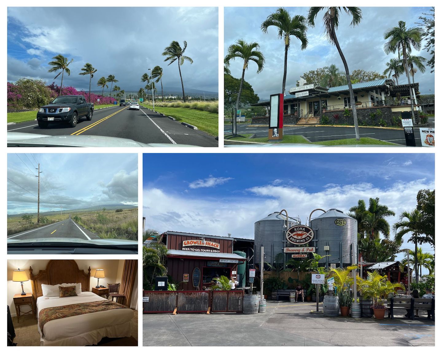
Day 1: Fly into the Kona airport on the Big Island. Rent a car and drive to Hawai’i Volcanos National Park. Spend two nights at the Volcano House in the national park.
Bonus tips: Grab lunch at Kona Brewing, stop at the grocery store to get any food/snacks for the next few days, and then grab a macadamia nut milk latte from Kona Coffee and Tea before hitting the road to Hawai’i Volcanos National Park. It’s a two hour drive so the caffeine boost is helpful after a long day of flying.
Day 2: Spend the day exploring Hawai’i Volcanos National Park. We made dinner reservations at the Volcano House restaurant and it was a fantastic choice after spending the day exploring and hiking.
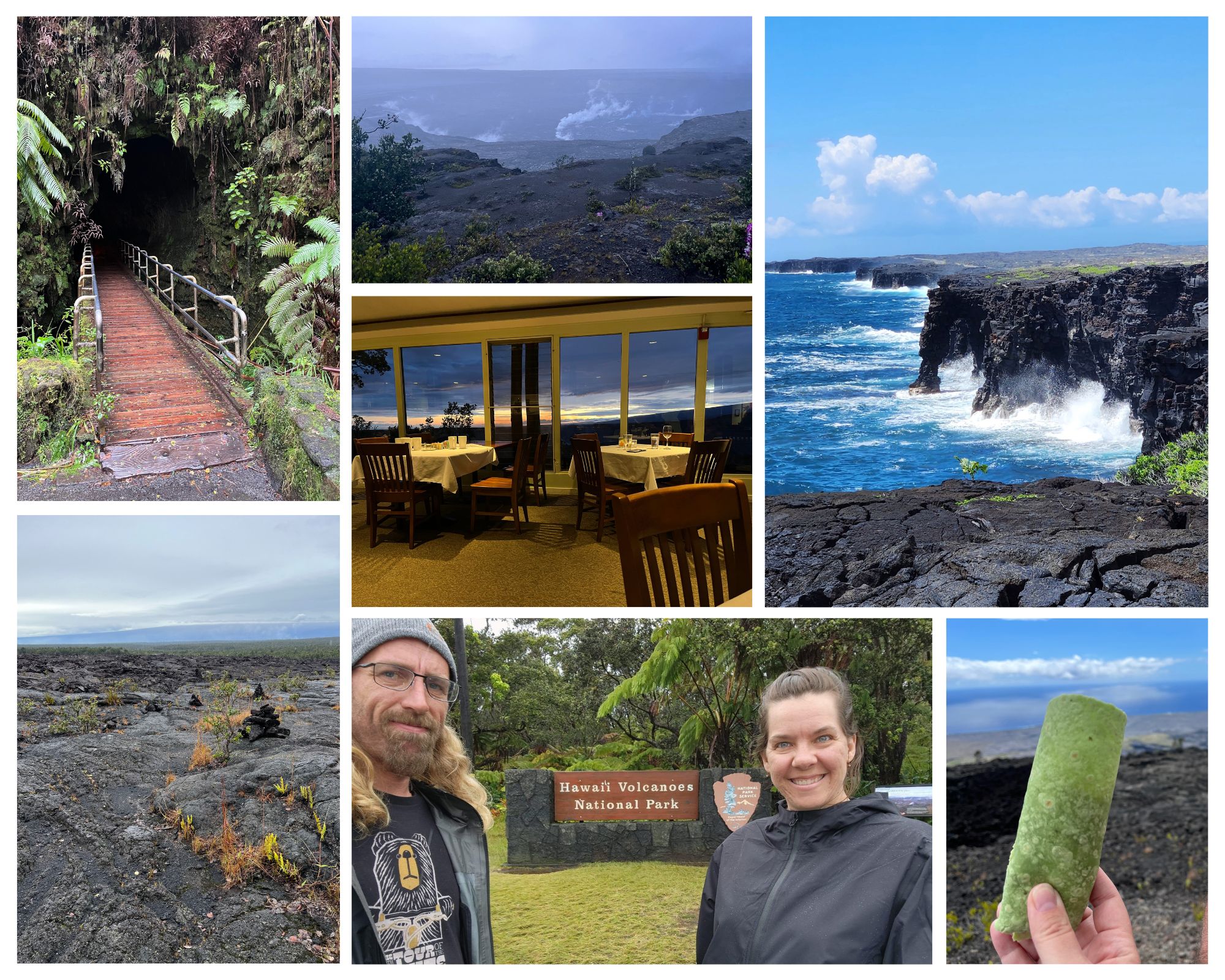
Suggested activities: Obviously get your picture with the sign because were you even there if you don’t have a sign picture? Stop in the Visitor Center to get your map and learn about the park. Drive Crater Rim Road and stop at the view points to see inside the crater. Grab a picnic lunch, drive Chain of Craters Road, and stop at any or all of the stops. Our favorite stops were the Kīlauea Iki Overlook, Thurston Lava Tube, Pu’u Huluhulu Cinder Cone hike, lunch on a curb near the Kealakomo Overlook starring out into the ocean, and the HöleiSeaArch. We wanted to hike the Kīlauea Iki trail but had heavy rain storms off and on and didn’t want to be hiking in the middle of that.
Day 3: Do any remaining things in HVNP and explore the area outside of the park. Can either spend one more night at the Volcano House or stay in a unique AirBnB for the night.
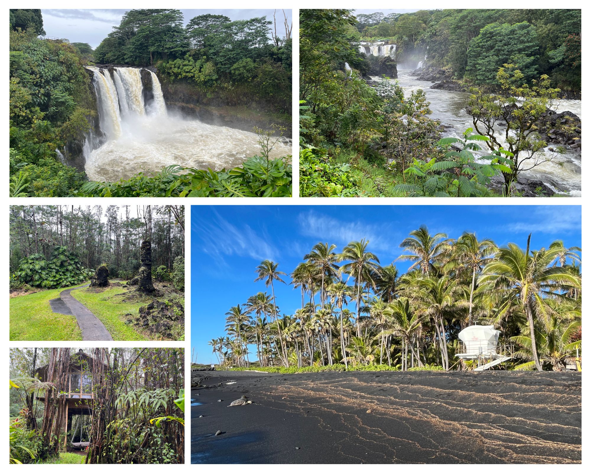
Some of our favorite stops were Punaluʻu Black Sand Beach, Wailuku River State Park (make sure to stop at both stops – Rainbow Falls and Boiling Pots), and Lava Tree State Monument. We stayed in a treehouse in the rainforest outside of HVNP. It was a fun and unique experience but I have mixed feelings about the specific place we stayed.
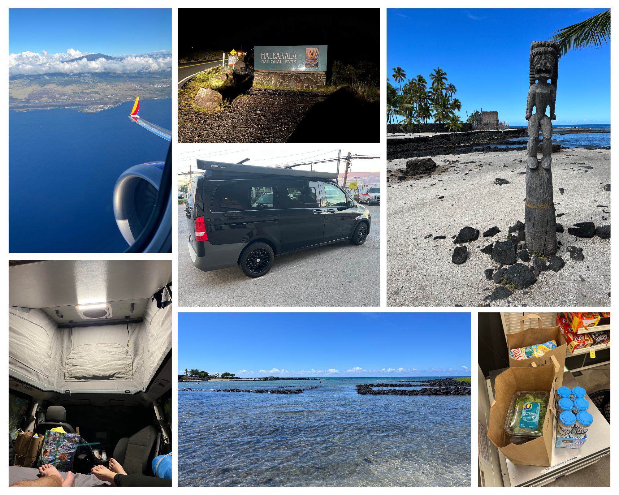
Day 4: Book an intra island flight for the afternoon to Maui. Spend the morning exploring a few more places on the way back to the airport.
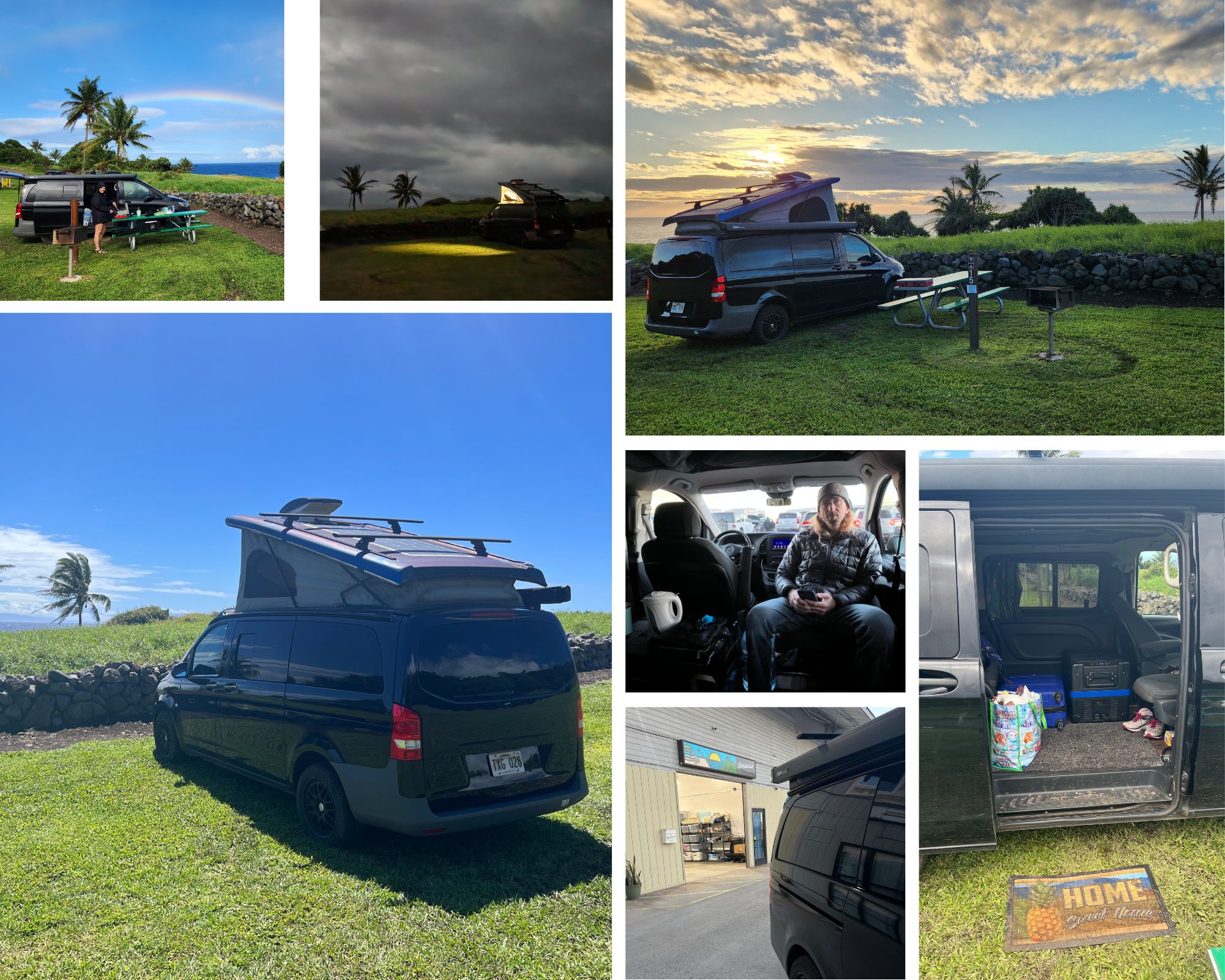
Our favorite stops were Puʻuhonua o Hōnaunau National Historical Park and Kaloko-Honoköhau National Historical Park. If you didn’t get to see the black sand beach yesterday, stop even for a few minutes on your way to Kona. We flew Southwest inter-island but learned they only fly once a day and the flight is often delayed. I’d suggest flying Hawaiian Airlines for inter-island. Once in Maui we picked up the campervan (highly recommend Campervan Hawaii!), stopped at the store for groceries, and headed up to Hosmer Grove Campground to camp for the evening. Because our flight was delayed we pulled in in the dark and didn’t have time to explore. Sad face.
Day 5: Get up super early to watch the sunrise on Haleakala, explore the top of the crater, drive the Road to Hana, and camp at KīpahuluCampground.
If you’re not staying at Hosmer Grove, be sure to reserve your sunrise ticket ahead of time. Post sunrise, hop in the van to warm up and drink some more coffee. Once warm go hike/explore the top of the crater. Drive to the Kīpahulu Campground in the afternoon and explore the Road to Hana on your way. Stop at attractions as you have time/interest. Driving in at the end of the day seemed ideal for exploring as a lot of the day traffic was on its way out. We had a chill drive and not many people were at the stops. We loved Kīpahulu Campground! Not only did we listen to the ocean for days, it’s such a beautiful area, and there is so much to do nearby.
Day 6: Hike the Pipiwai Trail in the morning. Drive to Hana in the afternoon and explore the sites you missed on the drive in. In general, have a chill day in one of the most beautiful places.
Day 7: Chose your own adventure day. This is your last day in Maui so find one more place to explore.
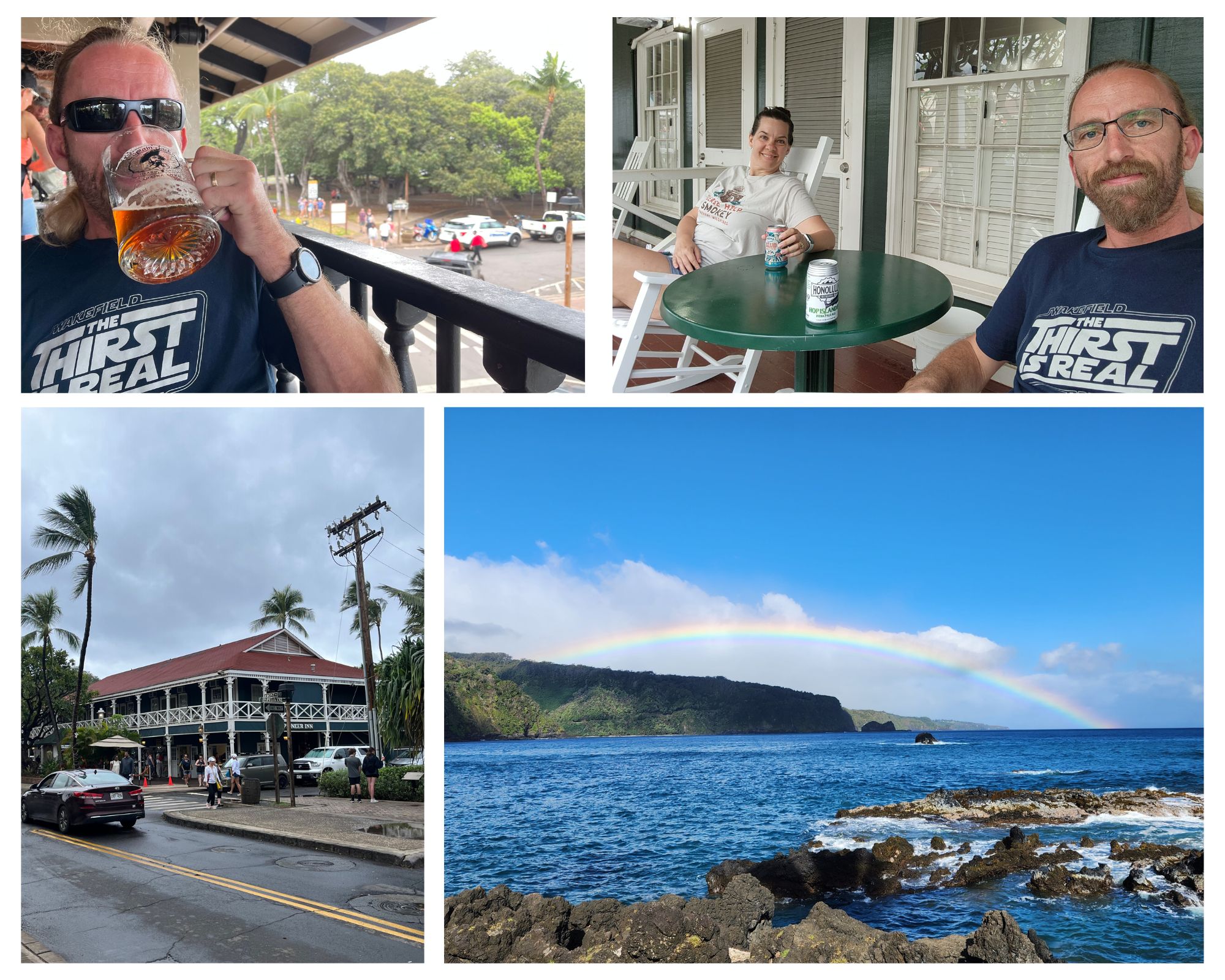
Our final destination was Lahaina. We visited in March which is prime whale watching season and scheduled a tour for the afternoon. Unfortunately, a storm rolled in that day and our tour was cancelled. We stayed at the Best Western on Front Street which was a fun vibe until we tried to go to sleep. The location was great and made for a fun last evening. We were able to do some souvenir shopping, eat, people watch, and get ready to head home. Problem with staying on Front Street is the party doesn’t stop just because you have an early morning flight. :/
Day 8: Return the campervan, head to the airport, and fly home. 🙁
We loved this campervan! It allowed us to experience Maui in a way we never could have staying in a hotel. This will forever be one of our favorite road trips. We rented from Campervan Hawaii and had a fantastic experience. The van was clean and had all the extras needed to live in for a few days. They even gave a full five gallon jug of water. 10/10 stars.
If you have questions about our trip, logistics, etc, feel free to leave a comment. Happy planning!
https://www.theroadwevetraveled.com/wp-content/uploads/2023/11/20230307_070117.jpeg8111440Carolinehttp://www.theroadwevetraveled.com/wp-content/uploads/2015/08/RWT_Logo@3x-300x143.pngCaroline2024-06-01 19:54:272024-09-19 19:28:33Epic Hawaii Road Trip Itinerary for National Park Lovers
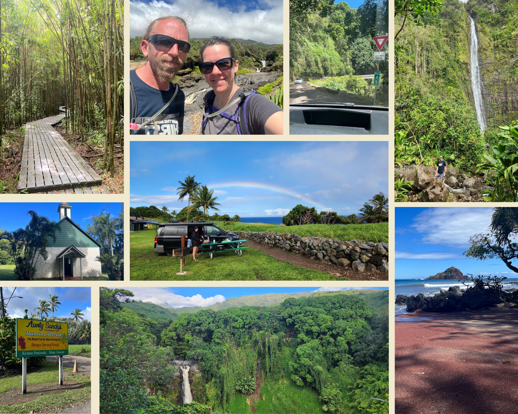
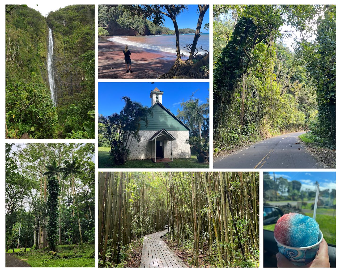
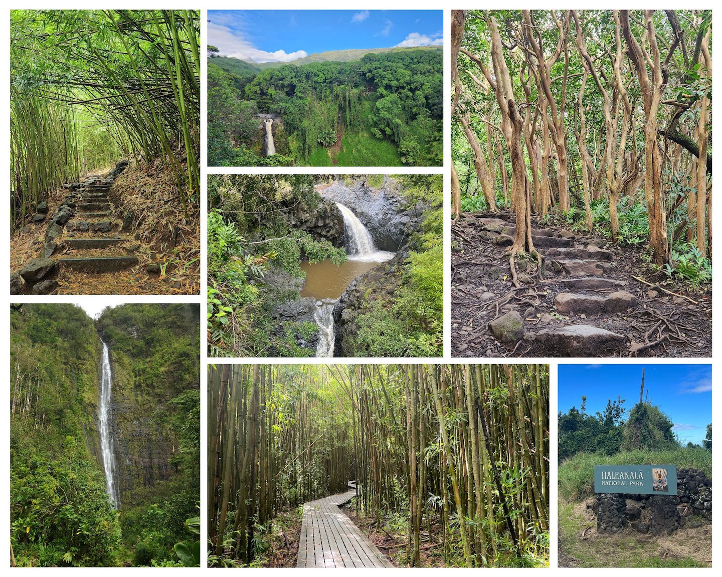
If you’ve been on the Road to Hana you know how epic it is. If you haven’t been on the Road to Hana, you should add it to your bucket list. It legitimately might be one of the most beautiful drives we’ve ever taken. We had some fun and exciting (not) weather on our drive so we got to experience the Road to Hana in a number of situations. Definitely got the heart pounding a little faster at times.
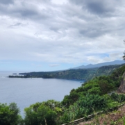
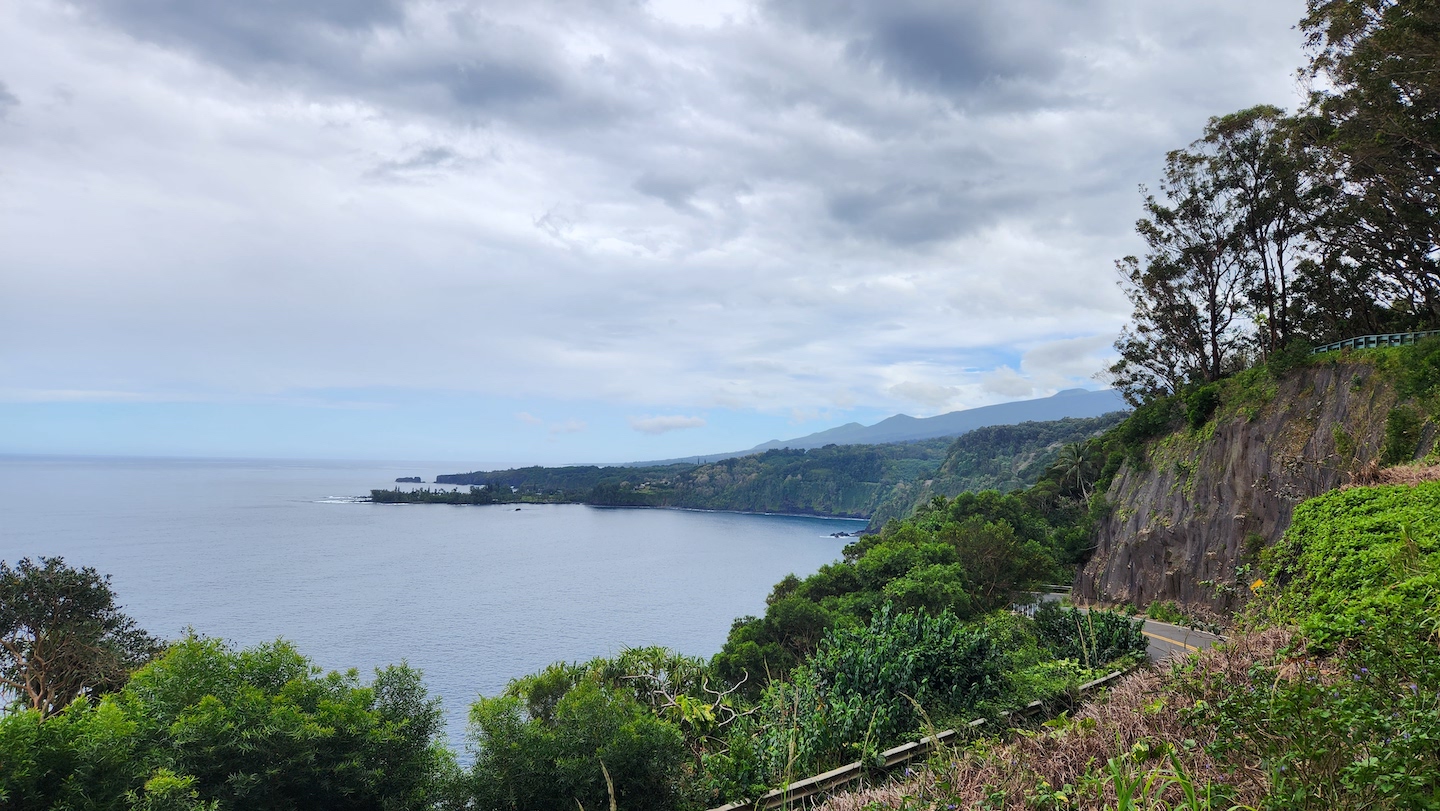
Road to Hana
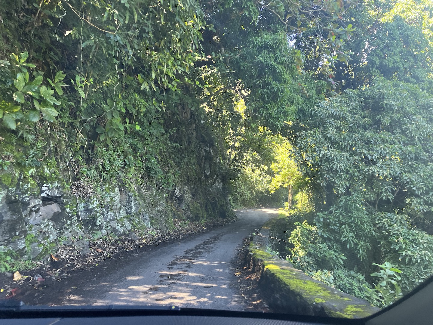
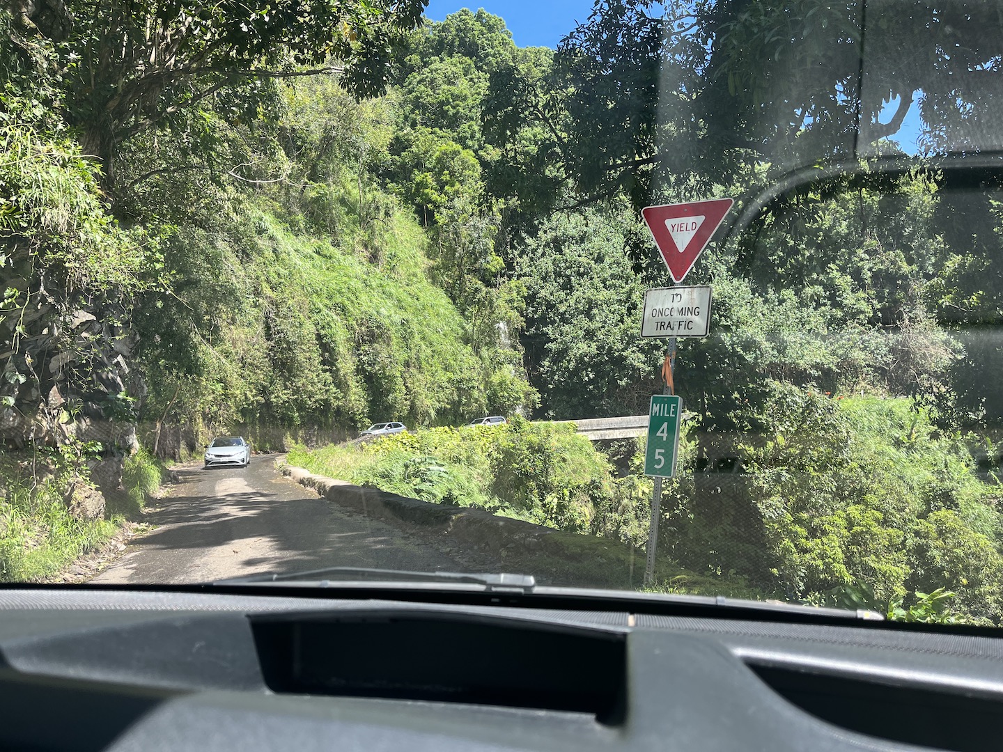
If this is your first time hearing about the Road to Hana, it’s a 59 mile stretch of road in Hawaii on the island of Maui between the towns of Kahului and Hana. The last 35 miles are what people are really referring to when they talk about the Road to Hana. The road takes you though a gorgeous, dense rain forest on the edge of a mountainside. The road is not for the faint of heart. There are 59 one lane bridges and 620 curves in the road. The road is pretty narrow in general and you have to be constantly paying attention.
Road to Hana
There is etiquette for driving the Road to Hana. Pay attention for locals and let them pass. Another biggie is at the bridges, traffic is supposed to proceed in order of arriving at the bridge. Sometimes one side would never stop which means the other side can never go. It was really frustrating when this would happen. If we all take turns we’ll all get where we are going.
One Lane Bridge on the Road to Hana
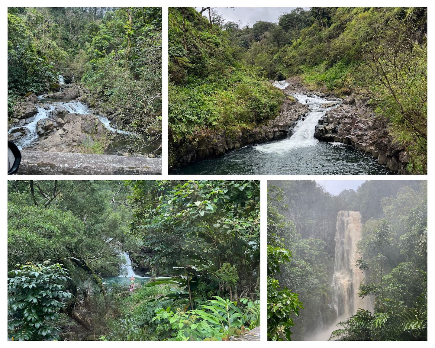
Aside from the beauty of the drive itself, there are stops all along the road which is probably a large reason as to why there is such a draw to this road. Waterfalls, different colored sand beaches, epic vistas, arboretums, food and beverage stops. It’s truly an epic adventure. There are a million websites telling you where all the stops are and which are the best and must do. Honestly, it got a little overwhelming trying to make sure we saw it all. We’ve become pretty adaptable when we travel and have learned to have a list of things we want to see but then figure it out as we go based on how we feel in the moment. That worked well for us on the Road to Hana.
Road to Hana
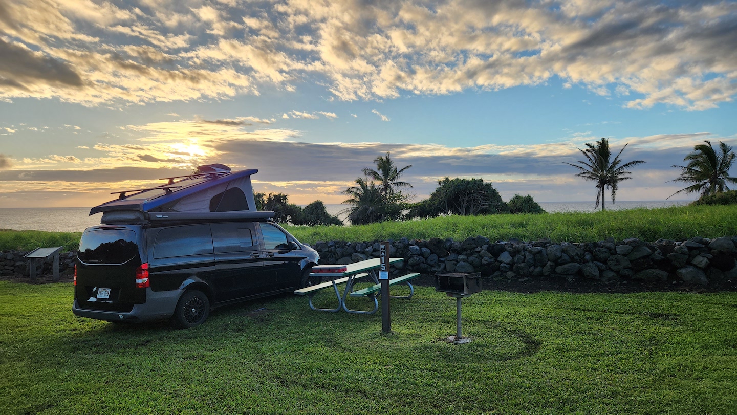
Lodging along the Road to Hana is hard to come by and can be expensive. Just passed the town of Hana is the Kīpahulu District of Haleakala National Park. We were fortunate to grab a campsite at the Kīpahulu campground within Haleakala National Park and it made the perfect home base.
Kipahulu Campground
If you’re planning to drive the road, get the smallest car you can get. For real. The lanes are narrow and you are going to be so much more comfortable in a smaller car. Think smaller and harrower. No wide race cars. We saw some people in Chargers which took up the entire lane. We had a Mercedes Metris campervan and it was the max size I’d want to drive. We met a couple at the campground who had rented a Sprinter Van and it was a bit big for the road.
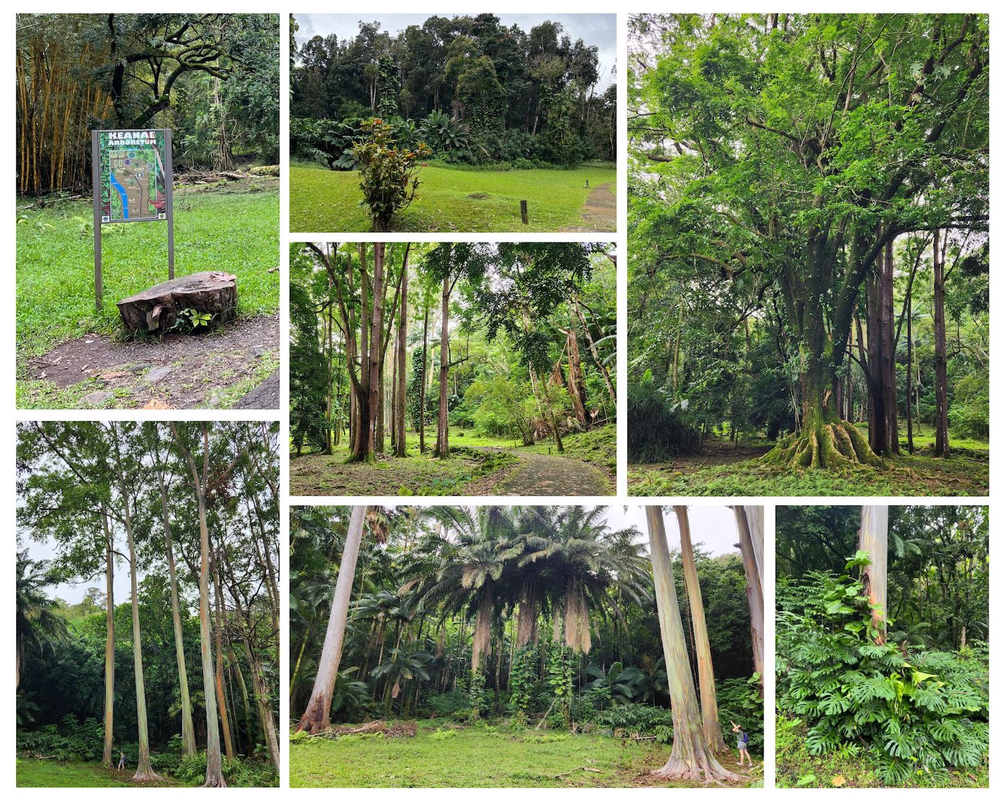
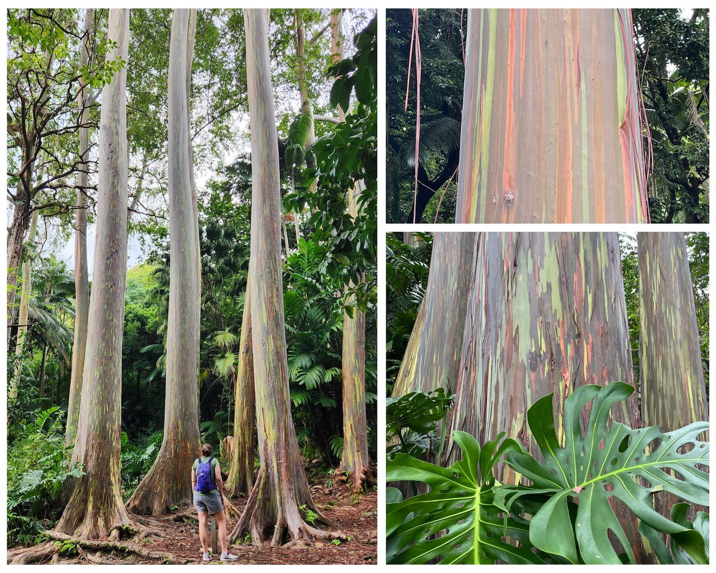
Keanae Arboretum
One of our favorite stops was the Keanae Arboretum to see the rainbow eucalyptus trees! Seriously, my favorite trees ever. A close second is any tree wrapped in vines, which are also all over Hawaii. The eucalyptus reminded me of rainbow colored redwoods. I’m not sure if they even come close to redwoods in height but they are tall. Add rainbow bark and you have the coolest tree ever! It’s a free and quick stop. There are lots of other beautiful plants to look at too.
Rainbow Eucalyptus at Keanae Arboretum
The Pipiwai Trail in Haleakala National Park is a must do. It’s one of my favorite hikes ever. It can be very wet and muddy, at least in March, so please make sure you are wearing appropriate hiking footwear.
Pipiwai Trail – Haleakala National Park
We had reservations at Waianapanapa State Park, the black sand beach, but didn’t end up going. I don’t remember why we didn’t go. Oh right, we spent too much time driving sketchy roads the day before and needed a break from driving. We had seen black sand on the Big Island so we had already checked that box. Instead, we had a leisurely day around camp and it was just what we needed. We explored the national park, drove into Hana, and explored the other end of the road.
Koki Beach
Koki Beach is a red sand beach. It’s not a good beach for swimming as it has dangerous currents, but it’s beautiful to look at.
Practically every turn in the road has a waterfall. Some you can swim in and some you cannot because they are on private property. The day we left it was storming really bad and the waterfalls all looked like something out of Charlie and the Chocolate Factory.
Waterfalls on the Road to Hana
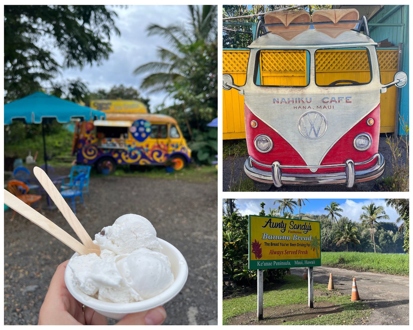
Some of our food stops were for coffee, ice cream, shaved ice, and banana bread. Everyone raves about Aunt Sandy’s and it’s legit. Don’t skip the banana bread. The Huli Huli chicken is supposedly legendary but it was closed when we got there. 🙁
Food Stops on the Road to Hana
There is no cell service on the Road to Hana. We downloaded the Guide Along app ahead of time and highly recommend it. The app is GPS based and narrates the drive. It tells you of upcoming stop ideas, must see places, and the history of the areas you are driving though.
A couple tips. Driving there and back to Hana from anywhere in Maui makes for a long day. If you can, I’d suggest staying someone near Hana so that you can really enjoy yourself. The weather can be unpredictable. It was literally flooding in Haleakala when we left and by the time we got to the start of the Road to Hana, it was sunny with blue skies. Always have your rain gear in Hawaii. Be respectful of private property. The entire area is absolutely gorgeous, and we all want to enjoy it, but people do live in the area and many of the attractions are on private property. Respect signs and do not go in areas you are asked to stay out of.
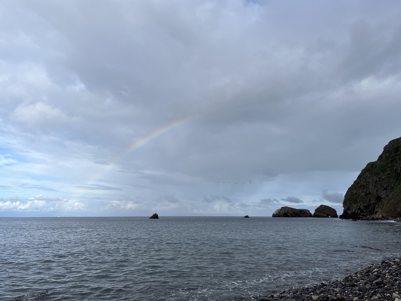
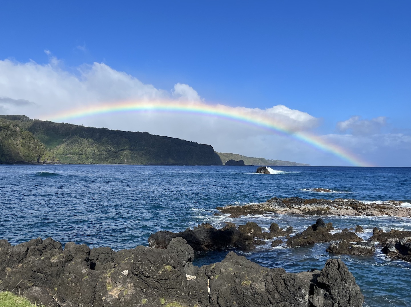
Rainbow on the Road to Hana
One final story before I wrap up this adventure. On our final morning at the Kipahulu Campground, we woke up to a crazy storm and a flood warning. The weather was only going to get worse as the morning went on, and we had afternoon whale watching reservations in Lahaina, so we decided to book it out of the area as fast as possible on a sketchy road in the middle of a sketchy storm. It felt like we were in the scene of a movie trying to outrun something. Flooded roads, dodging fallen trees, rain pouring. Being that it’s a rain forest, I’m sure it’s normal for that area, but this desert girl was a little freaked out. The Hana road crew was out cleaning up the road in the middle of the storm which made me feel better about our life choices in that moment. When we finally got out of the storm we saw the rainbow above and all was right in the world again.
The Road to Hana is an epic adventure and worth how every many hours of days you have to spend on it.
https://www.theroadwevetraveled.com/wp-content/uploads/2024/03/20230306_143832.jpeg8111440Carolinehttp://www.theroadwevetraveled.com/wp-content/uploads/2015/08/RWT_Logo@3x-300x143.pngCaroline2024-03-16 05:44:162025-01-02 14:54:41The Road to Hana - Maui, Hawaii