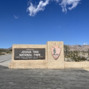
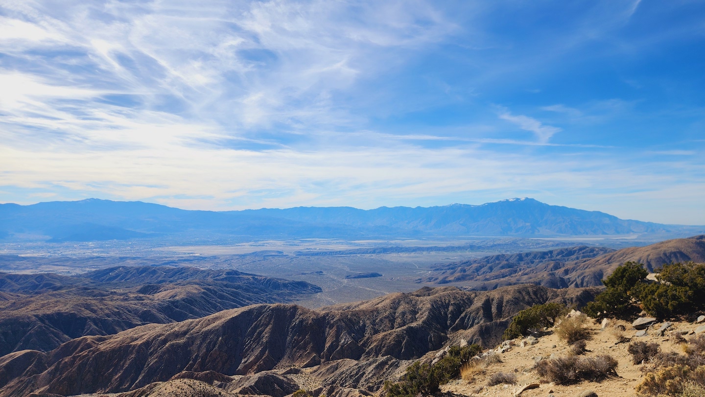
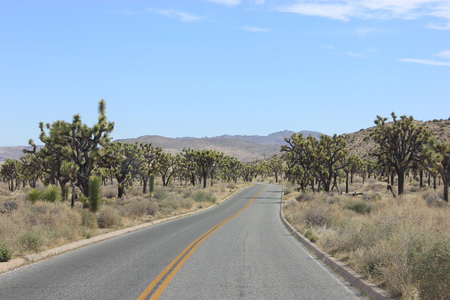
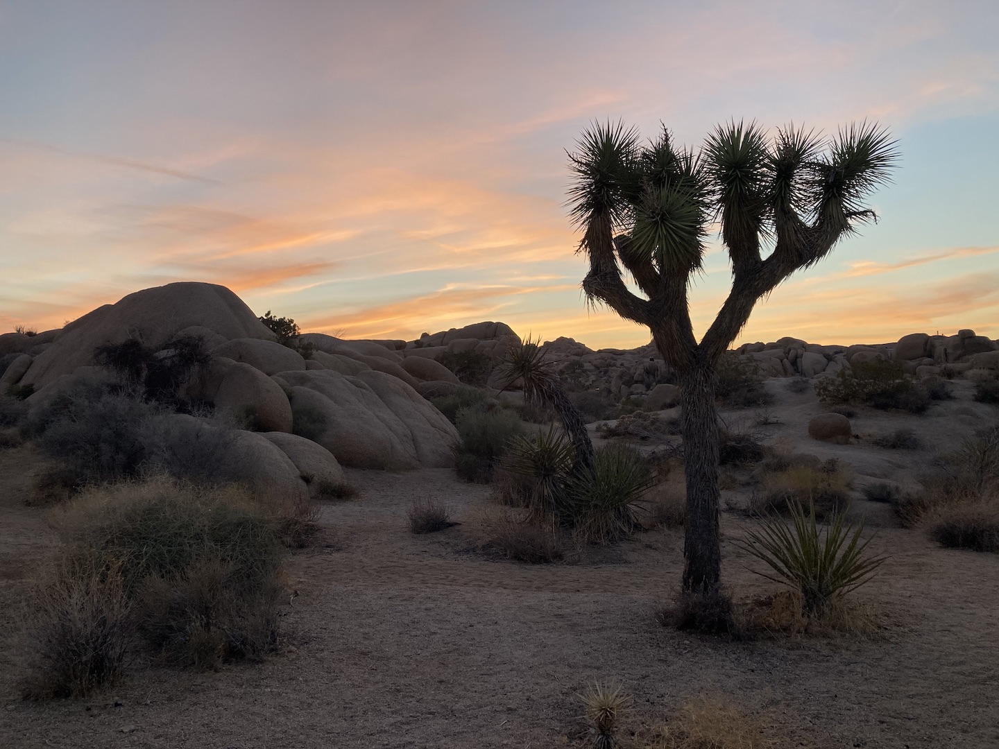
I visited Joshua Tree National Park on a solo trip for my 40th birthday. Recently, my husband and I realized I have visited 30 national parks and he only 29 because he didn’t go on my solo trip. We clearly had to remedy the situation so I planned a trip!
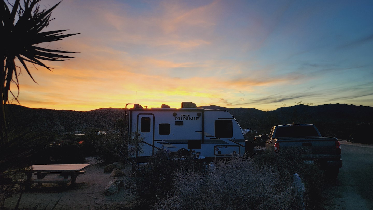
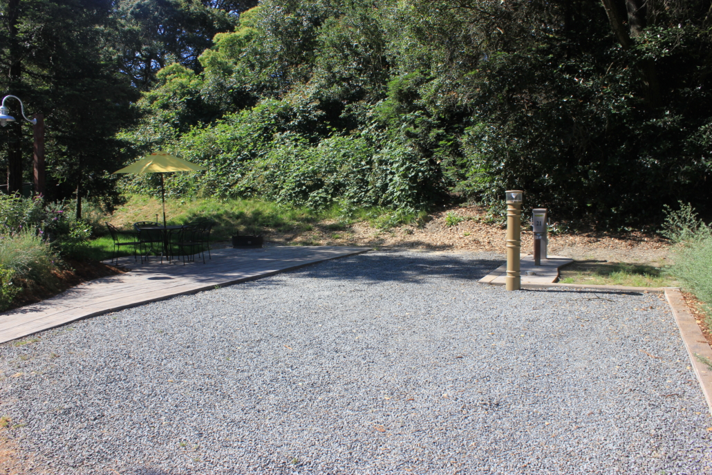
Being that it’s January in a desert park, it’s prime season and last minute campsites are hard to come by. All the reservable sites in the center of the park were booked but I found a few open sites at the Cottonwood Campground, which is an hour away from the main section of the park. One hour is better than not going to we booked the site and started planning.
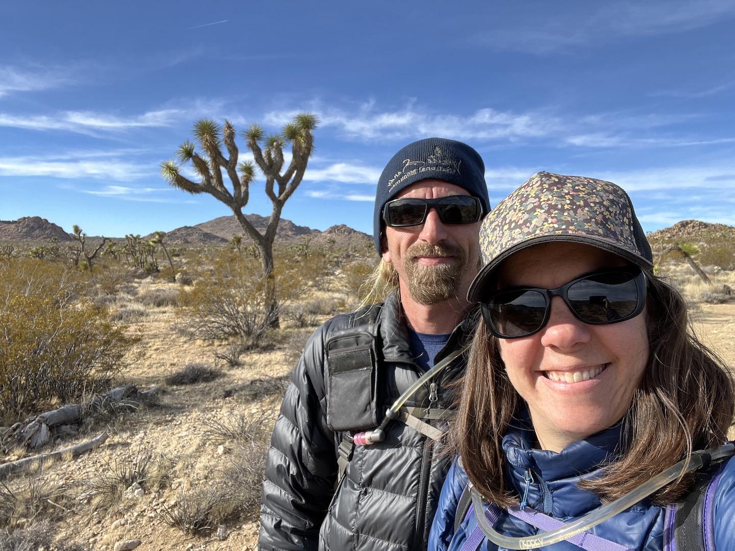
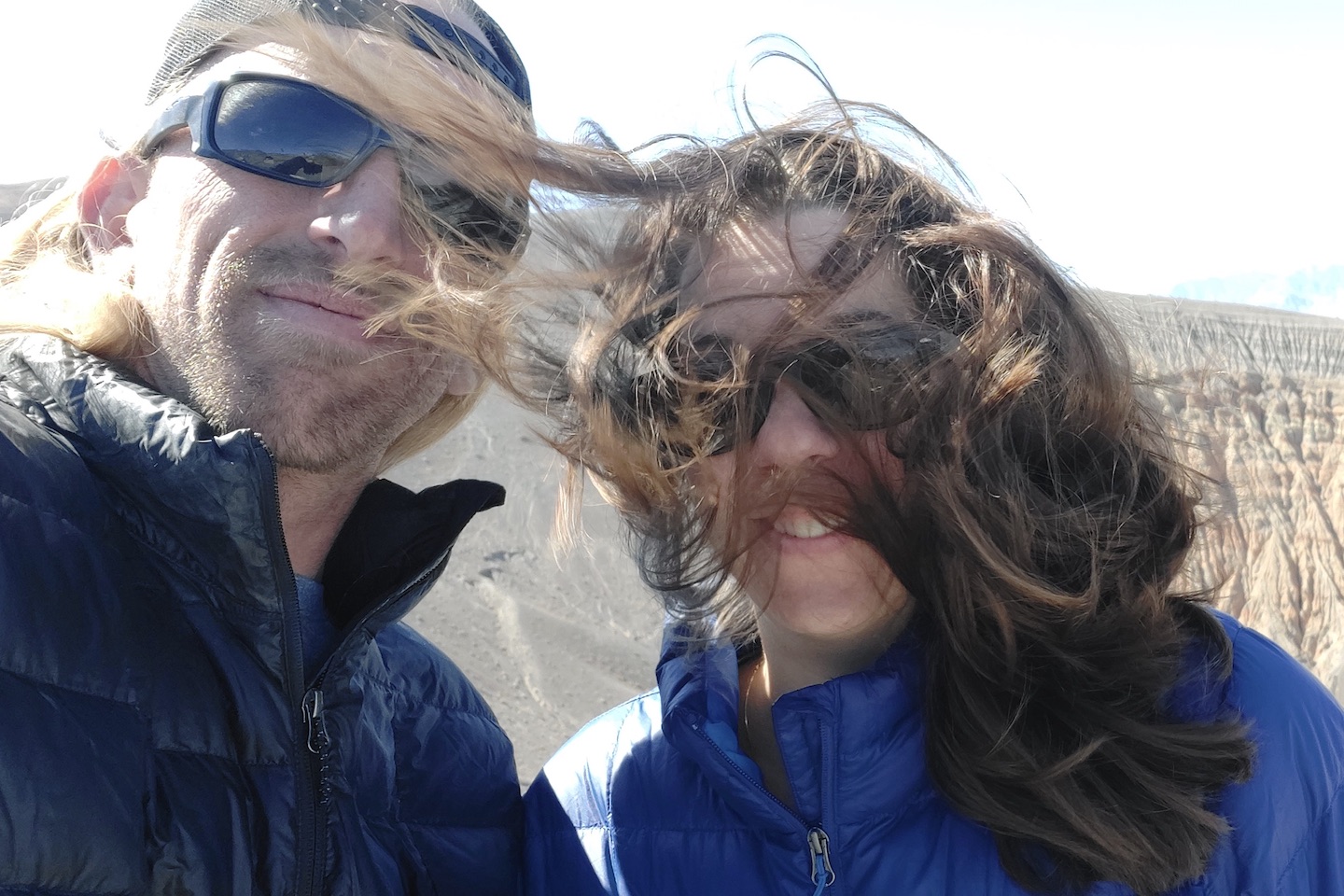
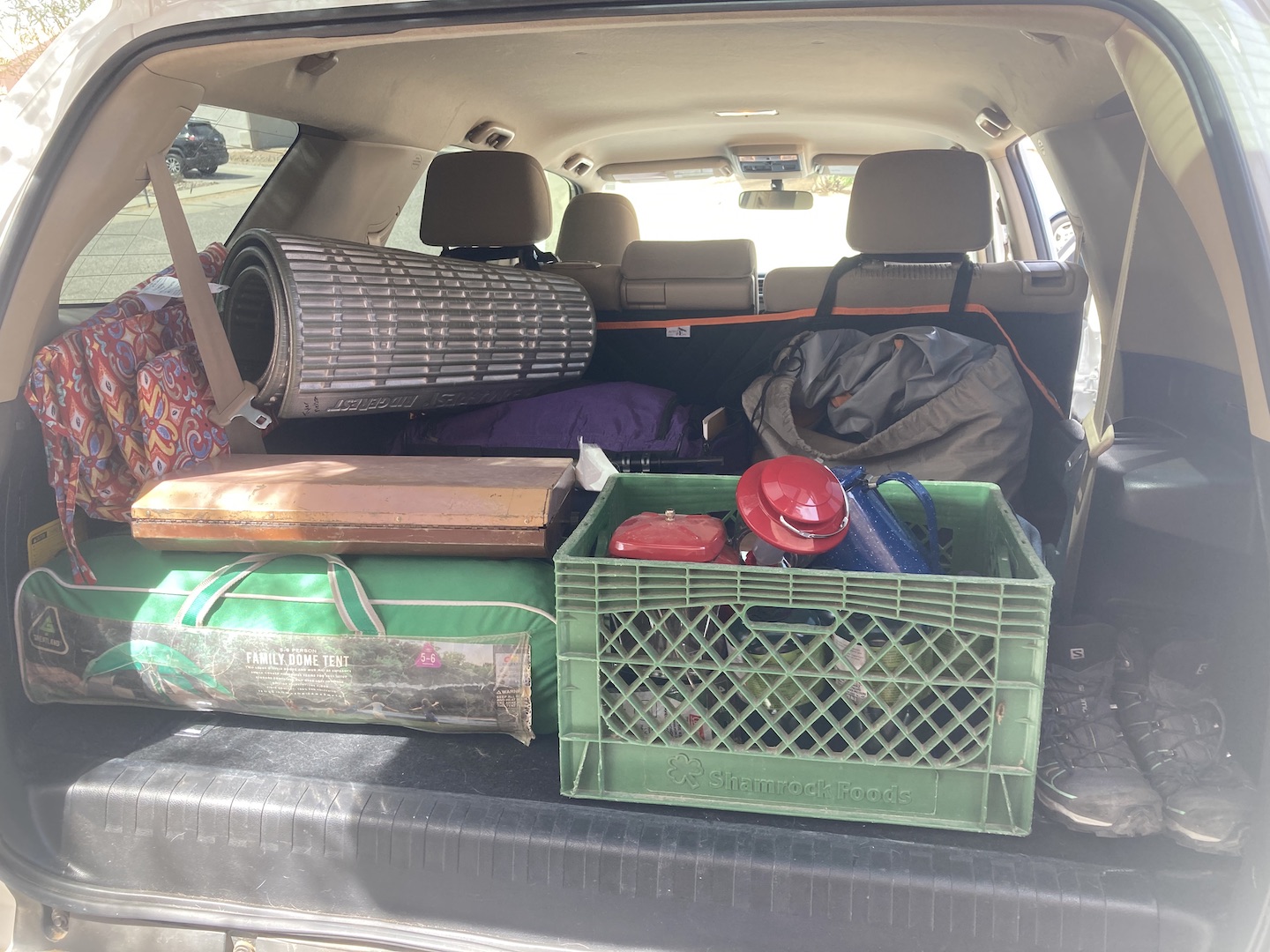
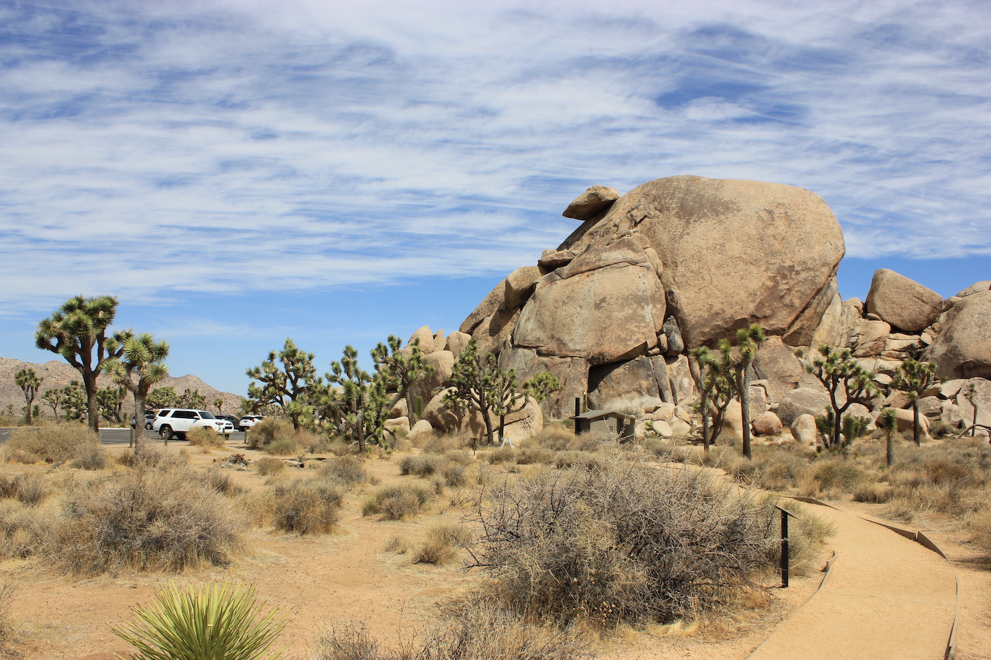
When I visited previously, I was by myself and stuck to the short hikes and more touristy things for obvious reasons. Going back with Brandon meant we could explore more so I started looking into what all there is to do. Basically we did all the things. 3 night camping, 2.5 days exploring, 5 hikes for a total of 13.5 miles, 1 ranger led tour, 2 quick stops, 1 western town, 2 grocery stores, 1 souvenir store, 2 visitor centers, 2 saloons, and drove through all 3 entry points. And that, my friends, is how I like to vacation. 🙂
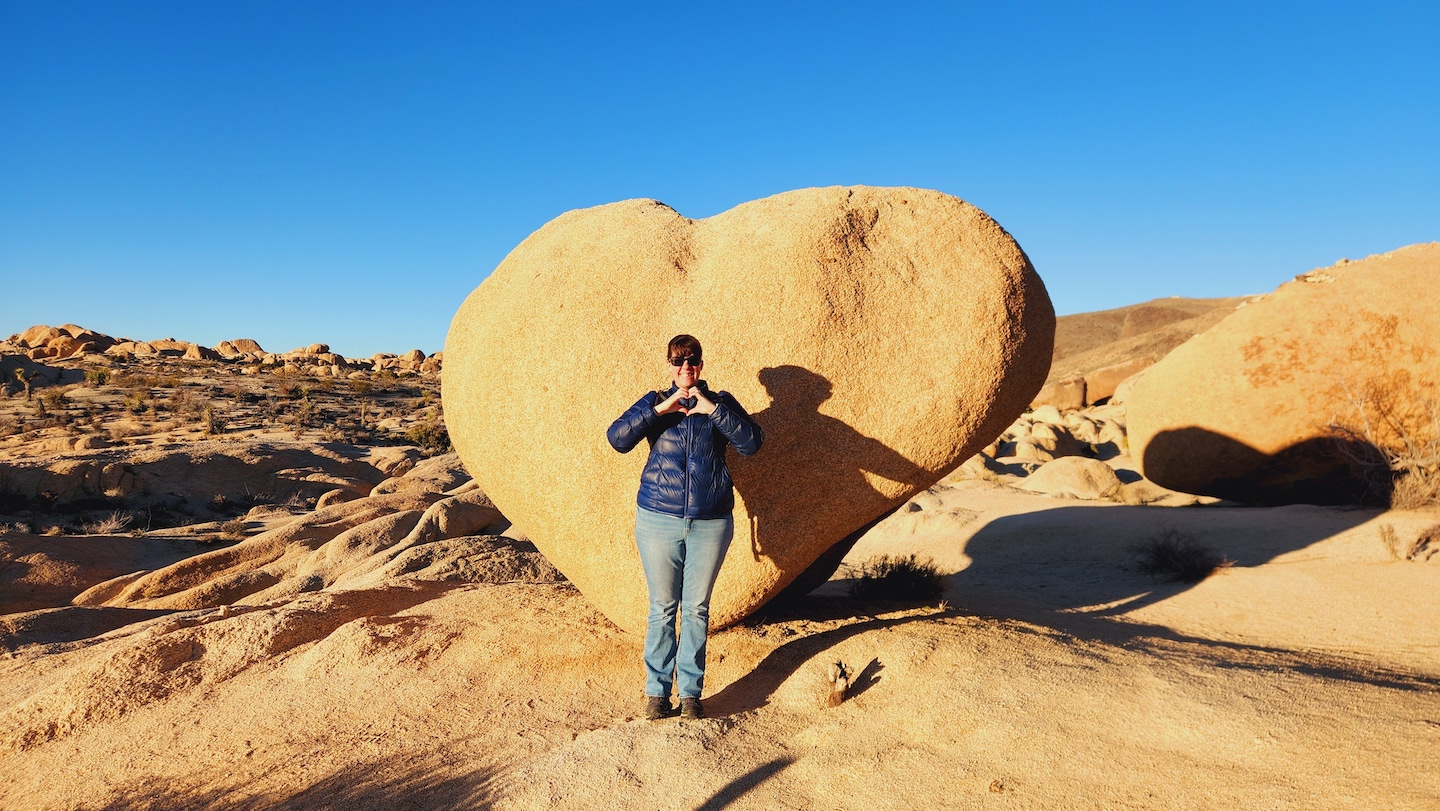
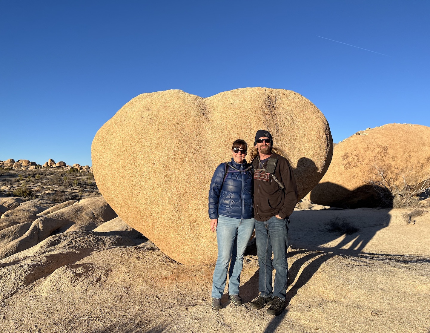
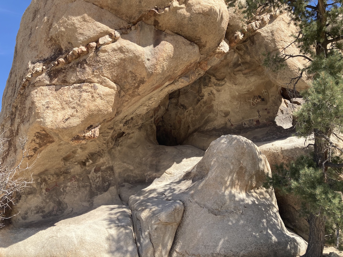
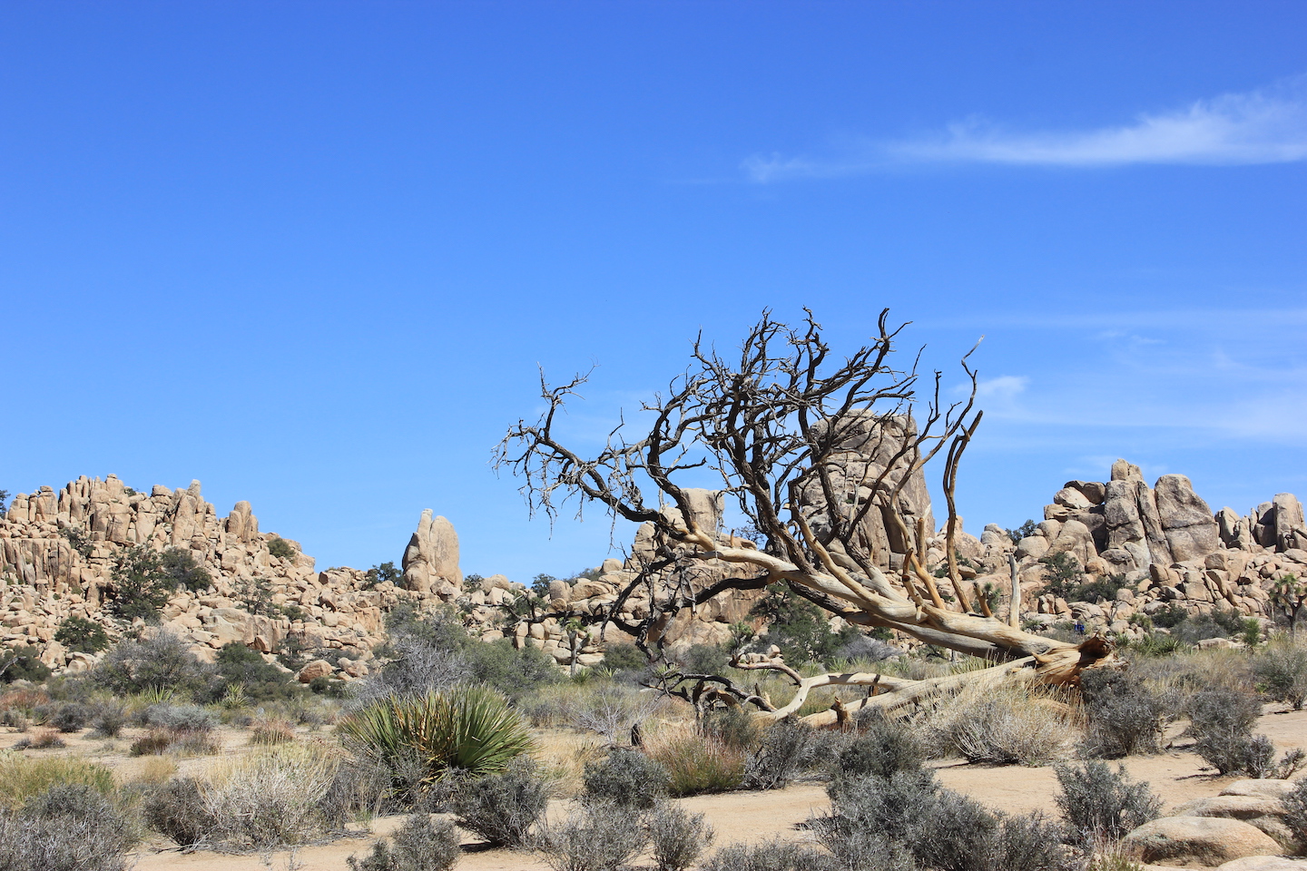
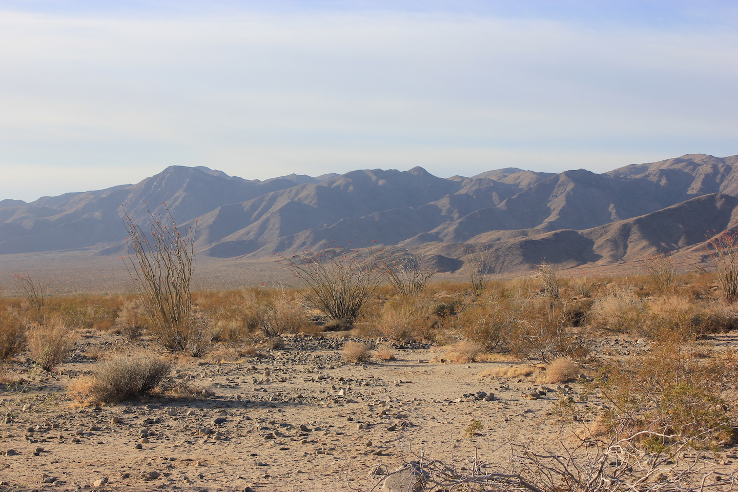
We arrived on a Thursday afternoon and got set up at camp. We still had some daylight to burn so we hit the road. Our first stop was the Cottonwood Spring. Next stop was the visitor center which wasn’t very exciting. Lastly, we headed to the Arch Rock trailhead. My goal was to find heart rock and we did! The internet is an interesting pace. Some places are unmarked and articles never get updated when they become marked. I’m not knocking anyone. People have no way of knowing when something changes but it does make it hard to plan for things. When I was searching for things to do, heart rock kept coming up and people were providing GPS coordinates and crazy directions. We were pleasantly surprised to find that it’s now a marked trail.
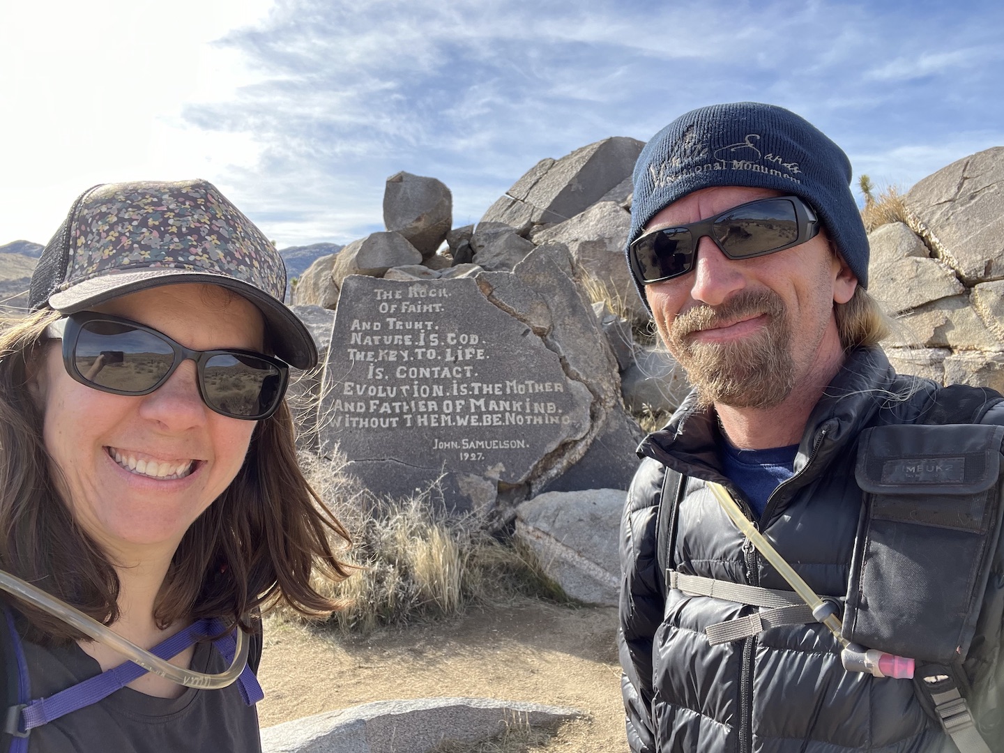
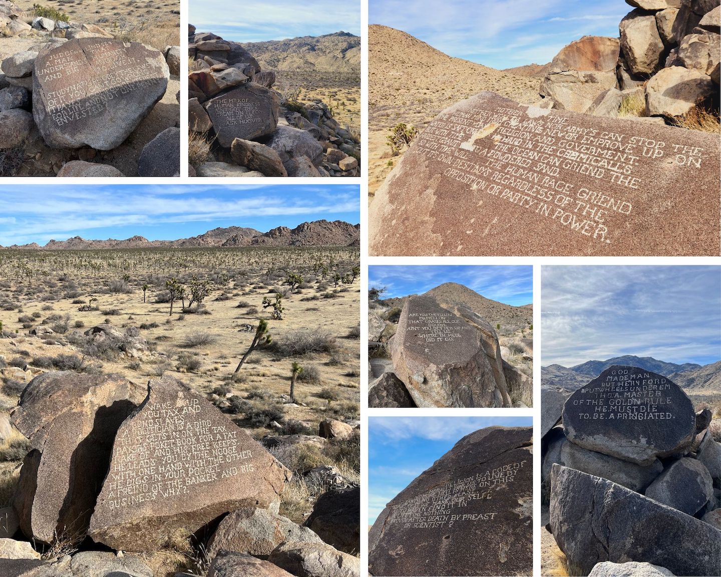
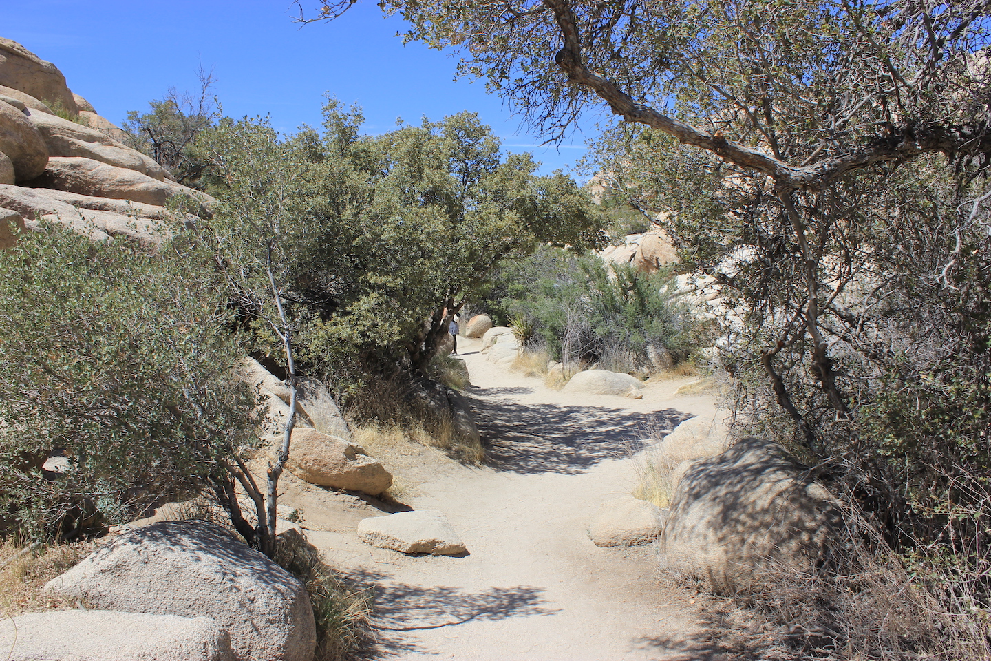
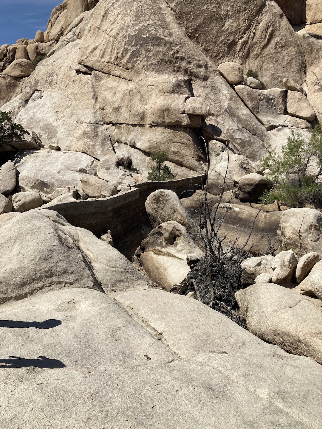
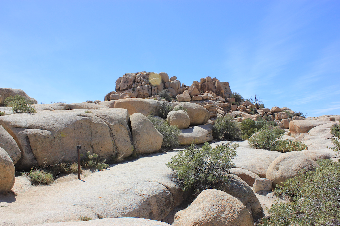
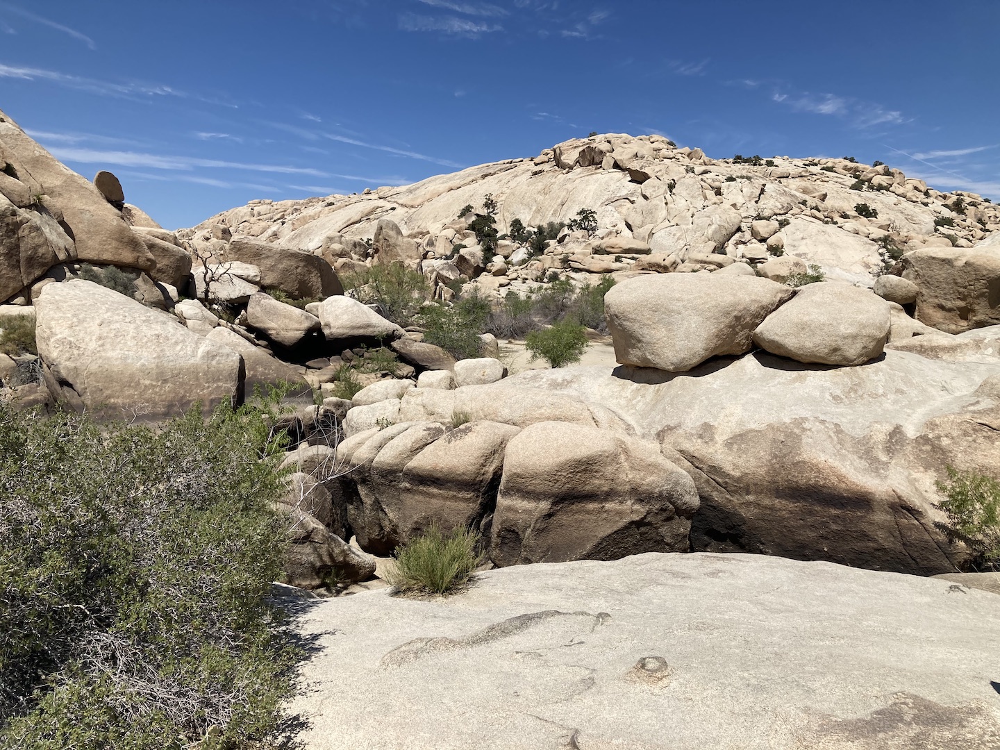
I was super excited for our Friday plans. I read about an unmarked hike to Samuelson Rocks and that was first on our list for the day. It’s not an official trail and on the internet you can find the GPS coordinates. I wasn’t totally keen on the idea of just walking through the desert towards some GPS coordinates and was trying to decide if we should really be going off trail. As I was studying park maps, like more detailed ones, I found actual trails to get to Samuelson Rocks. I’m not giving details, if you want to do this hike, you can figure out how to get there. There is no cell service in Joshua Tree and the trail is totally exposed, so be sure you have a GPS device, water, and snacks. As we turned onto one of the trails there was a sign that said you are entering backcountry. Be prepare to self rescue. When I mentioned this hike to a ranger at the visitor center he rolled his eyes and said there are no trails to it. If they didn’t want people finding the area, I assume it wouldn’t be on maps. My only advise, if you’re going to do this hike, look at the maps and figure out how to get there safely. The area can be very disorienting so make sure you have a GPS device and know how to navigate There is no trailhead and only a small parking pull out so we wanted to be there first thing in the morning to make sure we could park. Before the park was a park, miners and ranchers came to the area to mine for gold and build homesteads. John Samuelson was one of those guys and the legend goes that Samuelson was a radical thinker but no one really seems to know much else about him. He carved his thoughts into eight? boulders all strewn around a rocky hill in the area where he used to live. You can find remnants of the homestead. A car, fence, and bed frame are all randomly in places. What I loved most about this adventure is it was part hike park scavenger hunt. We spent probably a good hour at the site looking for the different rocks. Some are harder to find that others. We had the place to ourselves mostly, with the exception of two guys who happened to be hiking by and asked what we were doing. This hike was definitely a highlight of our trip. We hardly saw a soul and got to see something really special.
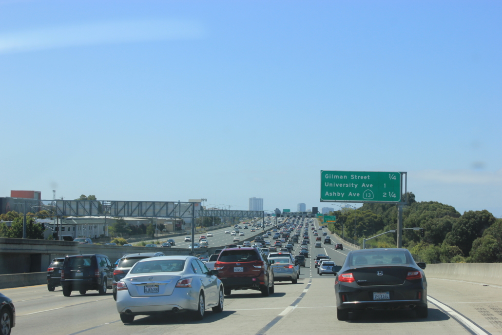
After we finished our hike, we headed into the town of Joshua Tree to check out a few places we read about no the internet. The first was Pioneertown. It’s an old western town that was used for movies. We live in Arizona and have several of these, so Pioneertown wasn’t that exciting. There’s a restaurant/bar and some souvenir stores. It’s a little ways out of town so I wouldn’t suggest going unless you really love that kind of thing. We made a few stops in Joshua Tree, the national park visitor center, Joshua Tree Coffee, a souvenir store, and the Joshua Tree Saloon. The place was crazy busy. We could barely get a seat. We drove through the 29 Palms Entrance to work our way back to Cottonwood Springs. It was a long day of driving and exploring but we got to see a lot.
We had 9am reservations for the Keys Ranch Tour so we hit the road early and made our way across the park. We arrived at the meet up location a little early and quickly took a short hike to see the pink house. Overtime people have carved their names into the property so the pictures online are better. I don’t understand why people do that.
We snapped a few pictures and headed to the meet up spot for the Keys Ranch Tour. The tour is in a locked area of Joshua Tree so if you miss the meet up time, you miss the tour. The tour is only offered certain times of the year and does sell out, so if you want to go get your tickets early. I love ranger talks and learning about the history of an area.
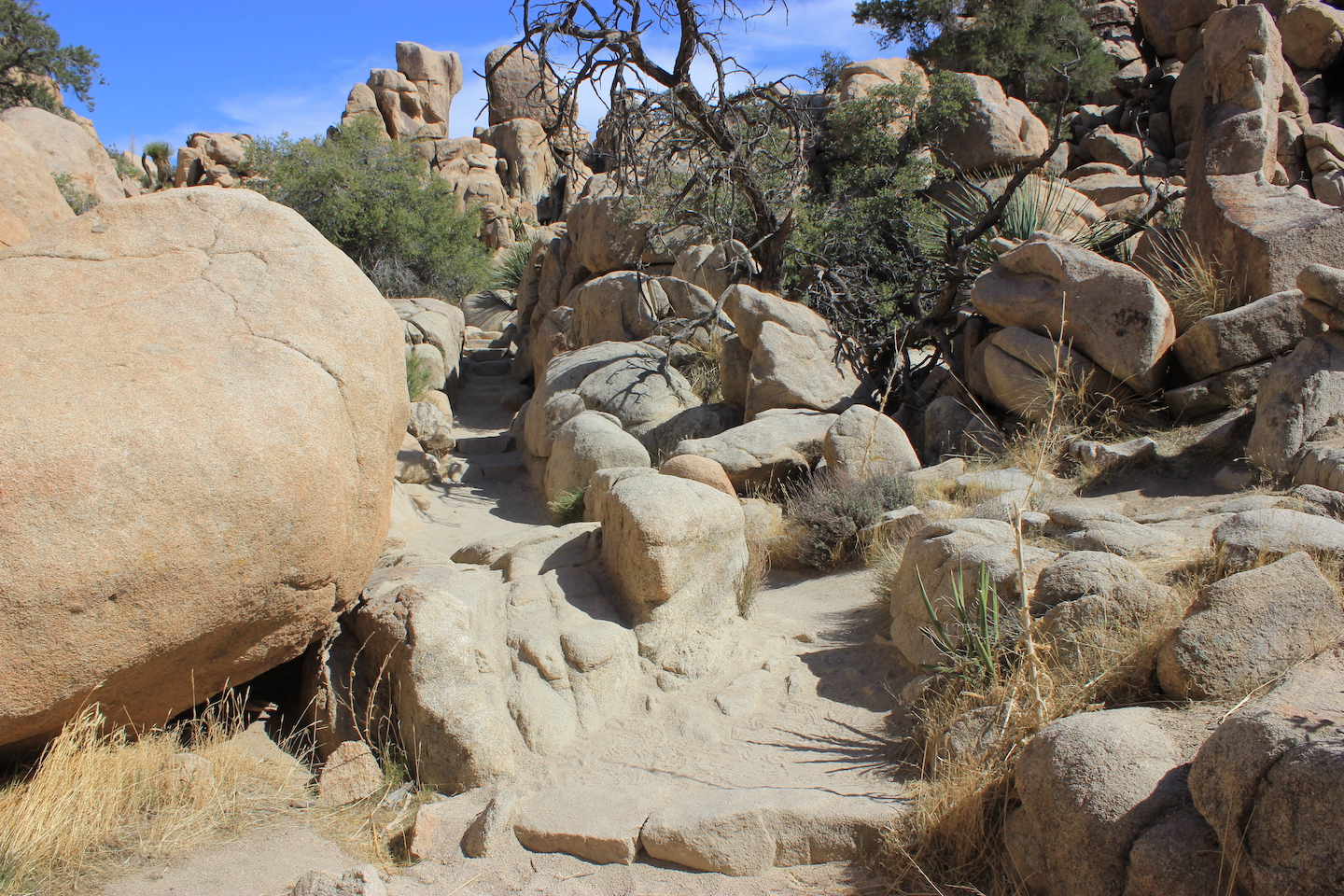
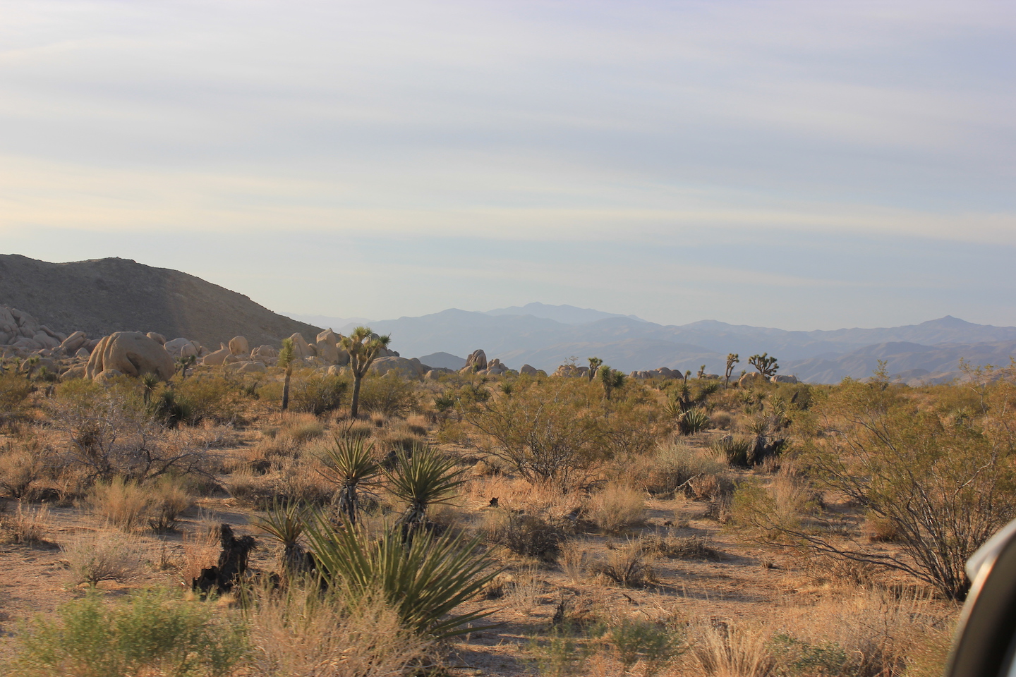
After the tour we did a few hikes in the area. First was Barker Dam.
Nest was Hidden Valley.
We drove up to up to the high up view and it was meh. We weren’t ready to call it a day yet, so we decided to his the Lost Horse Mine trail on our way back down from the high up view. Normally I wouldn’t tack a harder trail onto the end of a day but sometimes the spontaneous plans are the best.
The trail felt like a mirage towards the end. My watch mileage was telling me we should almost by there but my eyes felt different looking at how far we still had to go. The mileage was correct, thank goodness. Being that it was the end of the day, there was hardly anyone out hiking so we had to mine to ourselves mostly the entire time we were there. We had a drink and a snack, enjoyed the views, and headed back to the car. We were beat by the time we go back to the truck and this was the perfect end to our trip.
I’m pretty sure I was in bed as soon as we ate dinner. The next morning we packed up and headed home. We had an absolutely fabulous time in Joshua Tree and packed so much into our time. My favorite vacations are where you are so tired by the end of the day you practically fall asleep in your dinner.
https://www.theroadwevetraveled.com/wp-content/uploads/2025/08/IMG_8728.jpeg10801440Carolinehttp://www.theroadwevetraveled.com/wp-content/uploads/2015/08/RWT_Logo@3x-300x143.pngCaroline2025-08-13 03:37:412026-01-05 23:16:14Another Visit to Joshua National Park
The Eras Tour wrapped up last night after almost two years of shows. I can’t really put into words how I feel. It’s certainly bittersweet. I am so grateful for this show, that I was able to see it in person twice, for all the grainy live streams and videos on socials, and for the community it created. I’ve never been a part of something that has brought people together in the way this has. It’s remarkable and I am forever grateful to be able to witness this firsthand.
I’ve been a Taylor Swift fan since 2013 when I took Girl Child to see the Red Tour. I saw the Eras Tour twice in 2023 and wanted to make note of the concerts because they were so magical. If you’re not a Taylor Swift fan you’re probably rolling your eyes, but there’s a reason we’re all obsessed.
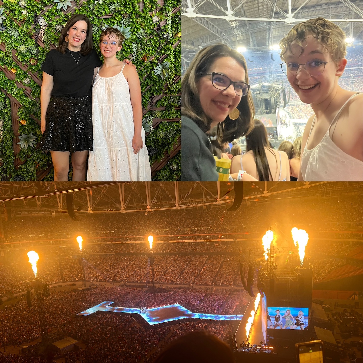
Heading to Glendale for the Eras Tour!
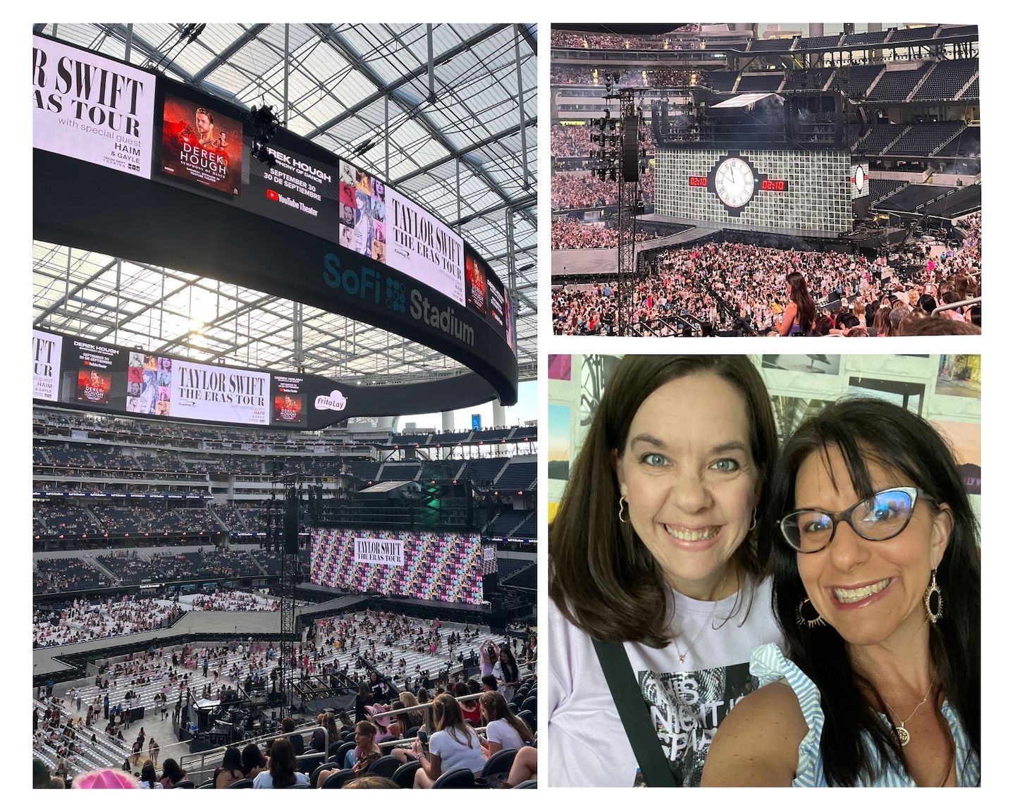
The first show we saw was in Glendale, second night. For those not in the SwiftVerse, Glendale was the opening city of the Eras Tour. We had tickets for the second night and made sure to stay off social media after the first show, so our show was a total surprise. IT WAS EPIC! I took my daughter and it was our third TS show together. Buying concerts tickets from Ticketmaster is nothing short of a nightmare and you basically get what you are lucky enough to grab and pay for before they are sold to someone else. I won’t rehash the fiasco that was getting tickets for this show. We ended up with nosebleeds on the side of the stage.
I don’t love nosebleeds, I’d certainly rather be closer to the stage, but the steepness of the rows makes me uneasy. Seeing the backstage action was cool though. Because it was the first weekend and the show hadn’t blown up on social media yet we didn’t know what we were seeing until after the fact. We saw the cleaning cart, which is what Taylor Swift is wheeled to the stage in. It seemed out of place and super random to be wheeling towards the stage. I grabbed a crappy picture to confirm I was actually seeing a cleaning cart. We also saw people walking backstage in these pink/orange jump suits. In my mind, I was like why are the ghostbusters here? Once the show started I realized they were the dancers. It would have been cooler to see them when I knew who they were but it was still cool to see. The downside to being on the side of the stage is that we missed most of the show visuals which are on a screen at the end of the stage. The screen on the side of the screen only showed Taylor Swift. It was still epic, don’t get me wrong, but we were bummed to be missing out on a part of the show.
A few weeks prior to the Eras Tour a friend died and her funeral was two days before this show. The mix of pain and joy in life is wild. I’m morning the loss of a best friend while simultaneously watching the opening weekend of the Eras Tour with my daughter and friends. Talk about the highest of highs and lowest of lows in the same moment.
Eras Tour Glendale Night 2
Being that we were attending a tour spanning all of Taylor’s albums, we wore outfits that matched our favorite eras. I opted for black and sequins for Reputation and Girl Child opted for a dress and boots for Debut. And we drew our cat eyeliner sharp enough to {insert lyrics from Vigilante Shit}.
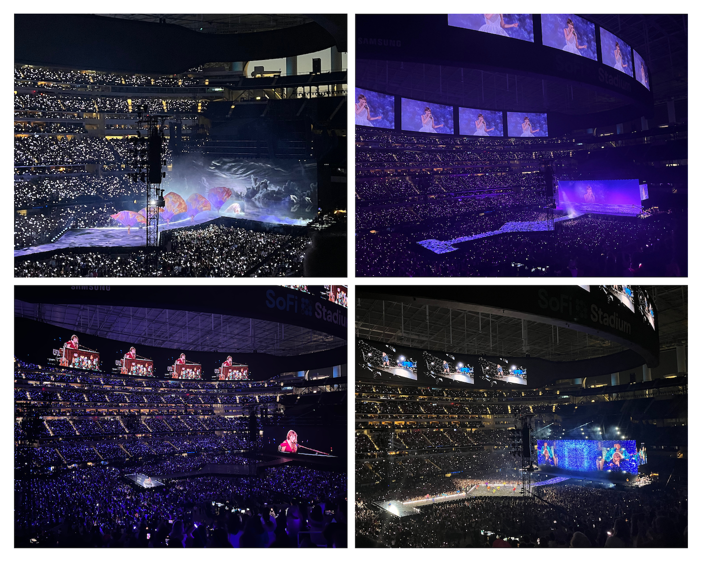
Taylor ended up performing for 3.5 hours. Probably around the 3 hour mark I was like is this ever going to end? Her concerts have always been longer than the average but 3.5 was wild.
The show was so epic that I immediately wanted to go again but get better seats. And I wanted to see it while not so deep in grief. As soon as videos and stories hit social media the show started blowing up and the Eras Tour madness began to grow. I knew if I wanted to see it again I’d have to get resale tickets ASAP because the prices would continue to drive up as more shows were held and the excitement grew. Within days we grabbed tickets to LA for night 3. I’ll be honest, buying resale tickets felt a little frivolous and as resale prices continued to climb I questioned selling my tickets. I’m so glad I didn’t because those 24 hours in LA are a core memory and worth every single penny.
Flying to LA to see the Eras Tour rounded out the experience. Shortly after we got to the airport in Tucson we noticed others in Taylor Swift shirts and everyone started to congregate. A young Swiftie came up to our group and offered us all friendship bracelets. (If you’ve not been following the tour, in one song Taylor Swift says to make the friendship bracelets and from that moment on Swifties make bracelets and share them with strangers.) There were several mothers traveling with their daughters and it was so sweet to see. Everything in LA was Taylor Swift themed and so fun!
We took a morning flight and arrived midday. I think we took a nap before the show which was obviously glorious. My biggest concern with the show was getting back to the hotel afterwards. 60,000+ people trying to leave one place at the same time creates insane gridlock. Our hotel wasn’t that far from the stadium but it wasn’t in the safest area to walk through, particularly at night. When we checked in, we found out our hotel was offering a roundtrip bus. The concierge told us the bus would be parked away from the arena so we could easily get out. Great…take my money.
When it was time to go to the concert, we boarded the bus with all the other Swifties and the excitement continued to grow. The bus dropped us off close to the stadium and the driver explained where we would be picked up afterwards. We accidentally purchased club level seats for the show (SCORE!) so getting into the stadium was a breeze. I didn’t even know what club meant, which would explain why we didn’t know what we purchased. Club seats have VIP entrances, their own bathrooms, bars, food, and merchandise, so that was fun. Except not the merchandise. The line was insane every second of the evening. We grabbed a drink and settled into our awesome seats and obviously made friends with people around us.
Eras Tour Los Angeles Night 3
One of my absolute favorite parts of the Eras Tour is the opening of the show. A countdown appears on the screen just before Taylor comes out and the energy in the stadium is unlike anything I’ve experienced in my life. Truly magical. And of course, the stadium loses it the second Taylor appears and then we sing together for the next 3.5 hours. After having gone through this experience twice, I can tell you 3 hours is my ideal concert time. Maybe 2.5 – 3. 3.5 was just a little too long. My vocal cords can’t hang for 3.5 hours nor can my feet. The fact that Taylor, her dancers, and band perform night after night confirms they are at the top of their game. An epic feat of endurance and talent.
Eras Tour Los Angeles Night 3
After the show ended we headed to the spot where our bus was supposed to pick us up. Except the bus wasn’t where it said it was supposed to be nor was it the bus we were expecting. Eventually we found a row of charter buses that said they were picking us up. It was super unorganized and we were all a little nervous to get on but also happy to have found some kind of transportation. Eventually the buses started working their way out of the gridlock but the whole experience was strange. There was literally a moment where I was like are we being kidnapped? We seemed to not be going towards our hotel and the driver would randomly stop in the middle of the street, get out of the bus, and go talk to other bus drivers who were doing the same. Eventually our bus started making all kinds of noise and beeping. The driver stoped the bus, opened the door, and told us all to get off because the bus is broken. Um, what? We ended up cramming into the other buses and eventually made our way back to out hotel. I have never been so excited to exit a vehicle in my life. I’m also glad I wasn’t kidnapped. It was such a strange experience.
24 Taylor Swift themed hours was magical. One thing I loved about traveling for a concert of this size is everyone was wearing their TS merchandise or friendship bracelets and was sparking up conversations. I’ve never talked to so many strangers in my life. Standing in the security line at LAX we made friends with everyone around us, discussing which songs we loved most, how many times we’ve seen TS, where we are coming from, how we got tickets. It was so fun. We ended up on the same flight as many of the same people as the day before and were able to hear from the mom/daughter duos about their experience. It was such an incredible experience. I’ve never been a part of something like this before and it was so fun.
Yesterday was the final show of the Eras Tour. I didn’t have tickets but watched it live on YouTube. Shout out to everyone who was live steaming so those of us at home could watch it with you. It was a beautiful show and watching it live was the perfect way to close out these last two years. Thank you to Taylor and her team for creating something so magical.
https://www.theroadwevetraveled.com/wp-content/uploads/2024/11/Beige-minimalist-photo-collage.jpg11521440Carolinehttp://www.theroadwevetraveled.com/wp-content/uploads/2015/08/RWT_Logo@3x-300x143.pngCaroline2024-12-10 06:38:192024-12-17 04:02:42The Eras Tour
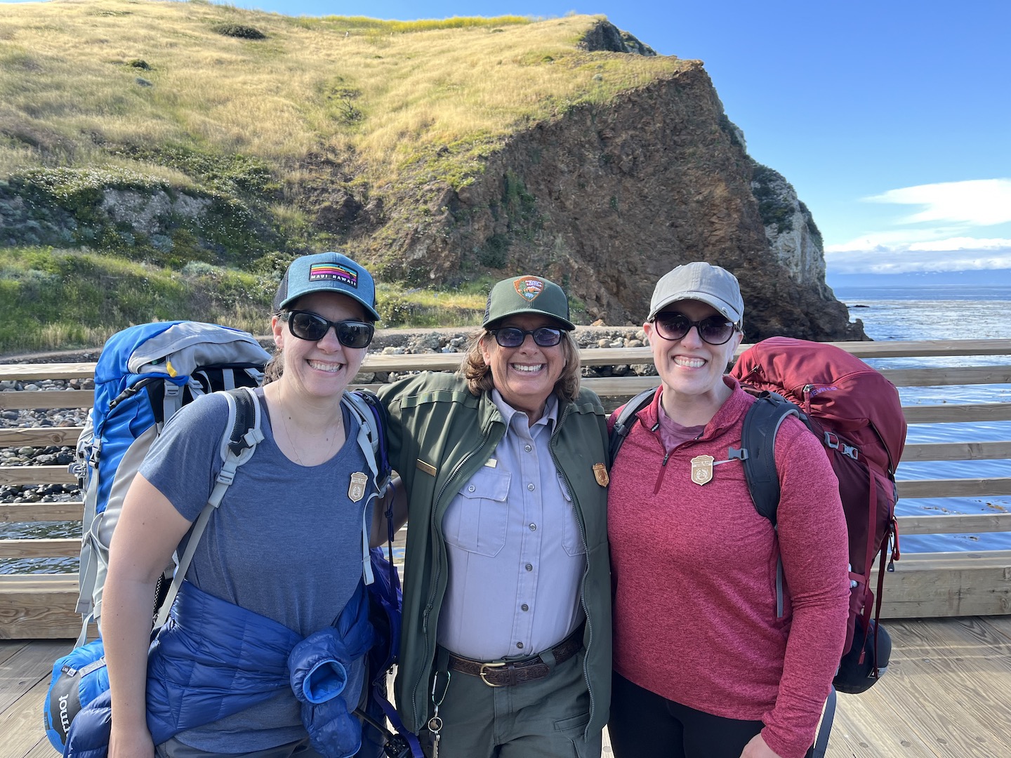
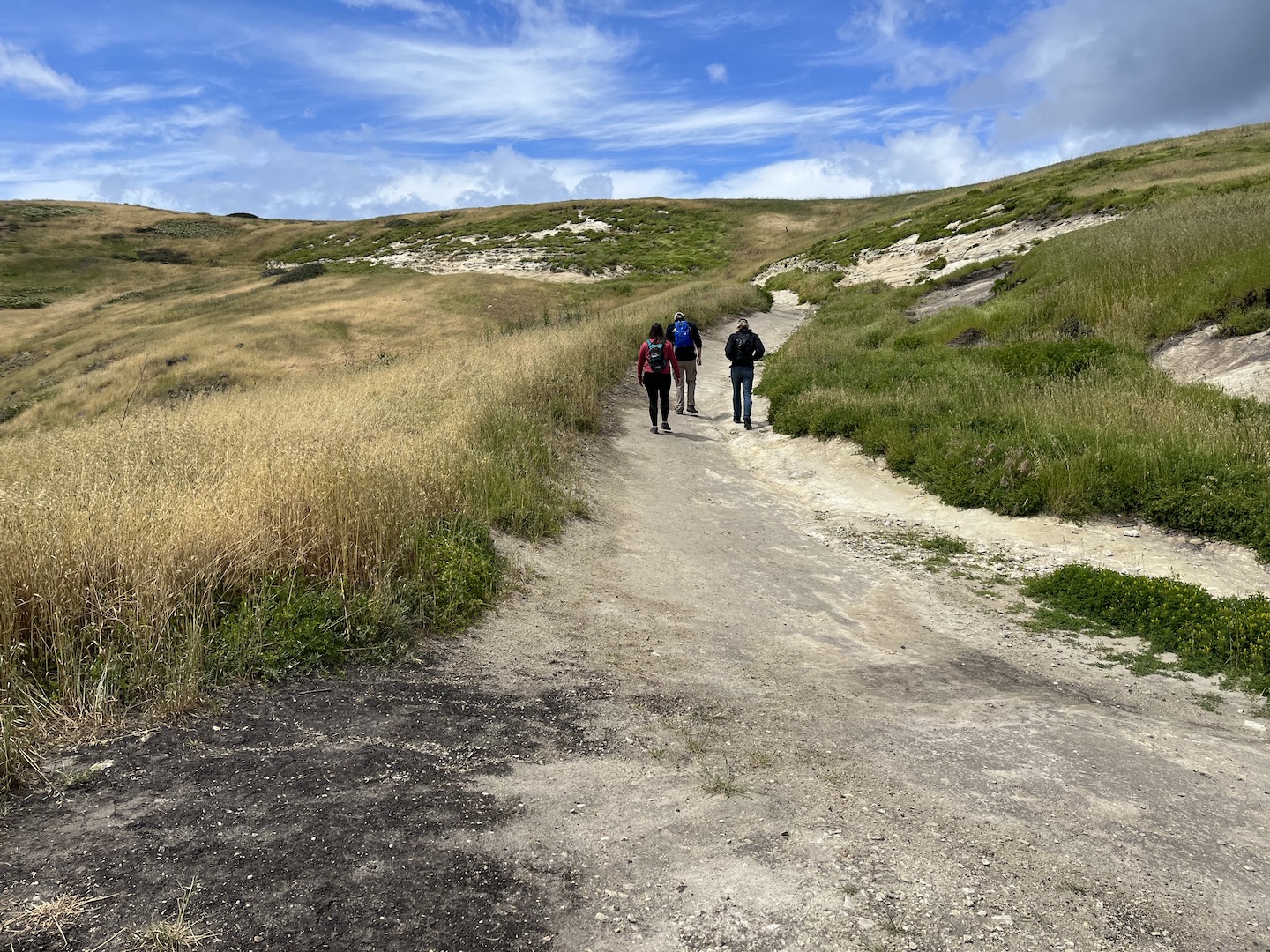
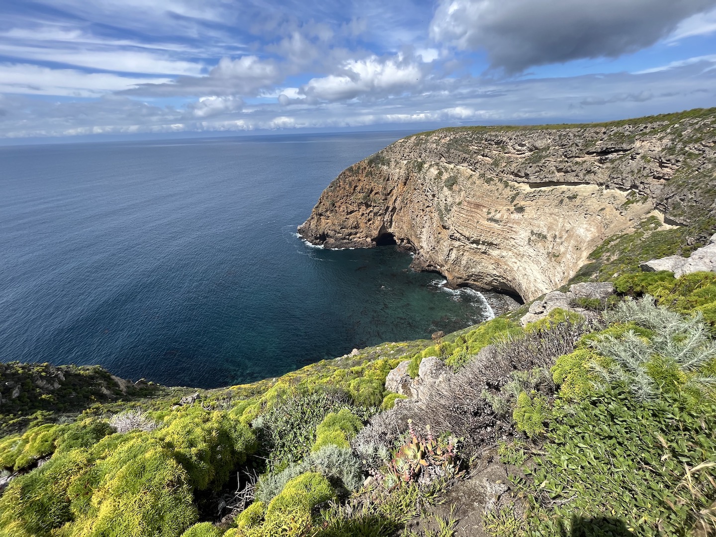
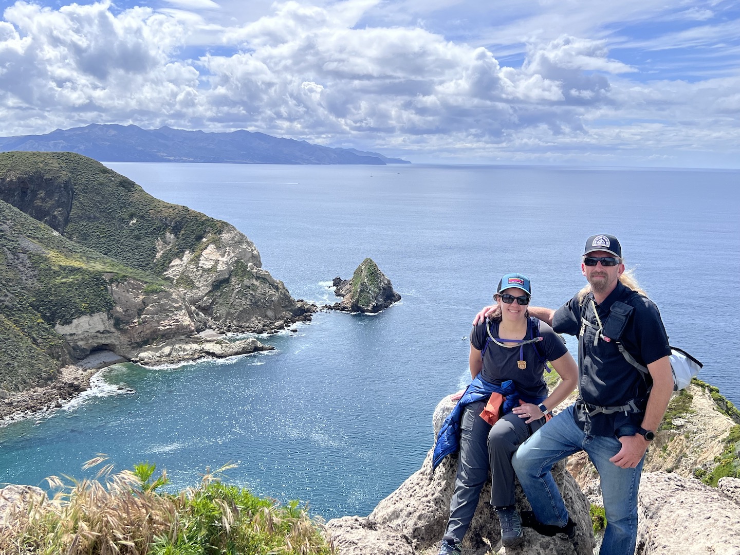
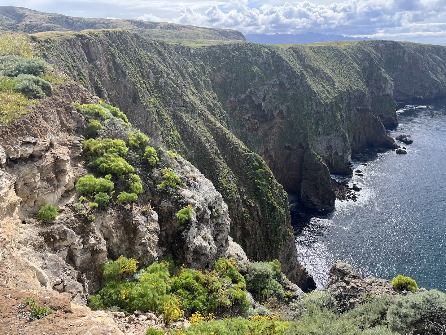
Channel Islands has been on my list for a while. We had a trip planned a couple years ago over fall break, but a crazy storm rolled in and basically cancelled our trip. Channel Islands is definitely one of my favorite national parks. It’s an hourish away from LA and feels otherworldly. The boat ride over was incredible, the islands are gorgeous, the views are epic, the baby foxes are the cutest thing in the world, and the company that joined us was the cherry on the top.
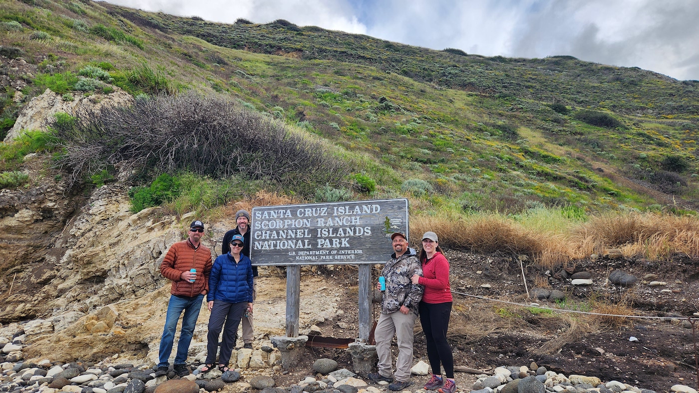
Santa Cruz Island, Channel Islands National Park
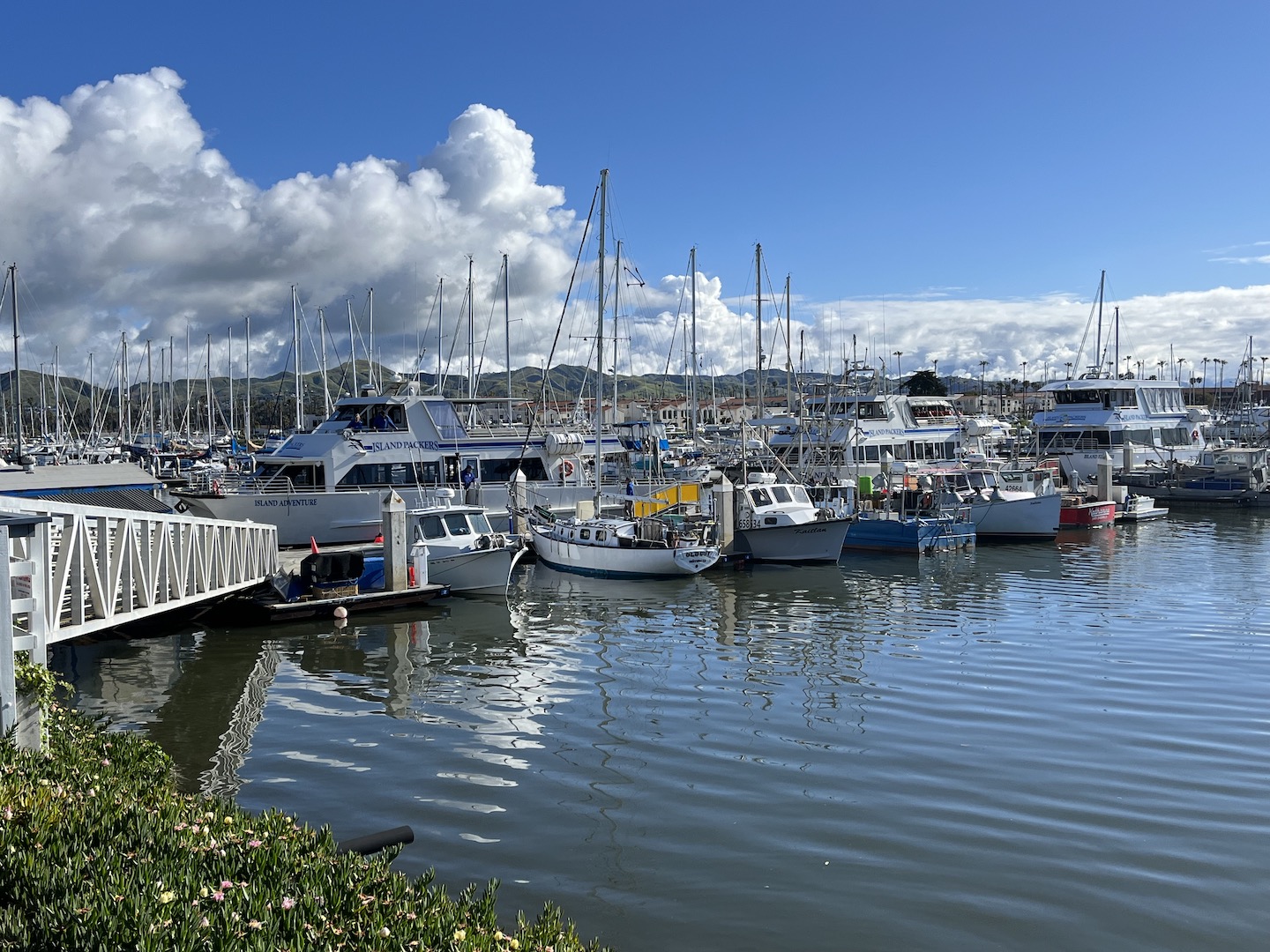
Channel Islands National Park consists of five islands off the coast of Ventura, California. There are no roads/cars on the island and only a few buildings. Mostly structures from when the land was privately owned prior to becoming a national park. It’s a rustic experience which is so fun and harder and harder to come by these days. To get to the islands, you have to take a ferry. We booked an early morning ferry and spent the night in Ventura so we could be at the dock bright and early.
Island Packers ferry
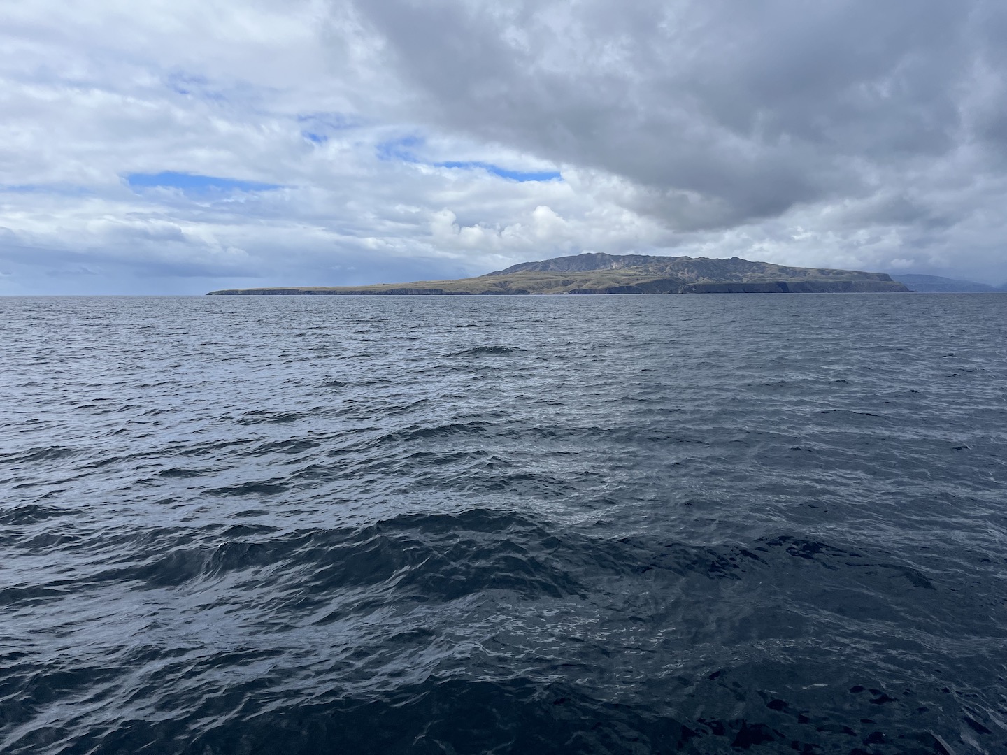
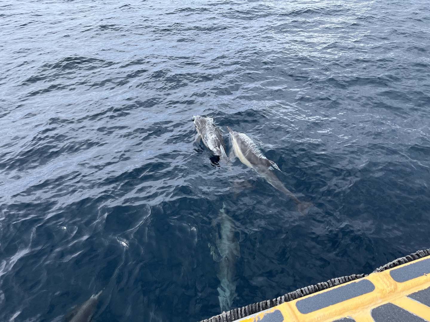
The ferry ride over started our adventure as we saw lots of wildlife. Dolphins swimming with the ferry was definitely a highlight!
Dolphins swimming with the ferry on the way to Santa Cruz Island
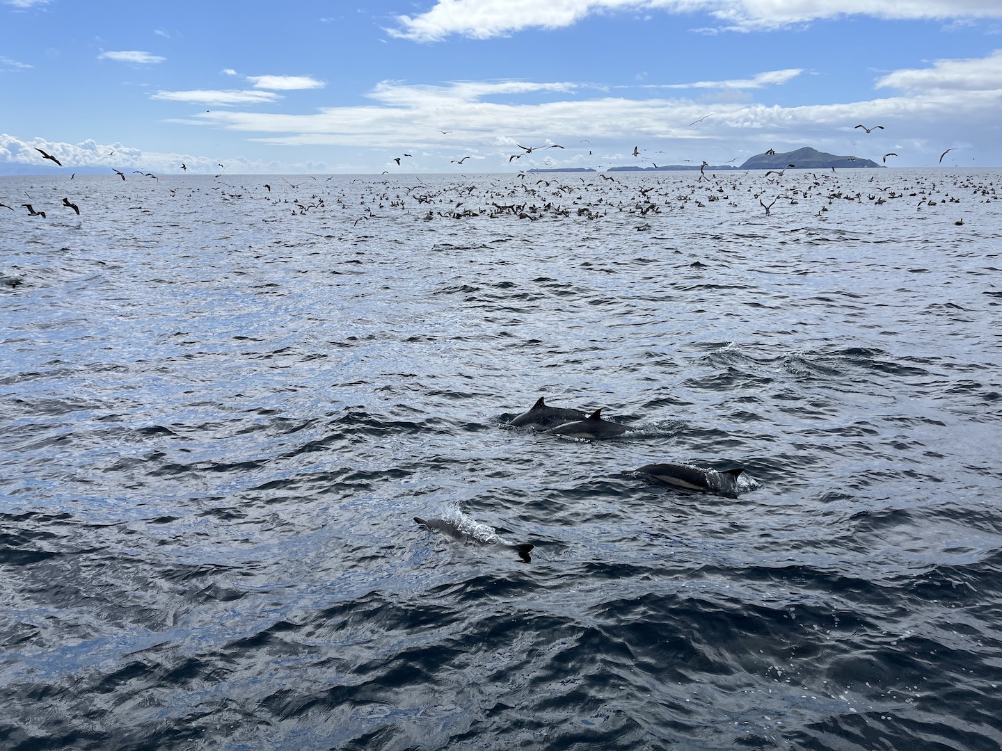
At one point our captain spotted a bunch of birds sitting on the water and circling around. He said that usually means there is a lot of plankton or something in the water which leads to a lot of wildlife. He was right! We saw so many dolphins, a whale, and tons of birds. We stayed there for a while just watching and it was incredible! The ride over was beautiful and added to the excitement of what we were about to see.
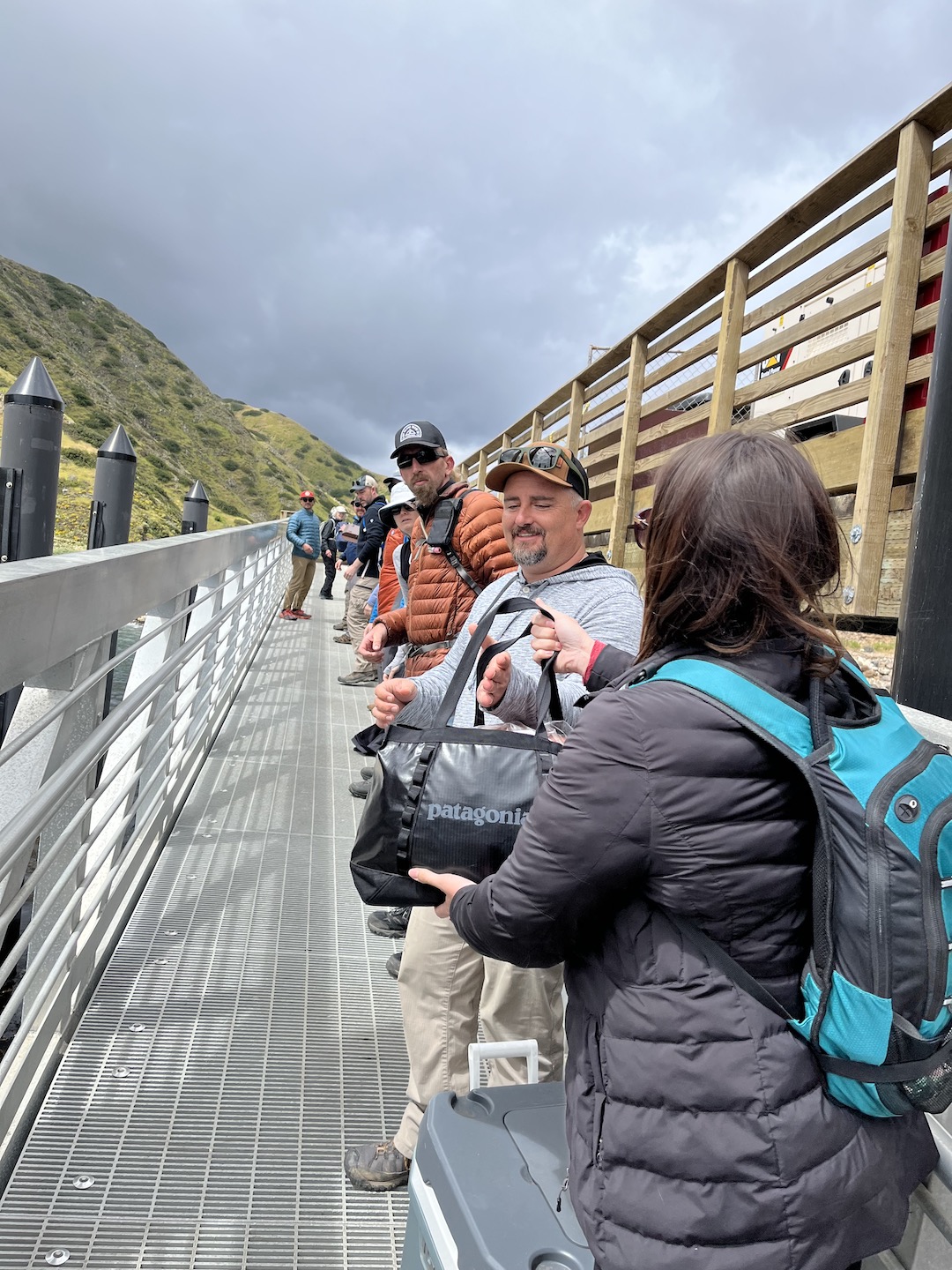
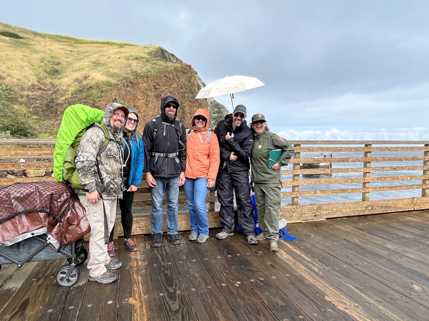
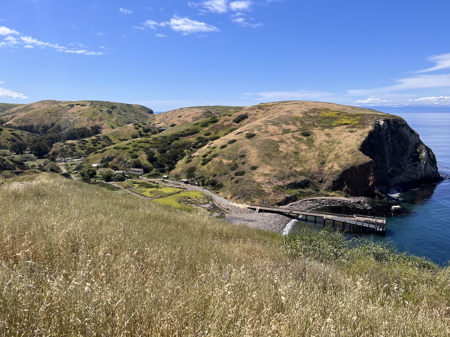
We visited Santa Cruz Island and you can camp or take a day trip. Those camping are the last to exit the ferry as we had to unload our gear. We made a line across the boat/dock and passed every item down one by one. It was an interesting endeavor as not everyone in the line understood we were all in this until all the gear was off the boat. Not just your bag.
Once everything was unloaded, we met with a ranger for a mandatory meeting where she shared tips and warned us about the incredibly cute little island foxes and how much of a nuisance they can be. She played a game and asked a few questions. I knew the answer to one of her questions and won myself a Junior Ranger badge which I proudly wore for the entire weekend! It’s the closest I will ever be to a Ranger so I’ll take it. Ranger Karen was the absolute best! She was so cheerful every time we saw her. I mean, I probably would be too if lived on Santa Cruz Island.
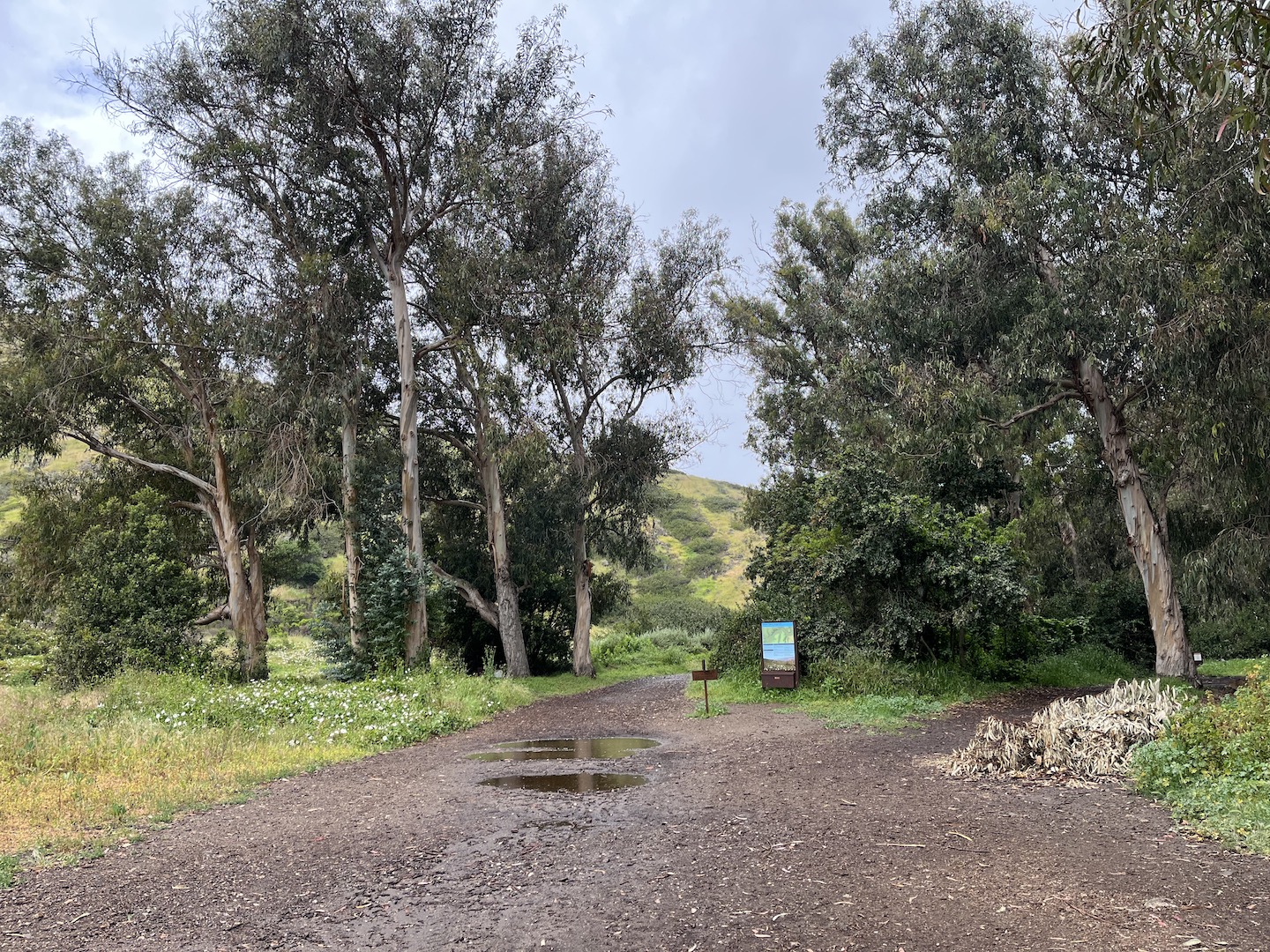
Of course, as soon as we finished our ranger talk it started raining. We quickly put on our rain gear, covered our stuff as best as we could, and made the short walk to the campground. The sites are .5 – 1 mile from the dock, so not too far. You have to be able to carry all your stuff but the walk is easy/flat and you can load your stuff into a wagon. We mostly brought a wagon so we could bring a cooler. (Island Packers has specific rules around what you can bring to the island, so be sure to check those out before packing.)
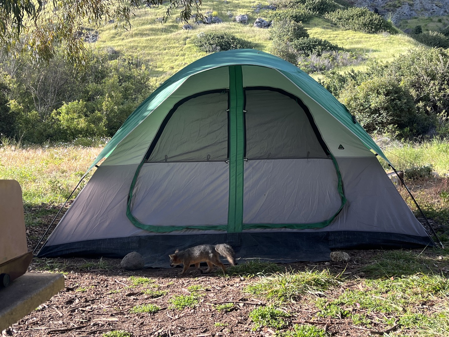
Scorpion Canyon Campground on Santa Cruz Island Channel Islands fox visiting camp
Fortunately it didn’t rain for long and we were able to set up camp and start exploring. We visited May 2023 and everything was green.
The views are epic once on top of the island. I could not believe LA was just across the channel. We could see it in the distance and it looked so green and hilly.
Eventually we made our way back to camp and then decided to head to the beach for happy hour. Is there anything better than sitting on the beach with friends in a beautiful place listening to the waves?
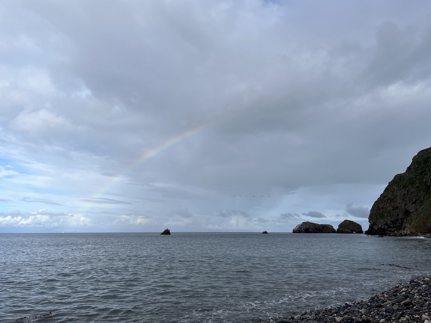
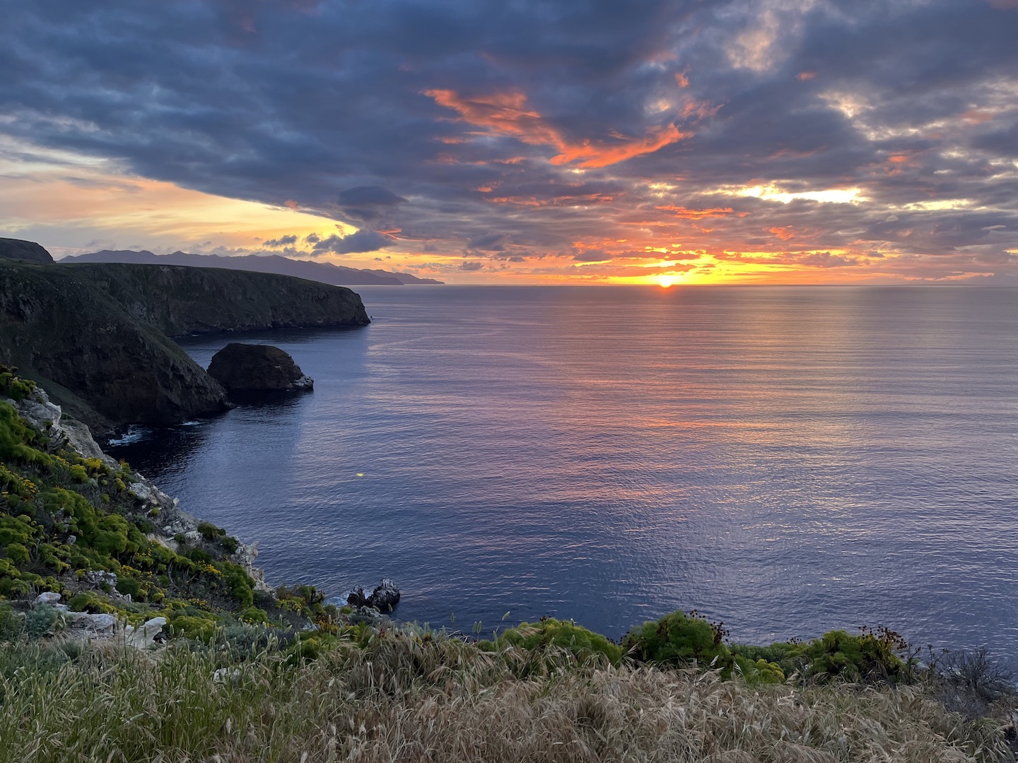
Heads up, there is tar in the water from the channel so be careful where you sit. Apparently tar seeps from the ocean floor off the California coast. We didn’t realize that and ended up with tar on our clothes. At some point after happy hour we ate dinner but I’m not sure if it was before or after we headed up a hill to catch the sunset. EPIC. We finished the night with games around the table. Days like this are what my dreams are made of.
Sunset at Channel Islands National Park
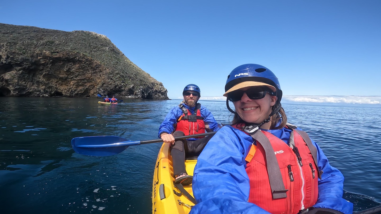
We unfortunately only made camping reservations for one night, so Day 2 started by packing up camp. I would highly recommend two nights on the island. One just wasn’t enough. We booked a sea kayaking excursion in the morning, so once camp was packed we headed over to the beach. We listened to the safety talk, put on our wet suits, grabbed kayaks, and headed out for some fun!
Sea kayaking at Channel Islands National Park
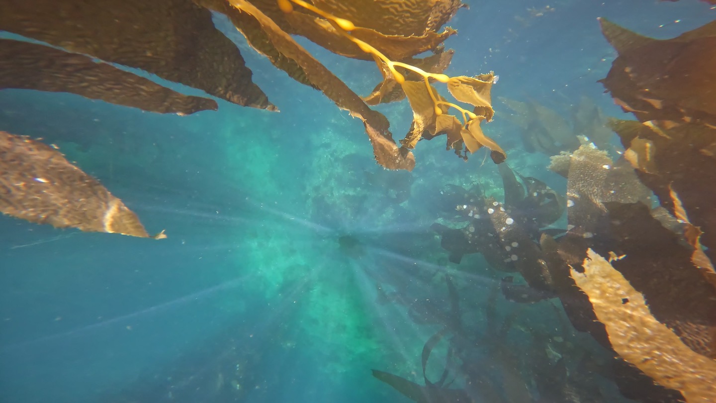
The water was absolutely gorgeous and was a deep, clear shade of blue. There were gorgeous kelp strands everywhere and it was stunning.
Kelp forest at Channel Islands National Park
I made a video of our sea kayaking adventure. I need to send a special shout out to my husband. I didn’t realize how much of a crappy kayaking parter I am until I watched the video. I stopped paddling so many times thinking we were drifting in the proper direction. Nope. Turns out The Husband was steering us. Oops. And thank you!
Scorpion Cove
While waiting for the afternoon ferry back to Ventura we explored the visitor center, took another short hike, and just hung out. We walked up to the top of one of the hills close to the dock and took in the ocean views one last time.
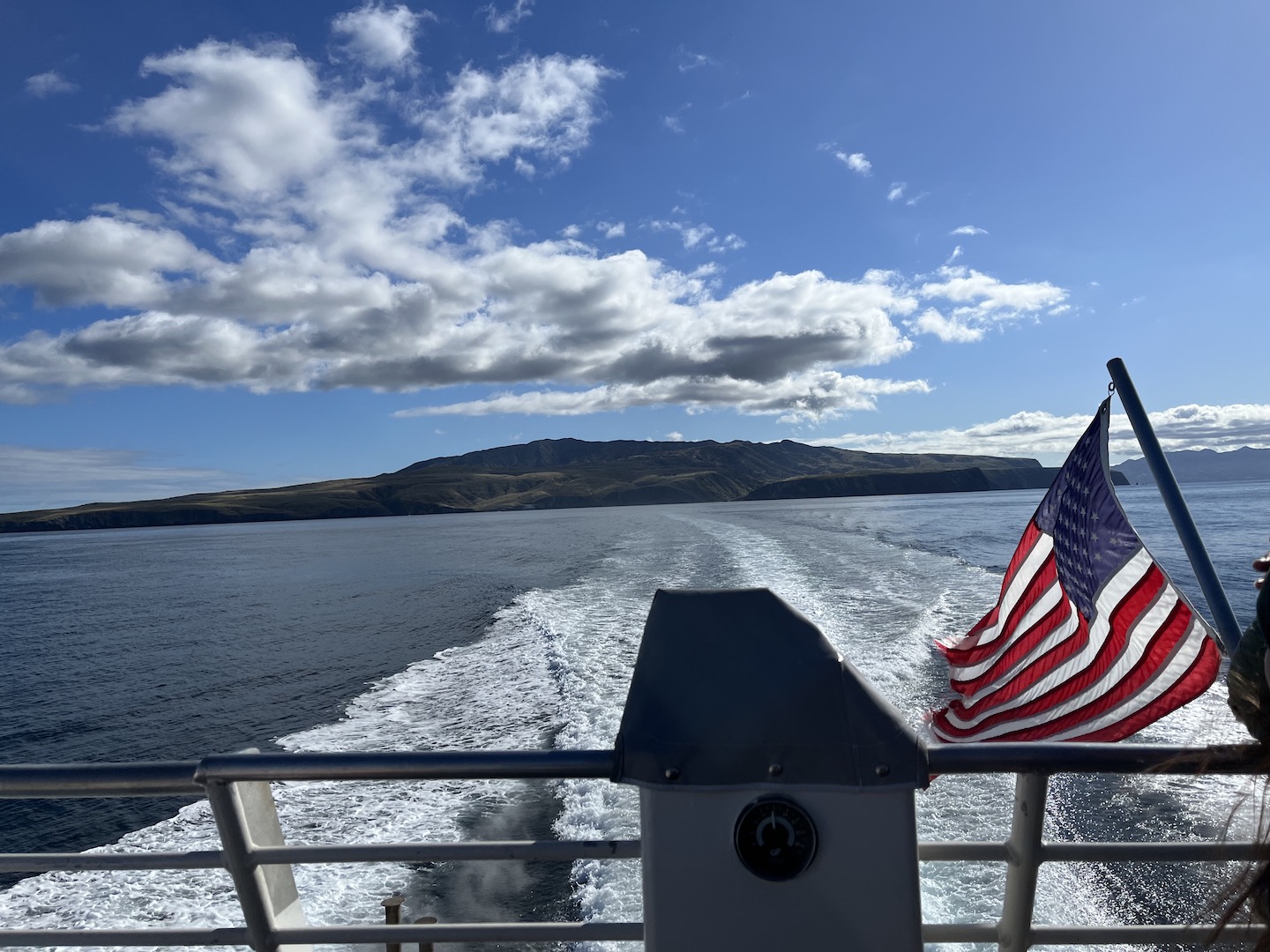
Ferry leaving Santa Cruz Island
We had so much fun on Santa Cruz Island and I’d highly recommend visiting! If you’re not a fan of camping, you can take a day trip. If you’re a camper, spend at least two nights if you can. One night will still be epic though if that’s all you have. We packed a lot of adventure into our roughly 1.5 days on the island. My only complaint is I could have used a nap post kayaking and couldn’t take one because we no longer had a campsite. Campground and ferry reservations fill up fast so make sure to plan ahead so you can make your trip happen. Happy camping!
https://www.theroadwevetraveled.com/wp-content/uploads/2024/06/IMG_3048.jpeg10801440Carolinehttp://www.theroadwevetraveled.com/wp-content/uploads/2015/08/RWT_Logo@3x-300x143.pngCaroline2024-07-22 05:22:252024-07-22 14:25:23Channel Islands National Park
If I’ve learned nothing else from this past year, it reminded me how important it is to do the things you want while you can. As such, my travel list has grown substantially. It’s possible all this time at home has provided extra time for wanderlust and list creating.
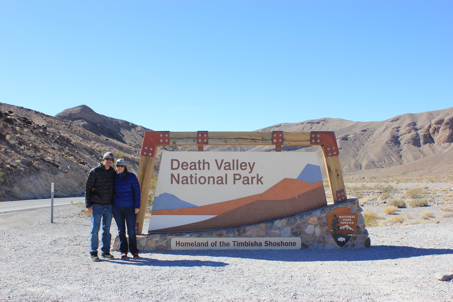
Death Valley National Park
Death Valley National Park was on my list because it’s a national park but it was never a priority. The hottest place on earth? Meh. I mean, what’s really great about that? Boy was I wrong! Death Valley is so cool! We were there for three days and only scratched the surface. Little Miss was supposed to join us but ended up having a conflict so we brought a couple friends. Traveling with friends is so much fun! We arrived in the afternoon and tried to squeeze in a few sites before dark.
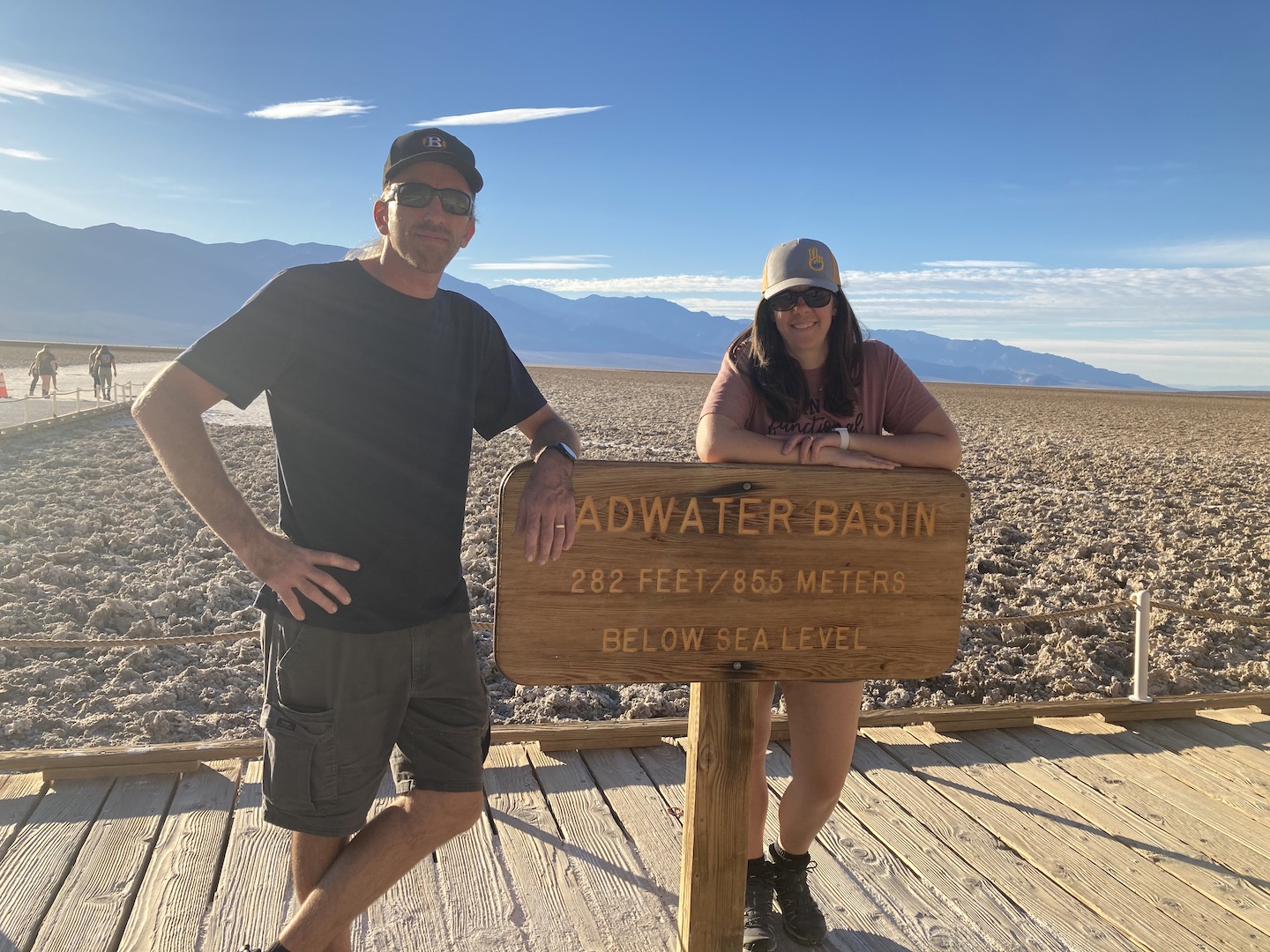
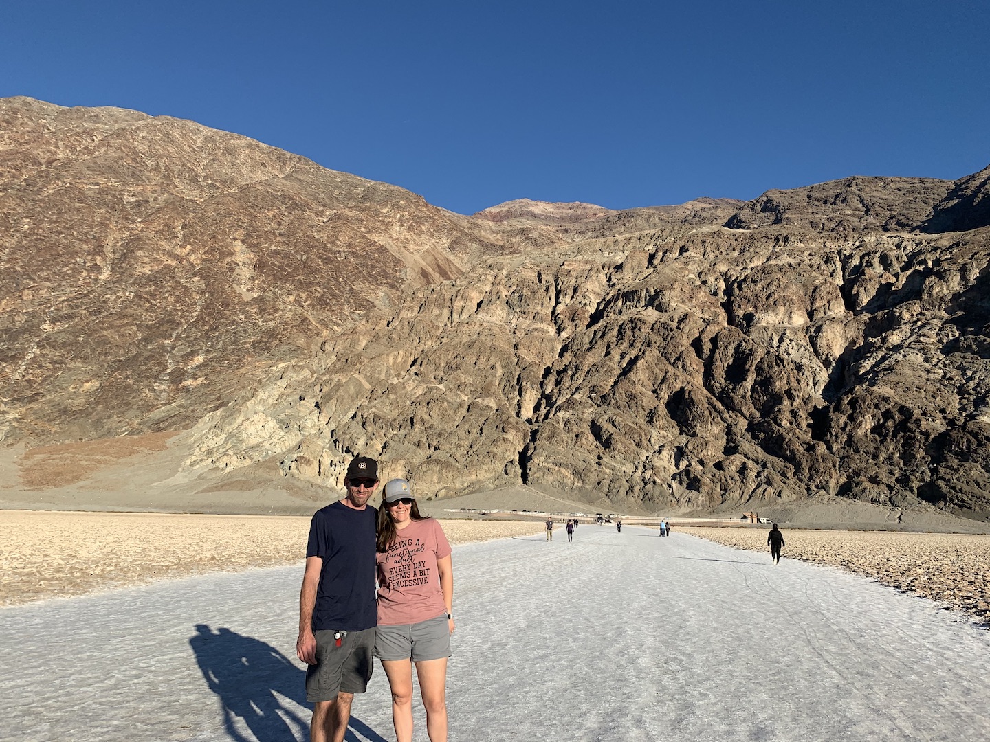
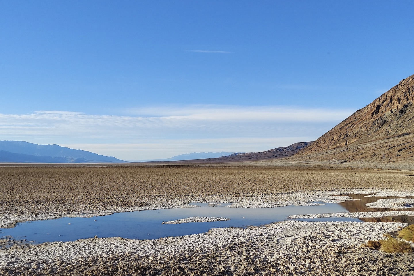
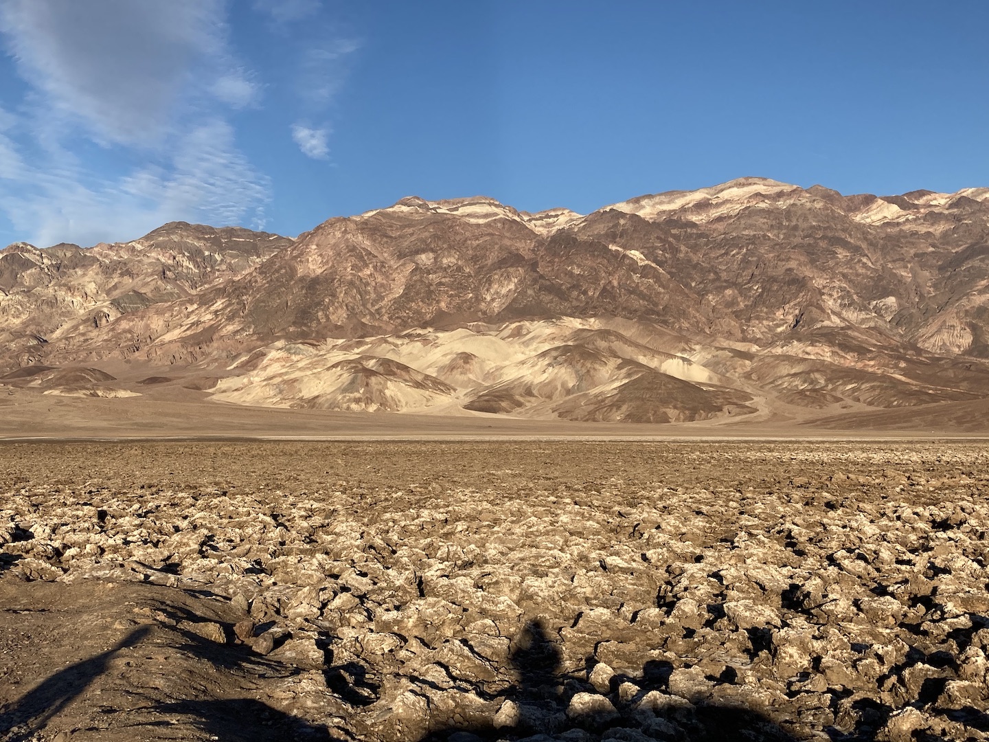
Badwater Basin
At 282 feet below sea level, Badwater Basin is the lowest point in North America. The area is covered in salt flats that you can walk out on. We walked out a ways but the scenery wasn’t changing so we turned around. Apparently we stopped too soon and if you walk out farther the salt flats start to get really cool. Next time.
Badwater Basin
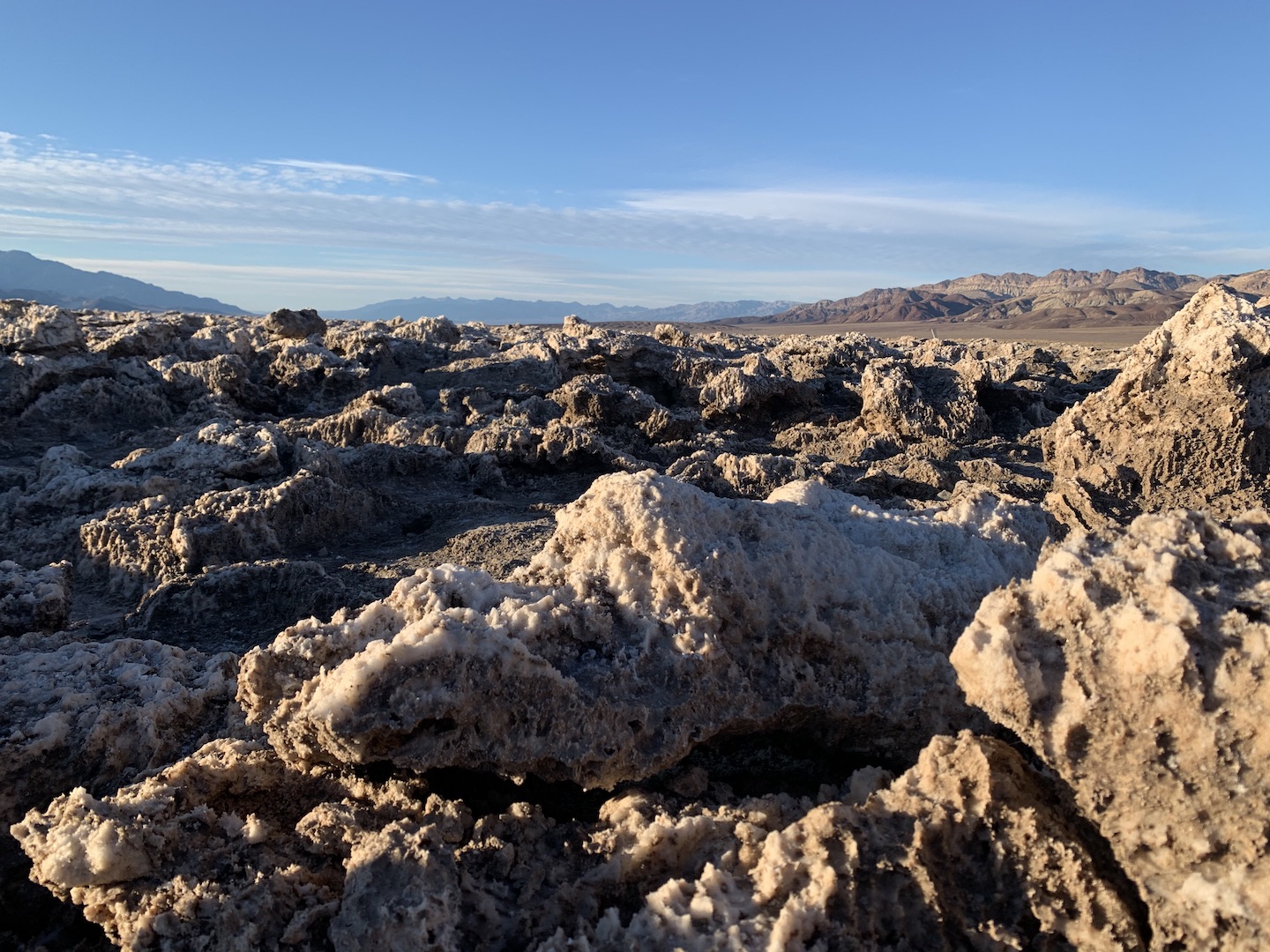
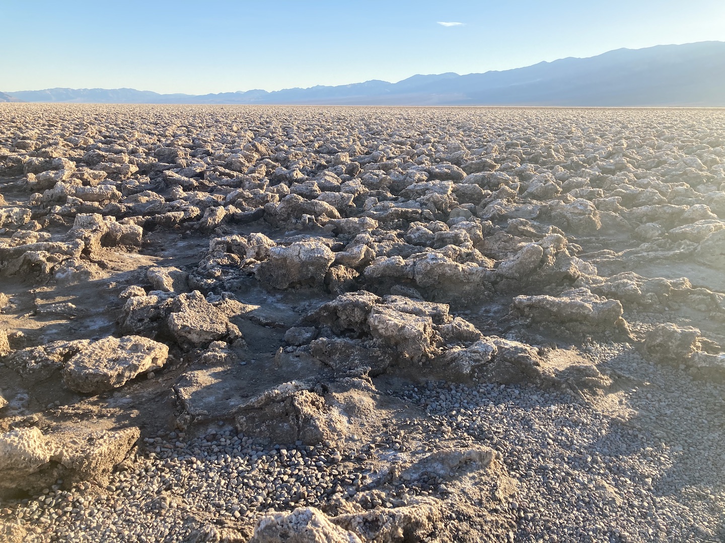
Right next to Badwater Basin is the Devil’s Golf Course. We almost didn’t stop here and I’m so glad we did! Pictures do not do the area justice. Those are not rocks but rather rock salt that has been eroded by wind and rain to create the jagged spires you see. They are fascinating to see in person!
Devil’s Golf Course
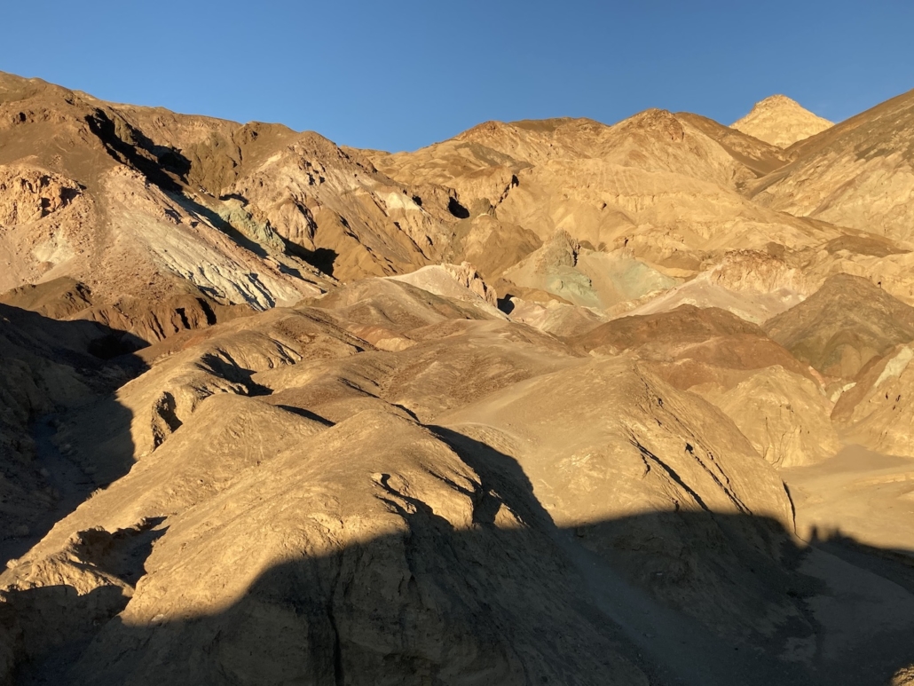
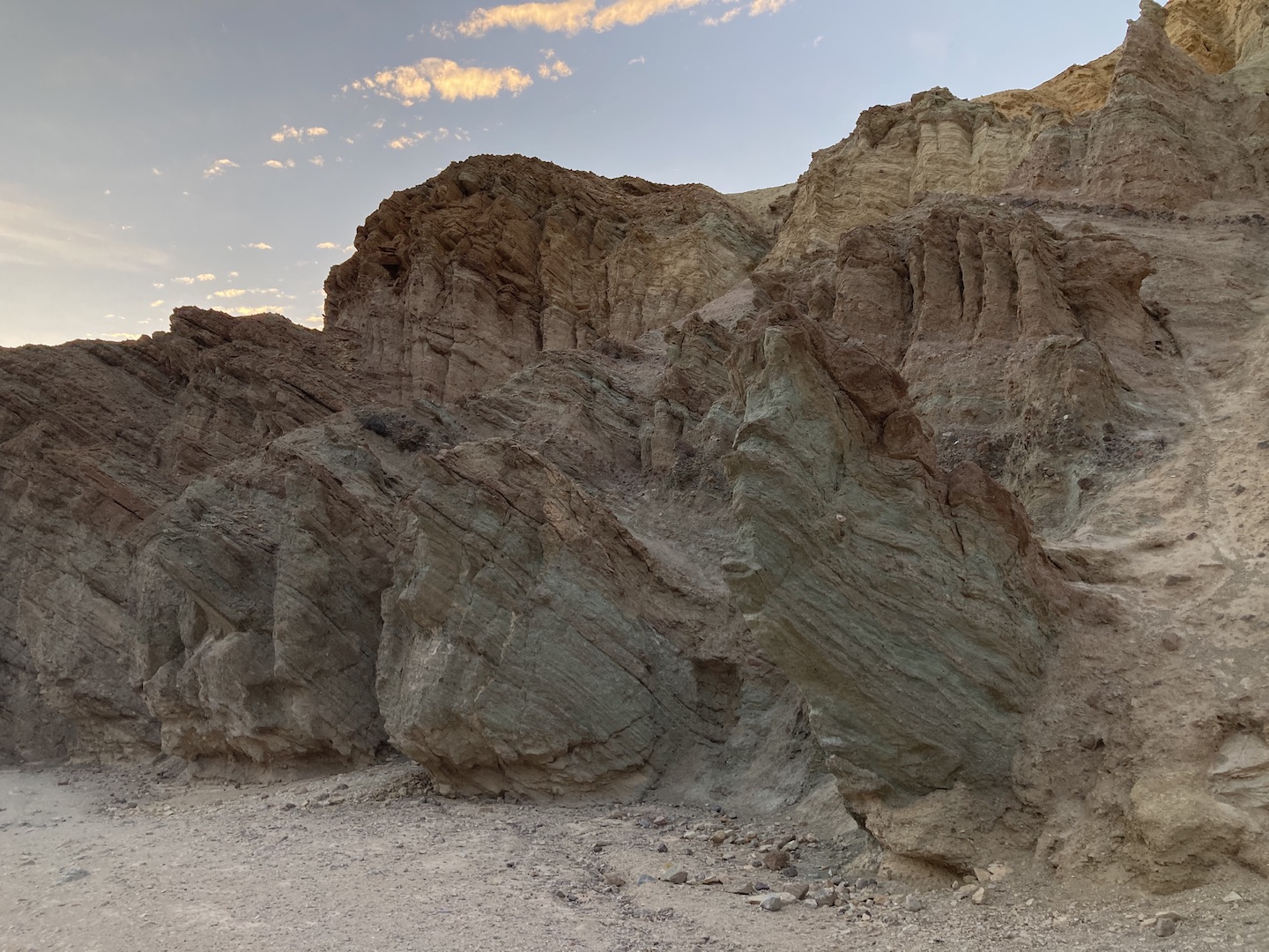
As we worked our way back to camp we drove Artists Drive Scenic Loop. It’s an 8.5 mile one way drive that winds through hills splashed with different colors.
Artist Palette
We had a little bit of daylight left after we finished the scenic drive so we stopped at Golden Canyon. We didn’t get very far in but what we saw was so cool. Apparently Star Wars was filmed in the some of the canyons back in the day and Golden happened to be one of the locations.
Golden Canyon
DAY 2
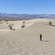
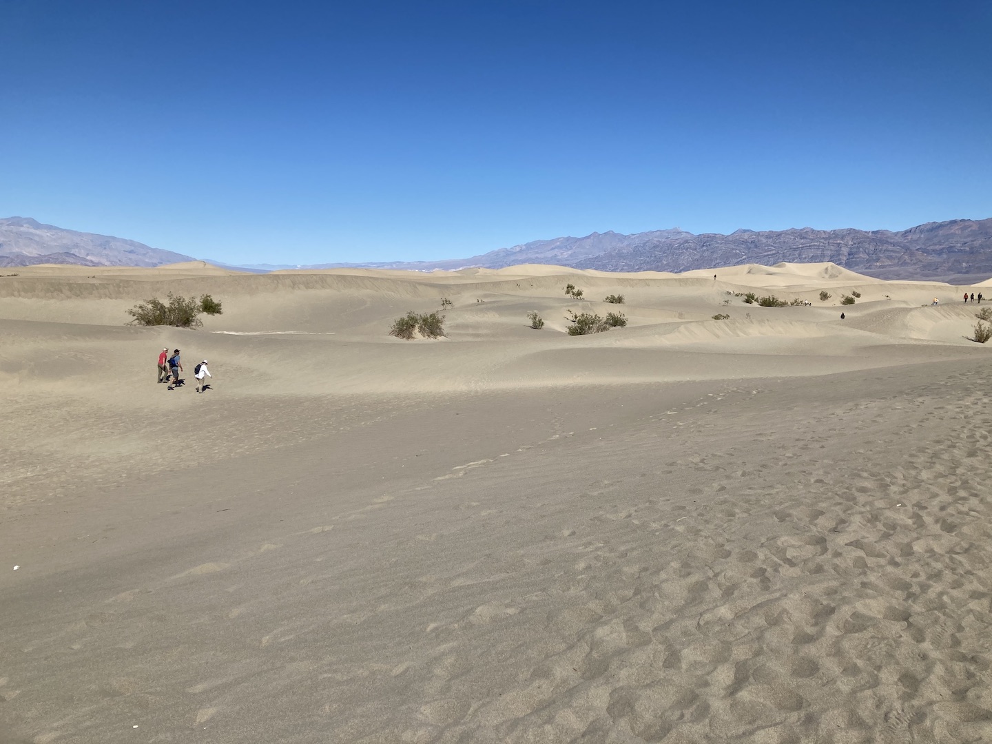
Our goal for the morning of Day 2 was the Ubahebe Crater and we stopped at the Mesquite Flat Sand Dunes on the way. If you haven’t been to sand dunes before, they’re similar to Las Vegas. Everything looks close but you soon find out your destination is miles away.
Mesquite Flat Sand Dunes
We planned to hike to the highest dune at only a mile away. Easy peasy, right? Not! We got 1/2 or 2/3 of the way there and decided we were good. The constant up and down sand hills is tiring. The dune we were going for is the tallest one you see in the right side of the picture below.
Mesquite Flat Sand Dunes
We read that it’s best to visit Ubahebe Crater earlier in the day as the wind picks up in the afternoon. That’s not a joke. We left camp later in the morning that planned so by the time we made it to the crater is was close to lunchtime. The wind is legit and was making it so hard to walk. You can walk around the entire crater but we opted for only a short section. Pictures do not do the crater justice. It’s huge and so cool in person.
Ubahebe Crater
The picture below is an accurate depiction of how windy it was. We planned to have a nice picnic lunch on the edge of the crater but instead huddled behind the truck in the parking lot.
If you are planning to visit the crater, the turn off of 190 is not well marked. We were traveling north on 190 and completely missed the turn off. Next thing we know we were at the sand dunes, which at this point we didn’t realize are after the turn off. Once we left the sand dunes we kept on driving and eventually realized we were driving west, towards the other exit of the park. Nothing like adding a bunch of unnecessary miles to the day!
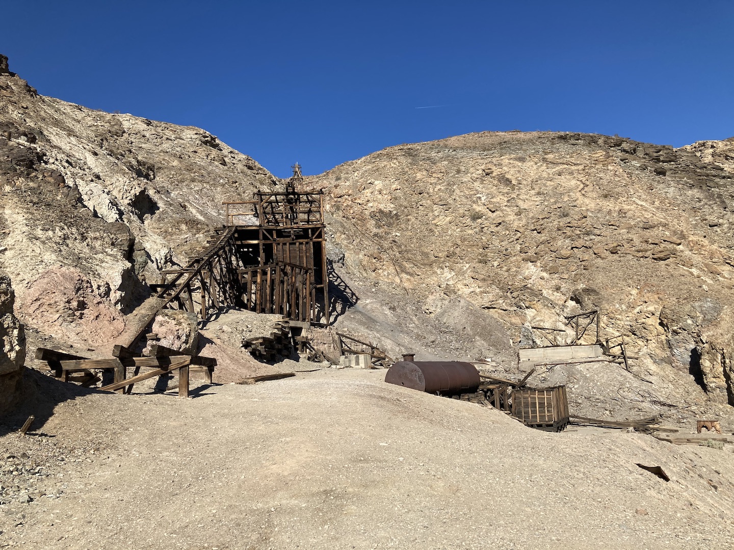
After lunch we worked our way back to camp and stopped at the Keane Wonder Mill & Mine. It was a gold mine in the early 1900’s and we spent some time exploring the area. I love seeing bits of history and imaging what it would be like to be alive during that time. I cannot, however, imagine mining in Death Valley pretty much anytime of year.
Keane Wonder Mill & Mine
After our mine exploration we headed back to camp. The boys had to do a little camper maintenance (change a broken leaf spring on a trailer) and they needed enough daylight to get the task done. Once the sun set, we watched a movie outside. Is there anything cooler than watching a movie outside while camping? I think not.
DAY 3
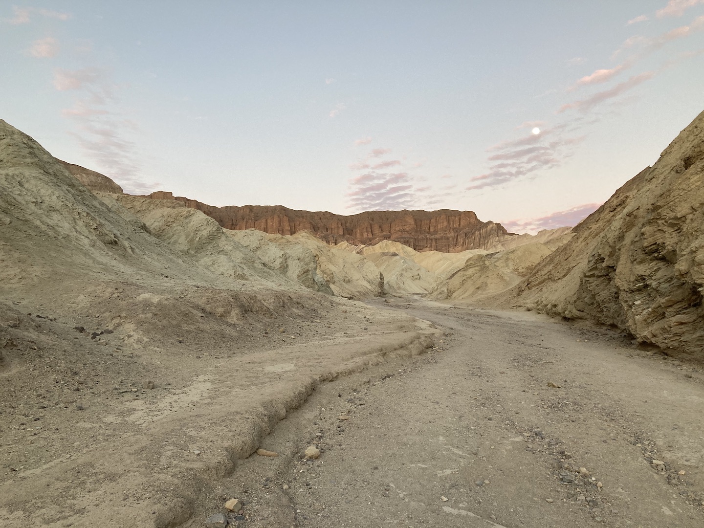
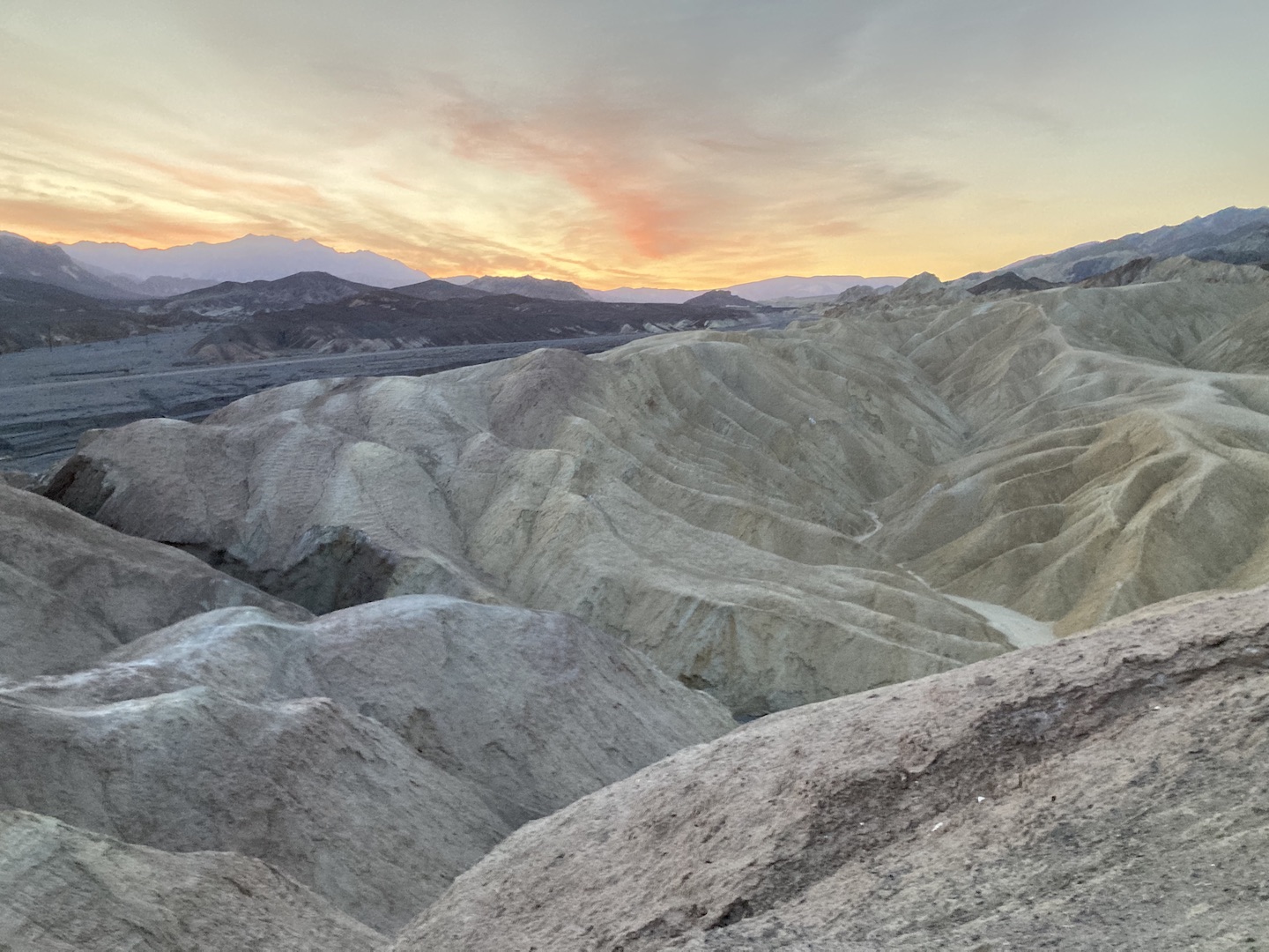
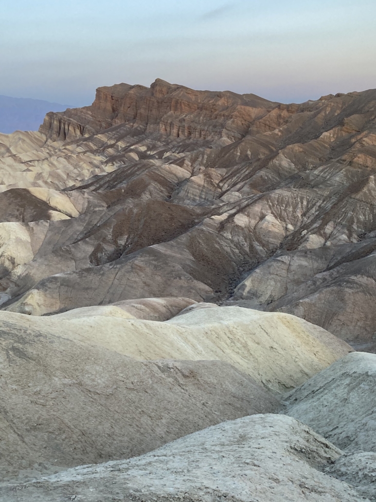
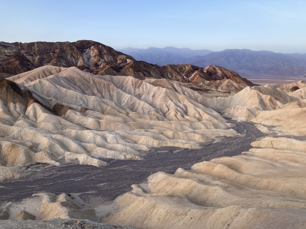
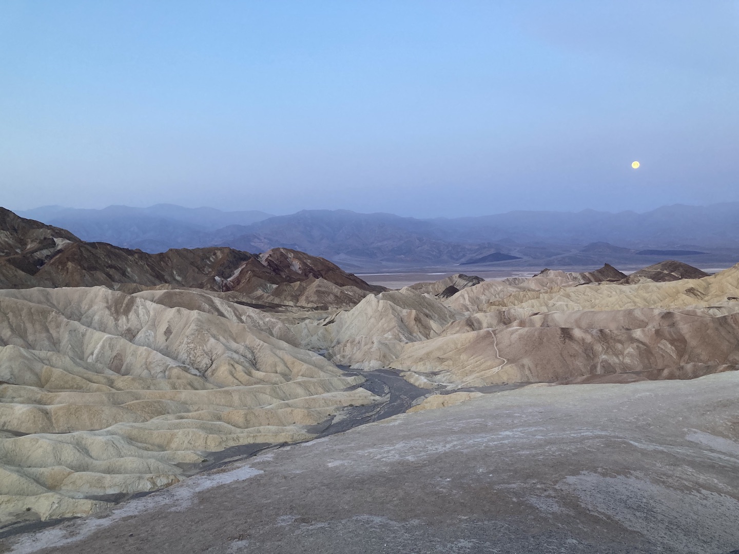
On our third day and final day in the park, we got up early to watch the sunrise at Zabriskie Point. It’s a short walk from the car but a very popular destination. Get there early to ensure a parking spot. This view of Death Valley is stunning. Even if you don’t get here for sunrise, be sure to stop by.
Sunrise at Zabriskie Point Full Moon Setting from Zabriskie Point
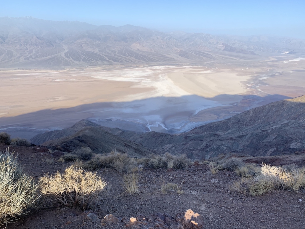
Our next destination was Dantes View, a viewpoint 5,500 feet above the valley floor. On the way, we drove through the 20 Mule Canyon which was a fun little side trip. Dantes View is 25 miles from Furnace Creek and not really worth the drive in my opinion. The view was nice but the drive was long and it was really windy up there. Personally, I’d rather have spent that time exploring the other areas of the park.
Dantes View
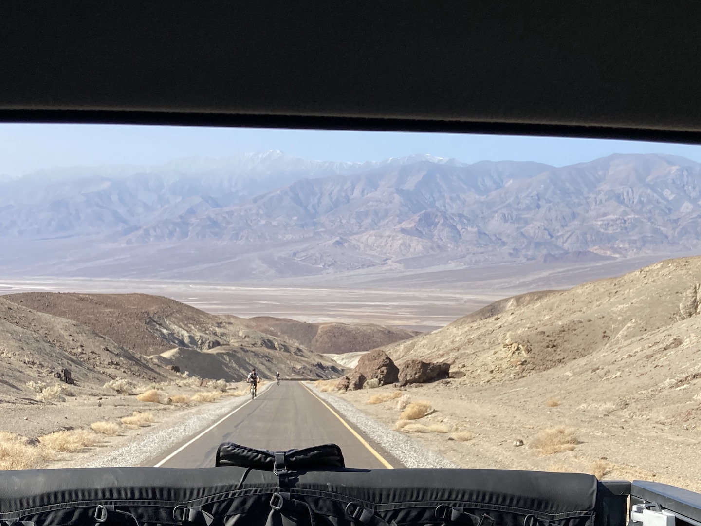
Next up, the boys wanted to ride Artist Drive so we picked up their bikes and dropped them off. Man, that road is steep! The picture below is one of my favorite from the trip. I was driving up the road and looked in my rear view to see this image. So I stopped and took a picture.
Riding Bikes on Artist Drive
And they rode their mountain bikes which makes it extra hard. But now they can say they rode in Death Valley!
Artist Palette
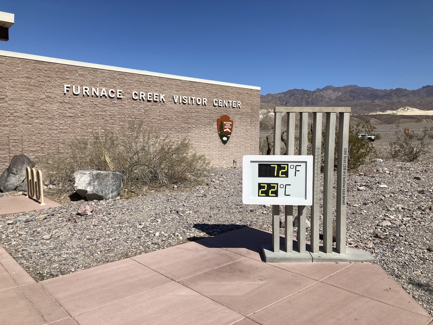
We visited in February 2021 and unfortunately, the Visitor Center was closed due to the pandemic. But we did get to see the iconic sign! The temps were perfect when we were there.
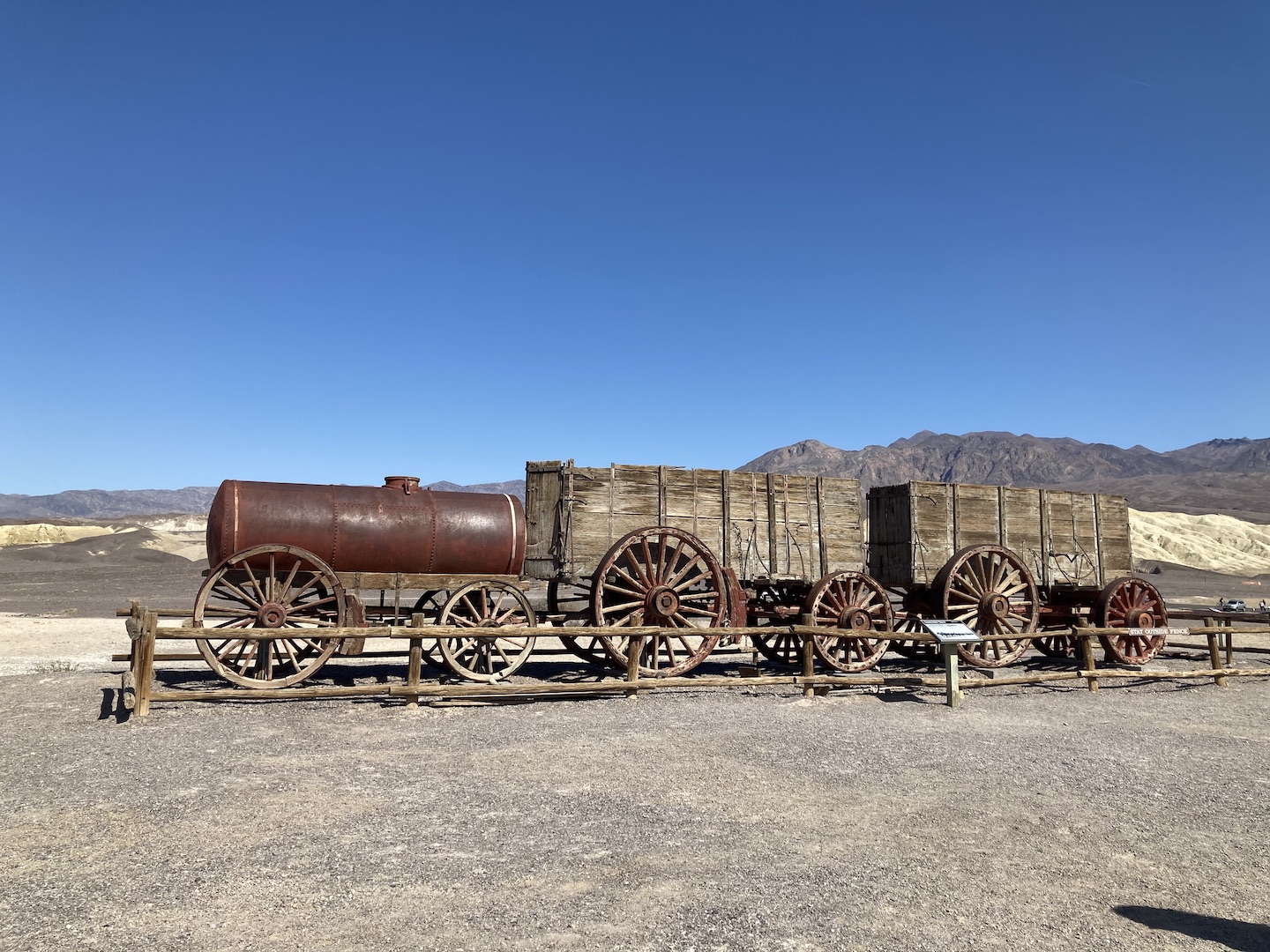
Our last stop was Harmony Borax Works. I had no idea borax is mined in California nor what it’s used for other than my favorite ant bait, but now I do! Borax was found in Death Valley in 1881 and a plant built shortly thereafter. The borax had to be hauled from Death Valley to the nearest railroad. They filled wagons, like the ones in the picture below, full of borax and then had 20-mule teams haul it 165 miles to the railroad. You know how on your box of borax is says 20 mule team and has a picture of mules and wagons? Now you know where that came from. Just another one of the many reasons I love national parks.
Harmony Borax Works
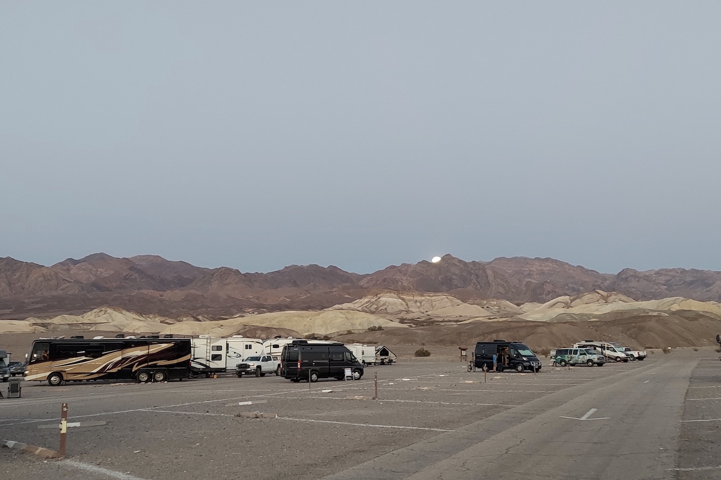
Unfortunately, our time in Death Valley had to come to an end but we will be back. There is still so much to explore. We stayed at the Sunset campground which is literally a parking lot. Most of the campgrounds in Death Valley do not take reservations but after speaking with a ranger, I learned they rarely fill up. We visited the end of February and the campground was hardly full. If you aren’t able to make a reservation I wouldn’t worry too much.
Full Moon Rising at the Sunset Campground in Death Valley National Park
Death Valley is barren and there is not much shade. I would not recommend visiting in the summer. The gas was stupid expensive so make sure you fill up before entering the park. I can’t think of any other tips other than to add Death Valley to your bucket list.
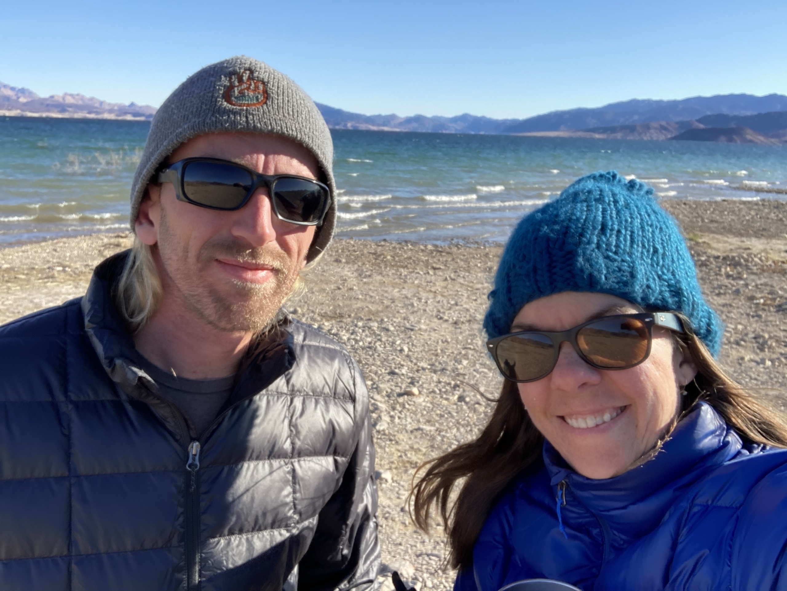
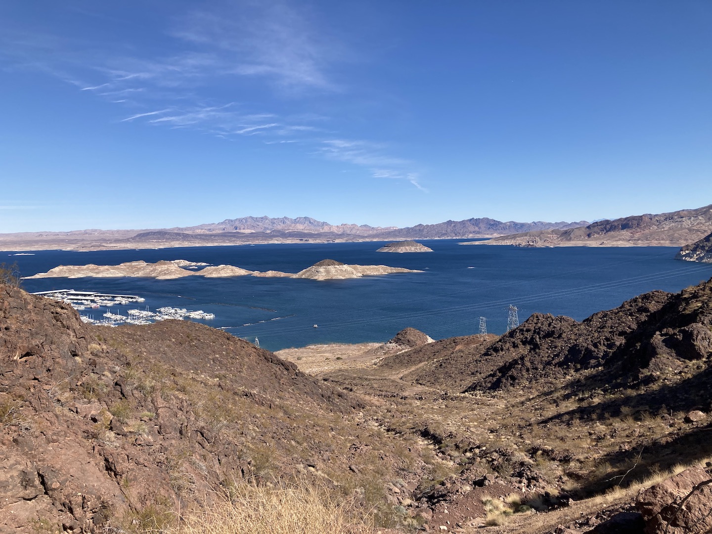
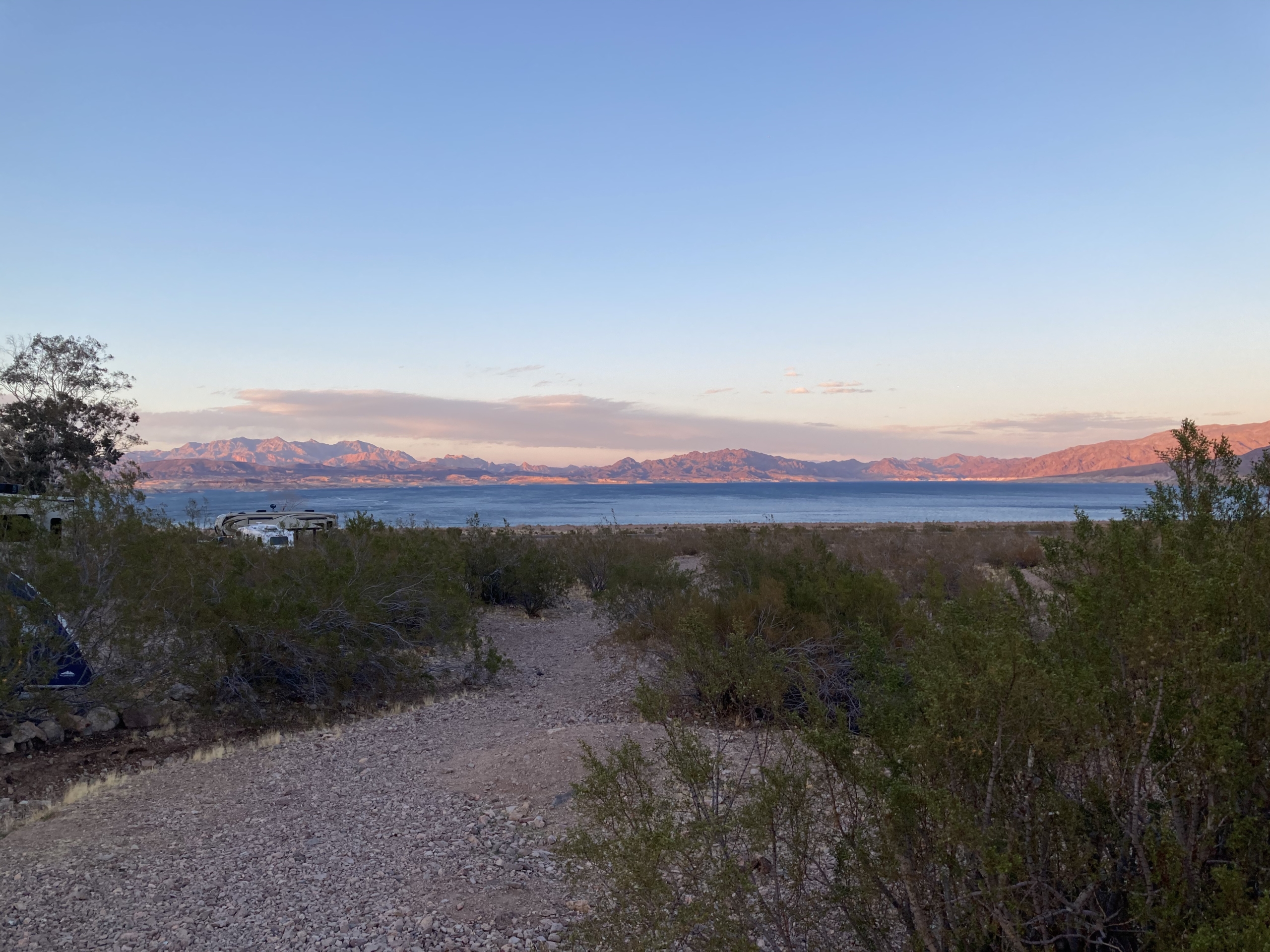
One our way home from Death Valley we stopped at Lake Mead for one night. We stayed at the Lake Mead RV Village at Boulder Beach. The sites are a little close together but you’re camping close to the lake so that’s expected. We weren’t right on the lake but it isn’t a far walk. Boulder Beach Campground is right next door and would be a great place to stay also.
Lake Mead National Recreation Area
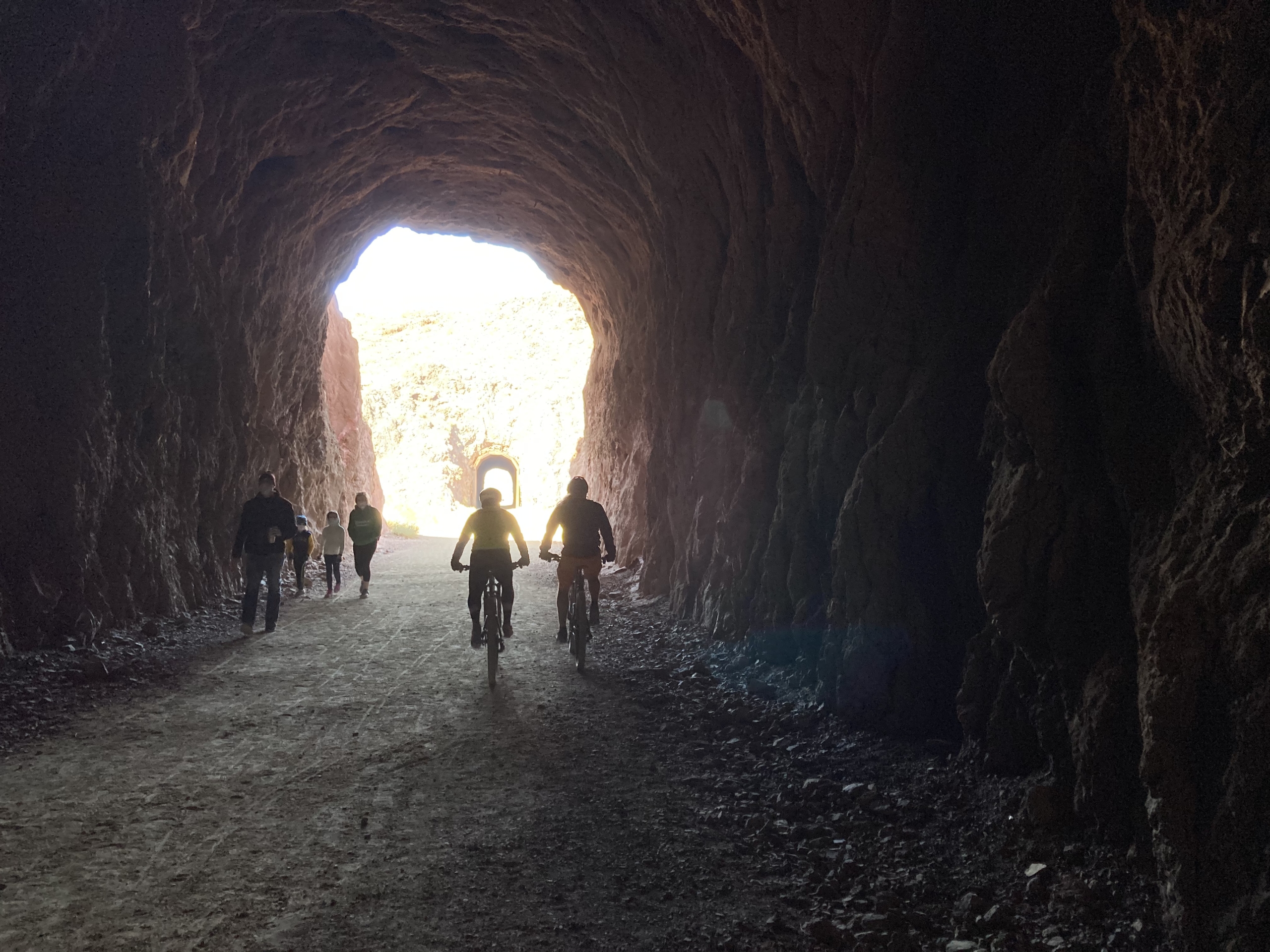
In order to build the Hoover Dam, a railroad was built to carry the supplies to the dam. A section of the Hoover Dam Railroad system still remains and has been converted to a hiking/biking path. I LOVE the Rails-To-Trails system! This trail has five tunnels, gorgeous lake views, ends at the Hoover Dam parking garage, and there are signs all along explaining how the railroad and dam were built. Once again, the boys rode their bikes and the girls walked. If you’re in the area, I’d suggest checking it out.
That’s a wrap on the Death Valley National Park recap! If you’ve been to DV, what did you think? Hopefully you loved it it as much as we did!
https://www.theroadwevetraveled.com/wp-content/uploads/2021/06/20210226_104653-2.jpeg9601440Carolinehttp://www.theroadwevetraveled.com/wp-content/uploads/2015/08/RWT_Logo@3x-300x143.pngCaroline2021-07-23 05:30:022021-07-23 14:30:05Death Valley National Park
After hearing that I went on a solo camping trip, several friends commented that they’d love to embark on a solo trip but don’t think they could do it. First of all, you are stronger than you think and you can certainly do it! Second, if you’d rather go on a girls trip let me know and I’ll tag along. 😉 I wrote this post in a way that will hopefully take you on this journey with me. Grab a drink and a snack because this one is a little long!
I’m not normally big on birthday celebrations but I turned 40 this year and wanted to ring in the decade right. There was no way I was going to do anything remotely close to the normal grind on my 40th. I wanted fun, new and epic. The problem was that my birthday was in the middle of the week and my husband is out of PTO. At first I felt sorry for myself, then I thought about trying to convince someone to come with me, and then I realized that I can do things by myself. The idea made me a little nervous so I knew I needed to make it happen. And that’s how this trip was born.
Leading up to the trip, the campsite was booked, the park was researched, dates were taken off work, but I kept the idea very quiet. I told only a couple people who needed to know, like my husband, and a few coworkers who happened to see some cryptic markings on my calendar. By keeping it quiet I was leaving room to back out as I still wasn’t totally comfortable with the idea.
MONDAY EVENING: I decided I wasn’t going. I thought of all the reasons why it was unsafe, stupid, thought of all the what if’s, and firmly told my husband I was staying home.
TUESDAY MORNING: I was driving home from the gym, thinking about what I would do instead of solo camp and realized that I was giving in to fear and that I’d probably regret not going for the rest of my life. I got to work and mentioned this to a coworker who proceeded to give me the best pep talk (we all need someone like this in our lives!), wrapped me in a virtual hug and by the end of the conversation the trip was back on. But for real this time. I spent the rest of the day frantically shopping and packing. And overpacking.
WEDNESDAY MORNING: I planned to leave early Wednesday morning but ended up having to work for a few hours. I finally got on the road around 11am. Google told me Joshua Tree National Park (JT) was five hours away but with stops and such it took about six. One thing I missed driving solo is a navigator. I knew there’d be no gas in the park but had no idea where I would need to stop to get gas. I could have figured this out ahead of time but am not used to planning to this level.
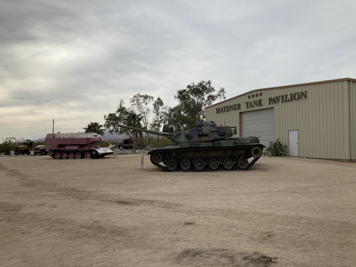
There were still so many unknowns at this point on the trip so the decision of where to stop for gas carried more weight than normal. I knew I was getting close to JT and saw three names on a sign so I decided I’d stop at the last one which was presumably the closest to JT. Turns out, the last one is just a road. At this point I was regretting not stopping at every gas station I passed but I kept going. The point of this trip was to work on not letting fear take over. I saw a sign for an upcoming summit and assumed it was just the top of a pass. I guess it was but they also had gas! And the General Patton Memorial Museum and Matzner Tank Pavilion. That was a fun stop and a huge sigh of relief. I filled up on gas, took a few pictures and headed to JT.
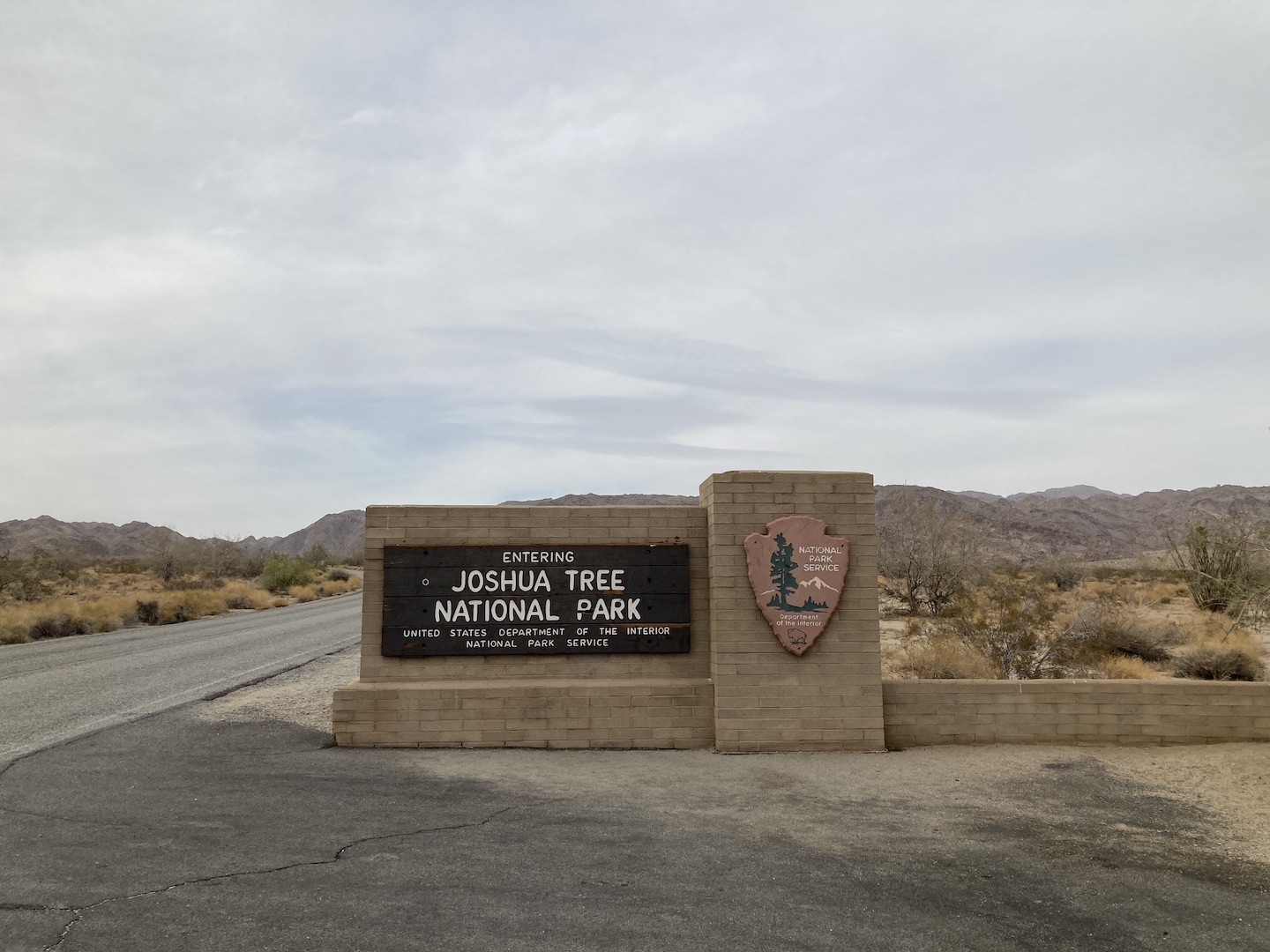
Of course, I had to stop for the obligatory sign picture.
Shortly after I entered the park I stopped at the Cottonwood Visitor Center to get a map. There were six kids, probably more like college students, there also and they asked me to take their picture. They handed me a disposal camera and a polaroid. The encounter made me chuckle and also reinforced that I’ve lived long enough now to see my childhood regain in popularity. I guess that’s fitting for 40. I made my way towards the campground and enjoyed the quiet drive through the park.
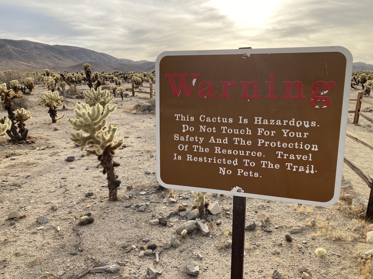
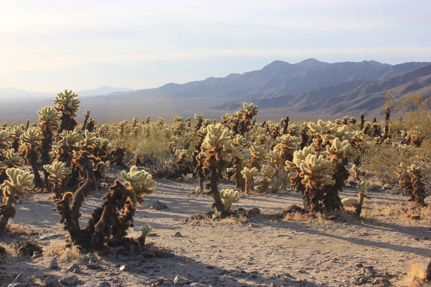
Along the way I stopped at the Cholla Cactus Garden. Living in the desert myself, cholla are not new to me so this sign made me laugh.
Cholla Cactus Garden
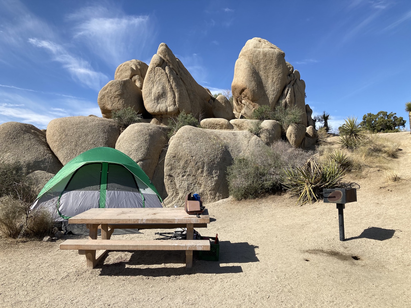
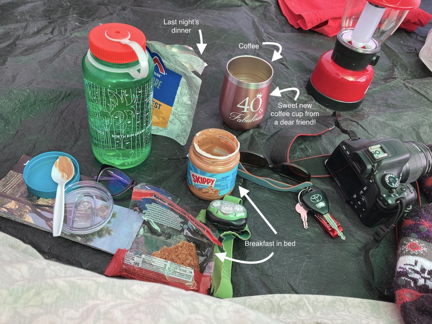
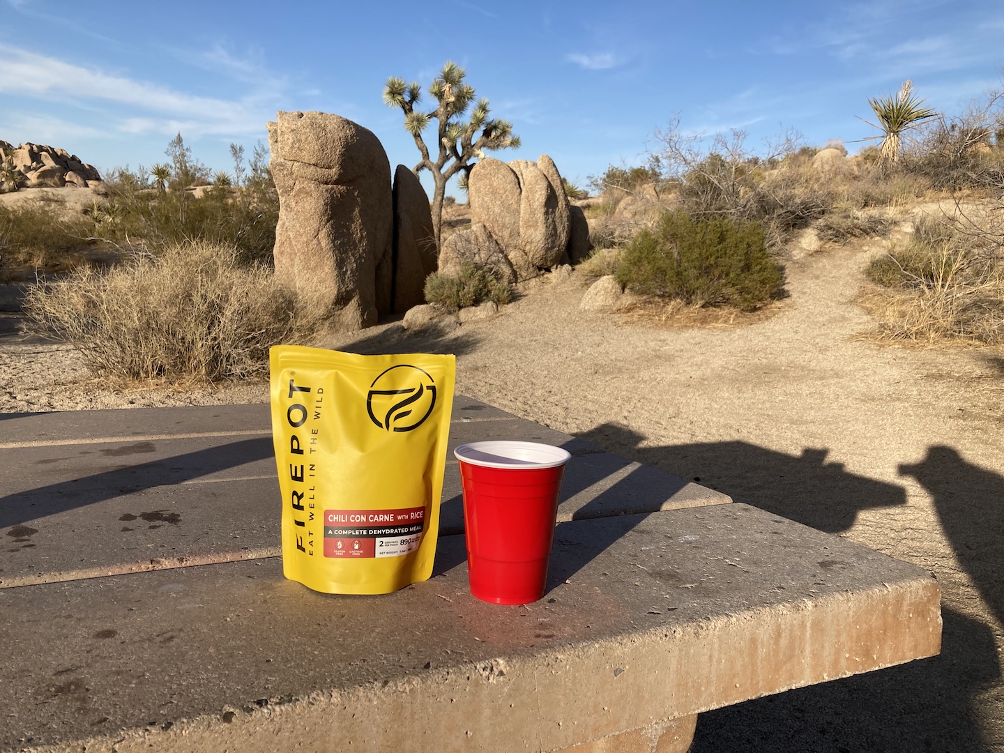
I arrived at the Jumbo Rocks Campground just before sunset. Surprisingly, I still remembered how to set up the tent! I got everything set up and popped open a bottle of wine. I didn’t want to deal with cooking on this trip so I brought oatmeal bars for breakfast, wraps for lunch, and backpacking meals for dinner. The only cooking I had to do was boil water for coffee and dinner. Backpacking meals really aren’t that great when not backpacking but they still beat having to actually make and clean up a meal.
Jumbo Rocks Campground campsite
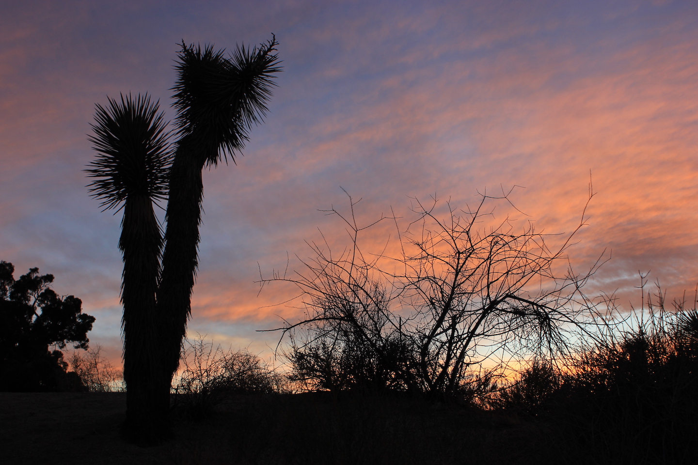
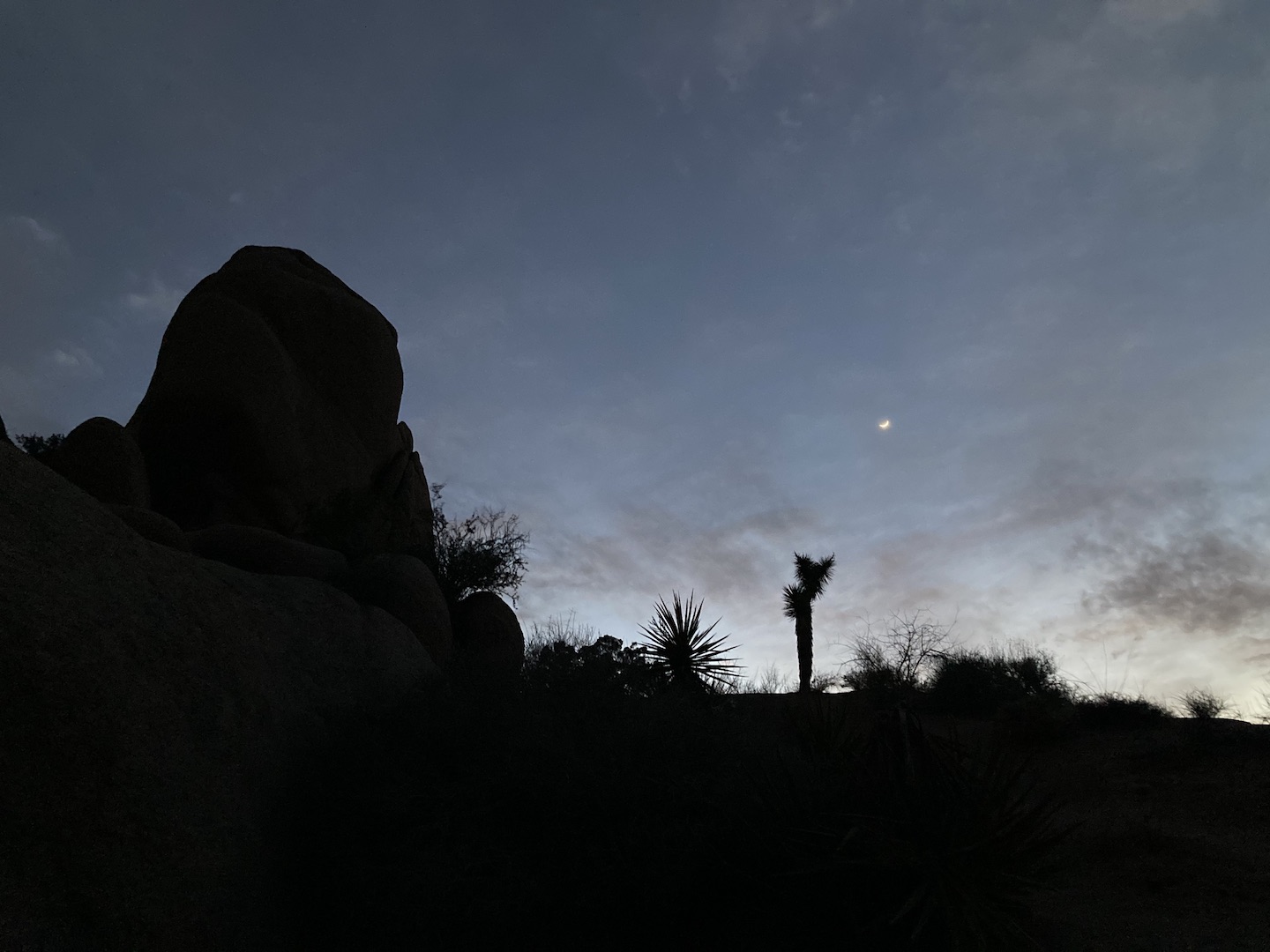
Sunset from Jumbo Rocks Campground
I ate dinner sitting in a chair and watching the sunset. At this point the stress of the day was starting to melt away but it was also starting to get cold. I retreated to my tent pretty early with the plan of reading but was so tired I crashed. Several hours later I was reminded of the downside to tent life when the wind picked up and it felt like my tent was going to fly away. This went on for a while so I ended up playing games on my phone for a few hours.
THURSDAY – MY BIRTHDAY!: When I awoke the next morning I was glad to see I hadn’t blown away during the night. I boiled some water for coffee and got back in bed.
I opened my book and started reading and since I had no required agenda, I kept pushing my self imposed deadline back. I read for an hour or two before finally getting out of bed to start the day.
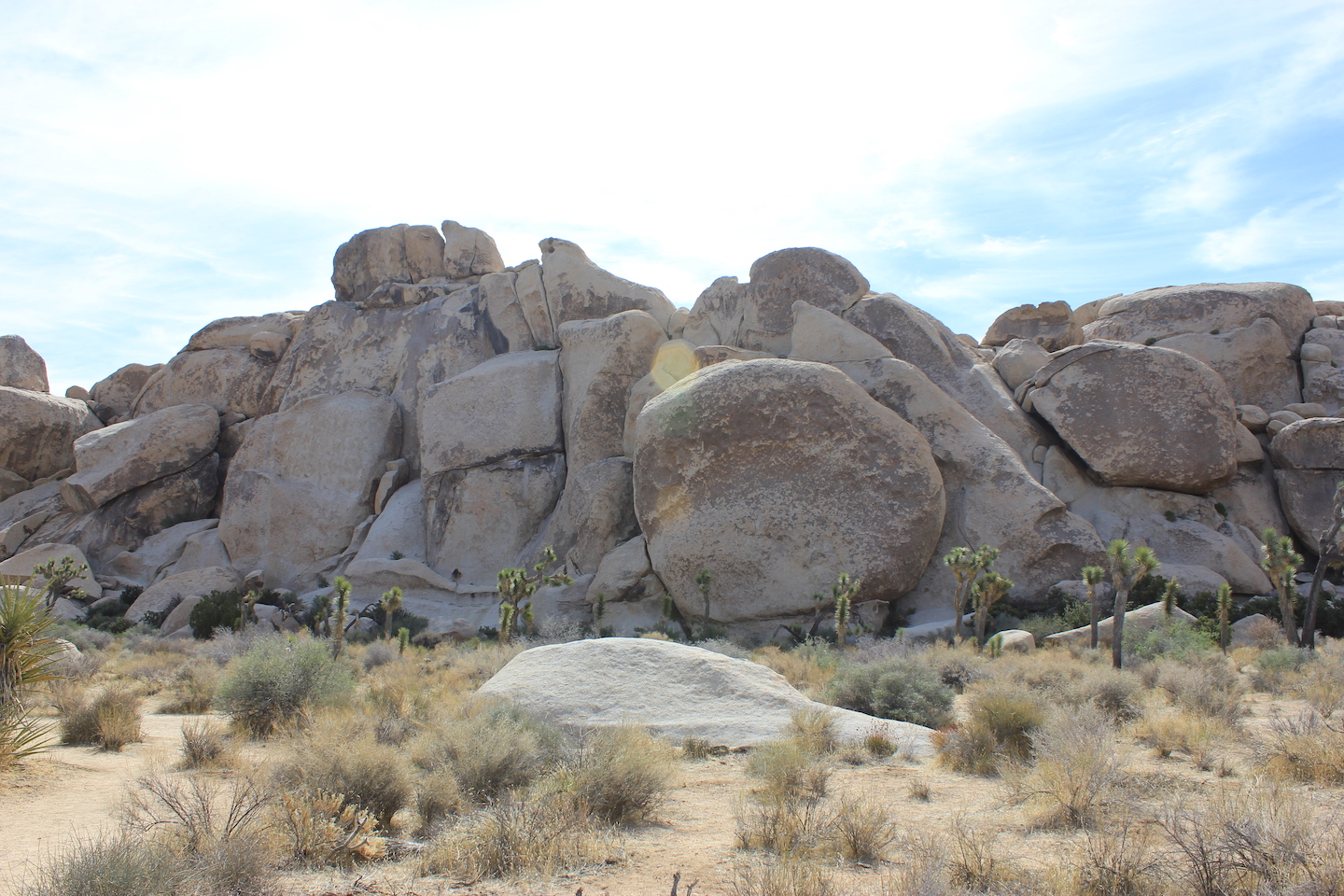
I finally made my way out of my tent to explore the park. I had no real plans other than to stop wherever I wanted. The first stop was the Hall of Horrors. I wasn’t sure what that was and was surprised to find there was no map or explanation. Fortunately the area is really pretty and walking around is fun on its own.
Hall of Horrors
The area has these huge rock piles surrounded by Joshua trees. For size reference, the trees are typically 20 – 40 feet high so those rocks are huge.
Hall of Horrors
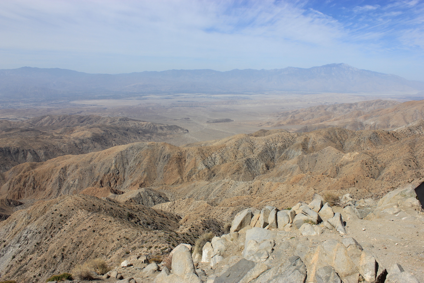
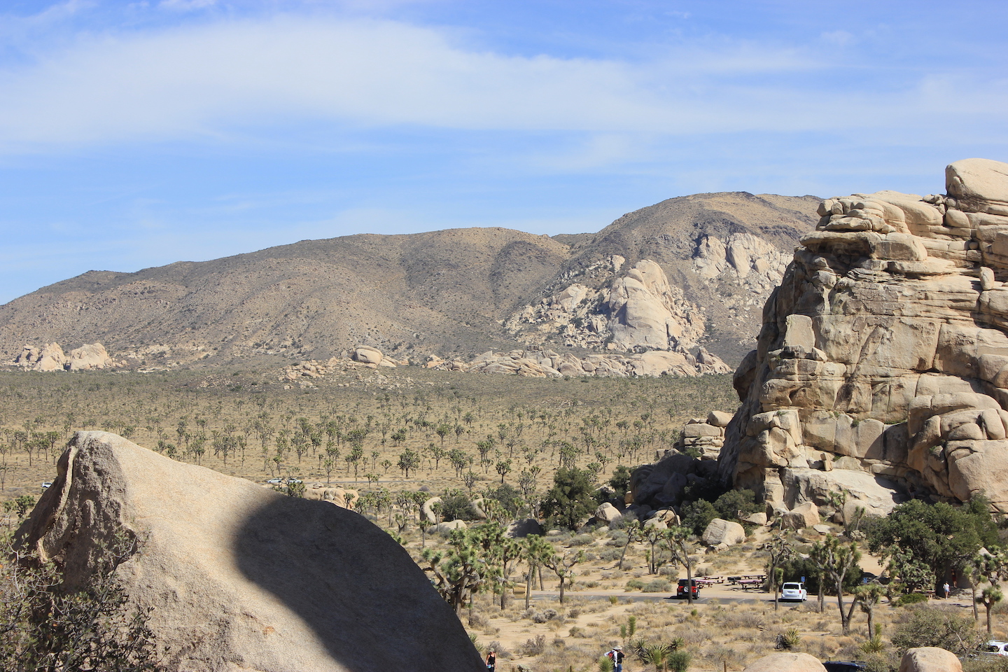
After the Hall of Horror I drove up to Keys View. The vista was pretty but there wasn’t much to do. I left and headed back down the hill/mountain.
View from Keys View
Next stop was the Cap Rock Nature Trail. This is a super easy trail with an explanation of the flora and fauna along the trail. I took a picture of my 4Runner and an outhouse with the trees and rocks to share a little size perspective. Since I was solo there are no people in any of my photos so this is it.
Cap Rock Nature Trail Cap Rock Nature Trail
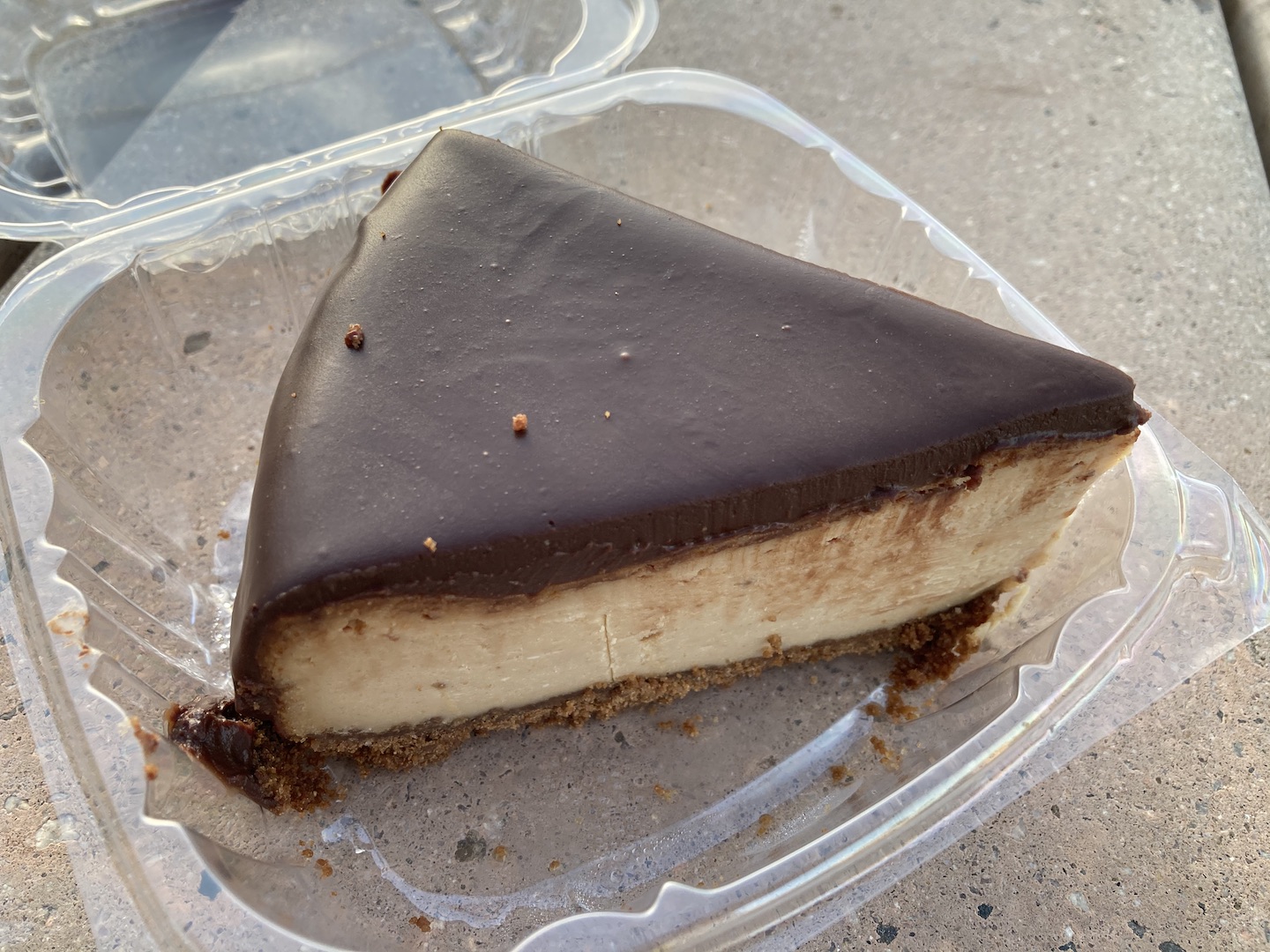
At this point it was around lunch time and I wanted to go to the town of Joshua Tree. I stopped at the ranger station to buy a few things and a local cafe where I found a piece of peanut butter chocolate cheesecake (gluten free and vegan!) which I saved for later.
I had read that the Black Rock area was supposed to be the best in the park and that they have some of the largest Joshua trees. This area is not connected to the main part of the park and you access it from the town of Yucca Valley (right next to the town of Joshua Tree). The area was not what I was expecting. There were lots of Joshua trees but I found the ones in the larger park to be more scenic. The campground was also a little rundown looking.
Black Rock area
I decided I didn’t want to explore any further and headed back to the main park. Once again, I could have used a navigator. I wasn’t using my GPS because I thought I knew where I was but I was wrong. After taking several wrong turns, I finally pulled over and started the GPS.
Pro tip: the Joshua Tree entrance seems to be the most popular and can get super backed up. Most importantly, they have the park sign blocked off so you cannot get a picture with it. Gasp! I know. Fortunately, I came in through the Cottonwood entrance and already had a sign picture but if you too are a sign picture junkie, make sure to visit one of the other entrances.
The drive into Joshua Tree National Park
By this point in the day, all the stress from the previous day was gone and I was loving life and my solo adventure. The next road I drove by said there was a trail so I took the left. This was my new plan. Just turn when prompted. The trail was the Barker Dam Nature Trail. JT has quite a few nature trails and they are all awesome and a great way to learn about the park. The first half of the trail takes you along rocks and eventually on rocks to the Barker Dam. Ranchers dammed the area years ago to collect water for their cattle. There was no water when I visited in mid-April but supposedly the area fills after rainstorms.
Barker Dam Trail
Barker Dam
Barker Dam Trail
Barker Dam
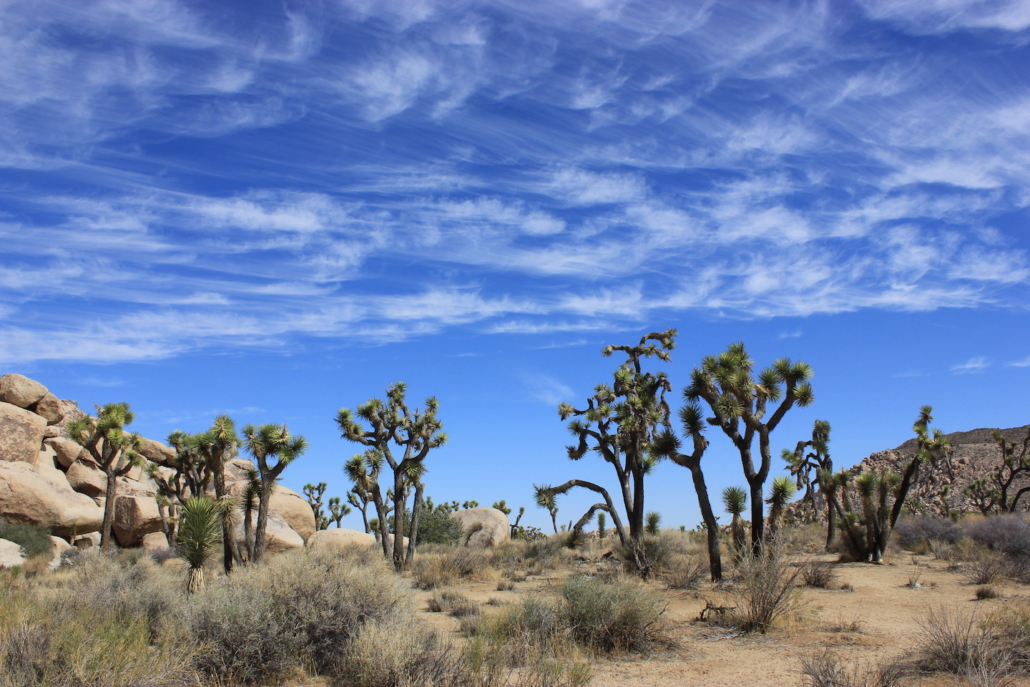
As you leave the dam area you enter a more traditional JT walk; through huge boulder fields and Joshua trees. It’s stunning, really. Towards the end of the trail there is a short side trail to some petroglyphs. This hike is listed as easy but there are a few areas around the dammed area where you are walking on rocks and down rock steps.
Petroglyphs along Barker Dam Trail
Barker Dam Trail
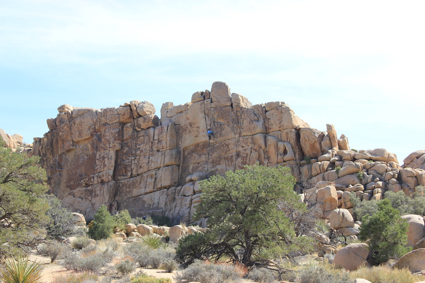
At this point in the day it was mid-afternoon so I kept telling myself after *this* stop I’m going back to camp to read and relax. And then I’d see another pullout and be drawn in. The next one was the Hidden Valley Nature Trail. A narrow gap in the rocks opens to a valley where a cowboy gang used to hide their illicit cattle. They’d rebrand them and sell them off in other states. The area is a big bowl surrounded by towering rocks. It’s a popular rock climbing area and I was able to watch a guy climb. I couldn’t see a rope so I thought he was free soloing (I watched Free Solo and am pretending like I know the lingo) which I was in awe of. Now that I’m home though I can see his rope. His climb was still incredible nonetheless.
Rock climber in Hidden Valley
This trail is listed as easy but that’s not true. The trail is just over a mile and there’s not much elevation change but there are so many rocks to navigate. On several occasions I though I was lost but someone had used spray paint to mark the trail. Not sure if that was legal or illegal but either way I’m grateful. I would not attempt this trail if you have any mobility issues. It’s a beautiful hike though.
View from the start of the Hidden Valley Nature Trail
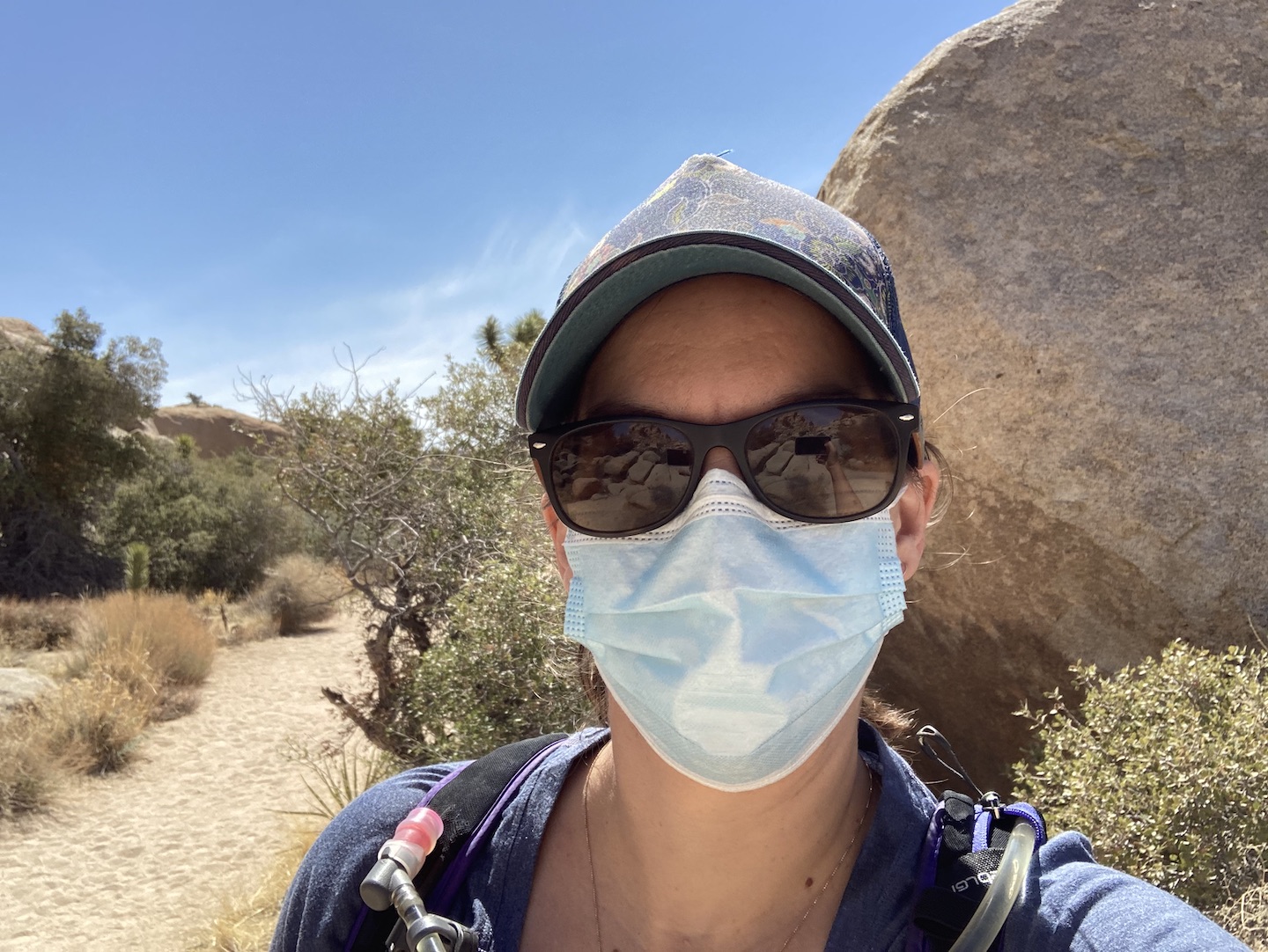
And because it’s 2021 and we’re in the middle of a pandemic, I took a selfie with my mask. Because why not. The trails were much more crowded in the afternoon and most people were good about mask wearing when passing.
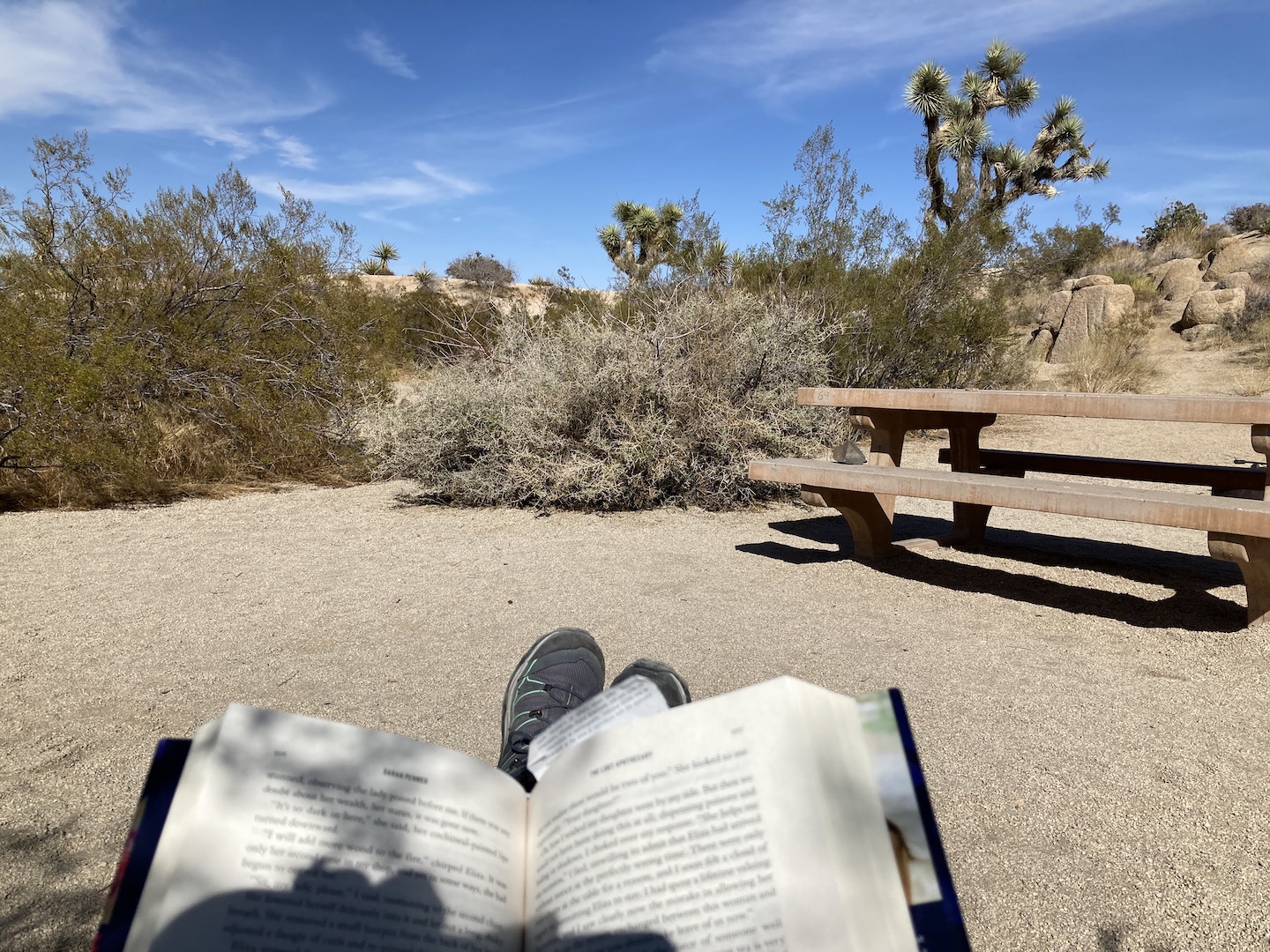
My book was finally calling me and I was ready to sit down. I took a few more pictures along the way, stopped at a few road side signs, and made my way back to camp. Once back at camp, I moved my chair into the shade, put up my feet and opened my book. Life. Is. Good.
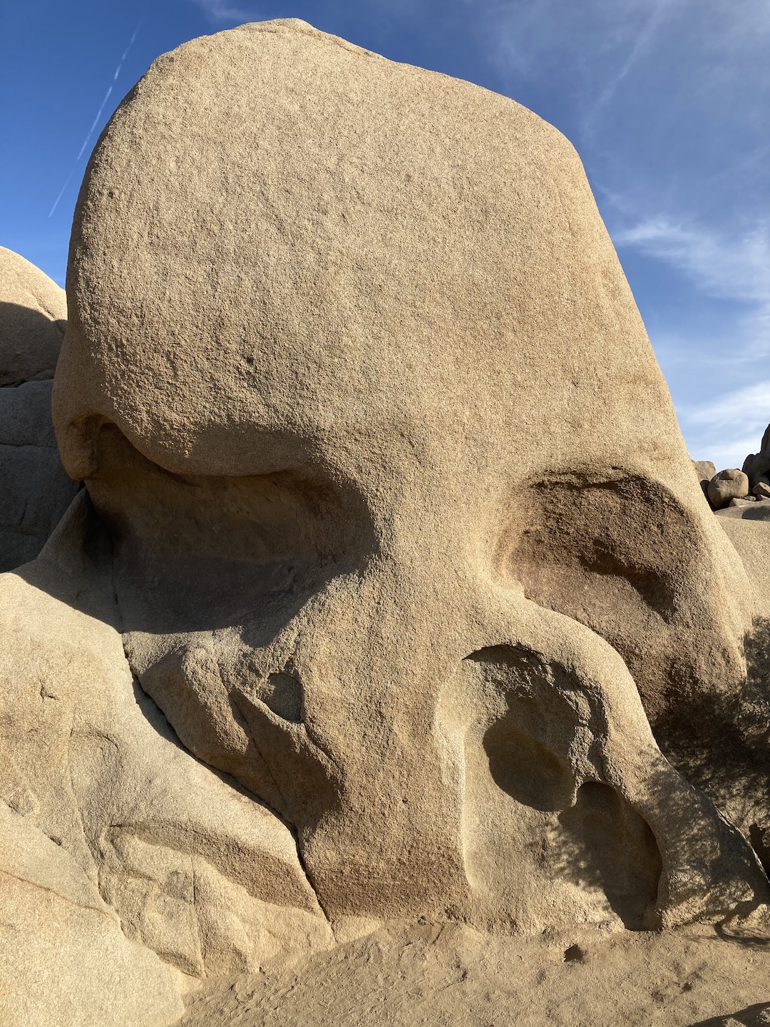
There was a trail near the campground to Skull Rock. It’s a “famous” rock formation in the park. I figured since I was so close I couldn’t not see it. I put the book down, grabbed my backpack and hiked another 1.7 miles to see Skull Rock. I would say it’s the most overrated formation in the park. It’s hard to get a picture of it because there are rocks in front of it and there are people everywhere. It’s not too far off the road but I wouldn’t go out of the way to see it.
Skull Rock
Once back at camp, I read until dinner time when I made another backpacking meal and drank some more wine. Dinner was not doing it for me but that might be because the cheesecake was calling my name. I decided to get the cheesecake from the cooler as a reward for when I finished dinner. I started with just one bite and planned to go back to my dinner but threw in the towel and ate cheesecake for dinner. It was heavenly and exactly what a girl should have for dinner on her 40th birthday. I even sang myself happy birthday in my head. 🙂
Birthday dinner!
I alternated between reading, eating cheesecake, drinking wine and watching the sun set. This exact scenario is now what my dreams are made of.
Sunset in Joshua Tree National Park
Eventually it got too cold and I retreated to the warmth of my bed where I stayed awake until my book was finished. I read the Lost Apothecary and it was so good! One of the main characters is named Caroline so that was fun.
FRIDAY: Fortunately, there was no wind that night so I slept like a baby and woke up at 4:50am. A little earlier than I would have preferred but it worked. As I laid in bed waiting for the sun to rise, I listened to what sounded like two owls hooting. Maybe it was just one but the sound was alternating locations. And at one point the coyotes chimed in. This went on for a while. I finally got up when it was light out and made some coffee and took a few pictures of the sun rising. The campsites are close together so I was trying to wait a little bit longer before making too much noise. Around 6am I decided it was late enough and packed up.
Sunrise in Joshua Tree National Park
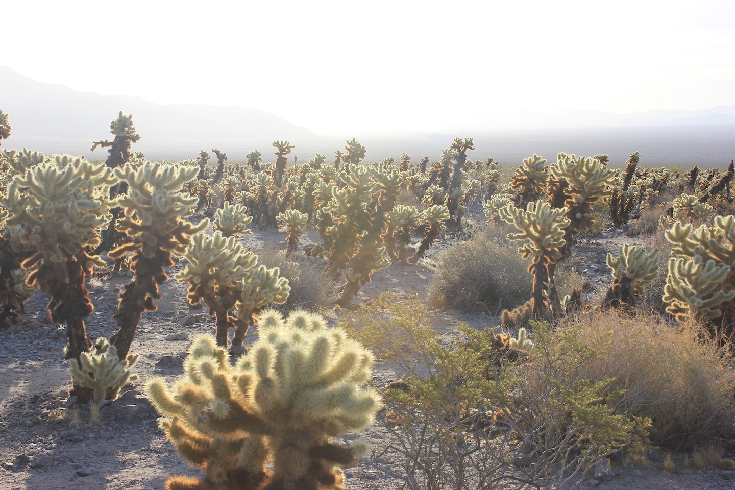
The drive out of the park was breathtaking. I was driving east as the sun was rising so all the plants were glowing and the mountains were in layers. Once again I took way too many pictures. I stopped at the cholla cactus garden again and took a few (or 100) more pictures, stopped at the ocotillo garden, and made my way to the Cottonwood Spring Oasis.
Glowing cholla is one of my favorite things.
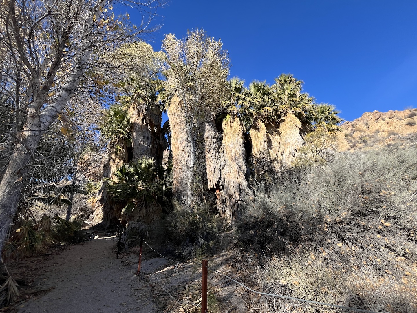
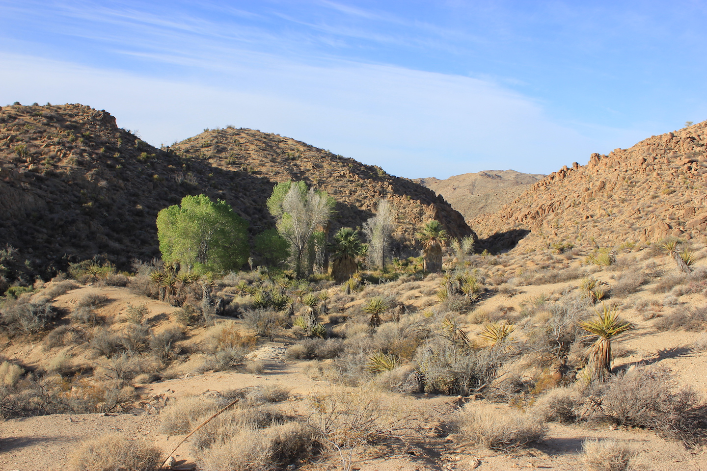
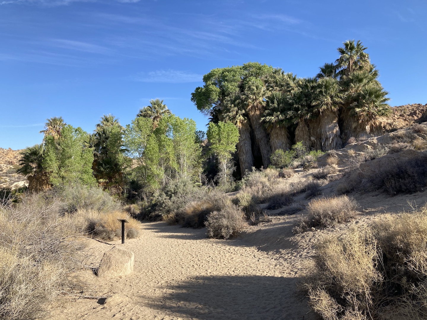
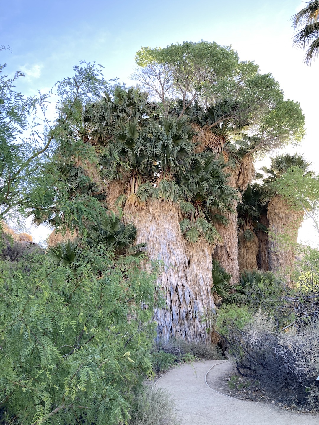
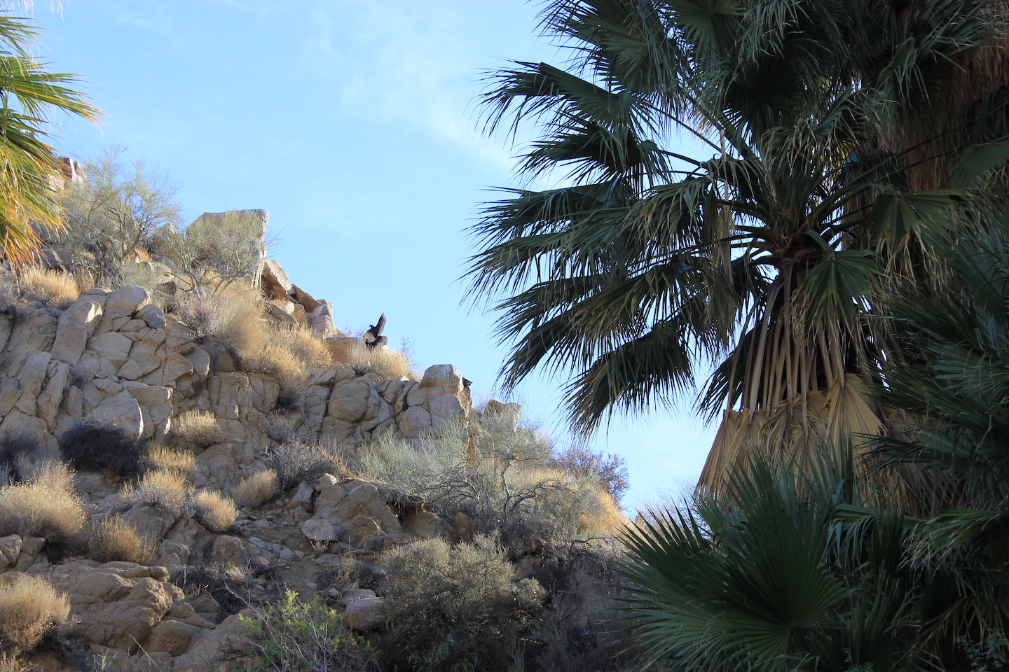
This landscape is so cool. It’s barren desert and then all of a sudden there’s a grouping of palm and cottonwood trees. Apparently this is the result of a crack in the earths crust.
Cottonwood Spring Oasis
I took a few pictures, walked around, and sat on a bench and listened to the birds chirping. There was a bird that was standing on top of a hill that had its wings spread open. It was the strangest thing. It was like it was warming its wings or showing off. I sat there for a few minutes expecting him to take off but instead he kept spinning in circles.
At that point it was time for me to leave. Someone was coming over at 4pm so I had to get back home. I stopped at the nearest gas station to get coffee for the drive home. Gas station coffee is hit or miss and this was totally a miss. It tasted like dirty water but that’s how it goes some days. And with that I was on the road home.
It’s taken me a few days to really digest my trip. I am so glad that I went and so grateful to everyone who encouraged me even when I started to doubt myself. This is the exact trip I envisioned when I wanted my 40th to stand out. I’m not sure if solo trips will be a regular thing in the future but I loved every moment of this one.
A couple things to note regarding Joshua Tree National Park. There is no cell service in the park. Like none. Pretty much as soon as I passed the entrance sign my phone stopped working. I do appreciate a forced break from the connected world so while this can be a little unnerving, it’s also always so lovely. There is also no water in the park. Make sure you take all you need plus a little extra.
https://www.theroadwevetraveled.com/wp-content/uploads/2021/04/IMG_3085.jpeg10801440Carolinehttp://www.theroadwevetraveled.com/wp-content/uploads/2015/08/RWT_Logo@3x-300x143.pngCaroline2021-04-23 06:19:512021-04-24 01:48:43A Solo Camping Trip in Joshua Tree National Park
Do you ever go somewhere and not totally enjoy it and then look back and realize you had an incredible time? That’s how I feel about our time in San Francisco. There were so many people and so many cars and so much waiting and so many traffic jams that I was ready to get outta dodge. But now that I’m looking though my pictures, I am reminded that we had a good time. We saw so many neat things and added memories to the memory bank.
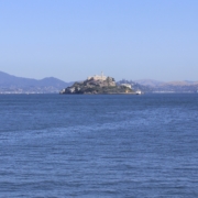
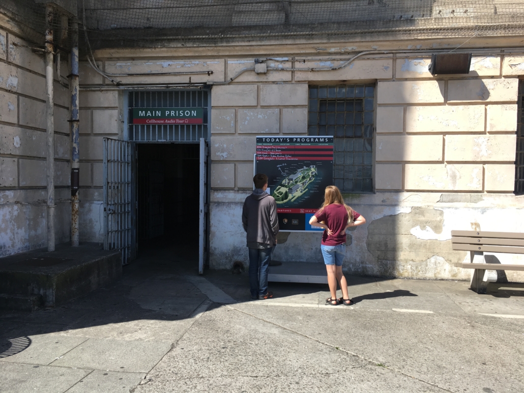
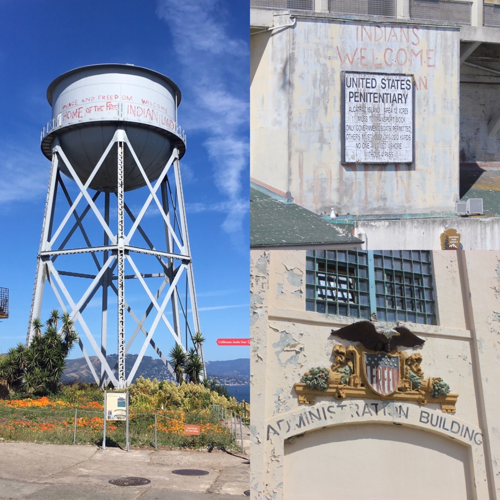
Alcatraz Island
Alcatraz Island
The reason we were in San Francisco in the first place is because Little Mister wanted to go to Alcatraz. It was a really cool experience and I’d recommend it if you are in SF. I had the great idea to book 9am tickets thinking the island would be less crowded. While that was the case, I didn’t realize we would be headed into San Francisco during morning rush hour. Doh. We had to leave the campground ridiculously early but we didn’t get caught in rush hour and we made our ferry with plenty of time to spare.
Alcatraz Island
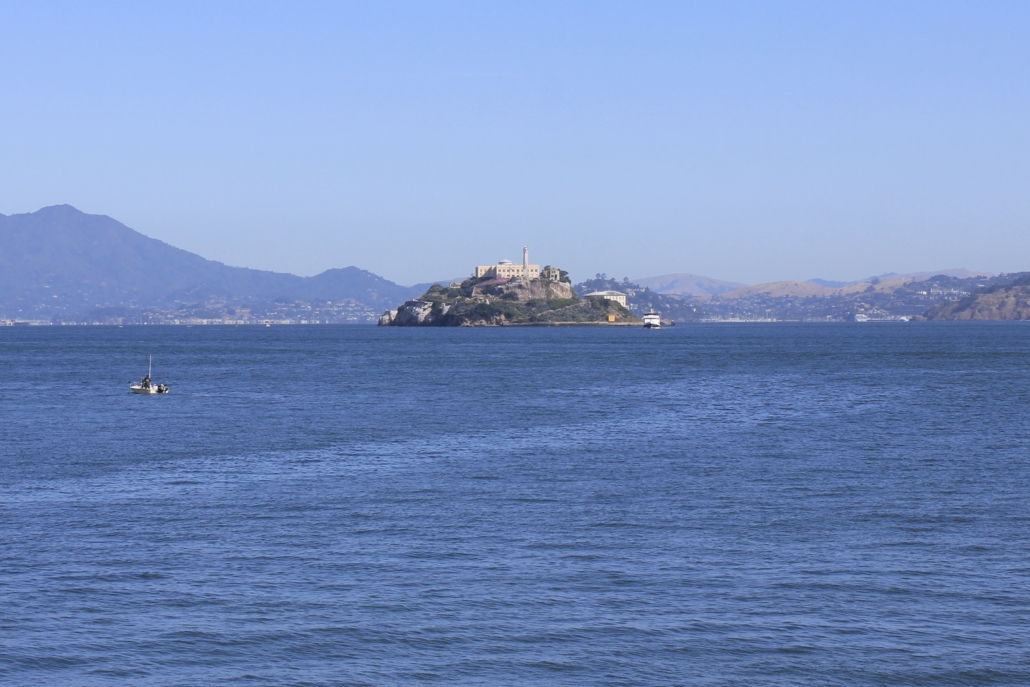
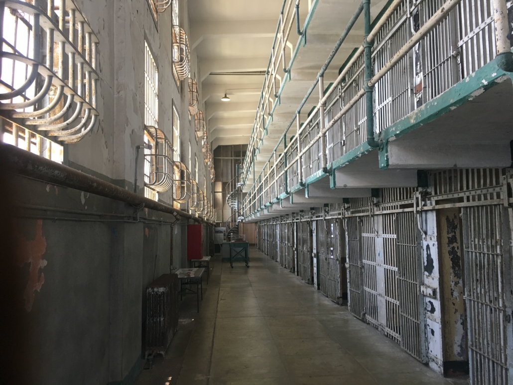
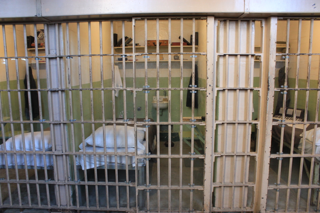
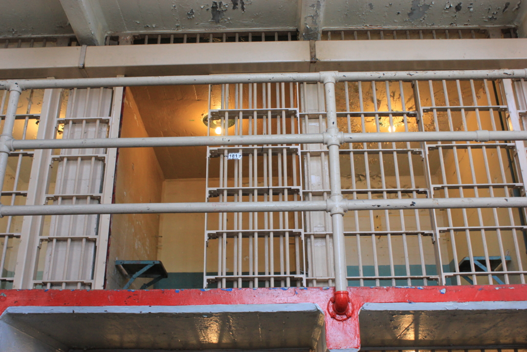
Alcatraz Island is gorgeous. Not only is the architecture cool, the flora is stunning, and the views are to die for. There are even good views from inside the prison.
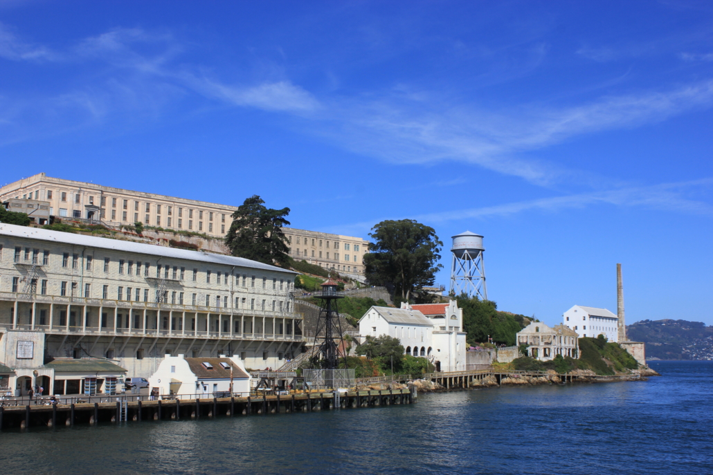
Flora on Alcatraz Island
You absolutely must get the headphones for the Cellhouse Audio Tour. Get off the boat and walk to the very top of the island to get your headphones. The audio tour walks you though the prison and the grounds and gives so much history. You can go at your own pace so there’s time to see everything.
I did not realize that American Indians occupied Alcatraz Island for 18 months after the prison closed. They were attempting the claim the land for the tribes of North America but were unsuccessful in the end. Evidence from their time there is all over the island.
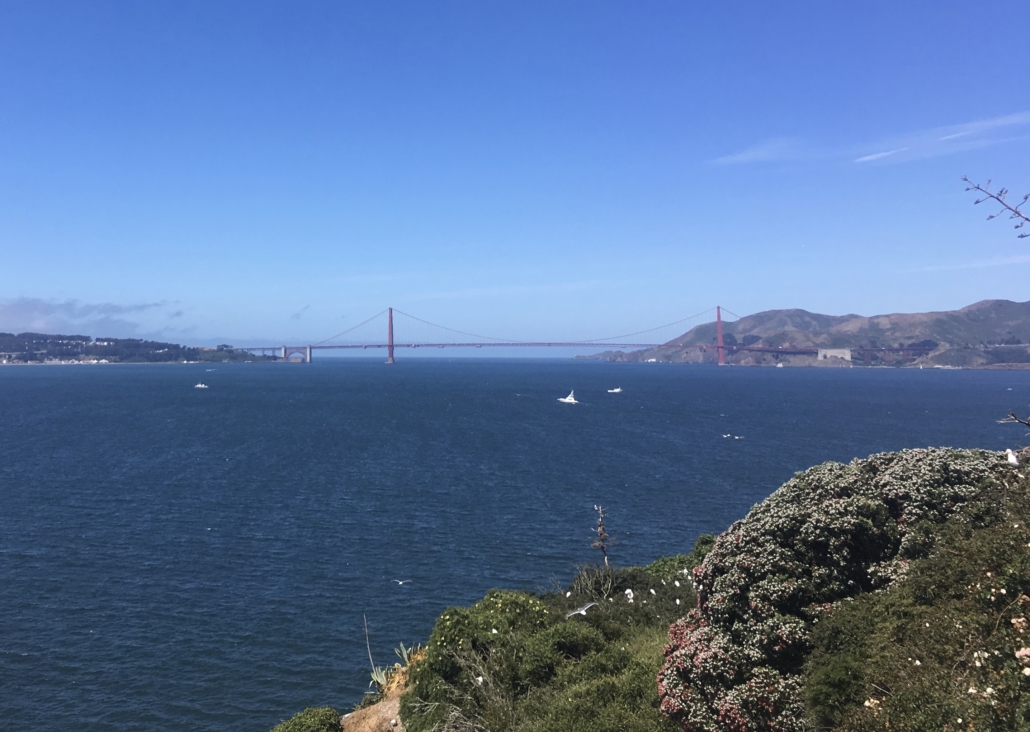
There are incredible views of the city and the Golden Gate Bridge around the backside of the island so be sure to go outside. If you’re listening to the audio tour it will take you out there.
Golden Gate Bridge
The hills at Alcatraz are no joke but if you have mobility issues there is a tram that will take you to the top of the island where the main prison is. Once at the top, the prison is easy to get around so as long as you can get on and off the ferry and can walk (ride or roll) around on flat surfaces you can enjoy Alcatraz.
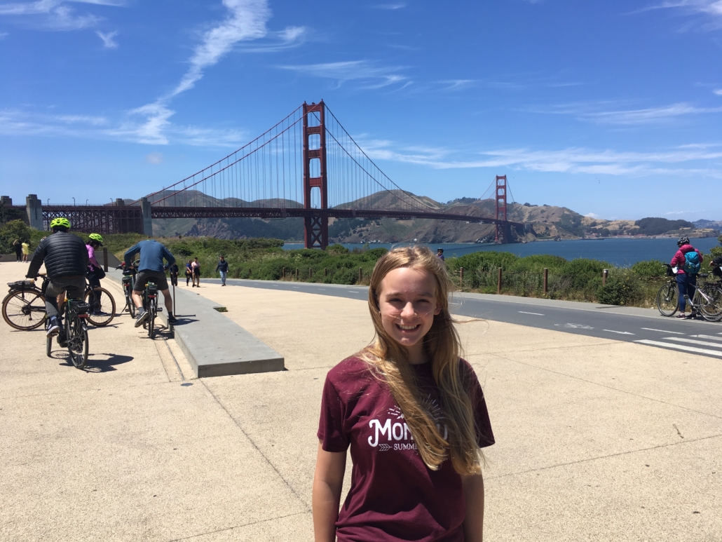
Golden Gate Bridge
Driving across the Golden Gate Bridge is so cool and totally worth the $7 toll. At least once. We also stopped near the Golden Gate Bridge Welcome Center to get a closer view. We were hoping to grab some of the rentable bikes to ride across the bridge but they were all in use.
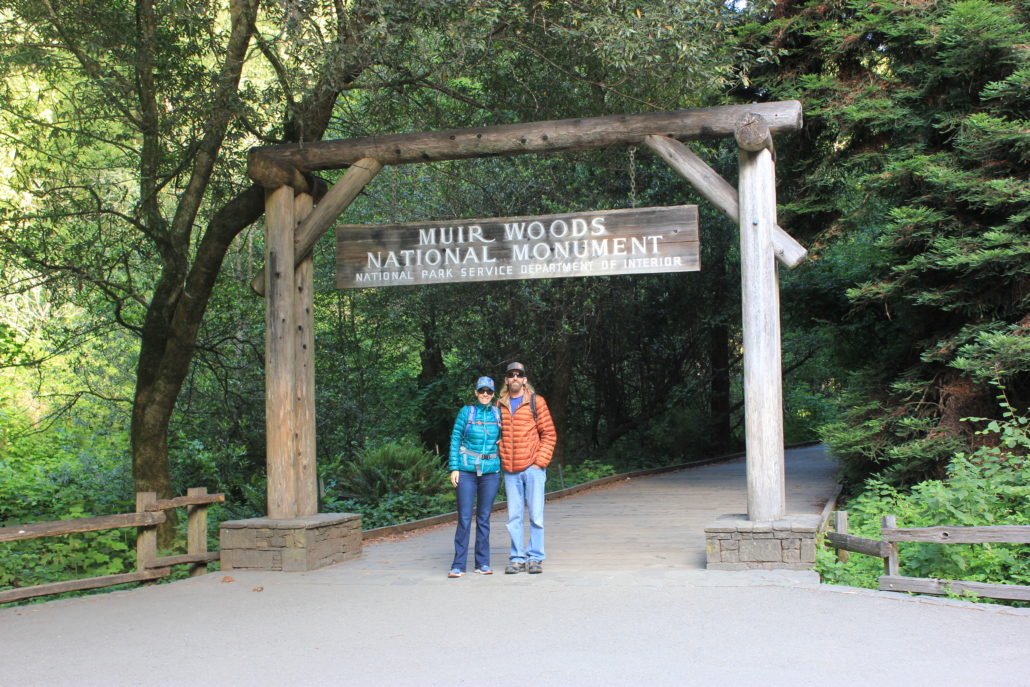
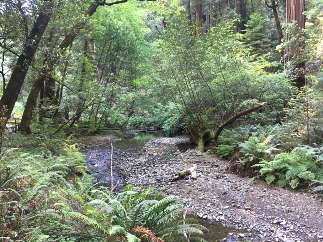
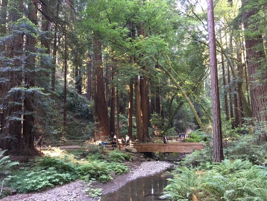
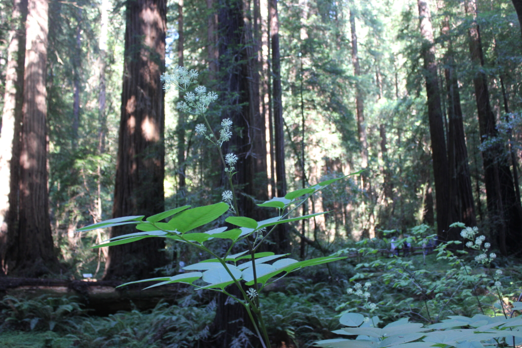
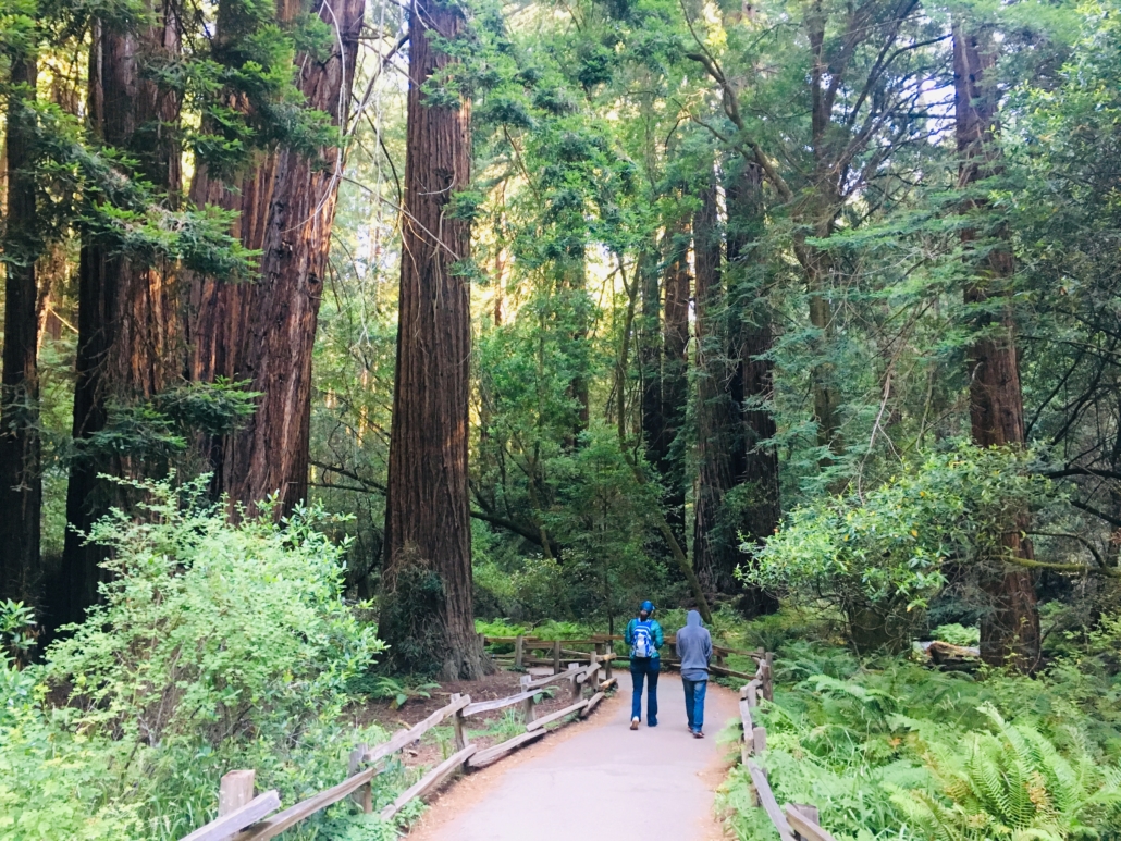
Muir Woods National Monument
I was surprised to find that Muir Woods National Monument is basically in the middle of the city. They have limited parking so if you want to park on site you have to make a reservation. The other option is to take a shuttle into the park. We made parking reservations for first thing in the morning and I’m glad we did. There were few people in the park and it was still very peaceful.
The canopy is dense and it was chilly! Be sure to bring warm clothes. One kid was in shorts and sandals so we didn’t stay terribly long. We walked the trails that bordered the stream and it made for a lovely morning walk. I would loved to have taken one of the trails that takes you above the tree line. Next time.
Walking through the redwoods at Muir Woods National Monument
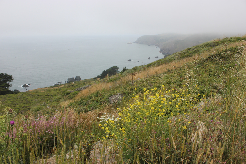
Point Reyes National Seashore
After leaving Muir Woods we headed up the Pacific Coast Highway/Highway 1 to visit Point Reyes National Seashore. This was my first time on the PCH and holy moly is it narrow and windy. There are some great spots to stop and take pictures though.
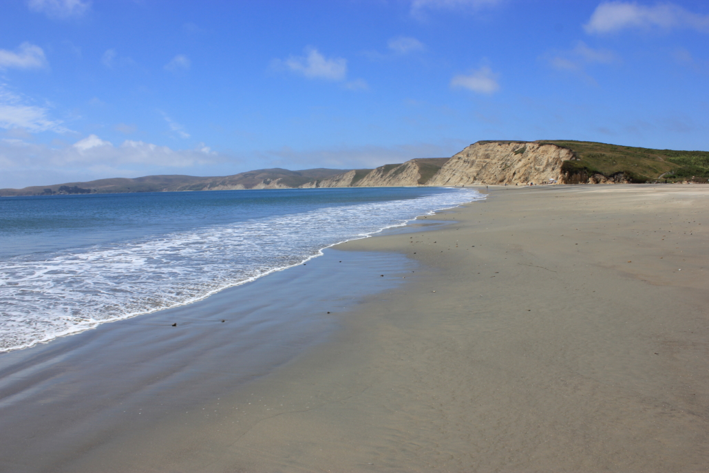
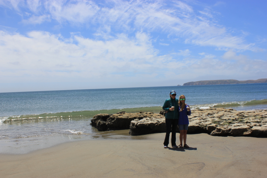
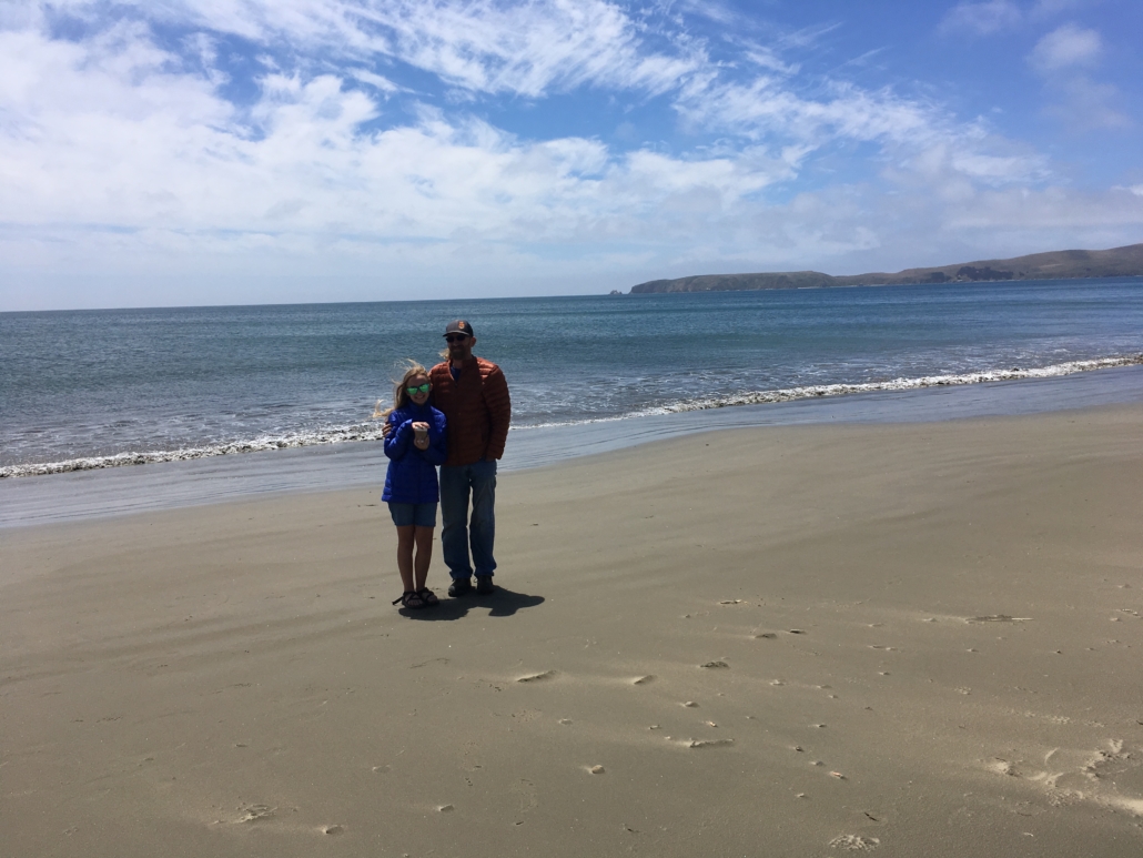
There is a lot to do in Point Reyes but it’s pretty spread out. At the advice of a ranger we headed to Drakes Beach. Wowza…it is gorgeous.
Drakes Beach, Point Reyes National Seashore
There is a small gift shop that sells food and coffee and we were so thankful. It was cold and windy so we grabbed warm drinks before heading to the shore.
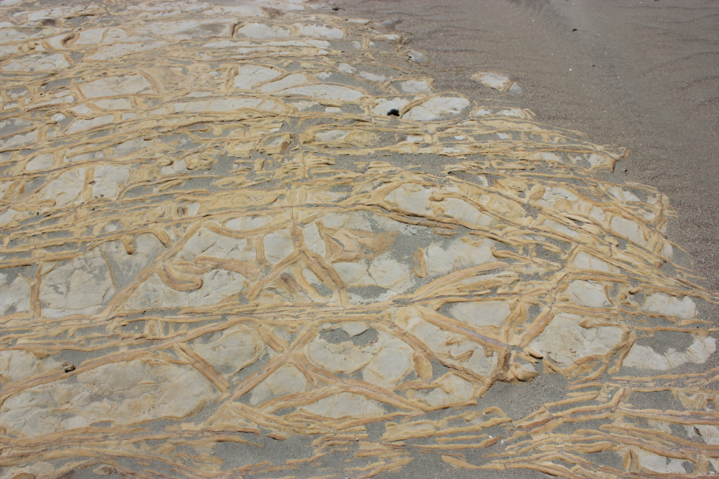
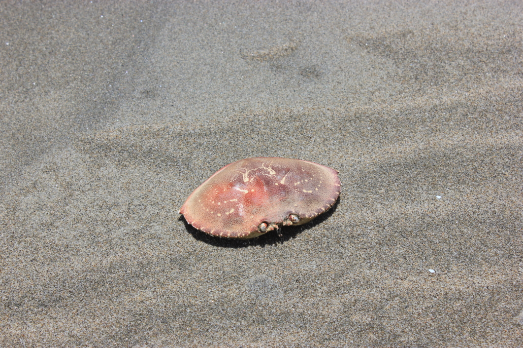
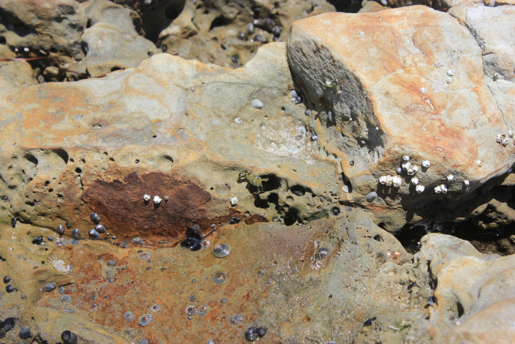
We spent sometime walking along the beach looking at all the neat rocks, shells and crabs.
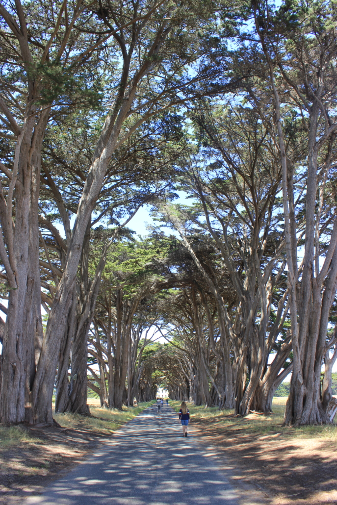
We stopped at the Cypress Tree Tunnel on our way out of the park to take a walk through the trees. It was a beautiful walk, albeit people were illegally flying drones through the tunnel.
Cypress Tree Tunnel
We stopped by the Inverness Store to buy peanut butter because we left our jar at the campground. The store is rather pricey so I would advise not leaving your lunch at the campground. Since we were there we took the short walk behind the store to see the shipwreck.
Shipwreck, Point Reyes National Seashore
San Francisco North KOA
We stayed at the San Francisco North KOA and it is one of the better campgrounds we’ve stayed at. First of all, and most importantly, they have an awesome game room! We had a blast playing air hockey, teaching the kids to play pool, and setting high scores on the arcade games.
The park is huge and there is tons to do, particularly if you have kids. Every evening they had a train or wagon ride go though the park around dusk. They were bumping kids music and everyone looked to be having a ball. We had a back-in spot in the Redwood Grove Area and it was awesome. I would definitely stay in this spot and campground again.
Tips for Visiting San Francisco
Have a big ‘ole dose of patience with you. I am not use to big city driving which includes leaving extra, extra early to account for the seemingly never ending traffic jams. I have friends from the Bay Area and they know how to get around this so maybe next time I will go with one of them.
Make reservations in advance for all the activities you are interested in to avoid missing out. For us that included booking ferry tickets to Alcatraz and a parking pass for Muir Woods. There really is so much to do and is was neat to see some of the iconic San Francisco destinations.
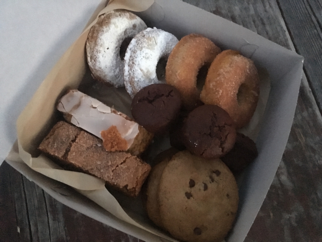
After San Francisco we made our way back to Arizona but not before stopping at my favorite bakery in L.A., Erin McKenna’s.
Box of goodies from Erin KcKenna’s Bakery
If you missed the other posts from this trip check out:
https://www.theroadwevetraveled.com/wp-content/uploads/2019/08/fullsizeoutput_224b.jpeg21683252Carolinehttp://www.theroadwevetraveled.com/wp-content/uploads/2015/08/RWT_Logo@3x-300x143.pngCaroline2019-09-02 18:44:132019-09-02 18:44:19San Francisco
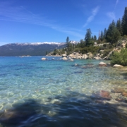
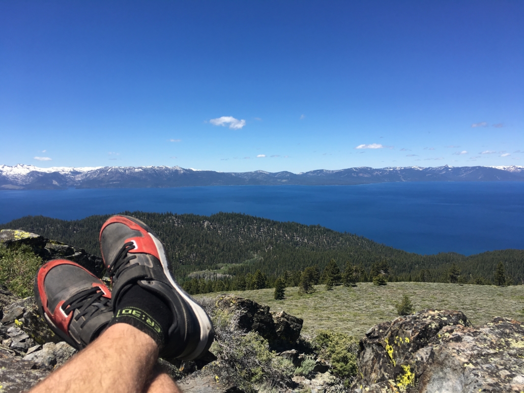
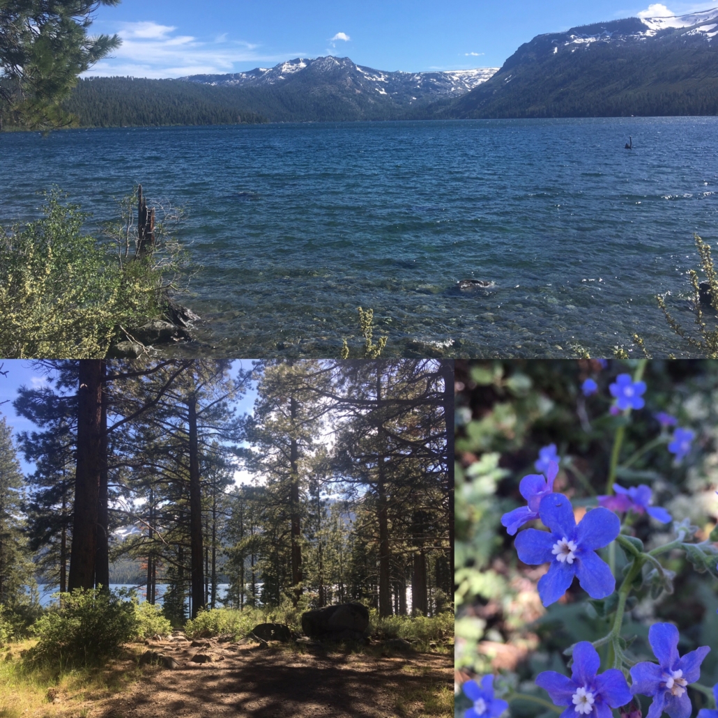
The next major stop on our California road trip was Lake Tahoe. Oh man…Tahoe is gorgeous. If we lived closer we would visit all the time.
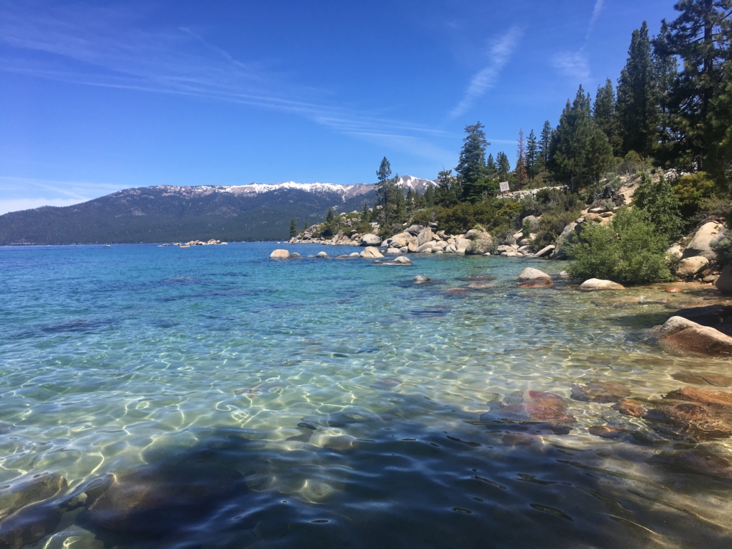
Sand Harbor Beach, Lake Tahoe
I completely underestimated the size of Lake Tahoe. I had all these activities planned around the lake but once we got there I realized that was more driving than we wanted to do. The lake is 72 miles around but the majority of that is two lane mountain roads. After driving two days to Tahoe the last thing we wanted to do was spend another day driving. We ended up staying mostly on the south end of the lake and that was perfectly fine.
Sand Harbor State Park
We visited several of the beaches and they are all gorgeous. You really can’t go wrong in Tahoe. That being said, Sand Harbor was definitely our favorite. Crystal clear water with large boulders below the surface. This is what dreams are made of.
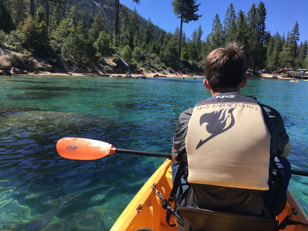
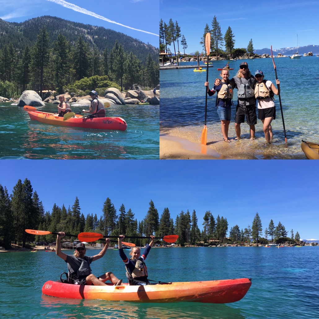
Kayaking at Sand Harbor
We rented kayaks from Sand Harbor Rentals and spent the morning paddling around. It was my favorite activity of our vacation and definitely at the top of my list of favorite things we’ve done.
Kayaking at Sand Harbor
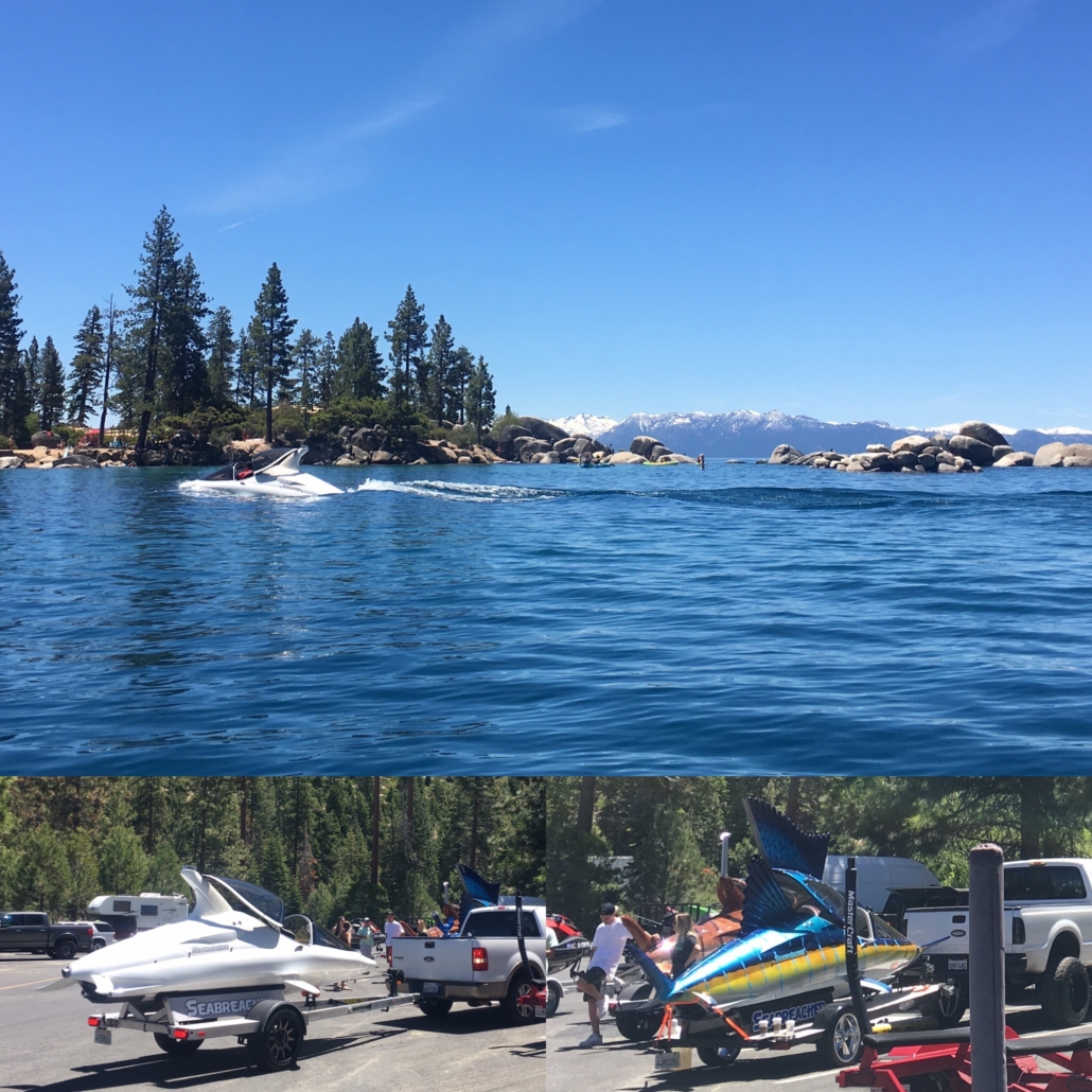
The day we were at Sand Harbor Seabreacher was there doing a photo shoot. Seabreacher makes mini submarine like watercraft that look like dolphins and fish. They go super fast, do barrel rolls, dive, and jump out of the water. They were so much fun to watch. Every time they would start doing tricks on the lake we’d paddle out there and watch.
Sand Harbor is the most popular beach in Tahoe so if you want to go you need to get there early. Once the parking lot is full the only way to enter is by public bus. There is no nearby parking and they do not allow parking on the side of the highway – there really isn’t anywhere to park anyway. Since we were there in the “off” season and it was a weekday, we arrived around 9am. There were still plenty of places to park and the beach was not yet crowded. By lunchtime the beach was completely full and the rental line was long.
One more Tahoe tidbit. The day we were at Sand Harbor lake winds were expected at 1pm with 4 foot swells so we were told we had to be back in the cove by noon. I rarely visit lakes so this was new to me. Sure enough, by early afternoon the lake was super choppy and we had beach waves. We sat on the beach eating our lunch, taking in the lake, and watched two different kayakers get rescued. It was really cool to see, minus the poor people that were stuck on the lake. I have no idea how common this is but for what it’s worth, lake winds are a thing.
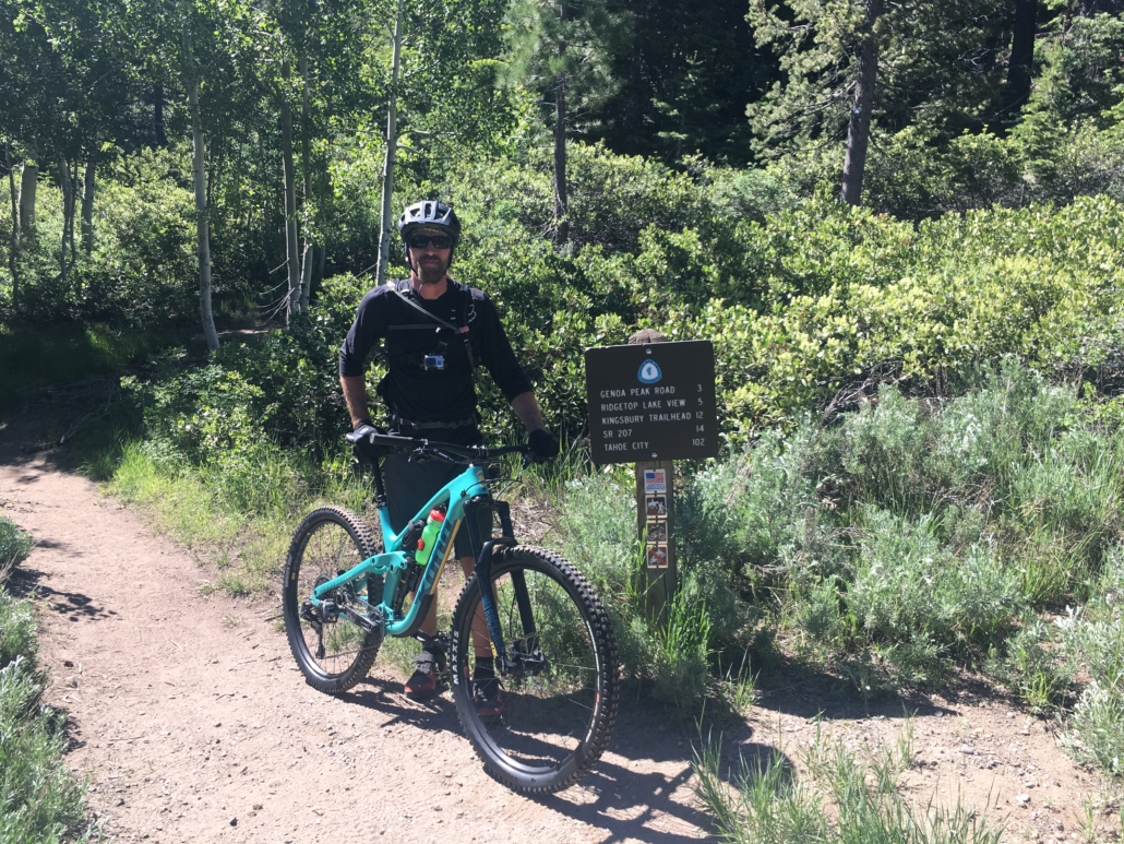
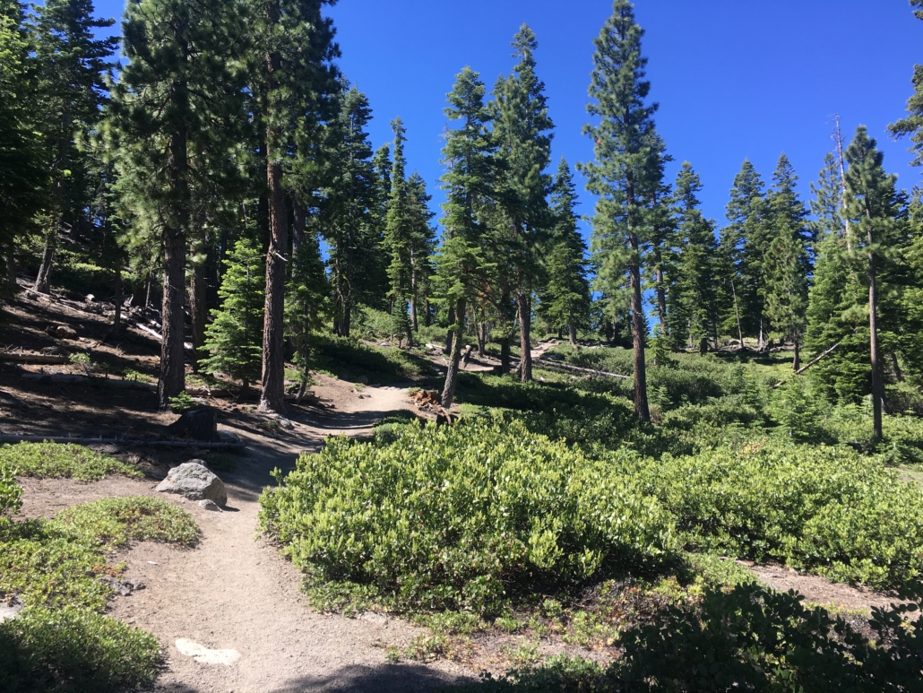
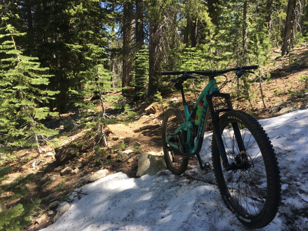
Mountain Biking the Tahoe Rim Trail
The Husband rented a mountain bike from Over the Edge Tahoe and rode a segment on the Tahoe Rim Trail.
Tahoe Rim Trail
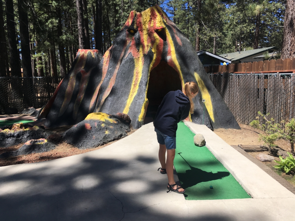
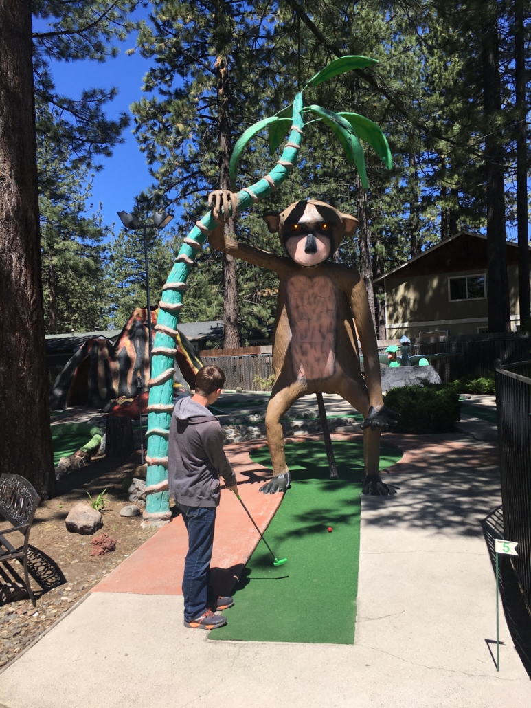
The kids and I dropped him off at the trailhead and went and played mini golf while he was riding. Figuring out when to pick him up was tricky in that cell service is spotty all around Tahoe but in the end it worked out perfectly.
Magic Carpet Golf in South Tahoe (supposedly there is also one in North Tahoe) was a fun stop and a great way to spend a few hours. We played 18 holes and then a few games of air hockey. For the record, I’m the air hockey champ. And since we’re stating things for the record, Little Mister is the mini golf champ. Little Miss and I were talking a bunch of smack the entire game. He stayed quiet and whooped us at mini golf.
Back to the Tahoe Rim Trail, the Husband had a ball and loved almost every single minute of his ride.
Tahoe Rim Trail Tahoe Rim Trail Tahoe Rim Trail
There are bikes shops all around Tahoe so it’s probably best to find one near the trail that you want to ride. Most also offer shuttles if you don’t want to drive.
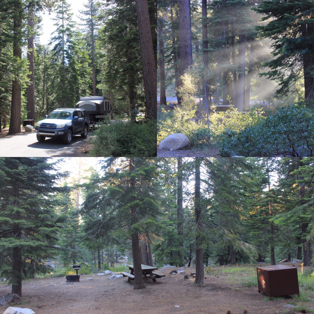
Fallen Leaf Lake Campground
We stayed at the Fallen Leaf Lake Campground in South Tahoe. I struggled with where to stay because there are so many campgrounds and everyone has an opinion on north versus south. We never made it to North Tahoe so I can’t compare the two ends but we had a thoroughly enjoyable time in South Tahoe. It’s definitely a populated area but Fallen Leaf Lake Campground is in the woods and very relaxing. I’d recommend it if you like camping.
Fallen Leaf Lake Campground
All of the sites at Fallen Leaf are nice and spacious. We were in 49 and it’s a pull thru site. Some of the sites are more in the trees, some have meadows backing them, and some back to the river. You really can’t go wrong.
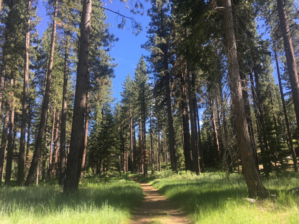
The walk to Fallen Leaf Lake
Access to Fallen Leaf Lake is towards the backside of the campground. It took me two days to figure this out. There is a road to the lake but it’s not the best and is mostly one lane. There are some incredibly gorgeous cabins along the lake and a marina. But that’s it. If you want to sit on the shore you need to access it from the campground.
Fallen Leaf Lake
If you’re not a fan of narrow roads I would not recommend driving to the lake. Little Miss and I decided to go on an adventure one evening and ended up on the one lane road with a boat on wheels coming towards us in the opposite direction. I kid you not. It didn’t look like a boat you’d want to ride in so I assume it had some other offical purpose. Fortunately, we met up with this boat near a driveway so I was able to get out of its way. We ended up being behind the boat on our way back from the lake and he was driving literally like one mile an hour. Nothing like driving down a one lane mountain road behind a boat going slower than walking speed. It was such a strange situation that all we could do was laugh.
Tips For Visiting Lake Tahoe
We visited towards the end of June and were surprised to find that Tahoe isn’t fully operational until July. The visitor centers are only open on the weekends in June and some businesses aren’t operating yet. The kids wanted to ride the mountain coaster at the Heavenly Ski Resort and we wanted to go on a river float but neither business was open. I wouldn’t worry about this if you visit in July but if it’s any earlier check to make sure the activities you want to do are available.
We have Verizon and had terrible reception in most of Tahoe. Our phones did not work at the campground nor in most areas. Our phones worked best on every lake shore and in the BevMo parking lot. Be sure to have your activities planned before coming to Tahoe. Being that the visitor centers were closed the entire time we were there and we had terrible reception, we made our way to the BevMo parking lot at least once a day to research activity options and such. Insider top: Don’t buy ice at BevMo. It’s crazy expensive.
If you missed the other posts from this trip check out:
We recently returned from our annual summer road trip and California was the destination this year. Little Mister (he’s not so little anymore so I probably need to come up with a new name) has been wanting to visit Alcatraz for years so we centered our trip around Alcatraz. Per usual, I then added on as much as possible within driving distance from said destination. I am fairly certain the family has a love/hate with this tactic but I don’t care. 🙂
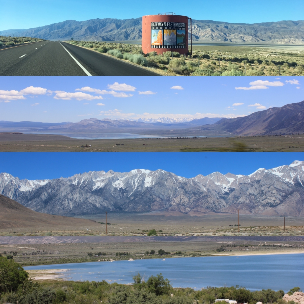
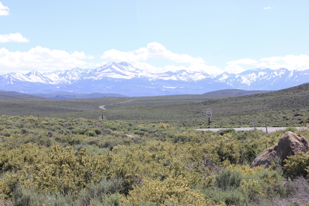
Our first destination was Lake Tahoe and we took Highway 395 to get there. If you’ve not taken a trip down 395, add it to your list. Not only is the scenery gorgeous, there is so much to do! We only stopped a handful of times but we will definitely be back to explore the area further.
Scenes from Highway 395
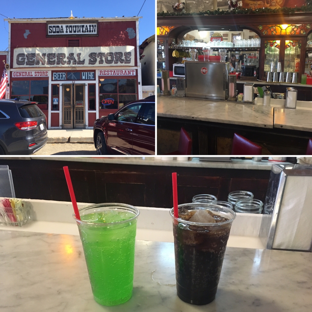
Our first stop was the town of Randsburg for a soda from their soda fountain. Randsburg is about a mile off the highway so it didn’t add too much time to the day. It’s an old mining town and has some cool looking buildings and a jail you can explore. The Randsburg General Store serves food, sells groceries, and has a soda fountain that has been in operation since 1904. I tried the lime phosphate soda while The Husband tried the root beer. Both were good and it was neat to experience a bit of history.
Old fashioned sodas from the Randsburg General Store
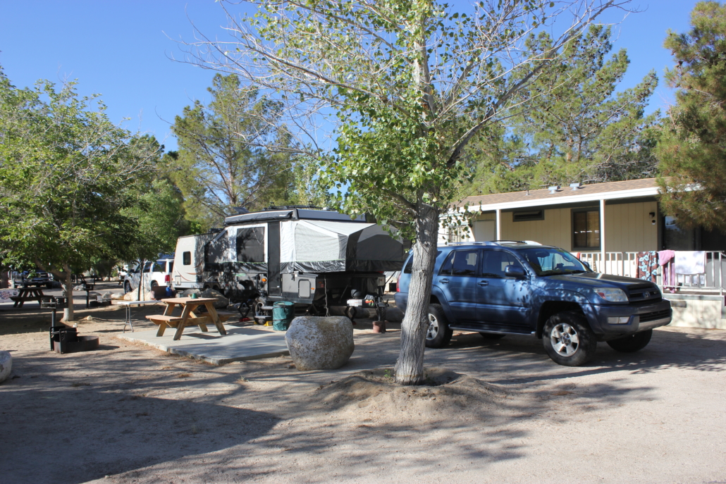
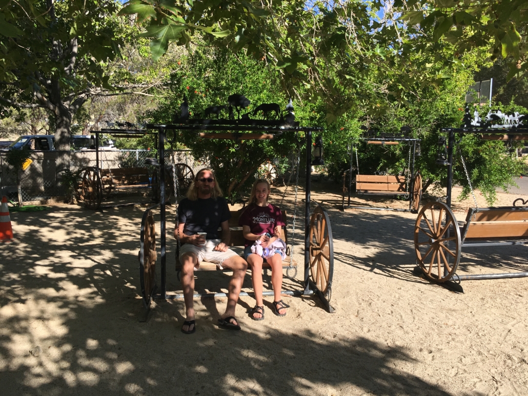
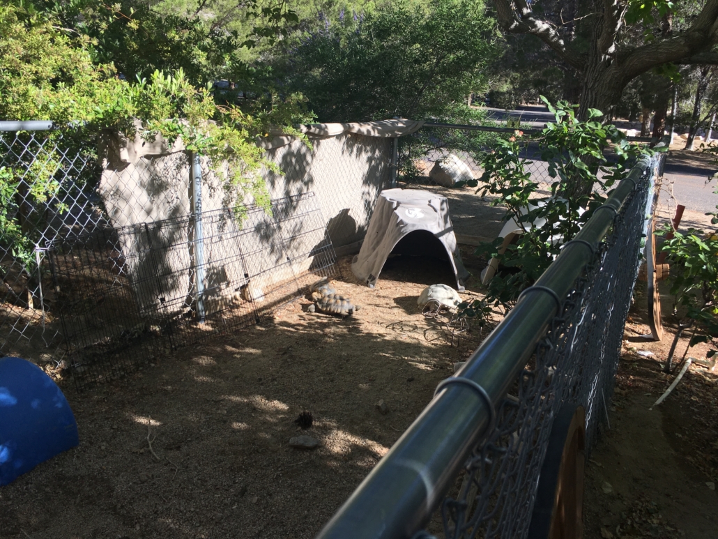
At this point we had been driving all day so we spent the night in Lone Pine at the Boulder Creek RV Resort. I was rather impressed with the campground. The sites are nicely spaced and clean and they have a well stocked store. They also have quite a few fun things to do on the grounds. There is a pool, playground, birds, desert tortoises, and a handful of swings to relax in. We didn’t spend much time at camp but it made for a nice place to stay on the way up the 395. The only downside is you have to actually call to make reservations. I run into this every so often and it boggles my mind.
Boulder Creek RV Resort Campsite
Swings at Boulder Creek RV Resort
Desert tortoise enclosure
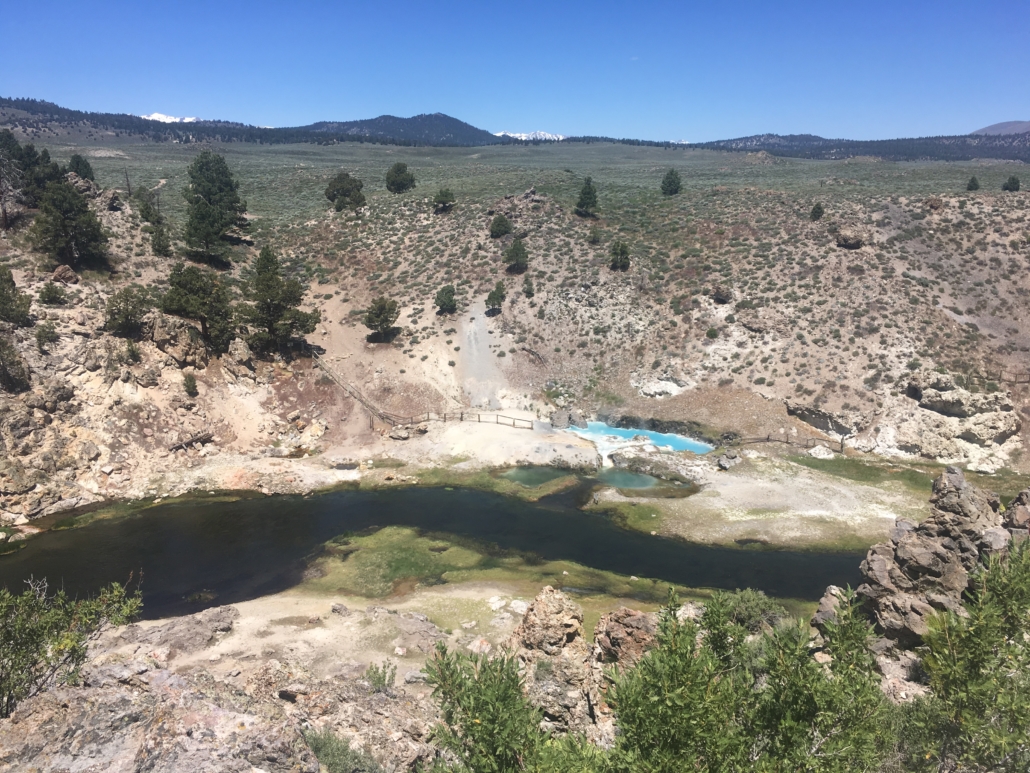
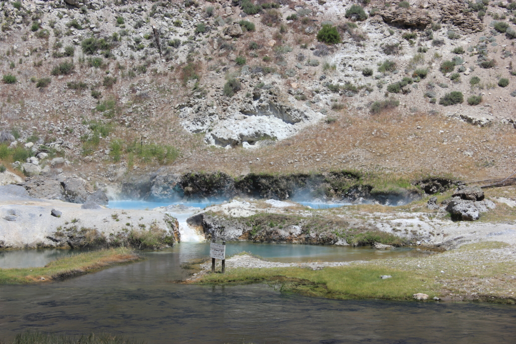
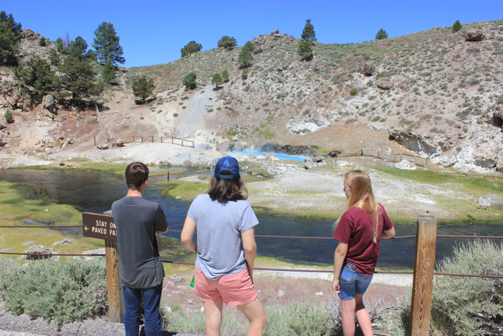
Our next stop was the Hot Creek Geological Site. A chamber of magma lies below the surface causing boiling hot water, colored pools, fumaroles, and occasionally geysers. It’s a couple miles off the highway and easy to get to. The first two miles are paved and the final mile is dirt but well maintained. There is a short, steep paved path down to the river.
Hot Creek Geological Site
You cannot go in the river or walk over to the pools but you can get close enough to see the steam coming off the pools. That blue color is really incredible.
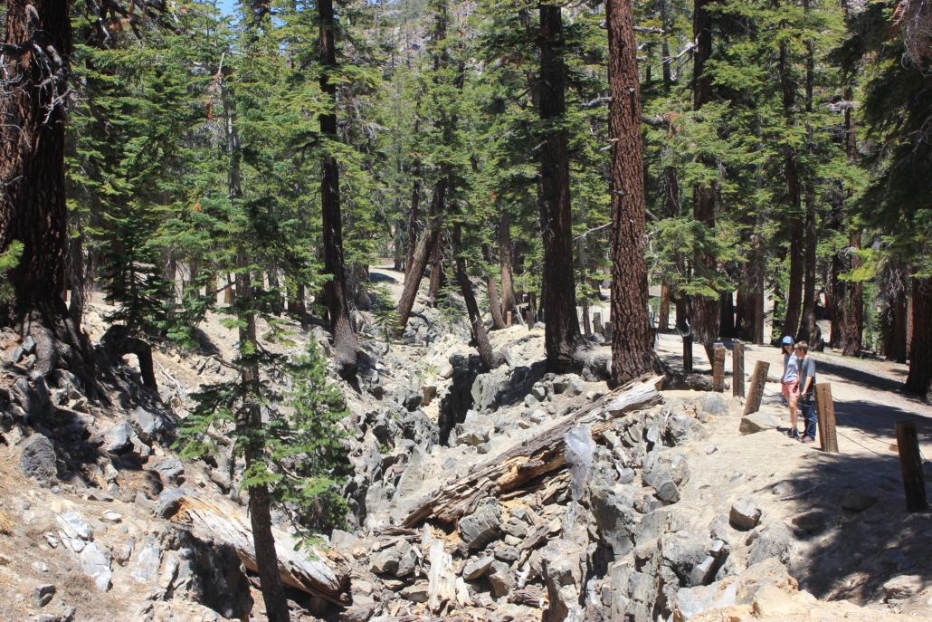
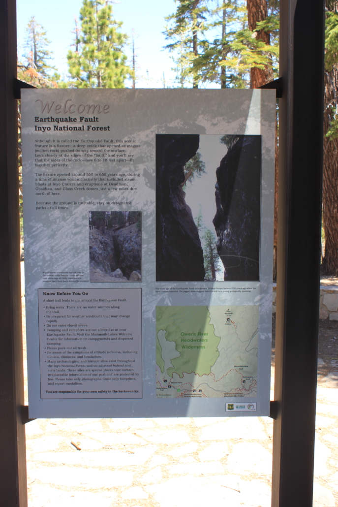
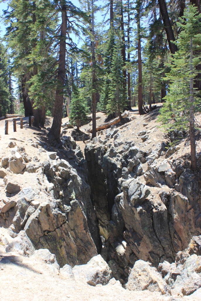
The Earthquake Fault in Mammoth Lakes was a little farther of a stop than I expected but the area is beautiful and the fault was cool to see. Technically it’s a fissure but it was caused by an earthquake and you can see how the two sides of rock go together. Aside from the neat history lesson and geology, the forest is gorgeous and the trees are huge. I’d love to come back to this area to camp and ride bikes.
Earthquake Fault – Mammoth Lakes
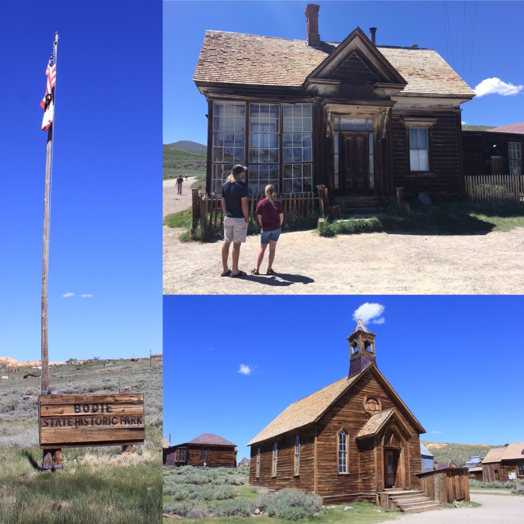
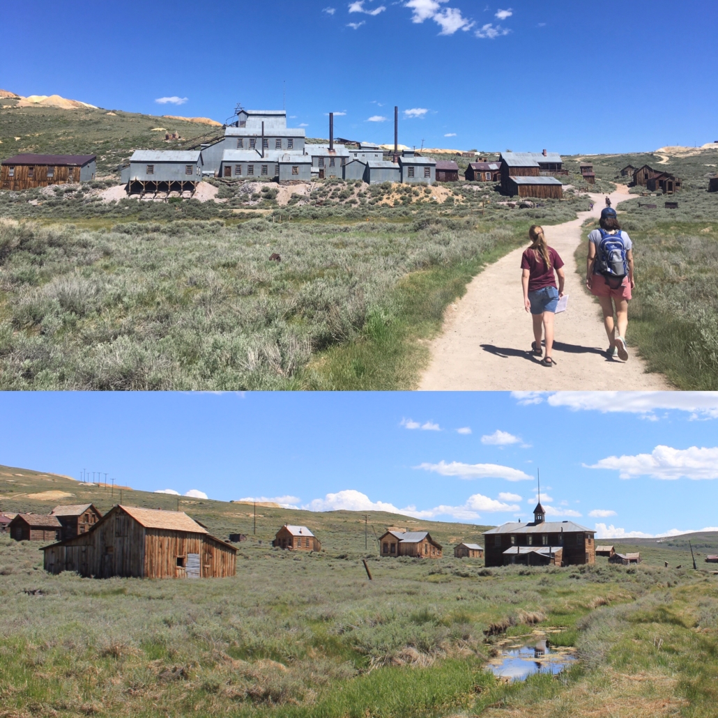
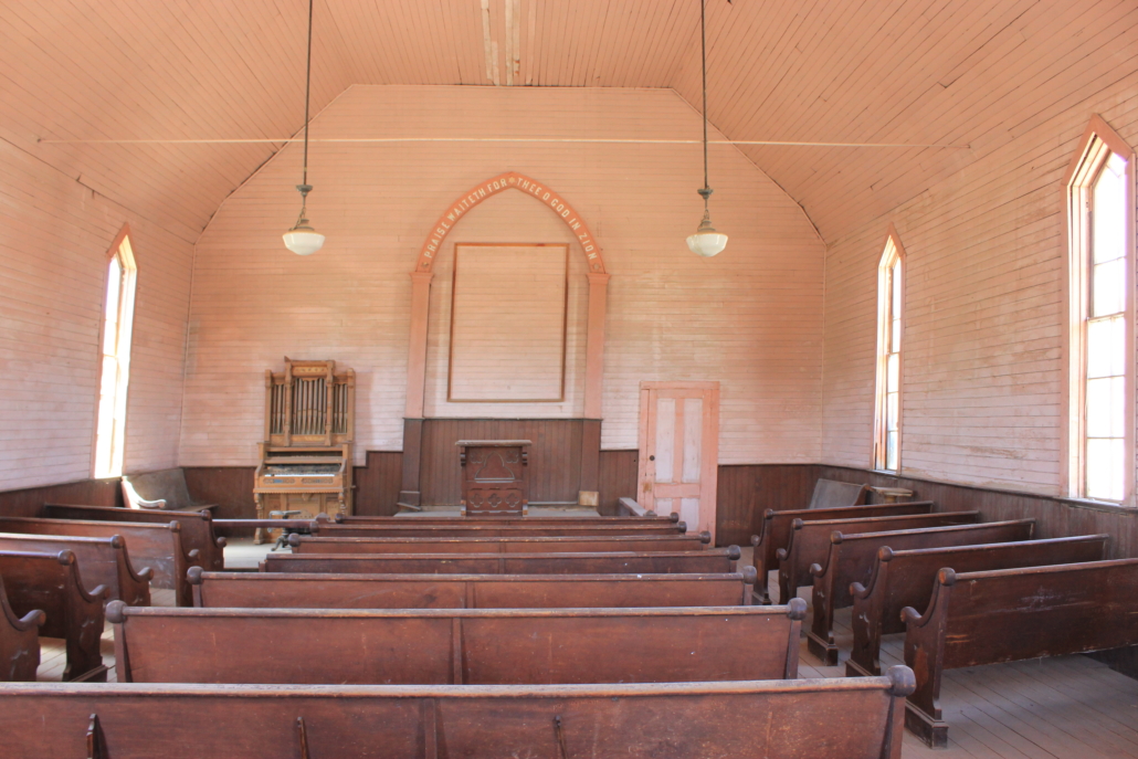
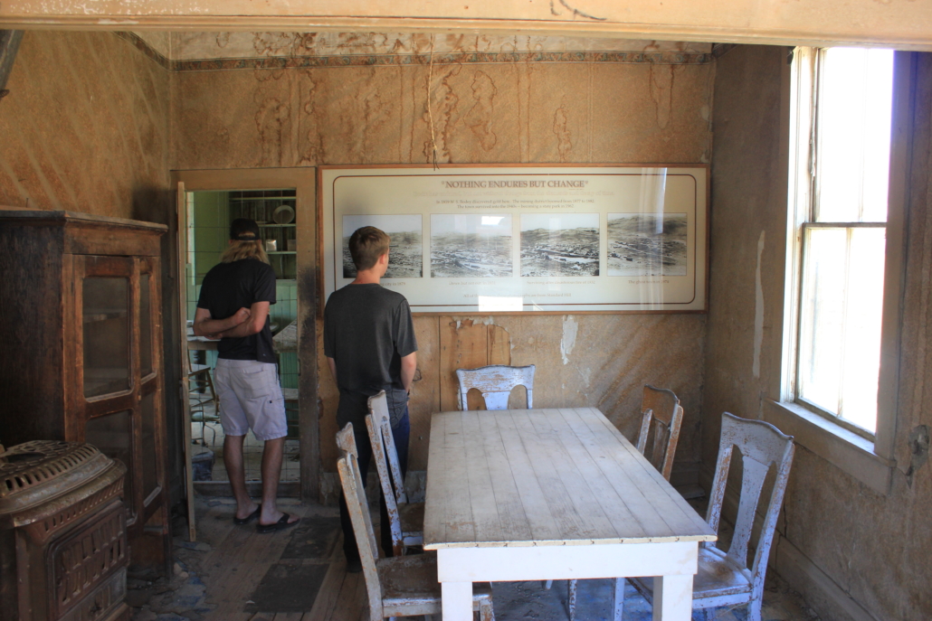
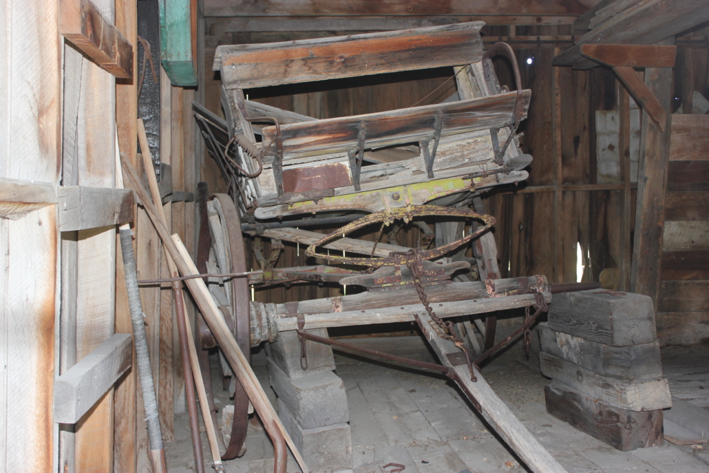
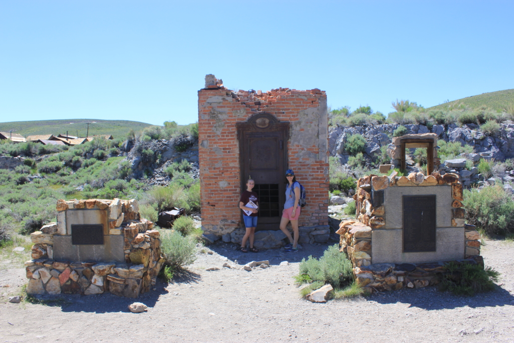
Our final stop on the 395 was Bodie Historical State Park, a gold-mining ghost town. Bodie is a little farther of a journey off the highway, about 20-30 minutes each way, but definitely worth a stop. Because Bodie is a state park there is a small entrance fee. Additionally, for $2 cash, they sell a brochure that tells the history of each building. I would recommend getting the brochure. It made walking through the town more exciting because we knew what we were looking at.
My favorite stop in the town was the bank, or what’s left of the bank. I spent many years working for a bank and have a soft spot for all things banking.
The only downside of driving the 395 was the gas prices. We paid $4 – $5 a gallon in all of California, but the highest prices were definitely along the 395. It’s a collection of small towns so high prices are expected but it definitely hurts the wallet.
If you are planning a trip to this area check out California Thru My Lens. Josh has tons of information on all the stops along the 395.
https://www.theroadwevetraveled.com/wp-content/uploads/2019/07/IMG_4996.jpg30244032Carolinehttp://www.theroadwevetraveled.com/wp-content/uploads/2015/08/RWT_Logo@3x-300x143.pngCaroline2019-07-29 05:21:192019-09-02 18:47:21Highway 395 in California
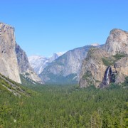
After Sequoia we headed to Yosemite. Yosemite spans nearly 1,200 square miles but the majority of the visitors stay within the seven square mile area know as Yosemite Valley. Many of Yosemite’s well know features can be accessed or seen from the valley. Read more
https://www.theroadwevetraveled.com/wp-content/uploads/2013/08/img_1186.jpeg9331400Carolinehttp://www.theroadwevetraveled.com/wp-content/uploads/2015/08/RWT_Logo@3x-300x143.pngCaroline2013-08-31 17:35:492020-05-31 03:37:50Yosemite National Park
After our Yellowstone trip we fell in love with the National Parks. We immediately started planning our next National Park trip and picked Yosemite as the destination. Read more
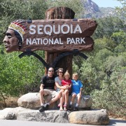
https://www.theroadwevetraveled.com/wp-content/uploads/2013/08/img_0401.jpeg9331400Carolinehttp://www.theroadwevetraveled.com/wp-content/uploads/2015/08/RWT_Logo@3x-300x143.pngCaroline2013-08-16 05:15:472020-05-31 04:02:26Sequoia and Kings Canyon National Parks