Ouray, Colorado – The Switzerland of America
I am in love with Ouray, Colorado, affectionally known as the Switzerland of America. The only thing it doesn’t have is mountain bike trails. It’s probably best that way because if it did we might have to move. We spent three glorious days in Ouray and it’s exactly what we needed. We had fun in Durango (which was our first stop on our summer road trip) but our campground was too noisy and crowded so we didn’t get to enjoy the peace that should come with camping. We have come to realize that we are campground people; not so much RV park people. Fortunately, our next stop was Ouray where we got the peace and quiet we were looking for.
The Million Dollar Highway
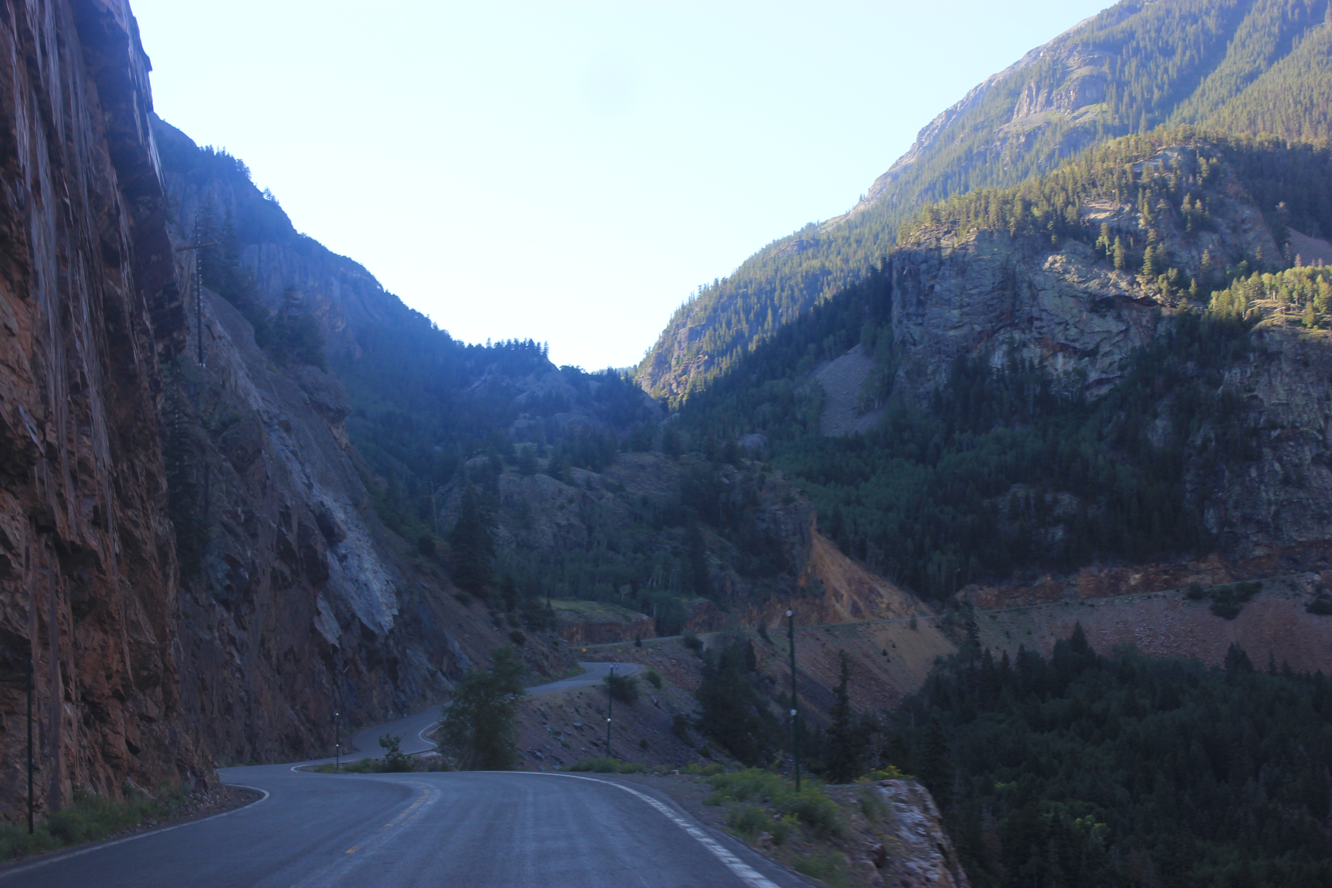
If you haven’t driven the Million Dollar Highway in Colorado you should definitely add it to your bucket list. Actually, if you don’t have Southwest Colorado on your bucket list just go ahead and add it. You’ll thank me later. The Million Dollar Highway is the section of Highway 550 that connects Silverton, Colorado and Ouray, Colorado. It’s not for the feint of heart as there are no guard rails and some very narrow shoulders with steep drop offs. I mean, the drive is beautiful if you like mountain passes above 10,000 feet, wildflowers, abandoned mines, ghost towns, tall trees, and sweeping vistas. If that’s not your thing then you might want to stay home. 😉
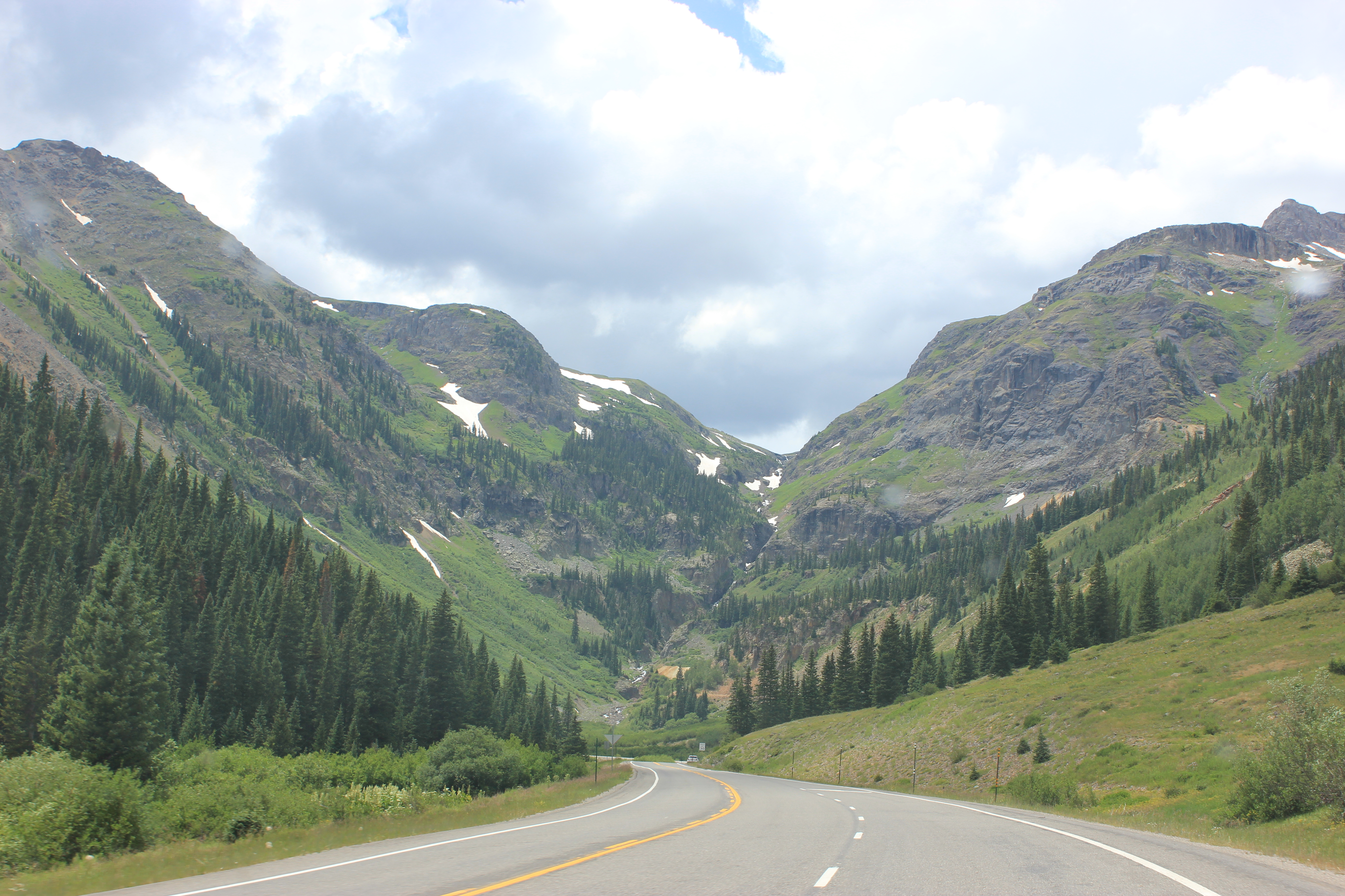
View from the Million Dollar Highway
View from the Million Dollar Highway
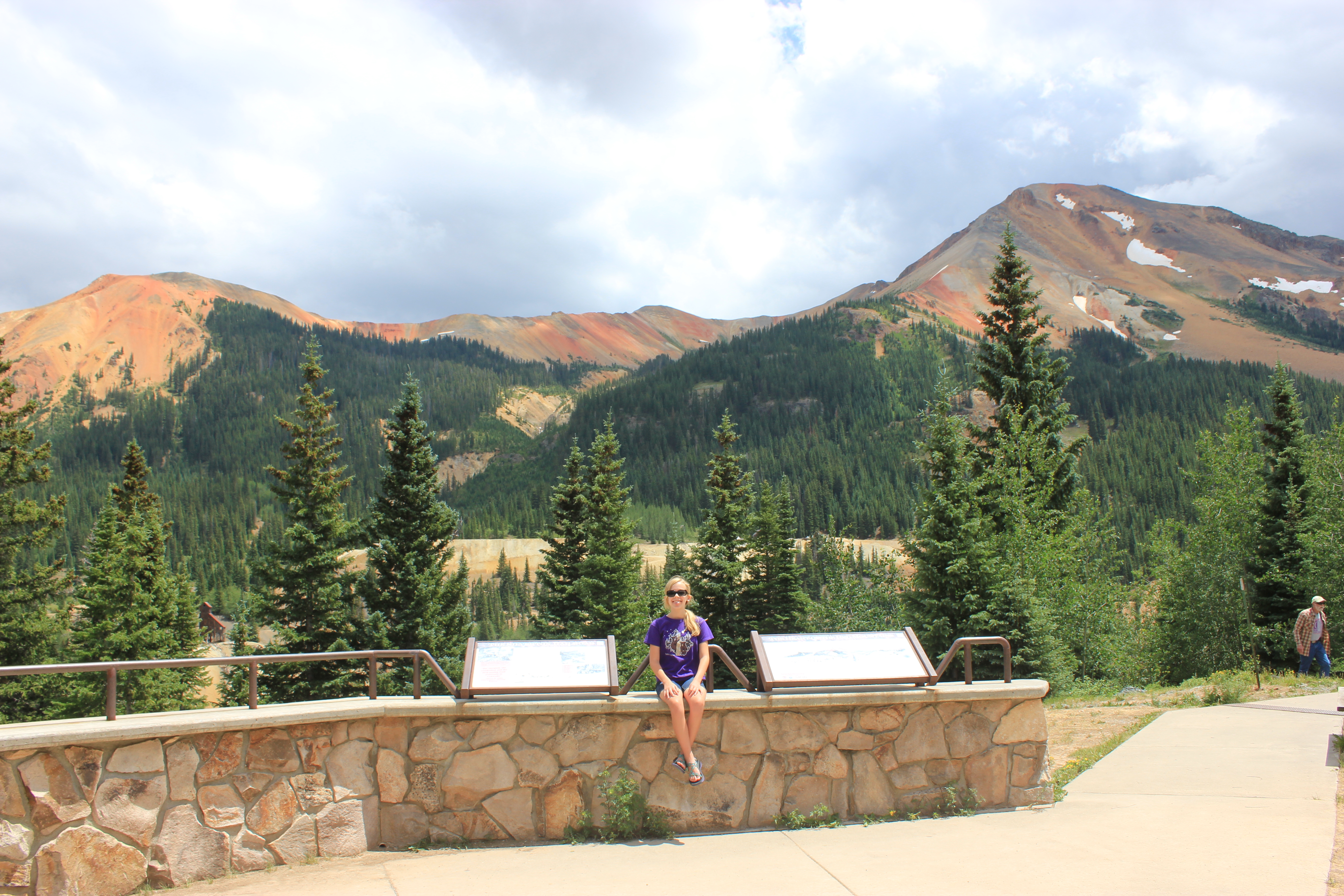
The highest point on the Million Dollar Highway is Red Mountain Pass at 11,018 feet.
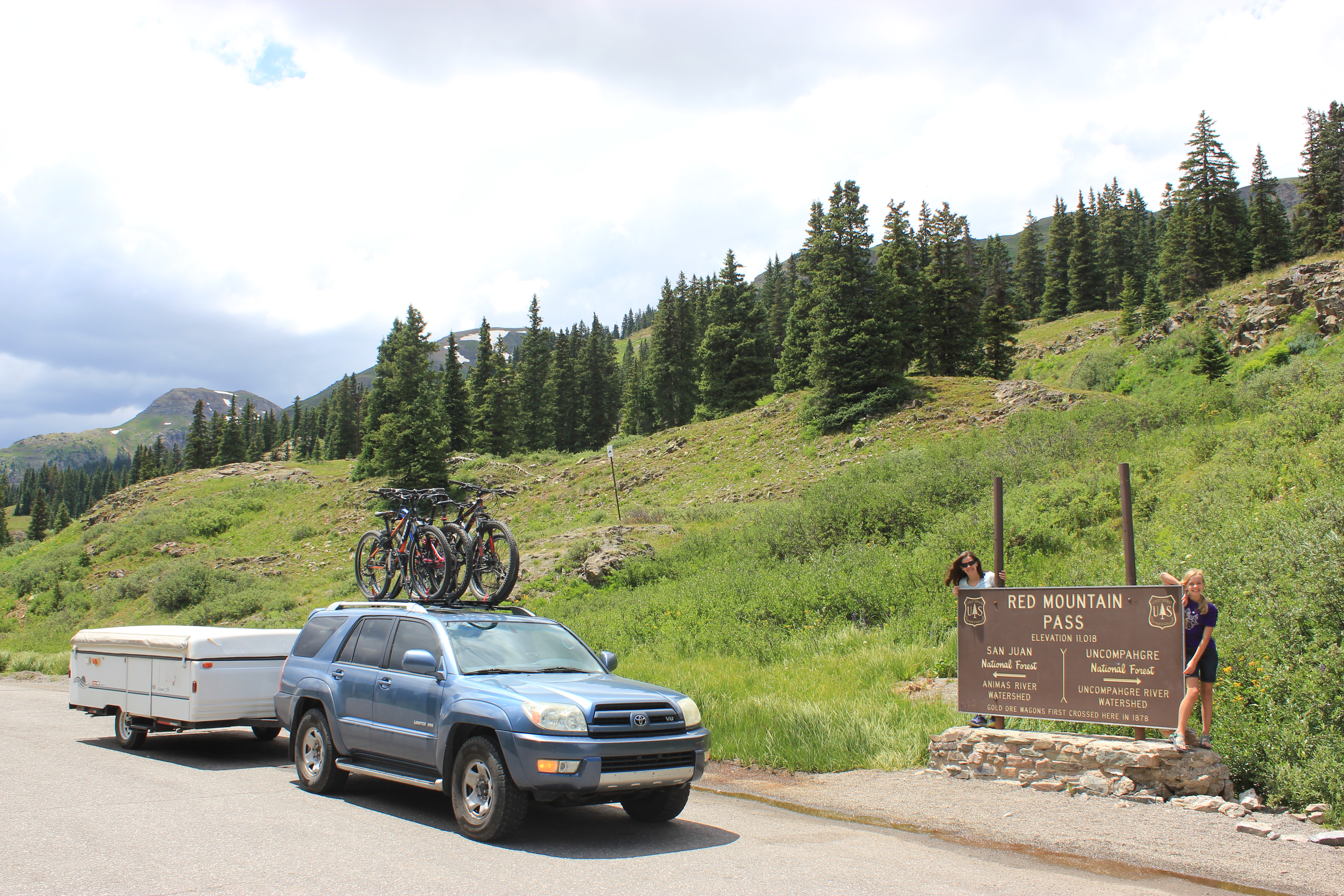
Red Mountain Pass
About half way between Silverton and Ouray is a parking area for the Red Mountain Overlook. In addition to views of the incredible Red Mountain, there is a small ghost town. You cannot enter the houses but you can get close enough to look in the windows.
Red Mountain Overlook
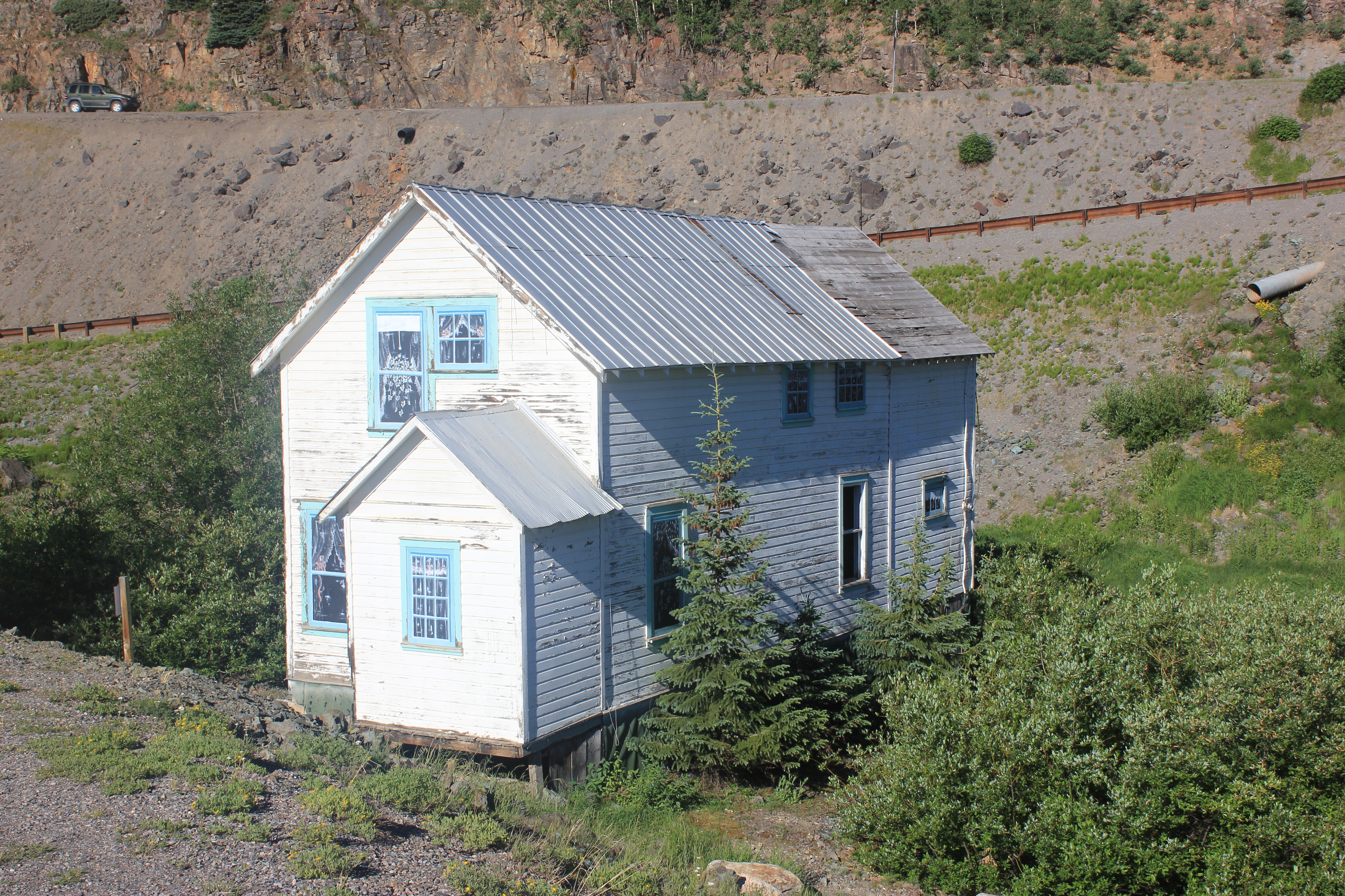
Ghost Town near Red Mountain Overlook
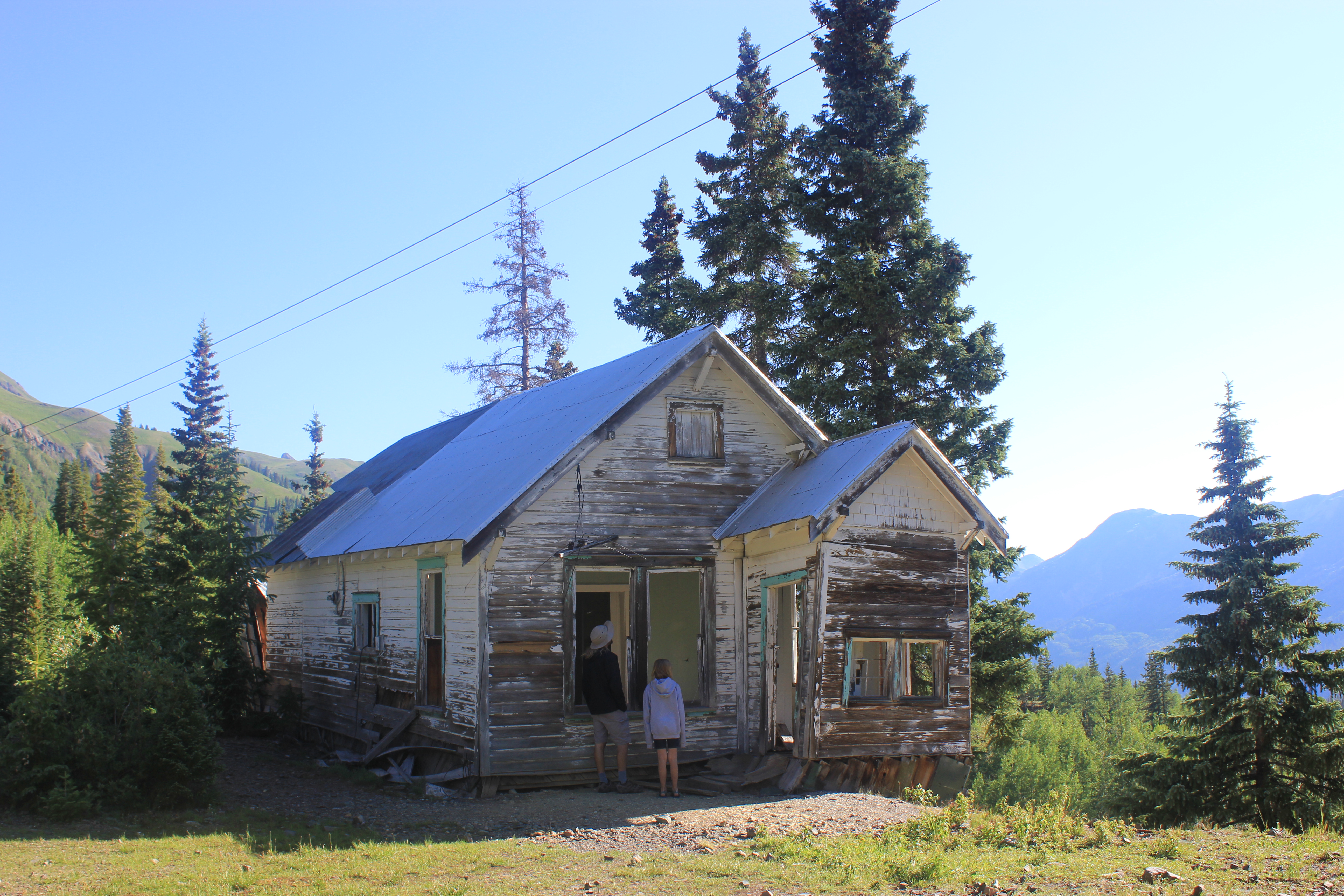
Ghost Town near Red Mountain Overlook
As you near Ouray the road gets pretty crazy. The speed limit is low and everyone was very courteous of larger vehicles but I’d hate to be on this road in the rain or snow. We were towing our pop-up so I was glad to be on the inside edge.
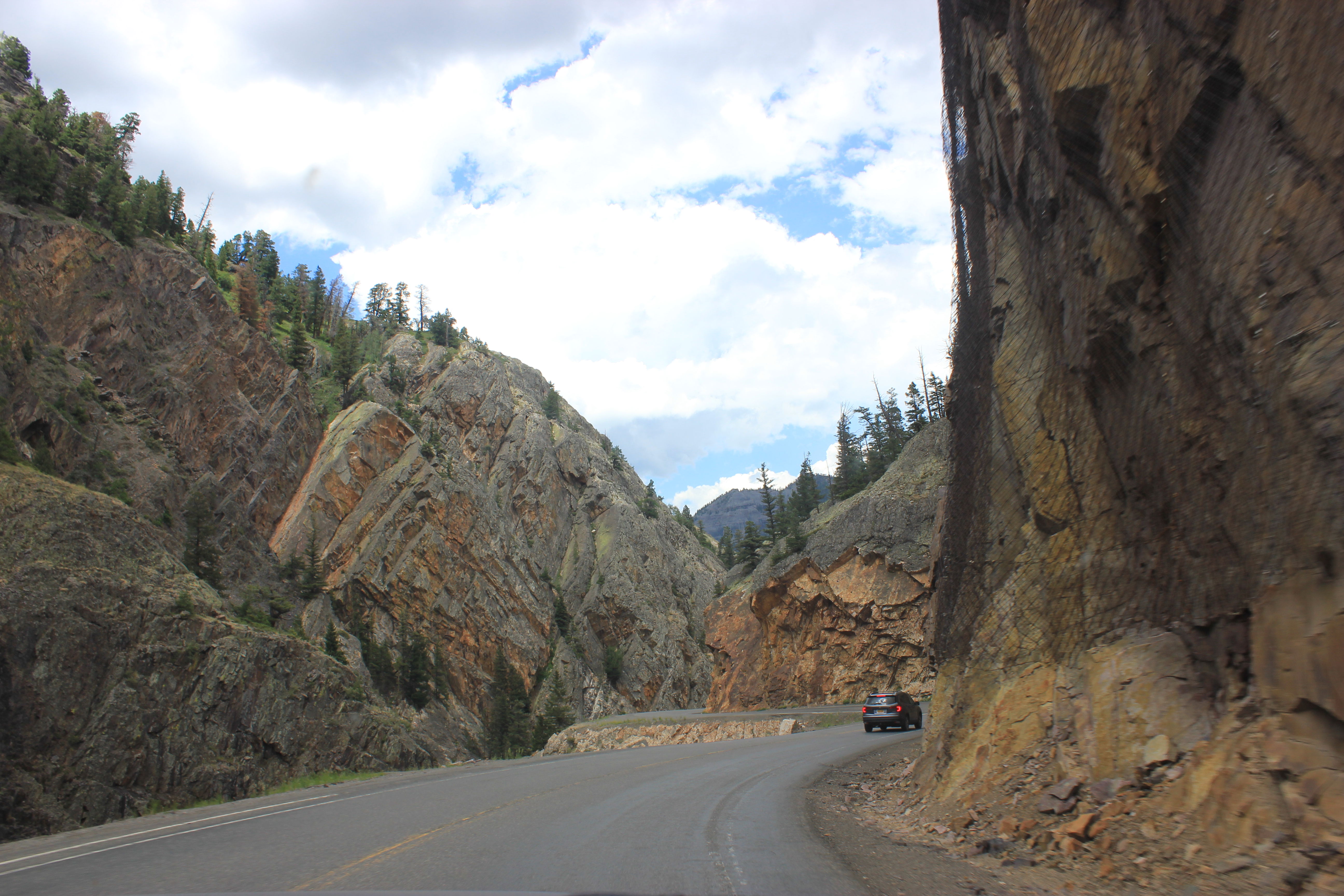
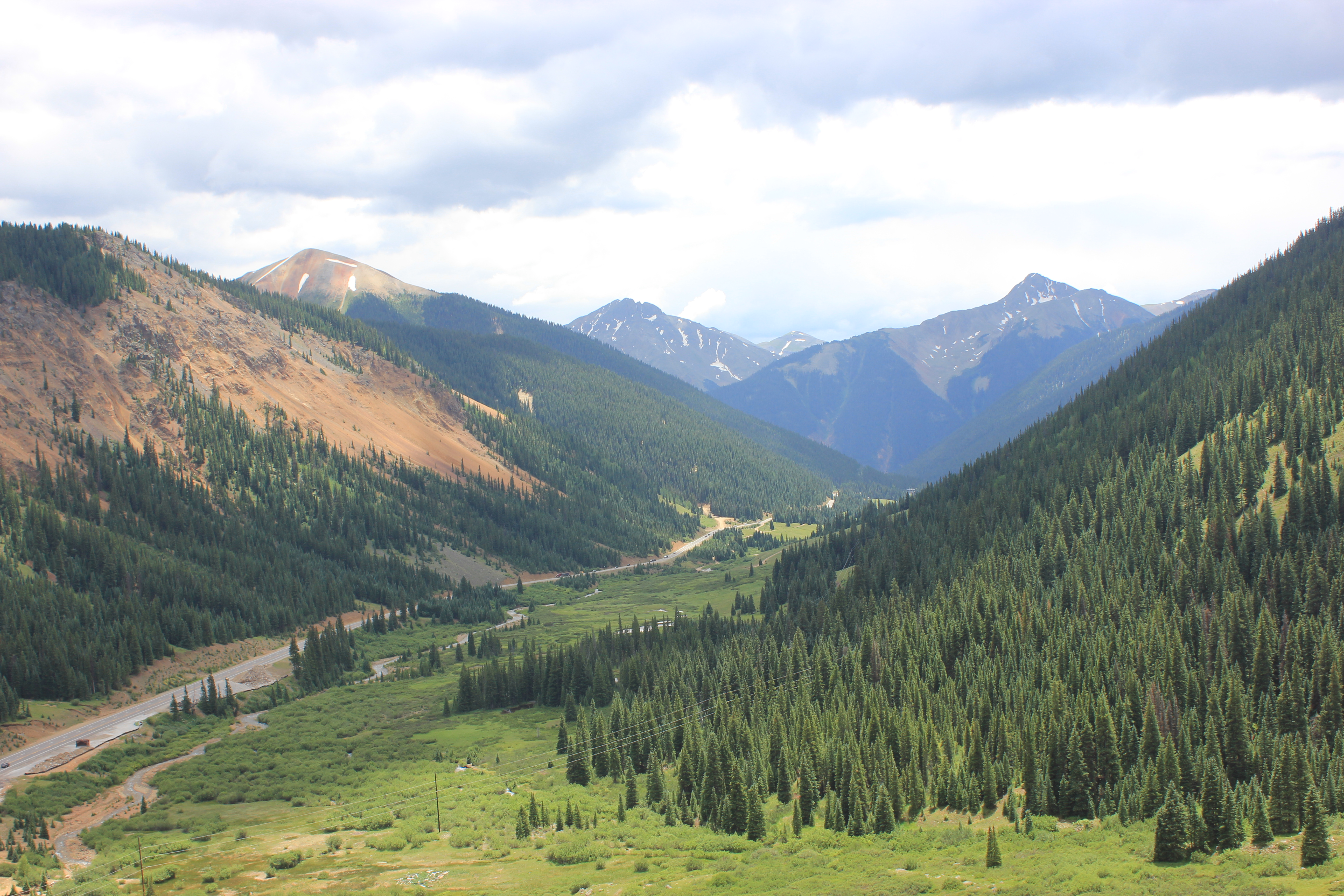
Million Dollar Highway (U.S. 550)
Million Dollar Highway (U.S. 550)
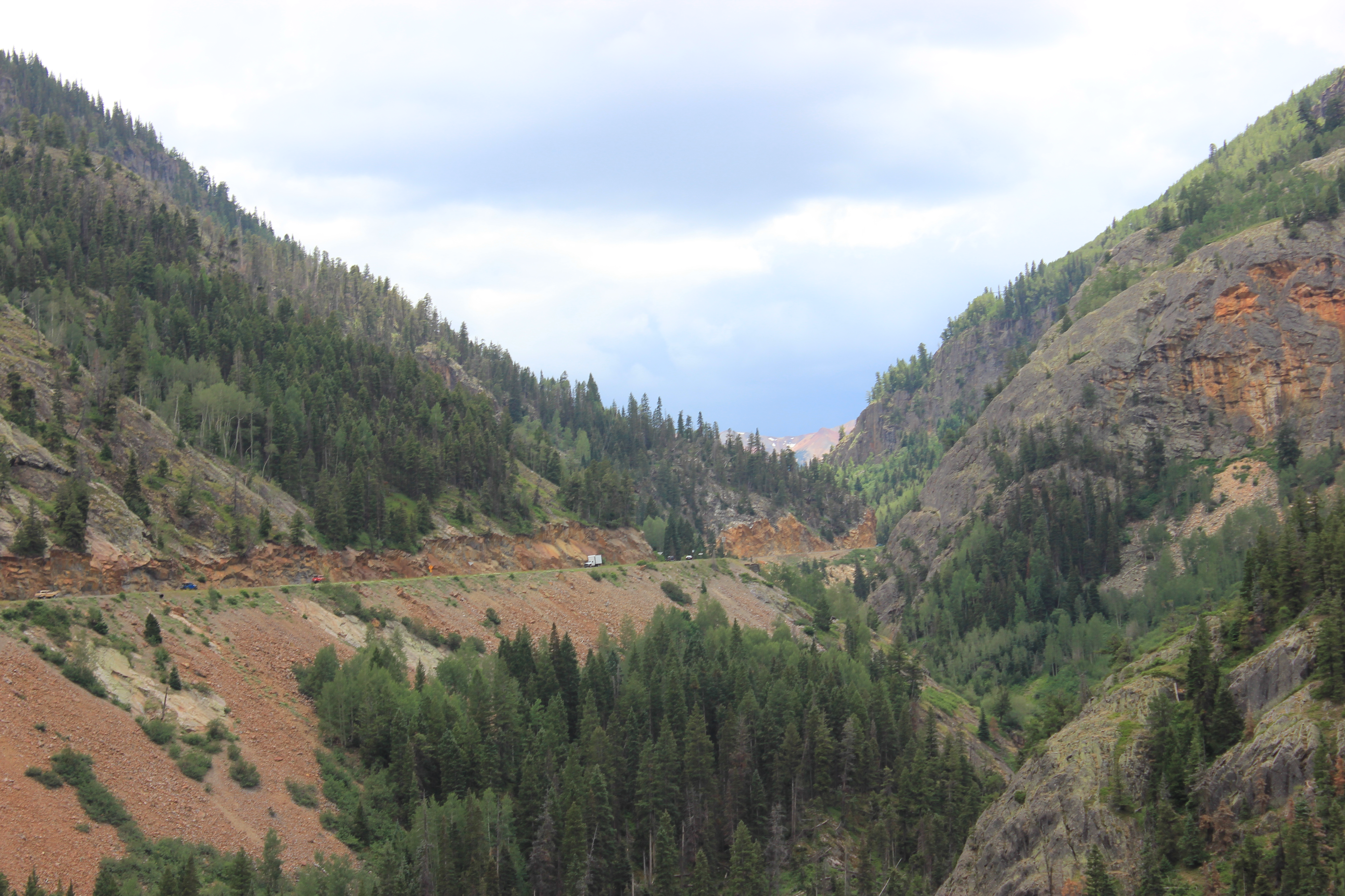
Million Dollar Highway (U.S. 550)
There are several suggestions as to why it’s called the Million Dollar Highway. One thing is for certain though; it’s an incredible drive.
Amphitheater Campground
We stayed at the Amphitheater Campground which is just outside of Ouray. This is one of my all time favorite campgrounds.
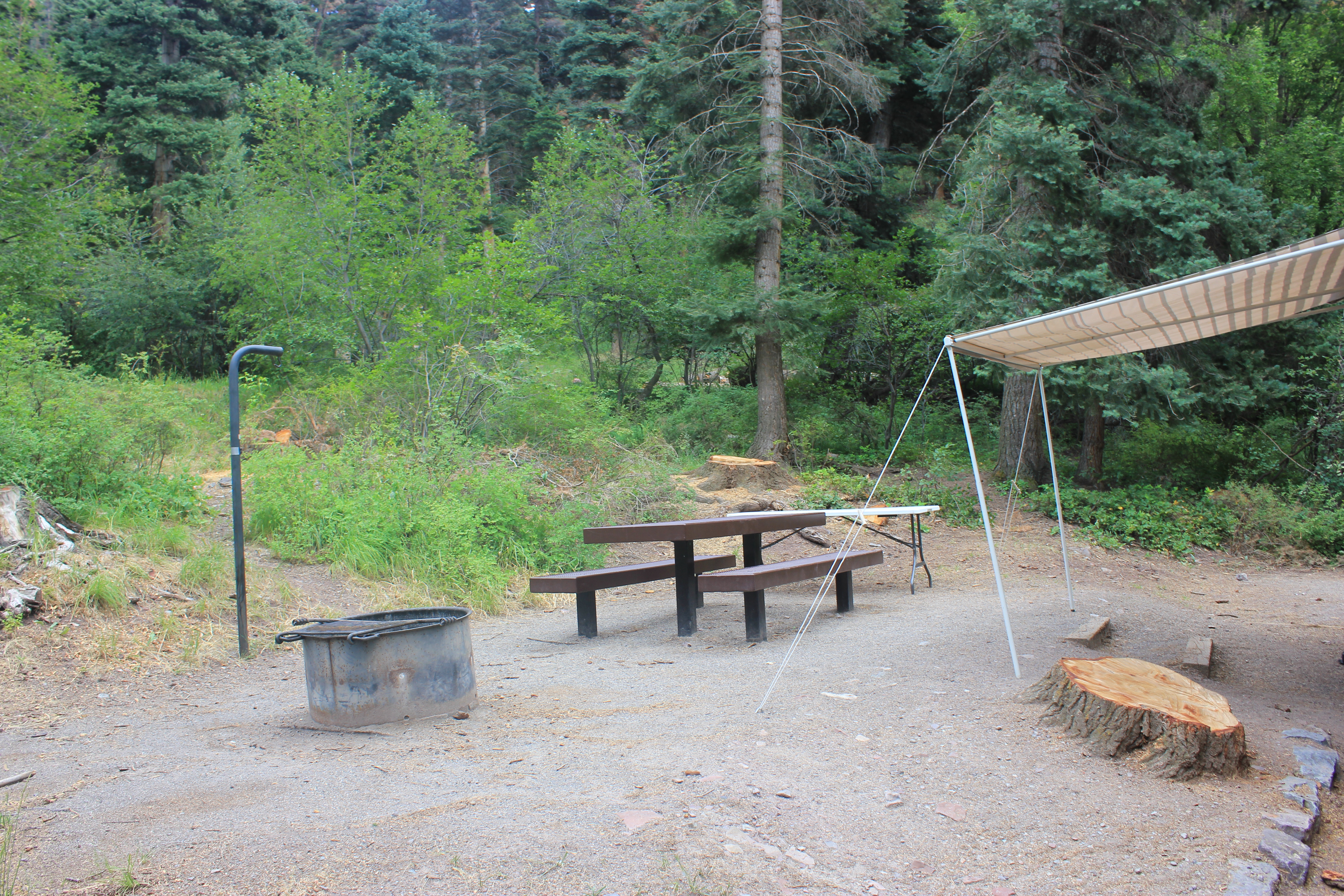
Amphitheater Campground
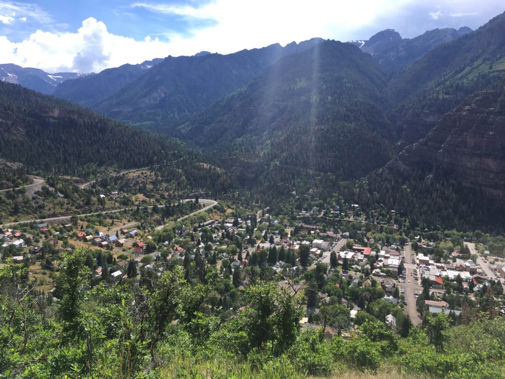
The campground sits just above Ouray and is nestled in the trees in the middle of the picture below.
We were in site 4 and it was an awesome site. We were surrounded by lots of trees and it felt very private. Site 6, however, was more open but has amazing views. It would be a great tent site. If you have an RV the door will open on the wrong side but it’ll be worth if for the views from your camp chair. The road up to the campground is narrow with some tight curves, so be sure to check the RV size limits before making your reservation. The campground is near several hiking trails and has a gorgeous overlook of the town of Ouray below.
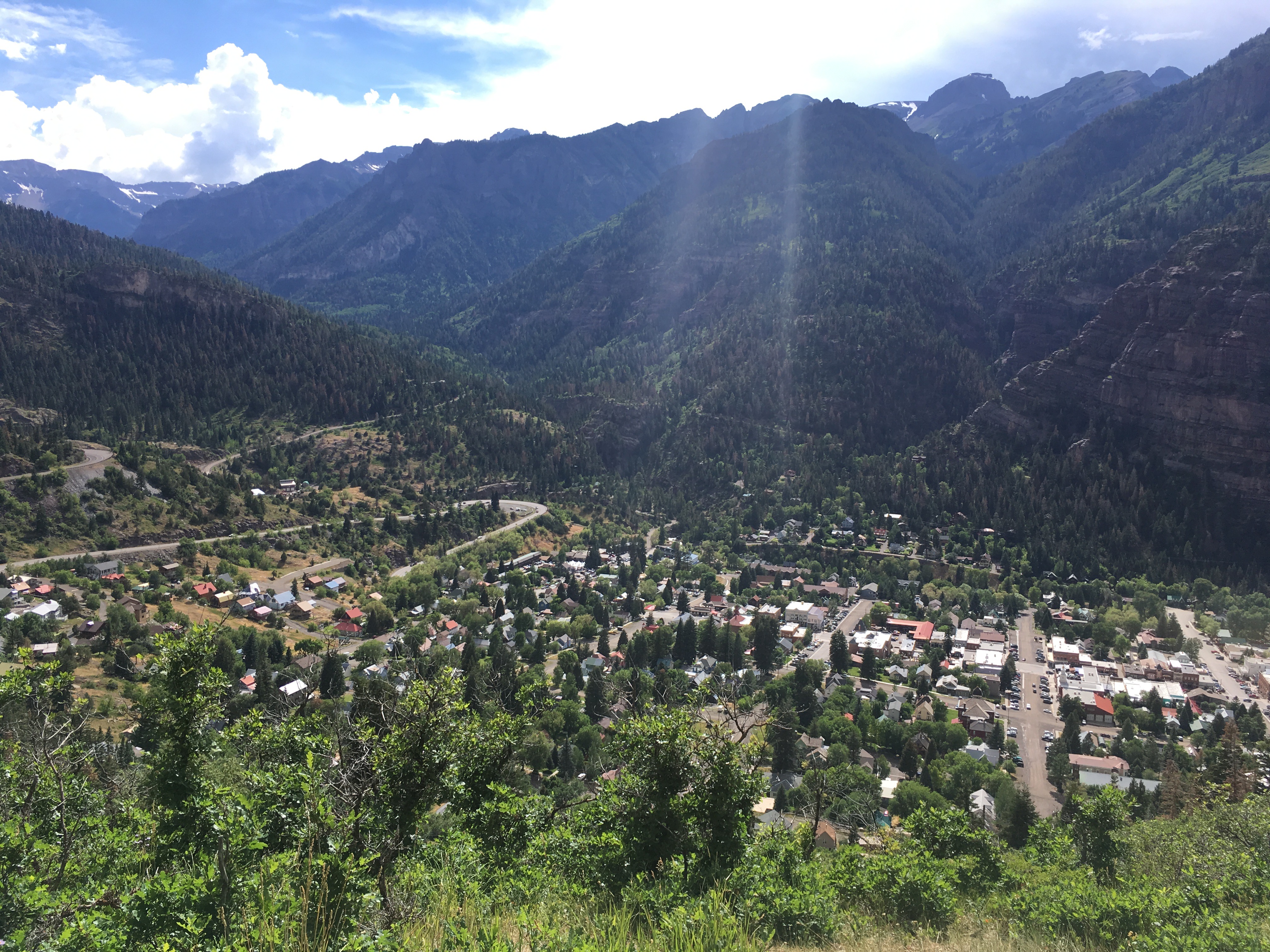
Ouray from the Amphitheater Campground Overlook
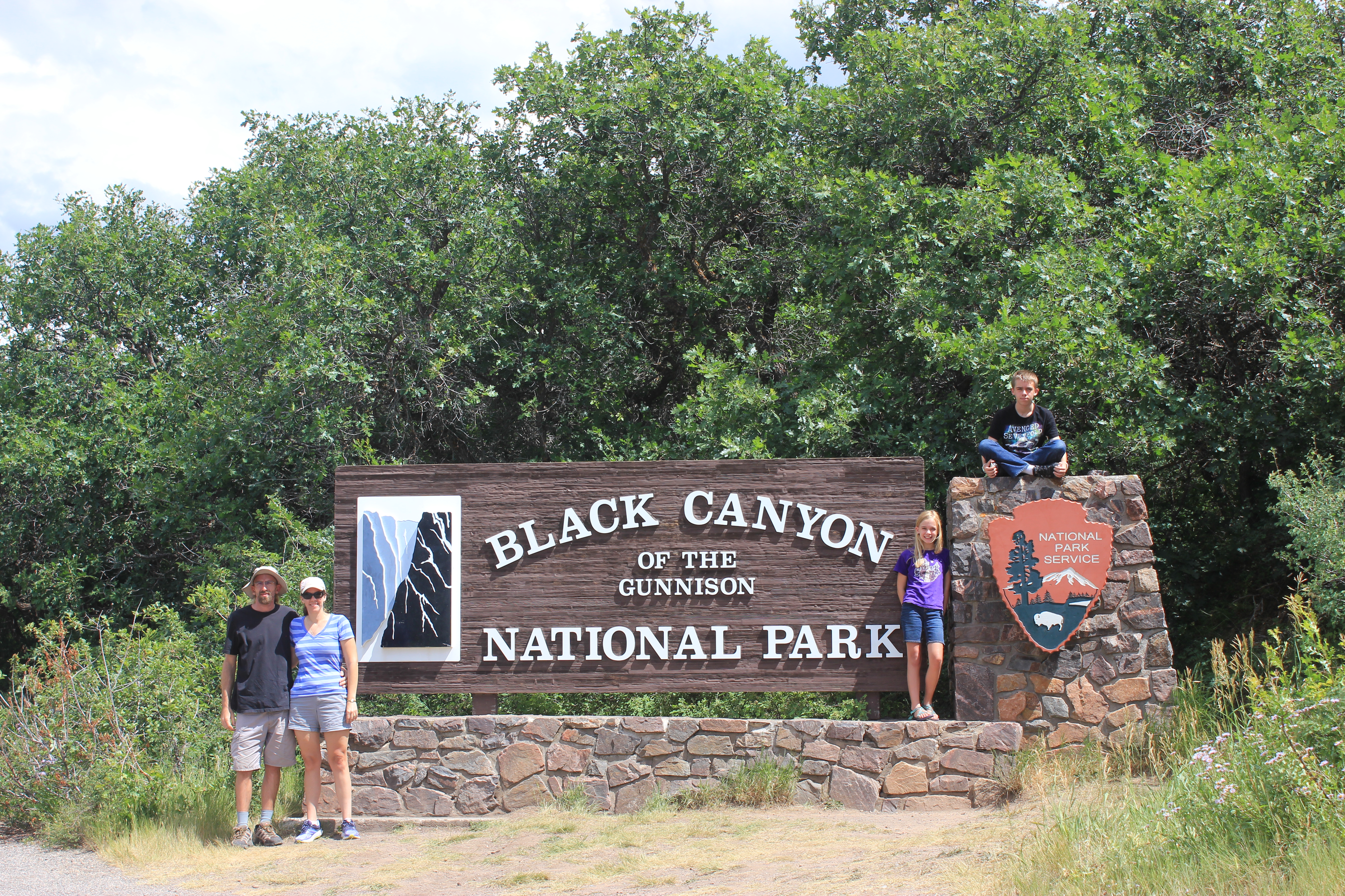
Black Canyon of the Gunnison National Park
While in Ouray we took a day trip to Black Canyon of the Gunnison National Park .
Our GPS said Black Canyon was one hour from Ouray. As we were nearing the end of the hour I was starting to question the GPS. We were still in the city and the mountains seemed far away, but then all of a sudden the canyon appeared! I assume it was similar to what the early explorers felt when they stumbled upon Black Canyon. You’re walking or riding along and next thing you know there’s a 2,000 foot canyon in front of you.
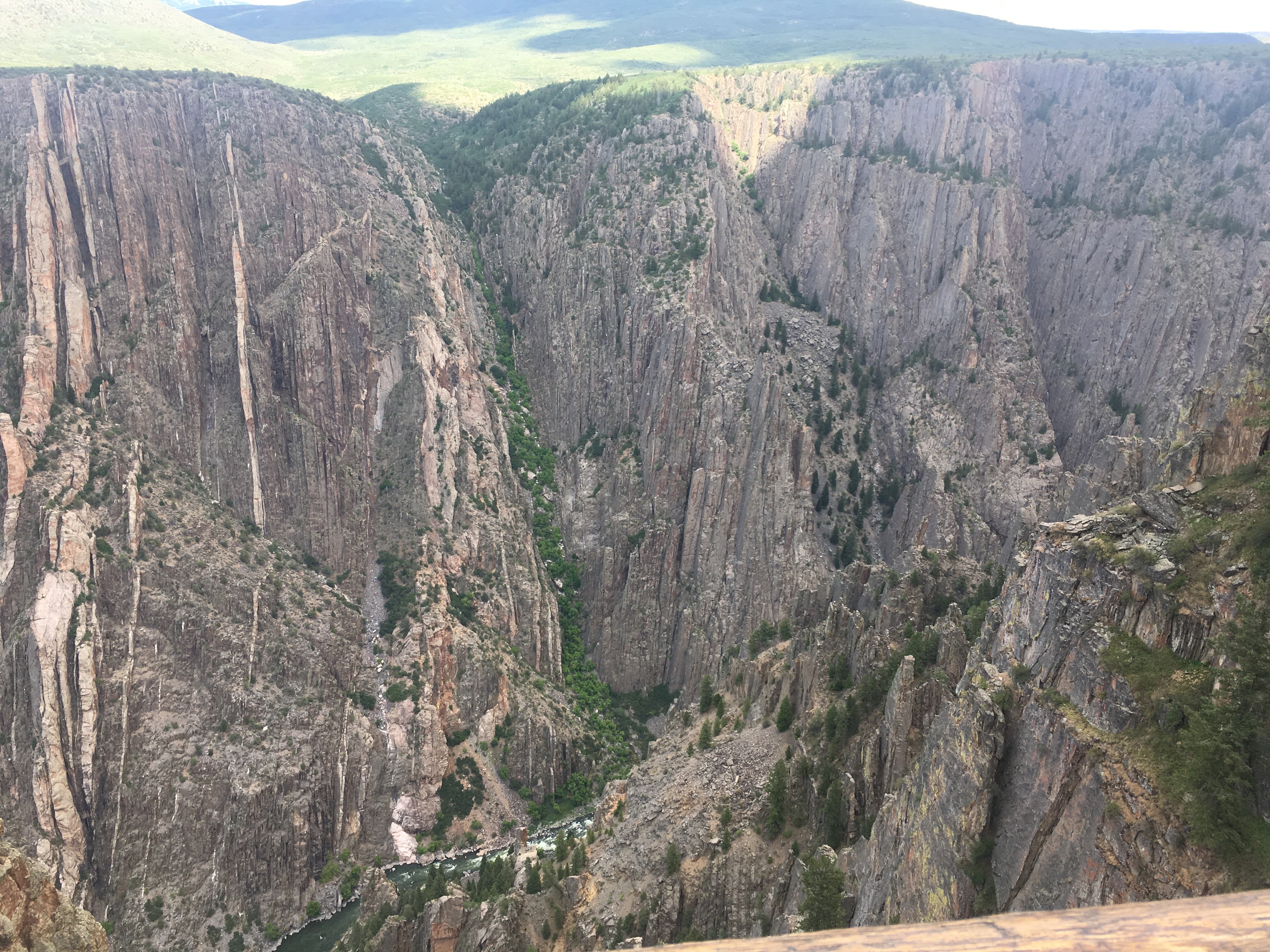
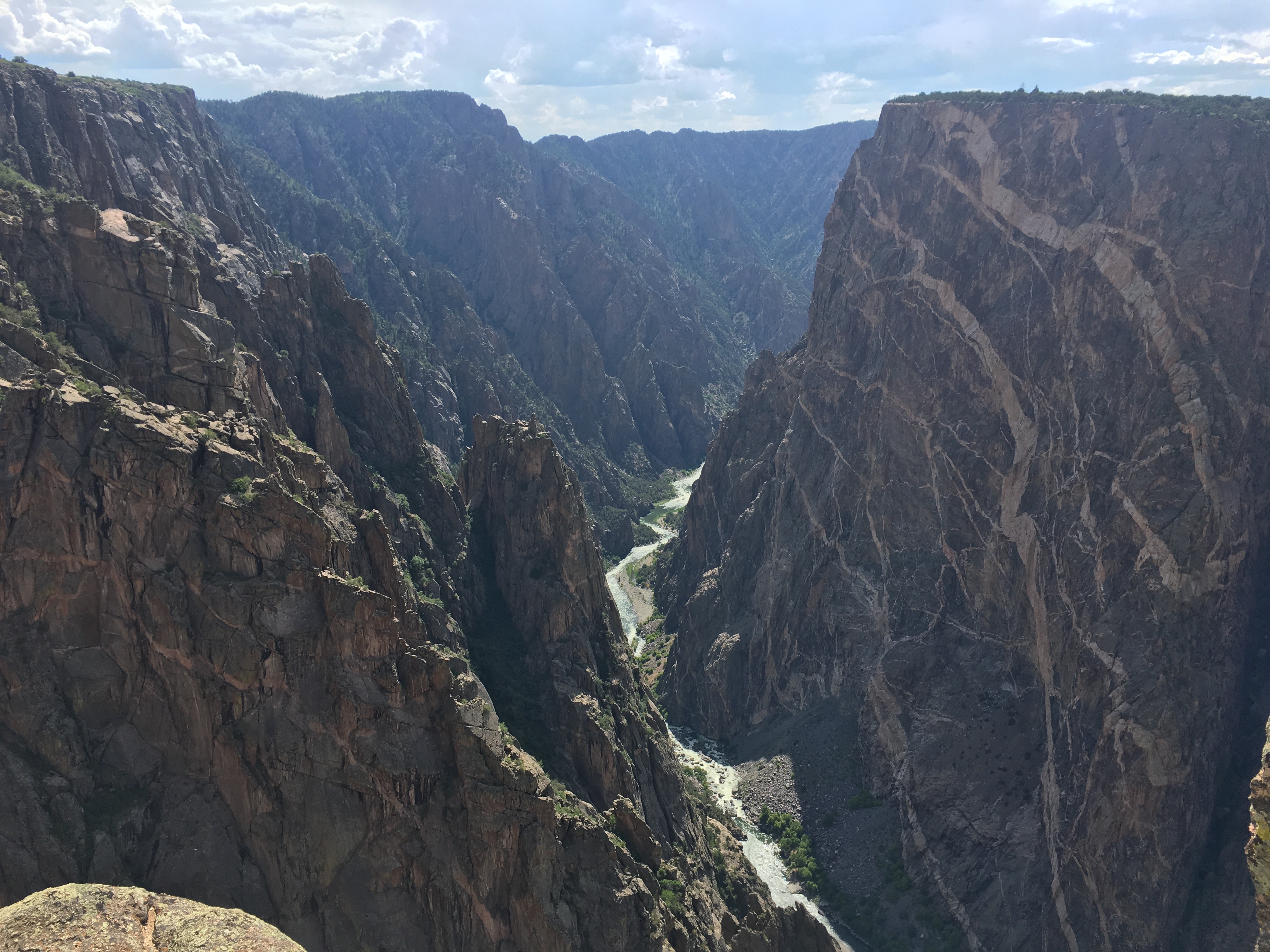
Black Canyon of the Gunnison
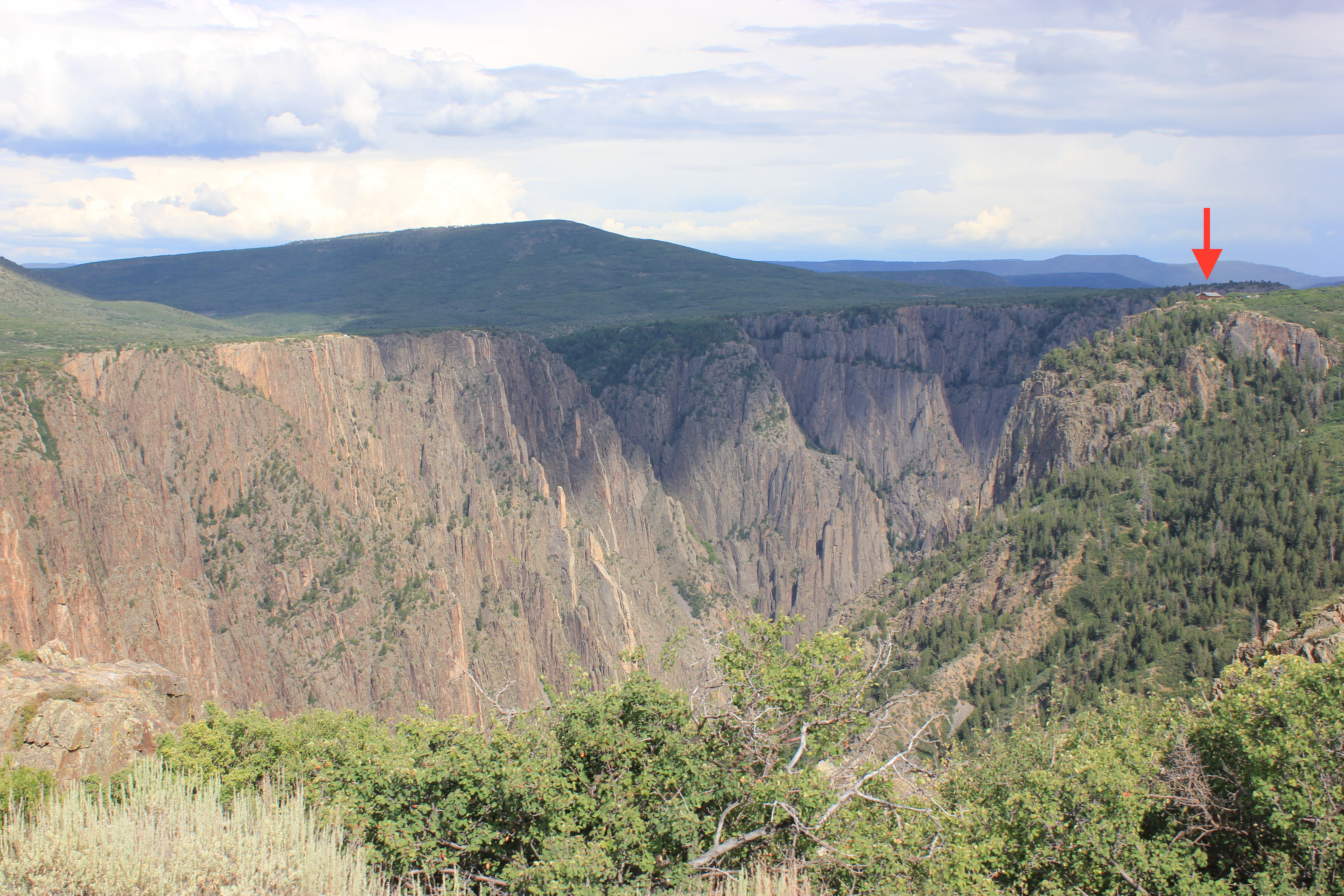
Black Canyon is a narrow canyon at only 40 feet. With a depth of 2,000 feet, the walls are often in the shadows which is how it got its name. I find it hard to really understand the magnitude of canyons without a little size perspective. In the picture below, the building below the red arrow is the visitor center.
There are three sections to the park – the North Rim, the South Rim, and the East Portal. The South Rim Drive is seven miles and has 12 overlooks. We visited in the afternoon and it was hot so we didn’t spend any time hiking. We just hit the overlooks. The East Portal is a road that takes you down to the river. The road is very steep with a 16% grade. We were out four-wheeling that morning so the kids weren’t interested in anymore slow, steep roads so we skipped visiting the river. There are no developed trails down to the Gunnision River so the road is your only option. Of course, unless you are up for bush whacking your way down and back up and then you can get a back country permit for said adventure. I’ve read stories of people that have done this and I have a much greater respect for them after seeing the canyon for myself.
The Painted Wall in Black Canyon of the Gunnison National Park
While staying in Ouray we also went four-wheeling. That was so much fun though that it deserves its own post. So you’ll have to wait a few days so I can write it. 🙂 If you’ve been to Ouray or have questions about visiting Ouray feel free to comment below.


Leave a Reply
Want to join the discussion?Feel free to contribute!