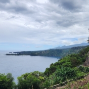
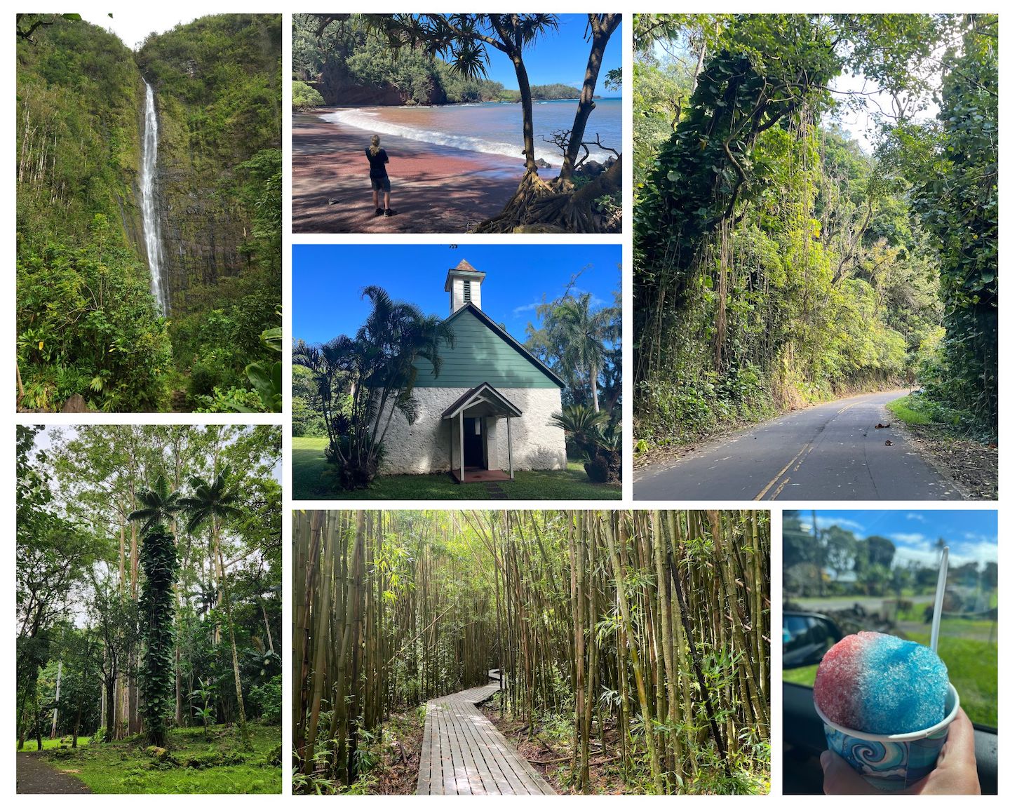
If you’ve been on the Road to Hana you know how epic it is. If you haven’t been on the Road to Hana, you should add it to your bucket list. It legitimately might be one of the most beautiful drives we’ve ever taken. We had some fun and exciting (not) weather on our drive so we got to experience the Road to Hana in a number of situations. Definitely got the heart pounding a little faster at times.
Road to Hana
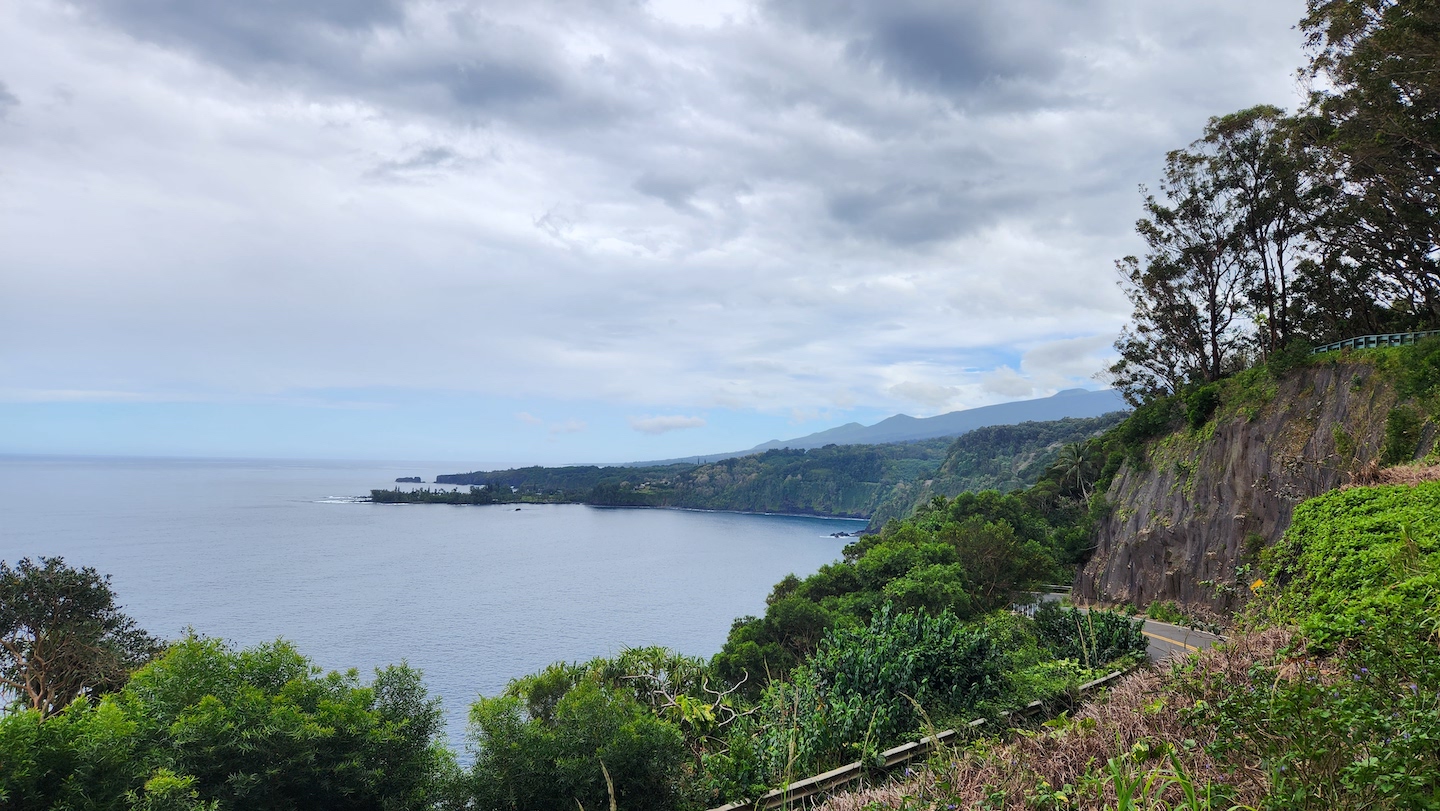
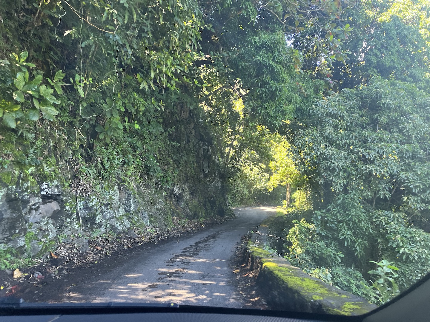
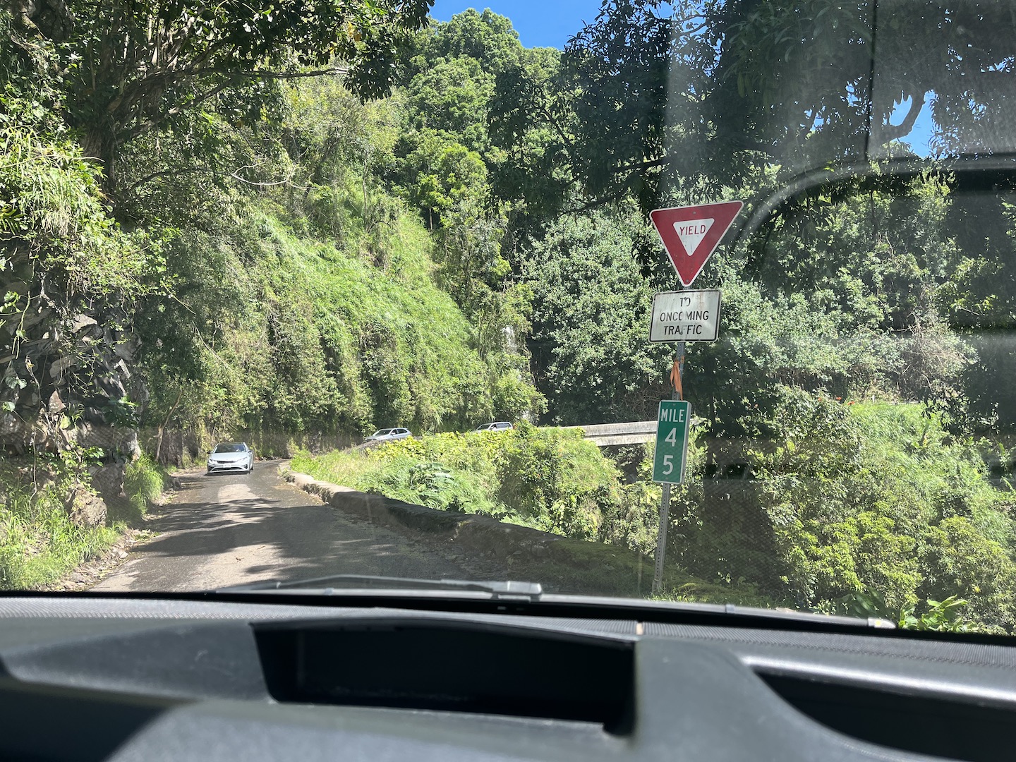
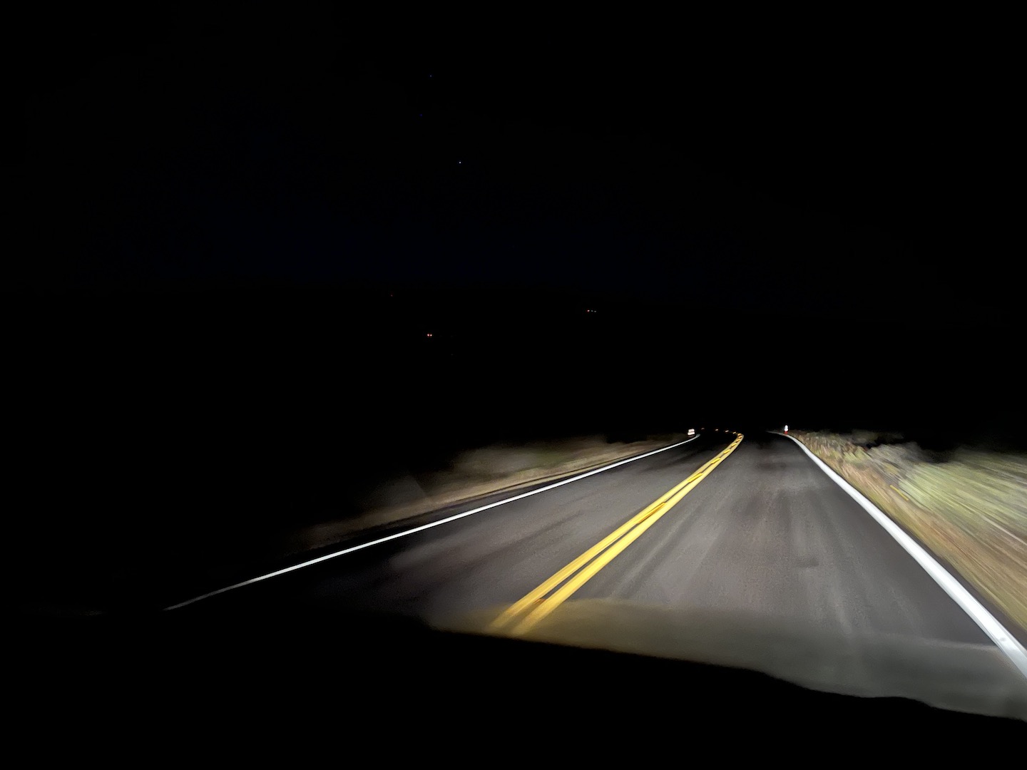
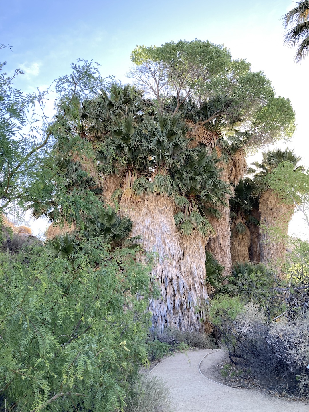
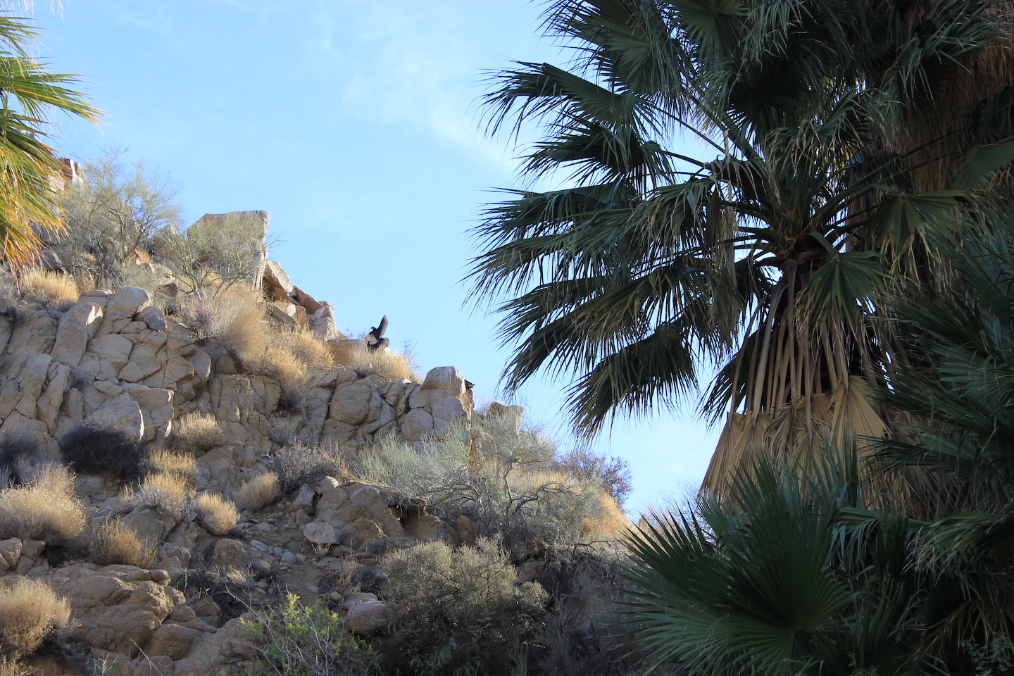
If this is your first time hearing about the Road to Hana, it’s a 59 mile stretch of road in Hawaii on the island of Maui between the towns of Kahului and Hana. The last 35 miles are what people are really referring to when they talk about the Road to Hana. The road takes you though a gorgeous, dense rain forest on the edge of a mountainside. The road is not for the faint of heart. There are 59 one lane bridges and 620 curves in the road. The road is pretty narrow in general and you have to be constantly paying attention.
Road to Hana
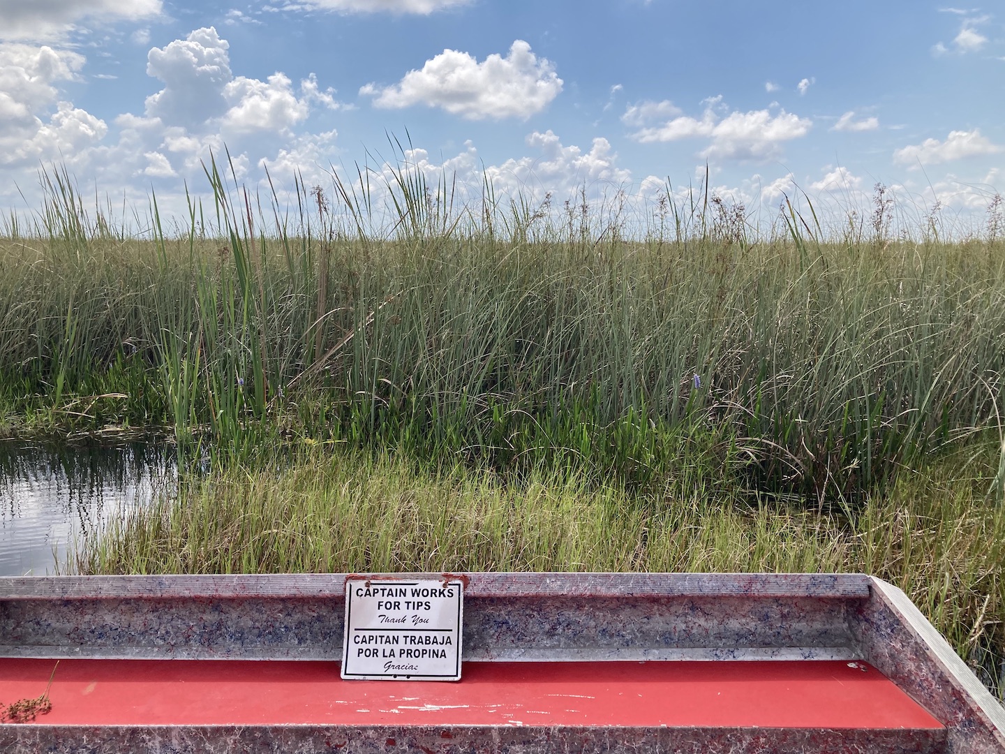
There is etiquette for driving the Road to Hana. Pay attention for locals and let them pass. Another biggie is at the bridges, traffic is supposed to proceed in order of arriving at the bridge. Sometimes one side would never stop which means the other side can never go. It was really frustrating when this would happen. If we all take turns we’ll all get where we are going.
One Lane Bridge on the Road to Hana
Aside from the beauty of the drive itself, there are stops all along the road which is probably a large reason as to why there is such a draw to this road. Waterfalls, different colored sand beaches, epic vistas, arboretums, food and beverage stops. It’s truly an epic adventure. There are a million websites telling you where all the stops are and which are the best and must do. Honestly, it got a little overwhelming trying to make sure we saw it all. We’ve become pretty adaptable when we travel and have learned to have a list of things we want to see but then figure it out as we go based on how we feel in the moment. That worked well for us on the Road to Hana.
Road to Hana
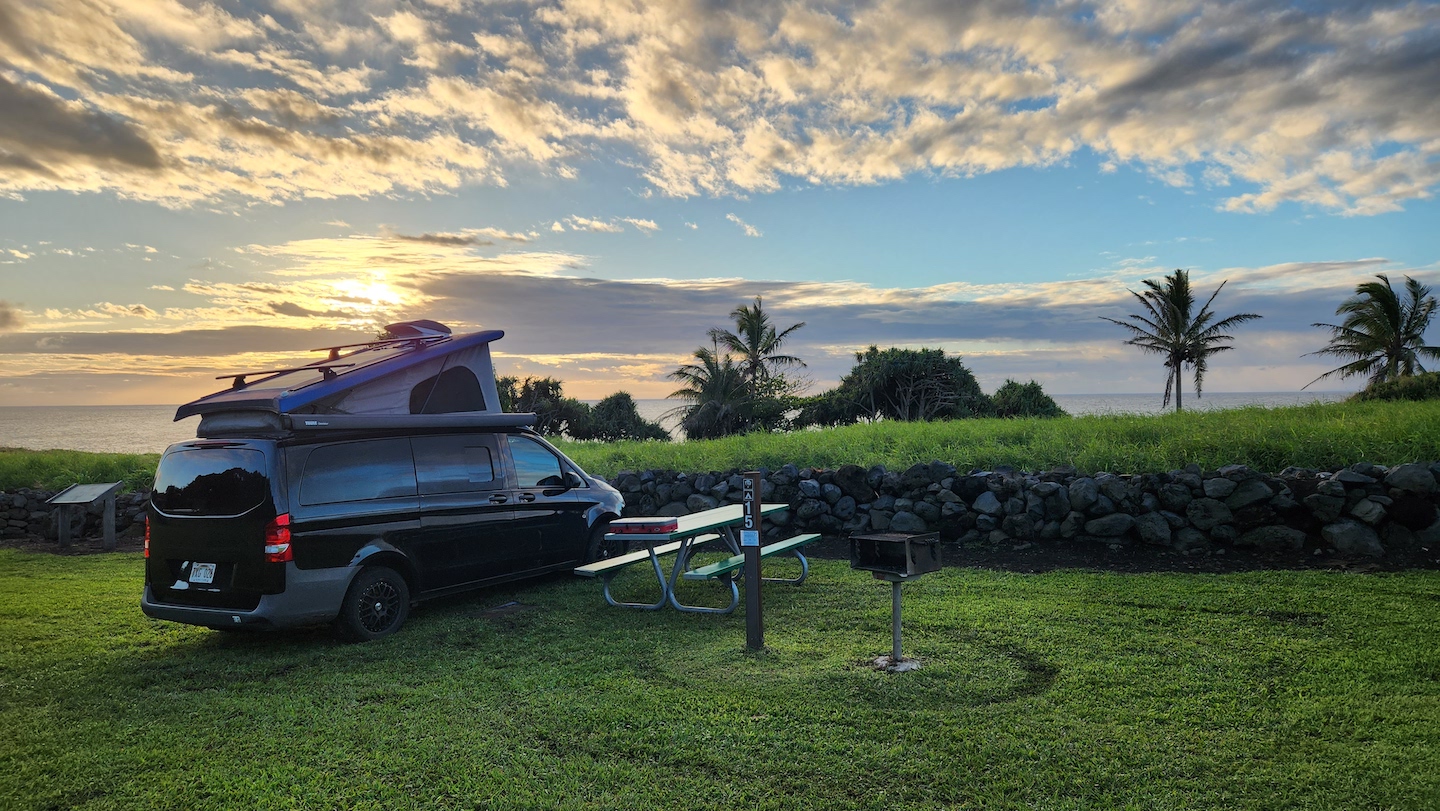
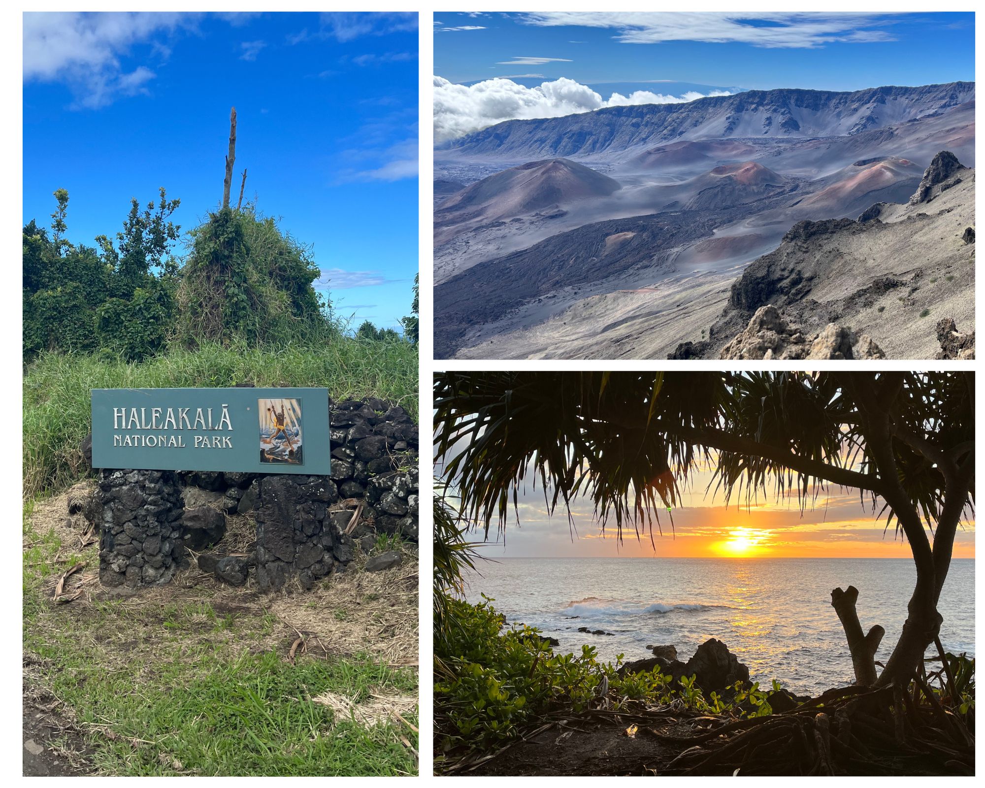
Lodging along the Road to Hana is hard to come by and can be expensive. Just passed the town of Hana is the Kipahulu District of Haleakala National Park. We were fortunate to grab a campsite at the Hosmer Grove campground within Haleakala National Park and it made the perfect home base.
Hosmer Grove Campground
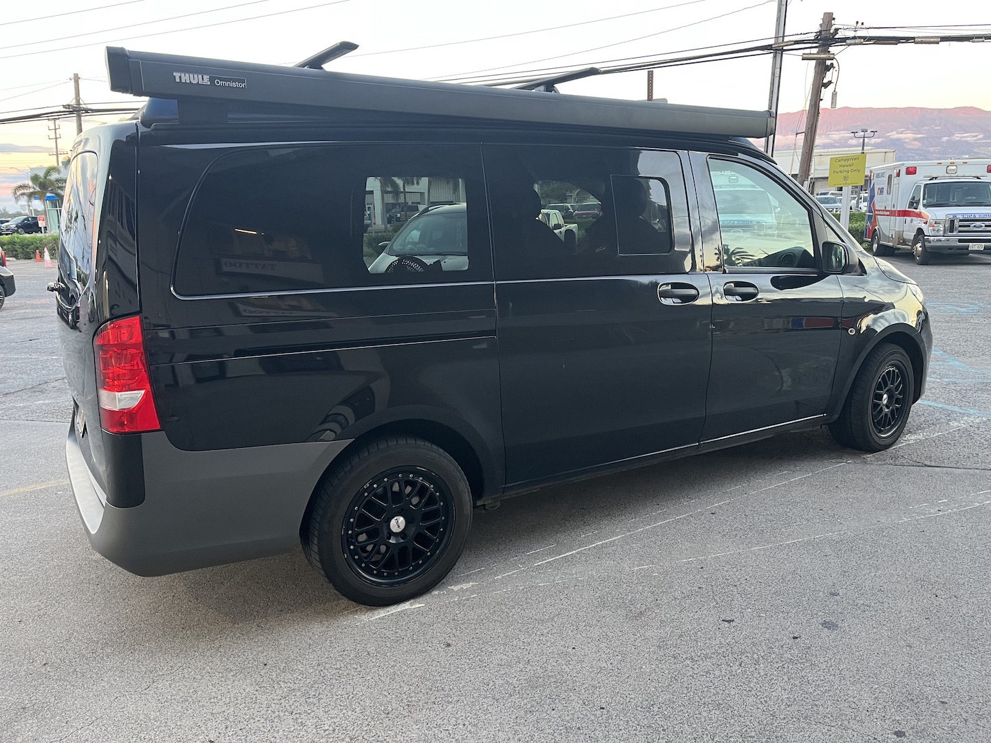
If you’re planning to drive the road, get the smallest car you can get. For real. The lanes are narrow and you are going to be so much more comfortable in a smaller car. Think smaller and harrower. No wide race cars. We saw some people in Chargers which took up the entire lane. We had a Mercedes Metris campervan and it was the max size I’d want to drive. We met a couple at the campground who had rented a Sprinter Van and it was a bit big for the road.
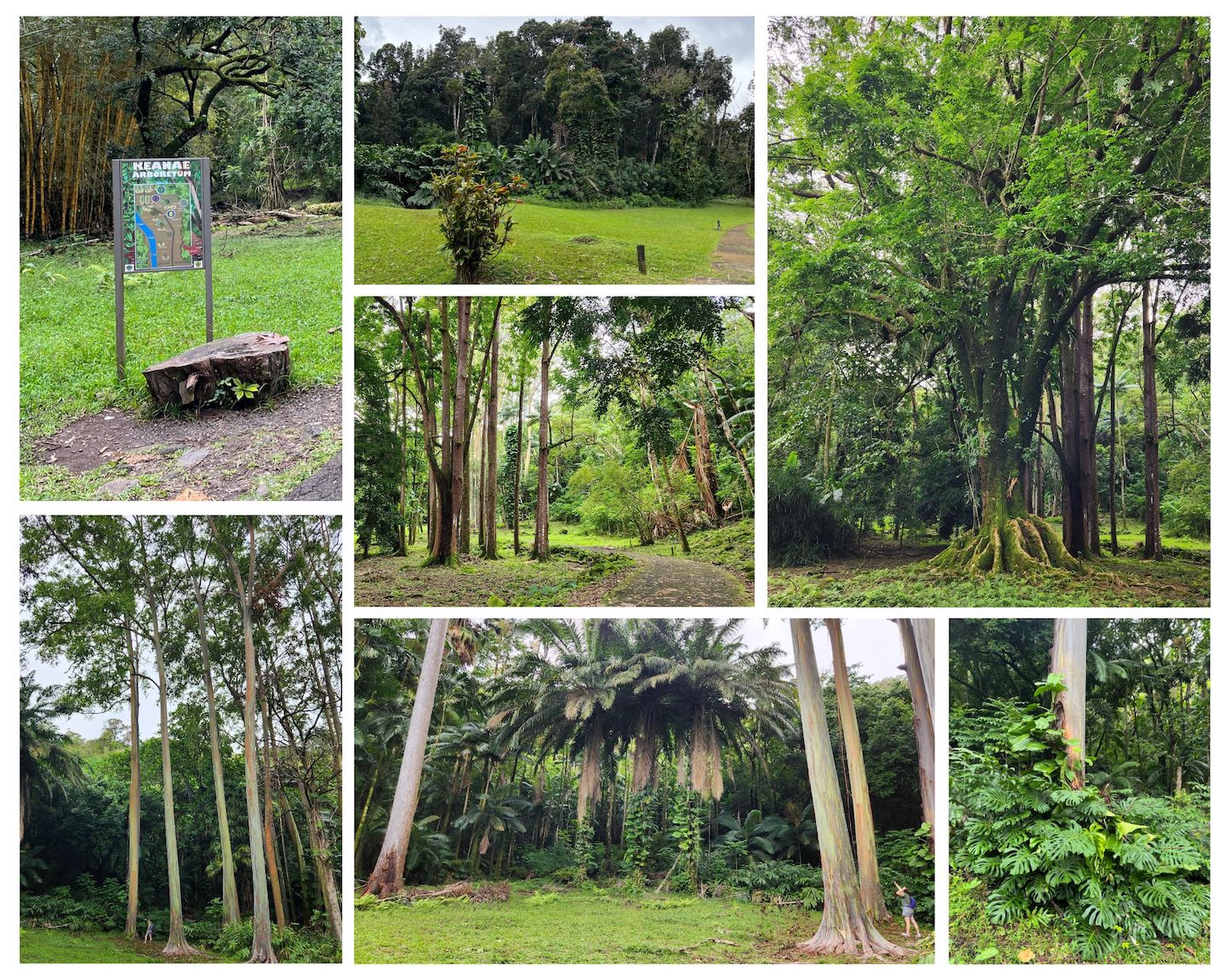
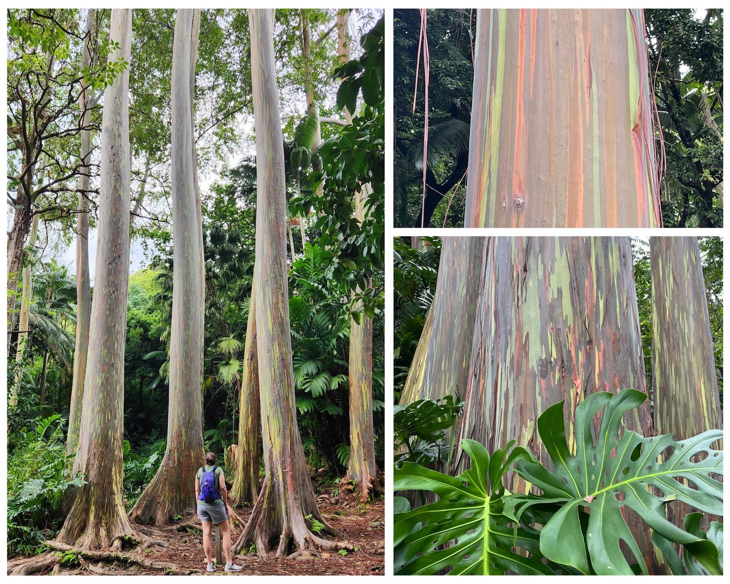
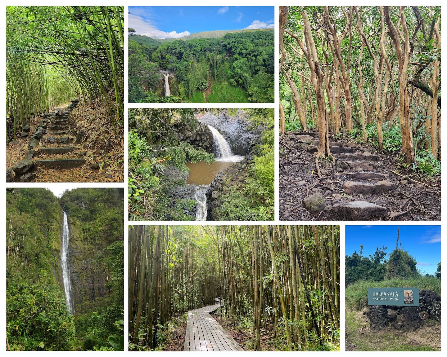
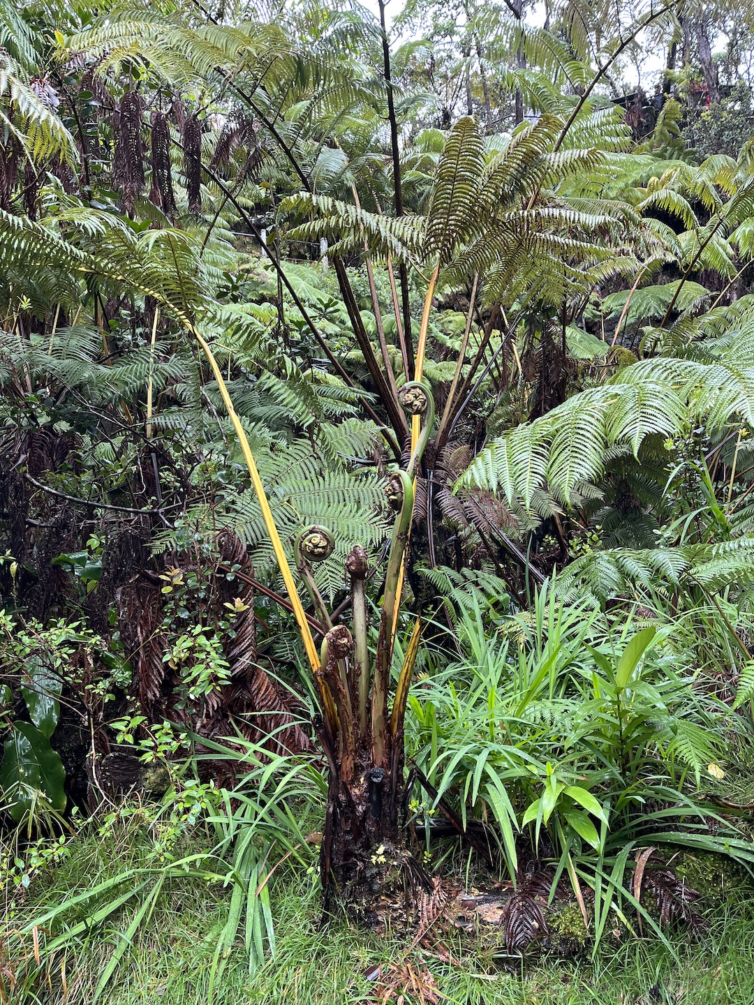
Keanae Arboretum
One of our favorite stops was the Keanae Arboretum to see the rainbow eucalyptus trees! Seriously, my favorite trees ever. A close second is any tree wrapped in vines, which are also all over Hawaii. The eucalyptus reminded me of rainbow colored redwoods. I’m not sure if they even come close to redwoods in right but they are tall. Add rainbow bark and you have the coolest tree ever! It’s a free and quick stop. There are lots of other beautiful plants to look at too.
Rainbow Eucalyptus at Keanae Arboretum
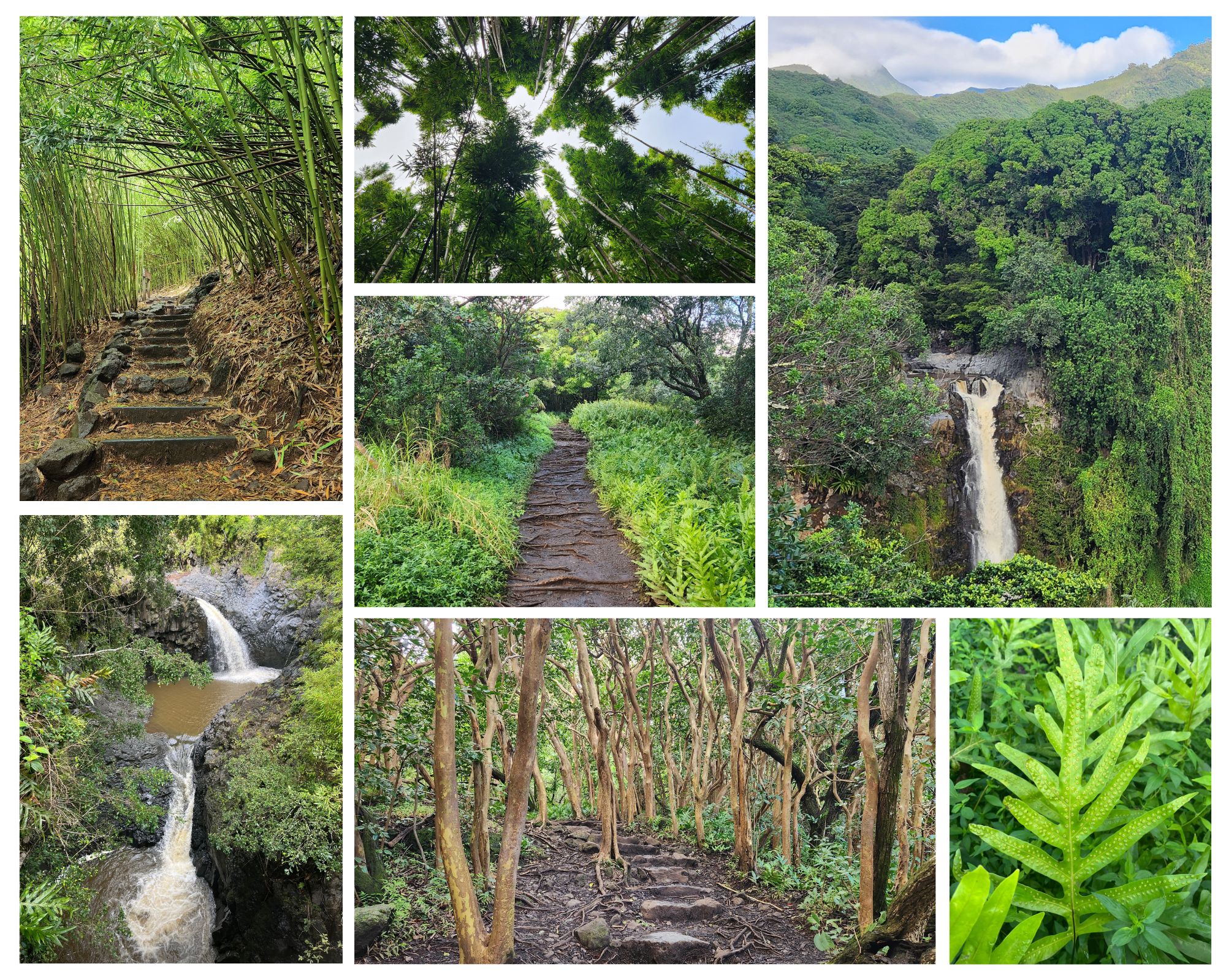
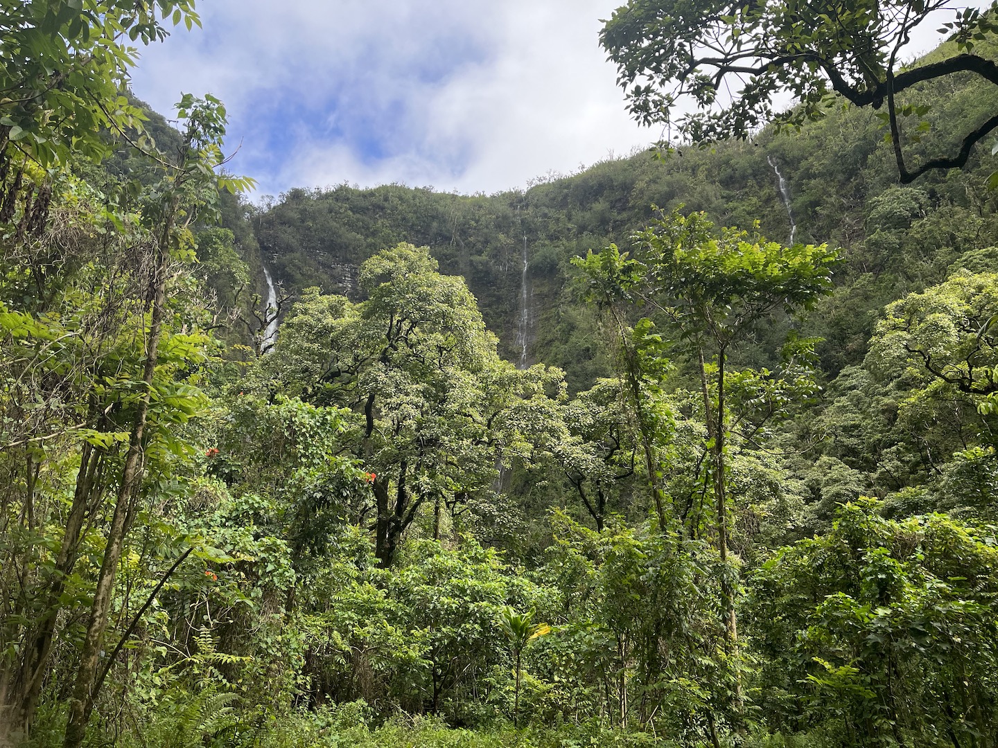
The Pipiwai Trail in Haleakala National Park is a must do. It’s one of my favorite hikes ever. It can be very wet and muddy, at least in March, so please make sure you are wearing appropriate hiking footwear.
Pipiwai Trail – Haleakala National Park
We had reservations at Waianapanapa State Park, the black sand beach, but didn’t end up going. I don’t remember why we didn’t go. Oh right, we spent too much time driving sketchy roads the day before and needed a break from driving. We had seen black sand on the Big Island so we had already checked that box. Instead, we had a leisurely day around camp and it was just what we needed. We explored the national park, drove into Hana, and explored the other end of the road.
Koki Beach
Koki Beach is a red sand beach. It’s not a good beach for swimming as it has dangerous currents, but it’s beautiful to look at.
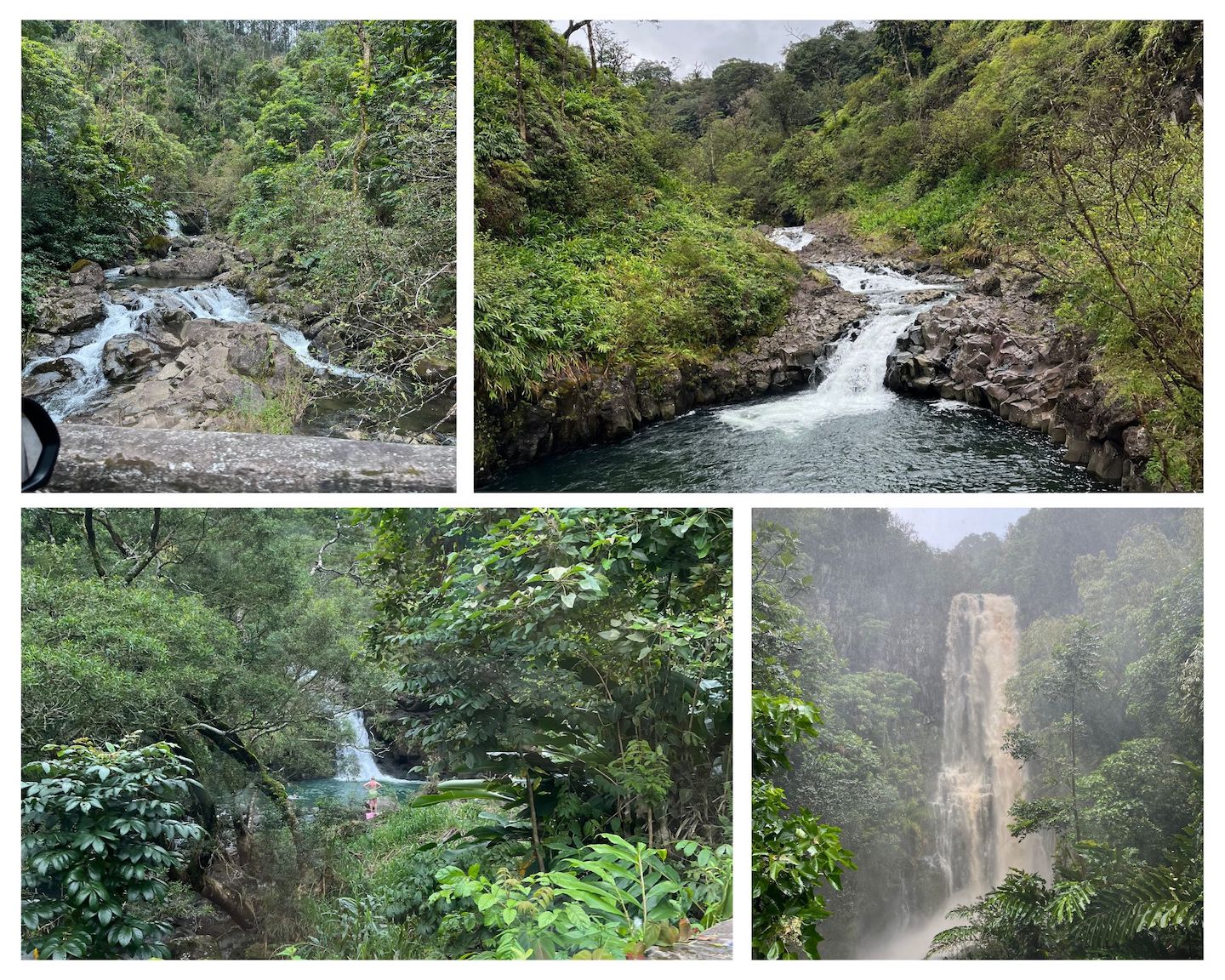
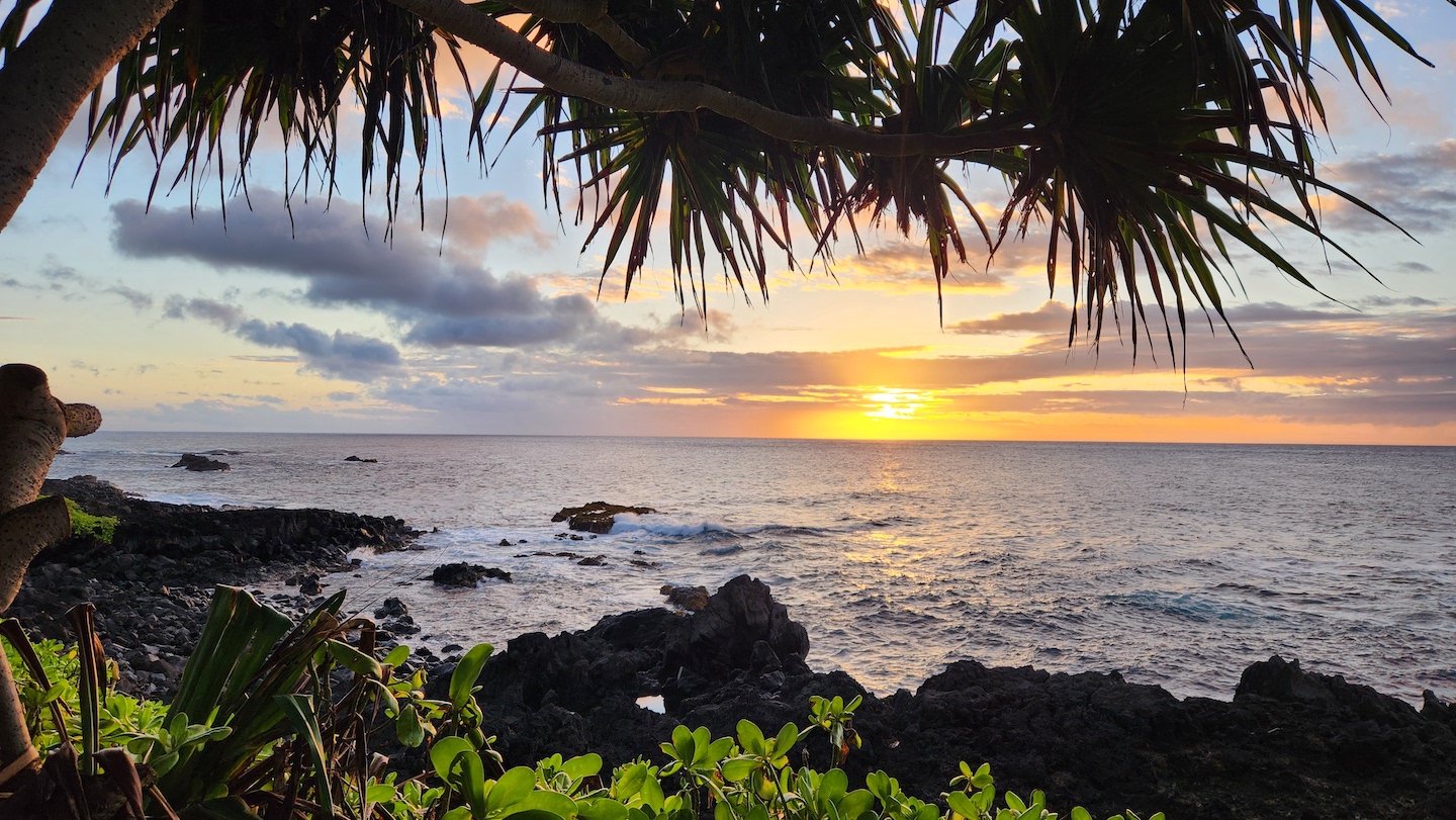
Practically every turn in the road has a waterfall. Some you can swim in and some you cannot because they are on private property. The day we left it was storming really bad and the waterfalls all looked like something out of Charlie and the Chocolate Factory.
Waterfalls on the Road to Hana
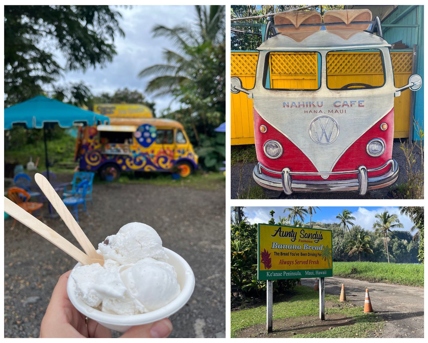
Some of our food stops were for coffee, ice cream, shaved ice, and banana bread. Everyone raves about Aunt Sandy’s and it’s legit. Don’t skip the banana bread. The Huli Huli chicken is supposedly legendary but it was closed when we got there. 🙁
Food Stops on the Road to Hana
There is no cell service on the Road to Hana. We downloaded the Guide Along app ahead of time and highly recommend it. The app is GPS based and narrates the drive. It tells you of upcoming stop ideas, must see places, and the history of the areas you are driving though.
A couple tips. Driving there and back to Hana from anywhere in Maui makes for a long day. If you can, I’d suggest staying someone near Hana so that you can really enjoy yourself. The weather can be unpredictable. It was literally flooding in Haleakala when we left and by the time we got to the start of the Road to Hana, it was sunny with blue skies. Always have your rain gear in Hawaii. Be respectful of private property. The entire area is absolutely gorgeous, and we all want to enjoy it, but people do live in the area and many of the attractions are on private property. Respect signs and do not go in areas you are asked to stay out of.
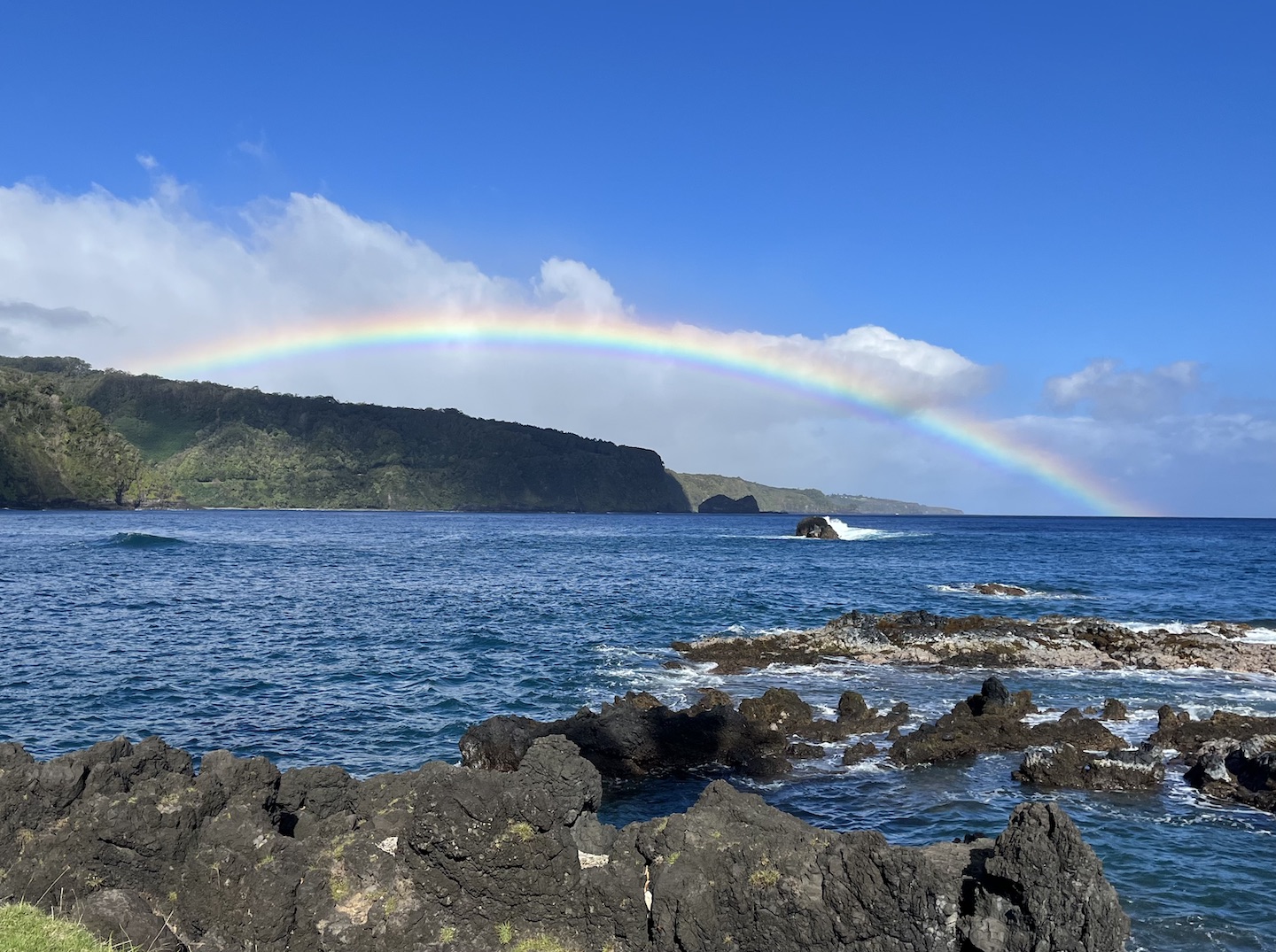
Rainbow on the Road to Hana
One final story before I wrap up this adventure. On our final morning at the Hosmer Grove Campground, we woke up to a crazy storm and a flood warning. The weather was only going to get worse as the morning went on, and we had afternoon whale watching reservations in Lahaina, so we decided to book it out of the area as fast as possible on a sketchy road in the middle of a sketchy storm. It felt like we were in the scene of a movie trying to outrun something. Flooded roads, dodging fallen trees, rain pouring. Being that it’s a rain forest, I’m sure it’s normal for that area, but this desert girl was a little freaked out. The Hana road crew was out cleaning up the road in the middle of the storm which made me feel better about our life choices in that moment. When we finally got out of the storm we saw the rainbow above and all was right in the world again.
The Road to Hana is an epic adventure and worth how every many hours of days you have to spend on it.
https://www.theroadwevetraveled.com/wp-content/uploads/2024/03/20230306_143832.jpeg8111440Carolinehttp://www.theroadwevetraveled.com/wp-content/uploads/2015/08/RWT_Logo@3x-300x143.pngCaroline2024-03-16 05:44:162024-03-16 05:44:20The Road to Hana - Maui, Hawaii
Haleakala National Park is definitely at the top of my favorite national parks list. The national park is a volcano divided into two sections. The summit district is at the top of the volcano with a mars looking landscape and the Kipahulu district is on the backside near the ocean and has the most gorgeous rainforest that you get to by driving one of the world’s most beautiful drives. The drive isn’t for the faint of heart but it’s bucket list worthy for sure.
Haleakala National Park
We flew in from the Big Island in the afternoon and picked up our rental camper van from Campervan Hawaii. This van itself was a highlight of this trip! We then stopped at Safeway to purchase the most expensive groceries of our lives and finally hit the road for the campground near the top of Haleakala.
Our sweet campervan!
Summit District
There are only six campsites at Hosmer Grove Campground and reservations are really hard to get. We were hoping for two nights, so that we could spend more time at the summit, but were only able to secure one night. We got to the campground after dark and left before the sun so I have no idea what anything other than the bathroom looks like. One of the coolest things about the campervan is that we didn’t have to set anything up. We pulled into our parking spot, put the shades in the windows, and went to sleep. I get the van life movement.
Lights of all the other cars driving up the Haleakala switchbacks for sunrise
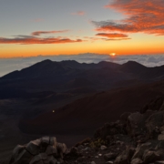
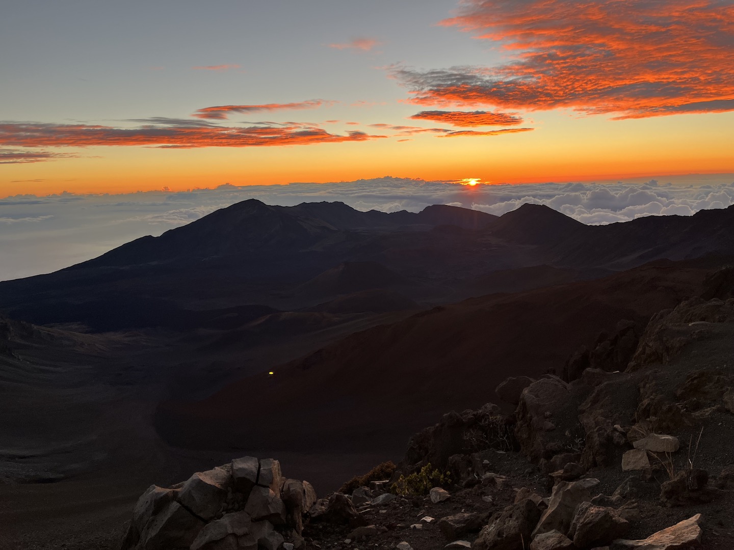
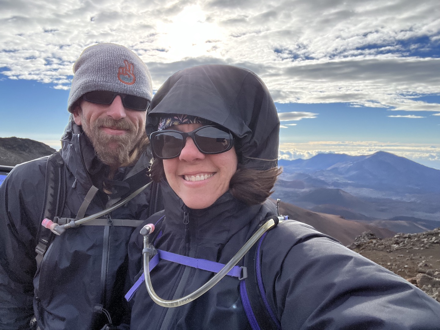
One of the top things to do in Haleakala is to watch the sunrise from the top of the volcano. You are above the clouds so the sunrise is magical. The internet had lots to say about this and I was a little nervous about whether it would be as epic as it was made out to be. It was. The top of the volcano is really cold and windy, so bring as many clothes and hand warmers as you can. We bundled up in as much as we could and walked over to grab a spot. Getting in the park before sunrise requires a permit but there were still a lot of people there for sunrise. Don’t let that scare you though. I actually thought that is part of what made it so moving. We were standing next to strangers waiting and hoping to catch a beautiful sunrise. Eventually everyone starts chatting with each other, sharing hand warmers, holding each others cameras. You learn what brought people to such a moment. Some for fun, some to remember loved ones.
Sunrise in Haleakala National Park
Before the sun rose the sky started changing colors and the second the sun peeped the clouds someone started singing a Hawaii chant which they continued until the sun was fully above the clouds. Talk about a magical, beautiful, moving moment. It’s one that will stay with me forever. We waited a bit to watch the sky a little longer but by this point we were frozen. Another perk of the campervan is we could make more coffee in the parking lot!
Heading out on a cold & windy hike into the crater
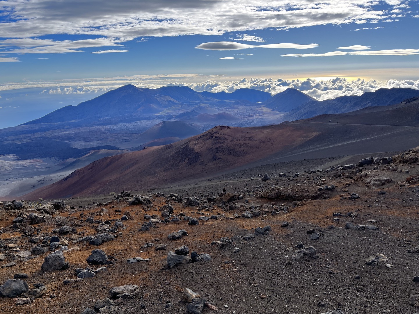
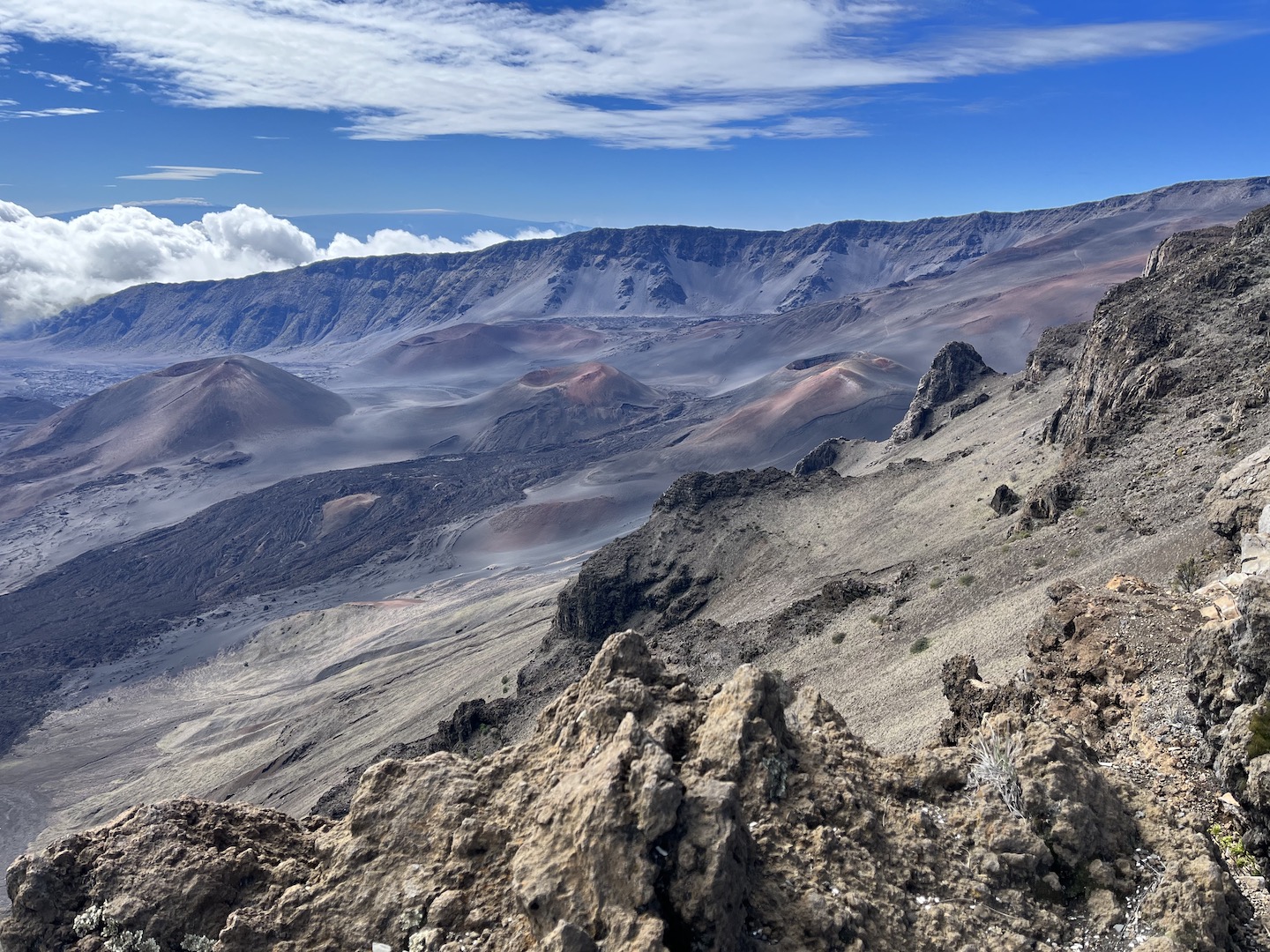
We sat in a the van for a bit, drinking coffee and warming up, while waiting for the temperature outside to rise. Eventually we got out of the warm van and hiked into the crater. I walked a little ways. The Husband walked a little farther than me. The elevation at the top of Haleakala is 10,000 feet so walking out of the crater is no joke.
Haleakala National Park crater from the Sliding Sands Trail Haleakala National Park crater from the Kalahaku Overlook
Kipahulu District
While we were only able to get one night at Hosmer Grove, we were able to secure two nights at Kipahulu Campground which is in the section of the national park near the ocean. It’s one of my all-time favorite campgrounds. Getting there is not for the faint of heart though. First, we had to drive down from the top of Haleakala which is a very windy road full of tight switchbacks. Once we got down from the mountain we had to drive around the island of Maui to get to Kipahula. To get there you take the famed Road to Hana! Honestly, it was a lot to drive in one day because both driving down the volcano and driving the Road to Hana requires a lot of intense concentration.
Sunset from the Kipahulu Campground
The campground is a grassy area with picnic tables. One of the coolest things is that the campground is right on the ocean. There’s no beach, just lava rocks, but you are probably 30 feet from the ocean, and serenaded by the ocean every waking moment. Heaven on earth. And if that isn’t enough, there is an epic hike that starts just outside of the campground.
Kipahulu Campground
The next morning we walked a short distance from the campground to the start of the Pipiwai trail. We started the hike first thing in the morning and I’m glad we did because the trail was busy as we were walking back. If you plan to hike this trail, please wear proper hiking footwear and take your 10 essentials. The trail is wet, muddy, and steep in some parts. We saw people in all kinds of craziness, like flip flops and a 16oz bottle of water.
Pipiwai Trail
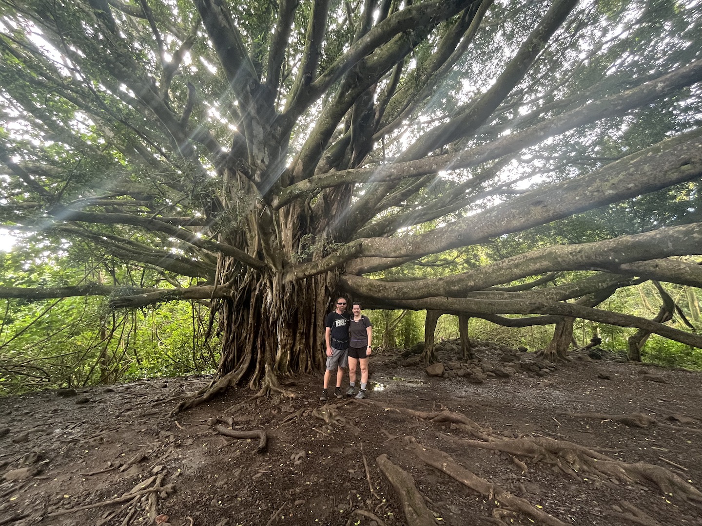
This is one of the most magical trails I’ve hiked. You start out in the rain forest, a thick rainforest with not a lot of air flow, and a decent incline. At this point I was questioning my life choices. Eventually we made it to the banyan tree and took a quick picture break.
Banyan tree on the Pipiwai trail
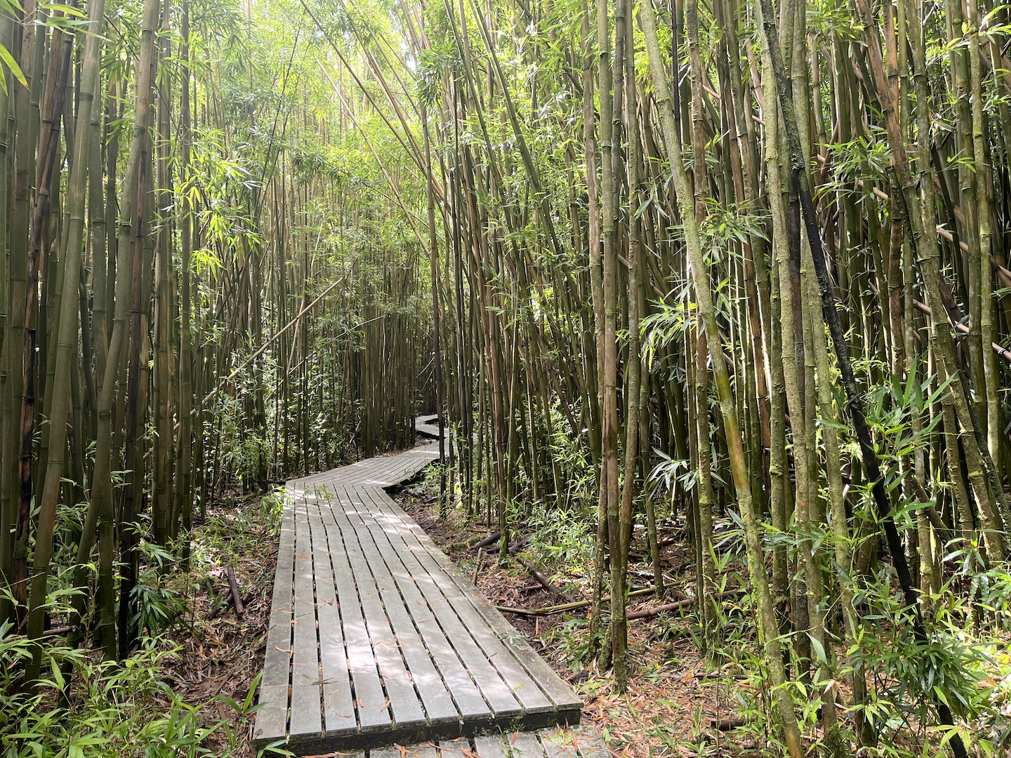
Sometime after that we entered the bamboo forest. Coolest part of the hike for sure! The bamboo clanking around sounded like wind chimes. And there was air flow again!
Epic bamboo forest on the Pipiwai trail
After the bamboo forest we crossed a few water falls and eventually made it to the end to see more waterfalls. It felt like a scene from Jurassic Park. You’re able to get closer to the falls than this picture and we did. The canyon walls are so high you have to be pretty far back to get multiple falls in one shot. Waimoko Falls on the left is 400 ft.
Waterfalls at the end of the Pipiwai trail
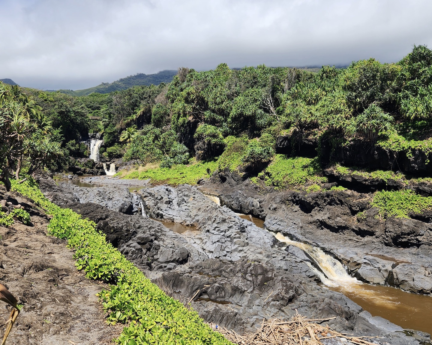
On our way back to camp we swung by the Pools of ‘Ohe’o near the visitor center. Apparently back in the day you could swim in these but that is no longer the case. We visited in March which is the rainy season and all the water looked liked chocolate milk.
Pools of ‘Ohe’o
We loved our time in Haleakala National Park. We wanted to spend more time at the summit exploring the crater but will have to save that for another trip. Camping in Kipahulu was epic and such a perfect location. Not only were we within walking distance from trails and the ocean, Hana is just down the road and we were able to leisurely explore the area. Overall a fabulous few days.
https://www.theroadwevetraveled.com/wp-content/uploads/2023/11/IMG_3656.jpeg10801440Carolinehttp://www.theroadwevetraveled.com/wp-content/uploads/2015/08/RWT_Logo@3x-300x143.pngCaroline2023-11-25 08:06:072023-11-25 08:06:11Haleakala National Park
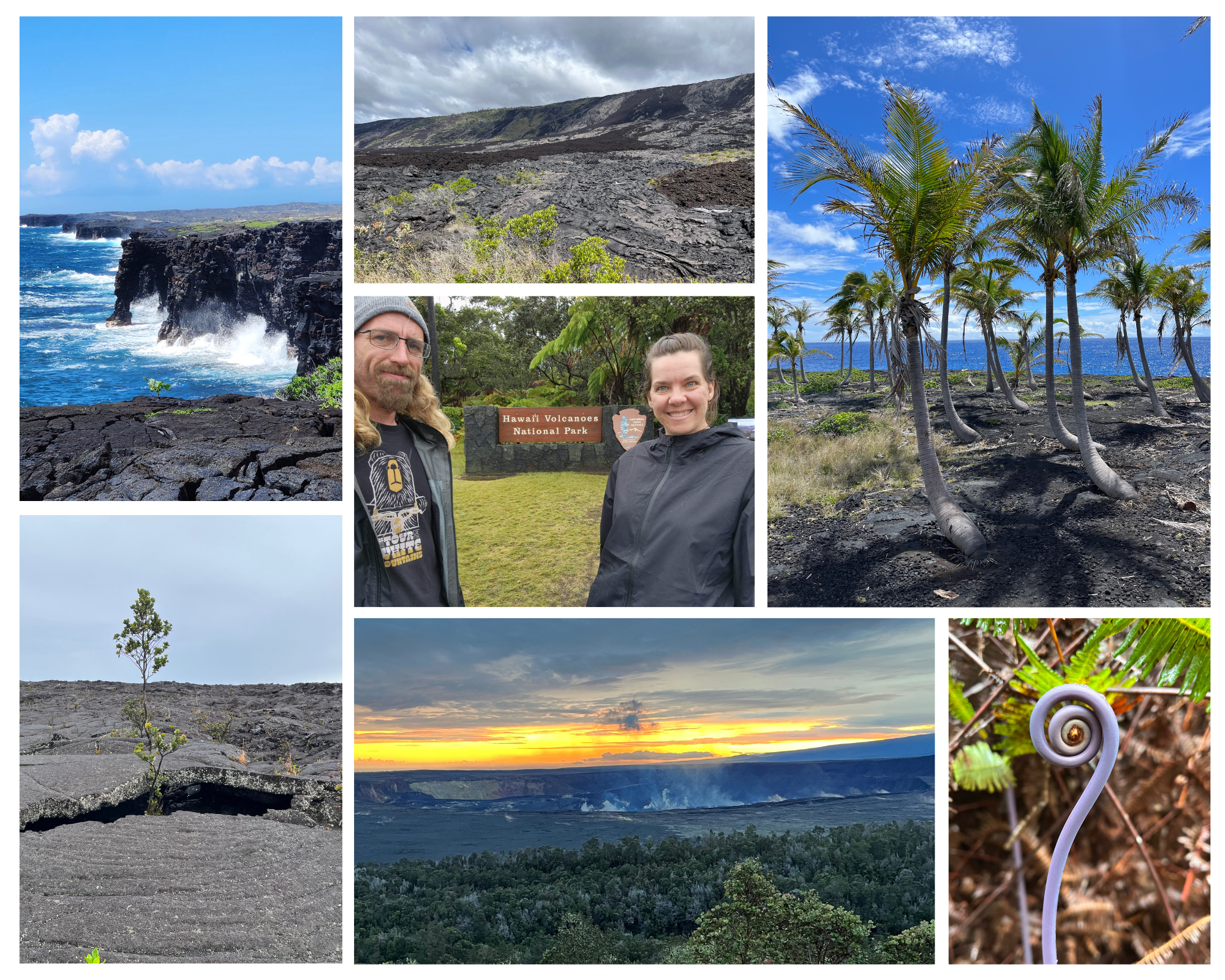
The Island of Hawaii, or the Big Island as most everyone knows it by, has so much to do. It made for a perfect start to our (rainy) Hawaii trip.
We started our Big Island visit by visiting Hawaii Volcanos National Park and stayed at the Volcano House hotel in the park. We had a blast and you can read more about that in my post.
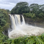
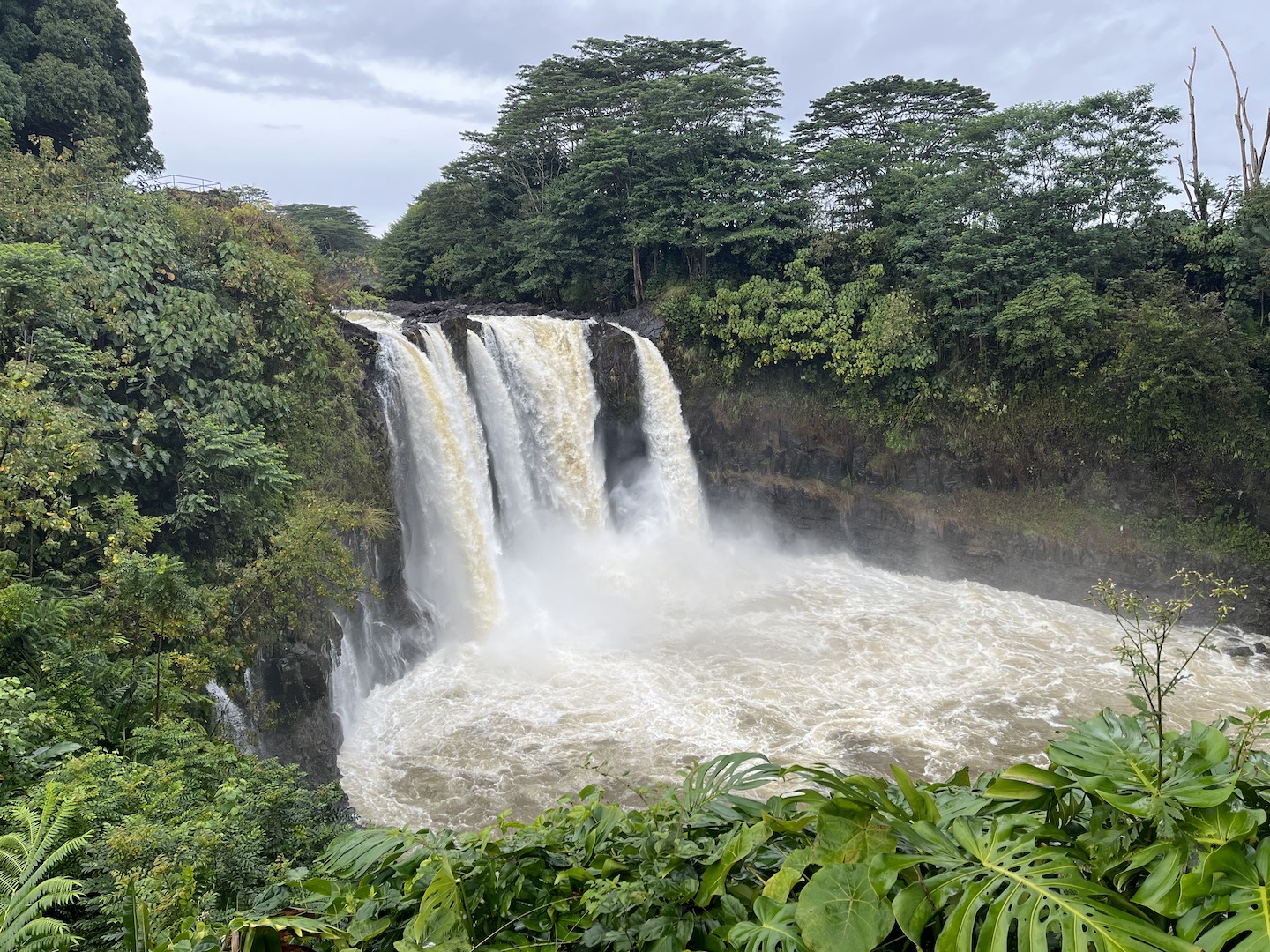
The national park is closer to the town of Hilo and there is lots to do and see in the area. The Wailuku River State Park was a fun surprise. There are two viewpoints in this park and both are right off the parking lots. The first viewpoint is an 80-foot waterfall called Rainbow Falls. We happened to visit in a very rainy season and the waterfall was raging. There weren’t any rainbows but the sheer power of the water was even better.
Rainbow Falls
Right next to the water fall is a huge banyan tree. I don’t know that this was the biggest we saw but it definitely had the most branches.
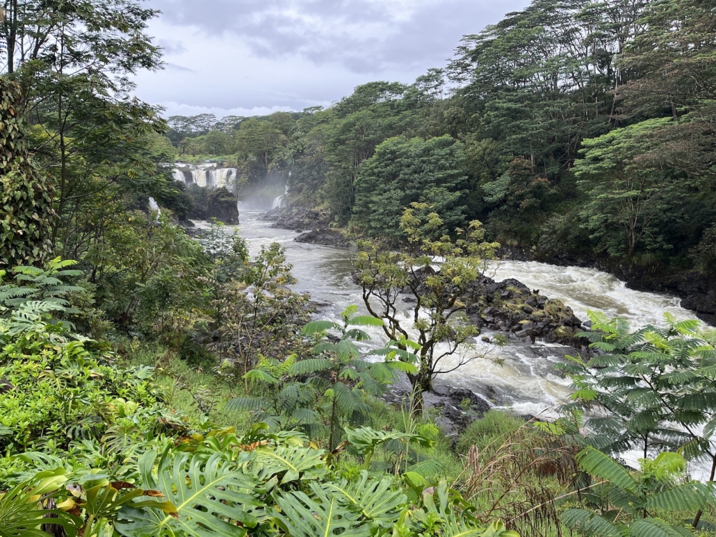
Just up the road from Rainbow Falls is Boiling Pots. The name comes from when the water is raging, like it was, the water looks like it’s boiling. There was no charge for this park and both sections were worth the stop.
Boiling Pots
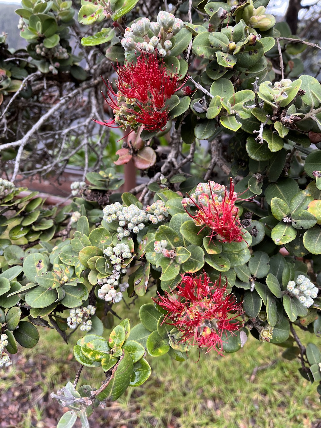
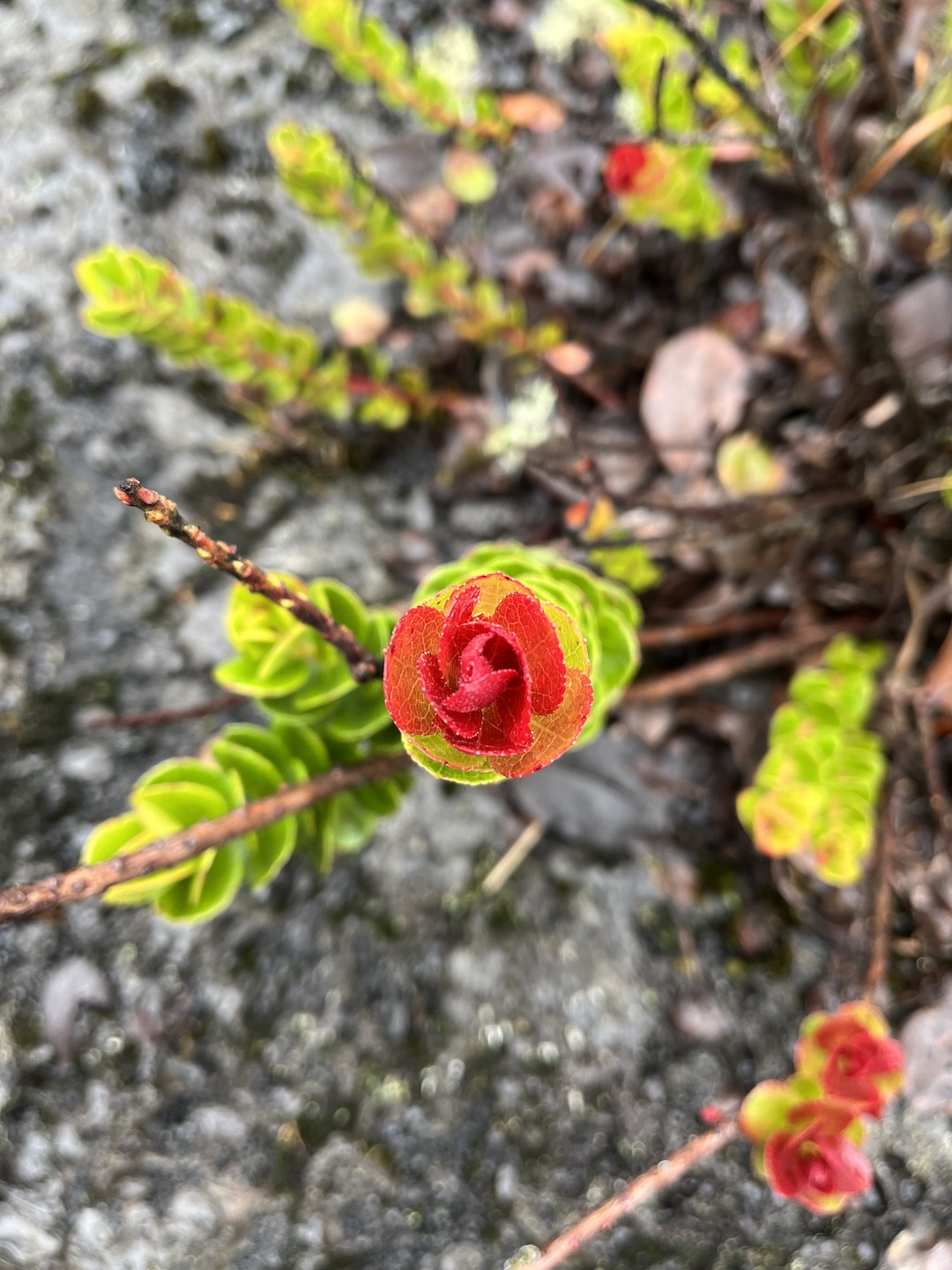
Lava Tree State Monument was a cool stop. This was one of the first places we stopped in Hawaii and we were blown away by the flora. It’s a little out of the way but I’m glad we made the drive.
Lava Tree State Monument
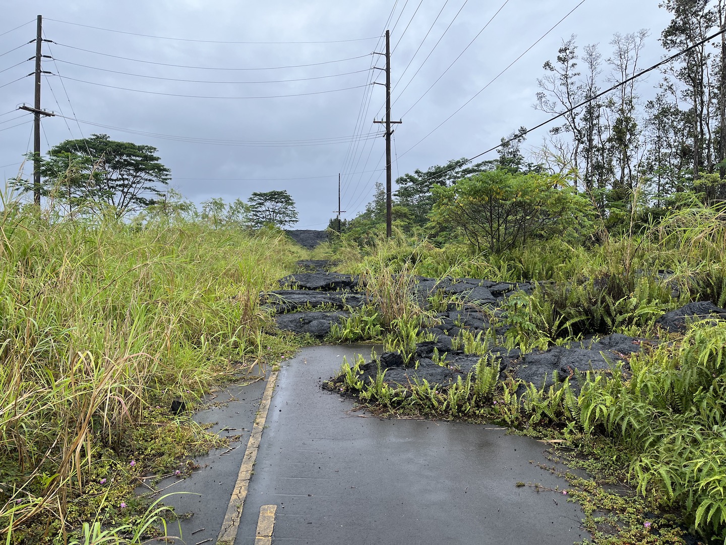
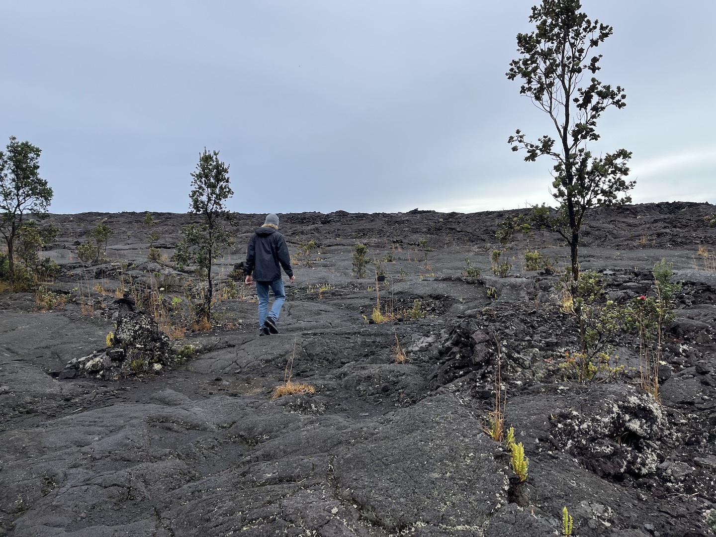
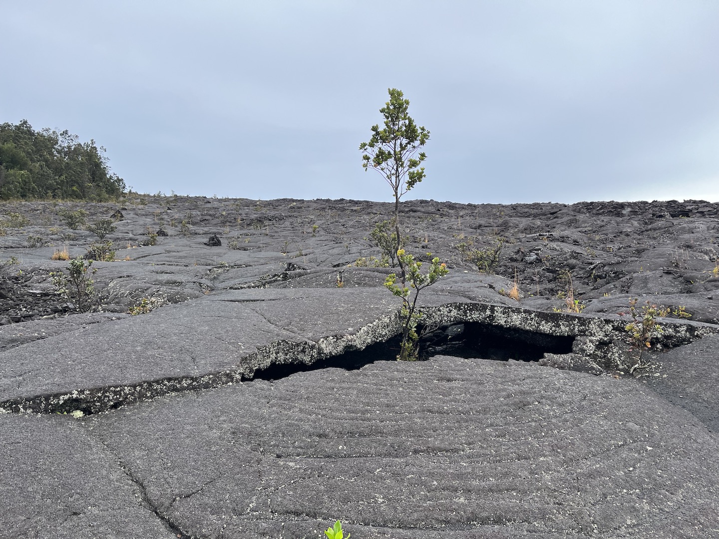
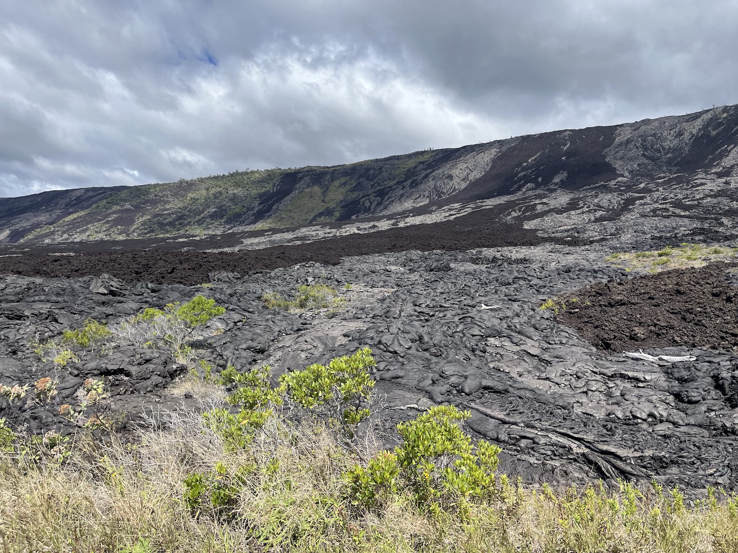
Just around the corner from Lava Tree is an area where recent lava flows covered the road. The location is on Google and is known as End of the Road. It’s a crazy thing to see. In general there is lots of this in Hawai’i, in particular on the big island, so if you’ve already seen lots of lava this may not be as exciting. For us it was at the beginning of our trip and was so cool.
End of the Road
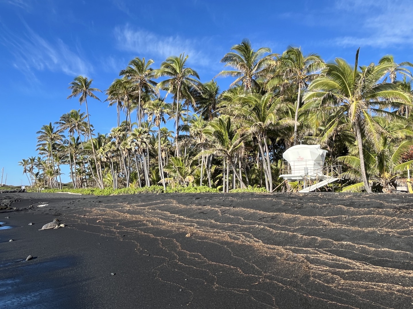
The Panalu’u Black Sand Beach was one of our favorite stops. It had been raining for a few days and sunshine was predicted for a few hours so we drove to the beach. We got there early in the morning and were two of four people there. The beach was beautiful and peaceful and just perfect. Not only is the sand black and the beach lined with coconut palm trees, it is known for green sea turtles sun bathing on the shore. Because we were there so early the turtles were still making their way to the beach. We watched them slowly swim to the shore and work their way up the beach. It was a site I will never forget. Eventually more people showed up, including the life guard who created barriers around the sea turtles because they are protected and tourists don’t have boundaries. For whatever it’s worth, the black sand is beautiful but is not comfortable to walk on. It’s crushed lava rock.
Panalu’u Black Sand Beach
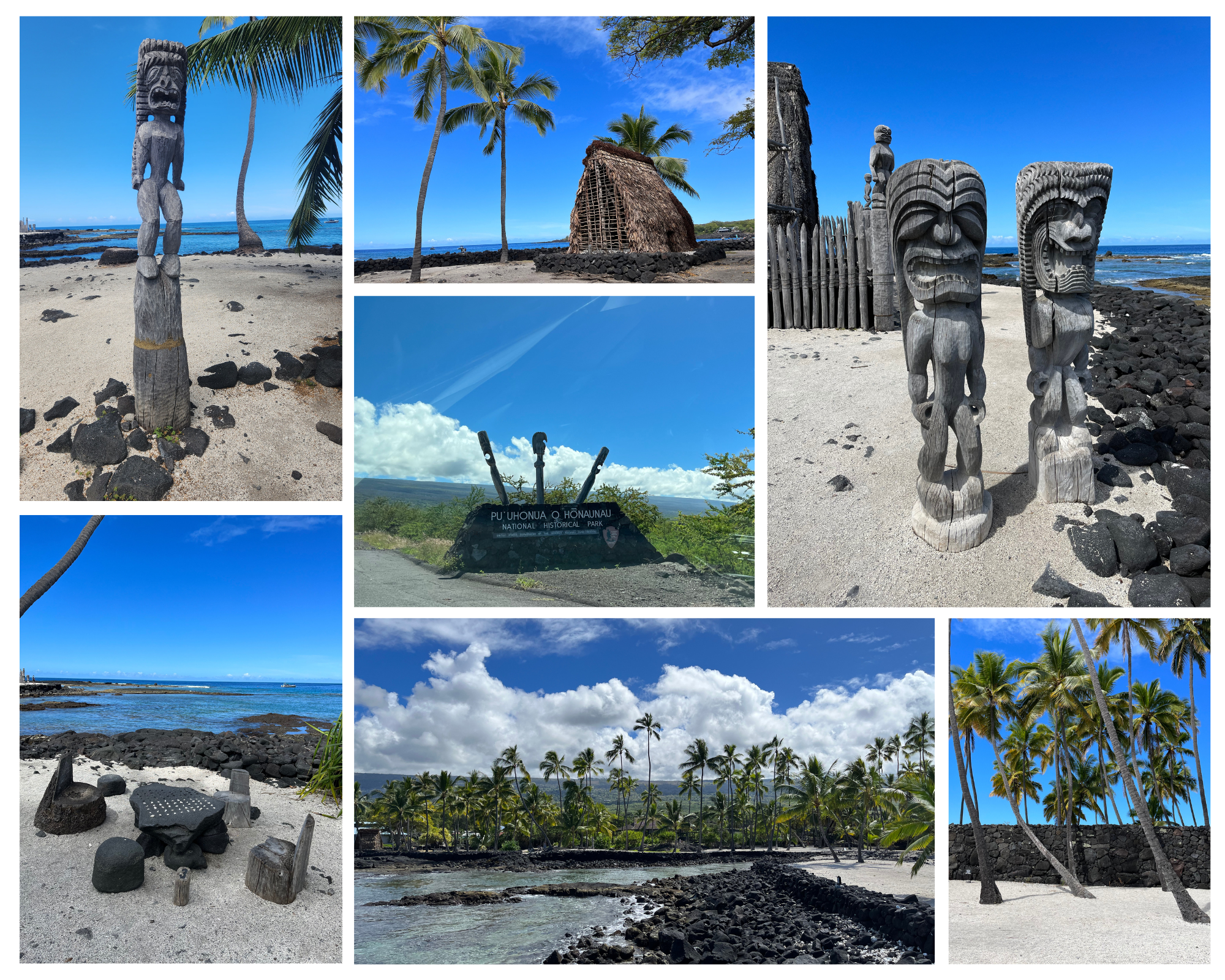
We had some time to kill on our way to the airport so we stopped at Pu’uhonua o Honaunu and Kaloko-Honokohau National Historic Parks.
Pu’uhonua o Honaunu National Historic Park was fascinating and gorgeous. A section of the park was a sanctuary for people who broke sacred laws (kapu) but first they had to make it there by swimming across the bay and walking across the lava rocks. That’s crazy to think about. I’m definitely grateful to be living in this century.
Pu’uhonua o Honaunu National Historic Park
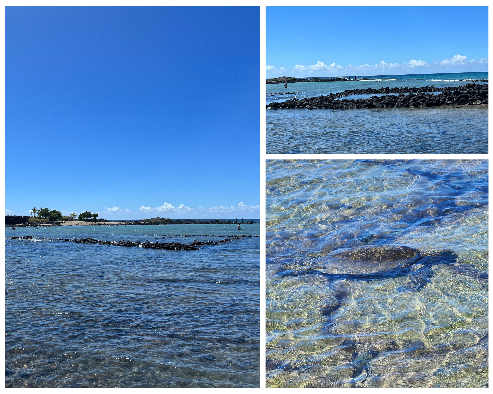
Kaloko-Honokohau National Historic Park was interesting too. We didn’t have as much time here but walked down to the beach where we saw lots of sea turtles (!!) and a fishpond and fish trap. Native Hawaiians created a fishpond where they could capture and hold fish until they were ready to eat them. Within the pond were fish traps built out of rocks. During high tide the water would bring in the fish and as the tide would leave the fish would get stuck in the traps as the water lever went down. Genius. I love learning how people used to lived.
Kaloko-Honokohau National Historic Parks
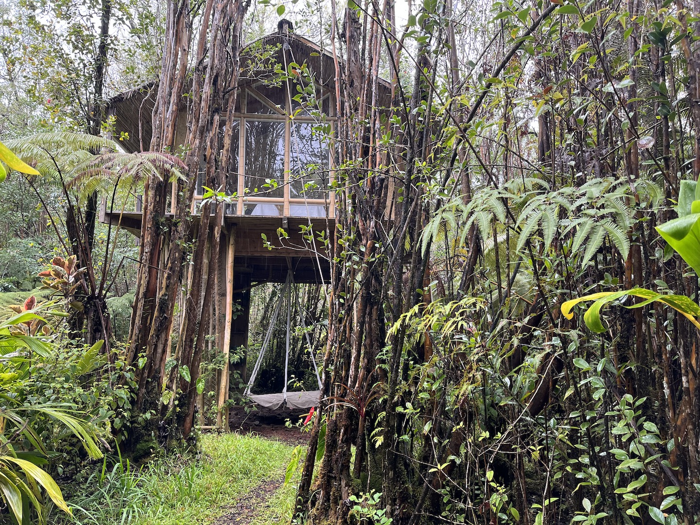
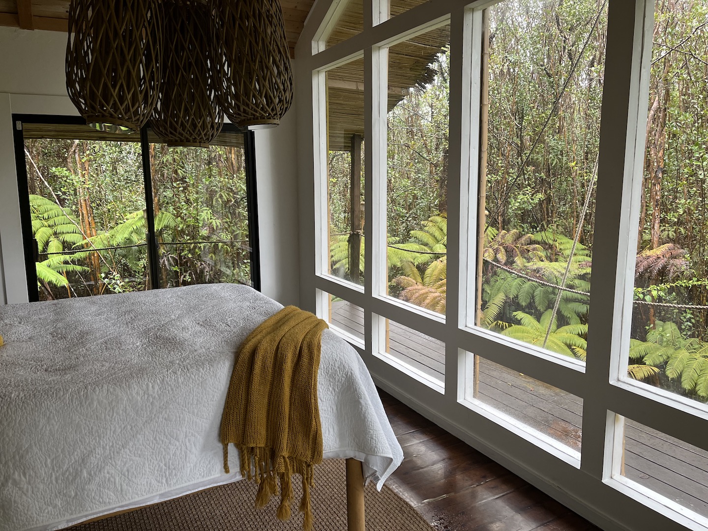
We stayed at the Volcano House most of the time except for the last evening when we stayed at a treehouse in the jungle. The treehouse was a neat experience but probably not something I would do again for a number of reasons. You have to climb a 15 foot ladder to enter or exit. I knew that when I made the reservation but my brain didn’t really process what that meant. I don’t love heights so climbing a wet, wooden ladder with a bag on my back wasn’t my favorite. The rain forest was gorgeous though and we were surrounded by the sound of the rain forest….coqui frogs included. Like all night long. It was neat for one night. The treehouse was off the grid, cool idea, but the lead acid battery for the solar was inside the treehouse (which is tiny) and did not have a vent to the outside. That’s dangerous and it made sleeping a little unnerving. We let the host know but I’m not sure if they made any changes. For that reason, I would not recommend the Air BnB but it was a once in a lifetime stay.
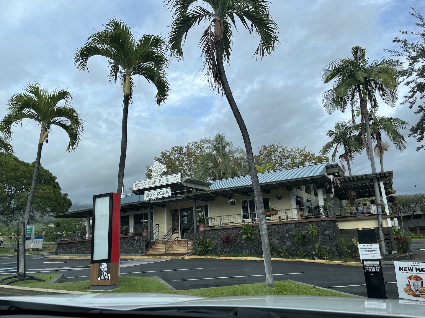
And a random shoutout, the macadamia nut milk lattes at Kona Coffee & Tea are AMAZING!
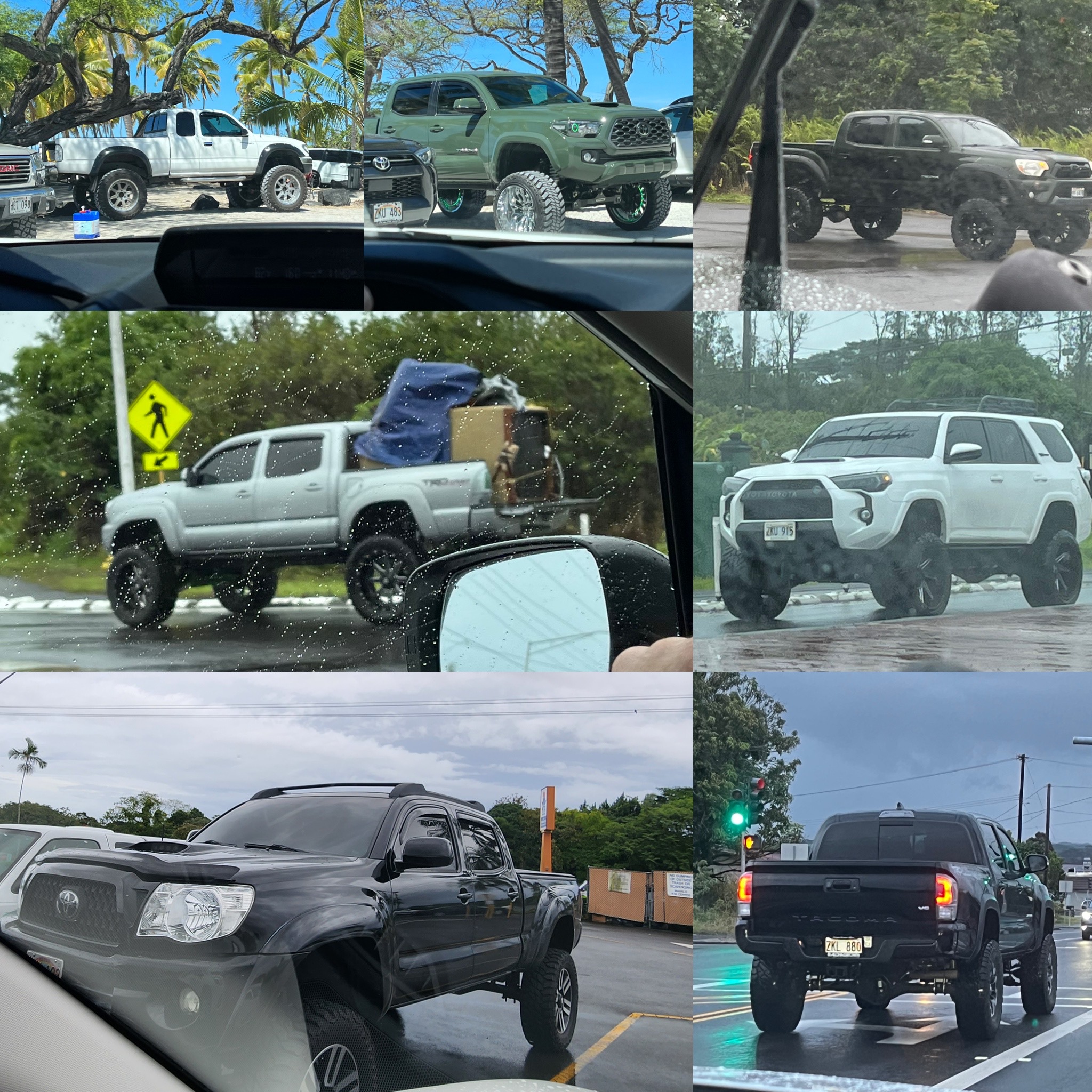
I’ll leave you with a funny tidbit. Hawaiians love Toyotas. In particular, lifted Tacomas. Their police vehicles are 4Runner’s. We’re Toyota fans so we support their love. I’ve just never seen so many lifted Tacomas in one place. It’s pretty comical.
After the Big Island we hopped over to Maui for a few days. It’s not a bad way to spend a week if I do say so myself. 🙂
https://www.theroadwevetraveled.com/wp-content/uploads/2023/08/IMG_3147.jpeg10801440Carolinehttp://www.theroadwevetraveled.com/wp-content/uploads/2015/08/RWT_Logo@3x-300x143.pngCaroline2023-08-23 05:11:392023-08-23 05:11:42A Visit to the Big Island of Hawaii
The Hawai’i national parks have always been on our bucket list but weren’t something we expected to visit anytime soon. We were planning to take a trip somewhere in March and still trying to figure out where to go. I casually suggested Hawai’i if we could do it cheap and next thing you know I was trying to figure out it. Spoiler alert: Hawaii and cheap cannot be used in the same sentence. We did it as inexpensive as we could but honestly, once I had researched everything there was no way we weren’t going to make it happen.
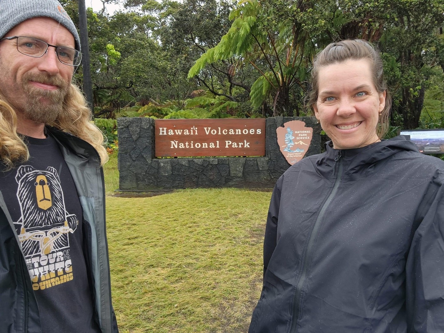
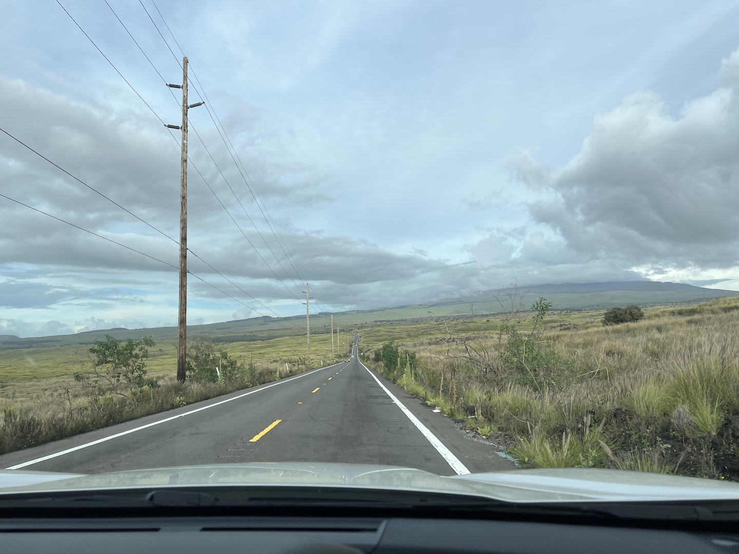
We flew into Kona and rented a car through Turo. It was my first Turo experience and I loved it. I’m all for anything I can do myself. We left the airport, picked up our car which was waiting for us in the airport parking lot, and hit the road to Hawai’i Volcanos National Park. It’s a two hour drive which after a 5.5 hour flight was a little long, but sometimes that’s how ya roll.
Drive to Hawaii Volcanos National Park
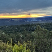
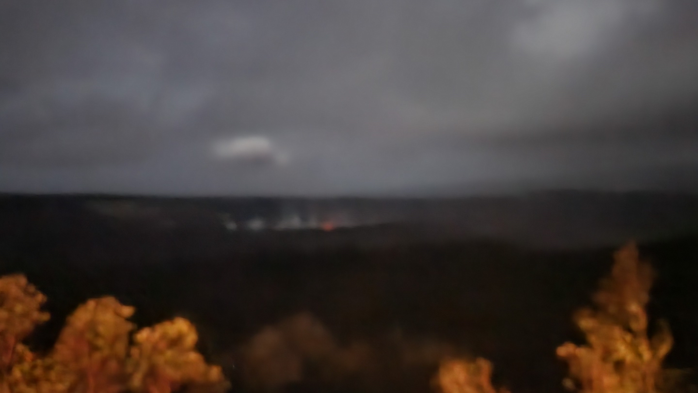
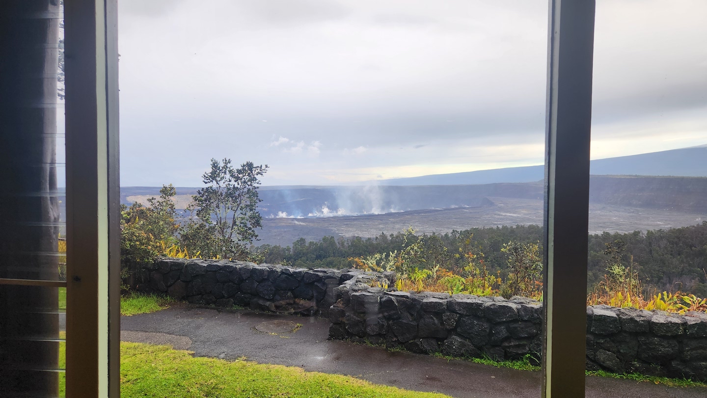
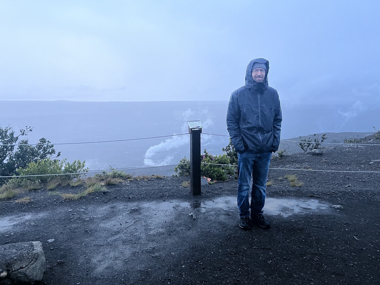
We stayed at the Volcano House because we wanted to be near the crater so we had the best chance of seeing lava. Unfortunately for us, the volcano stopped erupting several days before we arrived. We saw a tiny orange glow the first night but then it stopped. The Volcano House made a great home base though.
When I first started planning for Hawaii, so many of the top things to do lists were suggesting visiting active lava flows. I eventually learned that lava flows come and go, which makes sense, and seeing active lava is not something you can really plan for. Just an FYI if you are planning a trip and expecting to see lava flowing into the ocean like I was. Prior to our trip, I followed USGS Volcanoes and Hawaii Volcanos National Park on social media so I could stay current on the lava situation. Between when we booked our trip and arrived, Mauna Loa erupted once and Kilauea started and stopped multiple times. Basically, don’t get your hopes up.
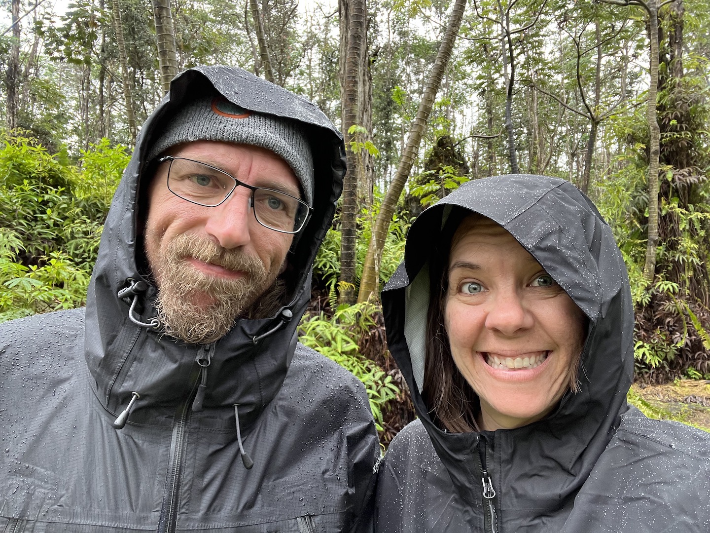
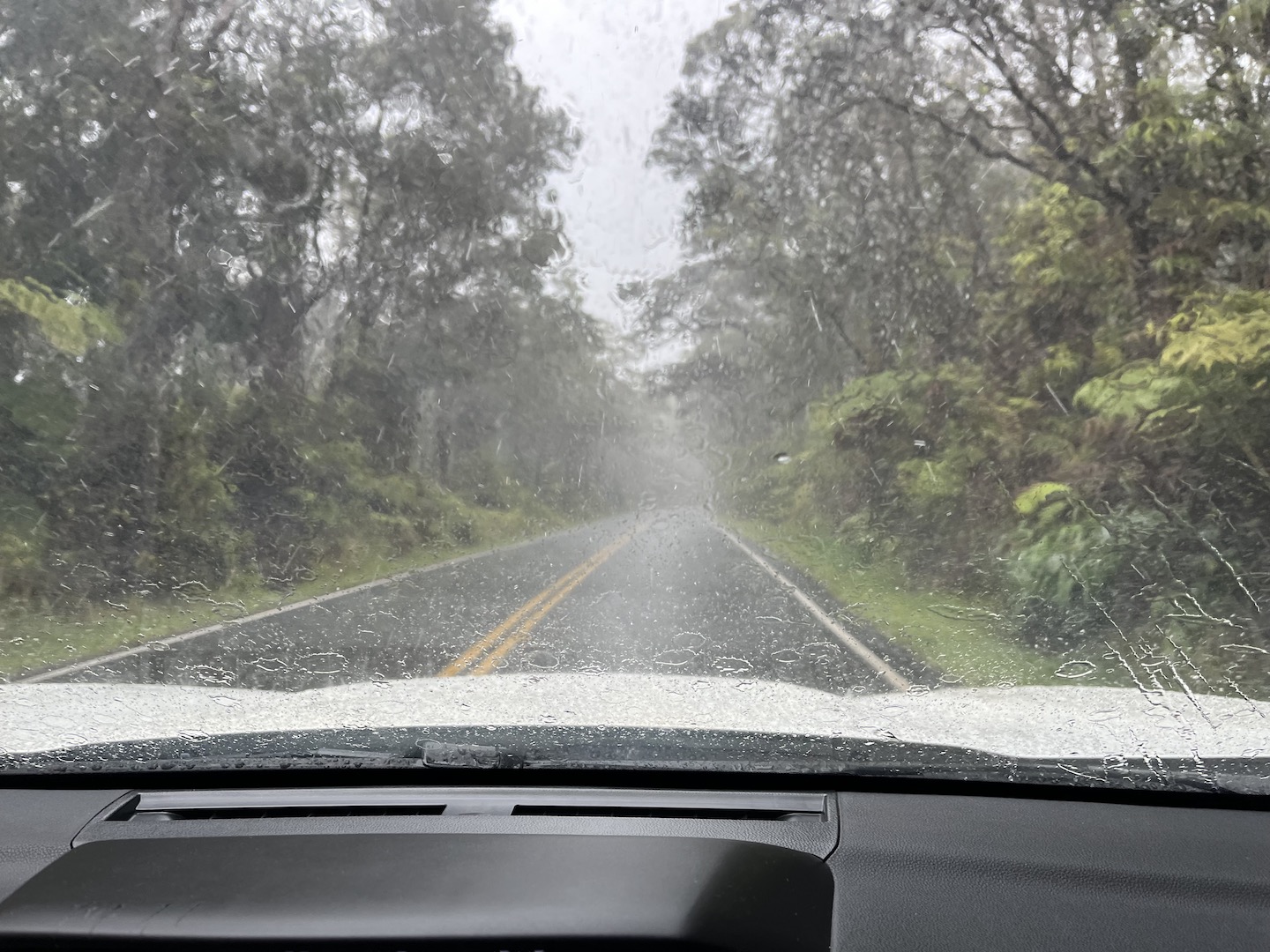
We visited in March and it was really rainy. The side of the island where the national park is is more rain foresty so that means it rains often. Be sure to bring a rain jacket but don’t let the rain prevent you from planning a trip. Granted I live in the desert and rain is a treat, but the rain added to the adventure.
We don’t own rain jackets so we borrowed some from friends for this trip. On our first full day on the island we woke up to rain but were really excited to use our rain jackets so we hopped in the car and set out to adventure in the rain. I’m sure you can see where this is going. Our first stop was Crater Rim Drive to see into the crater. It was pouring rain so I’m not sure why we actually left the hotel but we thought our rain jackets were going to save us. They didn’t. Turns out, the rain jacket I borrowed was actually a wind breaker, and rain jackets don’t protect your pants from the rain. We were sopping wet in about 60 seconds.
We got back in the car, went back to the hotel, and changed into dry clothes. Because my rain jacket was actually a wind breaker, the down jacket I was wearing underneath ended up soaking wet. Overall this was a hilarious and humbling experience. Just a reminder of how little we can actually control in life. After using a hair dryer to dry my down jacket, we drove into Hilo so I could buy an actual rain jacket. We learned two lessons in this experience. 1. Exploring in light rain is fun. Pouring rain does not make for a good experience even if you are fully waterproof. 2. Make sure your gear is actually waterproof.
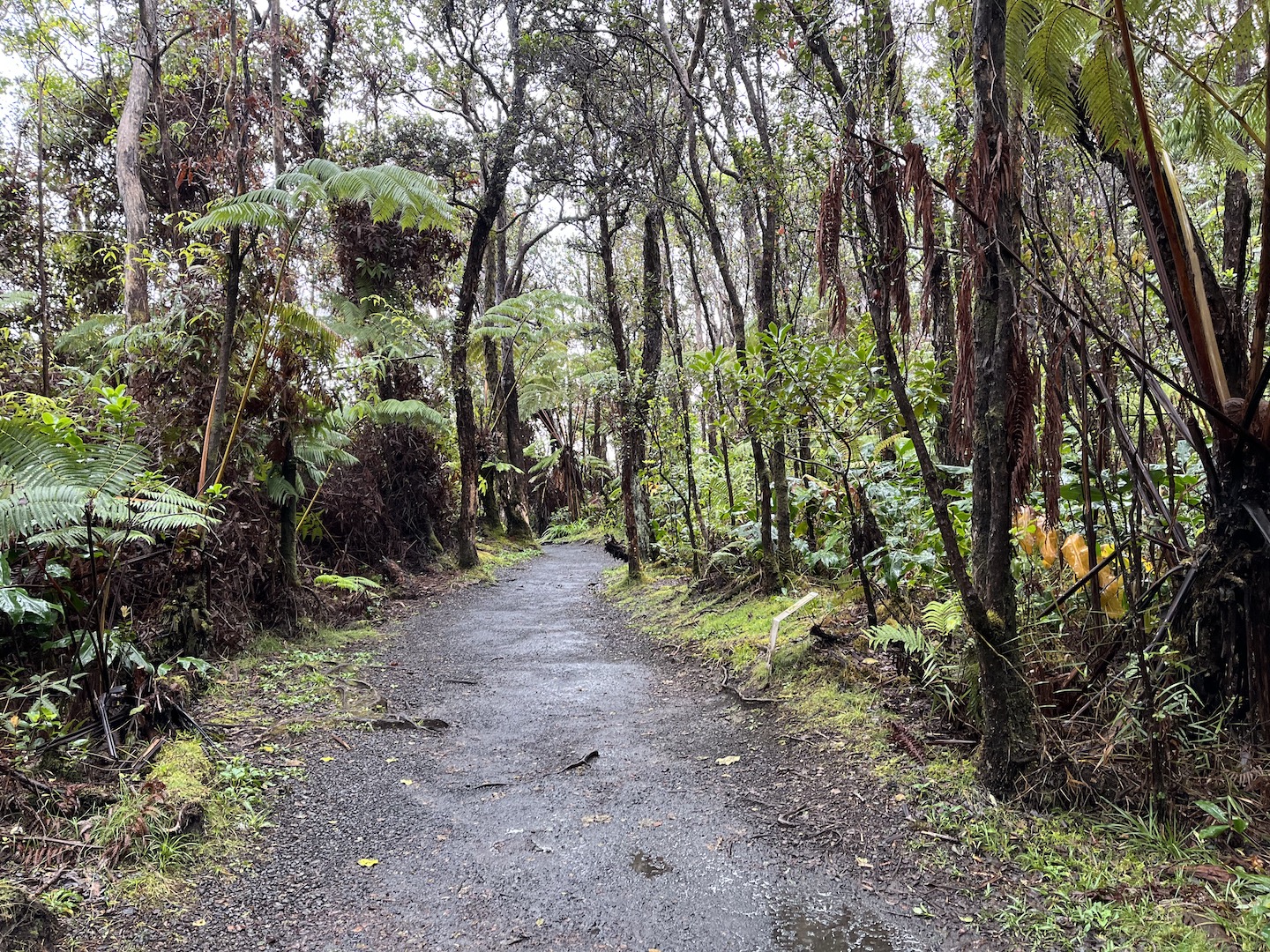
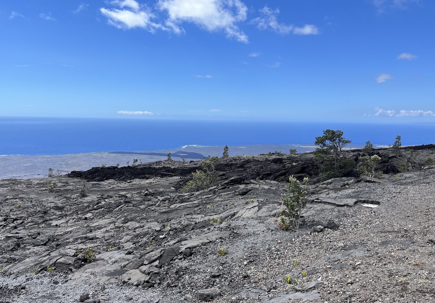
Over the next two days we explored as much of the park as we could in short bursts. Rain was is the forecast so we didn’t want to do anything that would leave us out in the elements for hours on end. That meant shorter adventures but we still saw so much and had a blast. The Chain of Craters Road is 18.8 miles and takes you from the visitor center all the way to the ocean. It’s a beautiful drive with stops all along the 18 miles. Some of our favorite stops were:
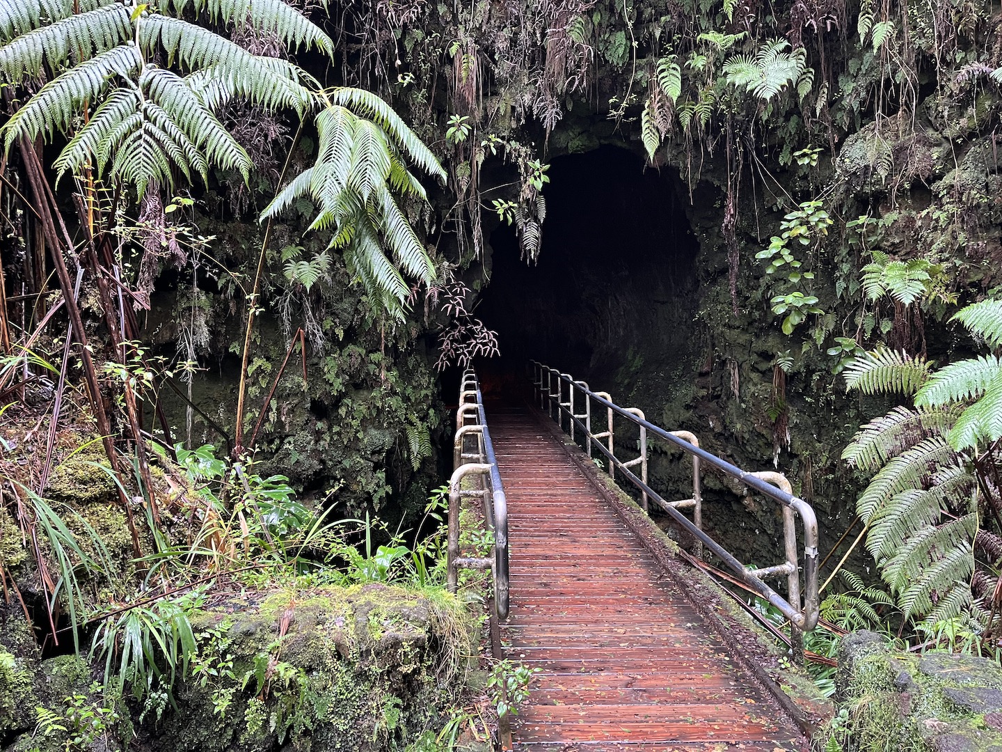
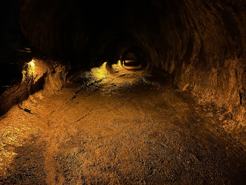
Thurston Lava Tube. The lava tube itself was a little anticlimactic but the area is beautiful. Oh, and it was raining so being in the tube gave us a quick rain break.
The entrance of the Thurston Lava Tube
Inside the Thurston Lava Tube
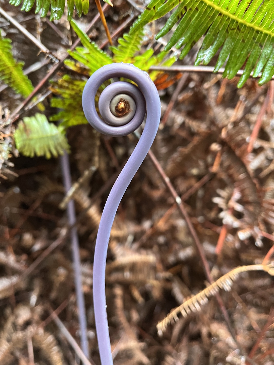
The parking lot for the lava tube is on the opposite side of the road of the trail…just a little FYI. There is a trail right in front of the parking lot so we started down that. Eventually we turned around and figured out where to go. The walk to the lava tube is through the rain forest and the flora is just gorgeous.
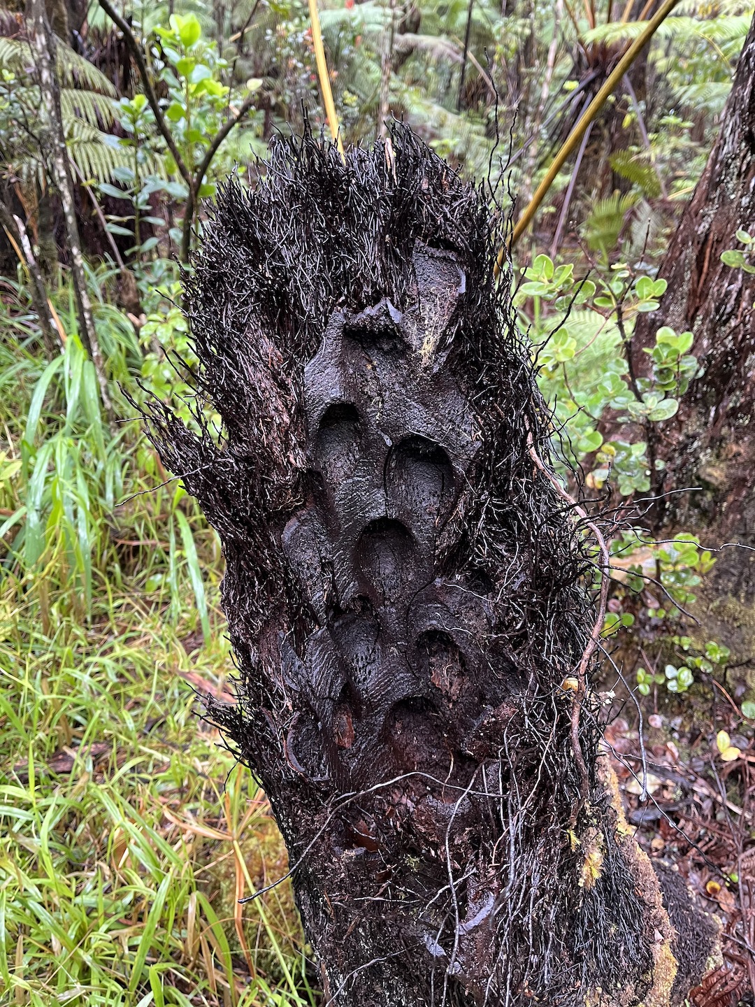
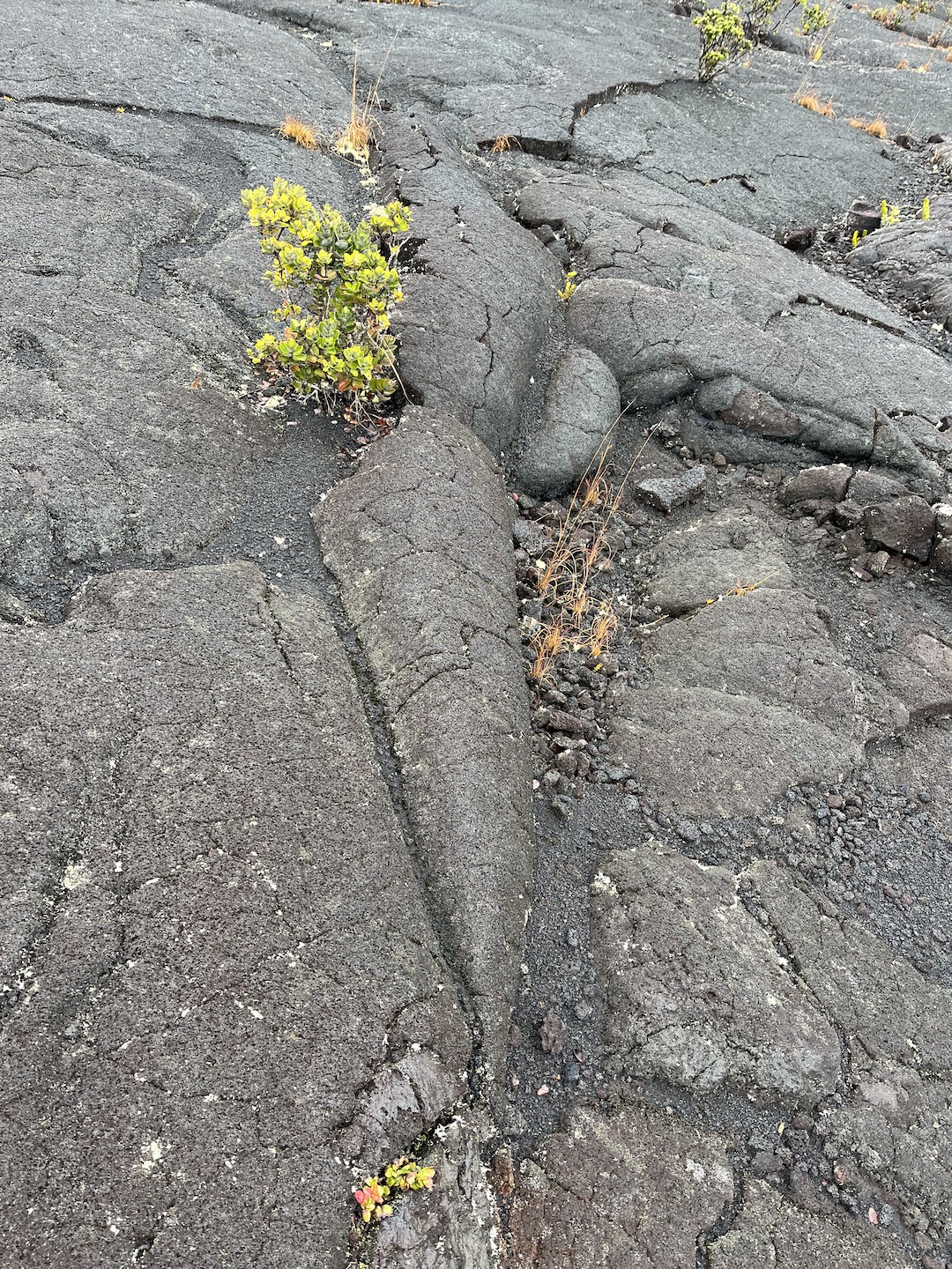
Pu’u Huluhulu Cinder Cone Hike. This hike starts at the Mauna Ula Trailhead parking lot. It takes you through a lava flow from the 1969 – 1974 eruption of Kilauea and to the top of the Pu’u Huluhulu cinder cone. The trail is marked with cairns so be sure you’re paying attention.
We were hiking in a drizzle so we basically had the trail to ourselves. The contrast between the lava and flora is beautiful. The lava carrot below is one of my favorites. Nature is the coolest.
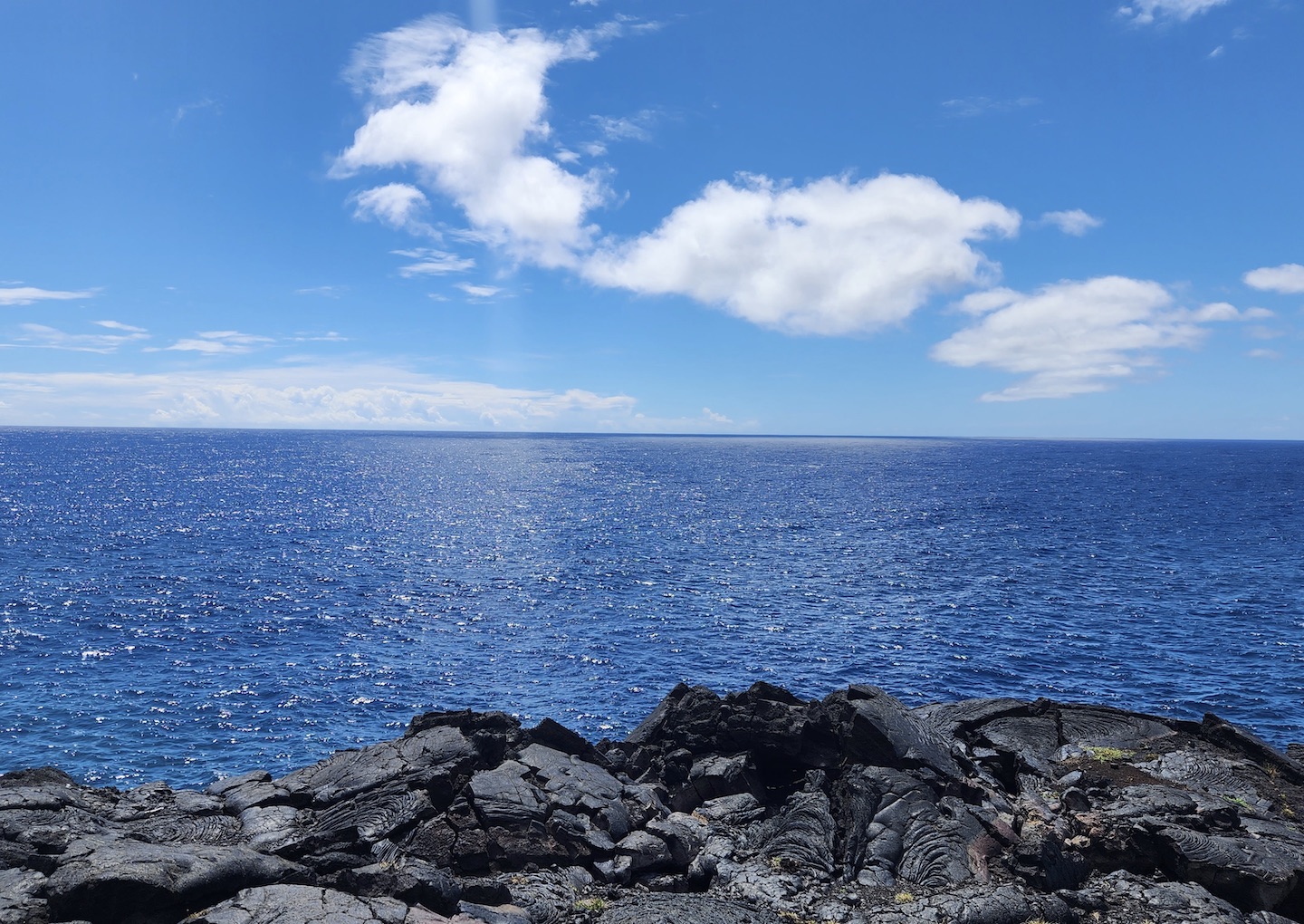
Holei Sea Arch. The Chain of Craters road ends at the parking lot for the Holei Sea Arch. It’s a 90 foot arch carved cut into the lava flows by the sea.
Holei Sea Arch
The drive down to the sea is gorgeous. Prior lava flows ran all the way to the ocean and you can see it on the drive. When it was active it looked like a lava water fall running off the cliffs.
The sea arch is a short walk from the parking lot. In general there isn’t much to do down here but it is gorgeous.
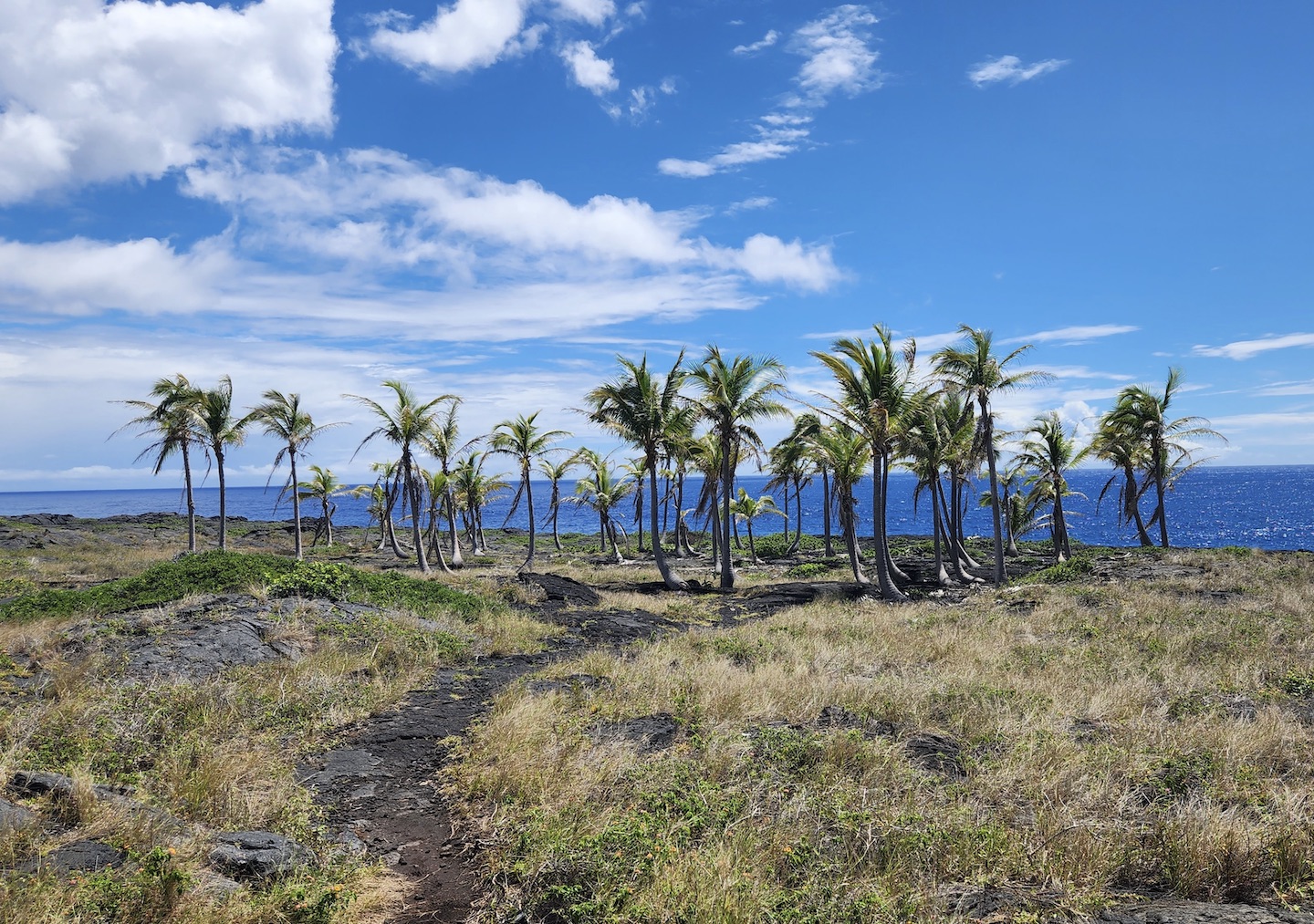
Just passed the arch we noticed a small grouping of coconut palm trees so we walked over. I’m not sure of the story behind them. They either grew out of the lava or the lava somehow missed them. So random.
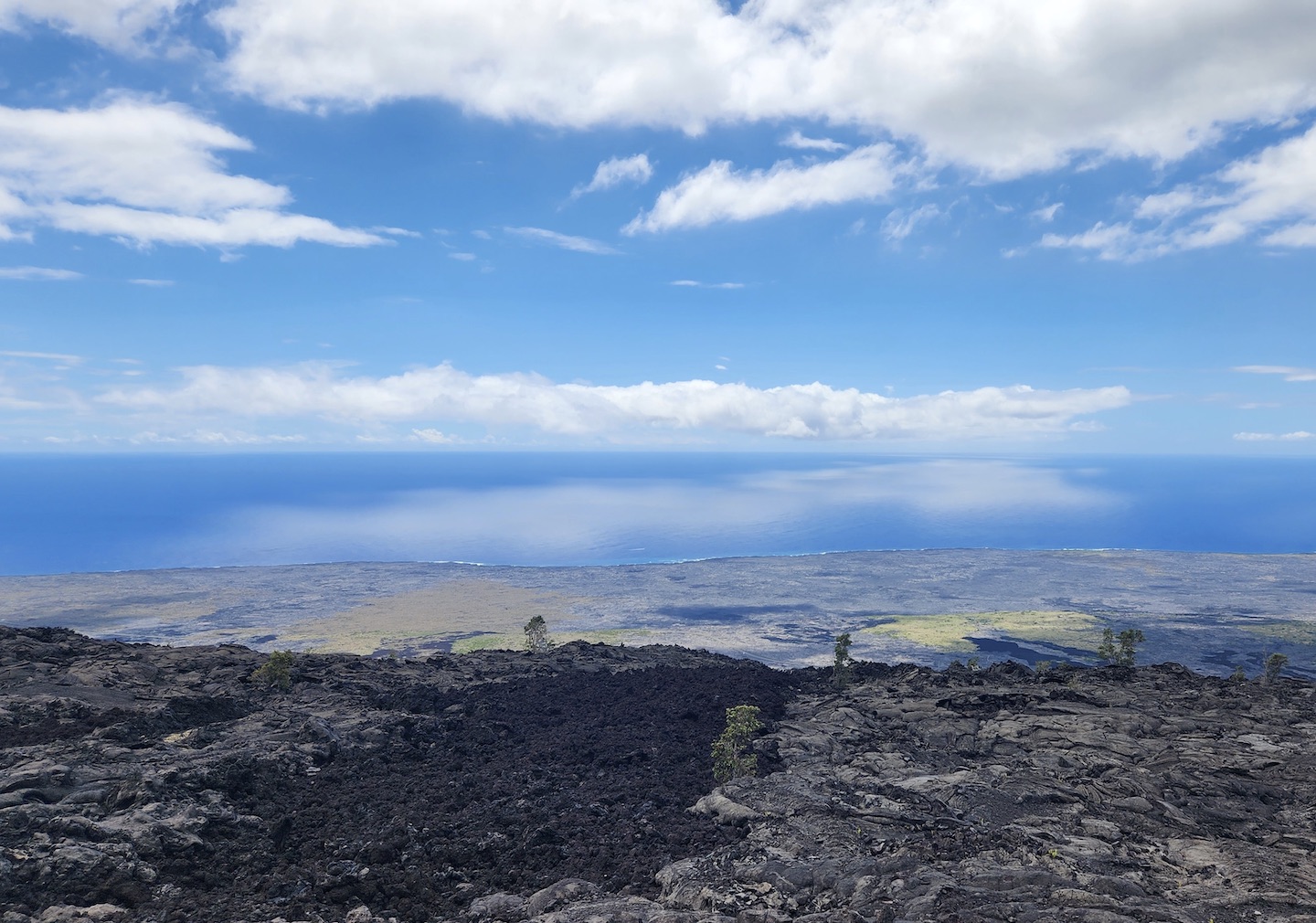
On our way back up the road we stopped at the top of the hill to eat lunch and take in the view one last time. The reflection of the clouds on the ocean was breathtaking. I could have stayed there all day.
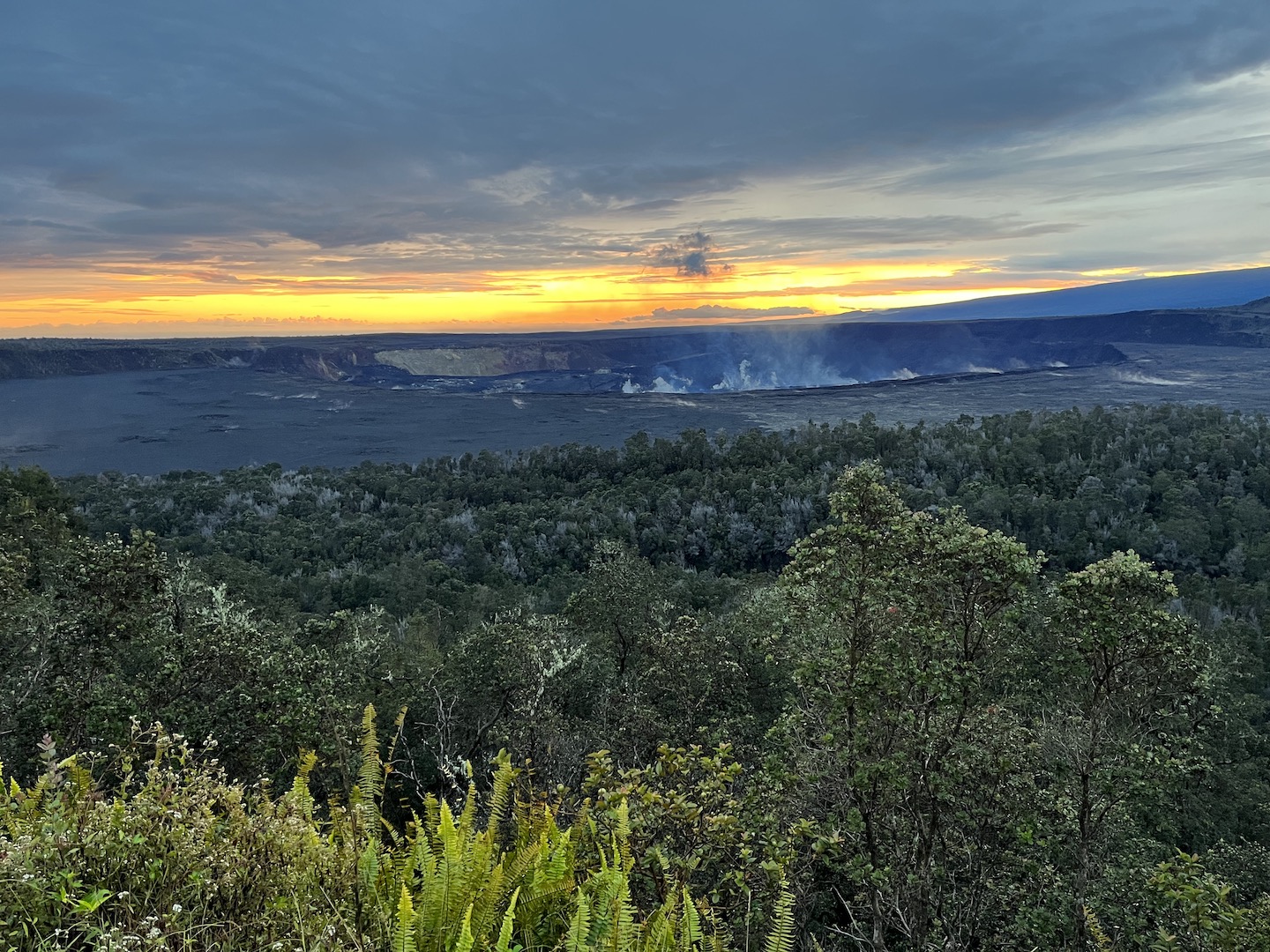
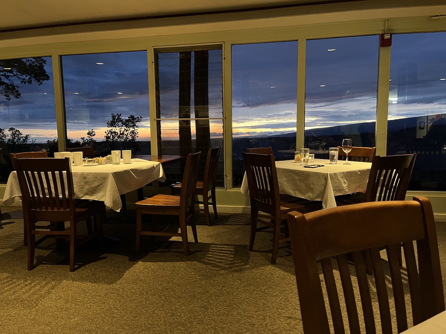
Our final night in the park we ate dinner at the Volcano House. Exploring and hiking all days works up an appetite and the food was fantastic. The restaurant overlooks the crater so we were treated to sunset with dinner.
We had a great time and are glad we made the trip to Hawai’i Volcanos National Park.
https://www.theroadwevetraveled.com/wp-content/uploads/2023/06/IMG_3337.jpeg10801440Carolinehttp://www.theroadwevetraveled.com/wp-content/uploads/2015/08/RWT_Logo@3x-300x143.pngCaroline2023-06-25 22:16:232023-06-25 22:16:26Hawai'i Volcanoes National Park
When you think of Everglades National Park in June what comes to mind? Humidity and swarms of mosquitoes? Yup. Me too. Except never actually having experienced that, I was like how bad can it be? It was bad. Like I was literally running from swarms of mosquitoes. While I’m not sure I want to relive that experience anytime soon, have you really lived if you haven’t ran from mosquito swarms? I think not. Crazy adventures make for the best memories/stories.
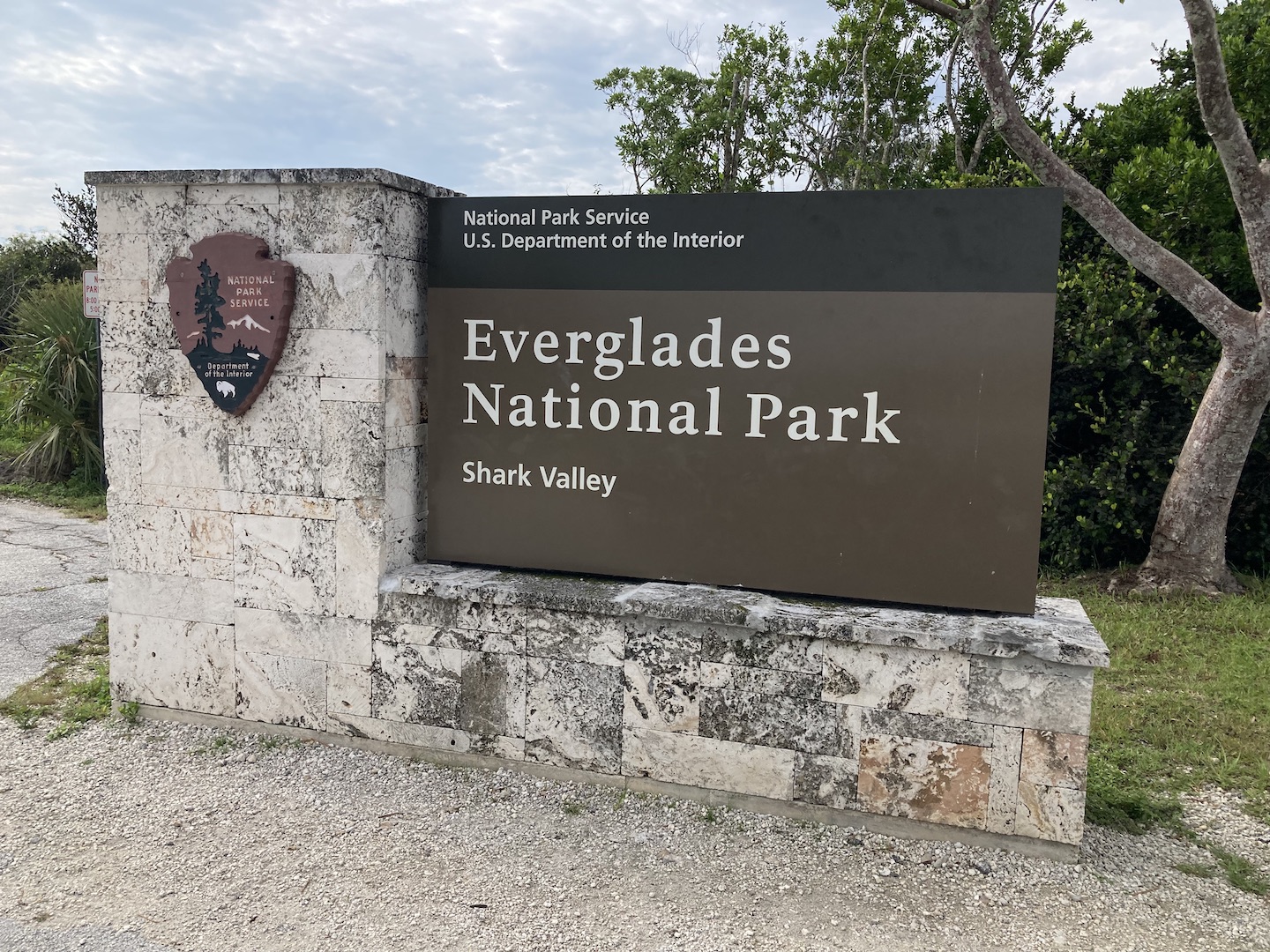
Everglades National Park sign taken from the car with the windows up because mosquitos
I’ve always wanted to visit Everglades and am not sure when we’ll be back that way so we decided to ignore the warnings and visit in June. I was really excited for Everglades because the terrain is so different from anything I’ve ever seen.
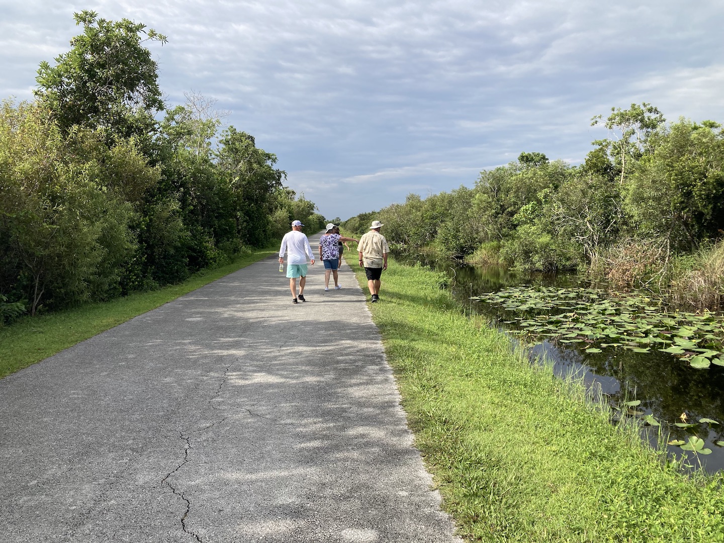
We arrived at the Shark Valley visitor center at 9am when it opened. Everglades is divided into several sections and we chose the Shark Valley area because we wanted to take an airboat ride which is in the northern section of the park. Shark Valley is a neat area with the chance for lots of wildlife sightings. There is a 15 mile path/loop that follows a river where alligators and other wildlife live. It’s really pretty. You can walk the path, rent a bicycle, or take a tram to complete the 15 miles. We didn’t have time for the tram ride so we opted to walk for a bit.
Shark Valley Loop Road
As all good visitors do, we stopped at the visitor center and asked the park ranger for a hike suggestion. He must have not liked our group because he gave no warning for the suggestion. Honestly, I have no idea why he suggested it in the first place. It was not appropriate for June.
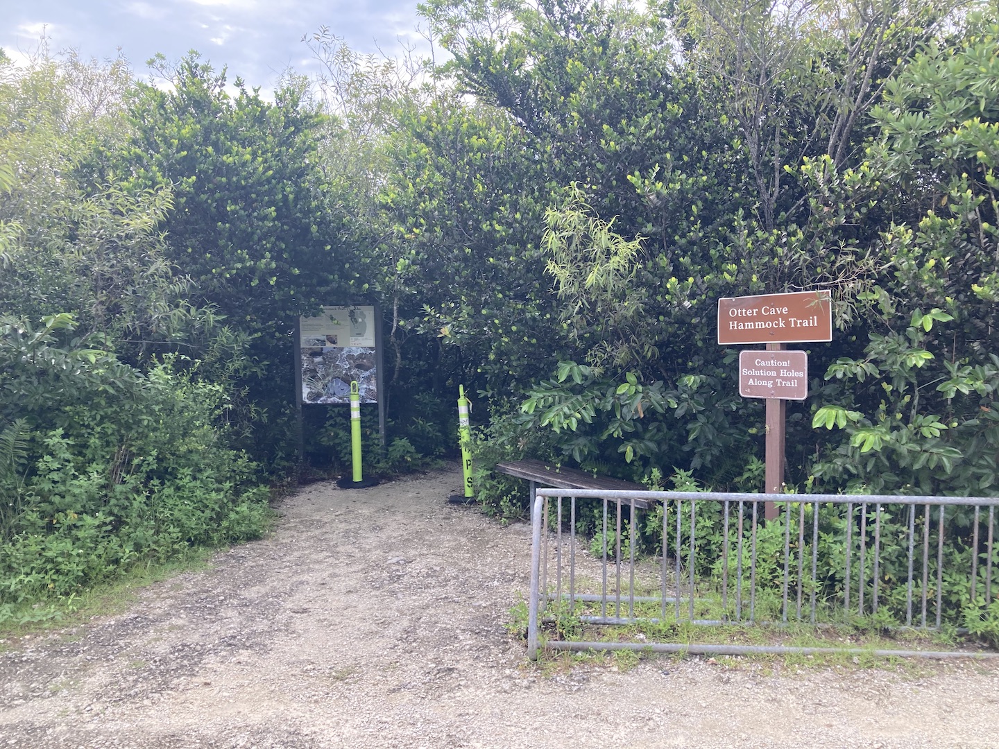
Entrance to Otter Cave Hammock Trail
The loop the ranger suggested was Bobcat Boardwalk Trail, Shark Valley Loop Road, Otter Cave Hammock Trail, and then back along Shark Valley Loop Road to the car. The mosquitoes weren’t too bad to start but then we made the brilliant decision to hike the Otter Cave Hammock Trail. Sounds like a cute trail, right? I have no clue what the trail looks like because we were being eaten alive and trying to run out of there as fast as possible. Turns out walking into a heavily wooded area in the middle of the summer is a terrible decision. Two of the six in our group knew better and didn’t follow us in. The four of us from Arizona foolishly kept going.
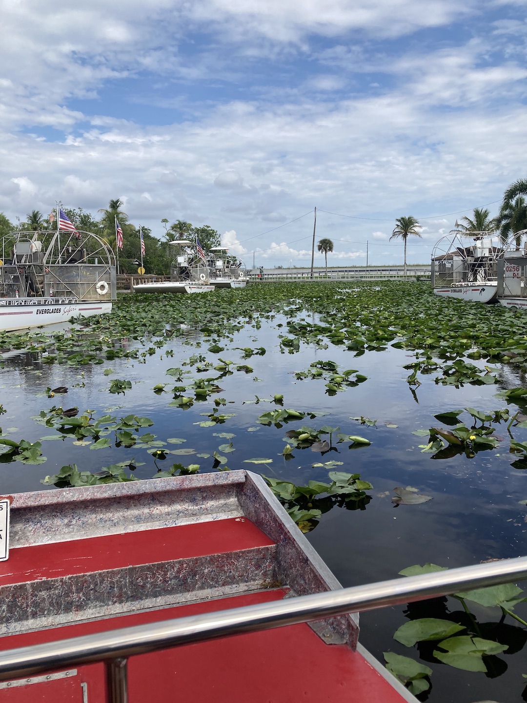
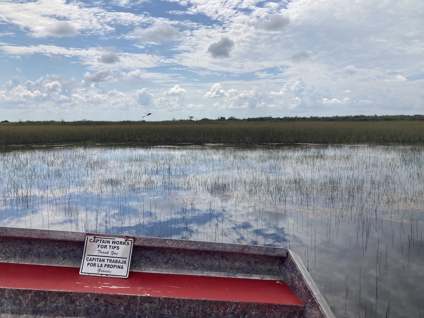
Once we exited Mosquito Cave Trail, several of us literally ran back to the car, being chased by swarms of mosquitos (you probably think I’m exaggerating but I’m not), jumped in and declared we were done with the Everglades. My skin is itching just thinking about how many mosquito bites I had. We had 11am tickets for an airboat ride, which it was not yet time for, but had no more interest in exploring so we drove to the airboat place and sat in the car until it was time for our ride. Since there were six of us, we had booked a private tour and our tour guide was able to start our tour a little earlier than planned.
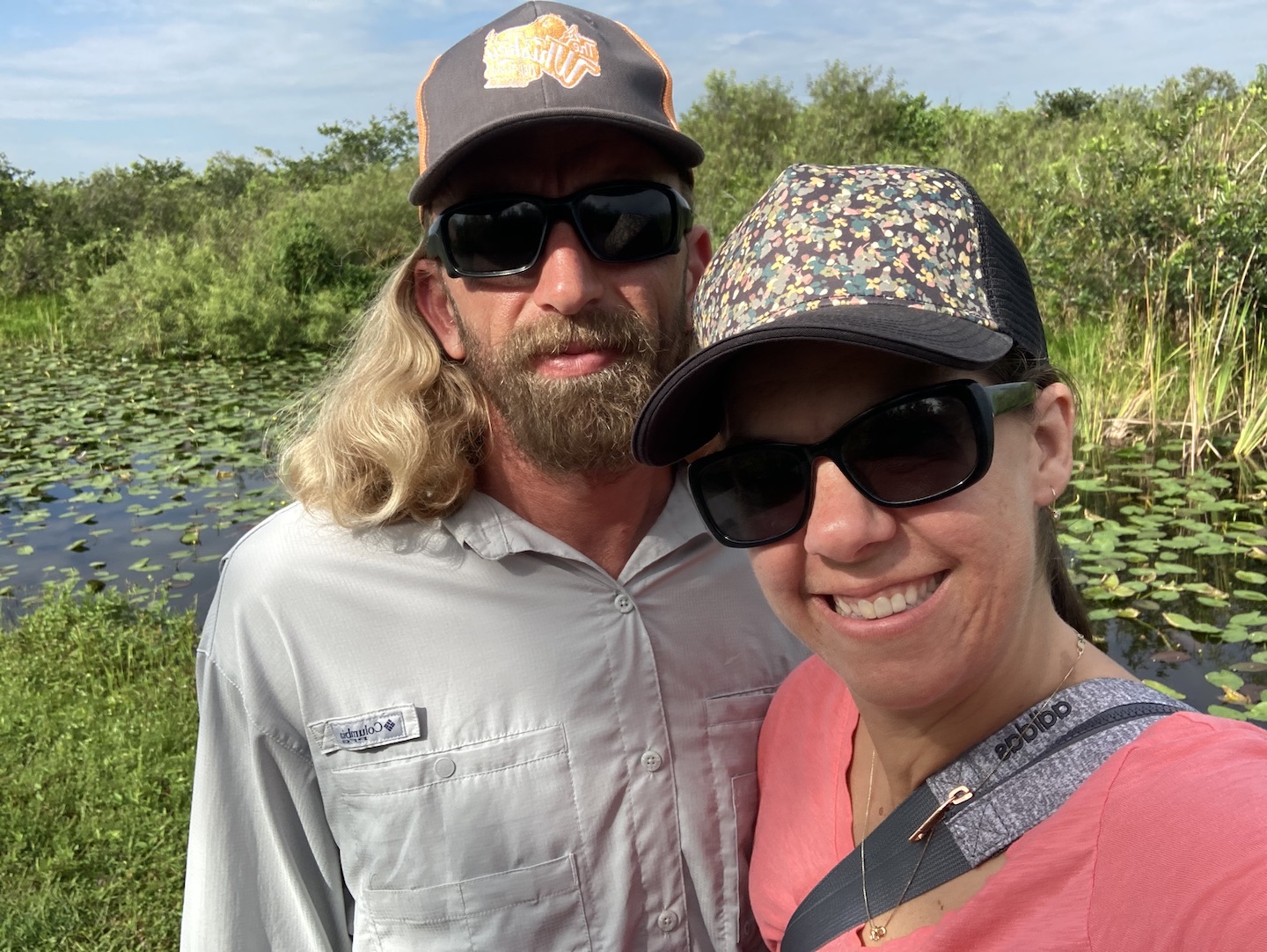
Everglades Safari Park Airboat Tour
The best decision we made was to book an airboat tour. If you visit in the summer, this is a must. Summer is wet season in the Everglades and the rain refills the grasslands. During the winter, or dry season, the ground dries up in many places. Ecosystems are so cool. In my next life I want to become a environmental scientist. Is it too late to change careers?
We thoroughly enjoyed the breeze in our face and lack of mosquitoes. Our tour guide was a lot of fun and shared lots of cool information. I could have spent hours out there. The area was gorgeous and gliding through the water and grass was a blast. There are airboat tours all over the area but only a few are licensed to operate in Everglades National Park. If that matters to you, be sure to look at who’s authorized to operate in the park.
Airboat tour in the Everglades
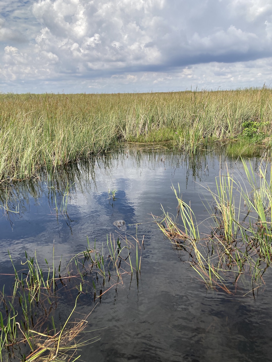
We didn’t see much wildlife because who the heck wants to be out in the middle of June. We were there to ride in an airboat so any wildlife was a bonus but we did happen to see one alligator. A mother guarding her nest of eggs. In the picture below, there is a dark circle in the middle of the picture. What looks like a rock is her head. Her nest is in the grass somewhere in the back.
Mama alligator in Everglades National Park
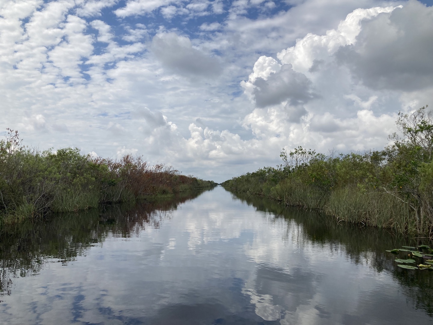
The views were incredible. I’m not sure if the water is always that still or if we were there on a good day but everywhere we turned, the sky perfectly reflected on the water. Hence why I could have stayed out there all day.
Evergaldes National Park
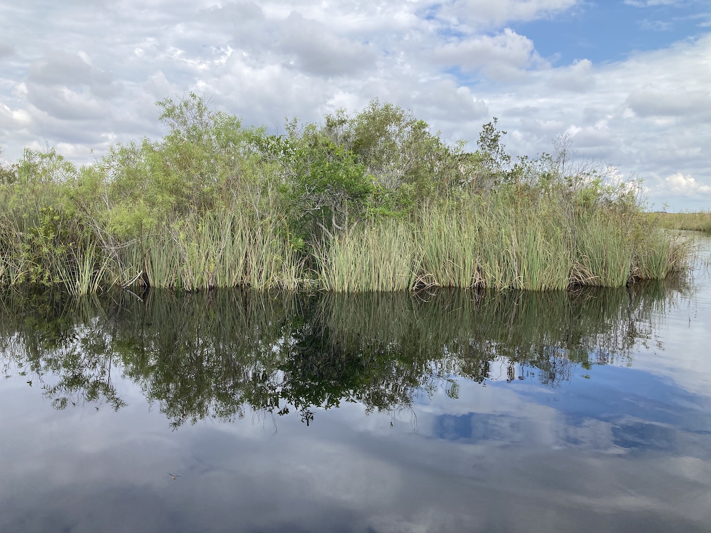
In the middle of the picture below is a pond apple tree. They’re all over this area. The crazy thing about these apples is that the seeds are poisonous. What?! So basically don’t eat pond apples.
Pond apple tree
I know I’ve complained a lot about the mosquitos but I’d do it all over again if given the chance. If you are planning to visit in the summer, I’d suggest minimizing your walking. Take the tram, rent a bicycle, or take an airboat tour. You want to be moving faster than the mosquitos. I’m disappointed that we didn’t get to see more of the area but that just means we’ll have to go back (not in June)!
Airboat ride through the Everglades
https://www.theroadwevetraveled.com/wp-content/uploads/2022/07/IMG_9255.jpeg14401080Carolinehttp://www.theroadwevetraveled.com/wp-content/uploads/2015/08/RWT_Logo@3x-300x143.pngCaroline2022-08-11 05:31:222022-08-11 05:31:22Everglades National Park in June
After hearing that I went on a solo camping trip, several friends commented that they’d love to embark on a solo trip but don’t think they could do it. First of all, you are stronger than you think and you can certainly do it! Second, if you’d rather go on a girls trip let me know and I’ll tag along. 😉 I wrote this post in a way that will hopefully take you on this journey with me. Grab a drink and a snack because this one is a little long!
I’m not normally big on birthday celebrations but I turned 40 this year and wanted to ring in the decade right. There was no way I was going to do anything remotely close to the normal grind on my 40th. I wanted fun, new and epic. The problem was that my birthday was in the middle of the week and my husband is out of PTO. At first I felt sorry for myself, then I thought about trying to convince someone to come with me, and then I realized that I can do things by myself. The idea made me a little nervous so I knew I needed to make it happen. And that’s how this trip was born.
Leading up to the trip, the campsite was booked, the park was researched, dates were taken off work, but I kept the idea very quiet. I told only a couple people who needed to know, like my husband, and a few coworkers who happened to see some cryptic markings on my calendar. By keeping it quiet I was leaving room to back out as I still wasn’t totally comfortable with the idea.
MONDAY EVENING: I decided I wasn’t going. I thought of all the reasons why it was unsafe, stupid, thought of all the what if’s, and firmly told my husband I was staying home.
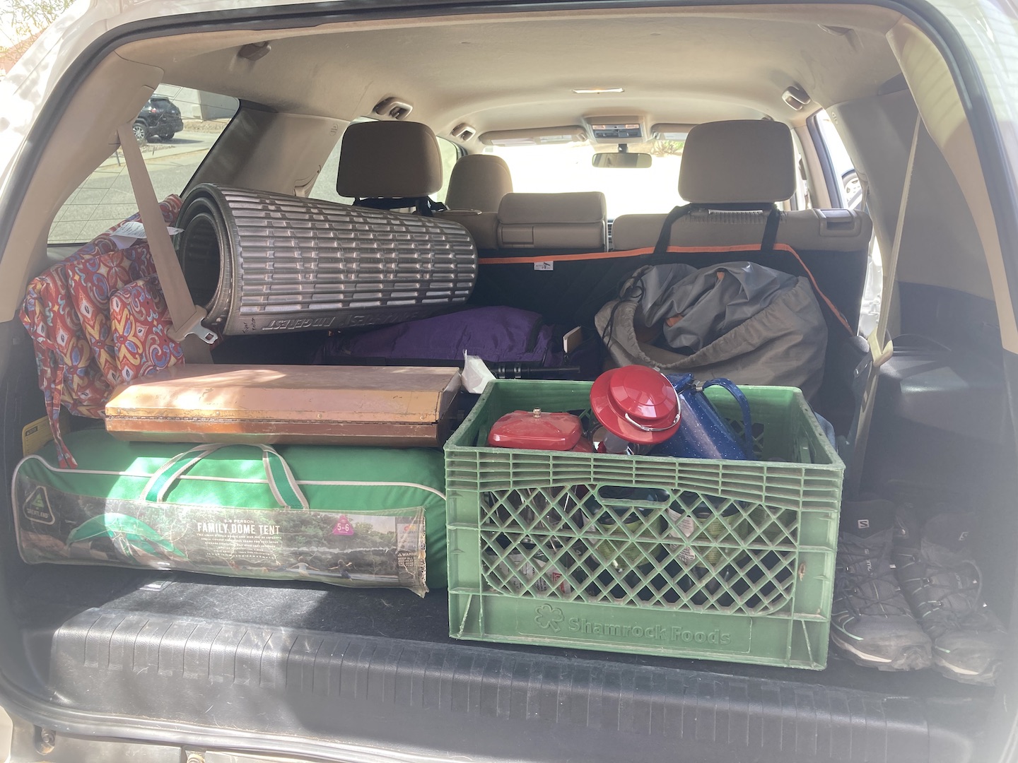
TUESDAY MORNING: I was driving home from the gym, thinking about what I would do instead of solo camp and realized that I was giving in to fear and that I’d probably regret not going for the rest of my life. I got to work and mentioned this to a coworker who proceeded to give me the best pep talk (we all need someone like this in our lives!), wrapped me in a virtual hug and by the end of the conversation the trip was back on. But for real this time. I spent the rest of the day frantically shopping and packing. And overpacking.
WEDNESDAY MORNING: I planned to leave early Wednesday morning but ended up having to work for a few hours. I finally got on the road around 11am. Google told me Joshua Tree National Park (JT) was five hours away but with stops and such it took about six. One thing I missed driving solo is a navigator. I knew there’d be no gas in the park but had no idea where I would need to stop to get gas. I could have figured this out ahead of time but am not used to planning to this level.
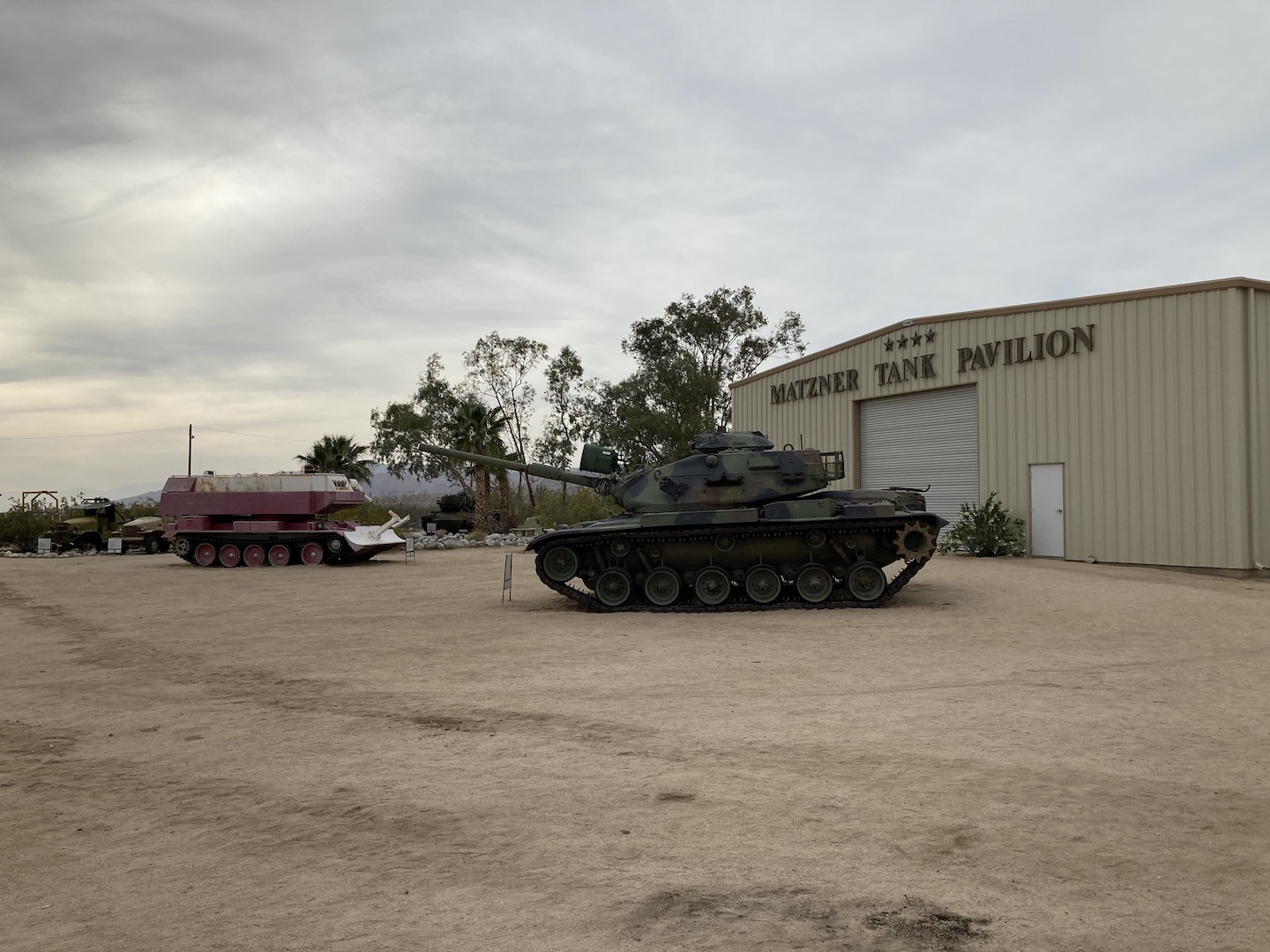
There were still so many unknowns at this point on the trip so the decision of where to stop for gas carried more weight than normal. I knew I was getting close to JT and saw three names on a sign so I decided I’d stop at the last one which was presumably the closest to JT. Turns out, the last one is just a road. At this point I was regretting not stopping at every gas station I passed but I kept going. The point of this trip was to work on not letting fear take over. I saw a sign for an upcoming summit and assumed it was just the top of a pass. I guess it was but they also had gas! And the General Patton Memorial Museum and Matzner Tank Pavilion. That was a fun stop and a huge sigh of relief. I filled up on gas, took a few pictures and headed to JT.
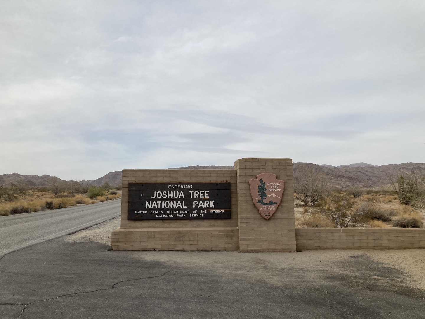
Of course, I had to stop for the obligatory sign picture.
Shortly after I entered the park I stopped at the Cottonwood Visitor Center to get a map. There were six kids, probably more like college students, there also and they asked me to take their picture. They handed me a disposal camera and a polaroid. The encounter made me chuckle and also reinforced that I’ve lived long enough now to see my childhood regain in popularity. I guess that’s fitting for 40. I made my way towards the campground and enjoyed the quiet drive through the park.
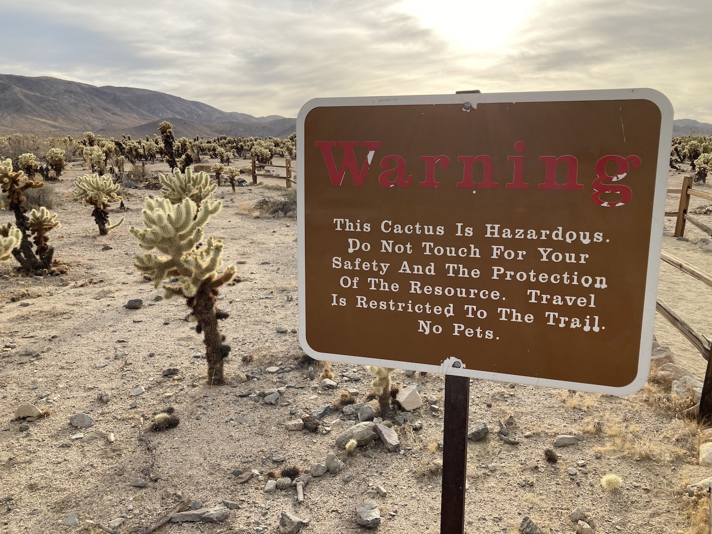
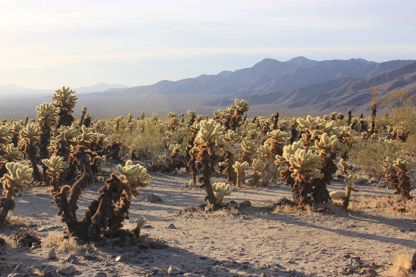
Along the way I stopped at the Cholla Cactus Garden. Living in the desert myself, cholla are not new to me so this sign made me laugh.
Cholla Cactus Garden
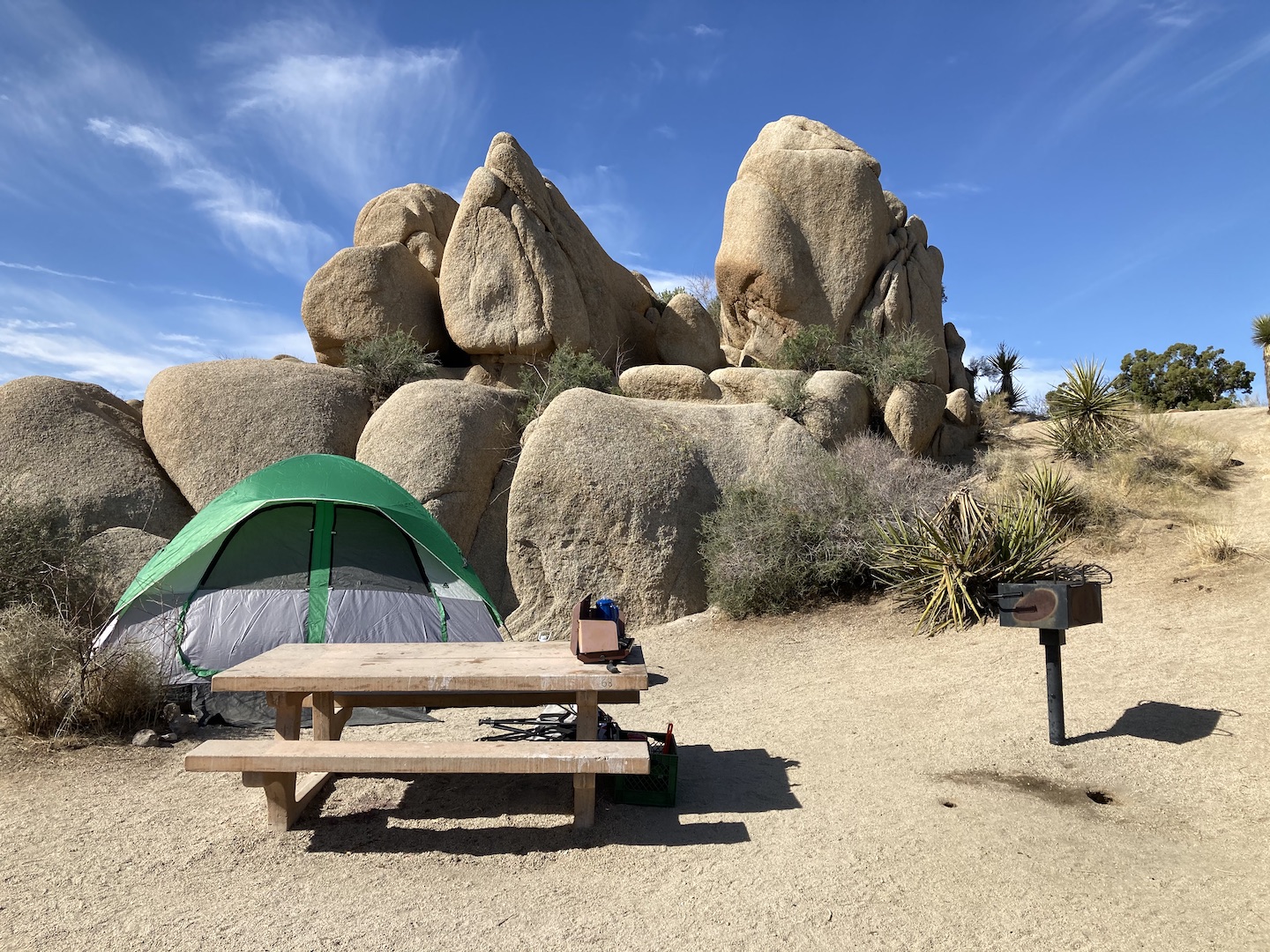
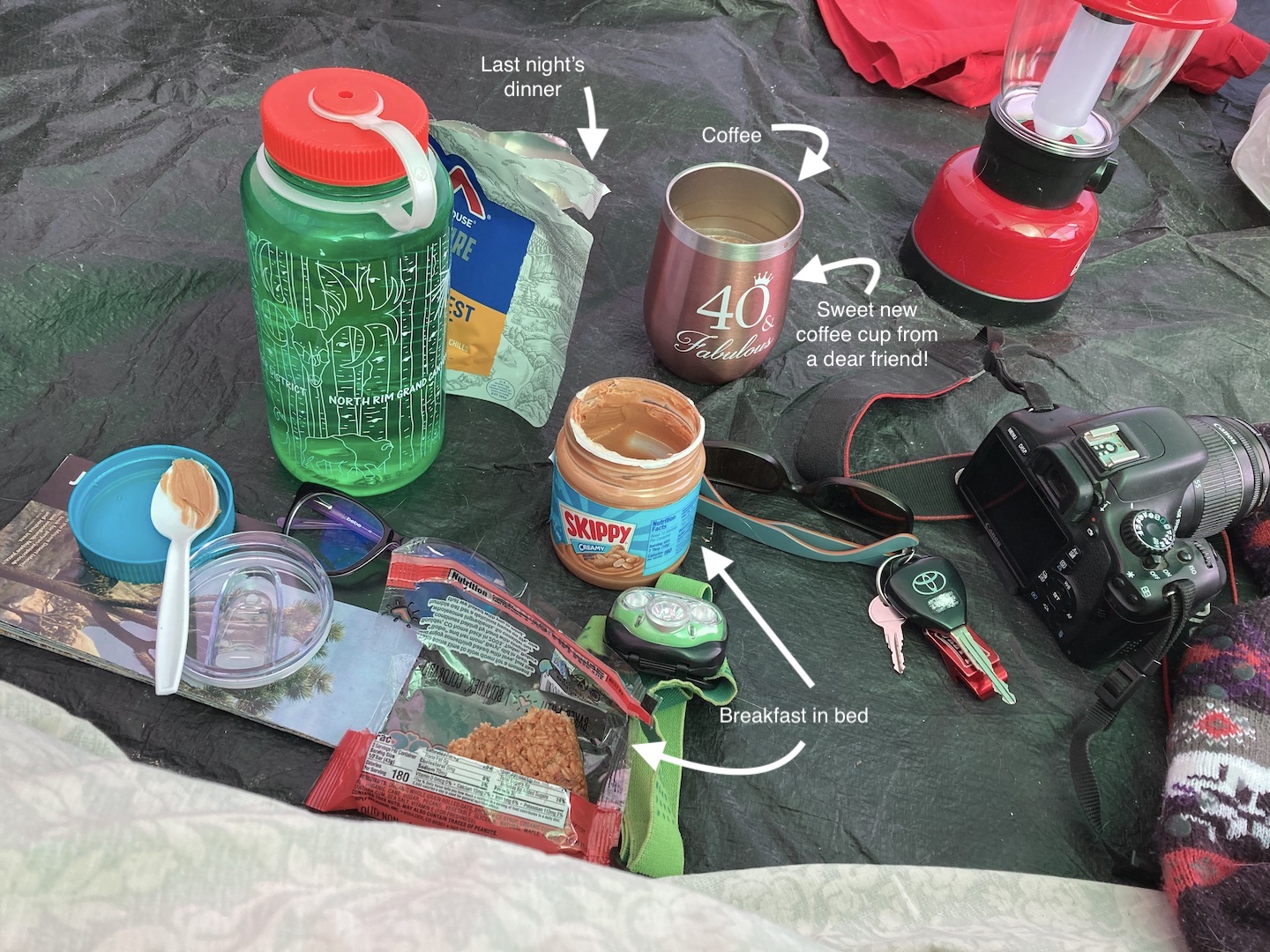
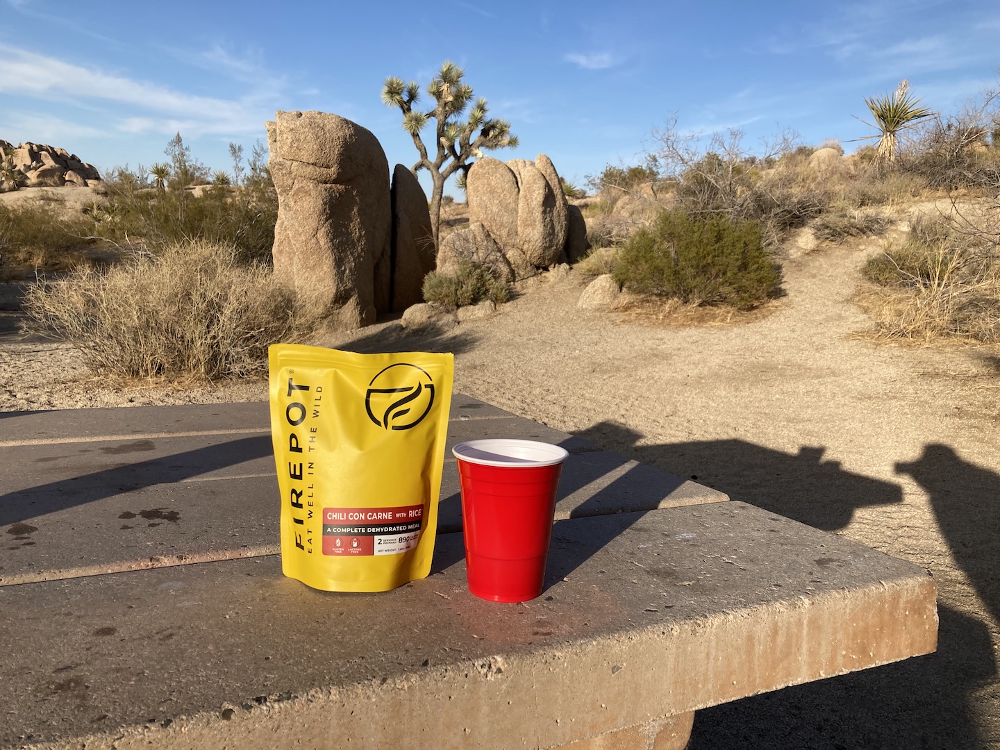
I arrived at the Jumbo Rocks Campground just before sunset. Surprisingly, I still remembered how to set up the tent! I got everything set up and popped open a bottle of wine. I didn’t want to deal with cooking on this trip so I brought oatmeal bars for breakfast, wraps for lunch, and backpacking meals for dinner. The only cooking I had to do was boil water for coffee and dinner. Backpacking meals really aren’t that great when not backpacking but they still beat having to actually make and clean up a meal.
Jumbo Rocks Campground campsite
Sunset from Jumbo Rocks Campground
I ate dinner sitting in a chair and watching the sunset. At this point the stress of the day was starting to melt away but it was also starting to get cold. I retreated to my tent pretty early with the plan of reading but was so tired I crashed. Several hours later I was reminded of the downside to tent life when the wind picked up and it felt like my tent was going to fly away. This went on for a while so I ended up playing games on my phone for a few hours.
THURSDAY – MY BIRTHDAY!: When I awoke the next morning I was glad to see I hadn’t blown away during the night. I boiled some water for coffee and got back in bed.
I opened my book and started reading and since I had no required agenda, I kept pushing my self imposed deadline back. I read for an hour or two before finally getting out of bed to start the day.
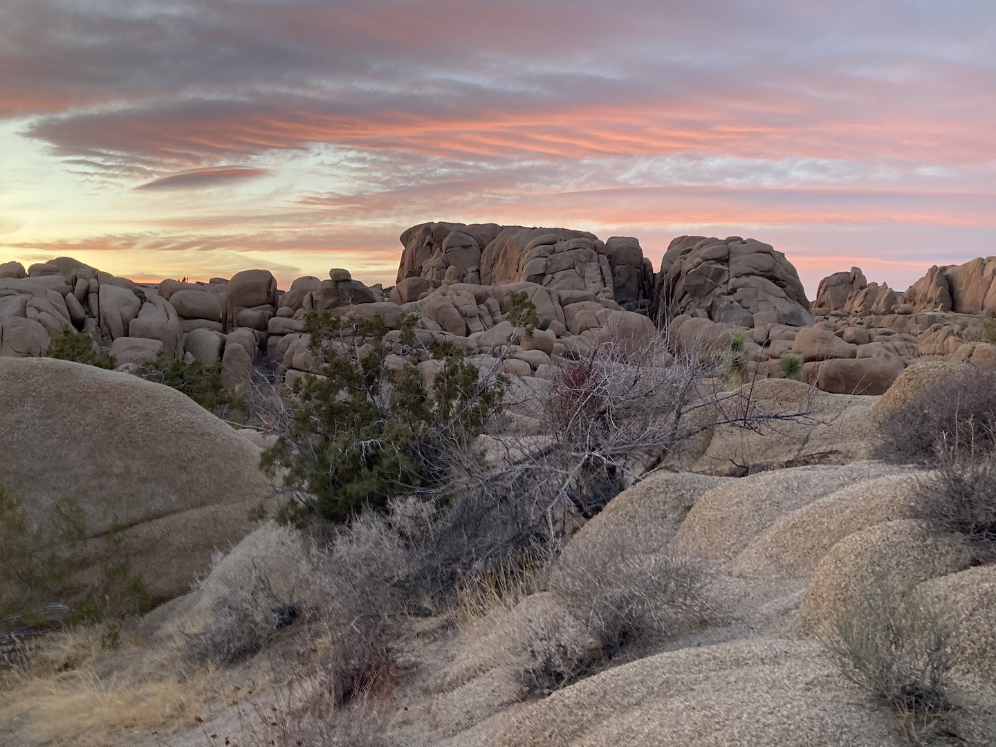
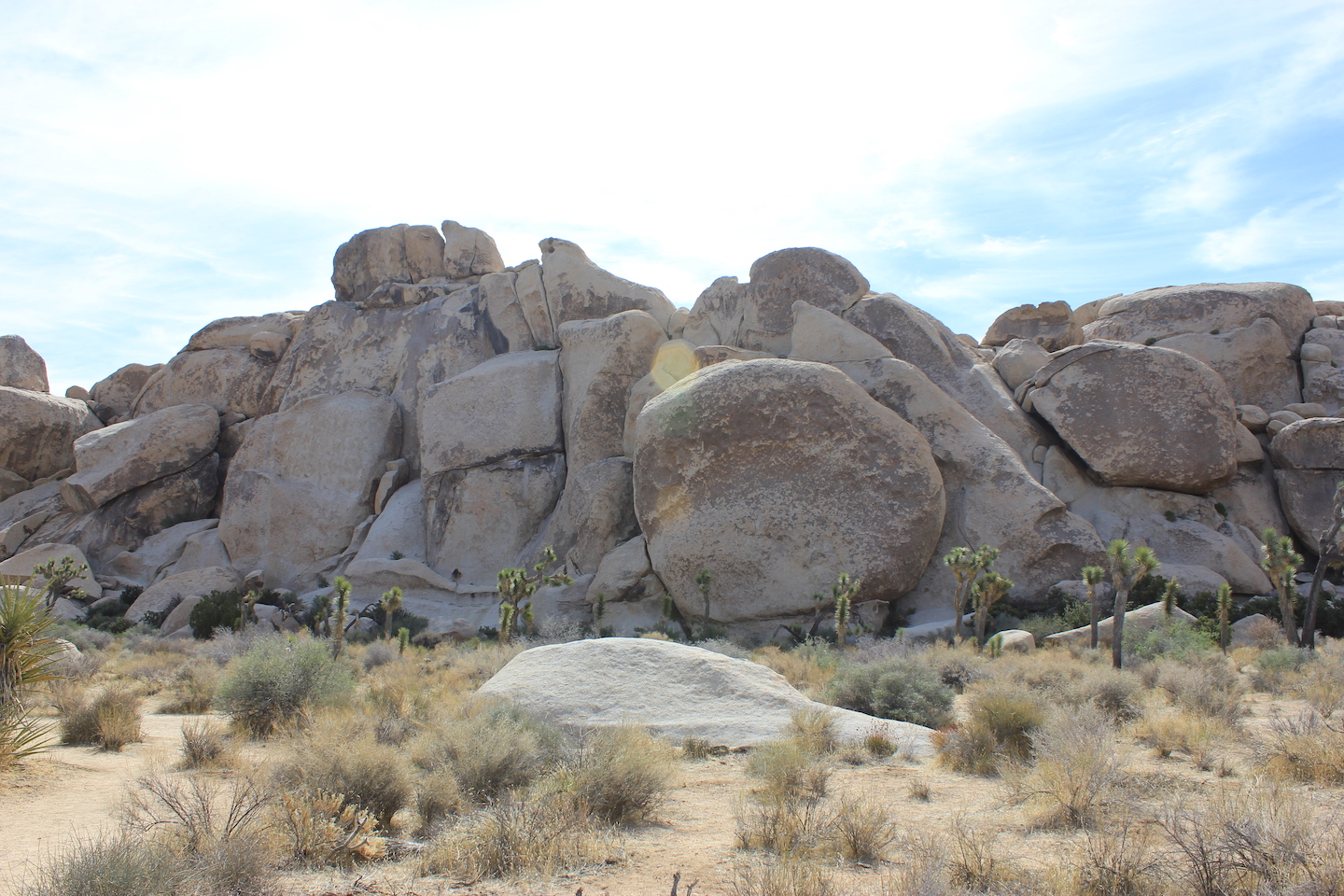
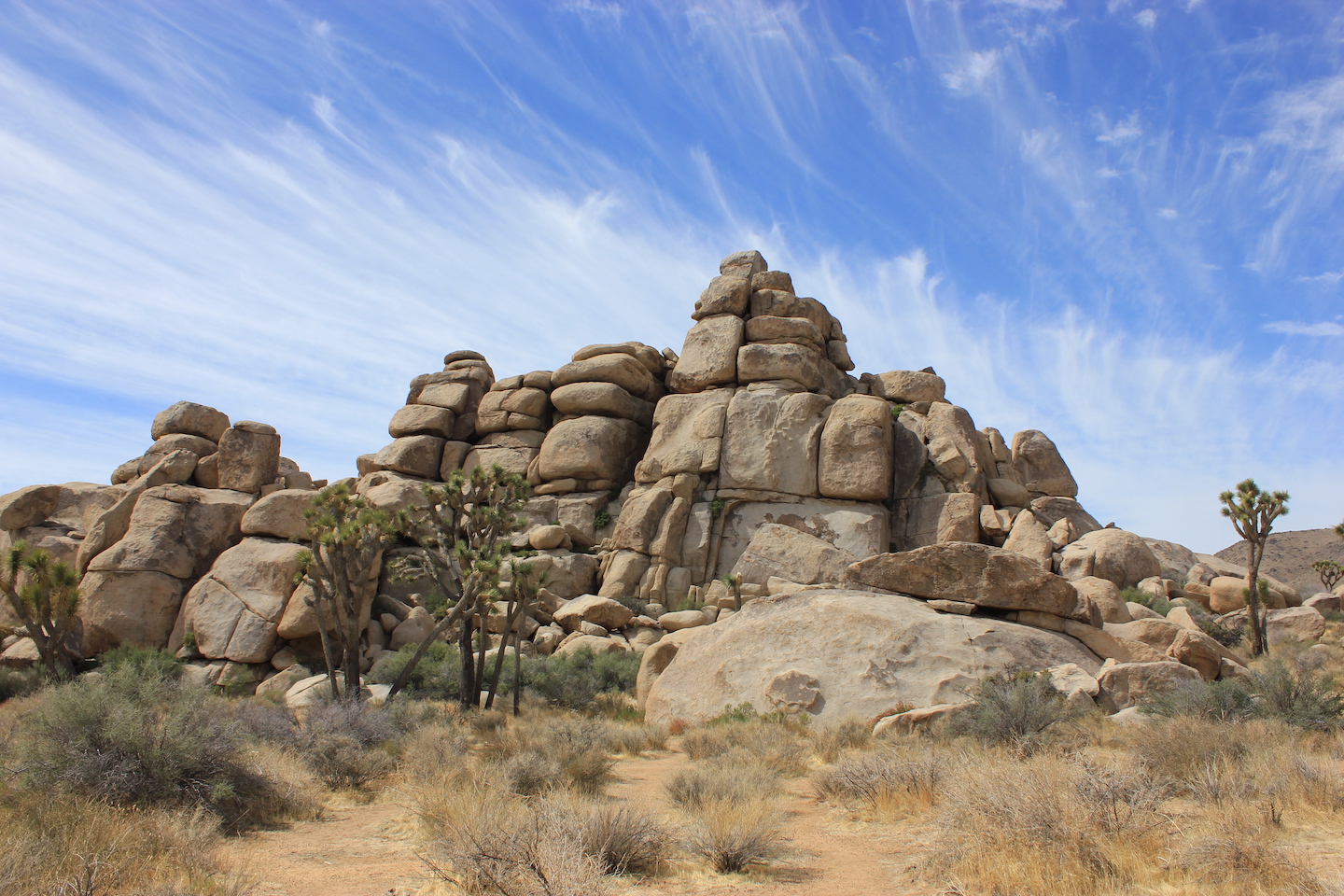
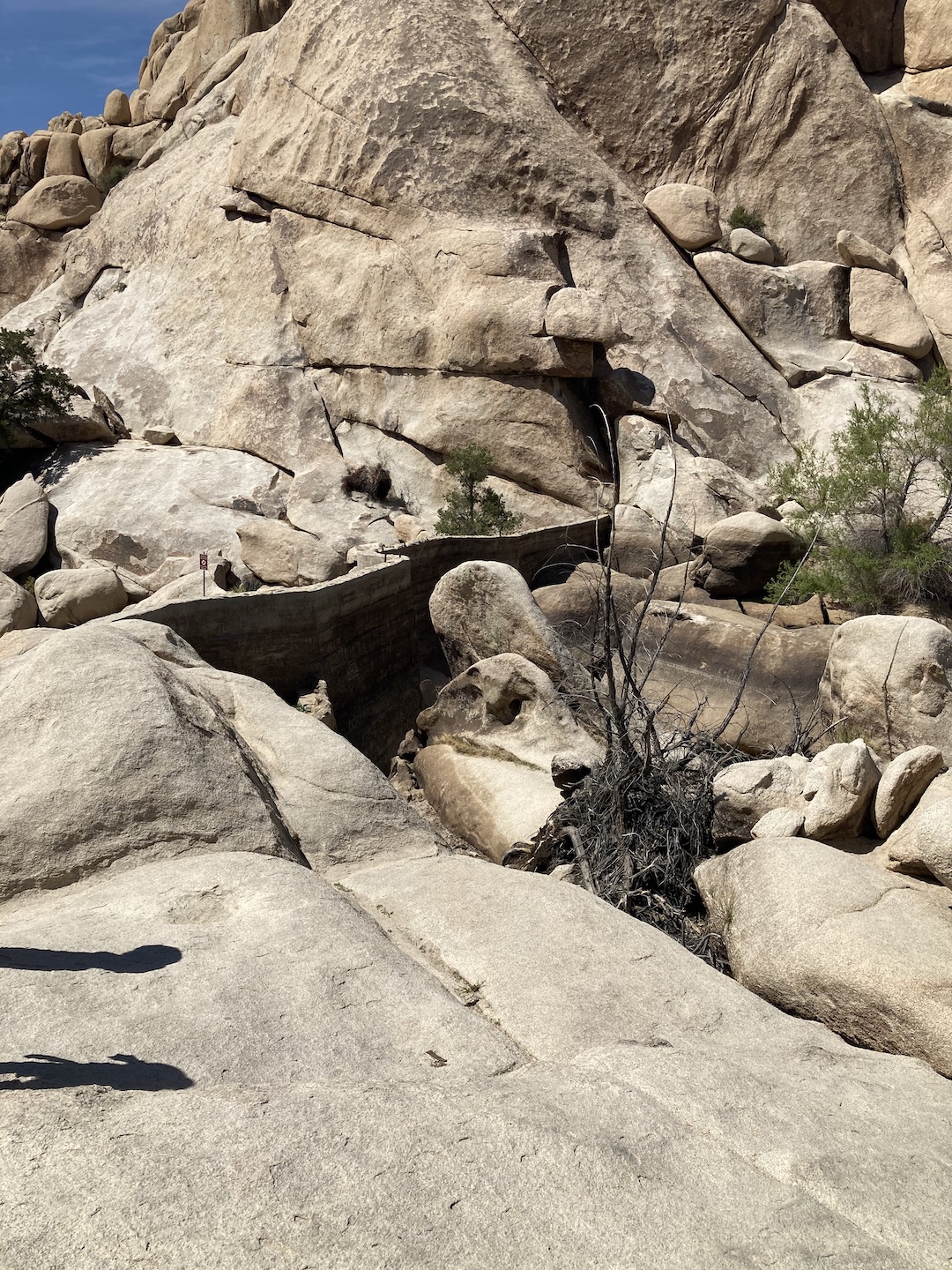
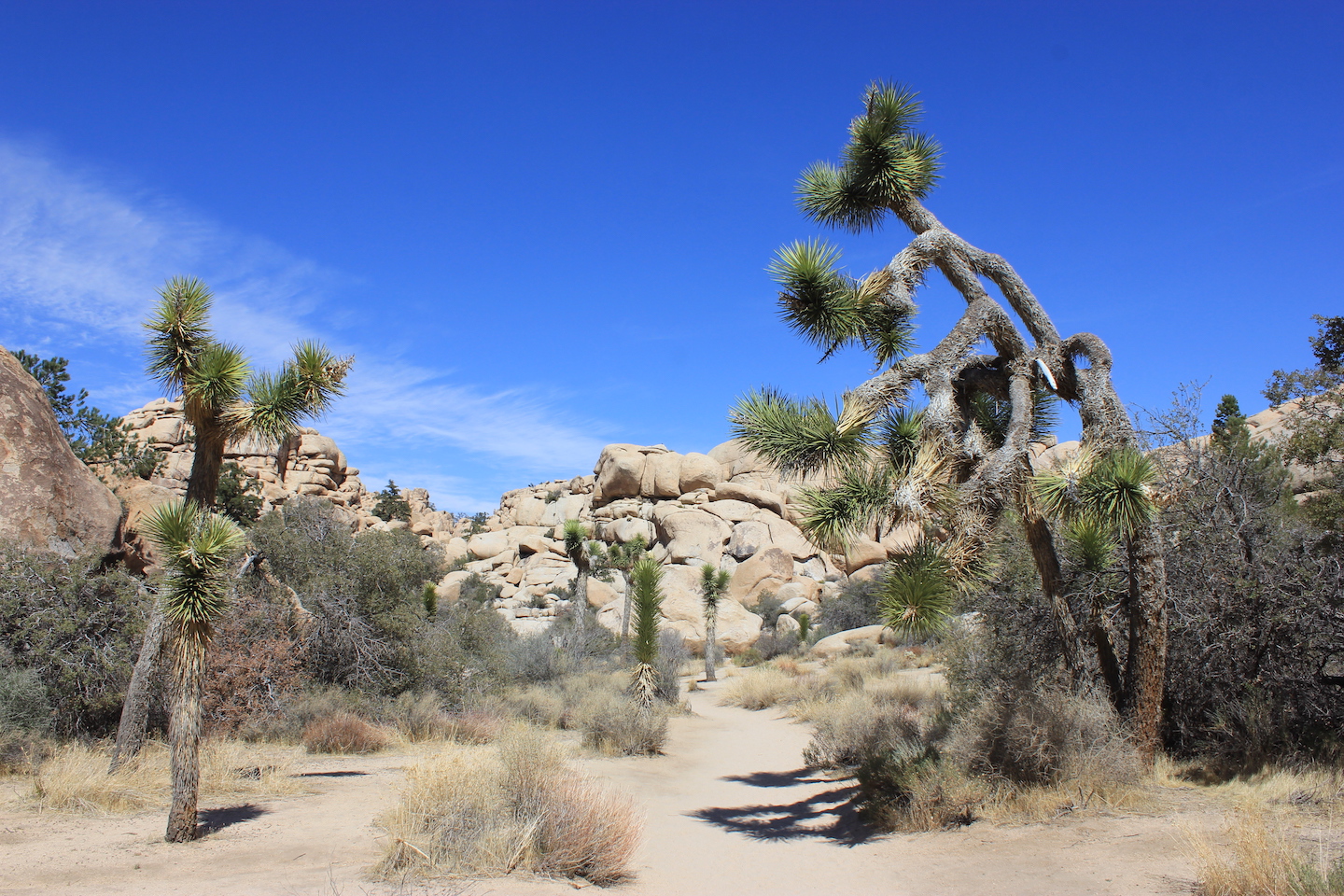
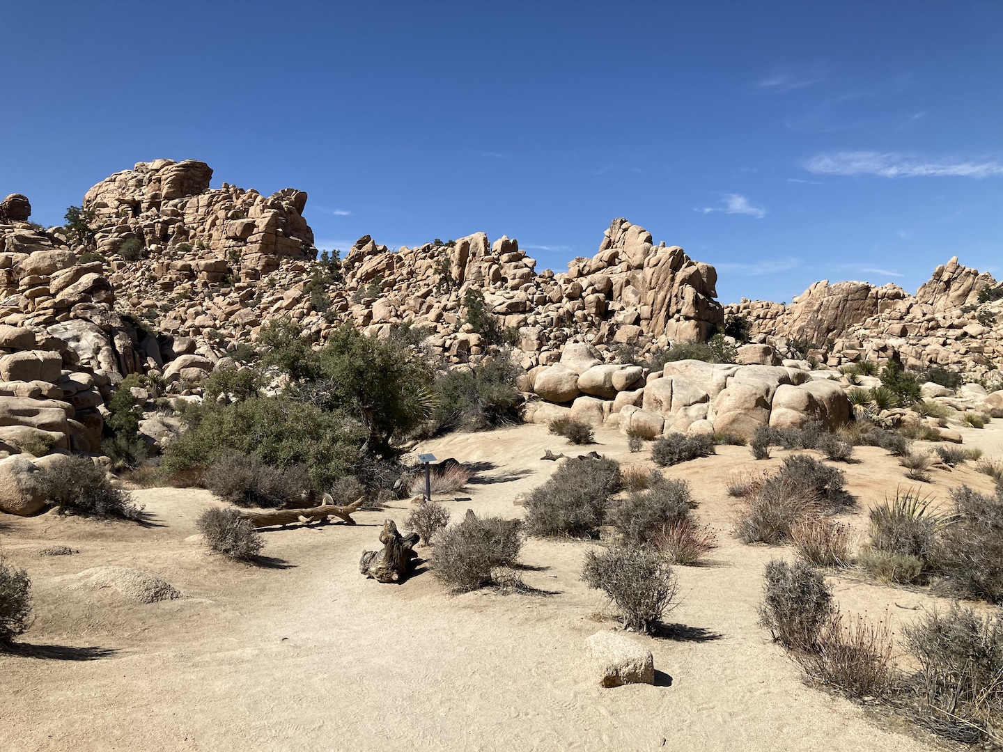
I finally made my way out of my tent to explore the park. I had no real plans other than to stop wherever I wanted. The first stop was the Hall of Horrors. I wasn’t sure what that was and was surprised to find there was no map or explanation. Fortunately the area is really pretty and walking around is fun on its own.
Hall of Horrors
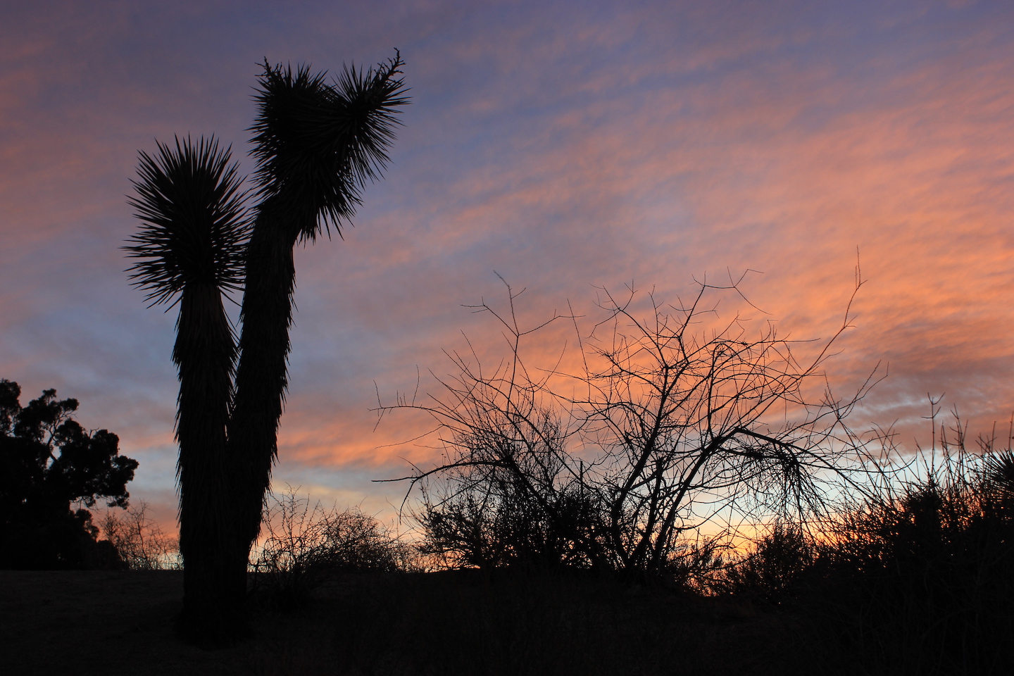
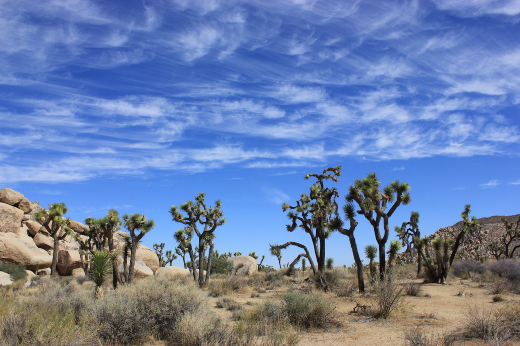
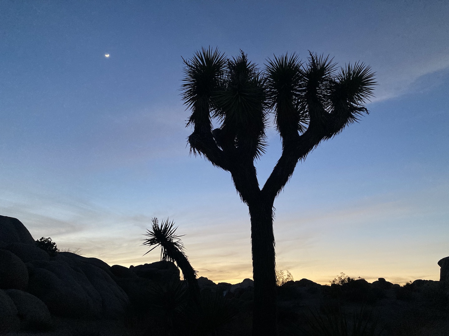
The area has these huge rock piles surrounded by Joshua trees. For size reference, the trees are typically 20 – 40 feet high so those rocks are huge.
Hall of Horrors
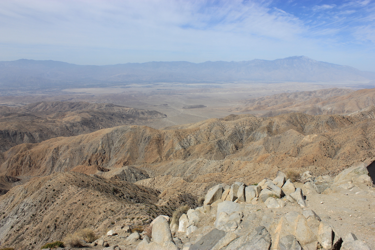
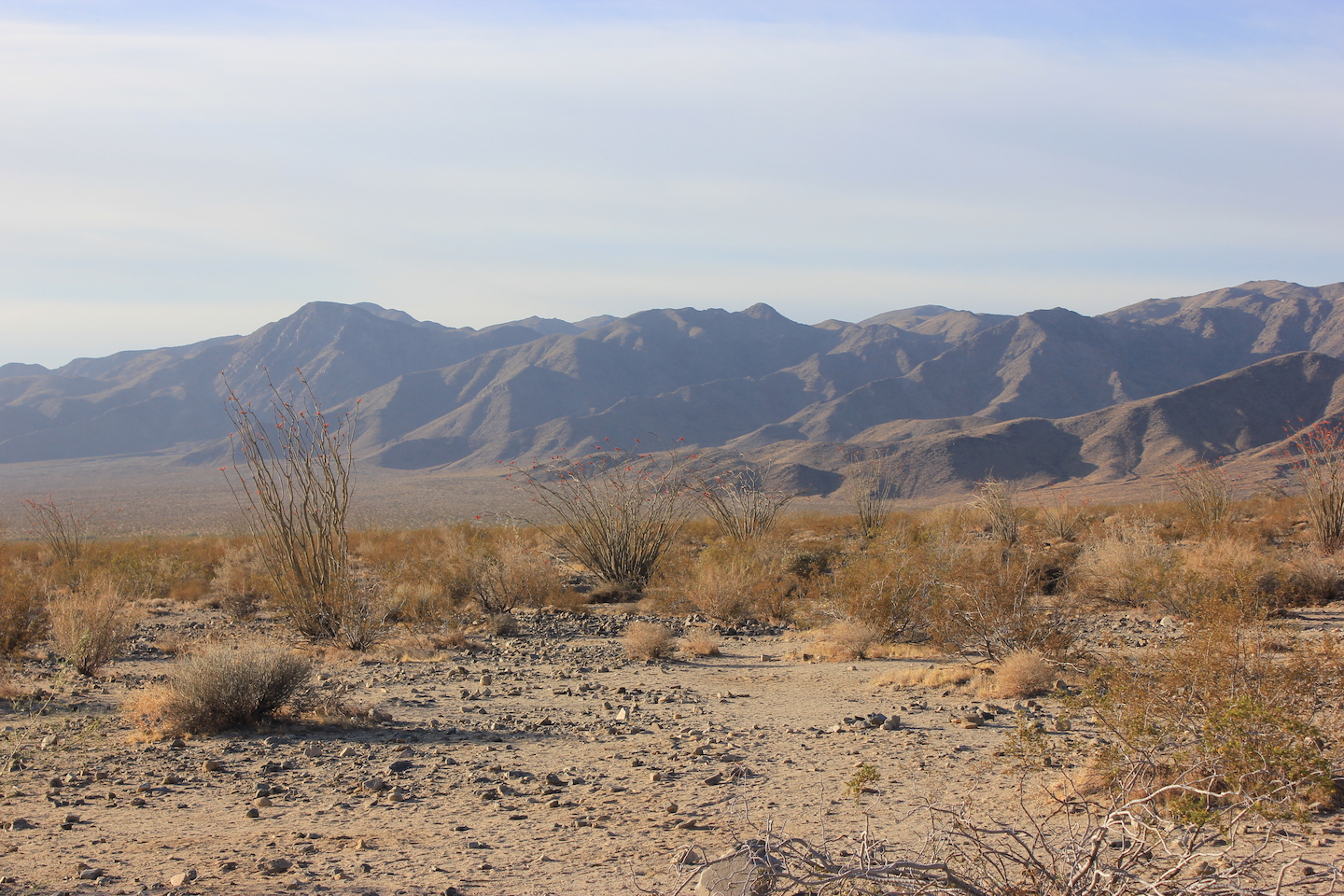
After the Hall of Horror I drove up to Keys View. The vista was pretty but there wasn’t much to do. I left and headed back down the hill/mountain.
View from Keys View
Next stop was the Cap Rock Nature Trail. This is a super easy trail with an explanation of the flora and fauna along the trail. I took a picture of my 4Runner and an outhouse with the trees and rocks to share a little size perspective. Since I was solo there are no people in any of my photos so this is it.
Cap Rock Nature Trail Cap Rock Nature Trail
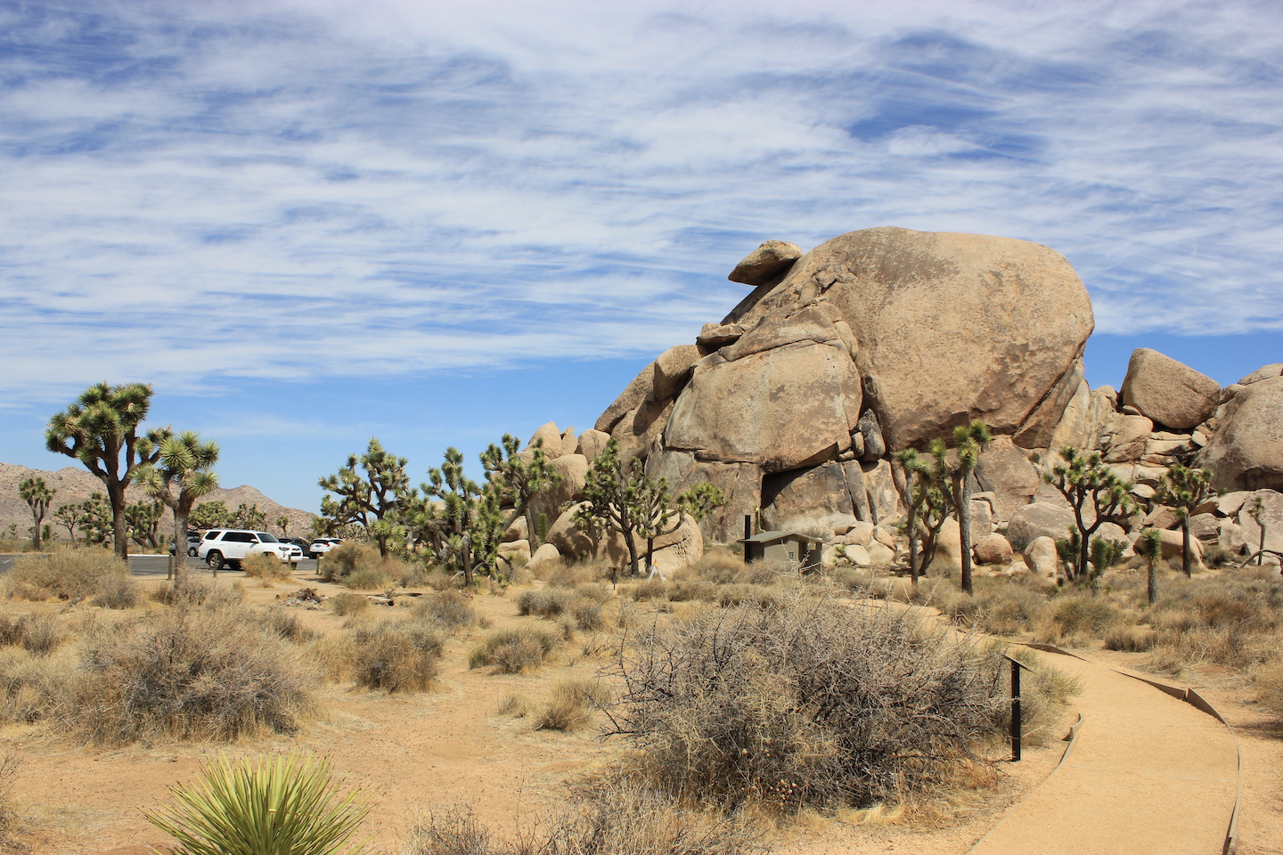
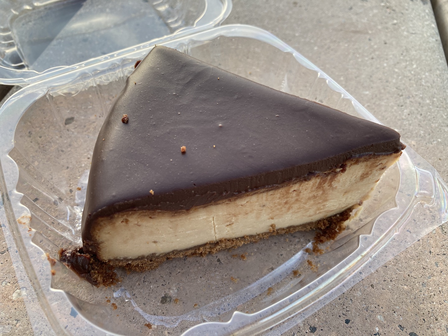
At this point it was around lunch time and I wanted to go to the town of Joshua Tree. I stopped at the ranger station to buy a few things and a local cafe where I found a piece of peanut butter chocolate cheesecake (gluten free and vegan!) which I saved for later.
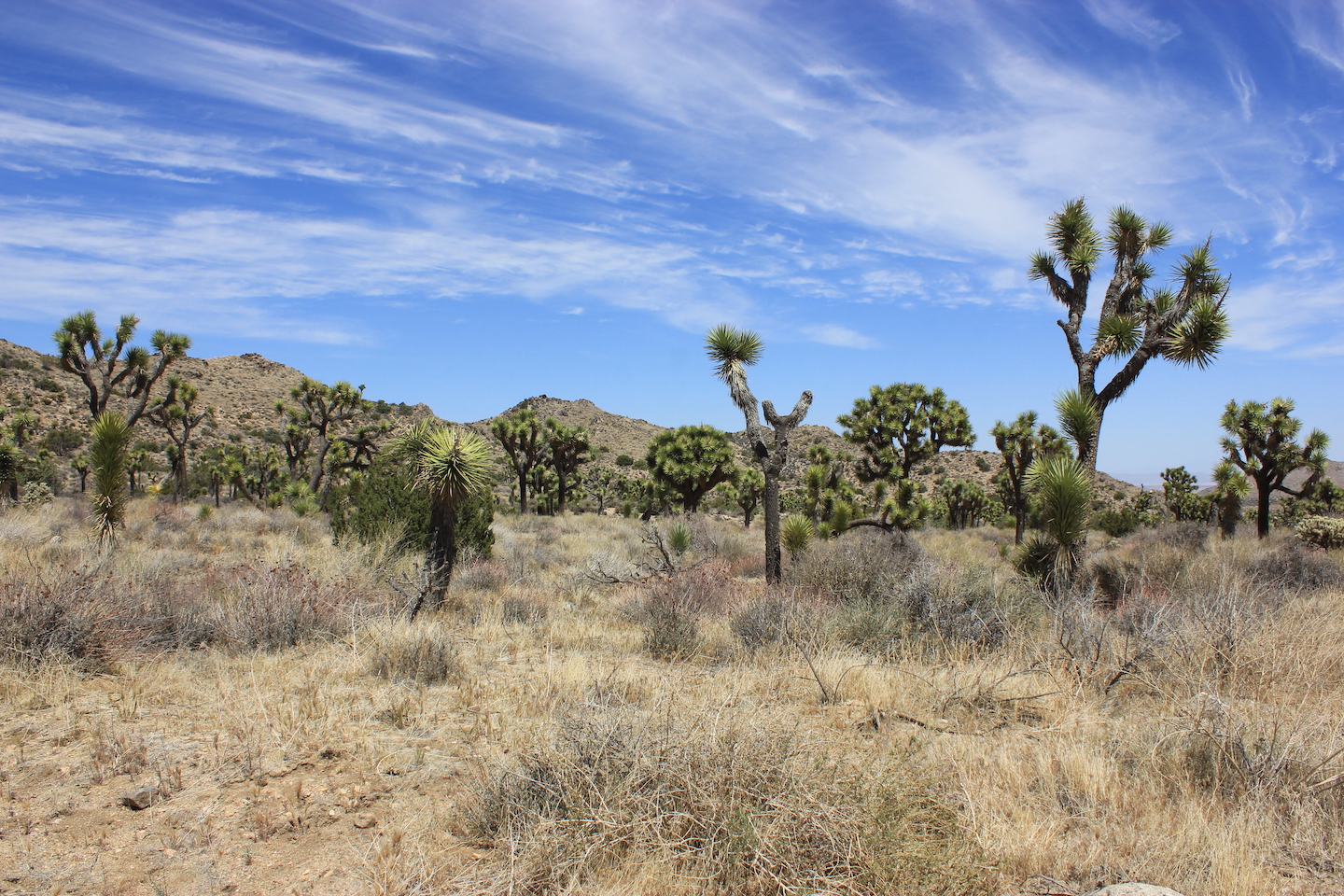
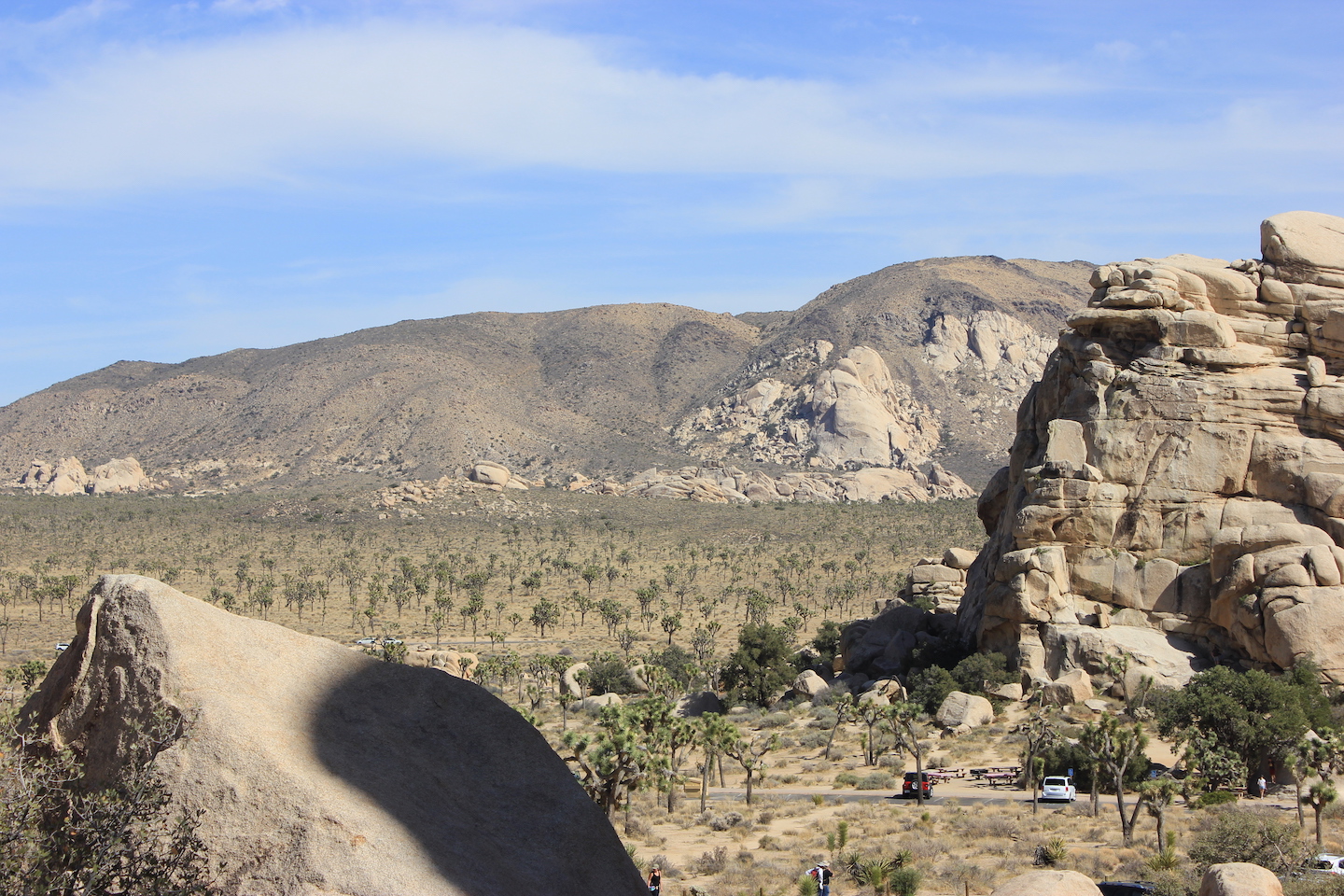
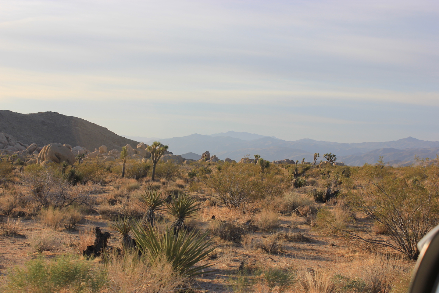
I had read that the Black Rock area was supposed to be the best in the park and that they have some of the largest Joshua trees. This area is not connected to the main part of the park and you access it from the town of Yucca Valley (right next to the town of Joshua Tree). The area was not what I was expecting. There were lots of Joshua trees but I found the ones in the larger park to be more scenic. The campground was also a little rundown looking.
Black Rock area
I decided I didn’t want to explore any further and headed back to the main park. Once again, I could have used a navigator. I wasn’t using my GPS because I thought I knew where I was but I was wrong. After taking several wrong turns, I finally pulled over and started the GPS.
Pro tip: the Joshua Tree entrance seems to be the most popular and can get super backed up. Most importantly, they have the park sign blocked off so you cannot get a picture with it. Gasp! I know. Fortunately, I came in through the Cottonwood entrance and already had a sign picture but if you too are a sign picture junkie, make sure to visit one of the other entrances.
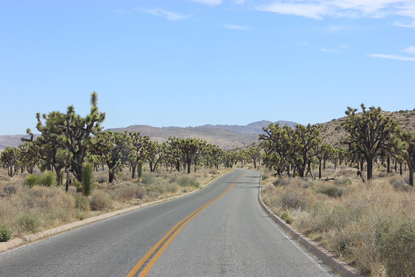
The drive into Joshua Tree National Park
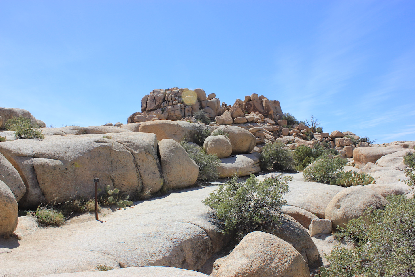
By this point in the day, all the stress from the previous day was gone and I was loving life and my solo adventure. The next road I drove by said there was a trail so I took the left. This was my new plan. Just turn when prompted. The trail was the Barker Dam Nature Trail. JT has quite a few nature trails and they are all awesome and a great way to learn about the park. The first half of the trail takes you along rocks and eventually on rocks to the Barker Dam. Ranchers dammed the area years ago to collect water for their cattle. There was no water when I visited in mid-April but supposedly the area fills after rainstorms.
Barker Dam Trail
Barker Dam
Barker Dam Trail
Barker Dam
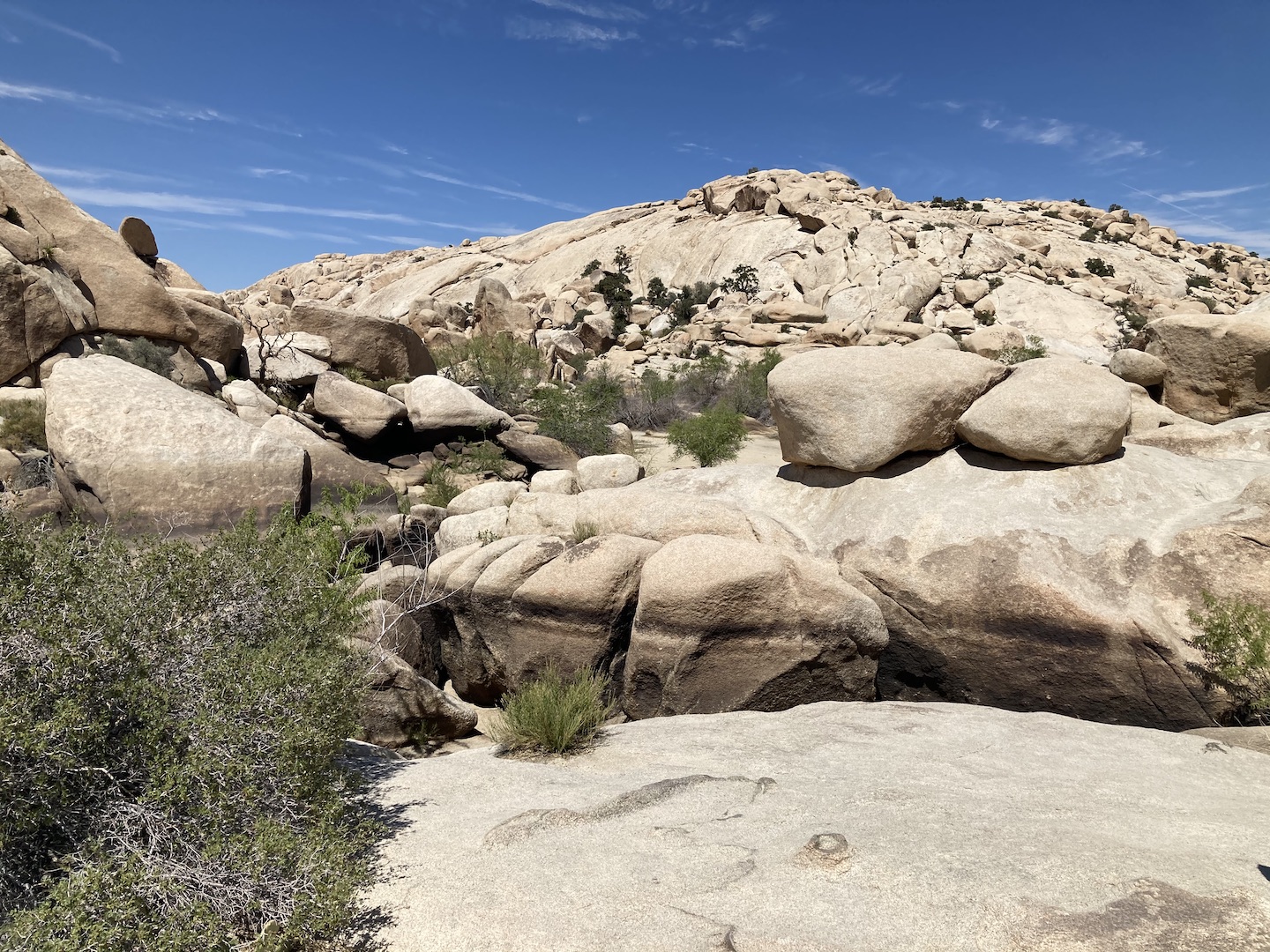
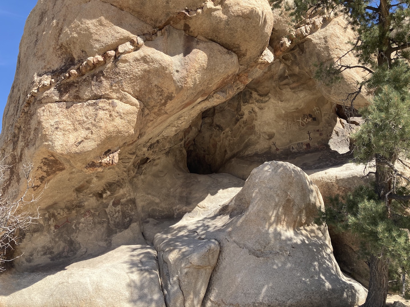
As you leave the dam area you enter a more traditional JT walk; through huge boulder fields and Joshua trees. It’s stunning, really. Towards the end of the trail there is a short side trail to some petroglyphs. This hike is listed as easy but there are a few areas around the dammed area where you are walking on rocks and down rock steps.
Petroglyphs along Barker Dam Trail
Barker Dam Trail
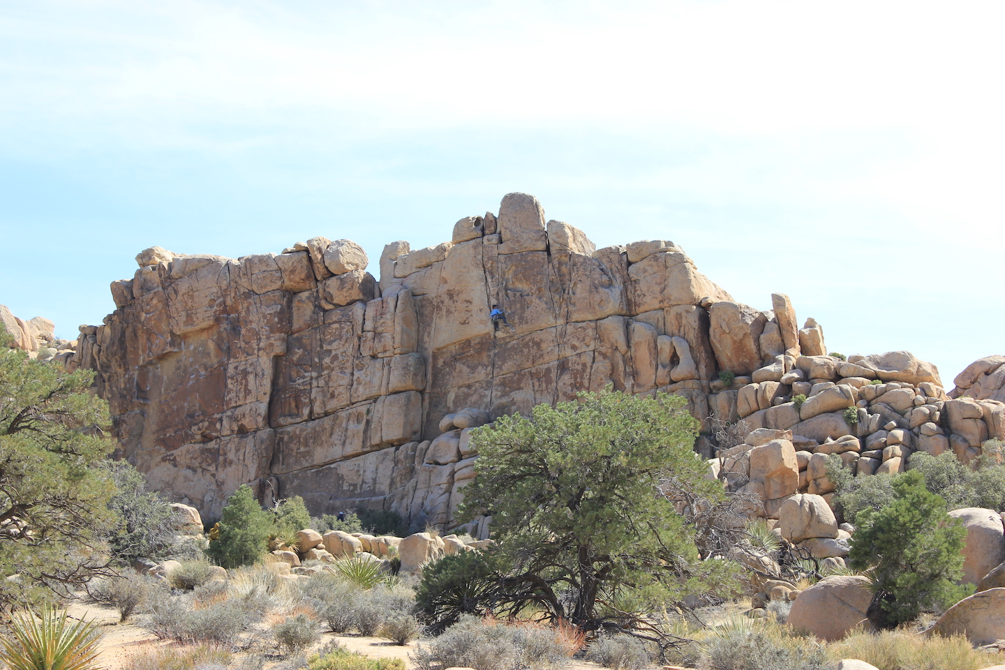
At this point in the day it was mid-afternoon so I kept telling myself after *this* stop I’m going back to camp to read and relax. And then I’d see another pullout and be drawn in. The next one was the Hidden Valley Nature Trail. A narrow gap in the rocks opens to a valley where a cowboy gang used to hide their illicit cattle. They’d rebrand them and sell them off in other states. The area is a big bowl surrounded by towering rocks. It’s a popular rock climbing area and I was able to watch a guy climb. I couldn’t see a rope so I thought he was free soloing (I watched Free Solo and am pretending like I know the lingo) which I was in awe of. Now that I’m home though I can see his rope. His climb was still incredible nonetheless.
Rock climber in Hidden Valley
This trail is listed as easy but that’s not true. The trail is just over a mile and there’s not much elevation change but there are so many rocks to navigate. On several occasions I though I was lost but someone had used spray paint to mark the trail. Not sure if that was legal or illegal but either way I’m grateful. I would not attempt this trail if you have any mobility issues. It’s a beautiful hike though.
View from the start of the Hidden Valley Nature Trail
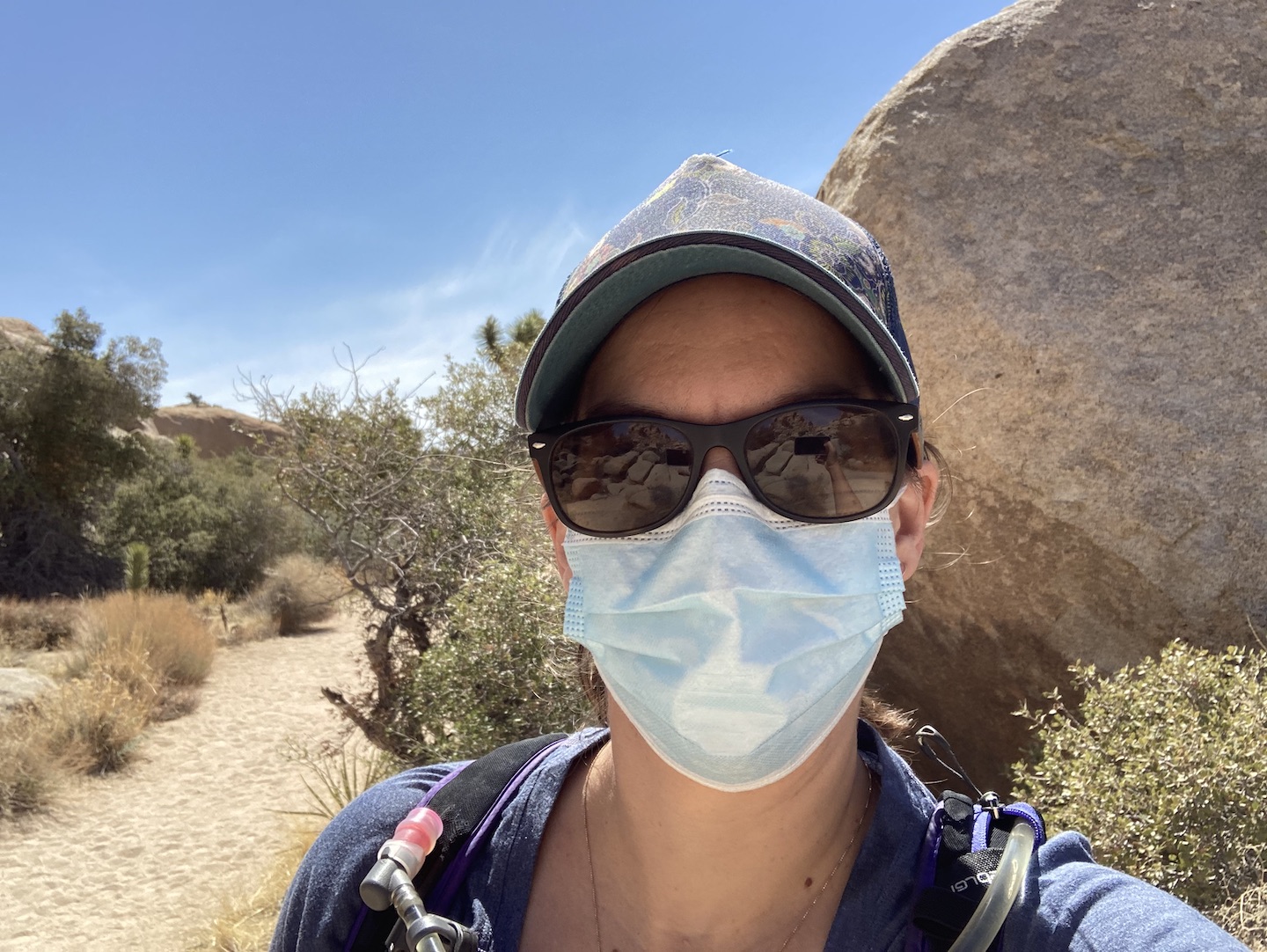
And because it’s 2021 and we’re in the middle of a pandemic, I took a selfie with my mask. Because why not. The trails were much more crowded in the afternoon and most people were good about mask wearing when passing.
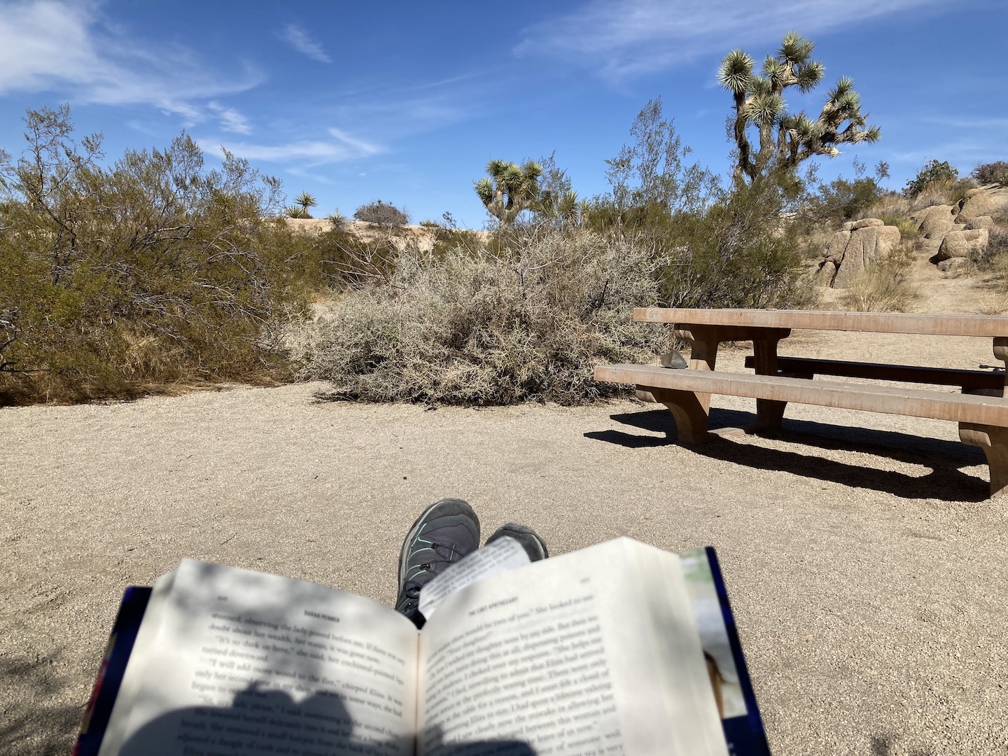
My book was finally calling me and I was ready to sit down. I took a few more pictures along the way, stopped at a few road side signs, and made my way back to camp. Once back at camp, I moved my chair into the shade, put up my feet and opened my book. Life. Is. Good.
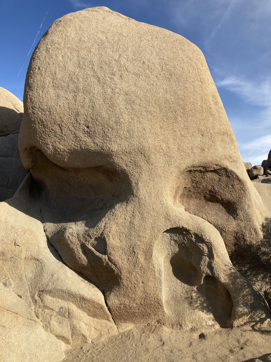
There was a trail near the campground to Skull Rock. It’s a “famous” rock formation in the park. I figured since I was so close I couldn’t not see it. I put the book down, grabbed my backpack and hiked another 1.7 miles to see Skull Rock. I would say it’s the most overrated formation in the park. It’s hard to get a picture of it because there are rocks in front of it and there are people everywhere. It’s not too far off the road but I wouldn’t go out of the way to see it.
Skull Rock
Once back at camp, I read until dinner time when I made another backpacking meal and drank some more wine. Dinner was not doing it for me but that might be because the cheesecake was calling my name. I decided to get the cheesecake from the cooler as a reward for when I finished dinner. I started with just one bite and planned to go back to my dinner but threw in the towel and ate cheesecake for dinner. It was heavenly and exactly what a girl should have for dinner on her 40th birthday. I even sang myself happy birthday in my head. 🙂
Birthday dinner!
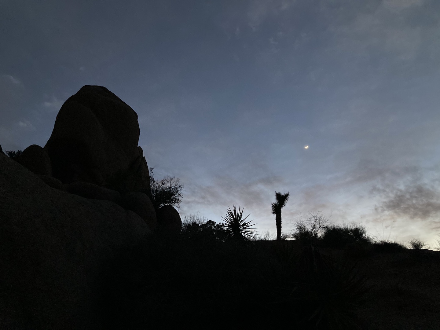
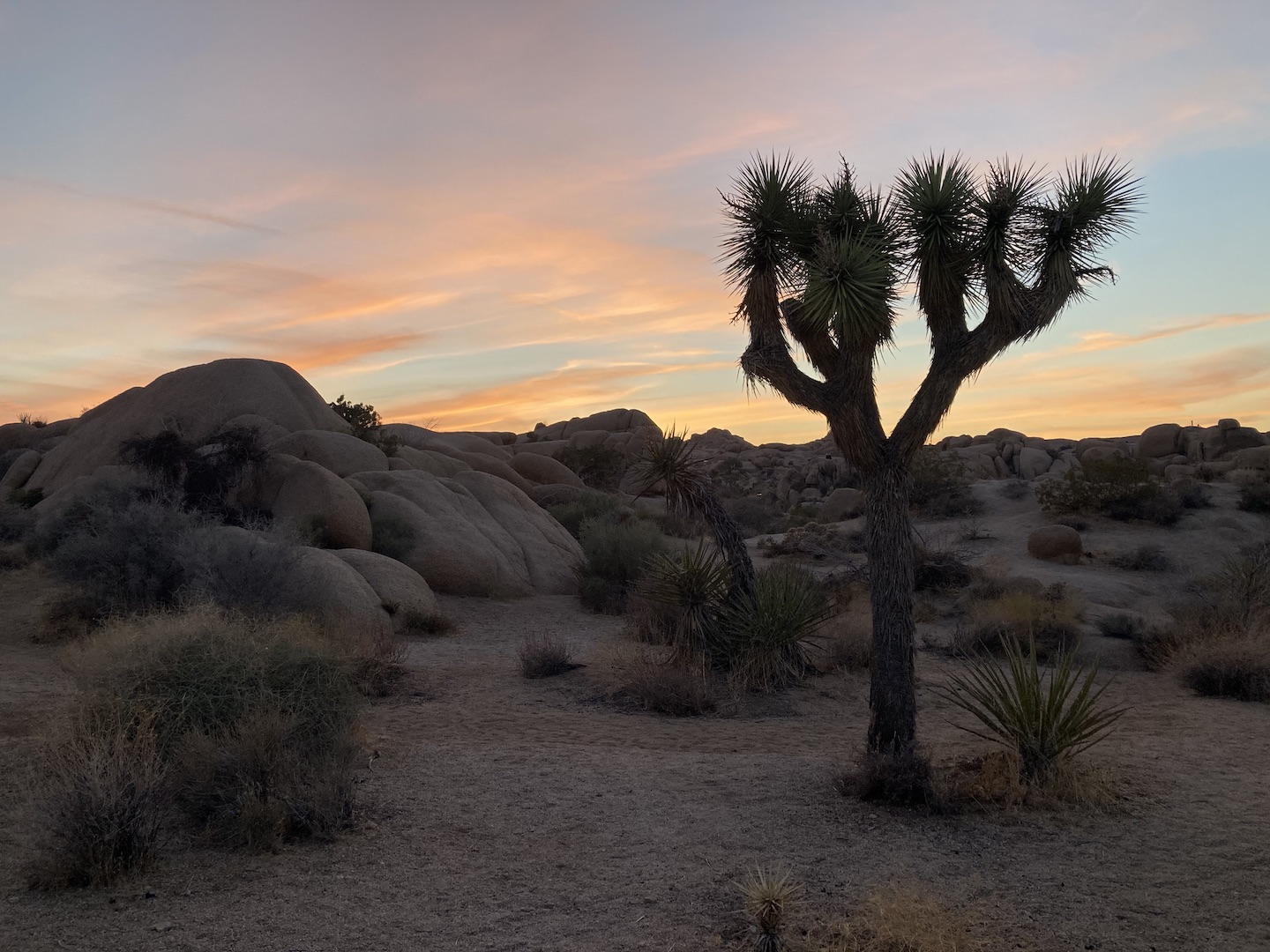
I alternated between reading, eating cheesecake, drinking wine and watching the sun set. This exact scenario is now what my dreams are made of.
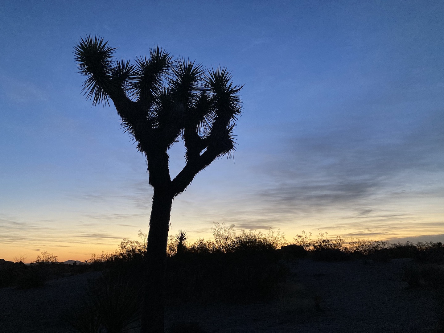
Sunset in Joshua Tree National Park
Eventually it got too cold and I retreated to the warmth of my bed where I stayed awake until my book was finished. I read the Lost Apothecary and it was so good! One of the main characters is named Caroline so that was fun.
FRIDAY: Fortunately, there was no wind that night so I slept like a baby and woke up at 4:50am. A little earlier than I would have preferred but it worked. As I laid in bed waiting for the sun to rise, I listened to what sounded like two owls hooting. Maybe it was just one but the sound was alternating locations. And at one point the coyotes chimed in. This went on for a while. I finally got up when it was light out and made some coffee and took a few pictures of the sun rising. The campsites are close together so I was trying to wait a little bit longer before making too much noise. Around 6am I decided it was late enough and packed up.
Sunrise in Joshua Tree National Park
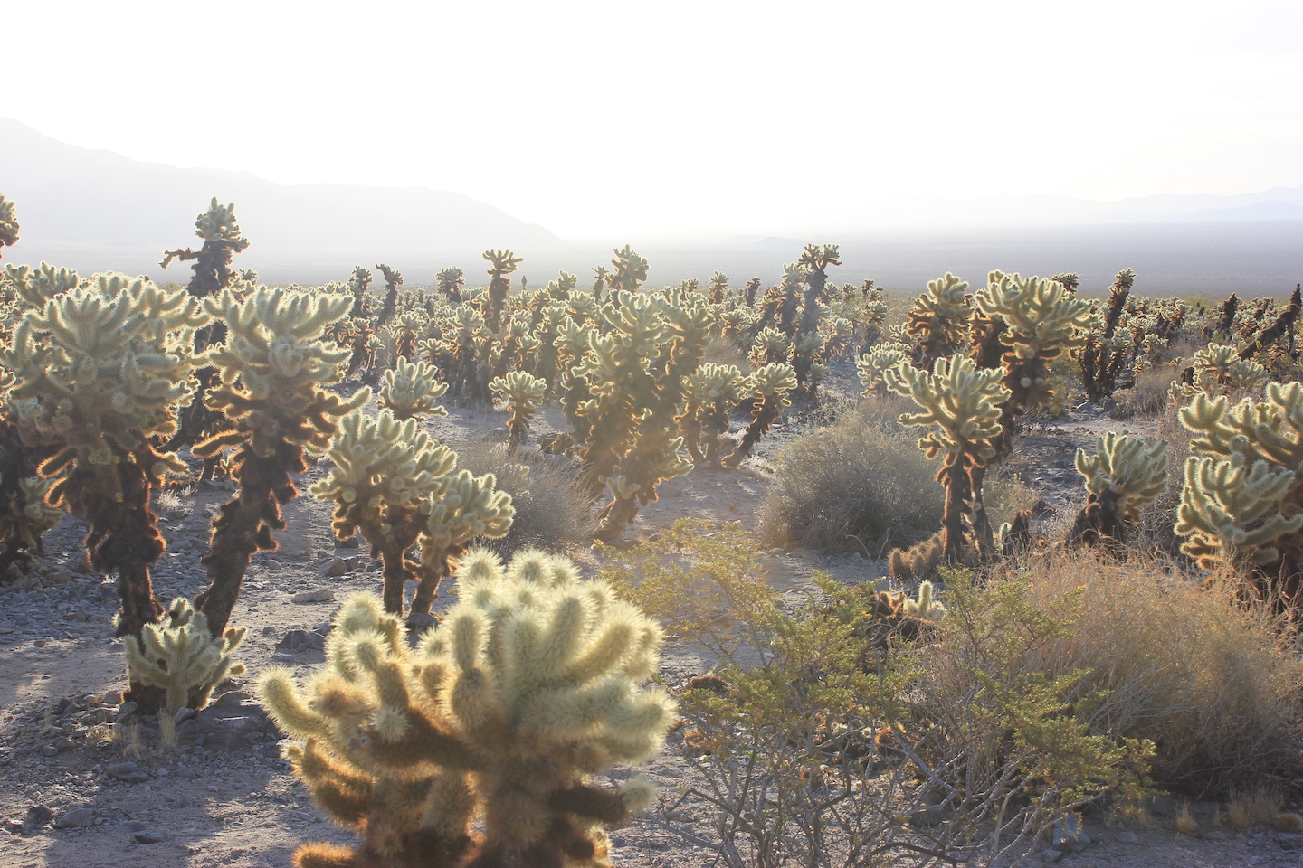
The drive out of the park was breathtaking. I was driving east as the sun was rising so all the plants were glowing and the mountains were in layers. Once again I took way too many pictures. I stopped at the cholla cactus garden again and took a few (or 100) more pictures, stopped at the ocotillo garden, and made my way to the Cottonwood Spring Oasis.
Glowing cholla is one of my favorite things.
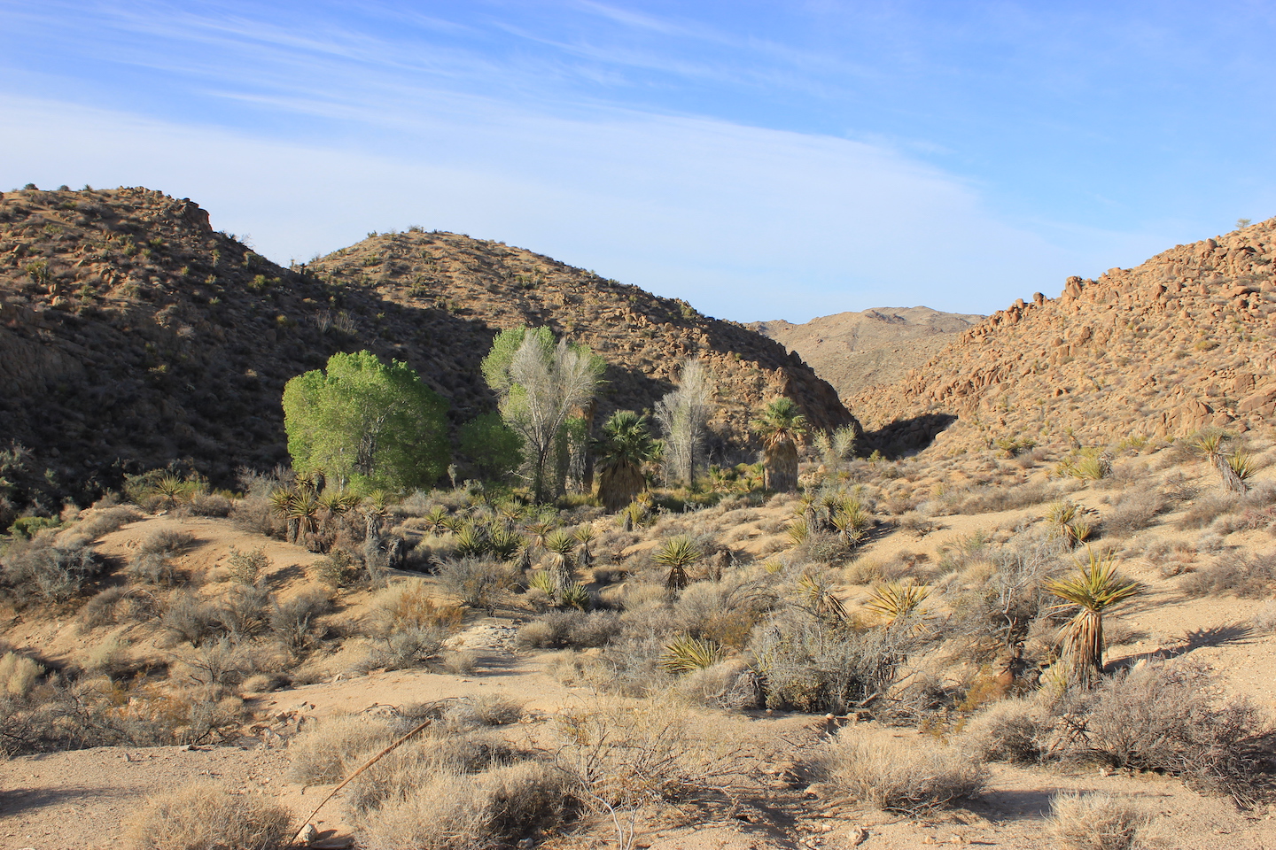
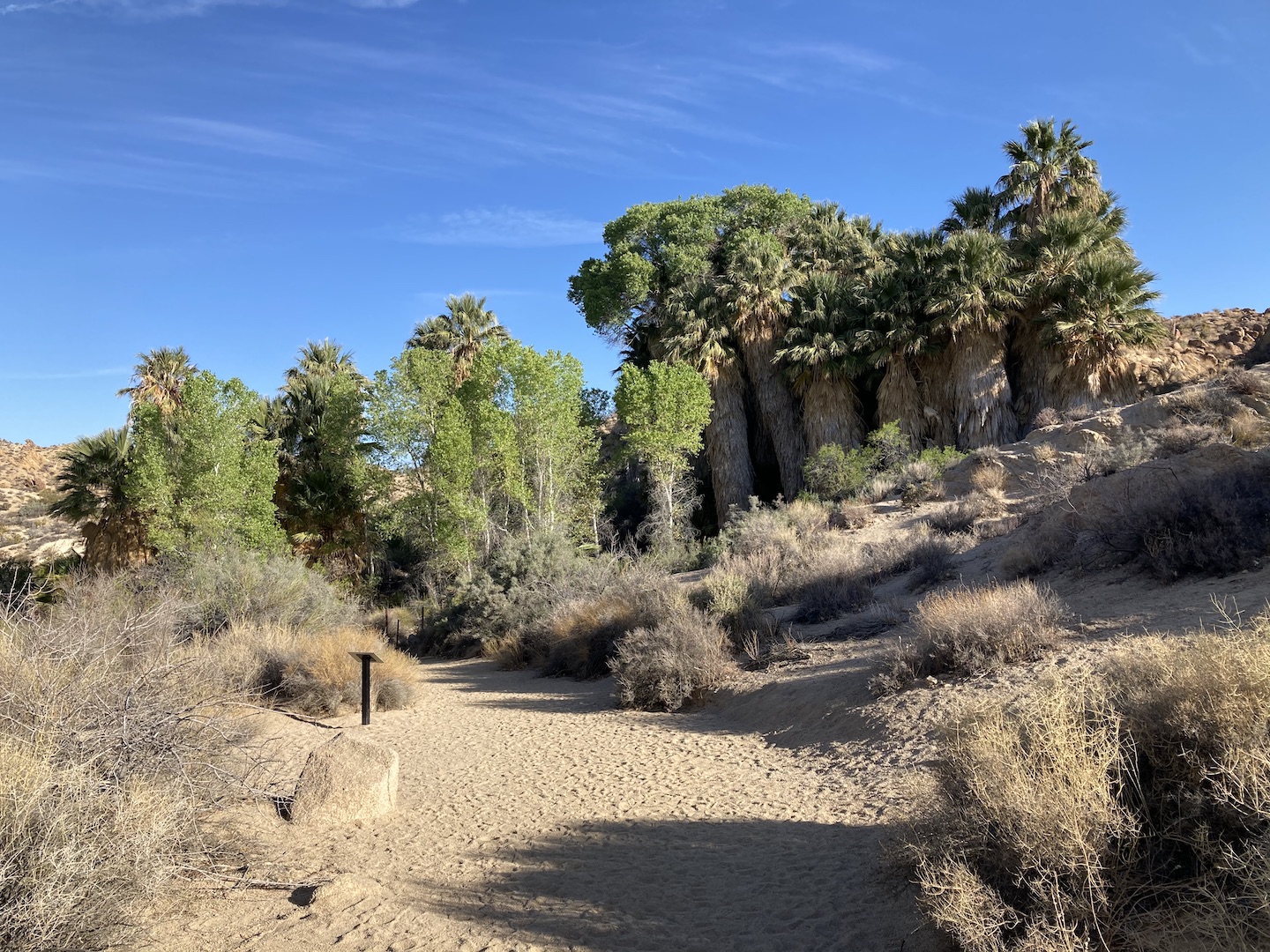
This landscape is so cool. It’s barren desert and then all of a sudden there’s a grouping of palm and cottonwood trees. Apparently this is the result of a crack in the earths crust.
Cottonwood Spring Oasis
I took a few pictures, walked around, and sat on a bench and listened to the birds chirping. There was a bird that was standing on top of a hill that had its wings spread open. It was the strangest thing. It was like it was warming its wings or showing off. I sat there for a few minutes expecting him to take off but instead he kept spinning in circles.
At that point it was time for me to leave. Someone was coming over at 4pm so I had to get back home. I stopped at the nearest gas station to get coffee for the drive home. Gas station coffee is hit or miss and this was totally a miss. It tasted like dirty water but that’s how it goes some days. And with that I was on the road home.
It’s taken me a few days to really digest my trip. I am so glad that I went and so grateful to everyone who encouraged me even when I started to doubt myself. This is the exact trip I envisioned when I wanted my 40th to stand out. I’m not sure if solo trips will be a regular thing in the future but I loved every moment of this one.
A couple things to note regarding Joshua Tree National Park. There is no cell service in the park. Like none. Pretty much as soon as I passed the entrance sign my phone stopped working. I do appreciate a forced break from the connected world so while this can be a little unnerving, it’s also always so lovely. There is also no water in the park. Make sure you take all you need plus a little extra.
https://www.theroadwevetraveled.com/wp-content/uploads/2021/04/IMG_3085.jpeg10801440Carolinehttp://www.theroadwevetraveled.com/wp-content/uploads/2015/08/RWT_Logo@3x-300x143.pngCaroline2021-04-23 06:19:512021-04-24 01:48:43A Solo Camping Trip in Joshua Tree National Park
When I started this blog I wanted to give a voice to the less popular national parks and to write about family friendly activities. It’s easy to find information on the most popular parks but that’s not always the case for the smaller parks. I kept running into this issue when planning and decided to do my part to build out the content. What I did not expect is the joy I would get in looking back and reading about our trips. As time goes on memories fade. I am so glad I decided to start this blog to capture some of our memories in written form. Now, my blog is part for the world and part for me. This post, however, is all for me because I want to remember the last several days forever. (I wrote this post mid-October and never got around to hitting post. I’m not changing anything because I like the way it was written.) Read more
https://www.theroadwevetraveled.com/wp-content/uploads/2017/10/fullsizeoutput_1b14.jpeg23203093Carolinehttp://www.theroadwevetraveled.com/wp-content/uploads/2015/08/RWT_Logo@3x-300x143.pngCaroline2018-01-14 05:13:232018-04-07 17:26:38Fall Break in Sedona
Saguaro National Park is practically in my backyard. And by practically I mean about 10 minutes from my backyard. I love hearing stories about how the park came to be and about the homesteaders that originally occupied the land. Can you imagine owning 480 acres with a house smack dab in the middle of what is now the national park? That would be an absolute dream. That’s no longer possible for anyone, but one day that was someone’s life. Read more
https://www.theroadwevetraveled.com/wp-content/uploads/2016/12/IMG_3485.jpeg9601440Carolinehttp://www.theroadwevetraveled.com/wp-content/uploads/2015/08/RWT_Logo@3x-300x143.pngCaroline2017-04-29 03:30:252017-04-29 03:56:18Garwood Loop Trail - Saguaro National Park
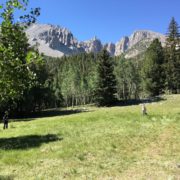
Great Basin National Park in Eastern Nevada is one of the least visited national parks in the system. Several of my favorite travel bloggers have been to Great Basin and every one has said it is a hidden gem. We needed a place to spend a few days on our way home from Glacier National Park so we chose Great Basin. Read more
https://www.theroadwevetraveled.com/wp-content/uploads/2016/07/IMG_0769.jpeg10801440Carolinehttp://www.theroadwevetraveled.com/wp-content/uploads/2015/08/RWT_Logo@3x-300x143.pngCaroline2016-07-30 17:03:422016-07-30 17:36:43Great Basin National Park