Route of the Hiawatha Mountain Bike Trail
I am crazy excited to write this post. Mostly because I had so much fun on this ride and want to relive every second of it. Every.Single.Second.
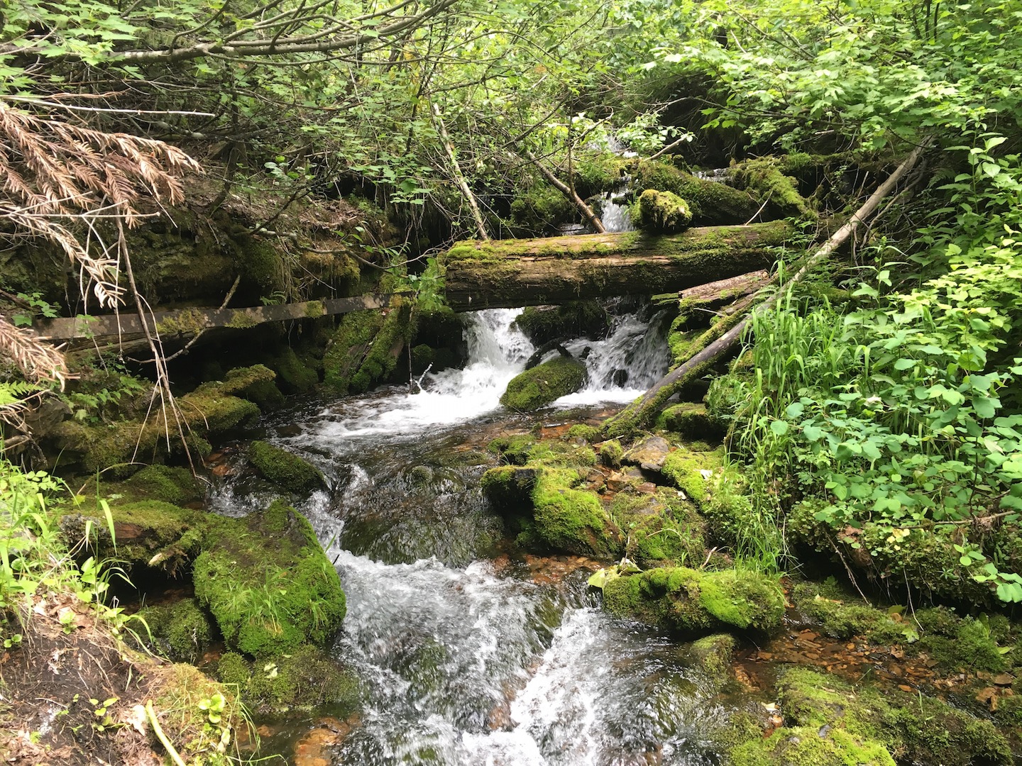
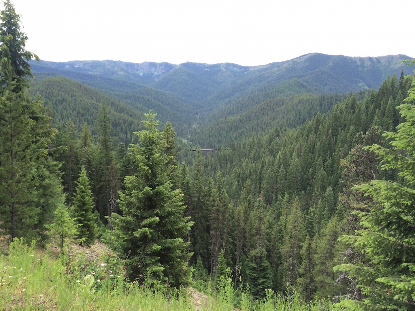
The Route of the Hiawatha is a 15 mile mountain bike trail through the Bitterroot Mountains on the Montana-Idaho border. The trail is an old railroad track that has been converted to a biking/hiking path. There is a whole Rails-to-Trails movement across the country whereby railroads no longer in use are being converted to multi-use trails. This particular section of the track was said to be one of the most scenic stretches of railroad in the country, and I would have to agree. I have never seen such dense forest. Granted, I live in the desert so forest is not something I see often, but it was incredible. And if the scenery isn’t enough to make the ride spectacular, it goes through 10 train tunnels and over seven trestle bridges!
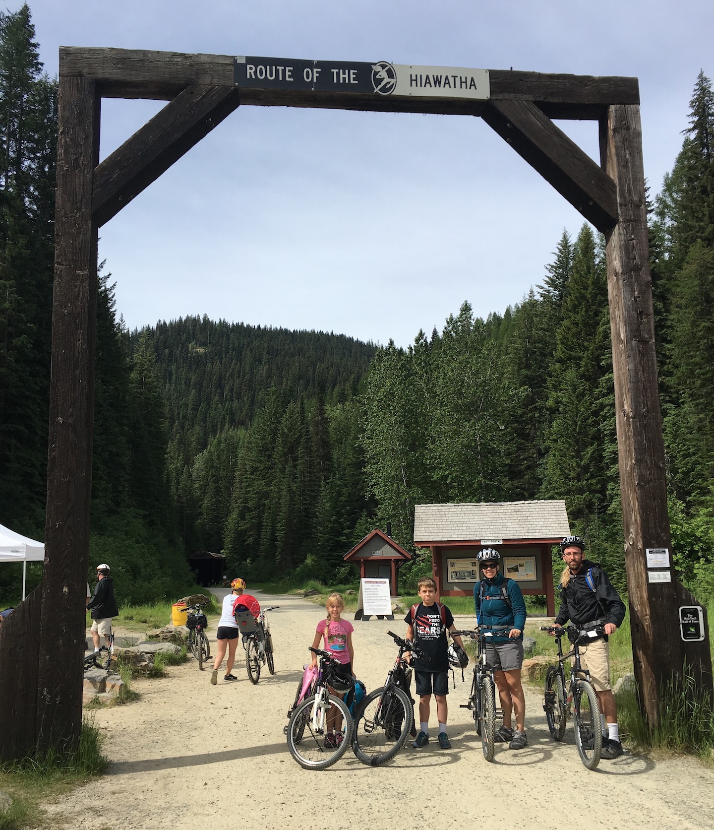
The start of the Route of the Hiawatha mountain bike trail
Someone I follow on Instagram posted a picture of the trail a couple months ago and I instantly knew we needed to figure out how to make this ride happen. Other than this summer we don’t have plans to be near the Montana-Idaho border in the foreseeable future, so it was now or possibly never. I tried to rearrange our vacation schedule to fit this in but all the campgrounds in Glacier National Park were full so I couldn’t change our reservations. We have awesome mountain biking trails in Southern Arizona but train tunnels and super high trestle bridges we do not. A day or two into our Glacier National Park trip and we knew we didn’t want to stay the entire week we had planned. Nothing against Glacier but I just couldn’t shake the thought of riding this trail. The kids were complaining about hiking so we gave them the choice – hike or bike. They chose bike. Off to the Montana-Idaho border we go! We canceled our reservations on the east side of the park and crammed everything we wanted to do into our remaining days in Glacier.
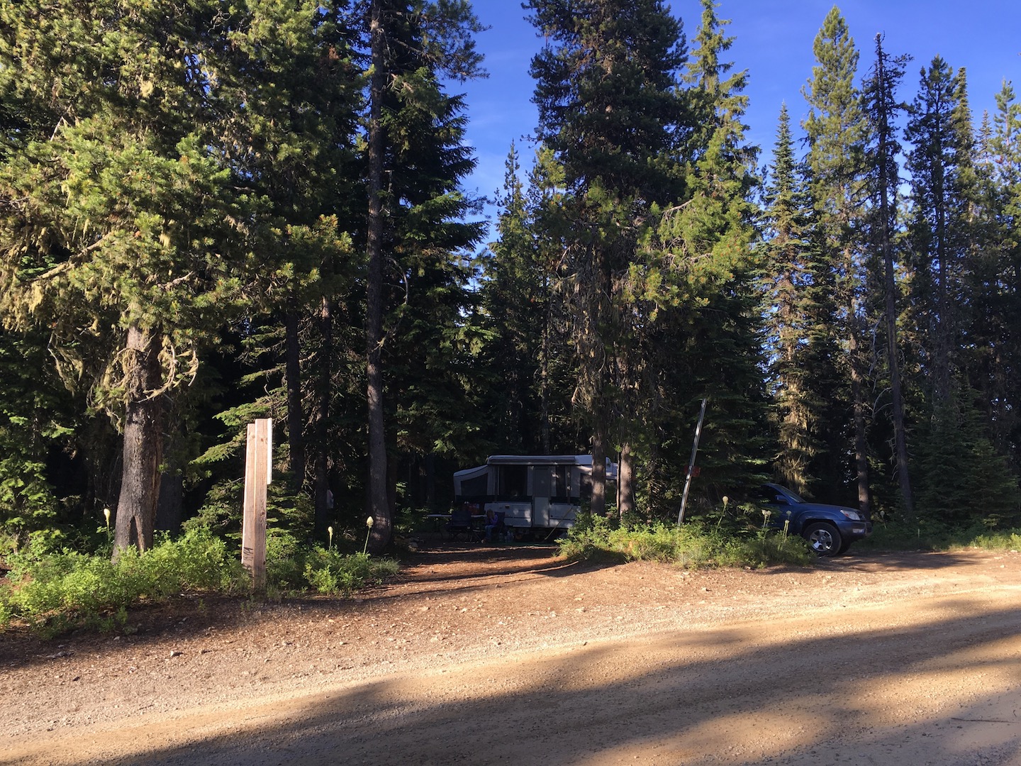
The only problem with our plan was that it was 4th of July weekend. Not a good combination when you are trying to find a campground at the last minute. With spotty internet access all throughout Montana, we decided to just drive and figure it out as we went. I’m really not a drive and figure it out type of gal but I did it anyway because I wanted to make this bike ride happen. Long story short, all the campgrounds in the surrounding towns were full. As a last resort we ended up driving down the dirt road near the trailhead. All of the dispersed sites were full and we were starting to get really discouraged. I was beginning to question what we had done and was worried that we might not find a place to stay. The dirt road started up a mountain side and we could not find a place to turn around. Now I’m kind of freaking out because we’re in the middle of nowhere, we’re on the side of a mountain with our camper in tow, and no one knows where we are. We decided that at the next possible turnaround we would head back down the mountain and try to find a hotel. It just so happens that the next possible turnaround was an empty campsite. For real! It kind of feels like that’s where we were supposed to be the entire time. Not only was it empty; it was beautiful. Hands down, this is the most beautiful forest I’ve ever seen.
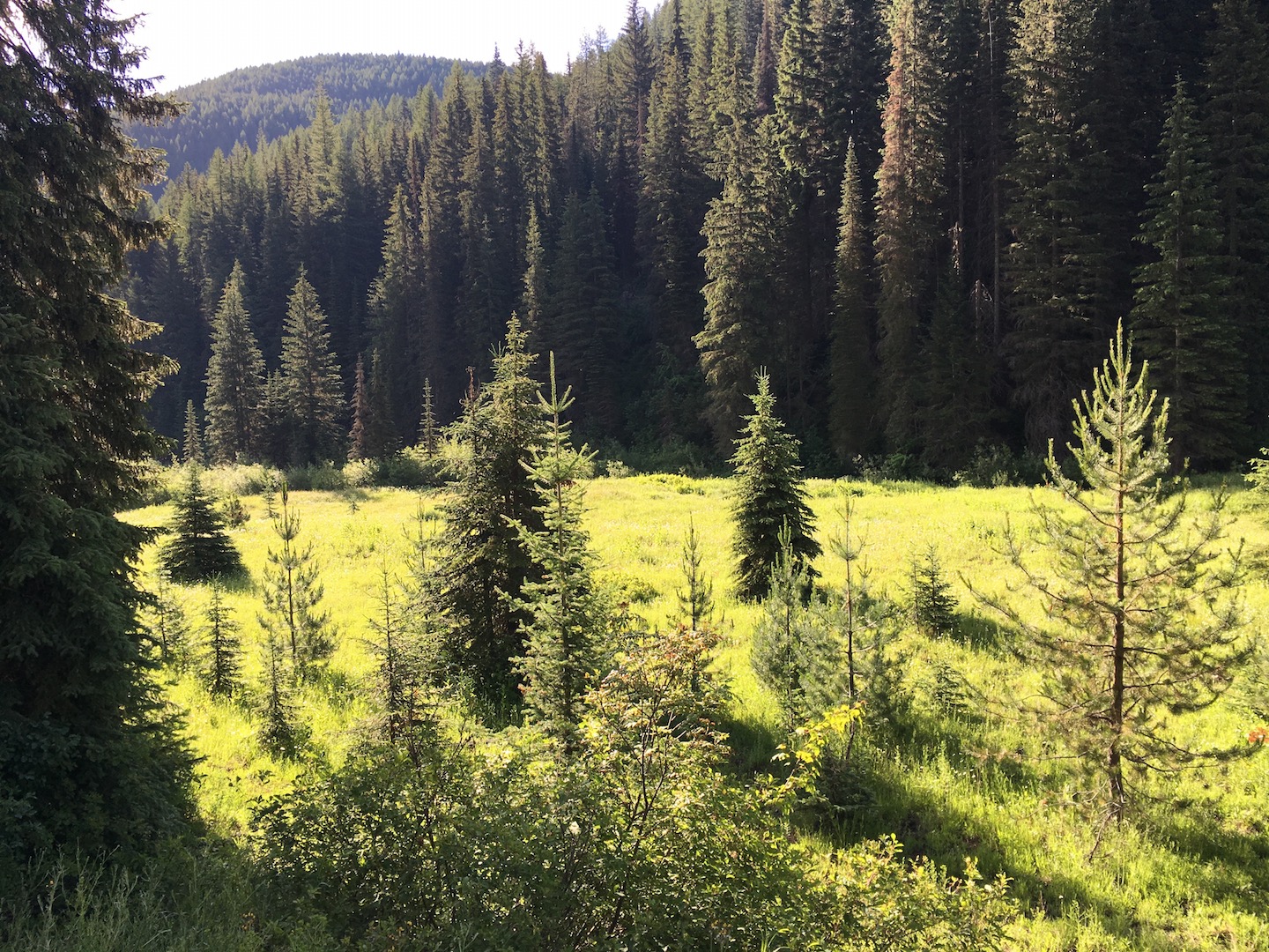
Lolo National Forest
I’ll share pictures of our ride but I also want to share all that we learned about camping in this area. There are not many options and I found the information on the trail website hard to decipher. Let’s start with the trail, shall we?
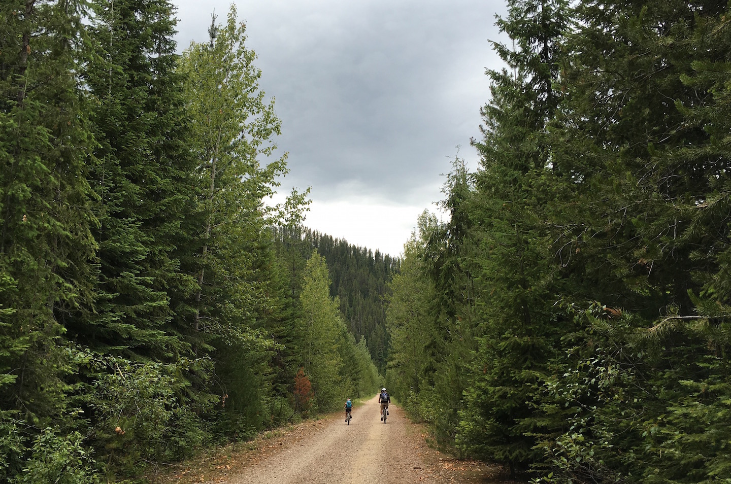
The trail is 15 miles of railroad grade downhill (not steep at all) and starts in Montana. Almost immediately you enter the Taft Tunnel, which is the longest of the 10 tunnels at 1.6 miles long. There are no lights inside the tunnel so you must have a light on your bike. I was really anxious for this tunnel. I was afraid that our lights wouldn’t be bright enough and that I’d freak out halfway through and who knows what would happen. Our minds can be so silly at times. The good news is that the tunnel was not nearly as bad as I had made it out to be. There were plenty of other people going through at the same time so I felt very comfortable. It was cold though. My fingers were frozen by the time I exited the tunnel. We wore jackets in the tunnel and took them off when we exited and stuffed them in our backpacks. There can be water inside the tunnel which creates mud. The water drips down the side of the walls and into gutters on each side. If the road is muddy you will end up with a line of dirt along your back from your rear wheel. As soon as you exit the tunnel you’ll be in Idaho and will be greeted by a waterfall.
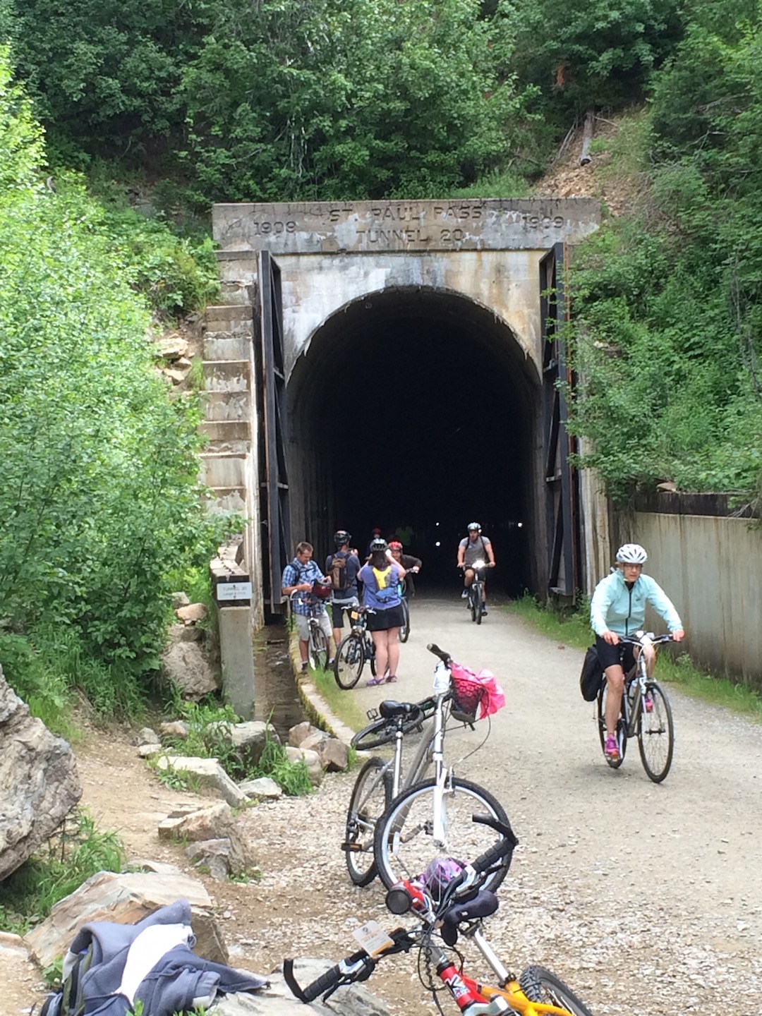
The Taft Tunnel, the longest of the 10 tunnels on the Route of the Hiawatha.
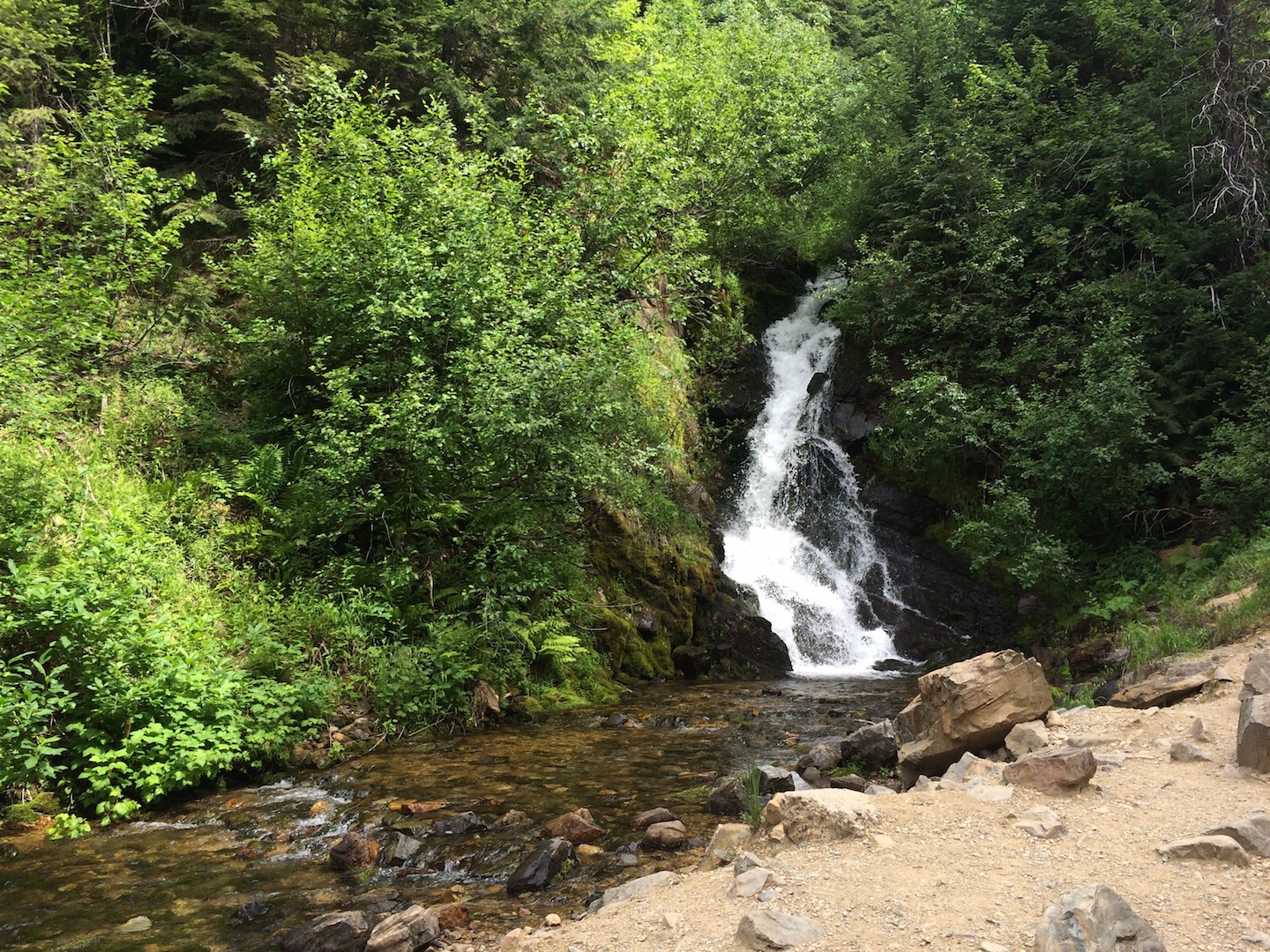
Waterfall near the exit of the Taft Tunnel
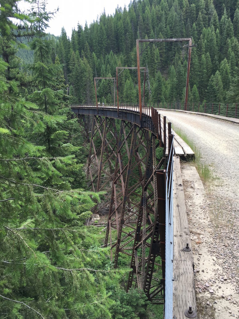
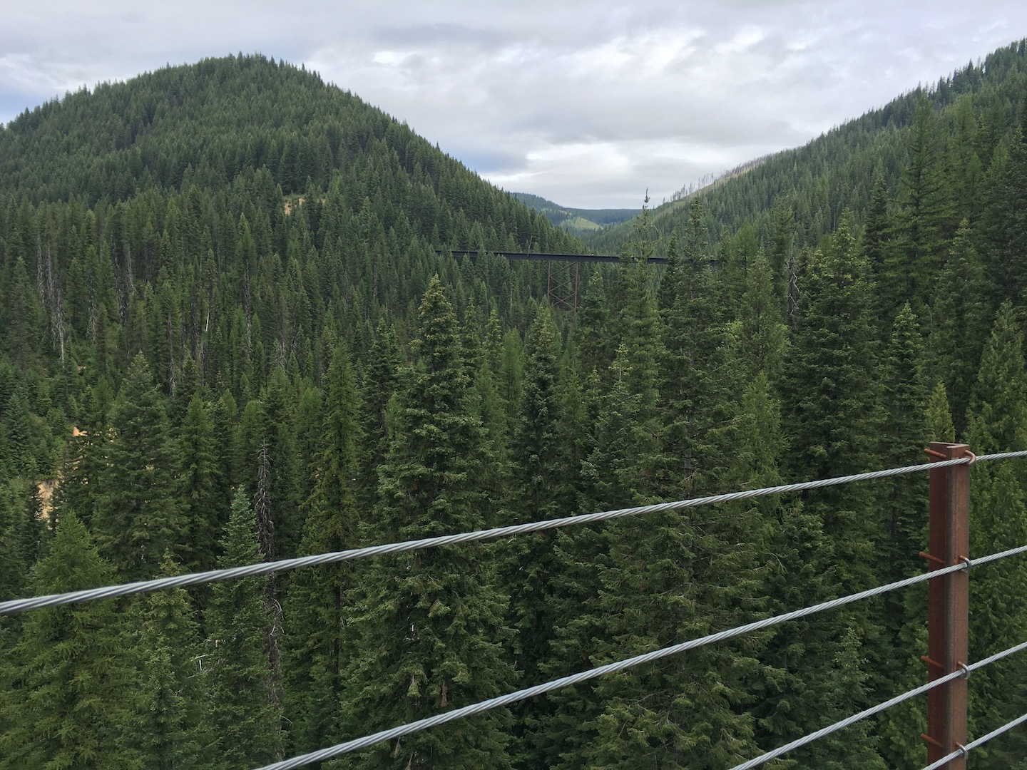
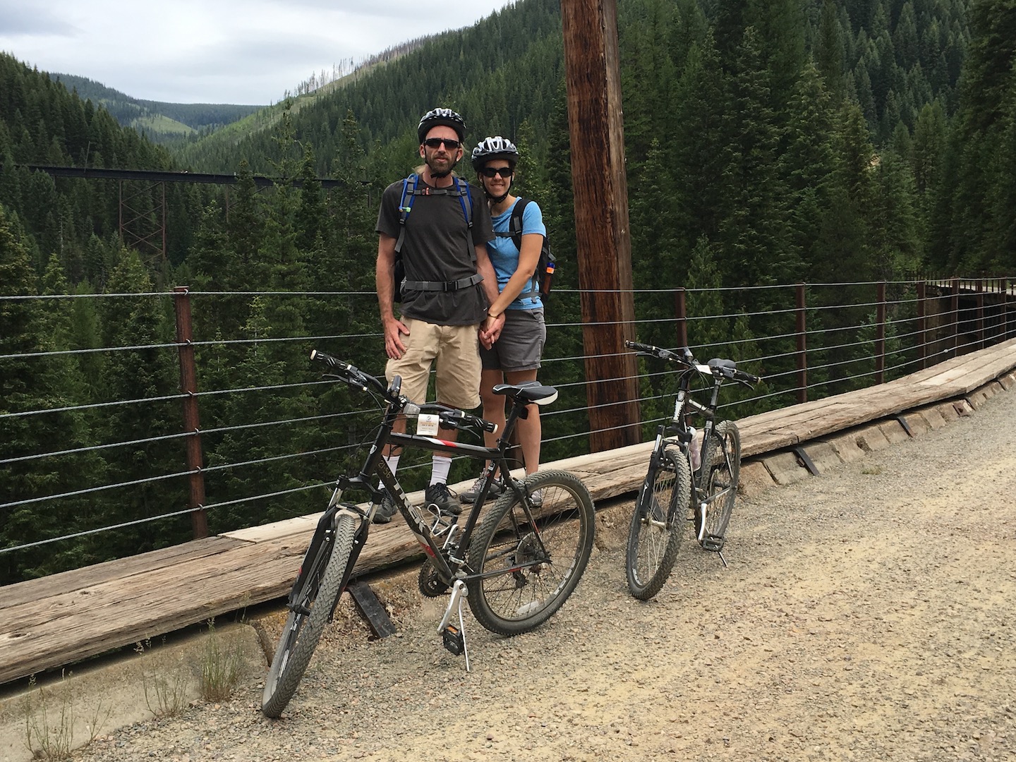
In addition to train tunnels there are seven trestle bridges to cross. Being that high up can be scary but it doesn’t feel like you’re that high up unless you look over the edge. My kids were a little uneasy on the bridges and I told them to just look forward and keep riding. The road surface doesn’t change on the bridges so if you just stay focused on the road you’ll be back amongst the trees quickly.

One of the seven trestle bridges on the Route of the Hiawatha
All along the route are signs telling of how the railroad was built and about the area. I wanted to stop at them all but it would have made for a super long day. We did stop at quite a few though.

One of the many stops on the Route of the Hiawatha
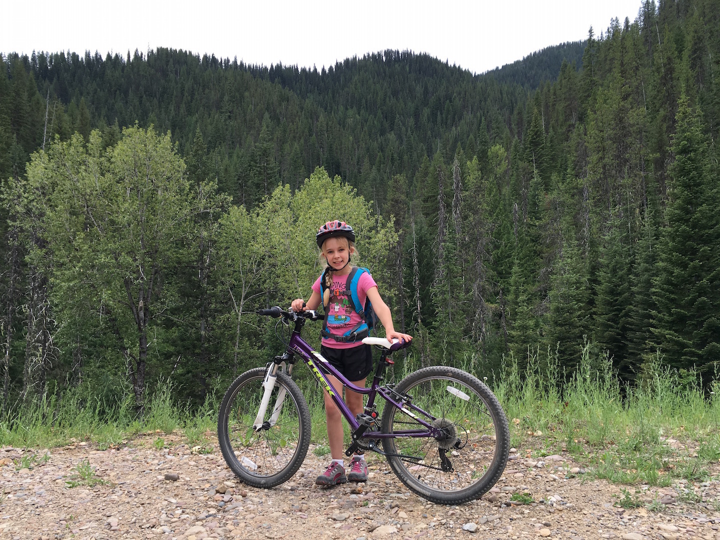
15 miles may sound like a long way but it’s not bad. Since it’s downhill you can coast a lot. That is if you weigh enough. Poor Little Miss had to pedal the entire time because her bike would practically stop as soon as she’d stop pedaling. The trail website says the ride takes 2.5 hours but it took us four. We stopped often to check out the scenery, to have a snack or eat lunch, and to just take in the beauty of where we were.
Hello, heaven.
River along the Route of the Hiawatha
There are two ways to get back to the top of the trail. 1) Ride your bike back up. 2) Take the shuttle. We chose option 2. The shuttle drops you off at the end of the Taft Tunnel and you have to ride back through it to get to your car. All-in-all, the ride ended up being 17 miles. Going back through the tunnel was easy peazy; however, halfway through I remember thinking, “Did we take a wrong turn somewhere?” It felt like we were riding forever and I could not see the light at the end of the tunnel. I’m sure it had something to do with the fact that I was tired and ready to get off my uncomfortable bike seat. Including the shuttle ride back to the top and our trip back through the Tuft Tunnel, our total ride time was five hours.
Here are a few pictures of the ride and a video of some of the tunnels and bridges:
Route of the Hiawatha Mountain Bike Trail
Route of the Hiawatha Mountain Bike Trail
Trees for days on the Route of the Hiawatha Mountain Bike Trail
Route of the Hiawatha Mountain Bike Trail
Route of the Hiawatha Mountain Bike Trail
Amazing, right?! We had the most perfect day and it made all the stress and craziness of the day before worth it.
If you find yourself in the area and without a mountain bike, you can rent one from the nearby Lookout Pass Ski Resort. They will give you a bike rack for your vehicle or will deliver the bike(s) to the trailhead for a small fee. All of the details can be found on their website by clicking here.
CAMPING:
We wanted to camp in the area but had a hard time figuring out where to do so prior to arriving in the area. The Route of the Hiawatha website has camping and hotel information which you can view by clicking here. I had a little trouble deciphering it though. Partly because we did not have a steady internet connection and partly because we were not familiar with the area. Here’s what I learned by actually being in the area. There are two types of camping available: campground or dispersed.
Campground:
The Route of the Hiawatha trailhead is a couple miles off I-90, down a dirt road. It is not near a town so if you would like campground accommodations you will need to stay in a nearby town. There are small towns all along I-90 in both Montana and Idaho. Each town seemed to be about 15 minutes apart and appeared to have only one campground per town.
Dispersed:
There is plenty of dispersed (free) camping in the area but I could not find a map showing the locations. I could only find names and locations but since I do not know the area it didn’t help much. The trail website says dispersed camping is available near the start and end of the trailhead and this is what I learned.
First of all, this is a picture of the road. The entire area looks like this. You want to camp here; trust me.
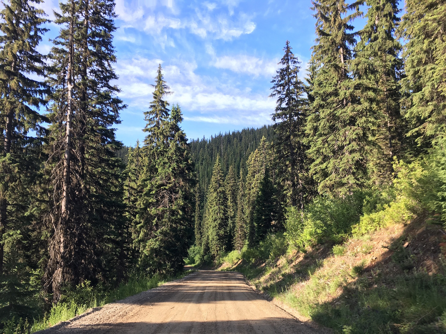
Rainy Creek Rd
The road to the trailhead is Rainy Creek Road. It’s just off I-90 at Exit 5. We saw maybe three sites between the highway and the trailhead. There is a large dirt area just off I-90 at Exit 5. It’s not an ideal location but it might be a good last resort if you can’t find camping elsewhere. Just something to keep in mind. There was a group of motorhomes in that spot when we drove by.
Shortly after the trailhead the road will start to climb the mountain and there are no campsites until you reach the top of the mountain. At the top, which happens to be right on the Idaho-Montana state line, are a couple of sites. One being the site we stayed in. I have no idea which direction we were facing but if you are coming from I-90 you will head west on the dirt road towards the trailhead. Once you get to the top of the mountain there is a T in the road.
- The campsite we stayed in is on the lefthand side, right at the T.
- Going straight takes you to the end of the trailhead where more camping is available.
- Don’t turn left! We drove our car, sans popup down the road and didn’t find any camping. The road wasn’t the greatest, there were steep drop-offs, and turn arounds were hard to find.
- I’m not sure what was right but there is at least one campsite down the road. A group of people were looking for a spot our second night in the area. They parked their cars at the T and walked up the road to the right and found a spot. The road looks somewhat steep so I definitely wouldn’t drive it without first walking up. They said there was a spot shortly up the road.
Here are a few pictures of our campsite:
Campsite off Rainy Creek Rd
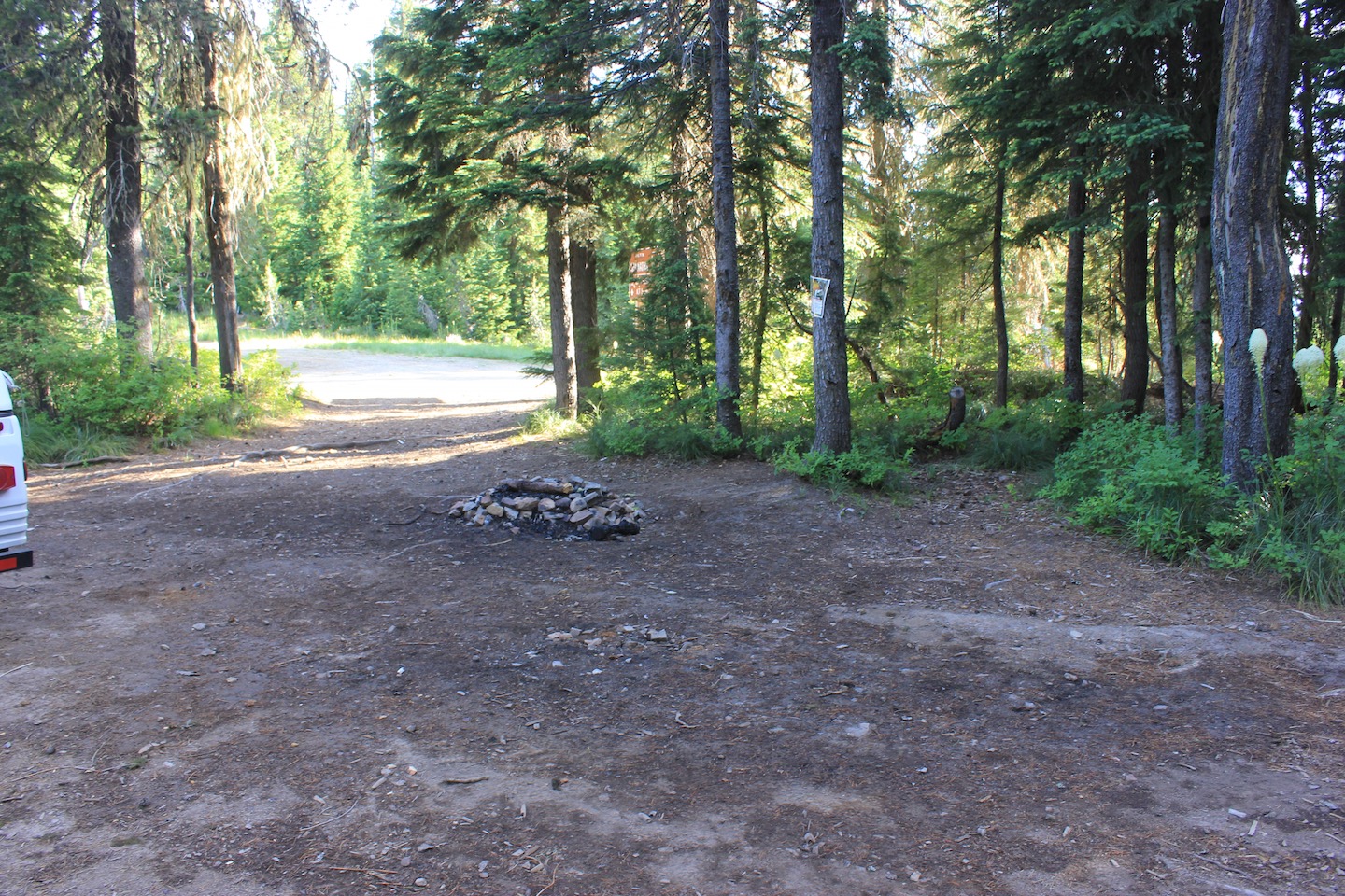
Campsite off Rainy Creek Rd

Campsite off Rainy Creek Rd
There are more sites available near the bottom of the trailhead. Supposedly they are streamside sites. I couldn’t figure out where they were on the map when I was researching the area. The trailhead website says they are along Loop Creek and the North Fork of the St. Joe River. The shuttle drove us through this area and we saw quite a few sites. I believe our campsite was five miles from I-90, so the ones near the bottom of the trailhead have to be at least 10+ miles off they highway. If you look at this trail map the campsites are located off of Loop Creek Rd. There may be easier ways to get to them depending on where you are coming from.
And just for fun…we finally saw a moose! In all of our travels we’ve never seen a moose. We saw one each of the two mornings we were in the area! They were in the middle of the road both times. We didn’t get a picture of the second one but he had much larger antlers. We were super excited both times.
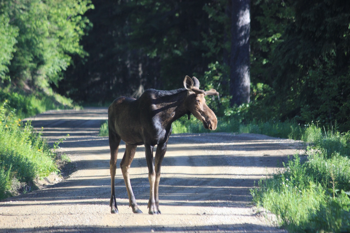
MOOSE!
If you are interested in this ride and have any questions please do not hesitate to ask. Have you ridden the Route of the Hiawatha? I’d love to hear from you if you have. 🙂
SUMMER 2016 ROAD TRIP
This post is one of several from our trip this summer. Visit these other links to read about the rest of our travels.


Awesome! Definitely putting this on my list to do someday. Nice recap.
Thanks, Nate! It was a blast! The bike rental shop has bike trailers for smaller kids so it really is possible for any stage in life. 🙂
Oh wow!!! I want to go…and camp and bike and explore….this all looks so wonderful!
Thanks, Abby! We had a blast.
Oh, we have to go there- and not just for the moose! It looks amazing, how cool.
It’s so much fun! I’d go back in a heartbeat. And the moose…so cool.
Hello! We are headed to the trail next month, and so excited! My littlest is 5, and good on a bike, but what do you think about the distance for him? I worry that he’ll tire out, and then what! Love your pix, thanks for all the info!
That’s so exciting! I love that trail. The distance may be a little long but it depends on how active your littlest is. The trail is downhill but my daughter didn’t weigh enough to be able to coast so she had to peddle most of the time. We took lots of breaks, stopped at all the signs and made a day of it. She was tired by the end but had a blast overall. Maybe get a tow strap in case he gets tired? I hope you have a fantastic time!!